Ascent Passport
- Ascent class — rock
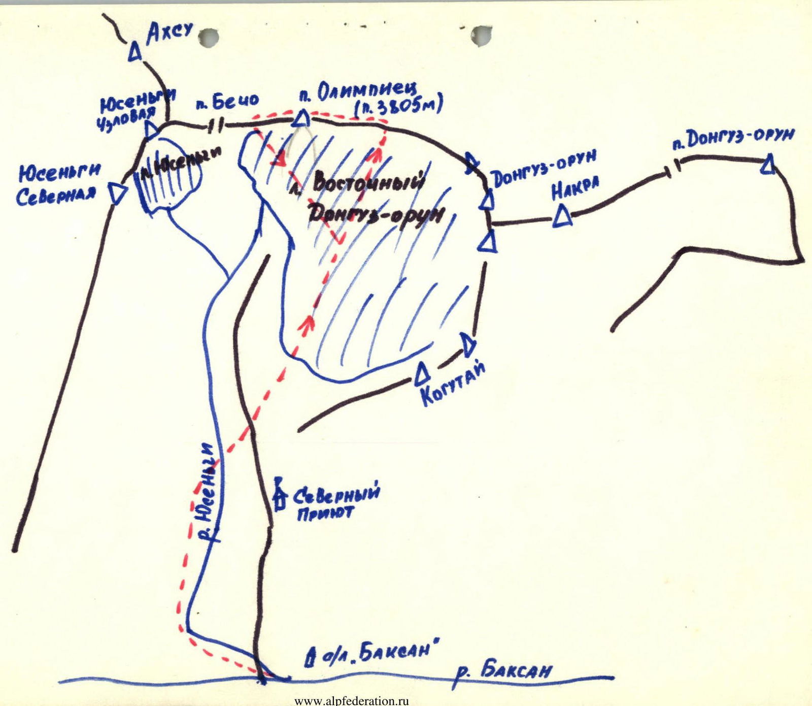
- Ascent area — Central Caucasus, Main Ridge
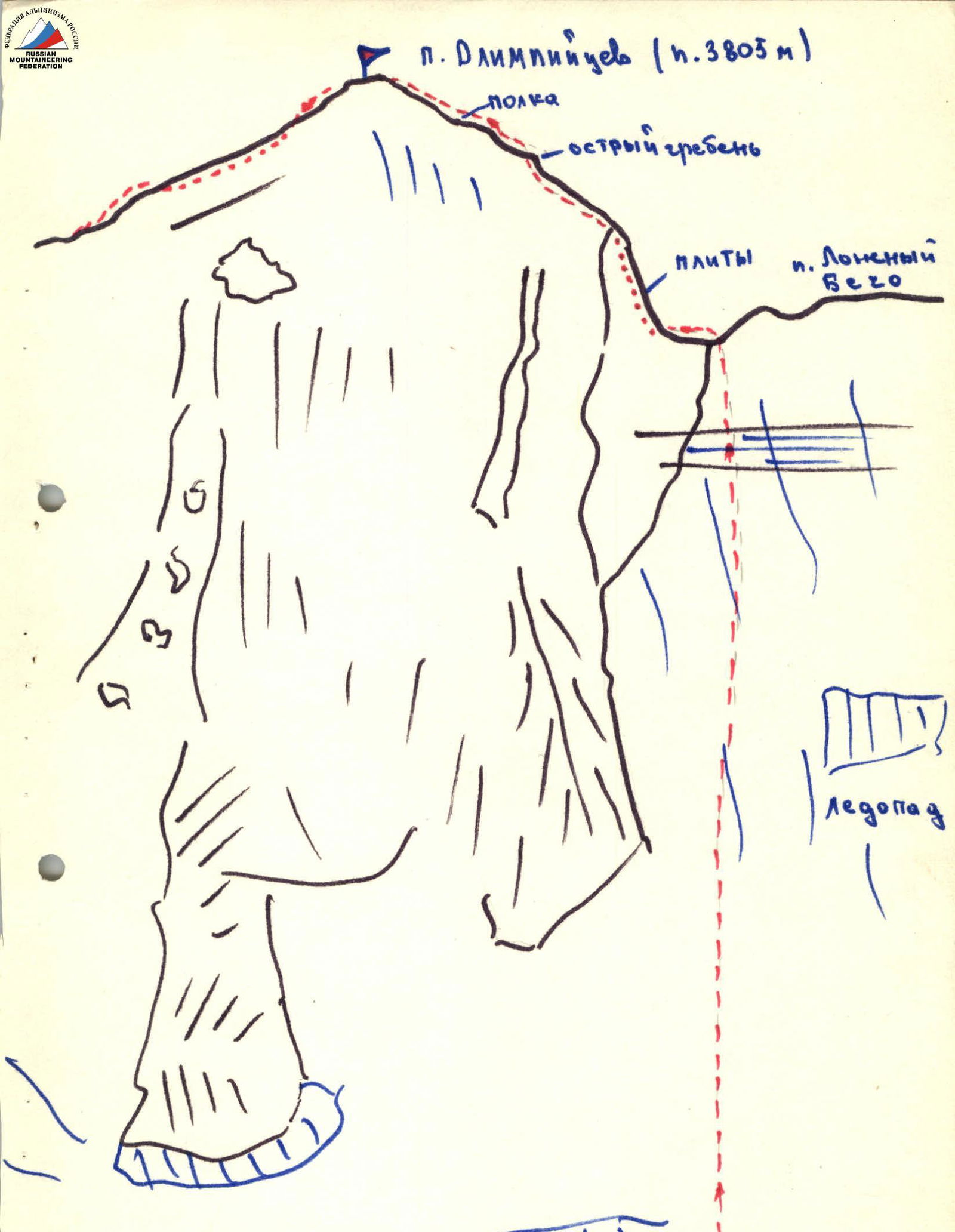
- Peak, its height, and ascent route — p. Olimpiycev, 3805 m, via the western ridge.
- Estimated difficulty category — 2A
- Route characteristics:
- height difference — 200 m
- average steepness — 40 m
- length of section I — 400 m
- Number of travel hours — 2
- Number of pitons hammered — 0
- Number of overnight stays — 0
- Surname, name, patronymic of the leader and participants, their sports qualification: Rudenko Aleksandr Vasil'evich, 1st sports category Kudinov Oleg Petrovich, 3rd sports category Yakimovichyute El'vira, 3rd sports category Marcinkyavichyute Liana, 3rd sports category Fedyaav Oleg Ivanovich, 3rd sports category
- Team coach — Moskalev G.A., Candidate Master of Sports
- Date of departure and return — July 7, 1980
Description of the route to p. Olimpiets (p. 3805) via the Western ridge (approximately 2A category of complexity). From the Lozhnyy Becho pass, ascend up easy rocks for 40 m. Then, bypassing the sharp ridge to the right, enter the dip under the snowy ascent. From the pass, 40–80 m up the snowy slopes to the left of the ridge to the ridge. Up the ridge (moderately difficult rocks) to the summit. Control point on the Lozhnyy Becho pass. Descent is possible by two options: 1st — descent along the Eastern ridge to the Becho pass. 2nd — descent along the Eastern ridge to the Becho pass, 80–100 m before the Becho pass, down the scree to the snow-ice plateau under pik Olimpiets (p. 3805) and further to the bivouac.
Character of the section
| Date | Designation | Average steepness, ° | Length, m | Character of relief | Designation | Difficulty | Condition | Conditions | Pitons |
|---|---|---|---|---|---|---|---|---|---|
| July 7, 1980 | I | 40 | 400 | Ridge with small walls | I | II | Damaged | Good rocks | 0 |