Route Description
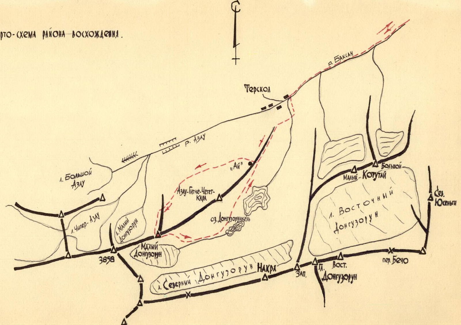
From the "Baksan" alpine base, the group departed by car at 8:00 on June 30, 1975, to the lower station of the "Cheget" ropeway and ascended to the "Ai" café. From here, the movement:
- is to the right along the road for 20 minutes,
- then along a faintly marked trail,
- traversing the northeastern slopes of Maly Donguzorun peak,
- we ascend to a saddle in the northern ridge.
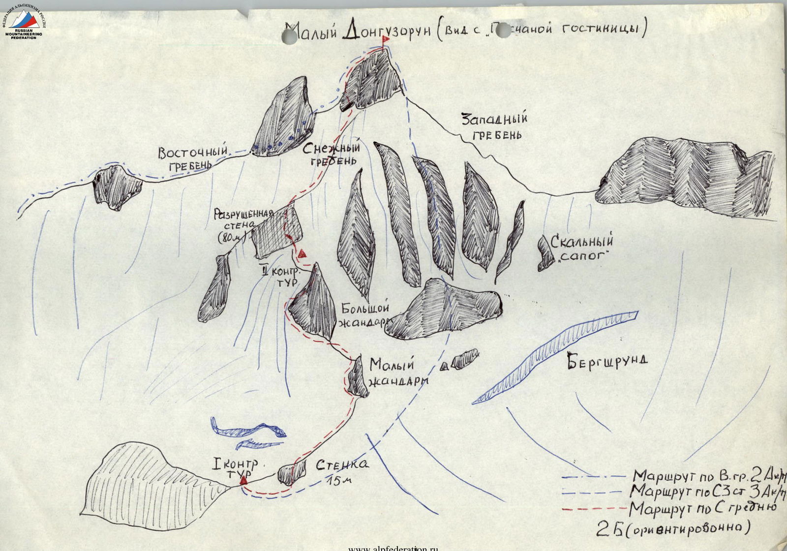
This is the starting point of the route. The path from the "Ai" café to the saddle takes 3 hours. The first control cairn was set up on the saddle.
At 14:00, the group began moving from the saddle in rope teams, to the right along the ridge on snow for 100–120 m below the wall.
Up the steep wall (80° steepness) for 15 m to the right and upwards, and exit onto the ridge (pitons used for protection).
From the saddle, it takes 30 minutes.
Then a 60–70 m ascent along simple ridge rocks to a small gendarme. The gendarme was bypassed on the left along ribbed slabs for 30–40 m with variable protection through ledges.
Up a 60° slab for 20–30 m to the shoulder of the small gendarme and exit below the wall of the large gendarme (variable protection through ledges).
From the wall, it takes 30 minutes.
The large gendarme was bypassed on the left by a traverse of 20–25 m along inclined slabs to a steep snowy couloir, then an ascent of 50 m to the right and upwards, without entering the couloir, along steep (70°) slabs of the gendarme to its summit (pitons used for protection, key point of the route).
Further along a gentle ridge for 50–60 m to the base of a ruined wall. Under the wall, a second control cairn was built. From the small gendarme, it takes 50 minutes.
Up the ruined wall with 65° steepness for 70–80 meters to the ridge with variable protection through ledges. Then an ascent of 300 m along a snowy ridge with 50–60° steepness below the summit tower (variable protection through ice axe). From the second control cairn, it takes 50 minutes. The ascent to the summit for 40–50 m along inclined slabs, with protection through ledges (caution! Live rocks on the slabs) takes 15–20 minutes. At 17:15, the group reached the summit of Maly Donguzorun.
Descent to the south along a Category I difficulty route took 1 hour (to "Medvezhye nochevki").
The route corresponds to Category 2B difficulty.