Report on the Ascent of Maly Donguz-Orun Peak via the Eastern Ridge, Category 2A, by the MAC "Freeline" Climbing Team from 01.07.2018 to 01.07.2018
I. Ascent Passport
| No. | 1. General Information | |
|---|---|---|
| 1.1 | Full Name, Sports Rank of the Leader | Otkidchev Pavel Anatolyevich, 3rd sports rank |
| 1.2 | Full Name, Sports Rank of the Participants | Shchedrin Georgy Alexandrovich, 2nd sports rank. Kovalev Roman Alexandrovich, 3rd sports rank. |
| 1.3 | Full Name of the Coach | Motienko Nikolai Ilyich |
| 1.4 | Organization | MAC "Freeline" |
| 2. Characteristics of the Ascent Object | ||
| 2.1 | Region | Caucasus, from Chiperaza Pass to Gumači peak |
| 2.2 | Valley | Baksan Valley |
| 2.3 | Section Number according to the 2013 Classification Table | 2.4 |
| 2.4 | Name and Height of the Peak | Donguzorun (M) 3769 m |
| 3. Characteristics of the Route | ||
| 3.1 | Name of the Route | To the Ridge |
| 3.2 | Proposed Category of Difficulty | 2A |
| 3.3 | Degree of Route Exploration | — |
| 3.4 | Nature of the Route Terrain | Rocky |
| 3.5 | Height Difference of the Route (as per altimeter or GPS data) | 309 m |
| 3.6 | Length of the Route (in meters) | 2000 m |
| 3.7 | Technical Elements of the Route (total length of sections of varying difficulty with terrain type indication) | 1st cat. rocky – 1000 m. 2nd cat. rocky – 990 m. 3rd cat. rocky – 10 m. 4th cat. ice/rock/combination – 0 m. Movement on a closed glacier – no. Abseiling (on descent) – no. |
| 3.8 | Descent from the Summit | Via the ascent route |
| 3.9 | Additional Characteristics of the Route | Water available in the form of snow |
| 4. Characteristics of the Team's Actions | ||
| 4.1 | Time of Movement | 1 hour 50 minutes |
| 4.2 | Overnight Stay | At a designated site |
| 4.3 | Departure onto the Route | 4:35 01.07.2018 |
| 4.4 | Arrival at the Summit | 6:25 01.07.2018 |
| 4.5 | Return to the Base Camp | 8:50 01.07.2018 |
| 5. Person Responsible for the Report | ||
| 5.1 | Full Name, e-mail | Otkidchev P. A., otkid@list.ru |
General Information
The Maly Donguz-Orun peak is located in a spur of the Main Caucasian Range in the area of Prielbrusye, south of Mount Elbrus. The coordinates of the peak are 43.2452° N, 42.4642° E, height 3769 m.
Name of the Peak
There is confusion regarding the name of the peak. According to the mountaineering classifier, the peak is named Maly Donguz-Orun, as is also the case in the ViewRanger app¹ (Fig. 1 and 2). However, on the General Staff map and the tourist map based on it, our peak is named Donguz-Orunbashi (Fig. 3). Meanwhile, locals, tourists, and climbers always refer to the peak depicted in Fig. 6 and 12 as Donguz-Orun², characterized by the "Semerka" glacier on its 1.5 km high northern wall, while on the map this peak is named according to its size: Donguzorun-Cheget-Karabashi (4454 m).
Practically all climbers are familiar with Mikhail Golubev's excellent website (caucatalog.narod.ru), which is an extremely comprehensive database of almost the entire Caucasus. However, even he has discrepancies: our peak is listed under the primary name "Cheget", which is used as a caption for photographs of the peak, while "Maly Donguz-Orun" is given as an additional name (Fig. 4). In reality, the name "Cheget" refers to the peak closest to the cable car (more accurately, a bump), to which a trail is laid (more on this later) and which is labeled on Golubev's map of the Central Caucasus³ as Azau-gitchechegetkara. On his main page, Golubev has posted a description of the ascent ("Ascent to Cheget Peak (3769 m) (Maly Donguz-Orun) (1B)"), but it is not very useful for future climbers, primarily because they did not follow the route, having overcome the summit tower directly.
Moreover, it's unclear why Golubev categorizes the peak as 1B, when it is classified as 2A according to the classifier, and indeed corresponds to this category. His website features around 50 (!) photographs of the peak from all possible angles, including those taken during his ascent. One of these photographs is included in this report (Fig. 5), and the rest can be viewed on the website⁴.
Description of the Approach
The path follows the highway along the Baksan Valley to Chegetskaya Polyana, about 1.5 km before the village of Terskol. If time allows, it's better to drive to Terskol itself and register at the local EMERCOM office there (a white building on the left side of the highway). If there's no time, register by phone +7(86638)71489 or +79286945119. There's a 100 ruble fee per car to enter Chegetskaya Polyana. No receipt is issued, so this might be a "scam" in the spirit of Ostap Bender, but we paid nonetheless. Next, you need to take the cable car, which significantly saves time on the ascent: the height difference from the lower station to the upper is about 1 km. The ticket costs 700 rubles. Before ascending, we inquired with the cashier if we could ascend today and descend tomorrow, to which we received a positive response, provided we inform the maintenance personnel. We notified them, but the next day during descent, the person responsible for boarding at the upper station (Kyunn) claimed we had to pay an additional 100 rubles. It turned out to be a "scam" because when we mentioned the cashier's permission to descend the next day without extra charge, the "Bender" made an offended face and said, "Alright, off you go, you won't be charged downstairs anyway." However, we weren't charged downstairs.
The upper cable car station is at a height just above 3000 m. From there to Cheget peak, a well-trodden trail follows, popular among tourists⁵ ⁶.
Preparation for the Ascent
Initially, it goes along the ridge to the left, then makes a sharp turn to the right towards the peak. In some places, the trail is covered by small snowfields, but overall, the ascent is very convenient. The peak is marked with a sign and the inscription "Cheget" in paint, although the highest point of the ridge is a few dozen meters to the west. This is where the overnight stay is: coordinates 43.2413° N, 42.4832° E, height 3461 m. There is a convenient cleared spot for two tents, and another tent can be set up a little lower (facing Donguz-Orun, walk a dozen meters to the left and down). Along the entire ridge, there's a "inflated" snowfield, so there's no issue with water.
The cable car ride takes about half an hour, and another hour of walking from the upper cable car station to the overnight stay location. The cable car stops operating at 16:00. If you miss the cable car (or decide to walk the entire path with backpacks for maximum "purity" of the ascent), it's not a problem, as there's a dirt road from top to bottom.
At the highest point of the ridge, there's excellent mobile coverage, and even 3G internet signal. However, if you descend from the ridge just a couple of meters to the south, the signal is completely lost.
For the route, we took the following equipment:
- Two static ropes, 30 m each, an 8 and a 9
- "Hardware": three friends, two nuts, two quickdraws
- Three slings, prusik cords, expendables
- Gas, burner, rescue blanket, mat
- Ice axe and crampons for each participant
In the end, we only needed the ice axes, and even those could have been dispensed with. However, it's necessary to bring all this equipment, except for the "hardware", which we didn't find necessary. We didn't take descenders or jumar; if needed, we would have used a carabiner with a UIAA knot for descent and a prusik for ascent. We also didn't bring sleeping bags, using down jackets instead due to the simplicity of the route and proximity to "civilization".
Description of the Ascent
Since the route is ridge-based and not very difficult, its description is provided without a UIAA scheme and special details. The southern (left) slope of the ridge is mostly gentle and scree-covered, with snowfields occasionally reaching up to the route. The northern (right) slope is steep and snowy, making it impossible to self-arrest in case of a fall. The nature of the ridge dictates the character of the route: almost all gendarmes and somewhat complex sections are bypassed on the left. A small flat-topped gendarme, located roughly halfway through the route before the characteristic "Finger" gendarme, is bypassed on the right. The direction of movement is always intuitively clear. Where the path goes through fine scree, a trail is trodden. Initially, the route follows a simple ridge, either along the middle of the ridge or slightly to the left. Not far from the start of the route, the ridge drops down for 10 meters, and a rappel anchor is left there, but we didn't rappel and instead bypassed this spot on the left. In some places on the ridge, one has to walk on a "knife-edge".
About halfway through the route is the "Academy" peak, not marked on any map, not even on Golubev's. Its coordinates are 43.2418° N, 42.4745° E. There's a memorial plaque there. Up to the "Academy" peak, the route is very simple, not more complicated than 1B. The main technical difficulty of the route begins when bypassing the "Finger" gendarme. Climbing is 2–2+, in some places 3–3+, but such sections are only a few meters. One could descend even lower and traverse the entire route via a snowfield, but that wouldn't meet the required difficulty. The rock is not very crumbly, the terrain is rich, and there are always places for protection. The summit tower is bypassed on the left, and the exit to it is from the other side of the ridge. From the summit, one could rappel a dozen meters to immediately reach the ridge, but we didn't bother and descended the same way we ascended. For "badge seekers", it's recommended to make a rappel there for training purposes.
We left the base camp at 4:35 and reached the summit by 6:25. The quick time is due to the participants not being roped together and not using protection, even when it would have been advisable (for example, when moving along the "knife-edge"). The return to the camp for the last participant was at 8:50. The journey back took just as long as to the summit because movement along the ridge involves constant descents and ascents, and when moving back, it doesn't feel like going downhill; the total ascent on the return is quite significant. Moreover, on the return, one has to navigate all the technical sections again, just like on the ascent. More precisely, in our case, almost all; we cut some sections straight across the snowfield on the southern slope of the ridge, but didn't save much time, no more than a hundred meters. That's when we needed the ice axes. Crampons weren't needed because the slope is gentle, and the snow is loose and holds well. We left the overnight site at 10:00 and headed down to the cable car, reaching Chegetskaya Polyana a little after 11:00 in the morning.
General Remarks
Thanks to the cable car, the route can be easily completed over a weekend. The route is beautiful and logical, with the technical part corresponding to 2A. It's ideal as a first "2" for "badge seekers" because it's relatively short, has mobile coverage throughout, water (in the form of snow), convenient spots for tents, and is close to rescue services. In our case, we undertook this route for an "opening", and were completely satisfied with the outcome.

Fig. 1. Peaks Cheget, Maly Donguz-Orun, and surrounding mountains in the ViewRanger navigator.
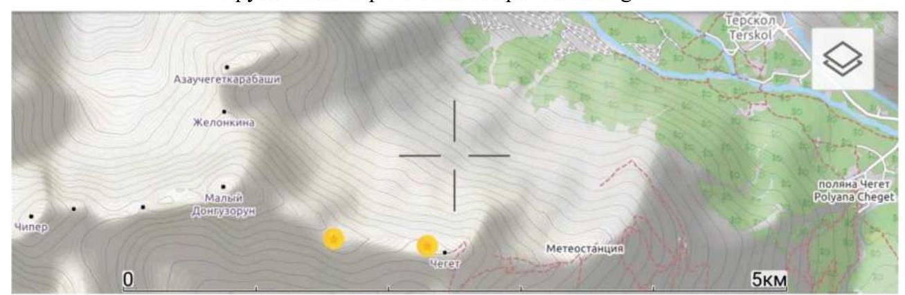
Fig. 2. Peaks Cheget and Maly Donguz-Orun in the ViewRanger navigator, close-up. The right marker indicates the overnight stay location, the left marker indicates the "Academy" peak. The label "meteorological station" corresponds to the upper cable car station (Kyunn).
↗
Fig. 3. Fragment of the tourist map of Kabardino-Balkaria. Our peak is labeled as Donguz-Orunbashi.
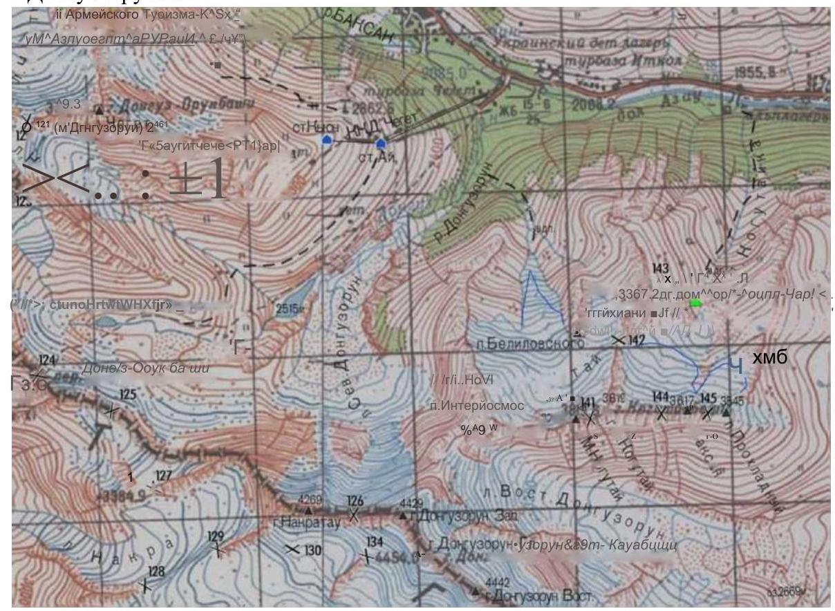
Fig. 4. Fragment of Golubev's map, compiled on the basis of General Staff maps with his additions. Our peak is labeled as p. Cheget (M. Donguzorun).
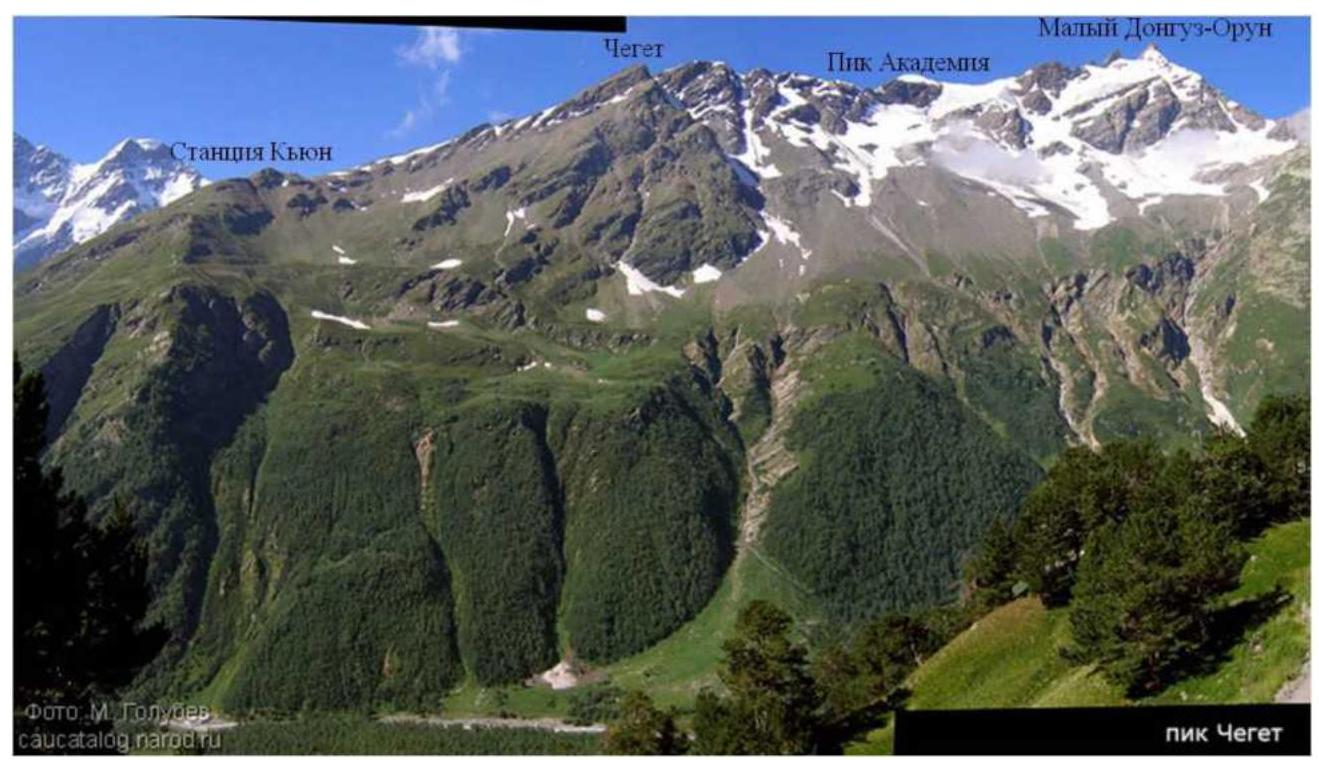
Fig. 5. Ascent route. Photo from Mikhail Golubev's website, captions added by us on top. The route line is not shown because the path always follows the ridge, mostly along its left part.

Fig. 6. Base camp.
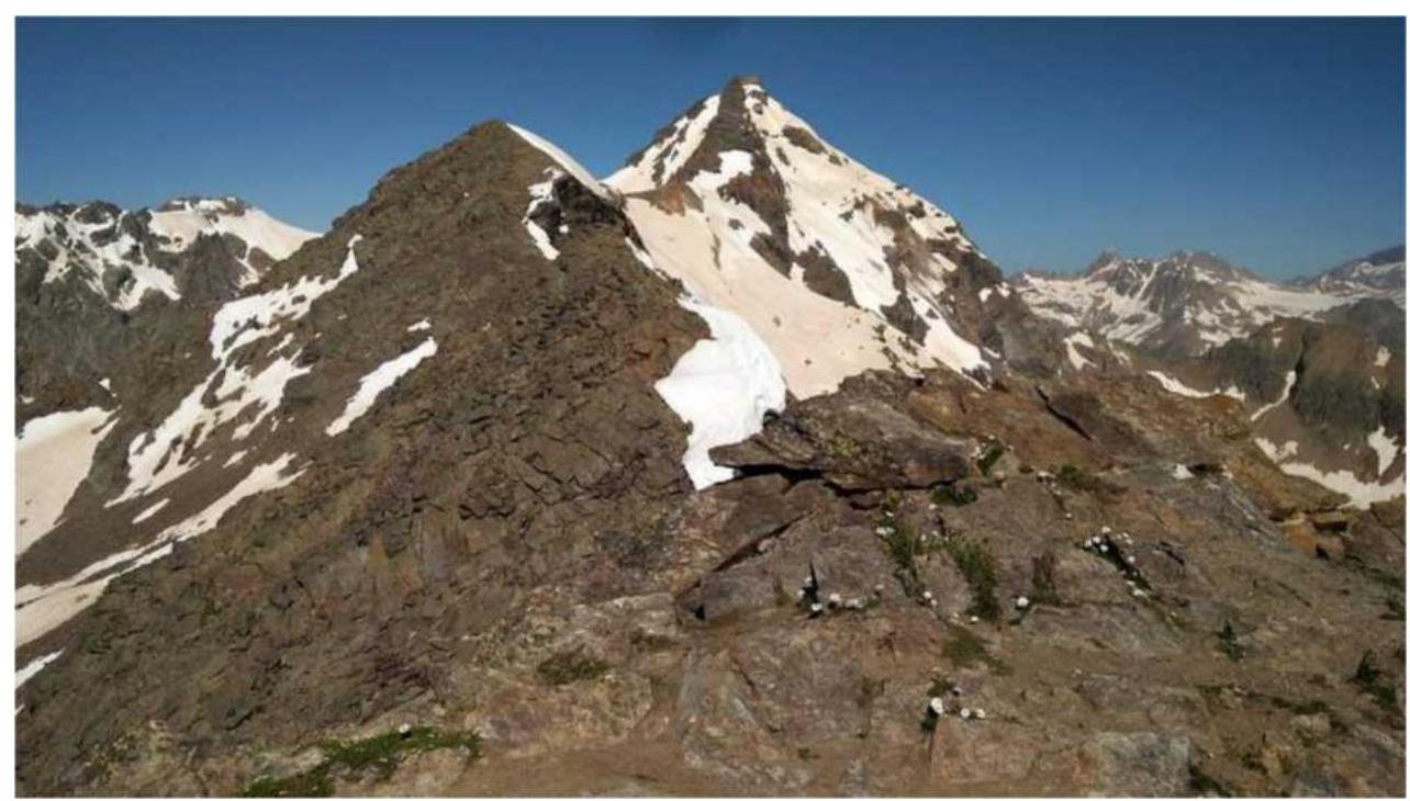
Fig. 7. Eastern ridge of the peak, view from the BC.
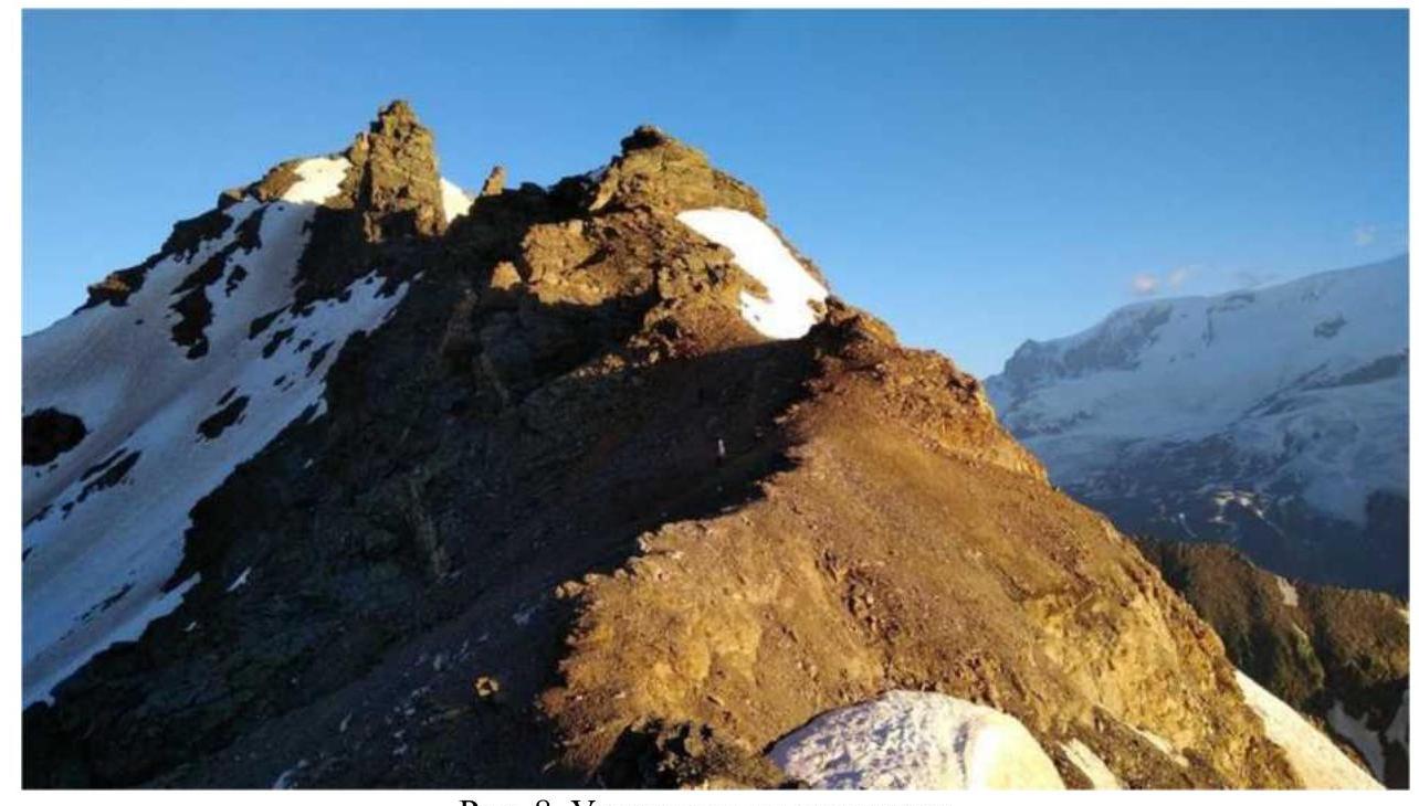
Fig. 8. Participants on the route.
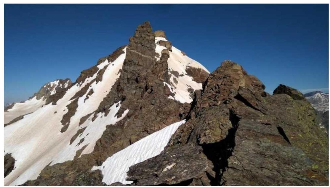
Fig. 9. View of the ridge towards the summit.
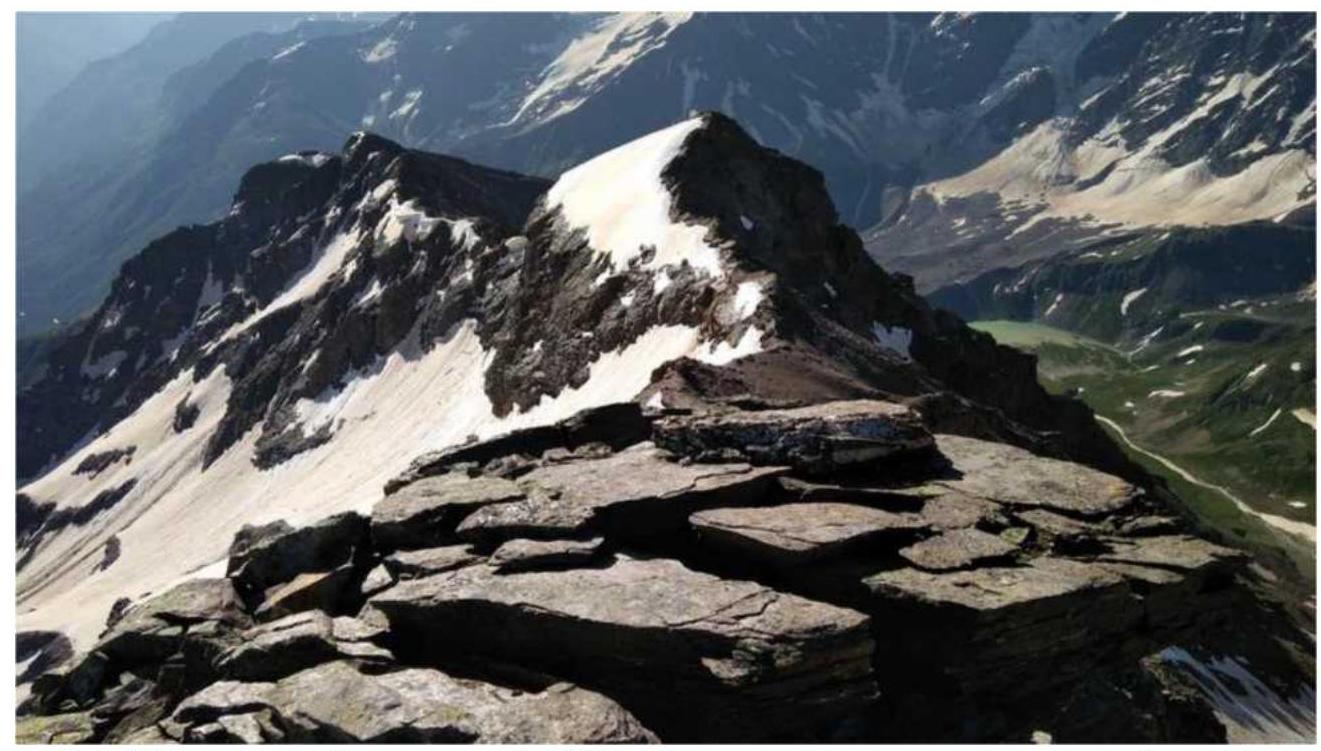
Fig. 10. View of the ridge towards the BC (this photo and the previous one were taken from the same point).
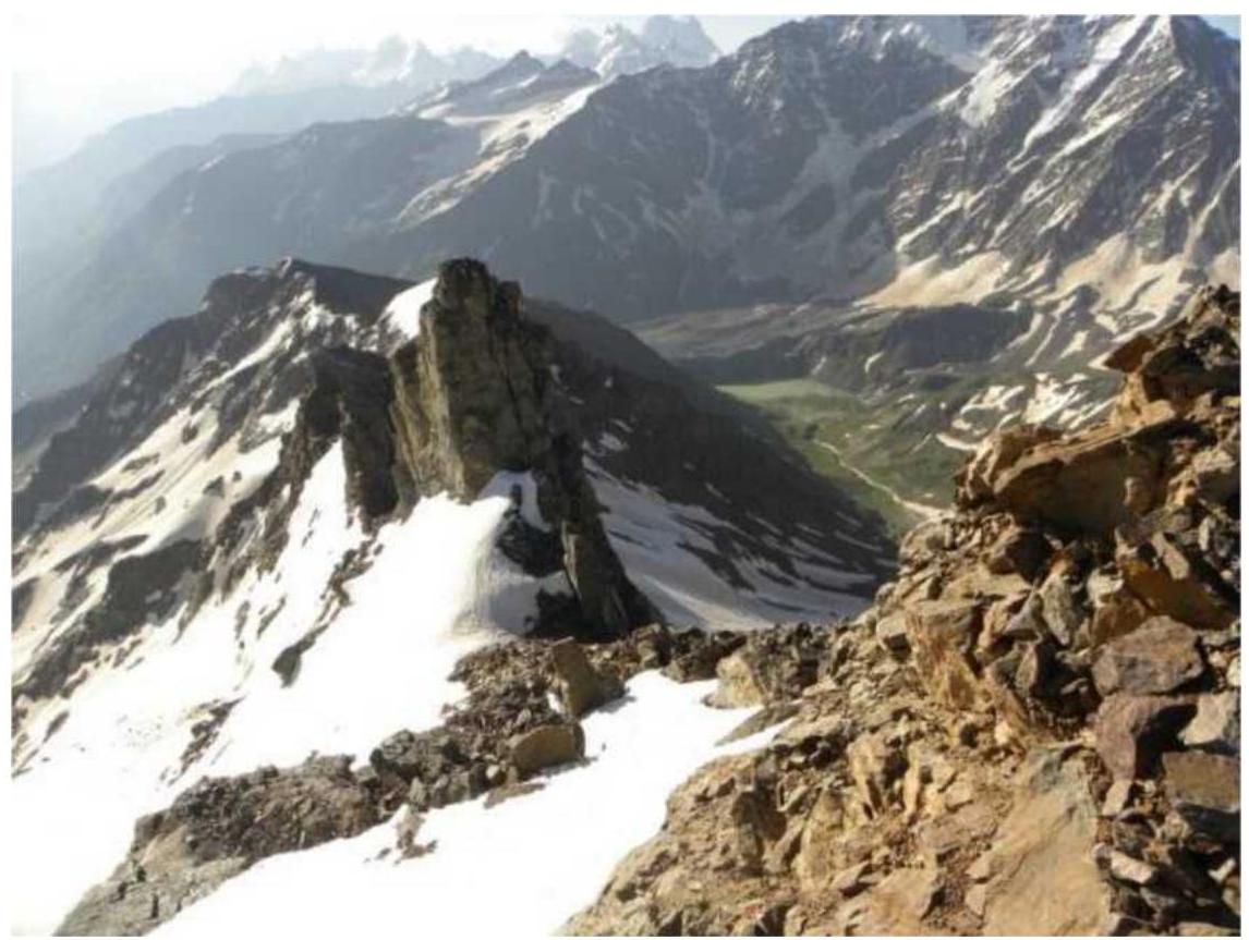
Fig. 11. View of the ridge towards the BC from the summit.
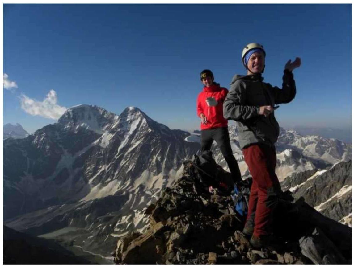
Fig. 12. Photo of participants on the summit, view of Donguz-Orun.
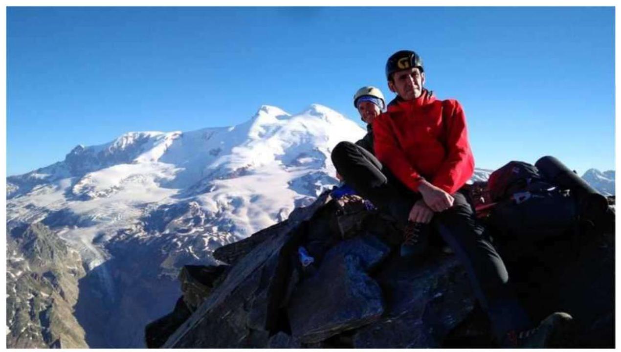
Fig. 13. Photo of participants on the summit, view of Elbrus.
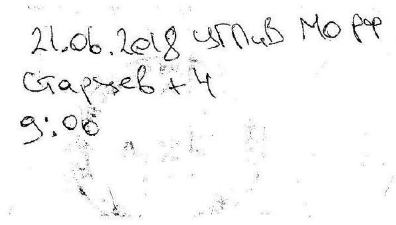
21 June 2018, Management of the Russian Navy Startsev +4 9:00
Fig. 14. Note from the summit.
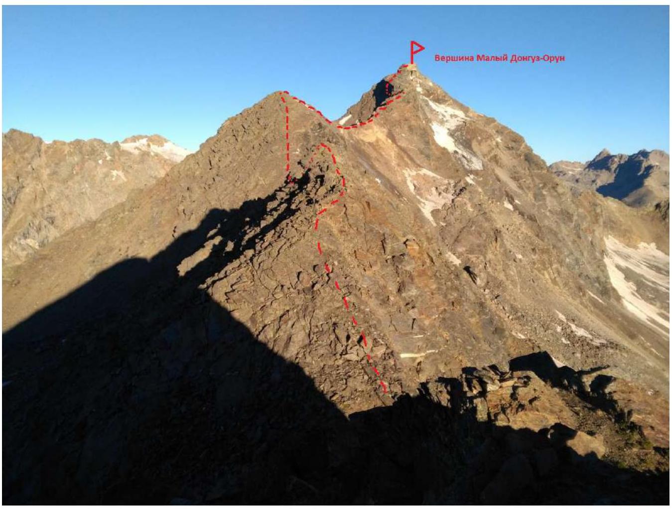
Fig. 15. Profile of the peak with the route thread.
¹ An excellent navigator for Android, showing popular tourist trails, peaks, various objects, contour lines, the ability to record and upload tracks, and more. ² The suffix "bashi", meaning "peak" in Turkic languages, is often omitted in names. ³ Main page > Schemes > Scheme of Passes and Peaks of the Central Caucasus. ⁴ Main page > Objects by Regions > Prielbrusye, Chegem > Cheget peak, summit. (Yes, and don't confuse "our" Cheget with Chegetkara peak, which is nearby in the Adylsu valley, and Cheget-tau-chan peak, which is also nearby in the Adyrsu valley.) ⁵ In the ViewRanger app, it is marked with a red dashed line. ⁶ (This footnote was in the original without a number; I've left it as is without a number)