Report
On the ascent to the summit Donguzorun Glavnaya via the southwest slope, category 2A, by the team of MAC "Freeline", September 30, 2024.
I. Ascent Report
| № | 1. General Information | |
|---|---|---|
| 1.1 | Full name, sports rank of the leader | Svitovoy Kirill Viktorovich, 2nd sports rank |
| 1.2 | Full name, sports rank of participants | Kozoderov Vasily Viktorovich, 2nd sports rank Balashova Alexandra Sergeevna, 3rd sports rank Del Andrey Alexandrovich, 3rd sports rank Chernov Stanislav Evgenievich, 3rd sports rank Shkurenko Yulia Viktorovna, 3rd sports rank Yakovlev Artem Borisovich, 3rd sports rank |
| 1.3 | Full name of the coach | Motienko Nikolai Ilyich |
| 1.4 | Organization | MAC "Freeline" |
| 2. Characteristics of the Ascent Object | ||
| 2.1 | Region | Central Caucasus |
| 2.2 | Valley | Kvish |
| 2.3 | Section number according to the classification table | 2.4. From Chipperazau pass to Gumači summit (Baksan, Adylsu, Shkhelda, Kyrtik valleys) |
| 2.4 | Name and height of the summit | Donguzorun Glavnaya (4454 m) |
| 2.5 | Geographical coordinates of the summit | 43.19481, 42.51455 |
| 3. Characteristics of the Route | ||
| 3.1 | Name of the route | Via SW slope |
| 3.2 | Proposed category of difficulty | 2A |
| 3.3 | Degree of route development | - |
| 3.4 | Nature of the route terrain | Ice and snow |
| 3.5 | Height difference of the route | 1250 m |
| 3.6 | Length of the route | ~7000 m |
| 3.7 | Technical elements of the route | 1st cat. ice ~ 2300 m. 2nd cat. ice ~ 1100 m. 3rd cat. ice ~ 100 m. Movement on closed glacier ~ 2900 m |
| 3.8 | Descent from the summit | Via the ascent route, 2A cat. |
| 3.9 | Additional characteristics of the route | Water on the route in the form of snow |
| 4. Characteristics of the team's actions | ||
| 4.1 | Time of movement | 15 hours |
| 4.2 | Overnight stays | - |
| 4.3 | Start of the route | 3:00, September 30, 2024 |
| 4.4 | Reaching the summit | 12:20, September 30, 2024 |
| 4.5 | Return to the base camp | 18:00, September 30, 2024 |
| 5. Responsible for the report | ||
| 5.1 | Full name, e-mail | Svitovoy Kirill Viktorovich svikir@yandex.ru |
II. Description of the Ascent
1. Characteristics of the Ascent Object
Donguzorun is one of the most famous peaks in the Elbrus region and the entire Central Caucasus. However, it is not frequently visited, partly because the mountain is located on the Main Caucasian Range, directly on the border between Russia and Georgia. Ascents:
- from the Russian side are generally prohibited,
- from the Georgian side are permitted, but the routes are not popular.
On the Georgian side, the mountain is located in the Upper Svaneti region. The route along the southwest slope is described in the book by A.F. Naumov "Gory Svanetii" and is included in the classifier (Mertzbacher route), but the description is outdated, primarily due to border restrictions. This report describes a variant of the route along the SW slope from the Kvish glacier.
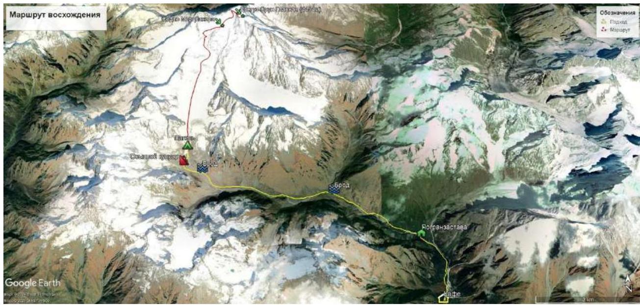
Fig. 1.1. Schematic map of the approach and ascent route. Access to the start of the route is by road from Zugdidi to Mestia, and then to the village of Mazeri, and further 3 km along a dirt road to a cafe at the start of the trail to the Ushba waterfalls. The approach to the route begins here.
Along the forest trail up the Dolra river valley to the border post. Here, passes made in Mazeri or Mestia will be checked. Then continue along the trail up the Dolra river valley. After 6.5 km, there is a ford across the Dolra river (which can be challenging at high water).
Then move up the Kvish river valley and at 11 km, cross the river above its confluence from two streams. The valley is wide, with many places for an intermediate camp.
After crossing the Kvish, leaving the "ram's foreheads" and the glacier tongue with a large waterfall to the right, continue along the riverbed to the west. Leaving a large rock bastion to the right, walk another kilometer and then ascend a scree couloir to the north and reach a large meadow with a stream at an altitude of 2900 m. It is convenient to set up a storm camp here, or:
- ascend to an altitude of 3200 m along a moraine ridge and set up camp at the edge of the glacier. There is water, but there are fewer places for tents.
The tongue of the glacier marks the beginning of the route.
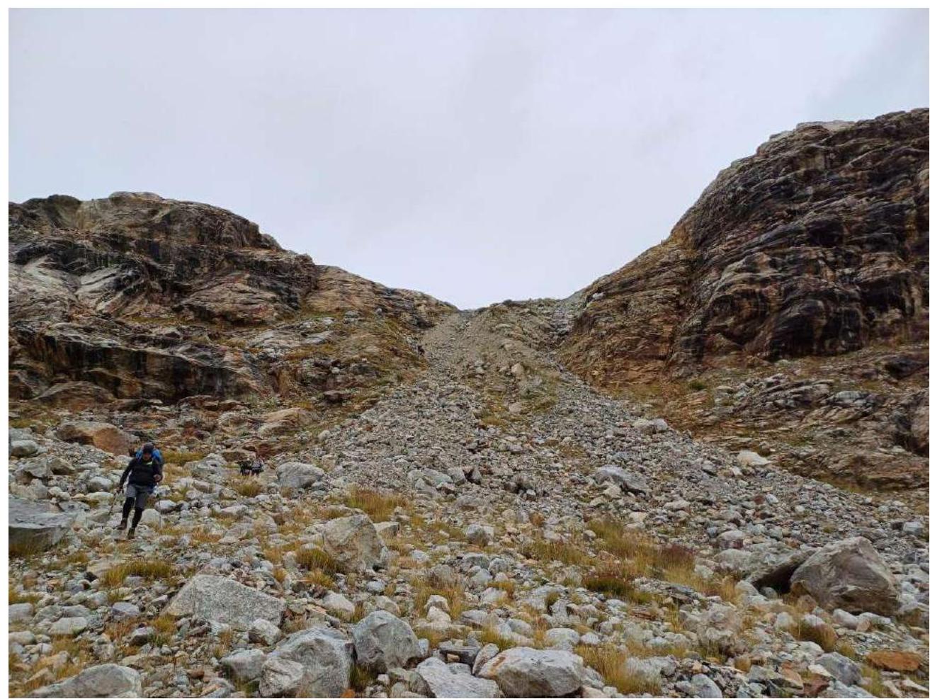
Fig. 1.2. Scree couloir convenient for ascent to the camp.
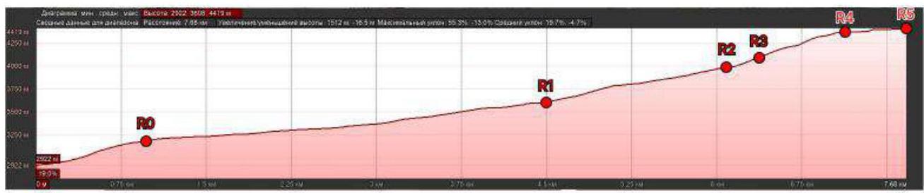
Fig. 1.3. Profile of the route.
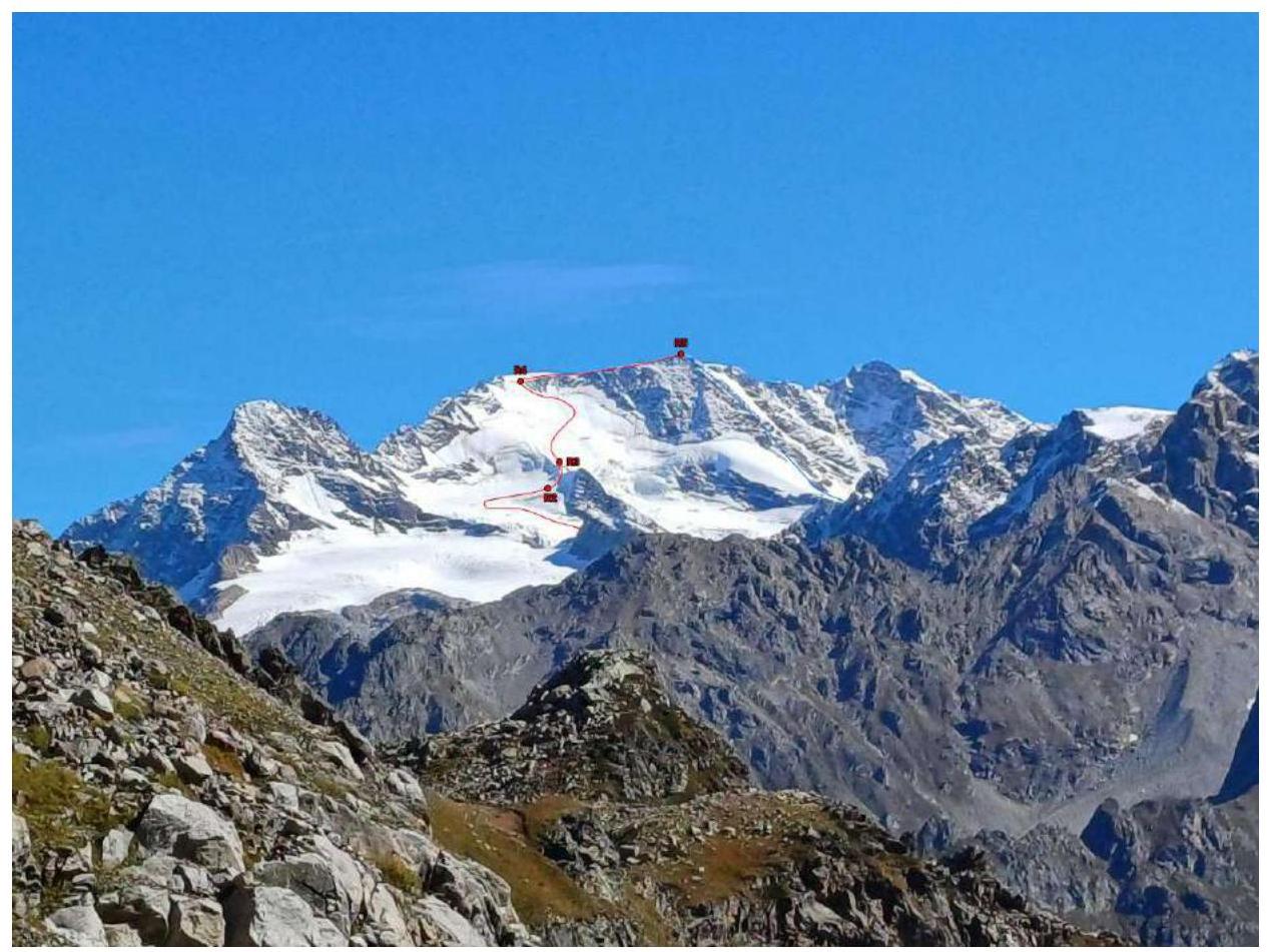
Fig. 1.4. Upper part of the route. Photo from Shtavler glacier (September 27, 2024).

Fig. 1.5. Thread of the route. Photo from the moraine of Kvish glacier (September 29, 2024).
2. Characteristics of the Route
Table 1. Technical characteristics of the route sections
| Section | Nature of the terrain | Cat. difficulty | Length, m | Type and number of pitons |
|---|---|---|---|---|
| R0–R1 | Gentle partially closed glacier with crevasses | n/c | 3500 m | - |
| R1–R2 | Closed heavily crevassed glacier ascending into the Nakra peak cirque | 1 | 1700 m | - |
| R2–R3 | Zone of crevasses and bergschrund below Mertzbacher Saddle | 3 | 100 m | 3 ice screws |
| R3–R4 | Steep glacier slope with zones of crevasses | 2+ | 1100 m | - |
| R4–R5 | Wide snow-covered rock ridge | 1 | 600 m | - |
3. Characteristics of the team's actions
| Section | Description | Photo number |
|---|---|---|
| R0–R1 | Simultaneous movement along a gentle, partially closed glacier in teams towards the base of a rock ridge that bisects the upper Kvish glacier. | - |
| R1–R2 | Simultaneous movement in teams across the heavily crevassed western branch of the Kvish glacier with numerous detours around large crevasses, including crossing snow bridges. | Photo 1 Photo 2 |
| R2–R3 | Simultaneous movement in teams through a zone of crevasses, then up a steep snowy slope - ascent through the bergschrund to Mertzbacher Saddle. | Photo 3 |
| R3–R4 | Simultaneous movement in teams up a steep closed glacier slope with deep snow and crevasses onto the pre-summit ridge. | Photo 4 |
| R4–R5 | Simultaneous movement in teams along a wide snow-covered pre-summit ridge to the summit. | Photo 5 |

Photo 1. Long detours around large crevasses on section R1–R2.
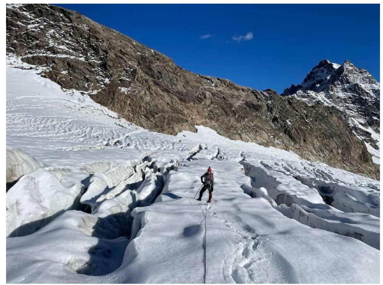
Photo 2. Zones of crevasses on section R1–R2.
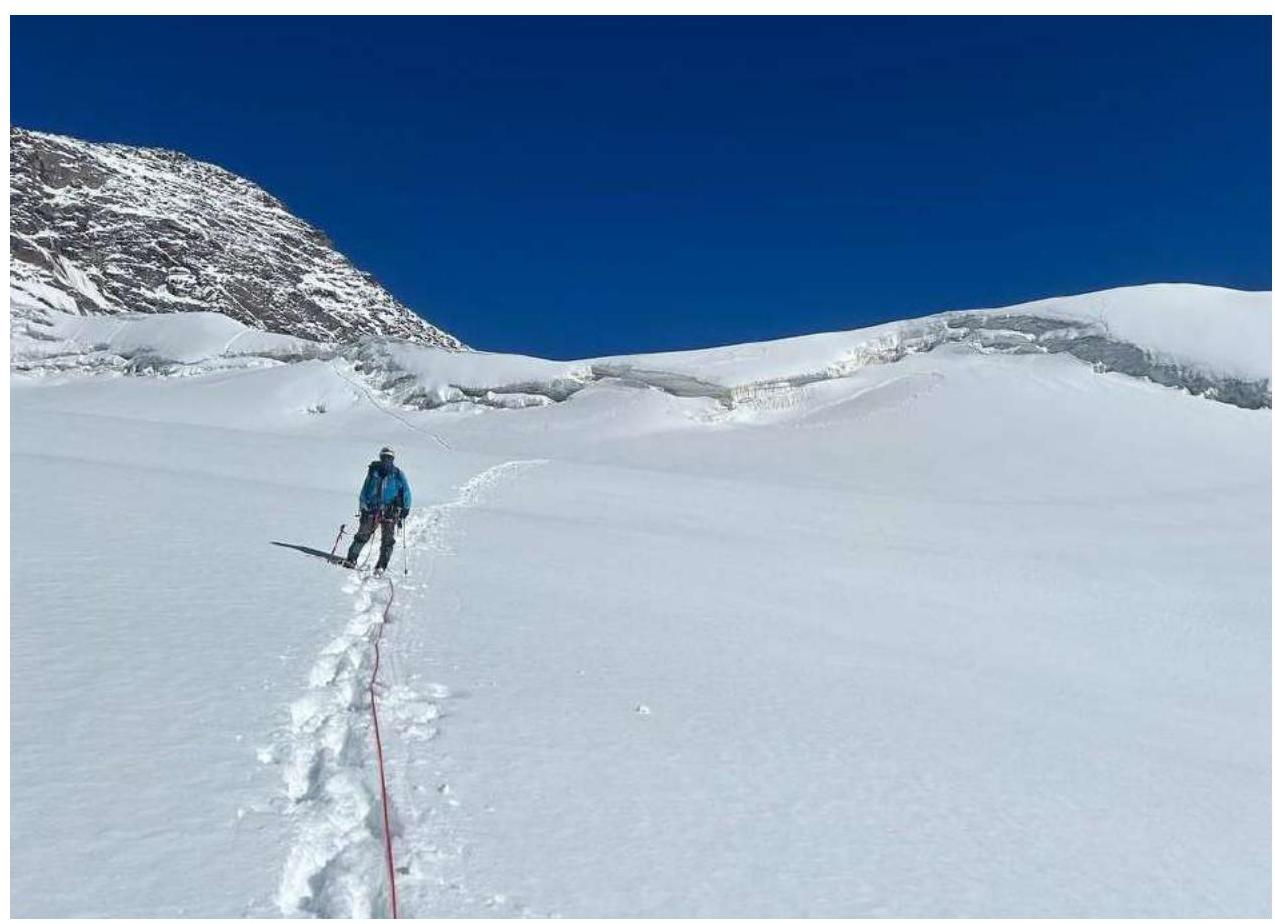
Photo 3. Ascent through the bergschrund to Mertzbacher Saddle.
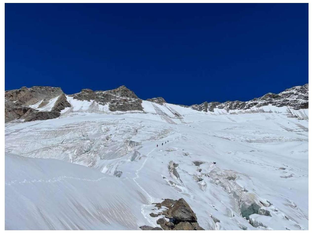
Photo 4. Group descending the SW slope. Photo from Mertzbacher Saddle.
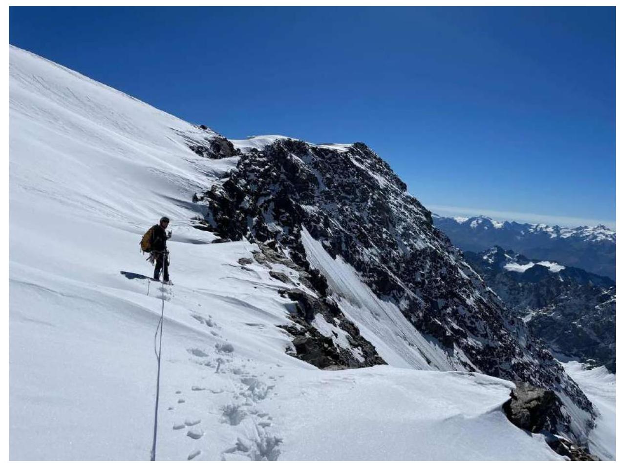
Photo 5. Pre-summit ridge.
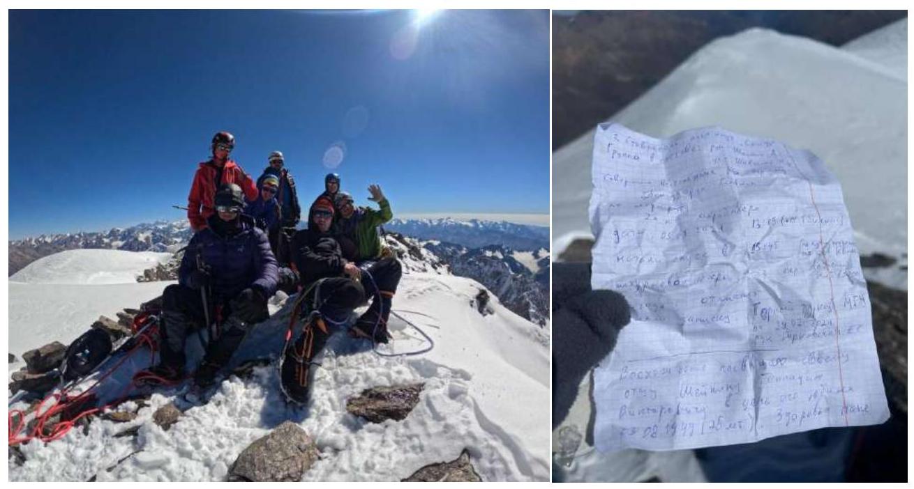
Team at the summit and a note from the summit log
The route is technically not difficult, and the ascent path is generally logical, but it requires a large amount of work in crevassed areas. Due to this, specifying exact distances in the report is problematic because of the constant detours and searches for passages through broken areas of the glacier. Orientation is generally not difficult, but only in conditions of normal visibility.
Main features of the route:
- Extensive crevassed zones on sections R1–R4 represent the main technical difficulty and danger
- The approach to the route is quite long but not difficult
- There is no mobile phone coverage on the route
- Border passes need to be arranged
The route was traversed by the team in two teams moving simultaneously, using belay points only when crossing the bergschrund below Mertzbacher Saddle. There was a lot of snow on the route. The summit is small and rocky. The descent from the summit was made via the ascent route. The route corresponds to category 2A difficulty but is very long and physically demanding. It requires skills:
- for prolonged work on snow and ice terrain
- for navigating and traversing heavily crevassed glaciers