Report
On the ascent to the peak 3858° via the North Ridge, made by the group a/l "Baksan" in the period from July 15–16, 1975, consisting of:
- Bodizhevsky V.K. — leader, Master of Sports of the USSR
- Ufimtsev V.D. — participant, 1st sports category
- Kovtun N.P. — participant, 1st sports category
- Kruk I.P. — participant, 1st sports category
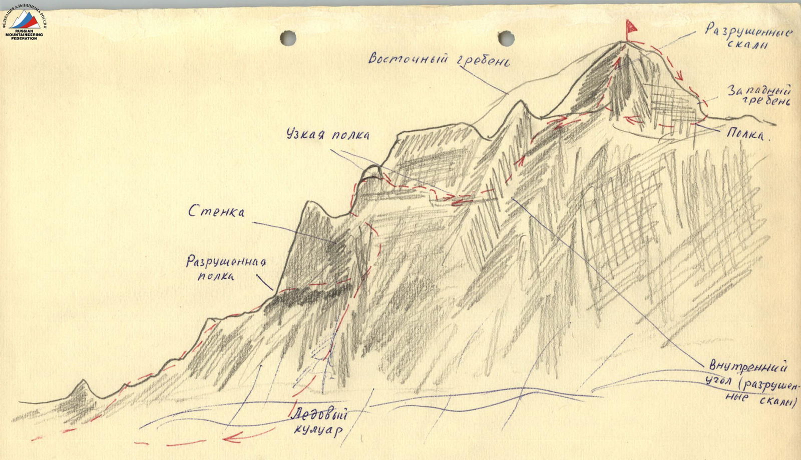
Description of the route
From the Azau meadow through the canyon, exit to the final lateral moraine of the tongue of the Bolshoi Azau glacier. Climb up the moraine to the glacier, cross it upwards to the left, and exit to the scree to the "Sand Hotel" below the Chipper-Azaou glacier — to the left of the Bolshoi Azau glacier. The "Sand Hotel" is the initial bivouac.
From the bivouac, go up towards the Chipper-Azaou pass, crossing the stream. Then, go upwards to the left along the glacier towards the North Ridge of peak 3858°.
On the right side of the ridge, or along the ridge (the ridge is a destroyed rock with many small gendarmes) to a large gendarme. Bypass the gendarme on the right along a ledge to the ice couloir. Up the ice couloir, crossing it from bottom to top, 80 m, exit to scree ledges under a vertical wall (piton protection).
From the ledges, go upwards to the left for 40 m to a lowering in the ridge (pitons).
Further along the sharp ridge to a narrow slot that cuts the gendarme in two halves. Movement:
- straight up the slot,
- or to the right of it along a narrow ledge (belay!) — 40 m.
From the narrow ledge, descend 45 m to the next ledge, and along it for 3 rope lengths to a wide internal angle leading to the pre-summit ridge.
Up the internal angle (destroyed rocks, belay!) to a lowering between the main and pre-summit ridges. Then along the ridge to a steep ascent up steep and heavily destroyed rocks (80 m) to the pre-summit ridge and further to the summit.
From the lowering, a traverse along a ledge to the West Ridge is possible, and along it to the left to the summit. The second path is less rockfall-prone.
4 pitons were hammered on the route.
Descent is via the ascent route. The route is rated 2B category of difficulty.
Map of the ascent area
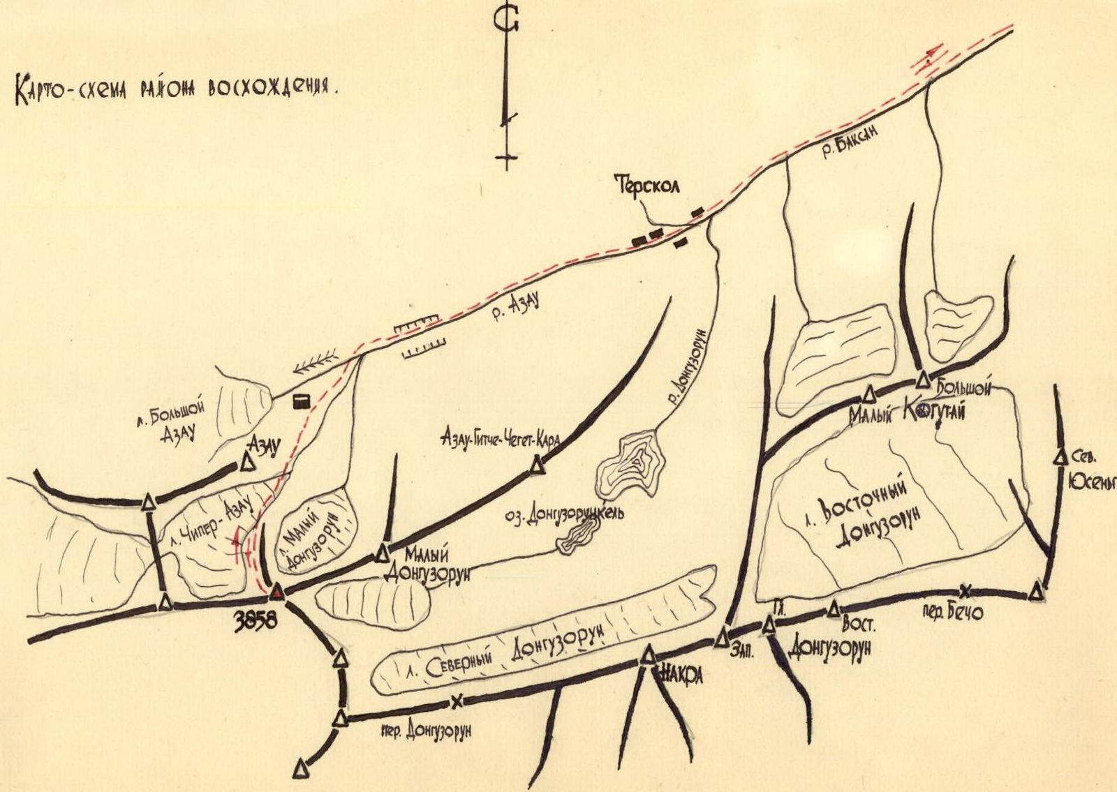
Diagram of the ascent to peak 3858° via the North Ridge