Passport
-
Climbing category — rock.
-
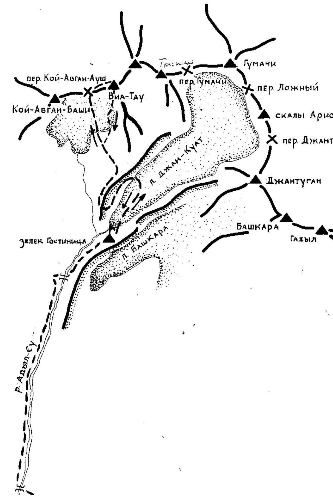
Central Caucasus, NW spur of the Main Caucasian Ridge, Mt. Gumači.
-
Mt. Viatau 3820 m via the 3rd ridge, combined route.
-
Proposed category of difficulty: 2B confirmed.
-
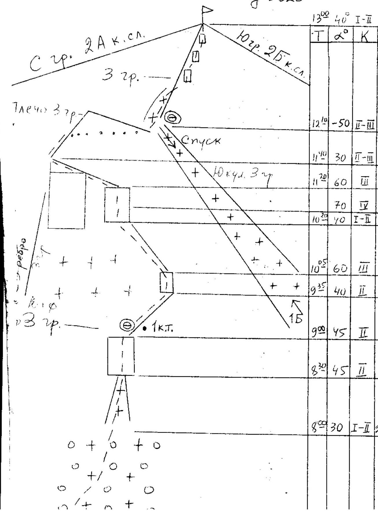
Height difference: 530 m, distance: 1060 m. Length of sections with III category of difficulty: 145 m, IV category of difficulty: 15 m.
Average steepness of the main part of the route: 47°.
- Pitons hammered in:
rock — 9/0, chocks — 2/0
- Traveling hours — 5
day 1
- No overnight stays. Possible overnight locations are marked on the diagram.
- Leader — S.P. Faleev, 1st sports category
participants: S.I. Nagorny, Master of Sports, E.M. Myagkov, 1st sports category, V.K. Burundukov, 2nd sports category
- Coach A.P. Makhinov, 2nd sports category. Departure on the route: August 15, 1985, 4:00 AM.
Reached the summit: August 15, 1985, 1:00 PM. Returned to the KSP: August 15, 1985, 5:55 PM.
- Organization: Elbrus region KSP
 |
|---|
BMA-TAY

8. Viatau 3820 m
Explanations
The route begins on steep snowy scree at the base of the Western ridge of Viatau (R0). The ascent goes straight up through the snow with step kicking, possibly in turns.
Further (R1) through a system of couloirs with snow (piton protection) to alternating slabs with ledges (22), which lead to a wide snowy cirque between the Western ridge on the right and the North-Western ridge of the Shoulder — Western — ridge (R3).
The ascent path goes to the right and up to the first control cairn, then along the Western ridge to a gendarme (R4), which is overcome head-on (piton protection). Beyond the gendarme (R5), a steep wall below the Western ridge, which is complex in its lower part and is traversed with thorough piton protection (Р?), and higher up — easier (R6).
Further along the Western ridge to the left, bypassing a small rock on the right and to a gap in the Western ridge (R9).
The descent (piton protection), initially steep, leads to the upper part of:
- The Djnogo couloir of the Western ridge (route 1B category of difficulty) (R10).
Further ascent goes along slabs and ledges to the summit (R12). Descent follows the ascent path down to the upper part of the Djnogo couloir of the Western ridge (R10) and then down this couloir.