ASCENT LOG
Bukabashi via the right part of the southern wall and the eastern ridge
(Report on the first ascent)
- Technical category.
- Central Caucasus, Almalykaya Ridge
- Bukabashi via the right part of the southern wall and the eastern ridge 3500 m.
- Supposed to be 4A category of complexity, first ascent.
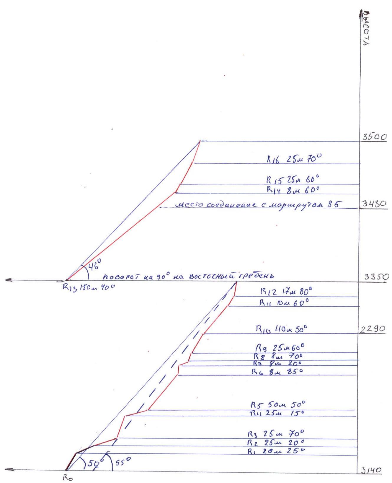
- Elevation gain: 370 m, length — 504 m.
The length of sections of the 5th category of complexity — 25 m. The length of 6A-6B sections — 0 m. The average steepness of the main part of the route — 55°, the entire route — 48°.
-
Total number of pitons left on the route — 0 pcs., including:
bolt pitons — 0 pcs.
Pitons used on the route:
- stationary bolt pitons — 0 pcs., including ITO — 0
- removable bolt pitons — 0 pcs., including ITO — 0
- rock pitons, nuts, friends — 21 pcs.
-
Team's total climbing hours: 9 hours and days — 1.
-
The group did not make any overnight stops on the route.
-
Team leader: Sergey Butov — 1st sports category
Roman Ivanov Ovsyannikov Mikhail — 2nd sports category
Mikhail Popov — 1st sports category.
-
Coach: Nikolai Motienko — Candidate Master of Sports, instructor II category.
-
Approach to the route: May 19, 2008 6:00 AM
-
Summit: May 19, 2008 4:00 PM
-
Return to Base Camp: 8:00 PM
-
Organization: FREELINE mountaineering club.
general photo of the summit view from the south
- yellow line — Fatakhov's route, 3B category of complexity
- red line — first ascent
general photo of the summit
view from the north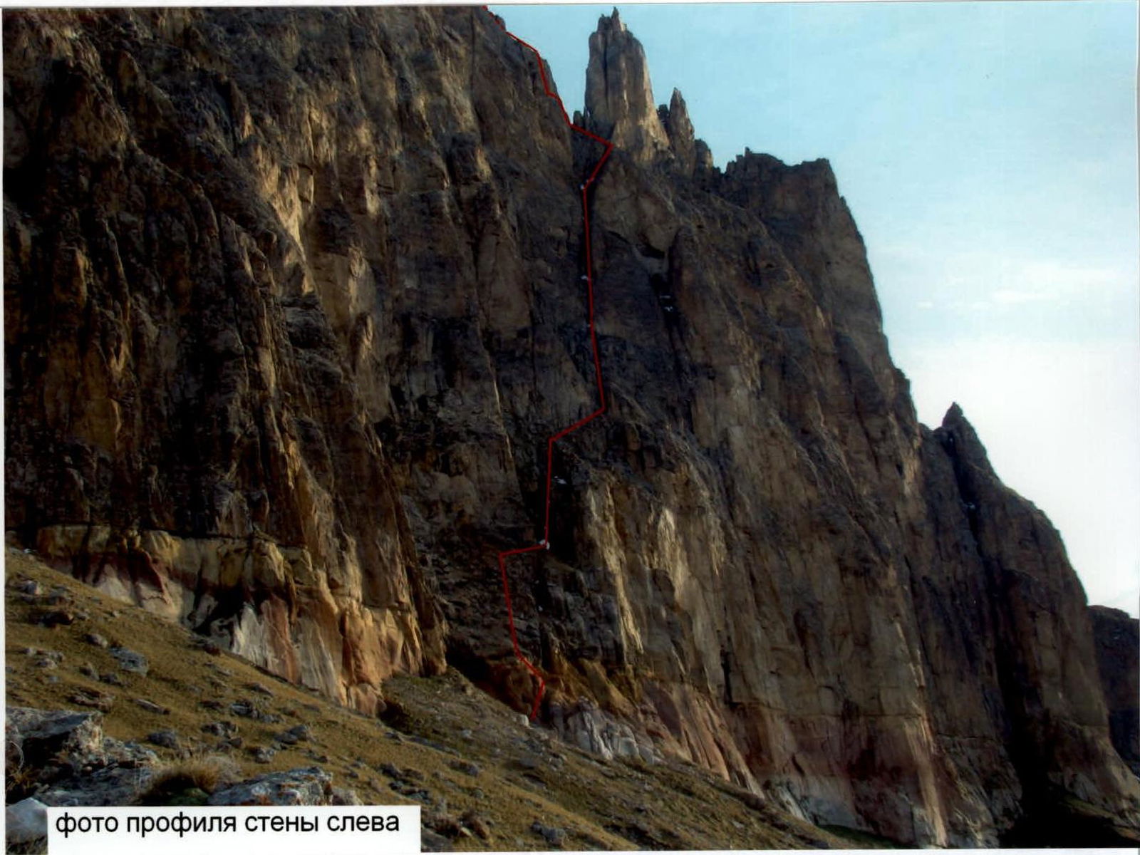
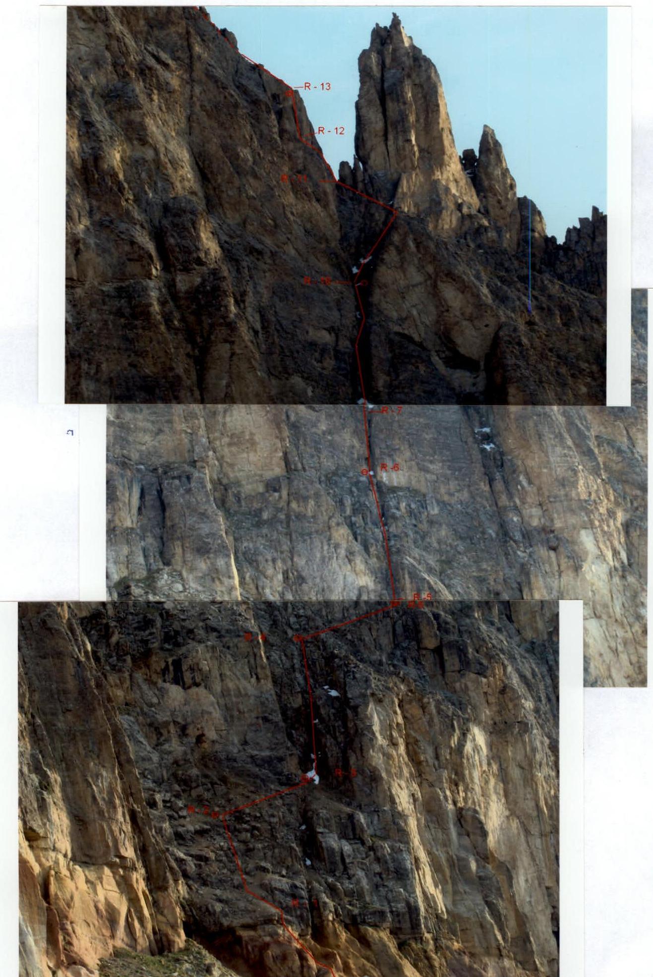
Drawn profile of the route
Photopanorama of the area. View from the northeast

Overview of the area
The Bukabashi peak is located in the upper reaches of the left tributary of the Gidzhit River, which flows into the Baksan River. The Bukabashi peaks rise as rocky towers in the heavily destroyed rocky ridge of Almalykaya, closing the upper reaches of the Gidzhit from the northeast. To the north, opposite Bukabashi, is the Inal massif; to the northwest, the Kinzhal plateau is visible.
Access to the area
A dirt road leads to the peak. It starts from the side of the bridge across the Baksan River. Immediately after the village of Bylym — turn right over the old bridge, then left along the serpentine to a small concrete bridge, after which turn left and exit to another serpentine on the left side of the valley. On the right side is a huge reservoir. The road goes 100 m under it, bending around and heading west, and leads to the southern side of Bukabashi — to the cheese factory. From the cheese factory begins the ascent to the base camp.
Approach to the base camp
In principle, the base camp can be set up right at the cheese factory, near the car. However, due to the large number of sheep and cows, it is more convenient to climb 15-20 minutes up and to the left. There are platforms for tents. The approach to the route from here will take 1-1.5 hours.
Ascent schedule
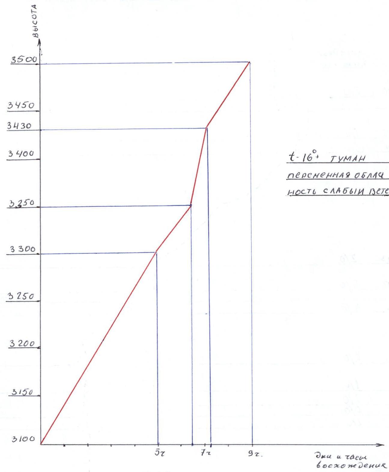
Air temperature –16 °C. Fog. Variable cloudiness, light wind. Climbing hours — 9. Scale 1:2500.
Route diagram in conventional symbols
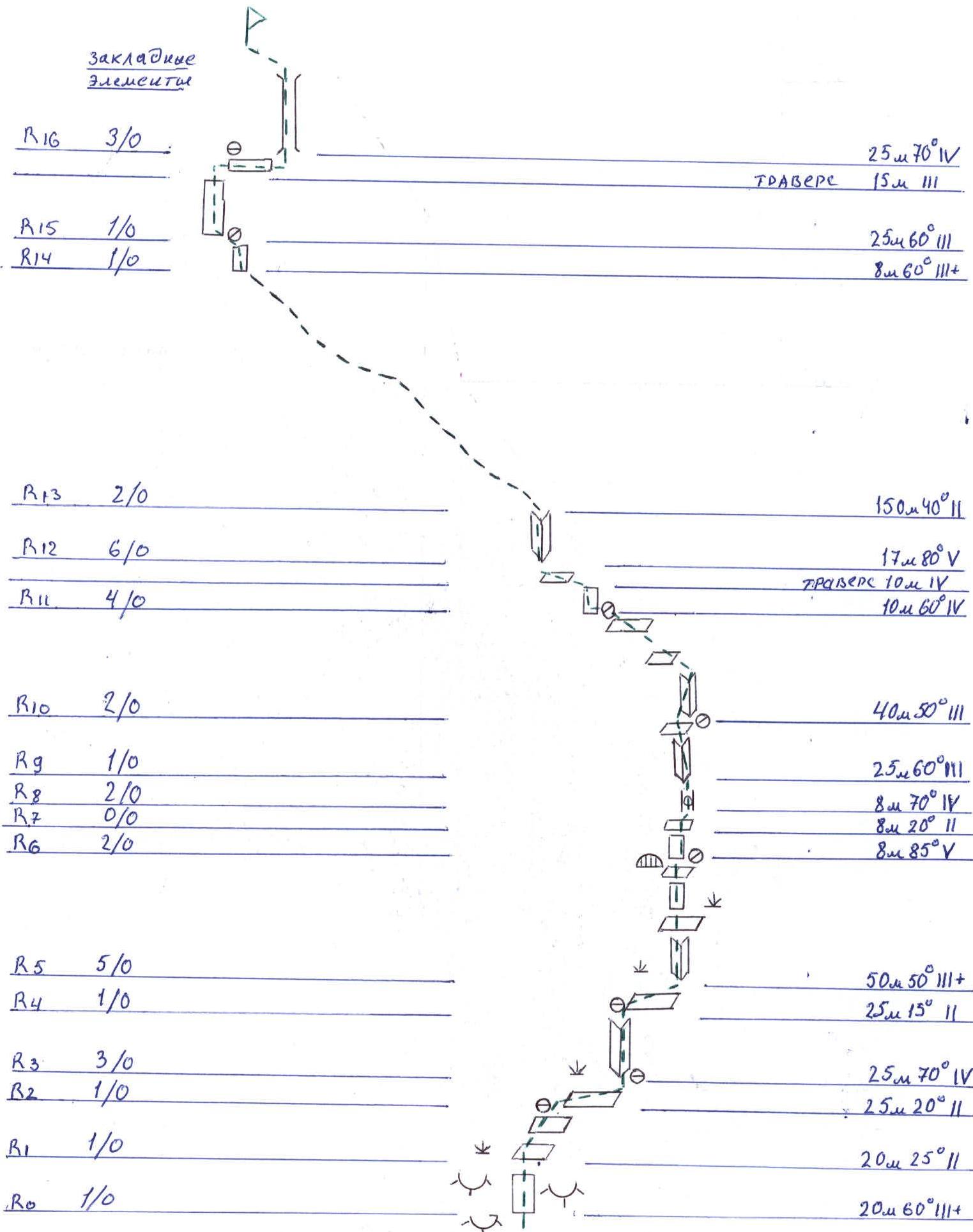
Route description
The route starts 80 m to the right of the grassy ridge extending from the middle of the southern wall to the south towards the road. 20 m along the "ram's foreheads" consisting of crumbly clay rock at 60° 3+ category of complexity.
- R1–R2: 20 m up and to the right along simple shelves — 25°, 2nd category of complexity.
- R2–R3: Traverse to the right towards a large internal corner — 25 m, 20°, 2nd category of complexity.
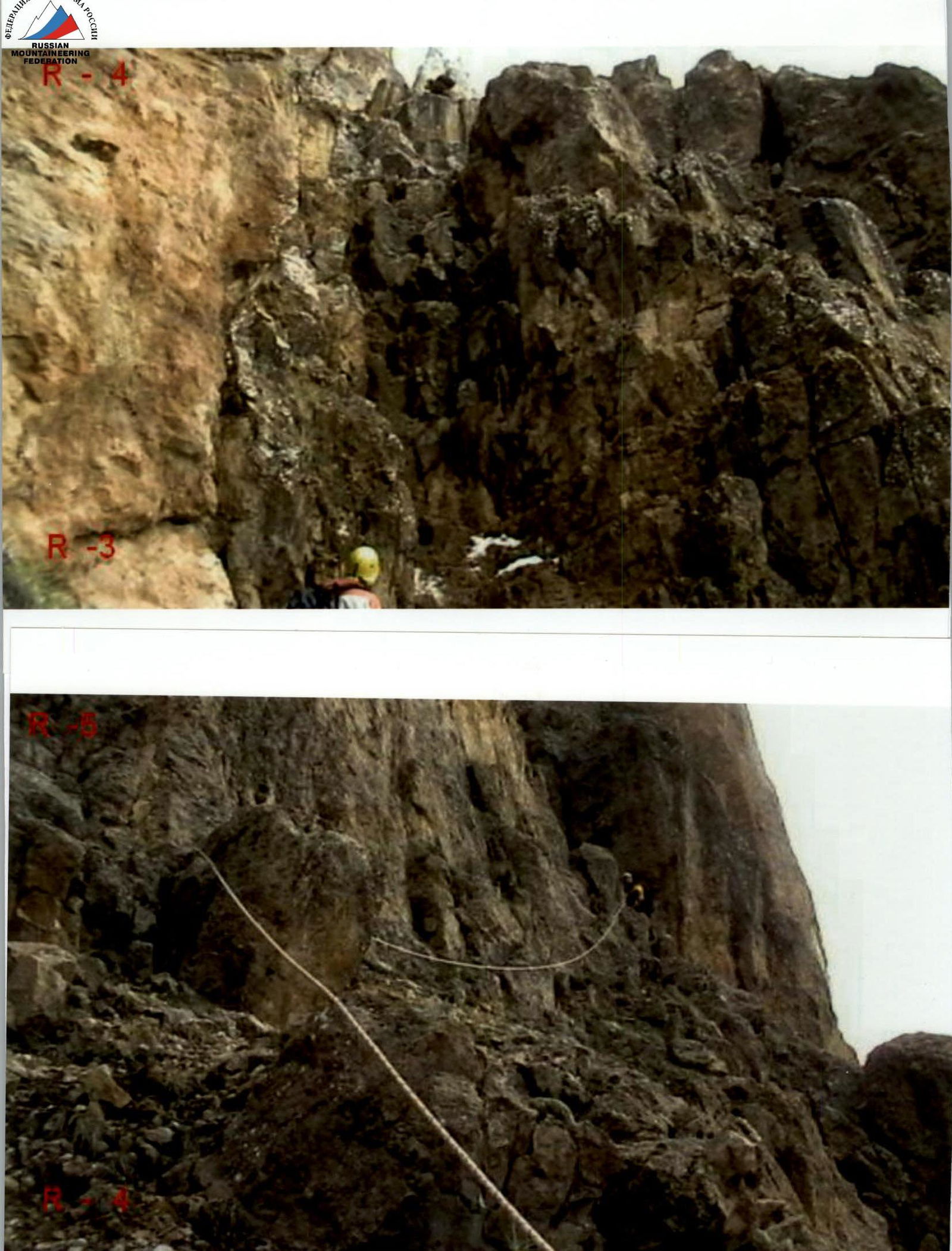
- R3–R4: Up through the center of the internal corner or along its right wall — 25 m, 70°, 4th category of complexity, exit onto a wide ledge.
- R4–R5: Along the ledge 25 m to the right to the beginning of the next internal corner.
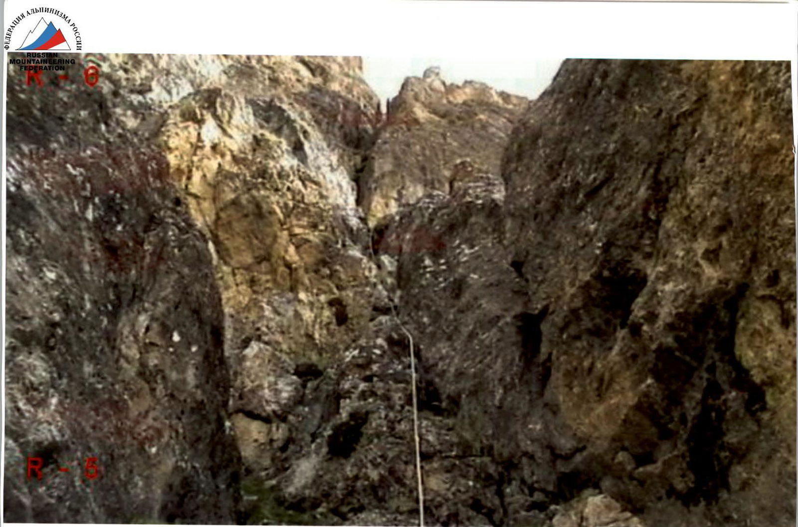
- R5–R6: Along the wide internal corner — a couloir, then along a wide ledge and a short wall, we approach an 8-meter wall with a niche and a large stone in the lower right corner — 50 m, 50°, 3+ category of complexity. There's a belay station in the niche.
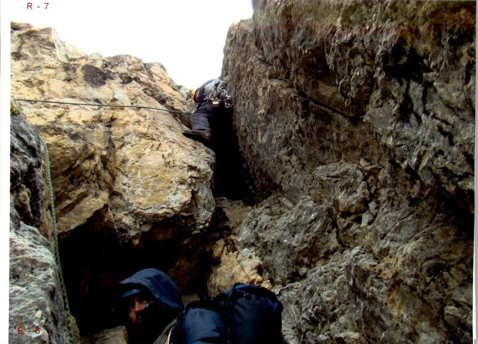
- R6–R7: Up the center of the wall or through a wide crack on the right side — 8 m, 85°, 5th category of complexity, exit onto an inclined ledge.
- R7–R8: 8 m up along it towards a large chimney with a stone in the middle.
- R8–R9: 18 m up the right wall of the chimney and through a "plug" — 70°, 4th category of complexity.
- R9–R10: The chimney turns into a large internal corner — a couloir, along it — 25 m, 60°, 3rd category of complexity to a small ledge with a niche. Belay station.
- R10–R11: Further up the internal corner 25 m to a wide ledge on the right and from it 15 m to the left along ledges to a saddle — 50°, 3rd category of complexity. Belay station on the saddle.
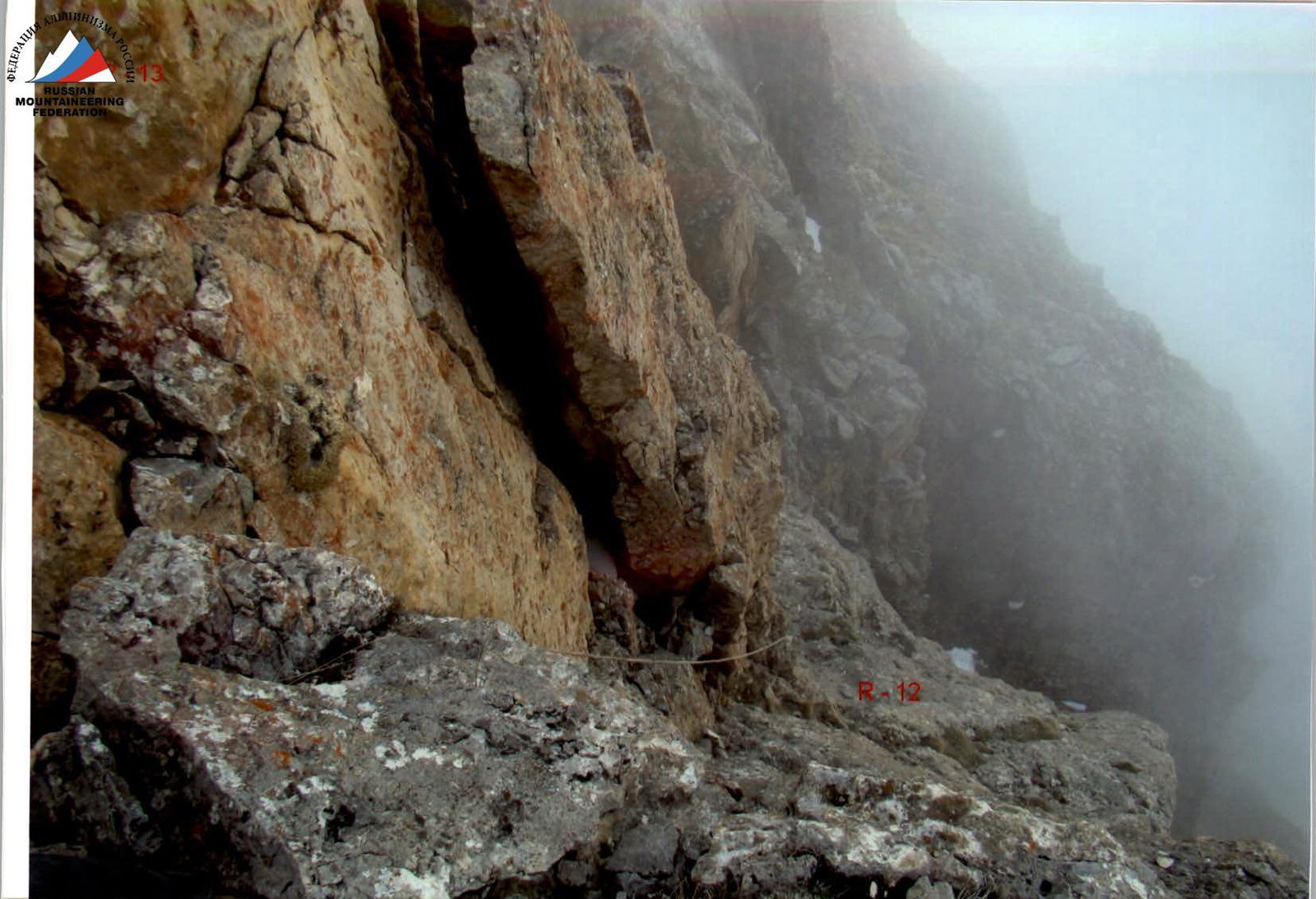
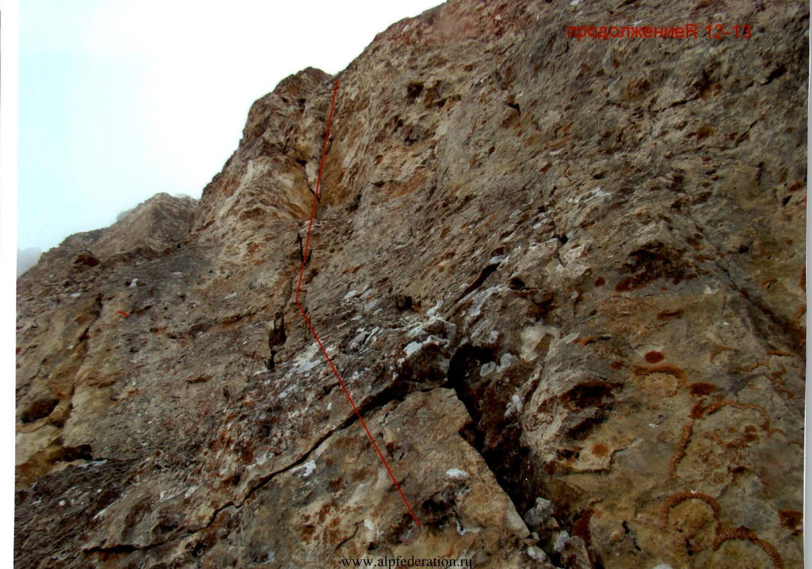
- R11–R12: From the saddle up and to the left — 10 m, 60°, 3+ category of complexity. Then traverse to the left along small ledges 10 m to a vaguely defined internal corner.
- R12–R13: Along it — 12 m to a small ledge for two people, from the ledge another 5 m to exit onto the eastern ridge — 80°, 5th category of complexity.
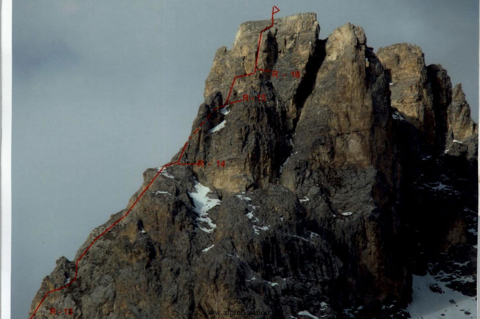
- R13–R14: Along simple rocks of the eastern ridge 150 m to join the 3B category route.
- R14–R15: Bypass a gendarme on the left along simple ledges and behind it along an 8-meter wall — 60°, 3+ category of complexity, ascend to a saddle.
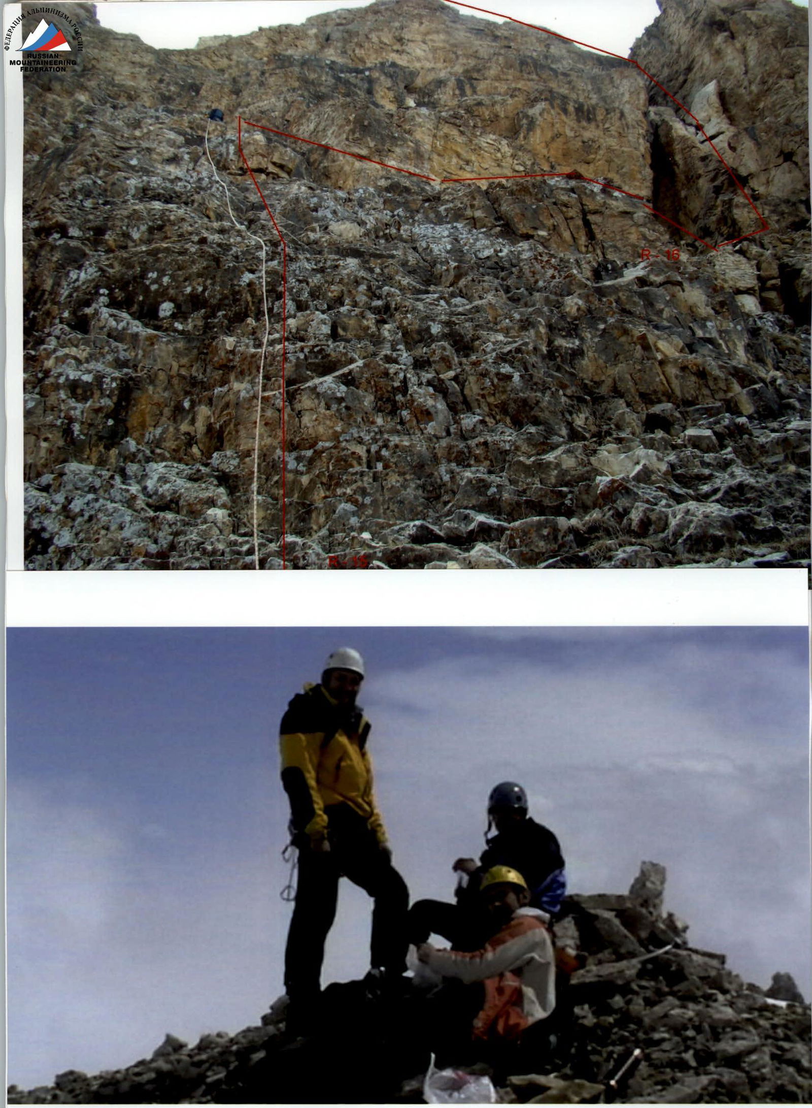
- R15–R16: From the saddle along simple rocks of the pre-summit tower — 25 m, 60°, 3rd category of complexity up to a wide ledge with a "carrot", along the ledge 15 m to the right and down to the beginning of a large destroyed chimney.
- R16–R17: Along the right wall of the chimney — 25 m, 70°, 4th category of complexity. Exit to the summit.
On the eastern side of the summit — rappel anchor. Descent to the saddle. Further along the ascent path to the point of exit onto the eastern ridge of the mountain. From here, one rappel to the left onto the northern slope of the mountain. Further — on foot, bypassing the mountain from the east, to the camp. It is possible to descend along the ascent route, but there is a high probability of dislodging a stone with the rope.
Tactical actions of the team
The route line is logical, and it's practically impossible to deviate. The first 6 ropes go through a system of internal corners to a clearly defined saddle on the eastern ridge. Further along the eastern ridge to the junction with the 3B category route. The ascent to the pre-summit tower was made on the right through a chimney, rather than on the left, as in the 3B category route, due to the obvious rockfall hazard in that area. The first six ropes were preliminarily climbed in February 2007. On the route, the leader was changed three times. Traverses between internal corners and three ropes along the eastern ridge were climbed simultaneously. When organizing a rappel from the eastern ridge to the north, the belay station was set high. Eight meters were missing to reach the ground. It was necessary to extend the rope. Equipment used — two main ropes, a set of friends and nuts.
Recommendations
When passing the R3–R4 section, it is better to stick to the option on the right wall due to the rockfall hazard inside the corner. The key section of the route R11–R13, due to its curvature, should be divided into parts. It is best to move the belay station from the saddle 10 meters higher to avoid working as a " Burlak". It is advisable to move the rappel station of the last rappel from the eastern ridge 10 meters lower to have enough rope to reach the ground. The base camp should not be set up too high; there will be problems with water. In principle, it is possible to set up camp not far from the cheese factory. 500 meters higher, both to the left and right of the slope, there are springs that disappear higher up. There are good spots for a campsite on the southwest slope — from the cheese factory up and to the left.
Safety assessment of the route
The mountain is generally prone to rockfall, but rockfalls were not observed. The route passes through protected areas, but there is a high probability of dislodging stones with the rope onto oneself. For belayers, there are safe positions everywhere. The ascent to the pre-summit tower is better done on the right through a huge destroyed chimney due to the high rockfall hazard on the left side of the tower. When organizing the first rappel, it is advisable for everyone who has descended to be three meters above the saddle under the protection of rocks. Stones dislodged by the rope fly exactly onto the line of further descent. Descent along the ascent route to the south is undesirable due to the above-mentioned problems. Therefore, we recommend a safe descent to the north and further path to the camp, bypassing the mountain from the east.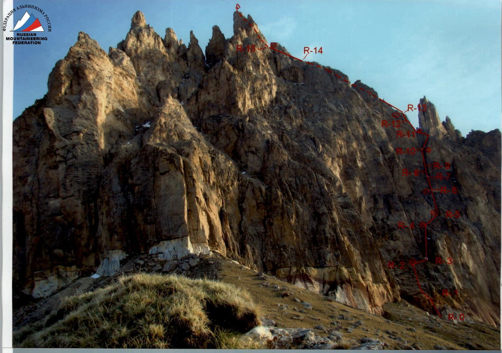
R14

R7