REPORT
ON THE ASCENT TO THE SUMMIT 1000-летия Ярославля VIA THE ROUTE THROUGH Жандарм Узловой, CATEGORY 2A, BY THE TRAINING DEPARTMENT OF A/C «ПОЛИТЕХНИК» UNDER THE GUIDANCE OF SOBOLEV A.A. ON AUGUST 4, 2022.
I. ASCENT DETAILS
| № | 1. General Information | |
|---|---|---|
| 1.1 | Full name, sports rank of the leader | Sobolev Alexey Alexandrovich, 1st sports rank |
| 1.2 | Full name, sports rank of participants | Abukhaniy Sabrina Mohammadovna, 3rd sports rank; Volobueva Anastasia Nikolaevna, 3rd sports rank; Kazakov Viktor Anatolyevich, 3rd sports rank; Romanov James Borisovich, 3rd sports rank |
| 1.3 | Full name of the coach | Molodozhen V.A. MS |
| 1.4 | Organization | A/C «Polytechnic» St. Petersburg |
| 2. Characteristics of the Ascent Object | ||
| 2.1 | Region | Caucasus, from the Chiperaza pass to the summit Gumachi (Baksan, Adylsu, Shhelda, Kyrtik valleys) |
| 2.2 | Valley | Adyr-Su |
| 2.3 | Section number according to the 2013 classification table | 2.4. |
| 2.4 | Name and height of the summit | 1000-летия Ярославля, 3680 m |
| 2.5 | Geographic coordinates of the summit (latitude/longitude), GPS coordinates *(1) | Latitude: 43.20480, Longitude: 42.77638. Coordinates are given in the WGS-84 system |
| 3. Characteristics of the Route | ||
| 3.1 | Name of the route | Through the Узловой pinnacle |
| 3.2 | Proposed category of difficulty | 2A |
| 3.3 | Degree of route development | - |
| 3.4 | Character of the route relief | Rocky |
| 3.5 | Height difference of the route (altimeter or GPS data) | 500 |
| 3.6 | Length of the route (in meters) | 1000 |
| 3.7 | Technical elements of the route (total length of sections with different difficulty categories, indicating relief character (ice-snow, rocky)) | I cat. rocky – 350 m. II cat. rocky – 650 m. Rappelling (on descent) – 1 section, 60 m |
| 3.8 | Descent from the summit | Via the ascent route |
| 3.9 | Additional route characteristics | - |
| 4. Characteristics of the Team's Actions | ||
| 4.1 | Travel time (team's walking hours, in hours and days) | 10 hours |
| 4.2 | Overnight stays | Koyavgan |
| 4.3 | Departure on the route | 2:15 04.08.2022 |
| 4.4 | Arrival at the summit | 7:55 04.08.2022 |
| 4.5 | Return to the base camp | 12:20 04.08.2022 |
| 5. Person Responsible for the Report | ||
| 5.1 | Full name, e-mail | Volobueva A.N. anastasiavolobueva@gmail.com |
*(1) Filled in ONLY if the summit is not listed in the Electronic Russian Classifier of Routes to Mountain Summits
II. ASCENT DESCRIPTION
1. Characteristics of the Ascent Object
1.1.
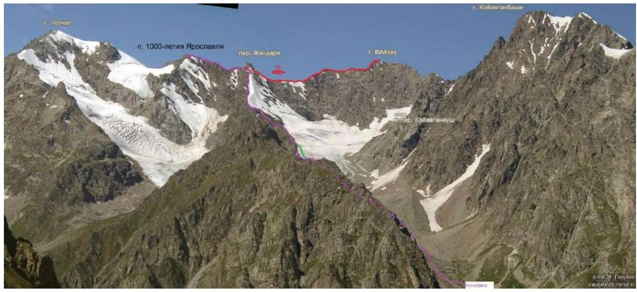
Source of the photo: http://caubasephotos1.narod.ru/photos/cau_0941_mg.jpg↗
The purple line indicates our route, the red line is the route to VIA-Tau via the N. ridge, 2B, and the green line marks the rappelling descent.
1.2. Photo of the route profile, size not less than 13 × 18 cm
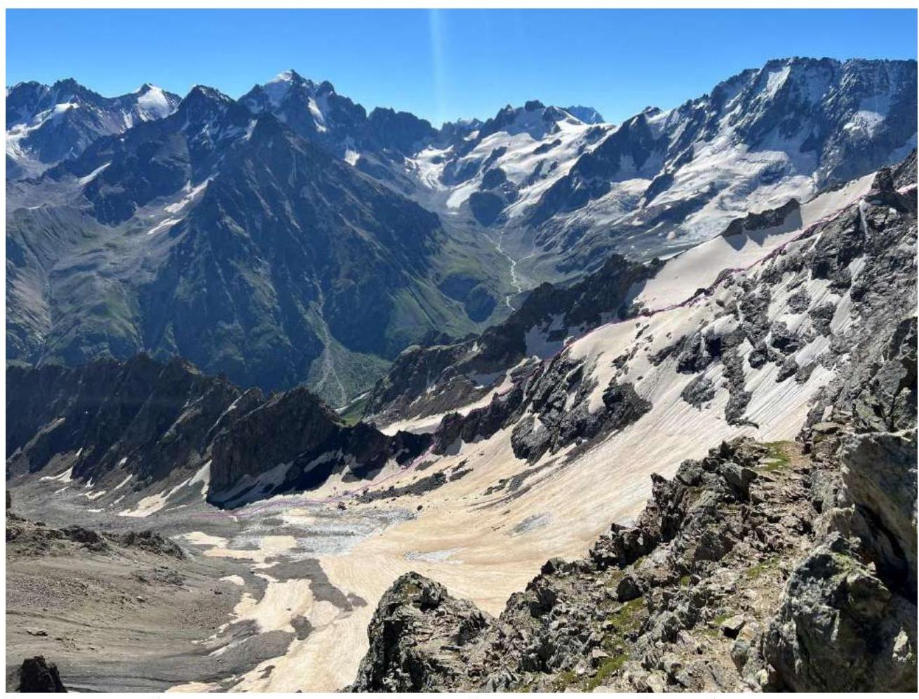
View of the ridge from the Узловой pinnacle and the eastern ridge from the summit of Чотчат and the Koyavgan glacier. Date of the photo: 29.07.2022. Location – Ложный Koyavgan pass.
1.3. Photopanorama of the area

Source of the photo: http://caubasephotos1.narod.ru/photos/cau_0941_mg.jpg↗
1.4. Map of the area
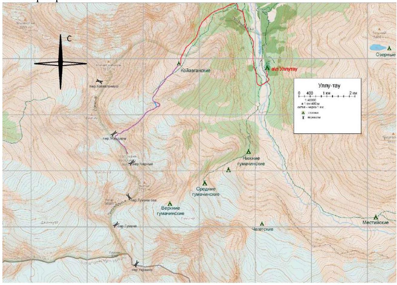
The red line indicates the approach to the overnight stay, the purple line is our route, and the blue section marks the rappelling descent.
2. Characteristics of the Route
The summit 1000-летия Ярославля is located in the Northern spur of the Main Caucasian Ridge, between the valleys of the Adylsu and Adyrsu rivers, between the summits of Чотчат and VIA-Tau. The ascent via the 2A route through the Жандарм pass is done from the Koyavgan overnight stays. As of 2022, the ascent to the overnight stays from the Ullutau tourist base is as follows:
- First, along the right bank of the Adyrsu river to the border post
- Then, crossing the bridge 30 m below the border post, move along the left orographic bank downstream to the waterfall
- Cross the stream
- Move up the steep path, initially between trees, then the trees end and the path becomes gentler, leading to the overnight stays on the left-bank moraine of the Koyavgan glacier
Time from the camp – 2–3 hours.
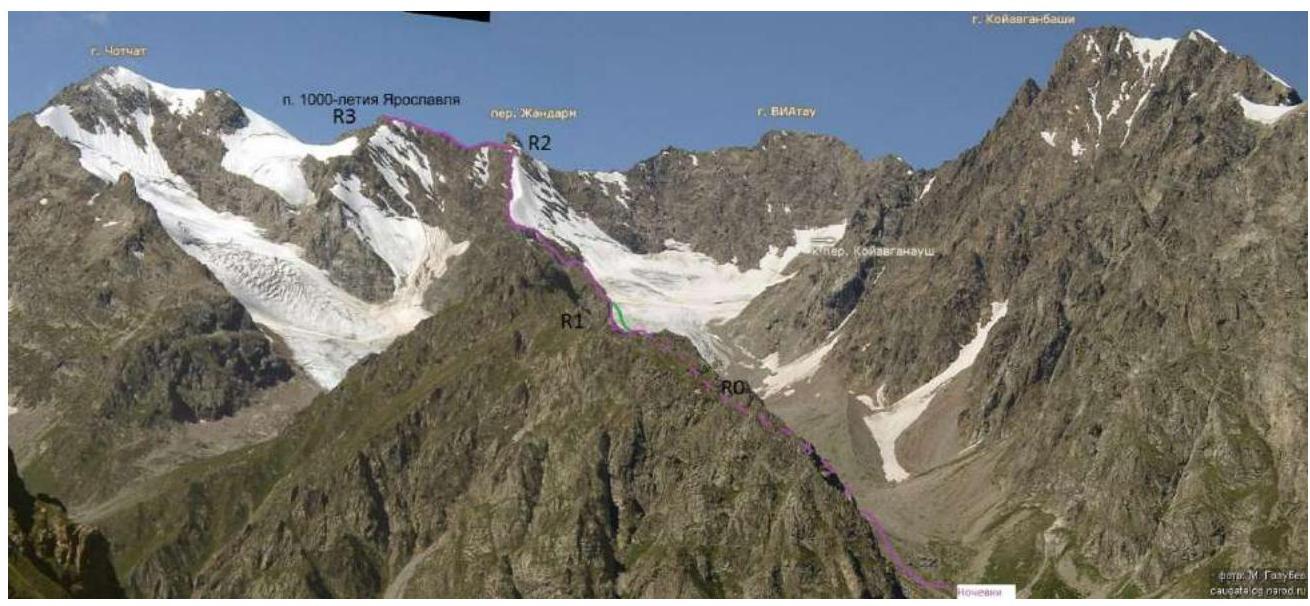
Technical characteristics of the route sections
| Section № | Relief character | Category of difficulty | Length, m | Type and number of pitons |
|---|---|---|---|---|
| R0–R1 | Glacier | n/k | 200 | - |
| R1–R2 | Destroyed rocks | 1–2 | 500 | 10, chocks, protection on ledges |
| R2–R3 | Destroyed rocks | 1–2 | 300 | 3, protection on ledges |
Overnight stays – R0: From the overnight stays, follow the cairns towards the middle moraine of the glacier, then stay near the right-bank moraine until it ends.
R0–R1:
- Enter the glacier, move towards the gap in the ridge descending from the Жандарм pass.
- The ascent to the ridge depends on the time of year and snow conditions, either via a snowy or scree slope.
R1–R2:
- Initially, bypass the ridge rocks to the left – ascent to the upper part of the ridge (landmark – rappelling loops).
- Then move along the ridge.
- местами по разрушенным скалам, местами по стенкам, обходя сложные участки по осыпным склонам.
- Stay on the upper part of the ridge, not going down too much.
- To Жандарм, the path repeats the initial part of the route to VIA-Tau 2B via the S. Ridge.
R2–R3: Bypass Жандарм via the ledges on the left, reach the ridge, and move left along the ridge, staying either on its upper part or on the slopes (mainly on the right).
- The first pinnacle is bypassed on the right in the direction of travel
- The second is overcome head-on
- After it, about 3 m of movement along the rocky "knife-edge"
The summit is marked with a metal plaque with the name.
Descent is done via the ascent route. The last part of the ridge from the Жандарм pass
- can be descended by rappelling directly onto the slope under the gap;
- then descend on foot down the snowy slope to the glacier.
3. Characteristics of the Team's Actions
3.1.
| Section № | Description | Photo № |
|---|---|---|
| Overnight stays – R0 | The ascent from the overnight stays is best scouted in advance or initially follow the middle moraine during ascent and then slightly move towards the right-bank moraine of the Koyavgan glacier. There is a path. Marked with cairns. | Photo 1 |
| R0–R1 | Moved up the glacier without crampons, the glacier is gentle, covered with stones. Ascent to the gap in the ridge initially via a snowy slope, then via a scree slope. | Photo 2 |
| R1–R2 | On the ridge, movement was simultaneous with protection. Initially, bypassing the ridge rocks to the left – ascent to the upper part of the ridge (landmark – rappelling loops). Then movement along the ridge. местами по разрушенным скалам, обходя сложные участки по осыпным склонам. Stay on the upper part of the ridge, not going down too much. It is possible to bypass the upper part of the ridge via the ledges to the left of the ridge, but this is slightly more labor-intensive. | Photo 3, 4 |
| R2–R3 | Simultaneous movement along the ridge. When bypassing Жандарм, it is advisable to set several points. From Жандарм, moved via the ledges (mainly on the right) and along the upper part of the ridge to the summit. There is not much space on the summit. | Photo 5, 6 |
Photos from the route: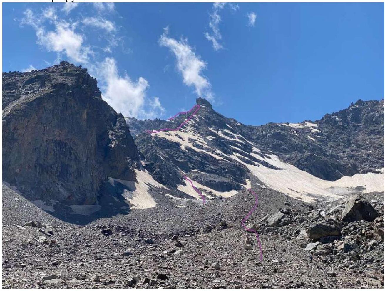
Photo 1. View of the route from the approach path.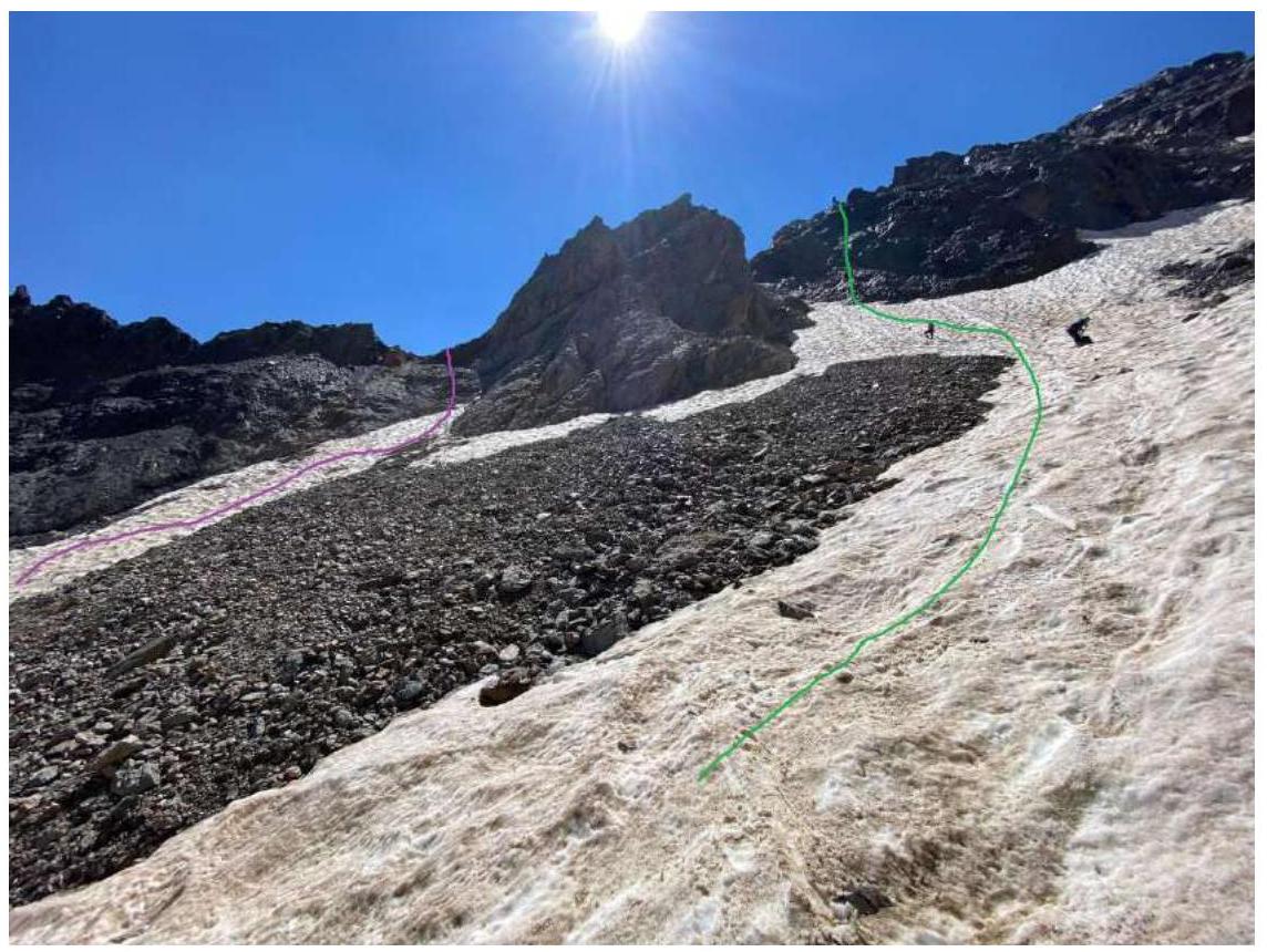
Photo 2. Purple line – ascent. Green – rappelling descent path.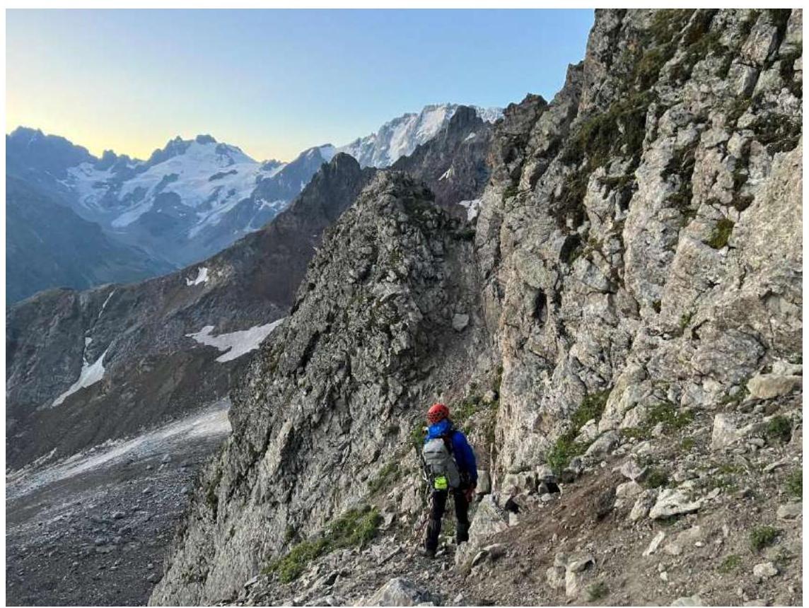
Photo 3. Ledges to the left of the ridge leading to Жандарм Узловой.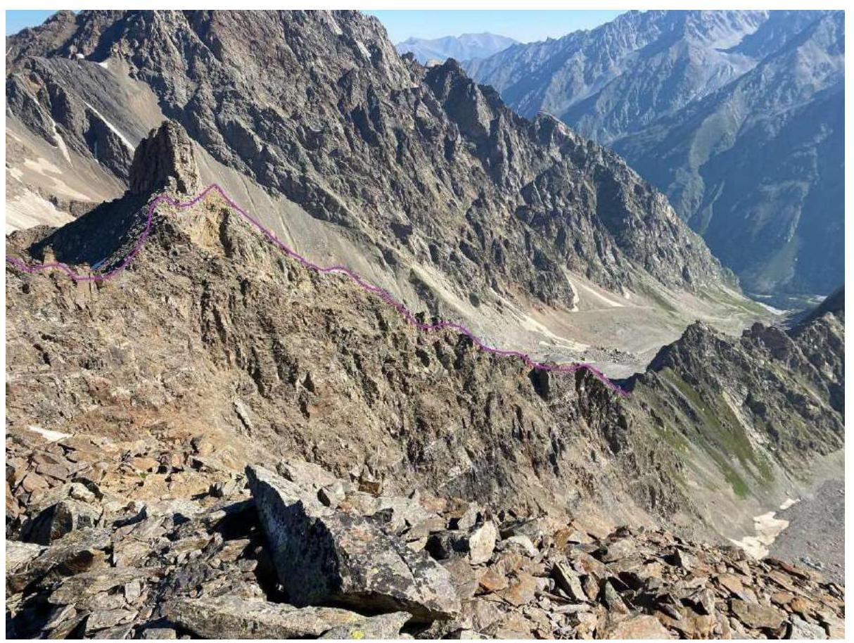
Photo 4. Profile of the ascent along the ridge to Жандарм (view from the ridge on the descent from the summit).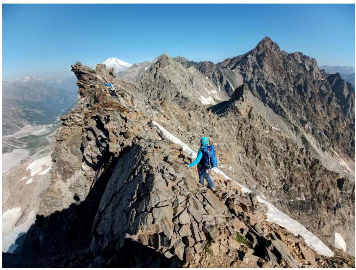
Photo 5. On the ridge between Жандарм and the summit (taken on the return journey). To the right of the center of the photo – Жандарм. And from it to the right and down, the ridge goes, along which the ascent is made.
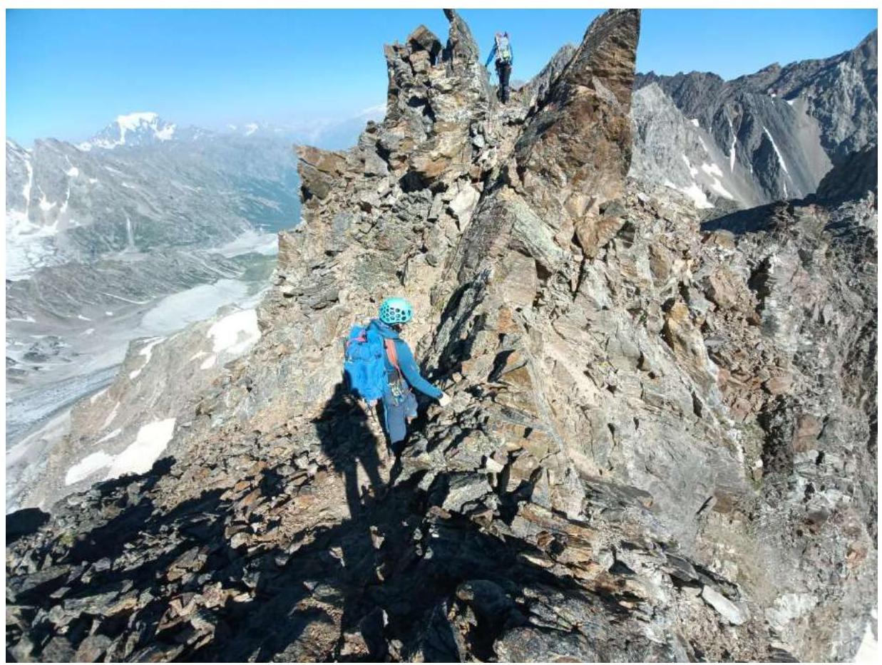
Photo 6. On the ridge between Жандарм and the summit.
3.2. Photo of the team on the summit near the control cairn.

Photo 7. On the summit.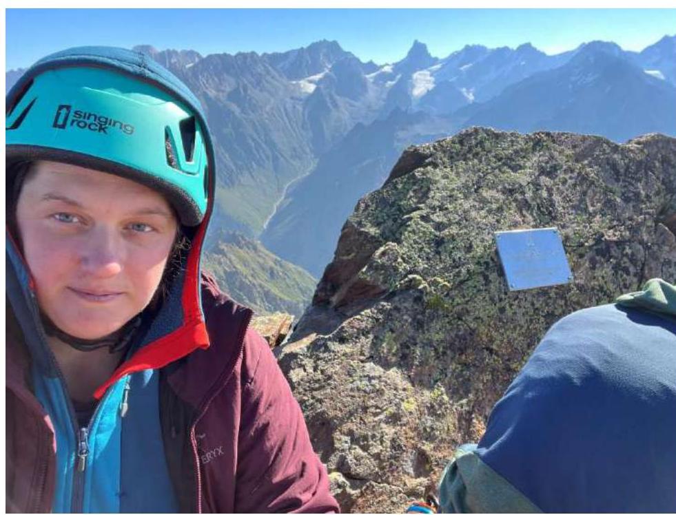
Photo 8. Against the background of the plaque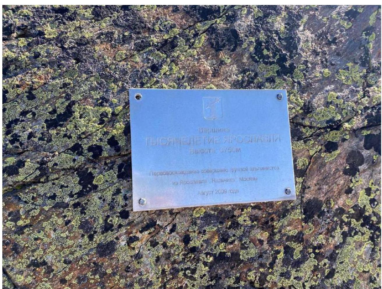
Photo 9. Plaque on the summit.
3.3.
The route is not prone to rockfall hazards since it follows the ridge. It is quite logical, although not frequently visited (we found a note from last year).
Proposed category of difficulty of the route:
- 2A (very similar to 2A via the S ridge on VIA-Tau)