Ascent Passport
- Ascent class — rock climbing.
- Ascent area: Central Caucasus, NW spurs of Adyr ridge, north of South Sabalyk glacier, from Adyrsu gorge side.
- Peak 3800 m, from Southeast, first ascent.
- Estimated category of difficulty — 1B.
- Elevation gain of the route 400 m.
- Pitons used 1/0.
- Number of climbing hours — 7 h.
- No overnight stays on the route. Bivouac on South Sabalyk glacier moraine.
- Leader Kiselev Nikolai Petrovich, Candidate Master of Sports.
Team members:
- Ratin Konstantin Feliksovich, 1st sports category
- Volchansky Evgeny Ignatievich, 1st sports category
- Alikov Vladimir Stepanovich, 2nd sports category
- Nesin Vitaly Pavlovich, 2nd sports category
- Coach Semykin Boris Ivanovich.
- Ascent completed during August 14–17, 1995.
- Alpclub "Vertikal", Volgograd.

View of p. 3800 from the spur of Stal peak
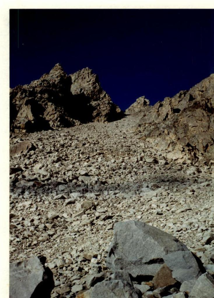
View of p. 3800 from the couloir.
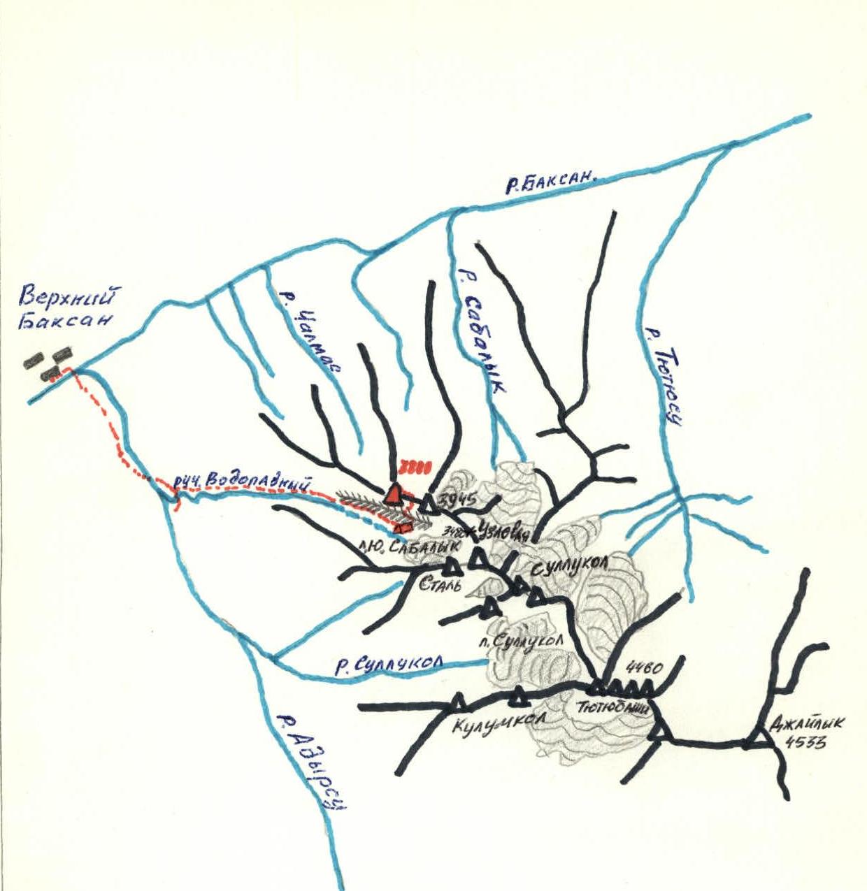
Scale 1:100 000
Schematic map of NW spurs of Adyr ridge.
Approach to the route
From Adyrsu valley, 200 m before the road crosses Vodopadnaya river (first right (photographically) tributary of Adyrsu river), turn left and ascend to the coastal ledge. Along the edge of the ledge, go up the valley for 150 m and, turning left, reach an inclined glade. In its upper part, the glade turns into a wide scree gully, ascending parallel to Vodopadnaya river.
Having ascended the gully to the end of the scree, it is necessary to:
- turn right and reach the ridge separating the gully from the river;
- ascend the grassy slopes to the terminal moraine of South Sabalyk glacier and reach the right-bank moraine.
From Adyrsu river to the bivouac on the moraine 8–9 h. Northwest of Vodopadny pass are unnamed peaks 3945 and 3800. The starting point of the route is the scree in the lower part of the couloir between the mentioned peaks.
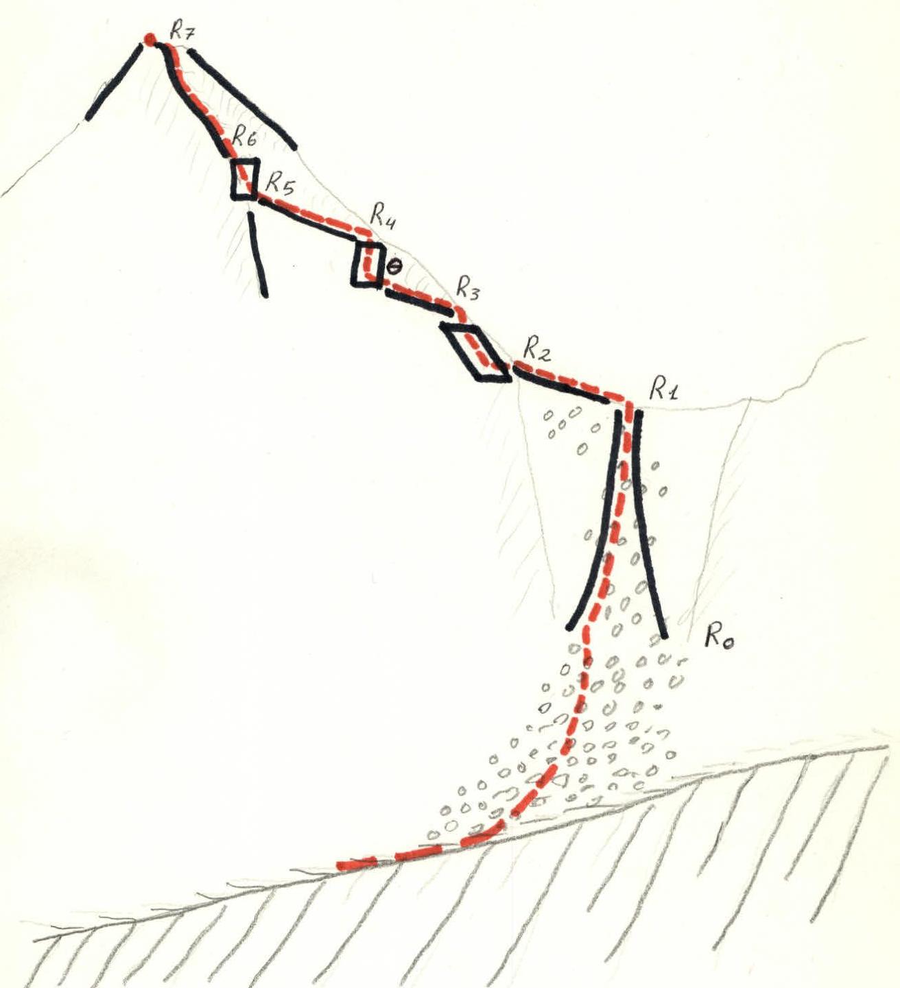
- R0 — 300 m, 25° (scree)
- R1 — 300 m, 30°, 1
- R2 — 40 m, 15°
- R3 — 20 m, 30°, 1
- R4 — 20 m, 60°, 2
- R5 — 20 m, 30°, 1
- R6 — 90 m, 50°, 2
- R7 — 80 m, 35°, 1