Report
on the first ascent of Shogentsukova peak via the South-Eastern wall, approximately 4A category of difficulty.
Ullu-tau 2007
Route Passport
- Mountain system — Caucasus, Adyr-su gorge. Name of the peak: Shogentsukova peak Peak number according to the 2001 classification table: 2.4.161
- Route name: via the South-Eastern wall
- Category of difficulty: 4A Passage: 1st passage Route type — combined.
- Route characteristics: Total length — 920 m. Height difference — 370 m. Average steepness of the main part of the route — 55°, sections — 70°. Length of sections with IV category of difficulty — 120 m. Length of sections with III category of difficulty — 340 m.
- Number of belay points and ITO used on the route: Hammered-in rock pitons — 4 pcs. Placed chocks — 12 pcs.
- Team's travel time on the route: 13 h, 1 day
- Leader: Olik A.P. — Candidate for Master of Sports, Participants: Cherkashenko M.I. — 2nd sports category, But S.Yu. — 2nd sports category, Sirota A.V. — 2nd sports category. Coach — Porokhnya Yu.I. — Honored Master of Sports
- Departure to the route: 5:00, July 18, 2007 Arrival at the summit: 15:40, July 18, 2007 Return to the base camp: 18:00, July 18, 2007
- Organization: OOO SOAB «Ullutau»
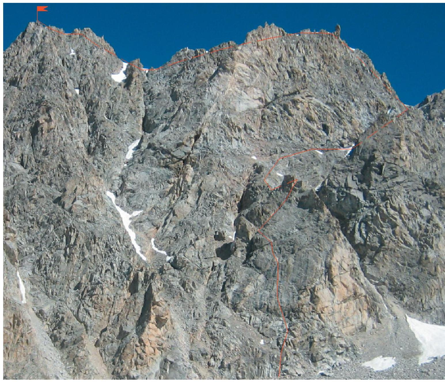
General photo of the route
Report on the team's passage
On July 15, 2007, after a training ascent to Shogentsukova peak via the Southern ridge, 2B category of difficulty, the team moved to a campsite at the end of the moraine between Shogentsukova peak and Jailyk peak. Bad weather.
July 16. Bad weather. Day of rest.
July 17. After bad weather, the lower, most steep part of the wall was covered in snow, which melted by 13:00. By 14:00, the duo Olik — Cherkashenko approached the wall for reconnaissance and, having passed its lower part, returned to the bivouac by 18:00. They took photos of:
- the general view of the route
- the lower part of the wall.
On July 18 at 5:00, the team left the bivouac and approached the start of the route at 5:40. To the left of the clearly visible yellow rocks, they moved via broken rocks of II category of difficulty to the right part of the wall with pronounced black streaks (> 50 m).
Further movement went as follows:
- Left — up the wall through a small exfoliation in its lower part.
- Having moved up to the right of the exfoliation for 20 m, they reached a small shelf (chocks, pitons), where they set up the 1st control cairn (70°, IV category of difficulty).
- Traverse left — up 50 m under the black inner corner with an overhang (60°, III category of difficulty).
- Right — up along the shelves under the overhang (chocks), and then left — exit under the inner corner (40 m, 60°, IV category of difficulty).
- Up the wide inner corner (40 m, 50°, III category of difficulty) to reach under the overhang (2nd control cairn).
- Left along broken rocks 50 m to a saddle (50°, III category of difficulty).
From the saddle, 70 m under the wall to a vaguely defined horizontal shelf (50°, III category of difficulty).
Along the shelf (belay via outcrops), traverse under the wall 120 m to the start of a steep (60°) snow-ice couloir. The couloir is safe.
Then ascent 70 m:
- via the couloir, or
- crossing it in its lower part, via rocks resembling «ram's foreheads» to a shoulder (60°, III category of difficulty) — 3rd control cairn.
From the shoulder, along the South-Eastern wall 50 m to a vaguely defined inner corner (50°, III category of difficulty).
Along the corner, keeping direction towards the right part of the «Pétard» gendarme, exit under the gendarme to the ridge (60°, 60 m, IV category of difficulty).
Bypassing the gendarme to the right, after 10 m, exit to the snowy ridge. Along the snowy ridge, through two dips, exit to the summit (≈250 m).
Reached the summit at 15:40 and descended to the glacier via the normal route (see description for Shogentsukova peak, 2B category of difficulty). Return to the original bivouac via the «Shogentsukova shoulder» took about 3 h.
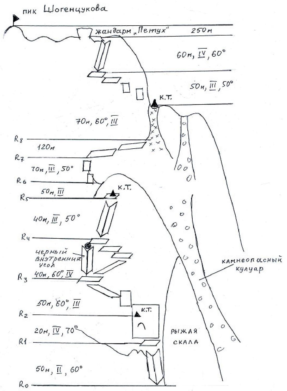
UIAA Scheme
Route Description
R0–R1. 50 m along broken rocks to the left of the inner corner to the right part of the wall with black streaks — II category of difficulty.
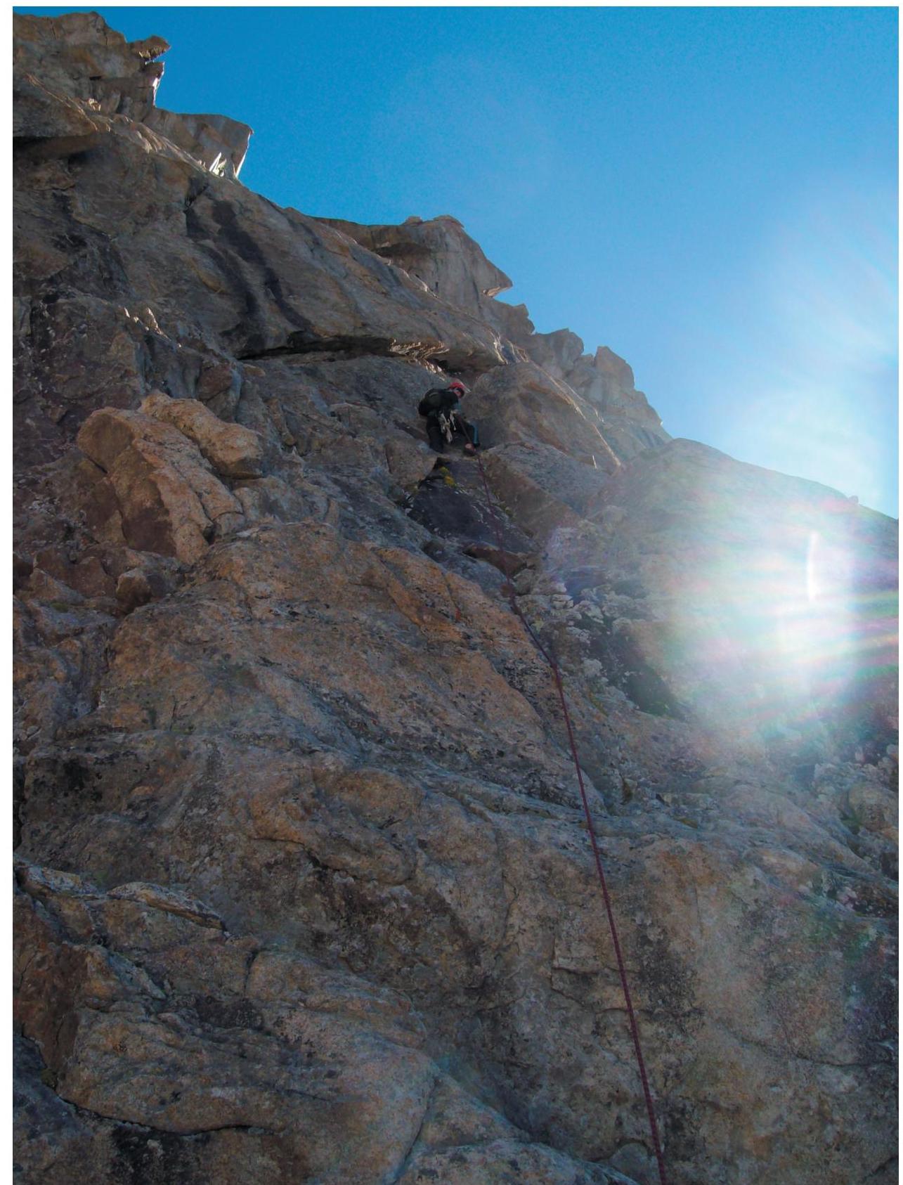
R1–R2. 20 m left — up through a small exfoliation to a shelf with a control cairn 70°, IV category of difficulty.
R2–R3. 50 m left — up along the wall and shelves to a shelf under the black inner corner with an overhang — 60°, III category of difficulty.
R3–R4. 40 m zigzag along shelves under the overhang to the base of a wide inner corner — 60°, IV category of difficulty.
R4–R5. 40 m along the inner corner under the overhang to a shelf (2nd control cairn) — 50°, III category of difficulty.
R5–R6. 50 m left along broken rocks to a saddle — 50°, III category of difficulty.
R6–R7. 70 m from the saddle under the wall to a vaguely defined horizontal shelf — 50°, III category of difficulty.
R7–R8. Along shelves to the start of the couloir — 120 m.
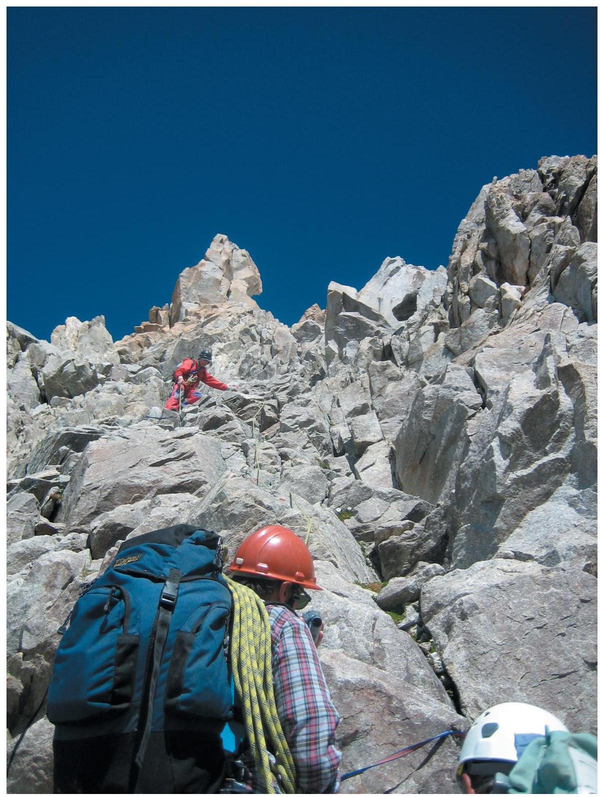
R8–R9. Along the couloir 70 m to a shoulder to the 3rd control cairn — 60°, III category of difficulty.
R9–R10. Along broken rocks 50 m to the start of a vaguely defined inner corner — 50°, III category of difficulty.
R10–R11. Along the inner corner 60 m to the ridge to the right of the «Pétard» gendarme — 60°, IV category of difficulty.
R11–R12. Bypassing the gendarme to the right and exit to the snowy ridge, along which, through two dips, exit to the summit — 250 m.
Descent via the route described for Shogentsukova peak via the Southern ridge, 2B category of difficulty.
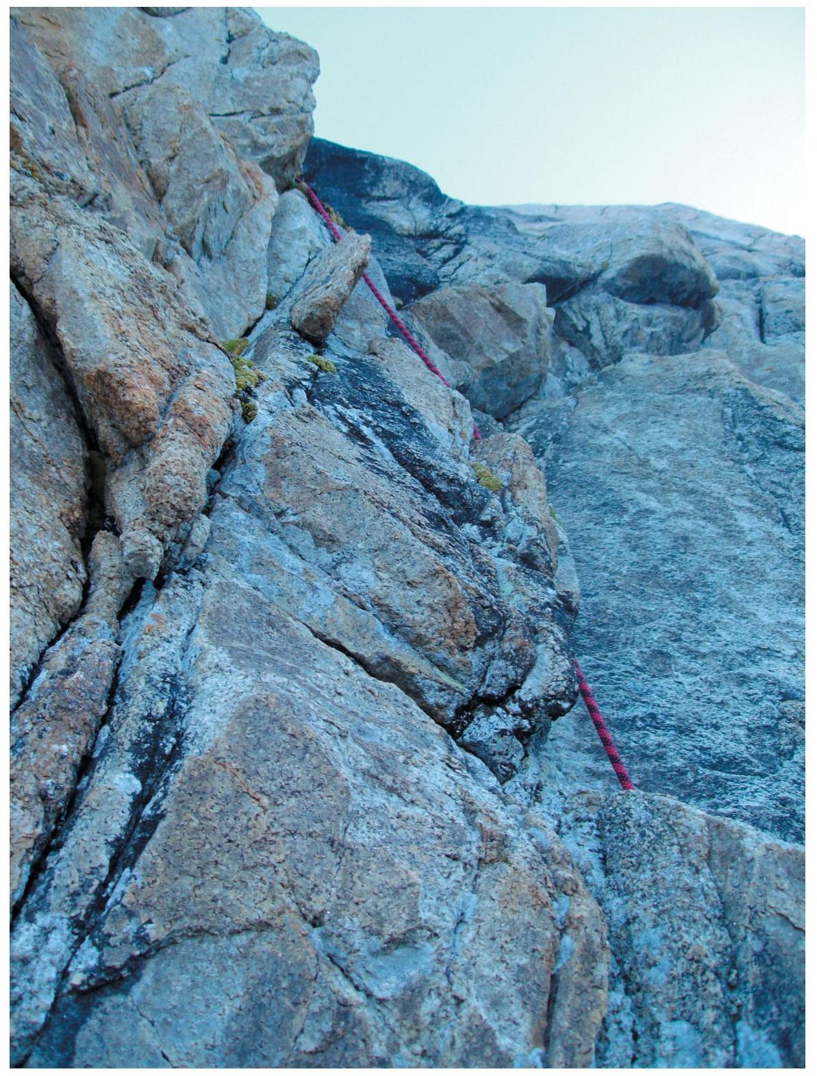
On section R1–R2
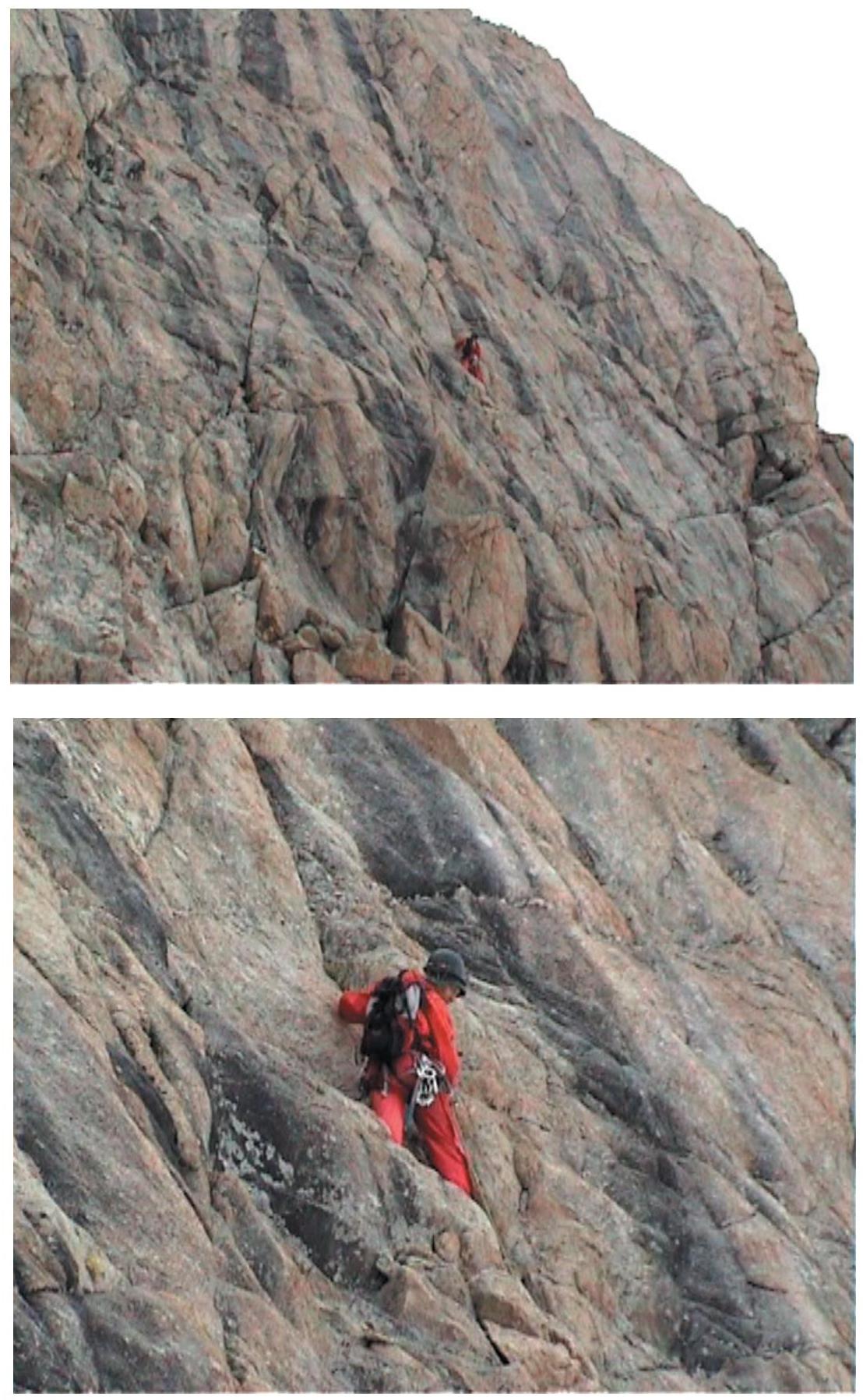
Section R2–R3
On section R3–R4
On section R9–R10
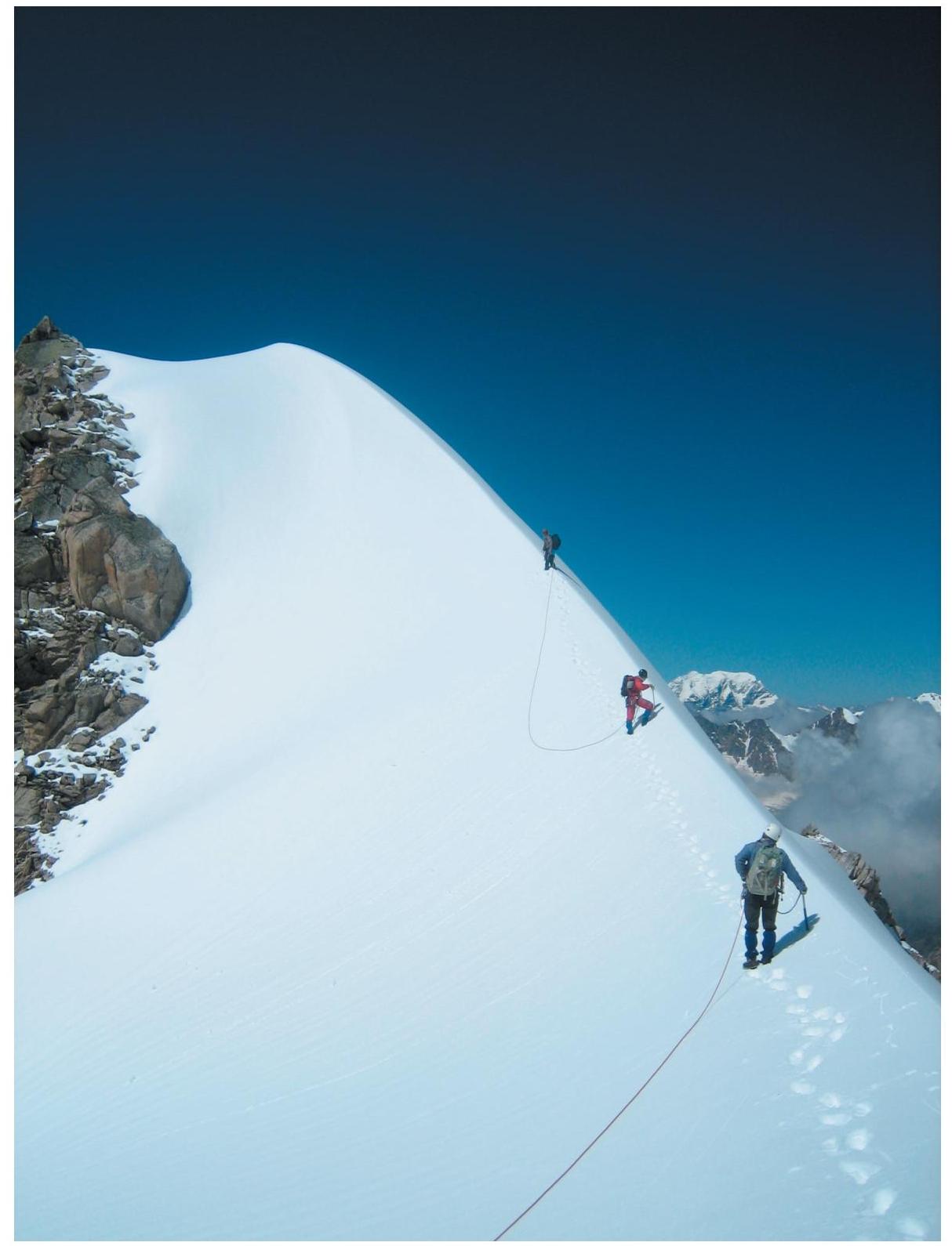
Pre-summit ridge