Ascent Passport
- Region: Central Caucasus, Adyrsu gorge, Main Caucasian Range, section according to KMGV – 2.4.1
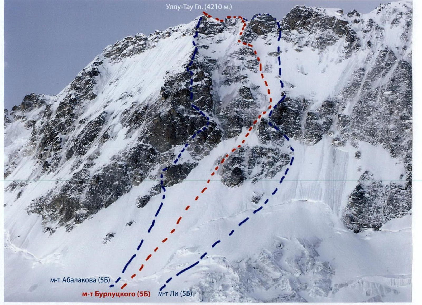
- Peak: Ullu-Tau Main, right of the rock islands N wall W ridge (S. Burlutsky's route)
- Category of difficulty: 5B
- Route character: ice-snow
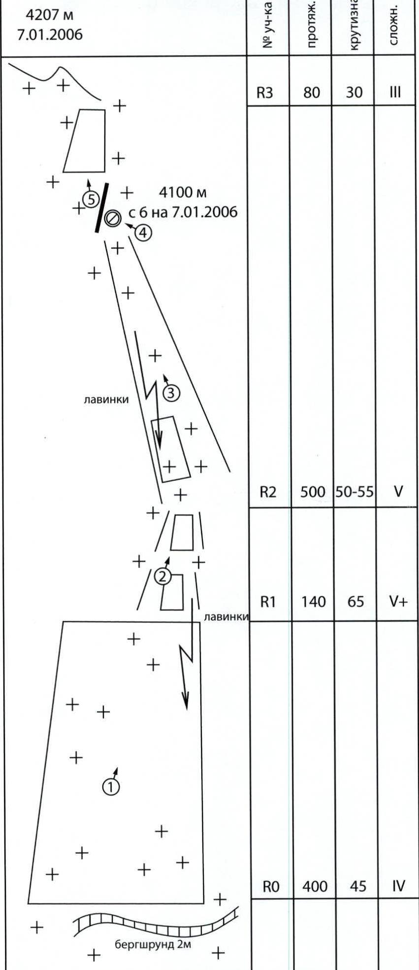
- Height difference of the route: from bergschrund to the summit – 800 m (approximately) Route length: – 1200 m. Length of sections: 5th cat. diff. – 640 m, Average steepness: entire route – 50° (until exit to the summit ridge)
- "Hooks" left on the route: 6 ice screws on descent
- Team's travel hours: 14 hours, 2 days
- Leader: Makovkin Mikhail Valerievich – CMS Participants: Astakhov Mikhail Valentinovich – MS, Shishkin Dmitry Viktorovich – 1st sports category
- Coach: Makovkin Mikhail Valerievich – CMS
- Exit to the route: 6:30, January 6, 2006 Summit ascent: 10:00, January 7, 2006 Return to "Ullu-Tau" tourist center: 14:00, January 8, 2006
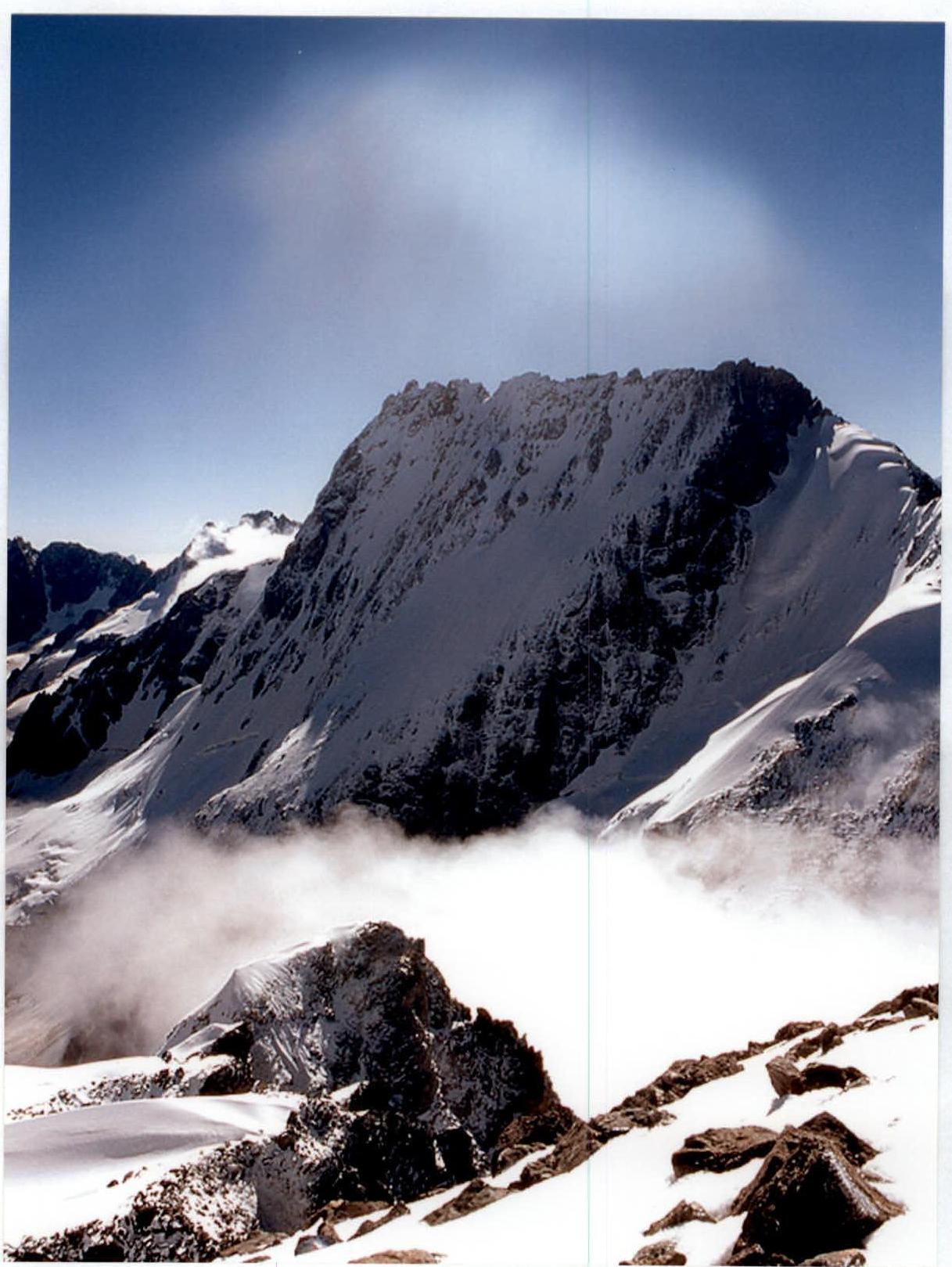
General photo of the summit January 4, 2006. View from Cheget overnight stay
Photo of the wall profile
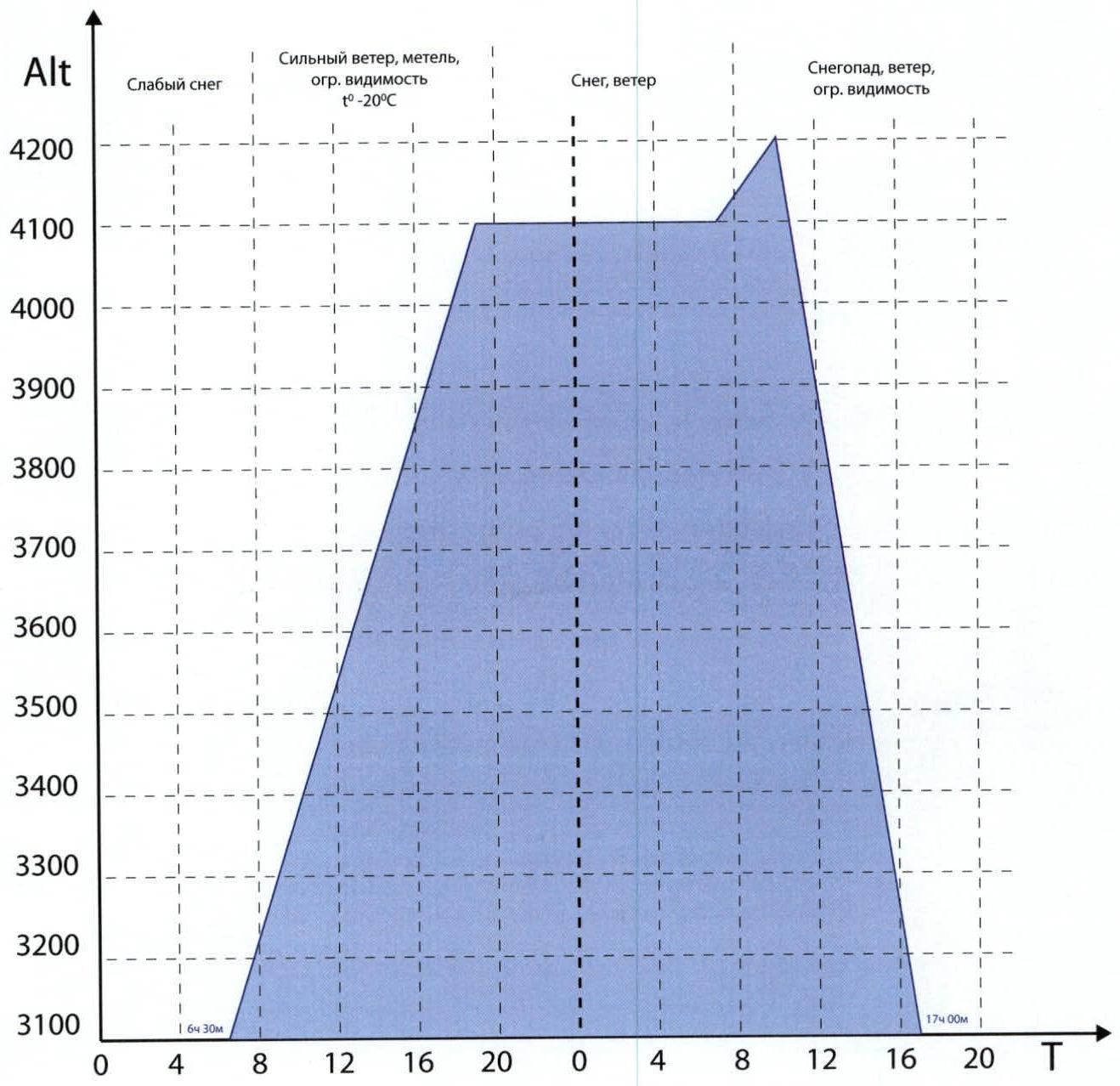
Ascent graph
Route diagram in UIAA symbols
Technical photograph of the route
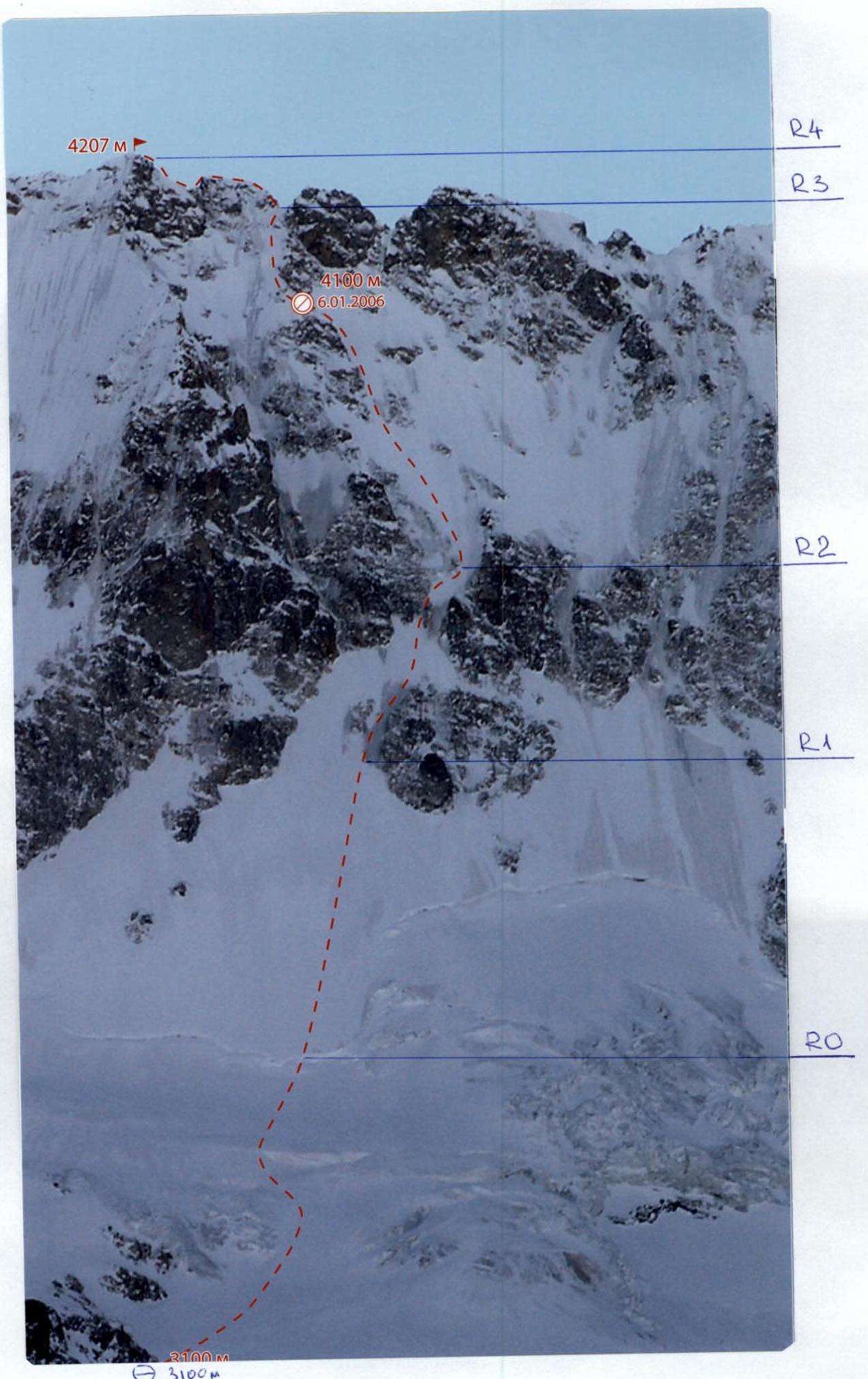
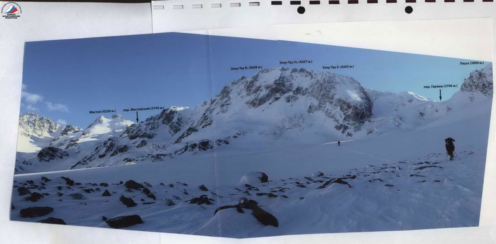
Photo illustration of the report
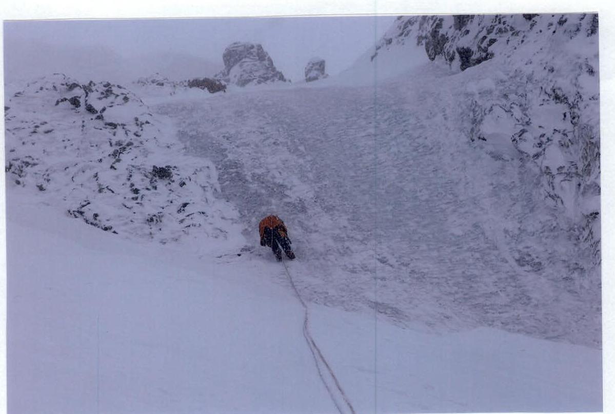
Photo 2. Descent via the ascent path on section R1–R2

Photo 3. Descent via the ascent path on section R2–R3