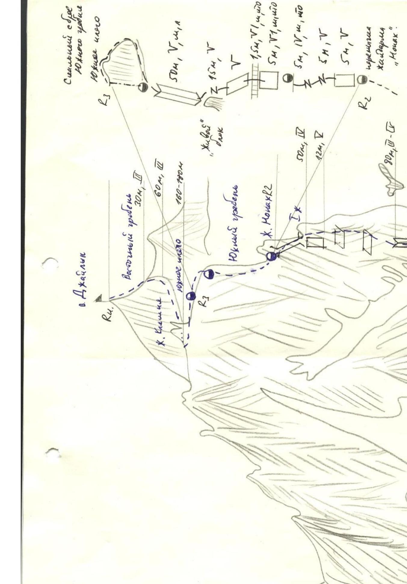
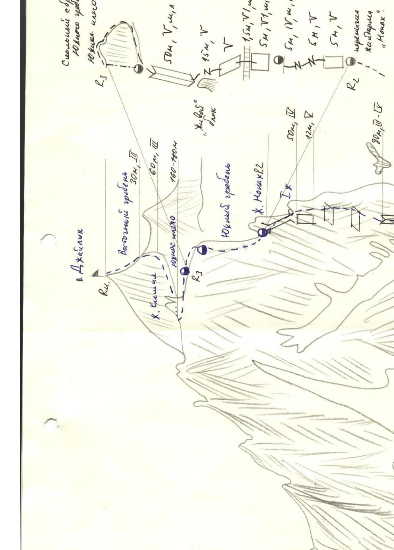
The summit of Dzhailyk has a 4B category of difficulty, the nature of the route is combined.
The summit of Dzhailyk is located on the sixth north-western Adyr spur. To the east of Dzhailyk (in the eastern branch) lies the summit of Cheget-bashi, to the south lies the summit of Kichkidar, and to the west lies the summit of Tyu.
The summit of Dzhailyk is surrounded by glaciers: the eastern and western ones, as well as the northern Pnom-Su. Three ridges branch out from the summit of Dzhailyk:
- to the Donkina pass,
- the eastern one - towards the glacier of the summit Dzhailyk Kinchat,
- the western one - turning into a long rocky fence, separating the glaciers of the western Dzhailyk and the northern Pnom-Su.
To the north-east, Dzhailyk drops with sheer walls and steep slopes, falling into the ridge between the massifs of Dzhailyk and Tyu-Tyu-S.
The route begins with an overnight stay on the Black Rocks in their branch from the western ridge to Dzhailyk, in the form of a short, barely noticeable rocky ridge. From the overnight site, it goes towards the main western ridge. At the beginning, the path goes along broken rocks to the first "gendarmes", which is bypassed on the left along a steep snow-ice slope. Above the "gendarmes" there is a snow shelf, then a simple rocky ridge of broken rocks begins. The length of this section of the ridge is 35-40 m.
Having passed this ridge, they reach the second "gendarmes" with sheer walls to the north-west and east. This "gendarmes" is bypassed on the left along a snow-ice couloir. Having passed 35-40 m along the couloir, one should climb up a 5-meter sloping shelf, leading to a gentle slab.
From the slab:
- descend to the right 1-1.5 m,
- then along the crack in the sheer wall, they rise to a horizontal shelf.
Above and to the right of this shelf lies a narrow rocky couloir - an inner corner. This couloir can be reached:
- by traversing the mentioned shelf to the right to the end,
- or from the shelf, climb straight up along the inner corner, and then along simple rocks above the shelf, traverse into the couloir.
In the couloir, on its right side, on a flat large stone - a control cairn. The entire path from the slab after the second "gendarmes" to the control cairn requires thorough piton belays.
From the control cairn, one should climb to the shoulder, to which a simple rocky couloir leads. From the shoulder, one needs to climb straight up for 10-12 m and exit to the right onto a cork to the right. After that, we come out onto a relatively decent ridge, along which we go to the mushroom-shaped "gendarmes"; the "gendarmes" is bypassed on the right along a shelf.
Further:
- along the edge of the snow, sticking to the left side of the wide couloir,
- to the snowy shoulder, from which steep snowslopes descend to the south-east and north,
- along a gentle snow-ice slope, we climb onto the summit ridge,
- leaving it to the left, along blade-like rocks on the southern slope of the summit, we reach the summit.
Descent via 3B (southern wall).
Time calculation:
- a/l "Ulu-Tau" - bivouac on Black Rocks - 4-5 hours
- bivouac on Black Rocks - control cairn - 4-4.5 hours
- from the control cairn to the summit via the saddle - 3-3.5 hours
- descent to Donkina pass - 5-6 hours