REPORT ON THE FIRST ASCENT TO THE SUMMIT OF UZUNKOL VIA THE NORTH-WEST RIDGE ROUTE, CATEGORY 2B, BY THE "SAMARA-PENZA" TEAM, AUGUST 24, 2022
1. Ascent Passport
| 1. General Information | ||
|---|---|---|
| 1.1 | Full Name, Sports Rank of the Leader | Klimov Sergey Alexandrovich, CMS |
| 1.2 | Full Name, Sports Rank of Participants | Strochkov Maxim Sergeevich, 1st sports rank |
| 1.3 | Full Name of Coaches | Erokhov Igor Yurievich, Knyazeva Marina Alexandrovna |
| 1.4 | Organization | SROO "FASO" |
| 2. Characteristics of the Ascent Object | ||
| 2.1 | Region | Uzunkol |
| 2.2 | Valley | Uzunkol valley (Myrdy river valley) |
| 2.3 | Number of the section according to the 2013 classification table | 2. CAUCASUS 2.3. From Nakhar Pass to Chipperazau Pass |
| 2.4 | Name and Height of the Summit | Uzunkol, 3487 m |
| 3. Characteristics of the Route | ||
| 3.1 | Name of the Route | Along the north-west ridge |
| 3.2 | Proposed Category of Difficulty | 2B |
| 3.3 | Degree of Route Exploration | First ascent |
| 3.4 | Nature of the Route Terrain | Rocky |
| 3.5 | Height Difference of the Route | 500 m |
| 3.6 | Route Length (in meters) | 1150 m |
| 3.7 | Technical Elements of the Route | Rocks I cat. dif. - 375 m, Rocks II cat. dif. - 275 m, Rocks III cat. dif. - 45 m, Rocks IV cat. dif. - 5 m |
| 3.8 | Descent from the Summit | Along the northern ridge |
| 4. Characteristics of the Team's Actions | ||
| 4.1 | Time of Movement (travel hours from camp to camp) | 8 hours, 1 day |
| 4.2 | Overnights | - |
| 4.3 | Exit to the Route from the Base Camp | 6:00, August 24, 2022 |
| 4.4 | Start of Work on the Route | 8:30, August 24, 2022 |
| 4.5 | Reach the Summit | 11:30, August 24, 2022 |
| 4.6 | Return to the Base Camp | 14:00, August 24, 2022 |
| 5. Person Responsible for the Report | ||
| 5.1 | Full Name, e-mail | Klimov Sergey Alexandrovich, Klimov_SA95@mail.ru |
2. Area Map-Scheme

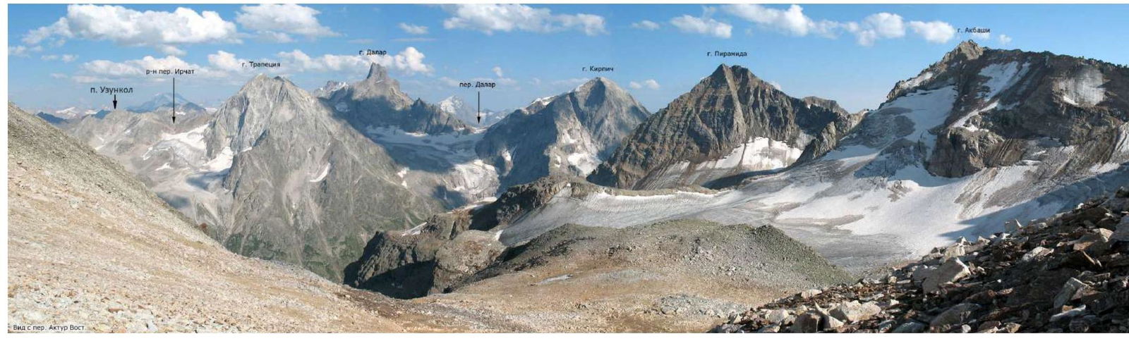
3. Area Panorama
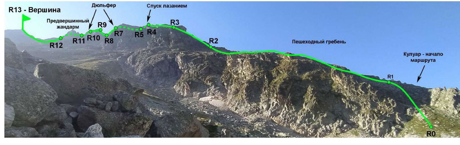
4. Technical Photograph of the Route
5. Route Diagram in UIAA Symbols
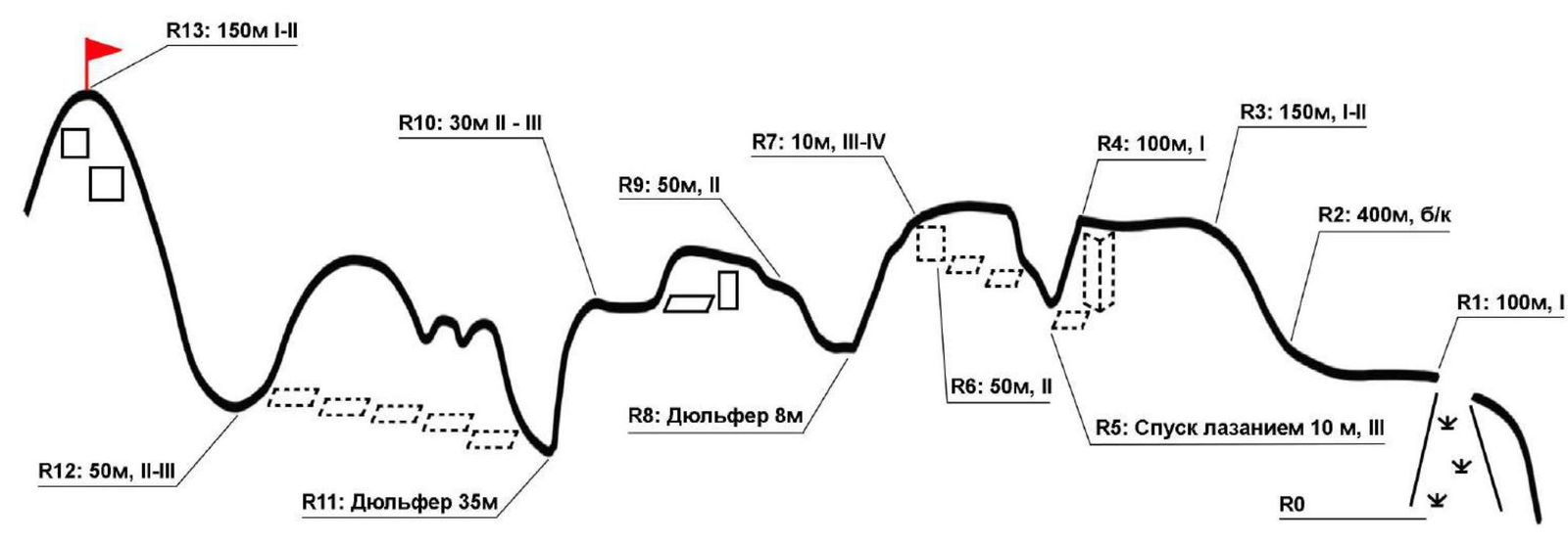
6. Route Characteristics and Description by Sections
The route follows the north-west ridge of Uzunkol peak. The team did not encounter any signs of other groups, which allows us to consider this ascent a first ascent of the route.
This route is technically more challenging than the route along the northern ridge to the same summit (classified as 2B), however, in the team's opinion, the technical difficulties on this route are not sufficient for a 3A category of difficulty, so we propose the 2B category.
| Section # | Route Description | Photo # |
|---|---|---|
| Approach | The approach to the cirque of Uzunkol peak coincides with the route "along the northern ridge". From Uzunkol alpine camp, cross the river and follow the dirt road towards the border post and further into the Myrdy valley. The road turns into a trail. Cross the river over the bridge and follow the trail under the slopes of Uzunkol peak to a clearing with a cairn on a stone. From here, go left up a hard-to-distinguish trail towards the forest. The trail into the cirque is overgrown, so it is necessary to find its beginning. Then move along the trail up, first through the forest, then along grassy and scree slopes until you exit into the cirque, bounded by the northern and north-western ridges of Uzunkol peak. Traverse the cirque to the right towards the north-west ridge, the starting point of the route is a wide grassy couloir in the lower part of the ridge. There is a cairn. | 1, 2, 3, 4, 5, 6 |
| R0–R1 | Up the grassy couloir to exit onto a wide ridge. | 6, 7 |
| R1–R2 | Along a wide grassy and partially scree ridge, move towards the rocky ridge. | 8 |
| R2–R3 | Then left up along simple rocks of the ridge. Exit onto a wide scree ridge. | 9 |
| R3–R4 | Move along the wide ridge, which gradually narrows, and approach a dip. | 10, 11 |
| R4–R5 | Descent down 10 m by climbing or rappelling. | 12 |
| R5–R6 | First 10–15 m along the rocky ridge, then move to its right side and progress along a series of grassy ledges until they end. | 13 |
| R6–R7 | From the last ledge, left up along a steep wall, climb back onto the ridge. | 13 |
| R7–R8 | Rappelling 8 m from the gendarme. | 14 |
| R8–R9 | Overcome the ascent and approach a section of a very narrow rocky ridge. | 15 |
| R9–R10 | Along the narrow ridge forward 4–5 m. Do not climb to the end! Then descend by climbing 3 m to a ledge on the left, along which bypass the remaining narrow part of the ridge and then along the main ridge approach a dip before the pre-summit gendarme. | 16 |
| R10–R11 | Rappelling to the right side 35 m onto a grassy ledge. | 17, 18 |
| R11–R12 | Bypass the pre-summit gendarme along a series of grassy ledges on the right and exit onto the pre-summit ridge. | 17 |
| R12–R13 | Then along the ridge and simple rocks of the summit tower, ascend to the summit of Uzunkol peak. | 17, 19, 20 |
| Descent | Move along simple rocks of the northern ridge towards the "saw" gendarme. Bypass the gendarme on the left along a trail and descend left down along scree slopes towards the cirque. Descent from the cirque to Uzunkol alpine camp follows the approach route. | - |
7. Photo Report from the Route
Photo # 1 — Cairn at the turn to the cirque
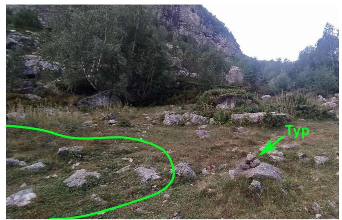
Photo # 2 — Beginning of the trail to the cirque
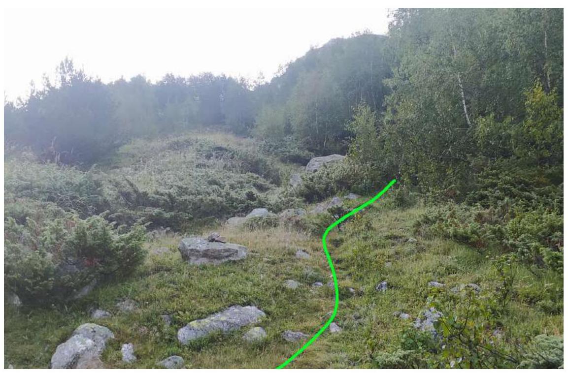
Photo # 3 — Approach along grassy slopes
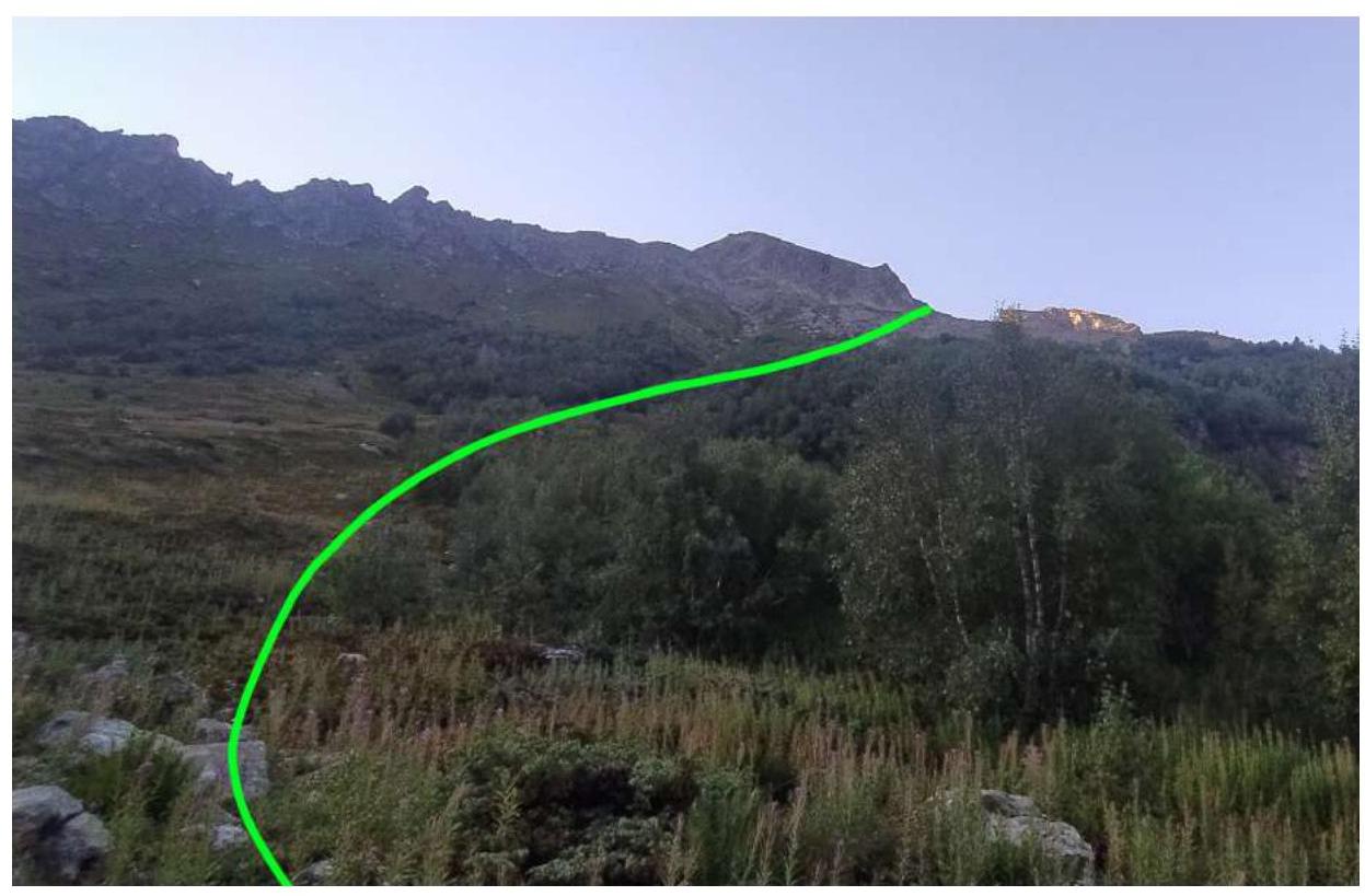
Photo # 4 — Scree slope before exiting into the cirque
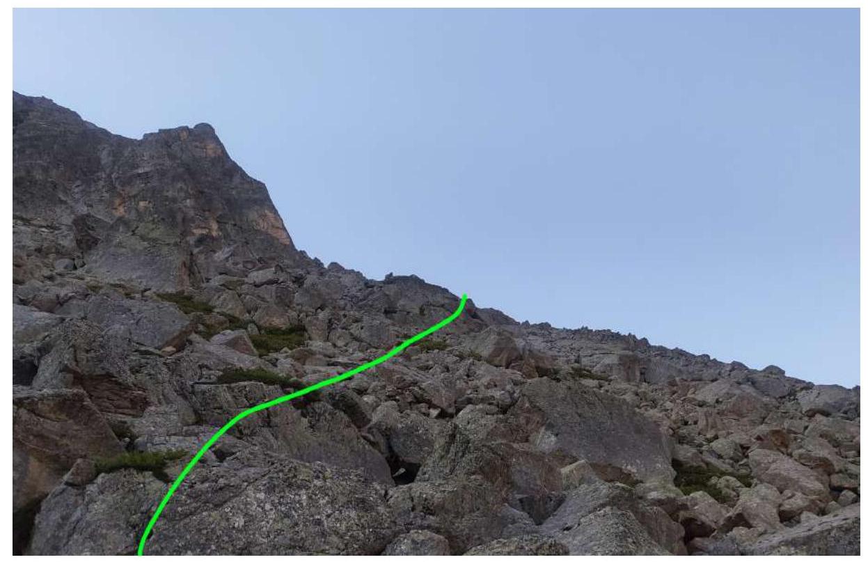
Photo # 5 — In the cirque of Uzunkol peak
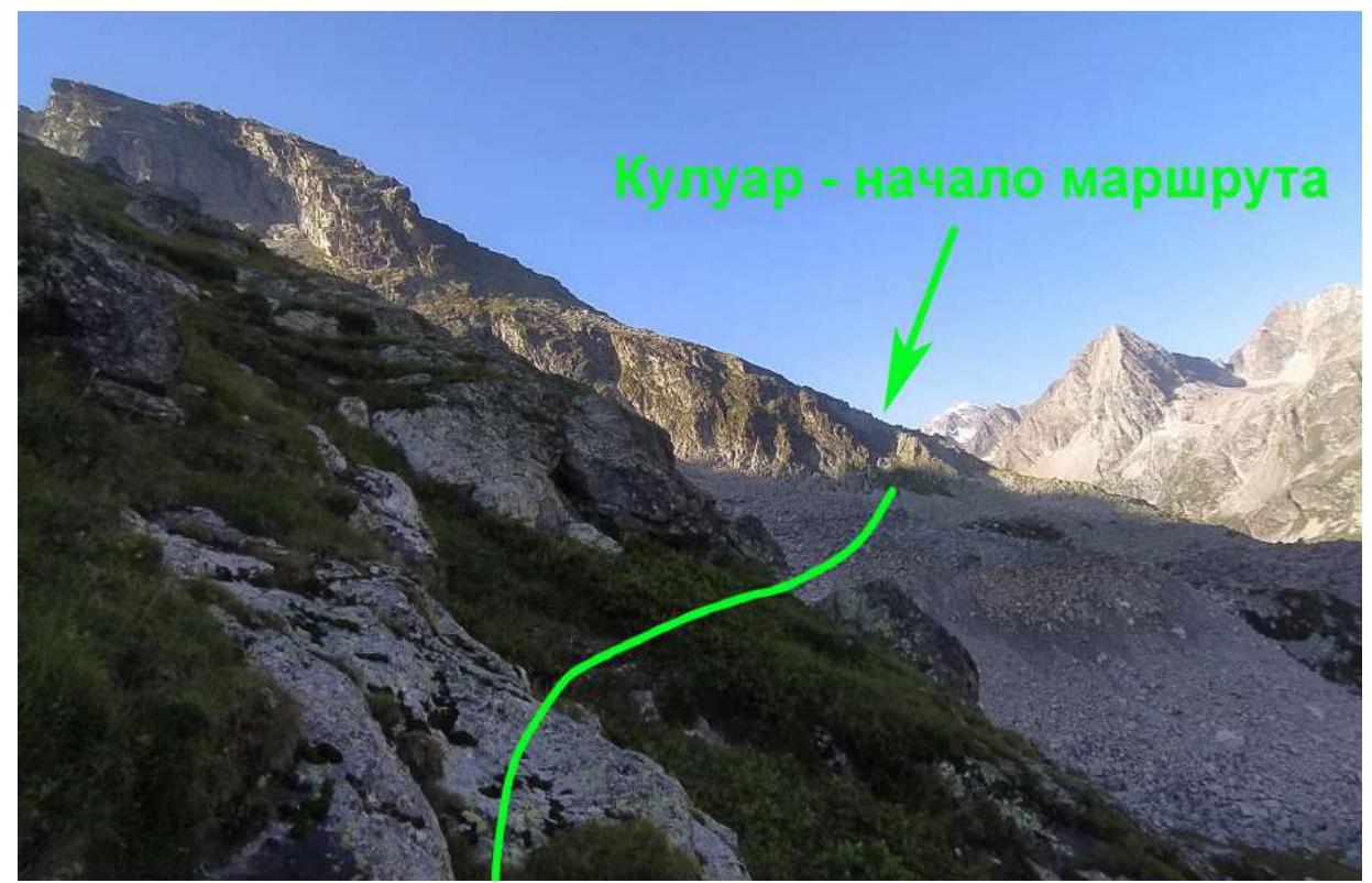
Photo # 6 — Approach to the start of the route and section R0–R1
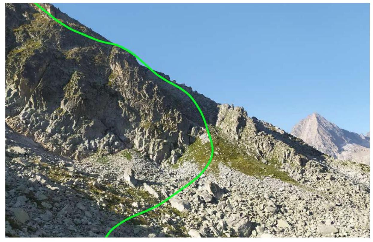
Photo # 7 — Cairn at the start of the route

Photo # 8 — Section R1–R2
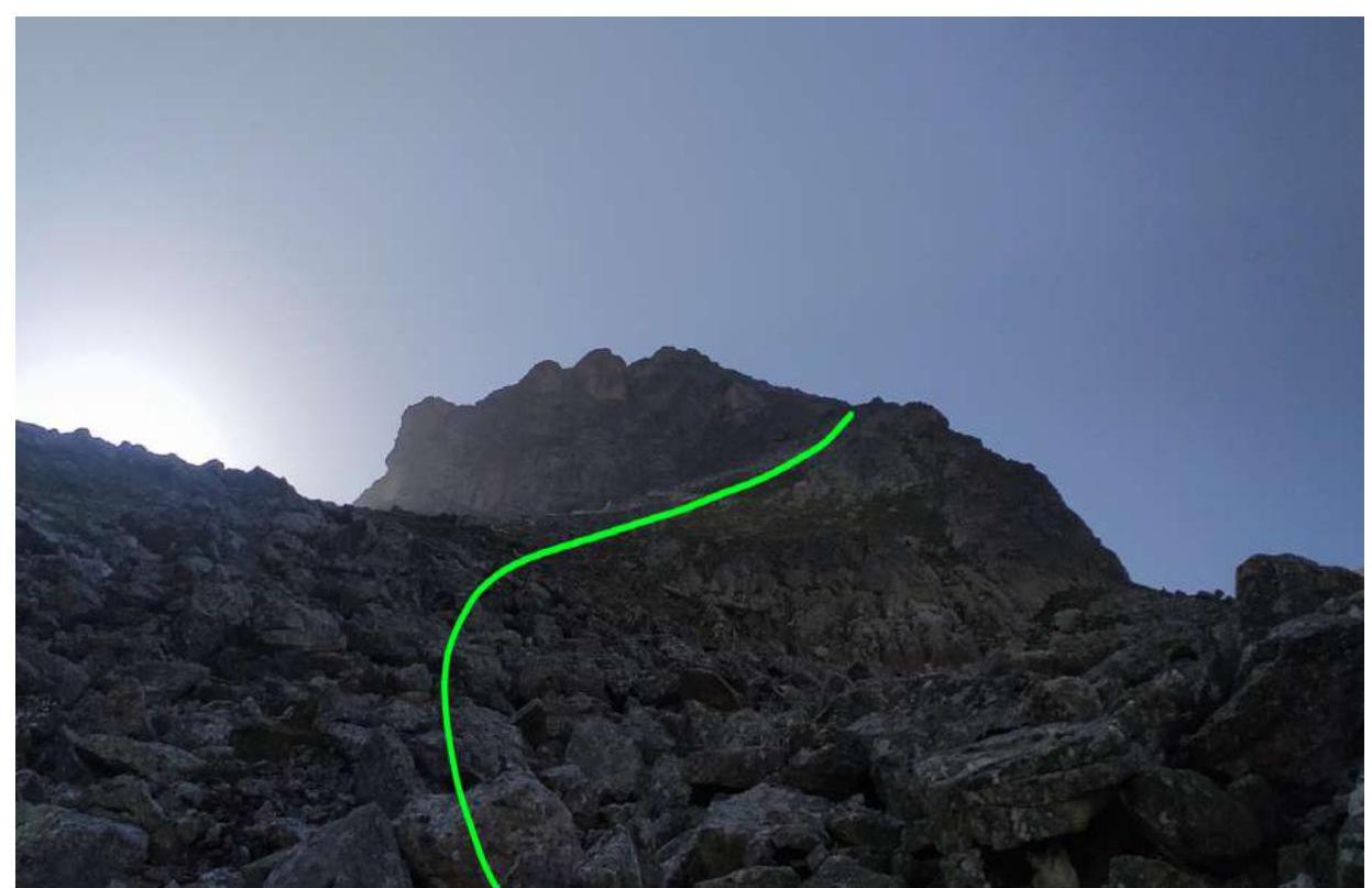
Photo # 9 — On section R2–R3
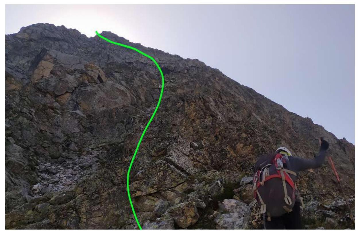
Photo # 10 — Section R3–R4
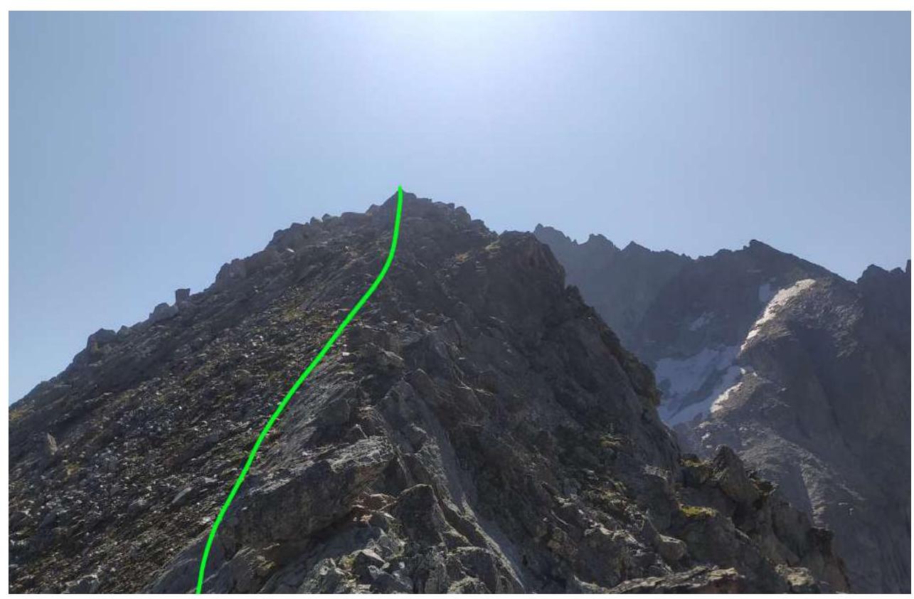
Photo # 11 — End of section R3–R4
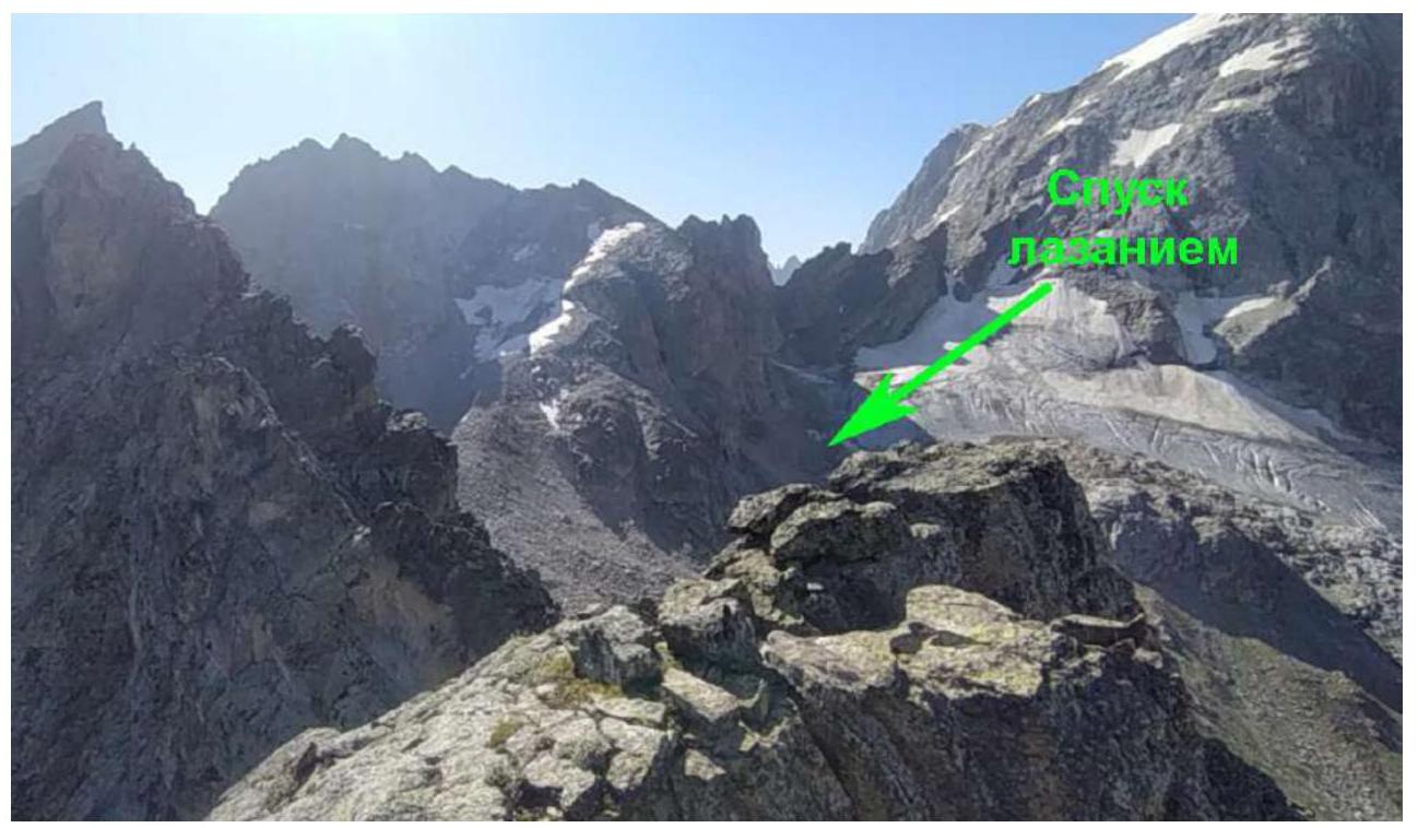
Photo # 12 — Descent by climbing on section R4–R5
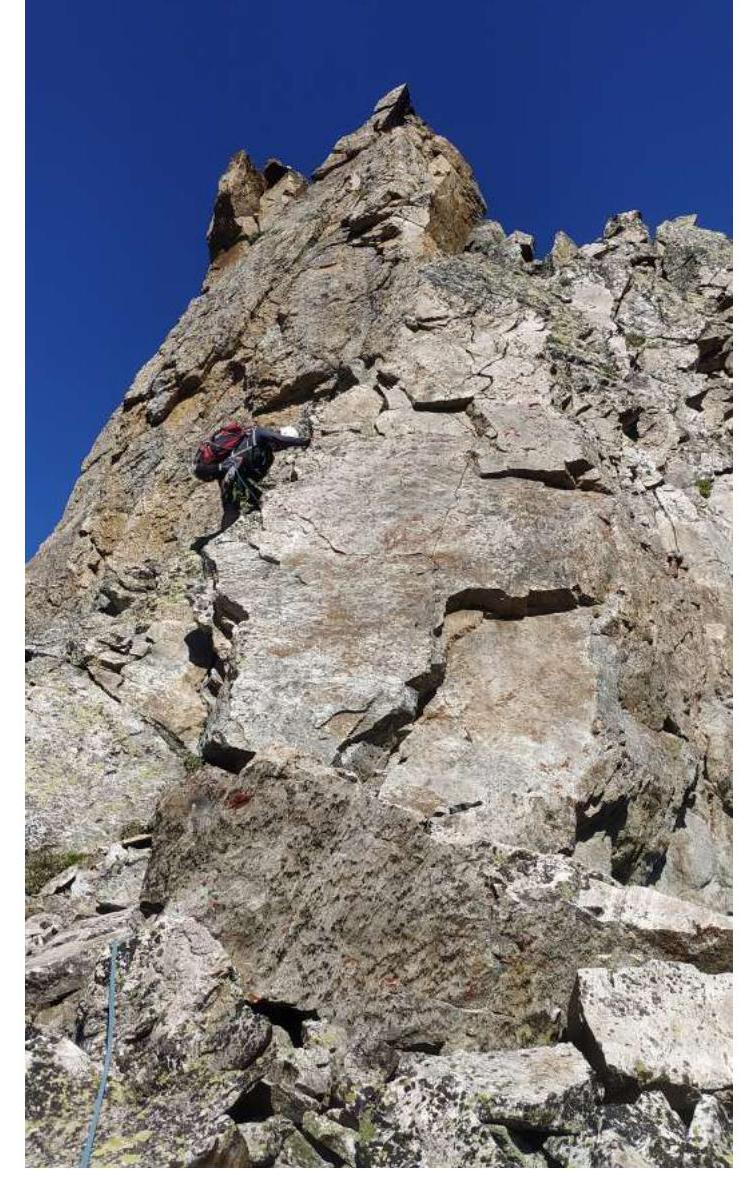
Photo # 13 — Sections R5–R6 and R6–R7
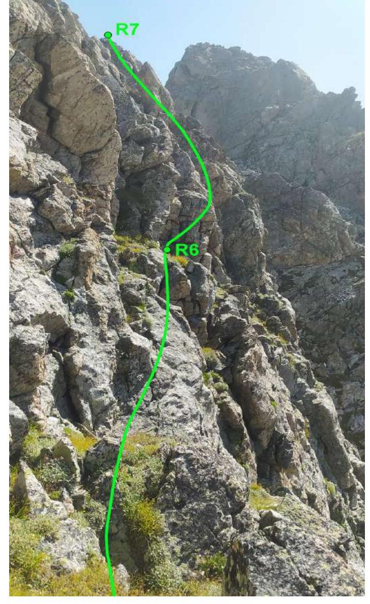
Photo # 14 — Rappelling from the gendarme. Section R7–R8
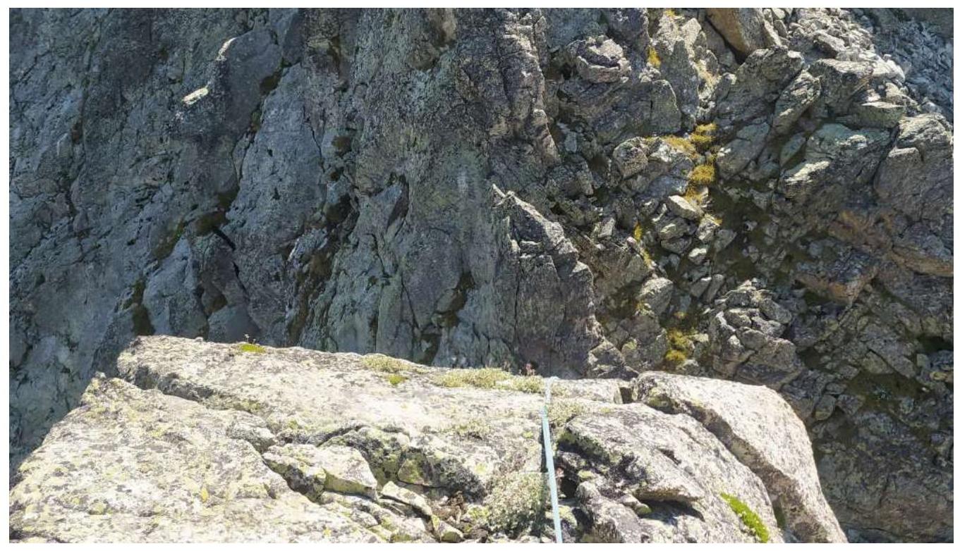
Photo # 15 — Beginning of section R8–R9
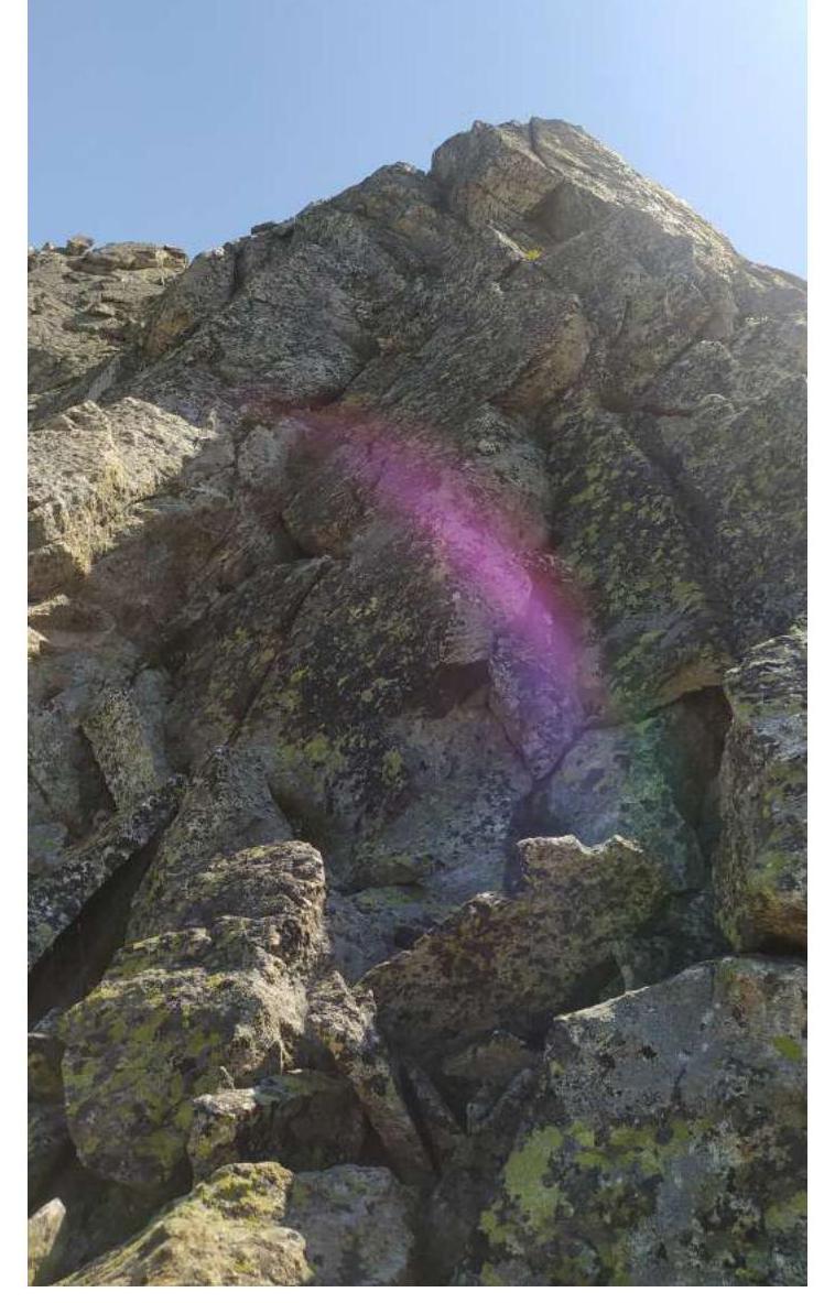
Photo # 16 — Beginning of section R9–R10

Photo # 17 — Sections R10–R11, R11–R12, and R12–R13
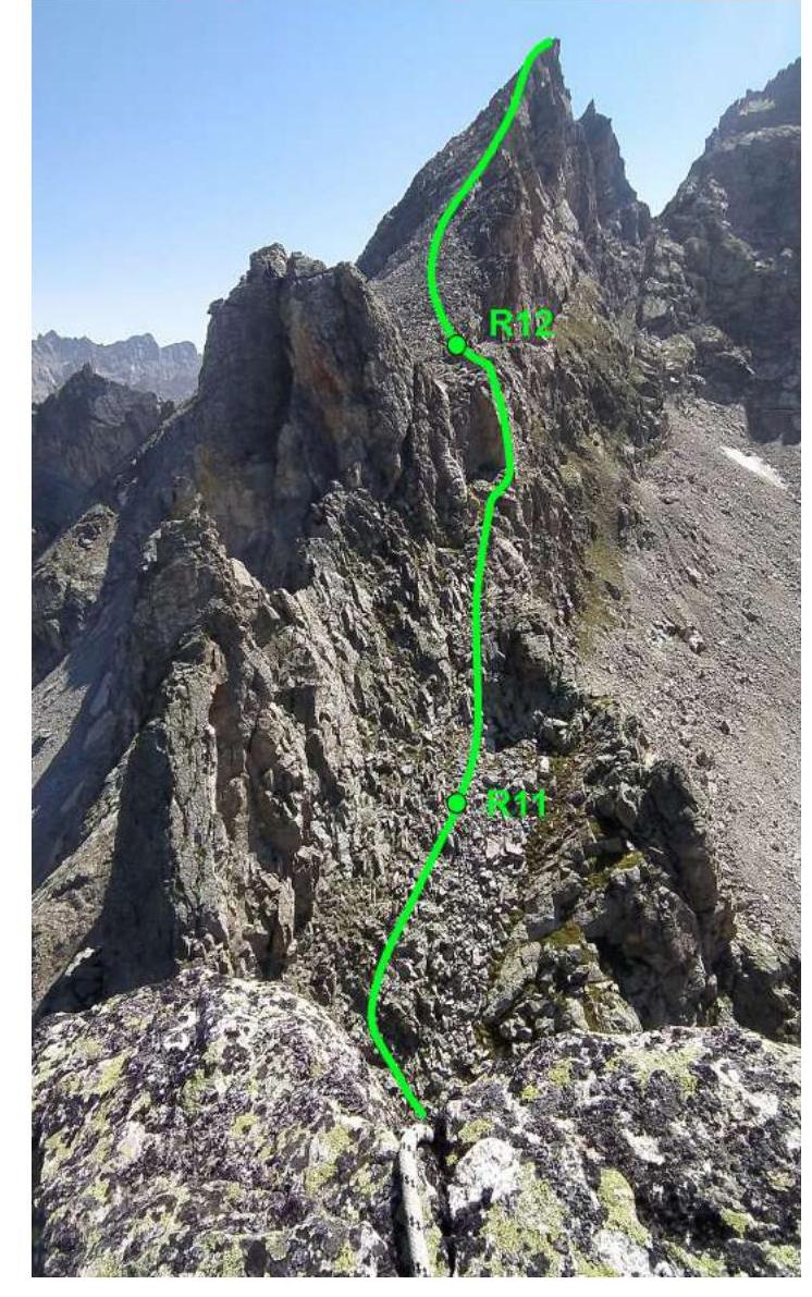
Photo # 18 — Rappelling on section R10–R11
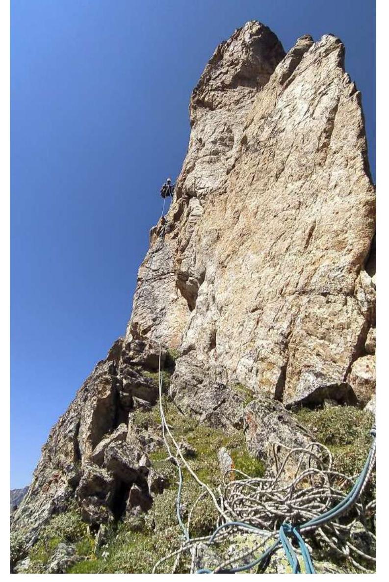
Photo # 19 — Section R12–R13
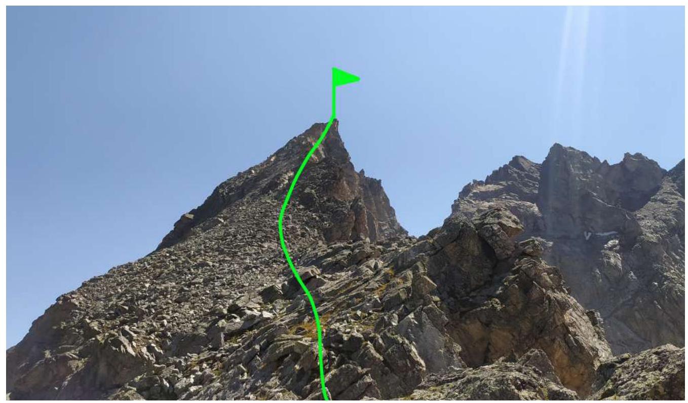
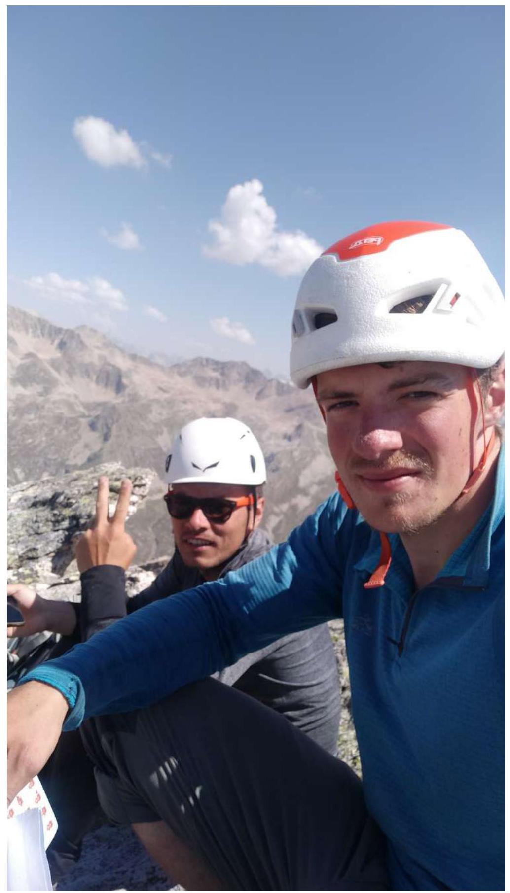
Photo # 20 — Team on the summit