
Report
on the first ascent to the summit Dolomit Yuzhnyy Malyy (proposed) via the Western wall, approximately 4A category of complexity by the team from Voronezh region on August 11, 2021
I. Climbing Passport
| 1. General Information | ||
|---|---|---|
| 1.1 | Full Name, sports rank of the leader | Danilkova Ekaterina Borisovna, CMS |
| 1.2 | Full Name, sports rank of the participants | Dmitrienko Evgeniy Vladimirovich, MS |
| 1.3 | Full Name of the coach | Torshin Mikhail Viktorovich |
| 1.4 | Organization | VROO "Sports Alpine Federation" |
| 2. Characteristics of the Climbing Object | ||
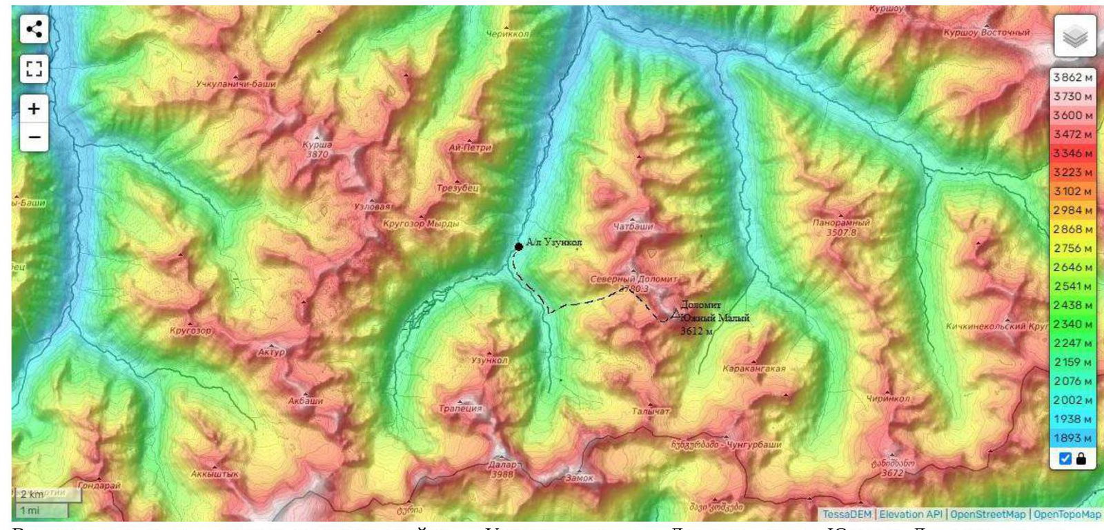
| 2.1 | Region | 2.3. From Nakhar pass to Chiperezau pass |
| 2.2 | Valley | Kichkinekol |
| 2.3 | Number of the section according to the classification table | – |
| 2.4 | Name and height of the summit | Dolomit Yuzhnyy Malyy (proposed), 3612 m |
| 2.5 | Geographical coordinates of the summit (latitude/longitude), GPS coordinates | 43°15′33″ N, 42°13′45″ E |
| 3. Characteristics of the Route | ||
| 3.1 | Name of the route | via the Western wall |
| 3.2 | Proposed category of complexity | 4А |
| 3.3 | Degree of route development | first ascent |
| 3.4 | Nature of the route terrain | rocky |
| 3.5 | Height difference of the route (data from altimeter or GPS) | 200 m |
| 3.6 | Length of the route (in meters) | 610 m |
| 3.7 | Technical elements of the route (total length of sections of various complexity categories indicating the nature of the terrain (ice-snow, rocky)) | 1B category rocky — 200 m. 2A category rocky — 10 m. 3A category rocky — 215 m. 4A category rocky — 75 m. 5A category rocky — 110 m. |
| 3.8 | Average steepness of the route, (°) | 41 |
| 3.9 | Average steepness of the main part of the route, (°) | 56 |
| 3.10 | Descent from the summit | – |
| 3.11 | Additional characteristics of the route | no water on the route |
| 4. Characteristics of the Team's Actions | ||
| 4.1 | Time of movement (team's walking hours, in hours and days) | 2 h 15 min |
| 4.2 | Overnights | no |
| 4.3 | Time of route preparation | – |
| 4.4 | Start of the route | 10:44, August 11, 2021 |
| 4.5 | Reach the summit | 14:00, August 11, 2021 |
| 4.6 | Return to the base camp | 15:15, August 11, 2021 |
| 5. Responsible for the Report | ||
| 5.1 | Full Name, e-mail | Danilkova E.B., asddeb@mail.ru |
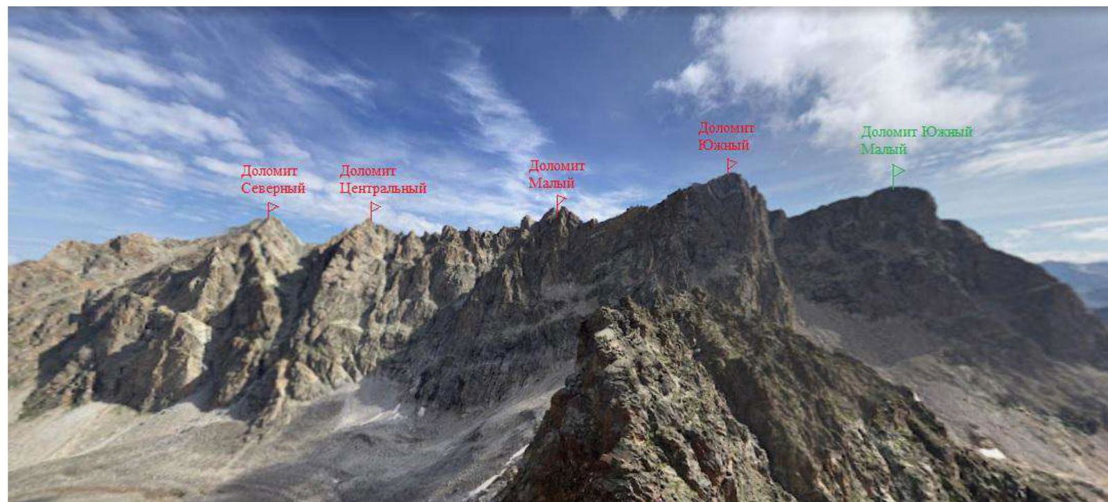
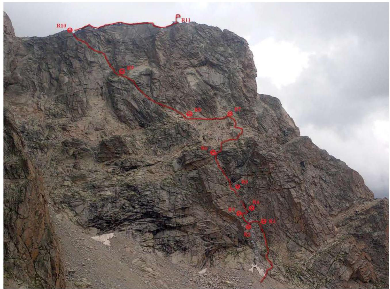
Panoramic Photo of the Area
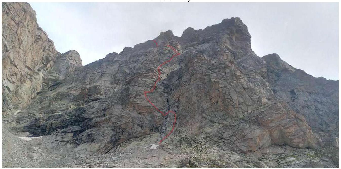
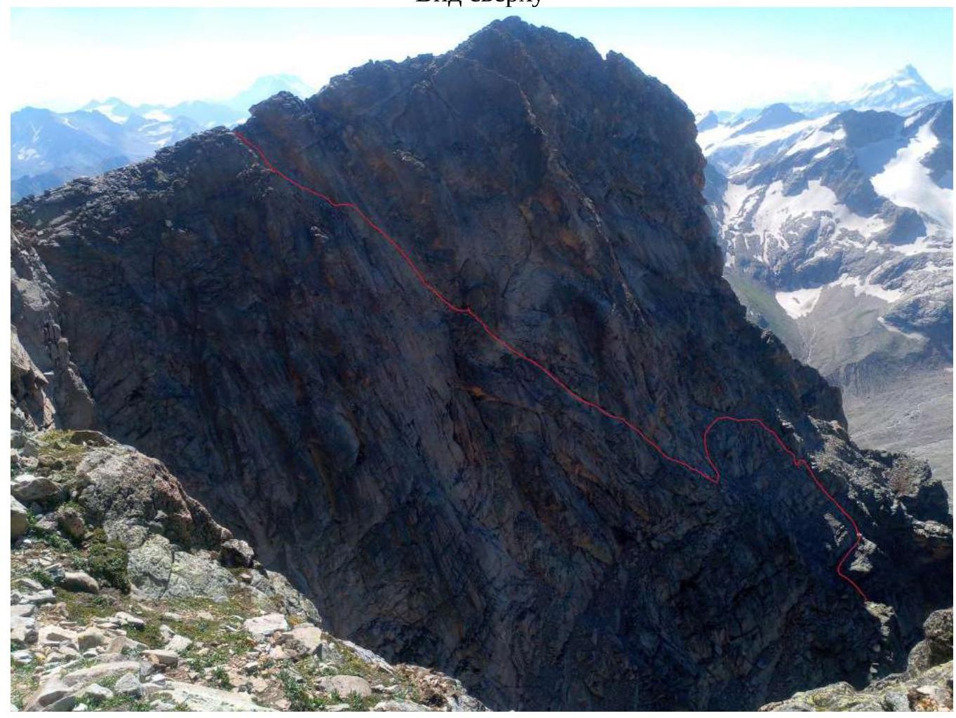
Route Line
General view

View from below
View from above
Area Map
The summit is located in a well-studied area — Uzunkol, in the Dolomit massif, to the right of Yuzhnyy Dolomit, to the right of rappels.
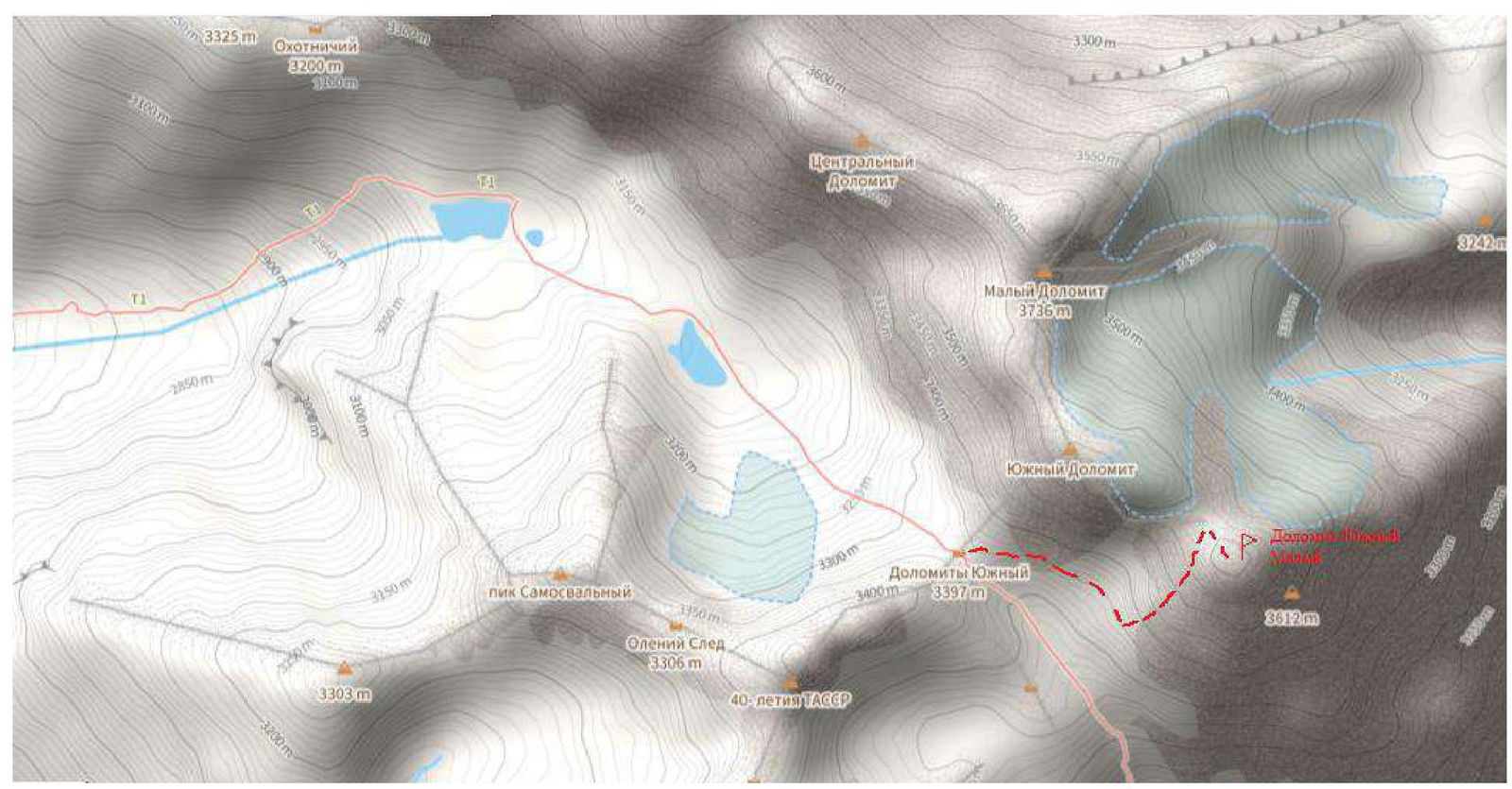
From Yuzhnyy pass, you need to move to the right, if you face the wall, traverse. Without losing height, traverse the slope of Yuzhnyy Dolomit, then traverse the descent couloir, after pronounced black streaks, exit to an oblique green shelf, where the route starts. Approach: From Yuzhnyy pass to the start of the route — approximately 20 min. From the camp near Dolomit lakes — one hour walk.
Technical Photo of the Route
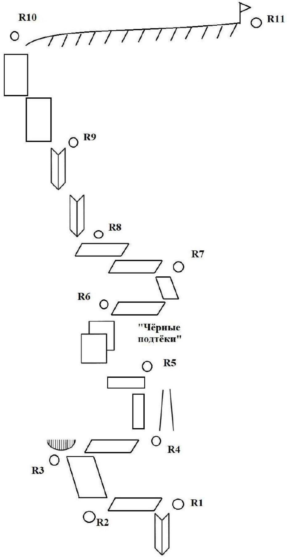
UIAA Scheme
Route Description
| Section # | Complexity of the section in symbols | Length of the section, m | Steepness° |
|---|---|---|---|
| R11 | 1 | 200 | 10 |
| R10 | IV–V | 80 | 70 |
| R9 | 3 | 100 | 45 |
| R8 | 3 | 30 | 30 |
| R7 | 3 | 50 | 45 |
| R6 | 4 | 60 | 60 |
| R5 | 5 | 10 | 80 |
| R4 | 4 | 15 | 80 |
| R3 | 3 | 35 | 60 |
| R2 | 2 | 10 | 70 |
| R1 | 5 | 20 | 70 |
The landmark for the start of the route is the black streaks on the rock and the internal angle. The first rope is positive, with green grass — an approach to the internal angle. Black streaks remain to the left and right of the trajectory. Then zigzag to the left, then to the right, to an unpleasant traverse to the right. From it upwards, focusing on a large chip to the left. Climbing is mainly on large slabs. To the left remain large ruins. In the center of the route, there is a semblance of a shelf with areas of green grass, it goes almost on foot to the left, third-category climbing. From the end of the shelf upwards, several options for passage, with an exit to the roof.
The summit is located to the right of the exit. We were guided by the readings on the clock — the highest point of the roof. We made a pronounced cairn, left a note in a flask.
Characteristics of the Team's Actions
| Section # | Description | Photo # |
|---|---|---|
| R0–R1 | Climbing up the internal angle 20 m, to the right of the black streak. Level 5, 70°. | №1 |
| R1–R2 | Moving left traverse horizontally with a slight descent. Length 10 m, 70°. | – |
| R2–R3 | Upwards to the left along a large relief 35 m of easy climbing (3 category) to a small cornice, 60°. | №2 |
| R3–R4 | From the cornice, traverse to the right 15 m to a black couloir. Insurance on anchors. 4 category of climbing, 80°. | №3 |
| R4–R5 | Move to the left of the couloir upwards to a shelf, 10 m. For insurance, the relief is poor. This is the key to the route. Level of climbing 5, 80°. | №4 |
| R5–R6 | Exit to the shelf. To the left of the black streaks along a large relief, easy climbing, 60 m upwards and to the left, 60°, 4 category. | – |
| R6–R7 | Further, the relief becomes more gentle. On foot along the shelf to the right 20 m, then upwards and to the left with easy climbing 30 m (3 category, 45°). | – |
| R7–R8 | Large scree shelf. Middle of the route. Along the shelf, move to the leftmost edge to an angle going upwards to the left. 3 category, 30°. | №5,6 |
| R8–R9 | 100 m of simple pleasant climbing along an oblique angle upwards and to the left to a larger relief, 45°. | – |
| R9–R10 | Stick to the direction upwards and to the left, to the left of the Tower, along a more complex relief to the exit to a saddle. 70°, 80 m IV–V category. Insurance on anchors and camalots. | №7,8 |
| R10–R11 | To the right along the ridge to the summit on foot 200 m. | №9,10 |
Tactical Actions of the Team
We moved simultaneously, both participants with free climbing, stopping and gathering in convenient places to transfer equipment. The weather was rainy and cold, with three cloud bursts, the rocks were wet and slippery.
In general, the route is rich in relief and monolithic. To the left, there are simpler paths, to the right — more complex ones. We did not experience difficulties in organizing insurance; it is possible to use both protection elements and camalots or pitons. Climbing is even, pleasant.
Descent via rappels to Yuzhnyy cirque.
We attempted the route three times: at 5:00, 9:00, and 10:00, reached Yuzhnyy pass, encountered a black cloud from the Georgian side, and returned to the tent. We monitored the change in pressure and the movement of clouds, from which we made a conclusion about retrying. In the end, we started only at 10:44 in a light drizzling rain and cold gusty wind. By the summit, the weather cleared up; we were at the summit at 13:48. After visiting the summit, we moved left to rappels, descended to the lakes at 15:15.
The overall impression of the route — the route is logical, monolithic, and safe. A relatively longer approach, compared to other routes, is offset by the lowest height of the summit on the approach and, therefore, the small length of the route. From this approach, only three routes are classified as 4A. One is on Dolomit Severnyy along the right counterfort of the Western wall — currently very dilapidated, crumbling, especially in the upper third, where a large collapse occurred several years ago, making it unsafe. There are also two traverses, Dolomit Severnyy and Yuzhnyy, towards each other. In comparison with all three routes, the proposed route is considered more technical and, most importantly, safe!
Photo Illustrations
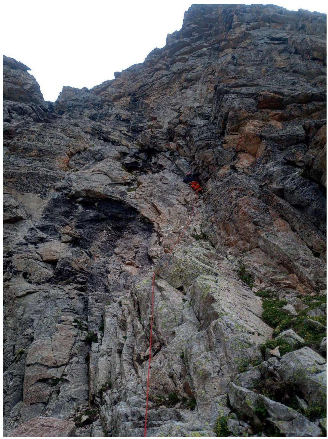
Photo 1. Section R0–R1, start of the route
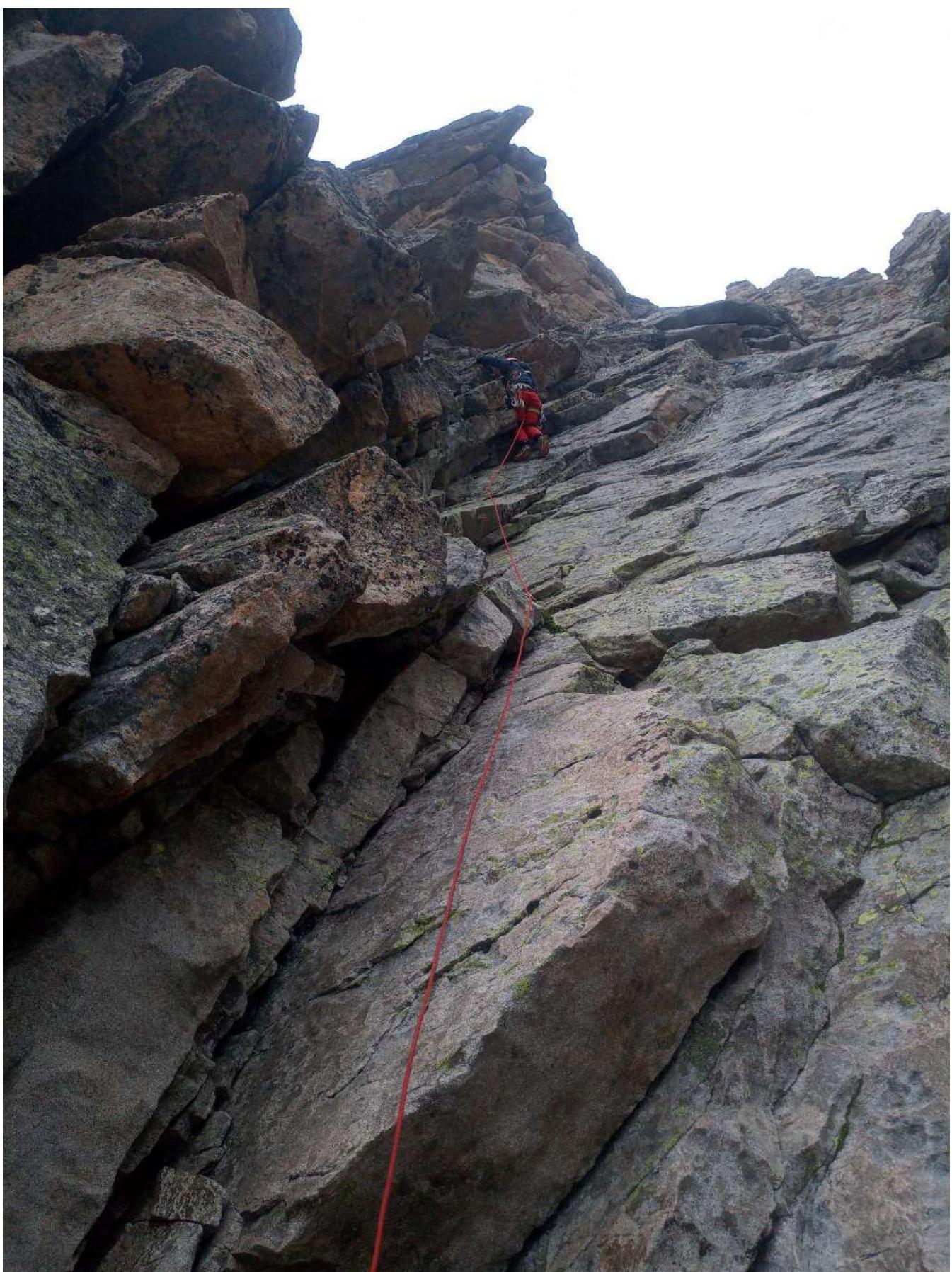
Photo 2. Section R2–R3
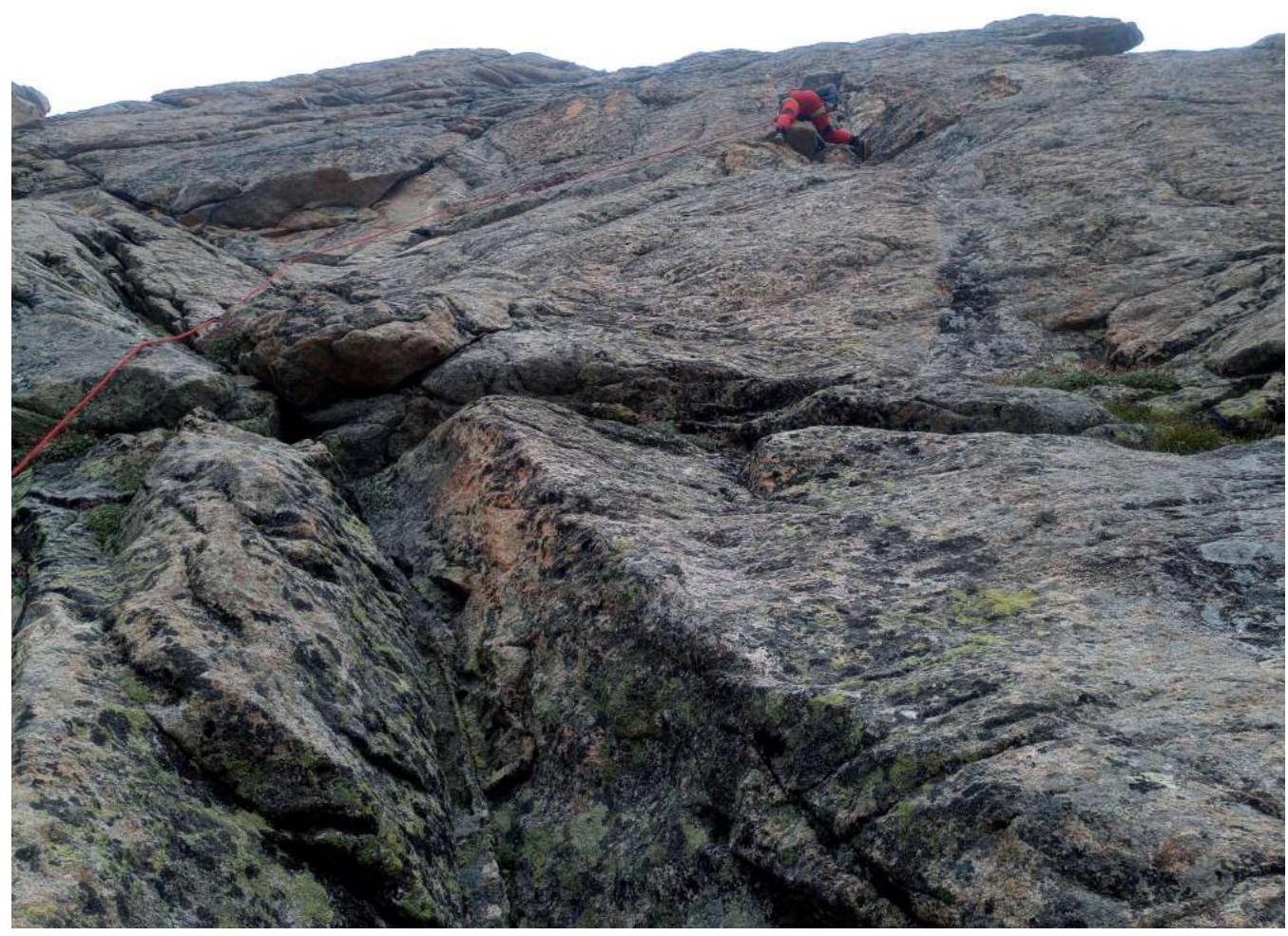
Photo 3. Section R3–R4 (a small cornice is clearly visible in the photo)
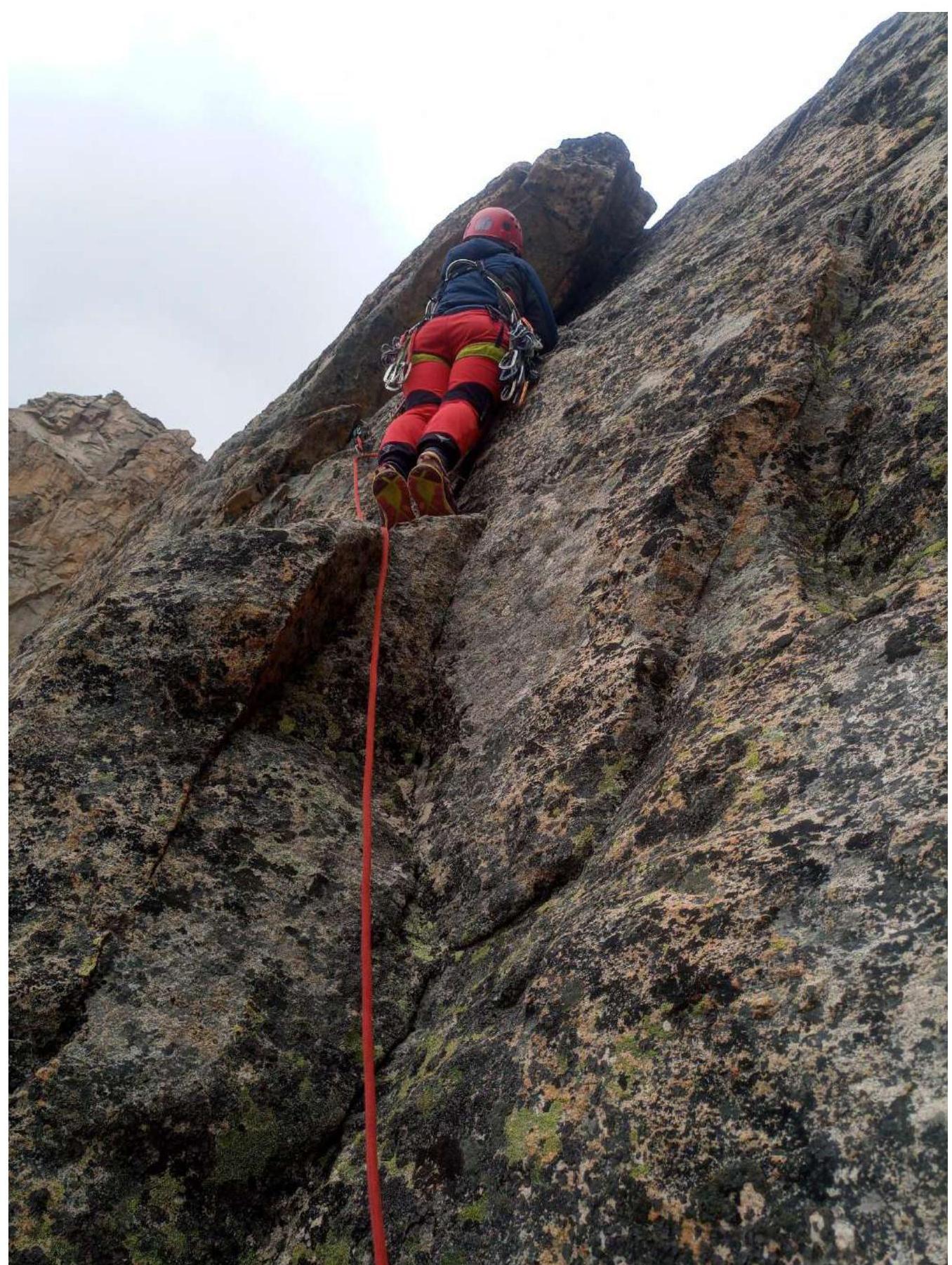
Photo 4. Section R4–R5, key to the route

Photo 5, 6. Section R7–R8, large shelf, middle of the route
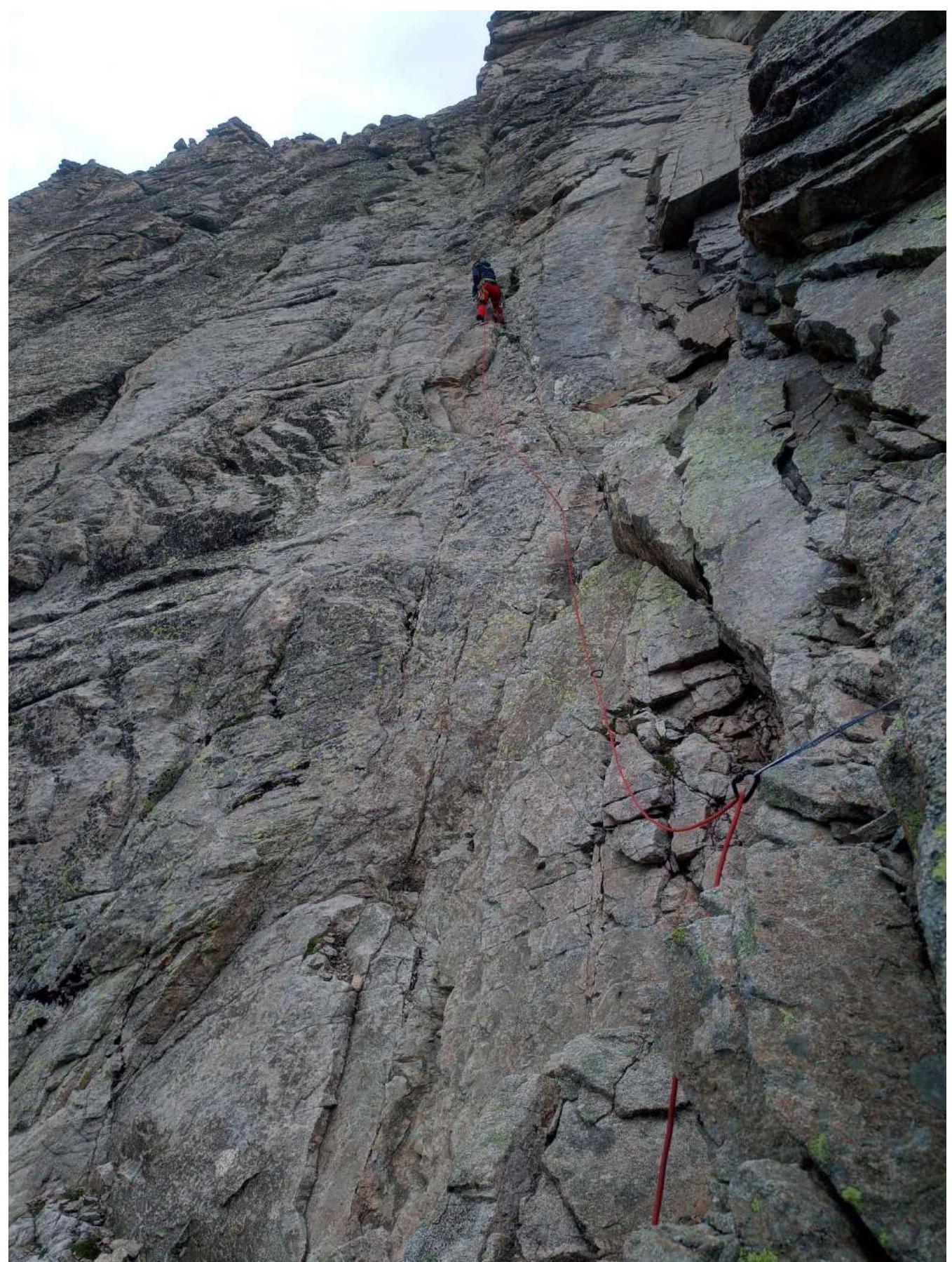
Photo 7. Section R9–R10.
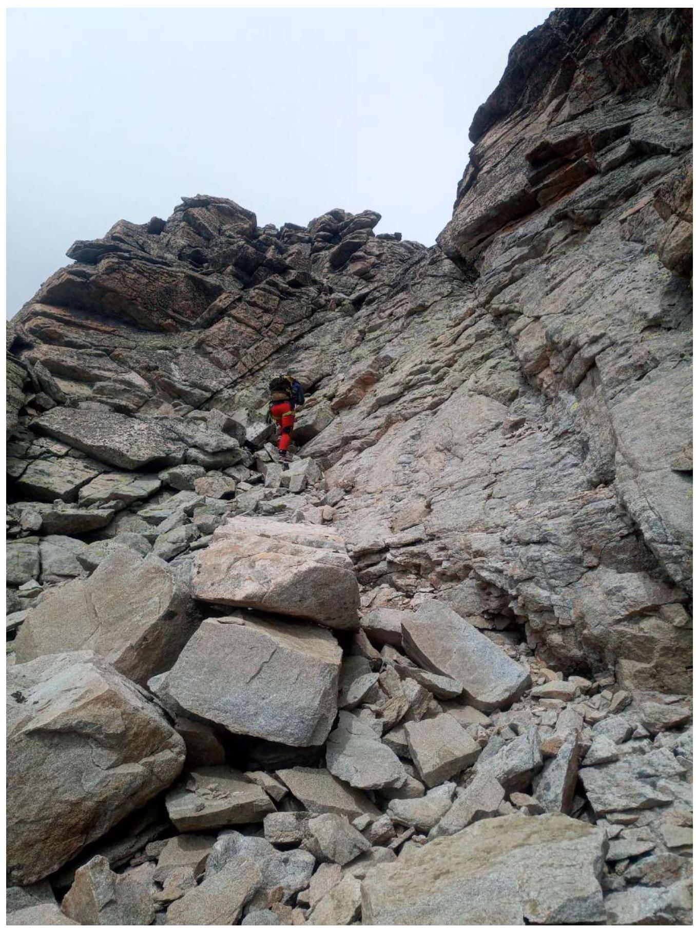
Photo 8. Exit to the ridge.
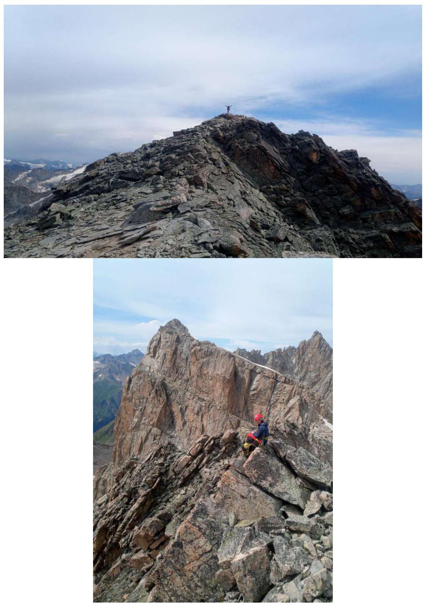
Photo 9, 10. Summit.
Comments
Sign in to leave a comment