Report
On the first ascent to the summit of Chirikol 3528 m via the South-Eastern ridge from Burvestnik Yuzhny pass according to the route of 3A category of complexity by the AUSB Uzunkol team from Stavropol on 19.08.2023
I. Ascent Report
| № | 1. General Information | |
|---|---|---|
| 1.1 | Full name, sports rank of the leader | Romakh Dmitry Viktorovich, 2nd sports rank |
| 1.2 | Full name, sports rank of participants | Klimonov Kirill Artemovich, 1st sports rank |
| 1.3 | Full name of coach | Kobylyatsky Nikolai Grigorievich |
| 1.4 | Organization | AUSB Uzunkol |
| 2. Characteristics of the ascent object | ||
| 2.1 | Region | Caucasus |
| 2.2 | Valley | Ullu-kam |
| 2.3 | Section number according to the 2020 classification table | 2.3 |
| 2.4 | Name and height of the summit | Chirikol 3528 m |
| 2.5 | Geographical coordinates of the summit (latitude/longitude), GPS coordinates | 43.24001 42.30498 |
| 3. Characteristics of the route | ||
| 3.1 | Name of the route | via the South-Eastern ridge, from Burvestnik Yuzhny pass |
| 3.2 | Proposed category of complexity | 3A |
| 3.3 | Degree of route exploration | First ascent |
| 3.4 | Relief characteristics of the route | Rocky |
| 3.5 | Height difference of the route (altimeter or GPS data) | 280 |
| 3.6 | Route length (in meters) | 880 m |
| 3.7 | Technical elements of the route (total length of sections of different categories of complexity with relief characteristics) | I cat. sl. grassy slope/rocks — 380 m. II, II+ cat. sl. rocks — 295 m. III, III+ cat. sl. rocks — 120 m. IV, IV+ cat. sl. rocks — 85 m. |
| 3.8 | Descent from the summit | Descent from the summit is done towards Yuzhny Elektrik pass or via the ascent route. |
| 3.9 | Additional route characteristics | Water is absent on the route in mid-summer. Many streams and a lake on the way to the start of the route |
| 4. Characteristics of the team's actions | ||
| 4.1 | Time of movement (team's walking hours, in hours and days) | 9 h 30 min |
| 4.2 | Overnight stays | Upper campsite |
| 4.3 | Departure to the route | 05:15 10.07.2021 |
| 4.4 | Arrival at the summit | 11:45 10.07.2021 |
| 4.5 | Return to the camp | 14:45 10.07.2021 |
| 5. Responsible for the report | ||
| 5.1 | Full name, e-mail | Romakh Dmitry Viktorovich dirom1693@gmail.com |
II. Ascent Description
- Characteristics of the ascent object
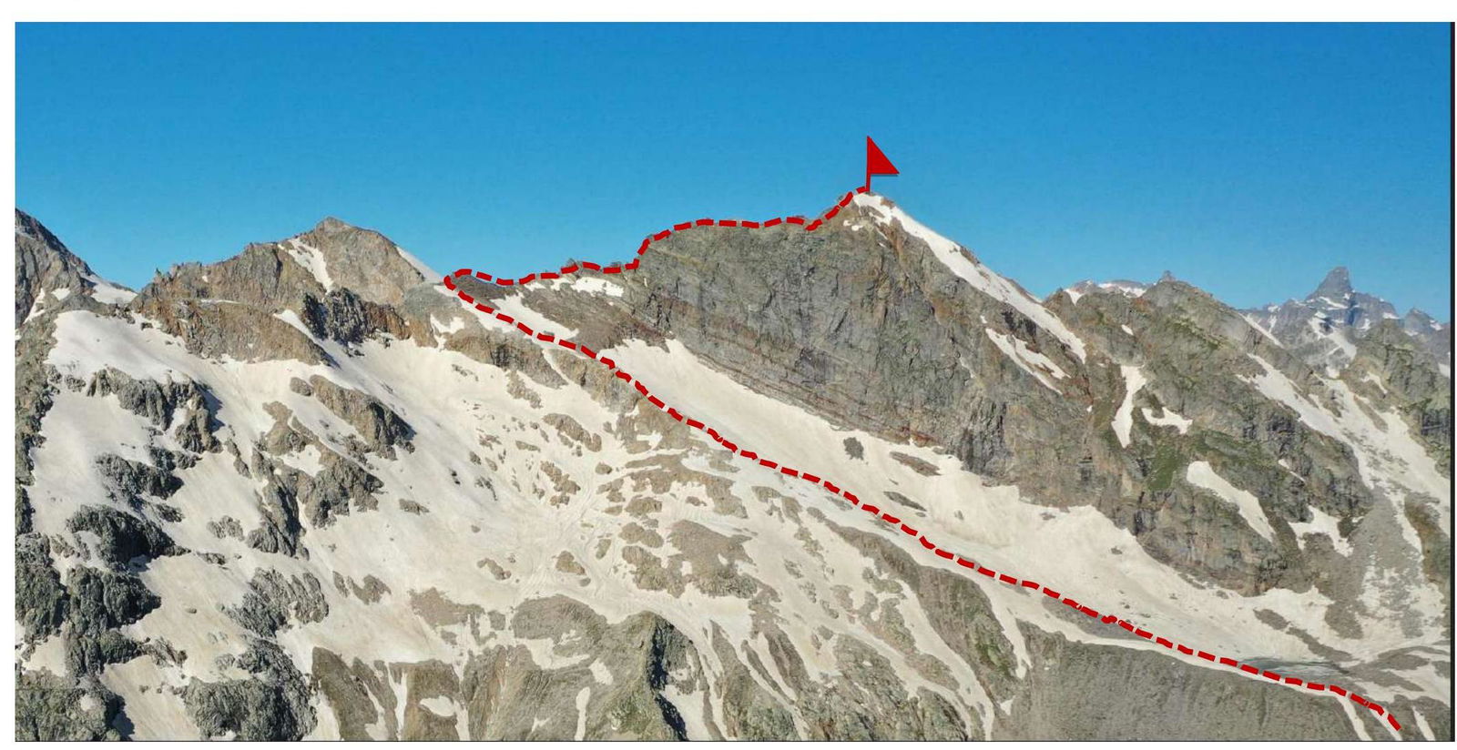 Photo №1. General photo of the summit (taken on 11.07.2021)
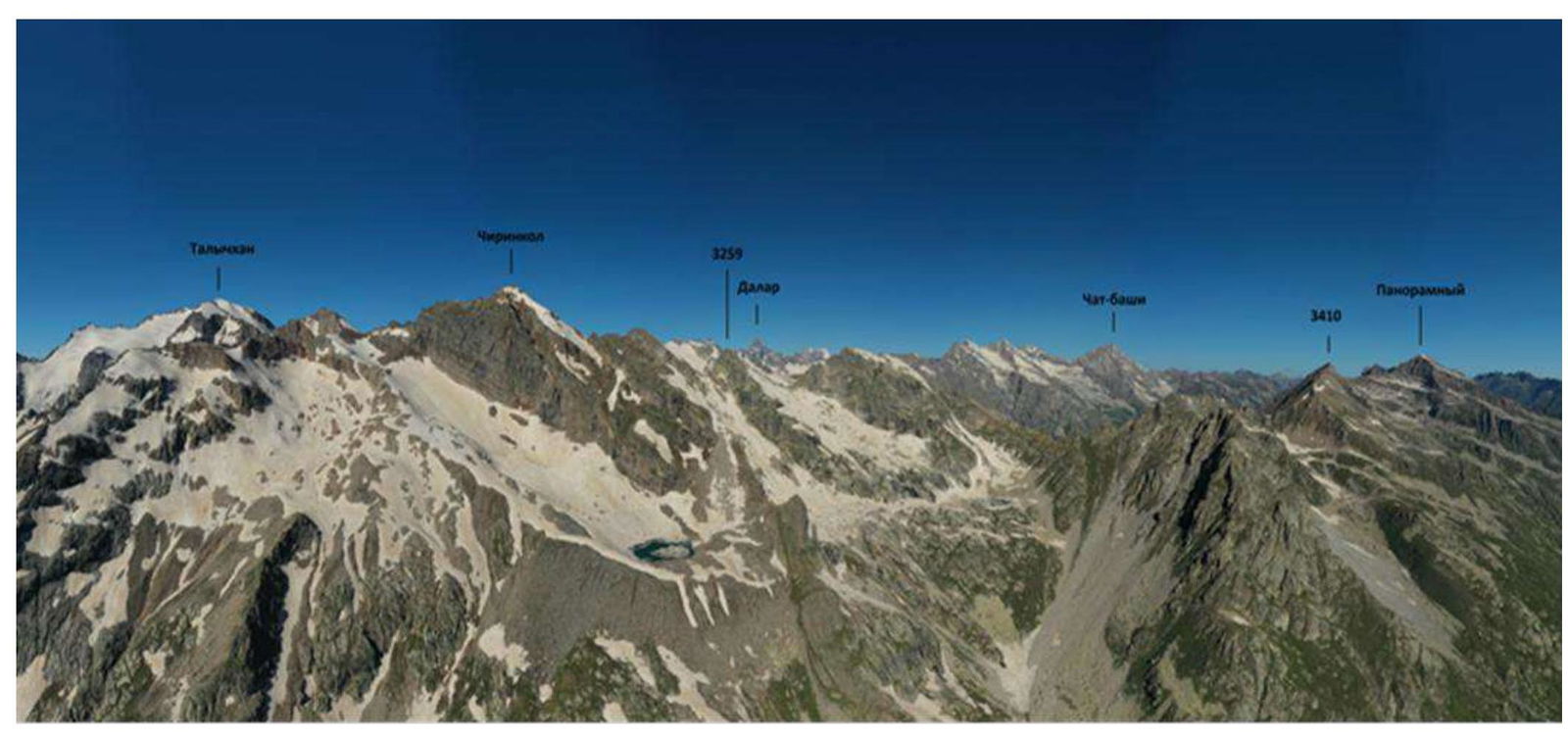 Photo №2. Panoramic photo of the area (taken on 11.07.2021 from the slopes of Kichkinekolskaya Bashnya peak).
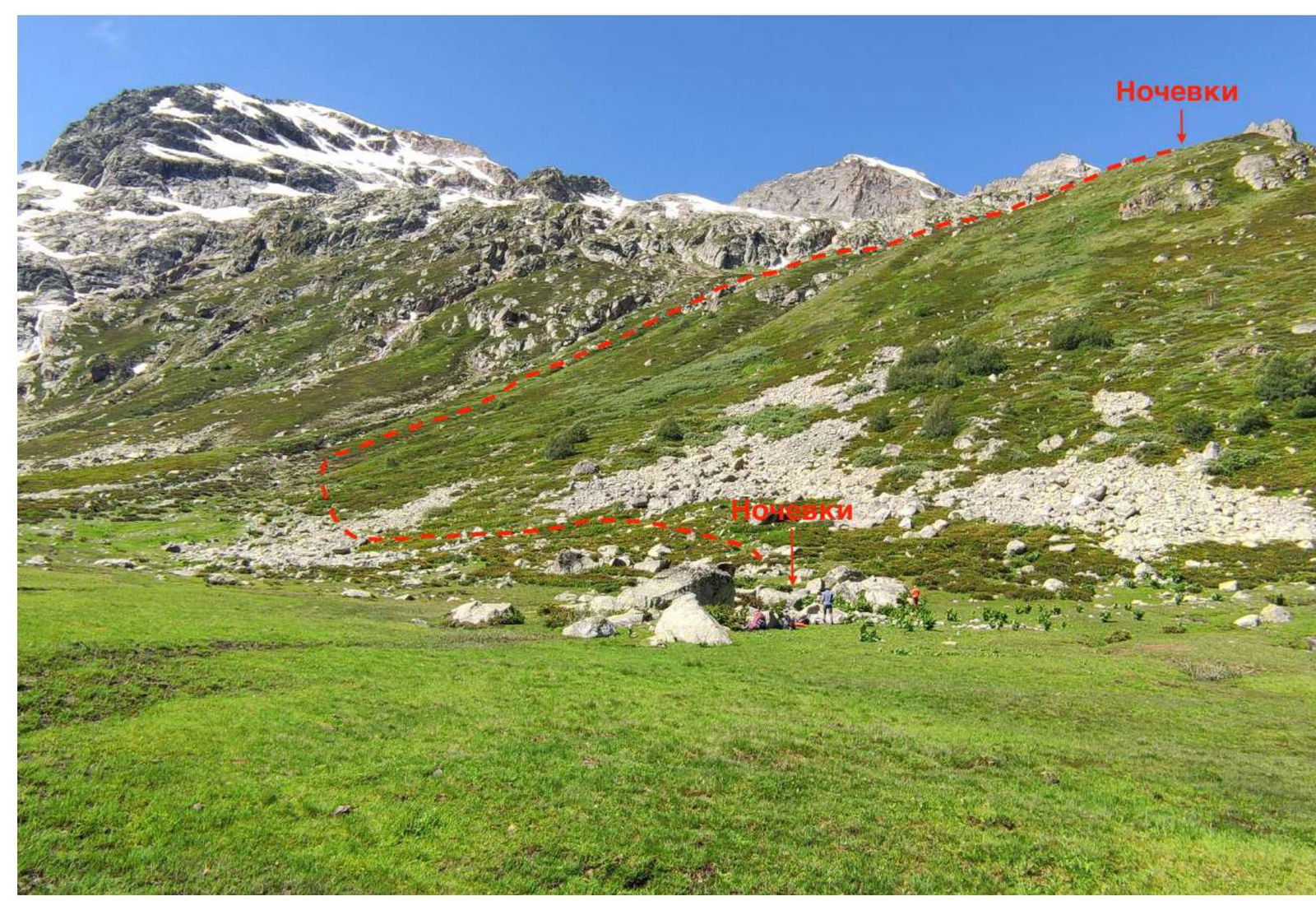 Photo №3. Overnight stays. Ascent to the pass
 Photo №4. Area map (source https://osmand.net/↗)
Chirikol peak is located in the Karachaevsky district of the Karachay-Cherkess Republic in a spur of the Main Caucasian Range, located between the rivers:
Photo №4. Area map (source https://osmand.net/↗)
Chirikol peak is located in the Karachaevsky district of the Karachay-Cherkess Republic in a spur of the Main Caucasian Range, located between the rivers:
- East Kichkinekol
- Chirikol.
We set up our base camp at the confluence of the Ullu-kam (Kuban) and East Kichkinekol rivers in the house of the director of the Uzunkol A/L, Enver Khabchaev (43.30166 42.31656).
From the Khurzuk settlement, it is necessary to move along a dirt road towards the border outpost, the same road that leads to the Uzunkol A/L. Immediately after the border outpost, there will be a fork. The road to the Uzunkol A/L will go straight, but we need to turn left into the Ullu-Kam (Kuban) valley, to the Khotyatau pass. The road is a bit worse than to the Uzunkol A/L, and only an SUV can pass. It is possible to arrange for a car to be sent by Enver Khasanbievich (tel. 8 (928) 389–19–72) and to stay in the house. The conditions are more than comfortable. The house is located 13.4 km from the border outpost.
The approach to the start of the route is done along the left bank of the East Kichkinekol river. The trail periodically disappears, but there are cairns to navigate by. In 1.5–2 hours from the base camp, we pass a rocky wall on the right side of the path (Photo №5). After another 1.5–2 hours (3.4 km), we reach a large boulder where we can set up an overnight stay (coordinates 43.24991 42.321587). There is an alternative approach path. The trail goes along the right (orographic) bank of the East Kichkinekol river. We move past the border outpost along a clear and well-defined trail to huge boulders (3–3.5 hours). After climbing onto them, look for a crossing to the left bank of the river, and then follow the description. From the large boulder, we start to bear right and upwards on the right side of the river (Photo №3, Photo №4). We can also set up an overnight stay after the steep ascent (coordinates 43.24956 42.314773). In summer, there is water at both overnight stays.
From the upper campsite, we head to the lake in about 45 minutes. Photo №6. After reaching the lake, following the stone ridges, we approach the start of the route to Burvestnik Yuzhny pass in about 1.5 hours (Photo №7 and №8).
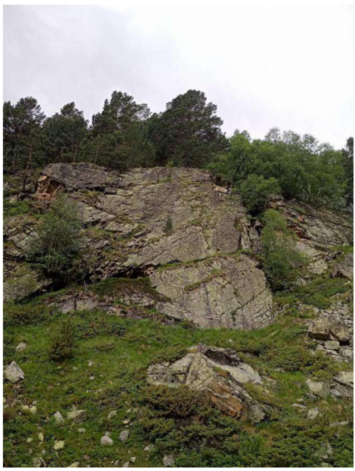 Photo №5. Rocky wall.
 Photo №6. Ascent from the upper campsite to the lake.
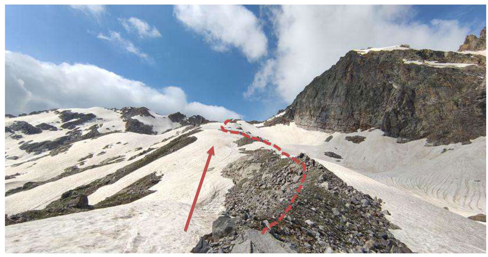 Photo №7. Approach from the lake to the start of the route.
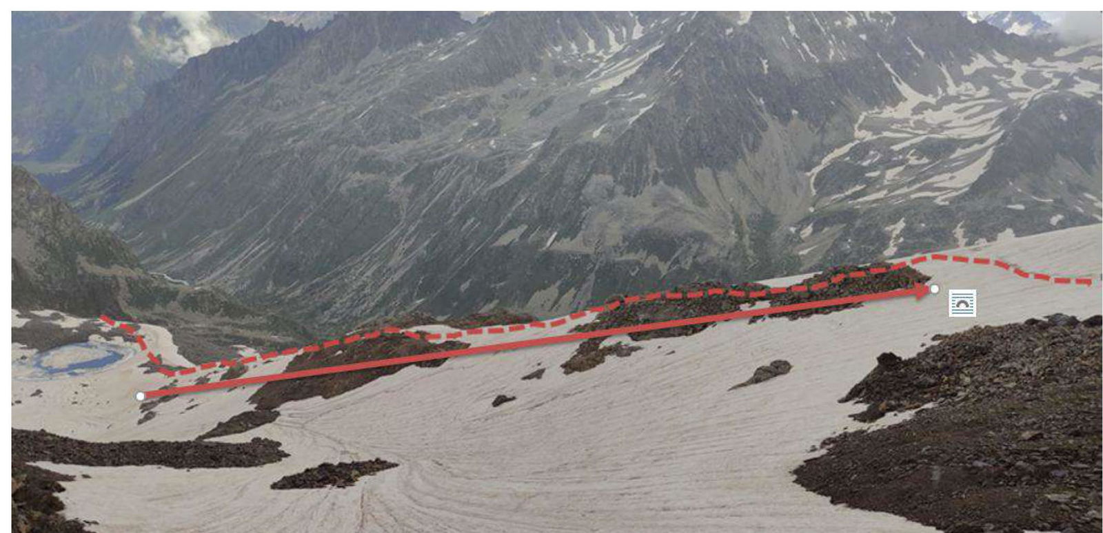 Photo №8. Approach from the lake to the start of the route.
2. Route characteristics
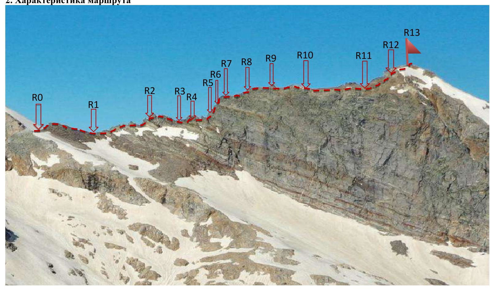 Photo №9. Technical photo of the route (taken on 06.07.2021)
| Section № | Relief characteristics | Category of complexity | Length, m | Type and number of hooks |
|---|---|---|---|---|
| R0–R1 | Rocky slope | 1 | 80 m | 0 |
| R1–R2 | Ridge | 3+ | 60 m | 3 protection elements |
| R2–R3 | Right of the ridge | 1 | 70 m | 1 |
| R3–R4 | Shelf and inner corner | 2 | 15 m | 2 |
| R4–R5 | Inner corner | 4 | 30 m | 5 anchor hooks |
| R5–R6 | Ridge | 2+ | 50 m | 4 anchor hooks |
| R6–R7 | Rocky wall (key section) | 4+ | 55 m | 3 protection elements + 4 anchor hooks |
| R7–R8 | Ridge (control cairn) | 3 | 60 m | 2 protection elements |
| R8–R9 | Ridge | 2+ | 50 m | 2 protection elements |
| R9–R10 | Ridge | 1 | 80 m | 0 |
| R10–R11 | Ridge | 1 | 150 m | 0 |
| R11–R12 | Large scree | 2 | 80 m | 0 |
| R12–R13 | Ridge | 2+ | 100 m | 0 |
3. Characteristics of the team's actions
| Section № | Description | Photo № |
|---|---|---|
| R0–R1 | Movement from the snowpatch along the ridge. Simultaneous movement. 80 m, 40°, I. | Photo №10 |
| R1–R2 | Movement along the ridge. Convenient belay station on a rock. Alternating movement. 60 m, 50°–65°, III+. | Photo №11 |
| R2–R3 | Bypass the sharp ridge on the right. Alternating movement. 70 m, 10°, I. | Photo №12 |
| R3–R4 | Move along the shelf to the right and up the weakly expressed corner. Alternating movement. 15 m, 55°, II. | Photo №13 |
| R4–R5 | Movement along a weakly expressed inner corner. Alternating movement. 30 m, 70°, IV. | Photo №14 |
| R5–R6 | Up the ridge. Alternating movement. 50 m, 60°, II+. | Photo №15 |
| R6–R7 | Up the rocky wall. Rappel. 55 m, 75°, IV+. | Photo №16 |
| R7–R8 | Up the ridge. Alternating movement. 60 m, 55°–80°, III. | Photo №17 |
| R8–R9 | Up the ridge. Alternating movement. 50 m, 65°, II+. | Photo №18 |
| R9–R10 | Ridge. Simultaneous movement. 80 m, 20°, I. | Photo №19 |
| R10–R11 | Ridge. Alternating movement. 150 m, 15°, I. | Photo №20 |
| R11–R12 | Up the large scree. Alternating movement. 80 m, 45°, II. | Photo №21 |
| R12–R13 | Up the ridge. Alternating movement. 100 m, 45°, II+. | Photo №21 |
| Descent | Photo №22 |
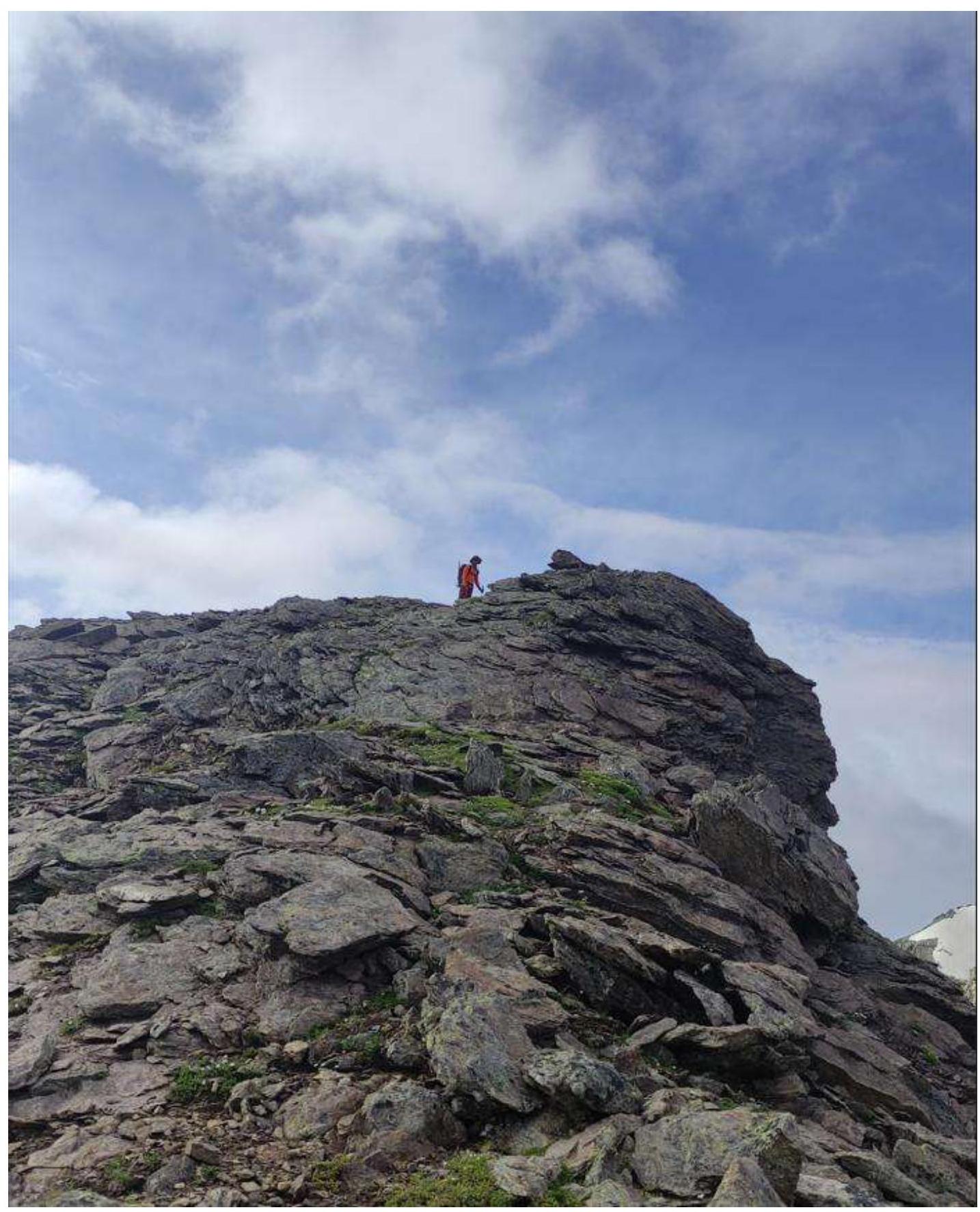 Photo №10. Section R0–R1.
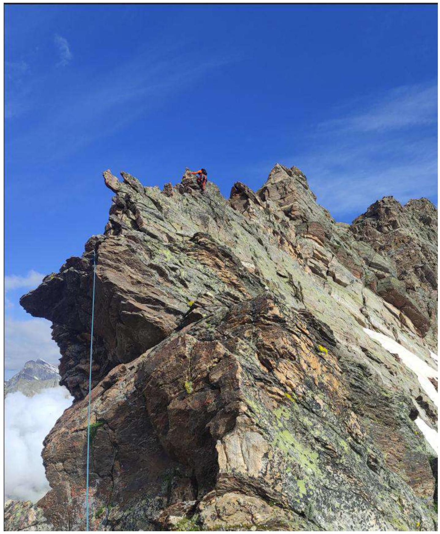
Photo №11. Section R1–R2.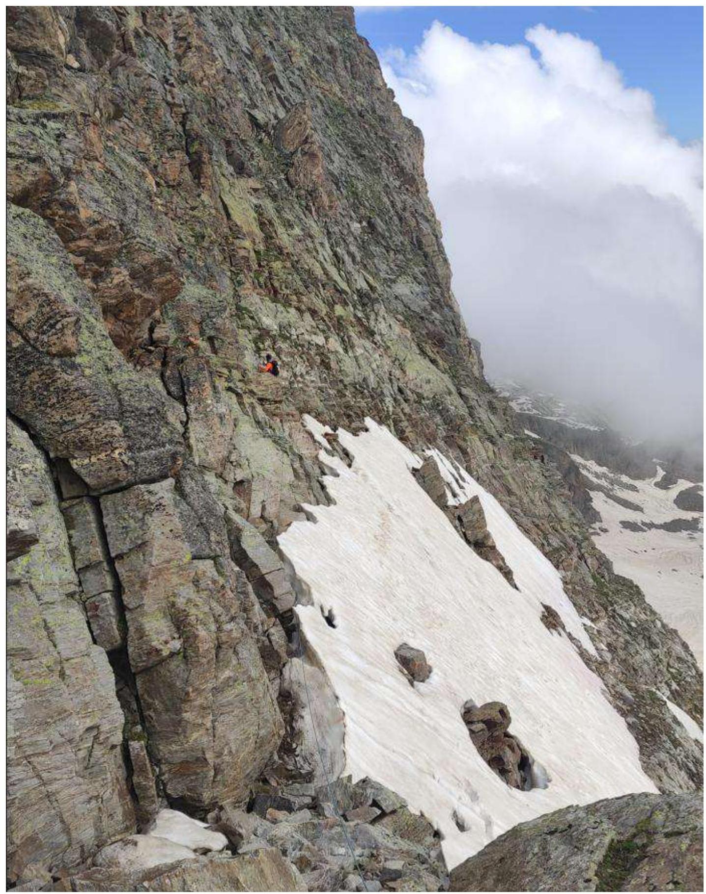
Photo №12. Section R2–R3.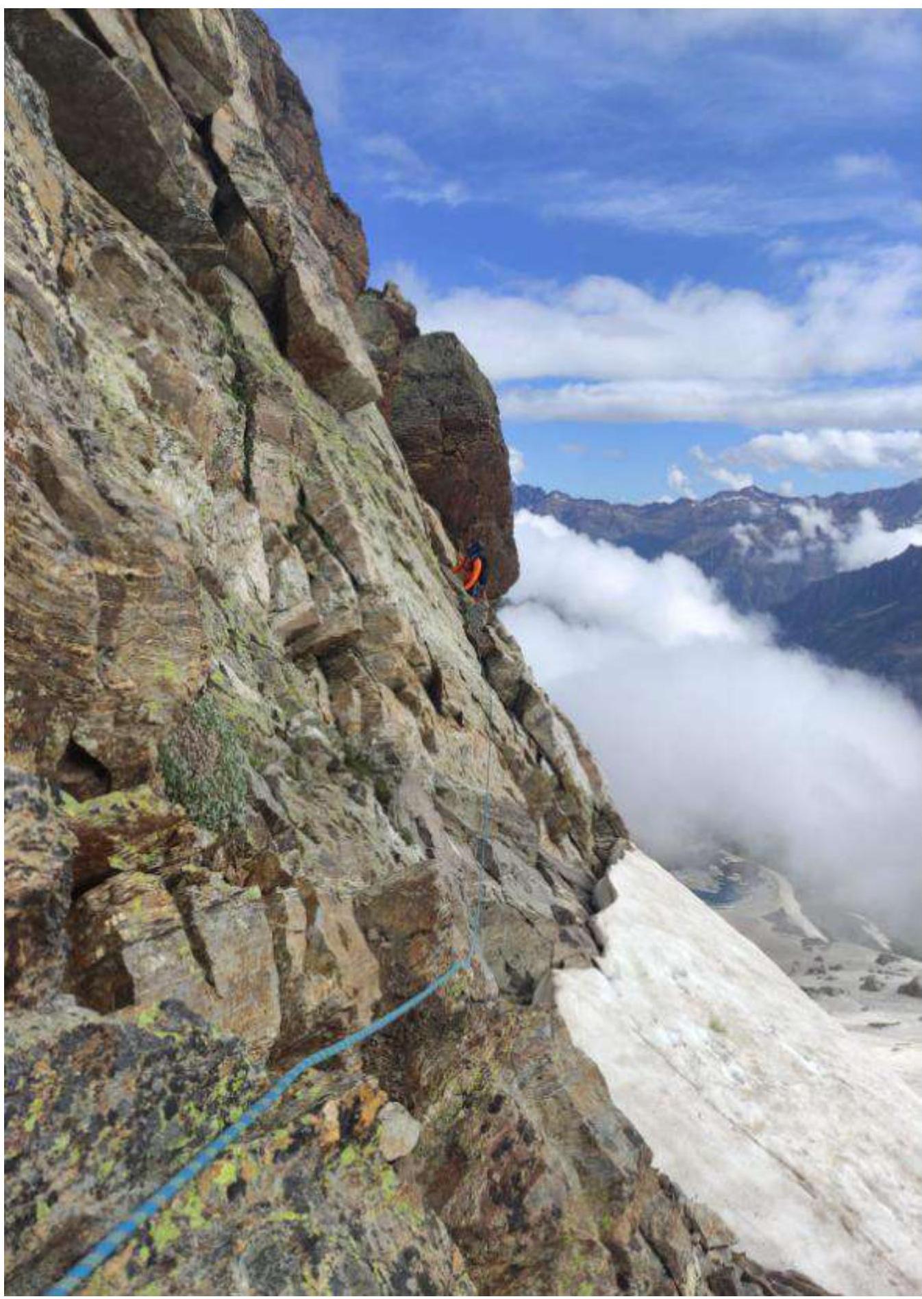
Photo №13. Section R3–R4.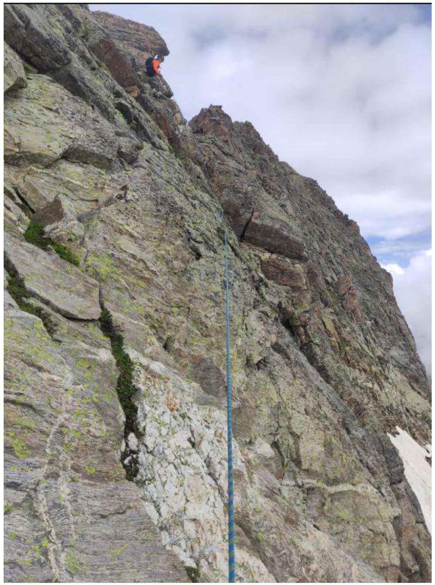
Photo №14. Section R4–R5.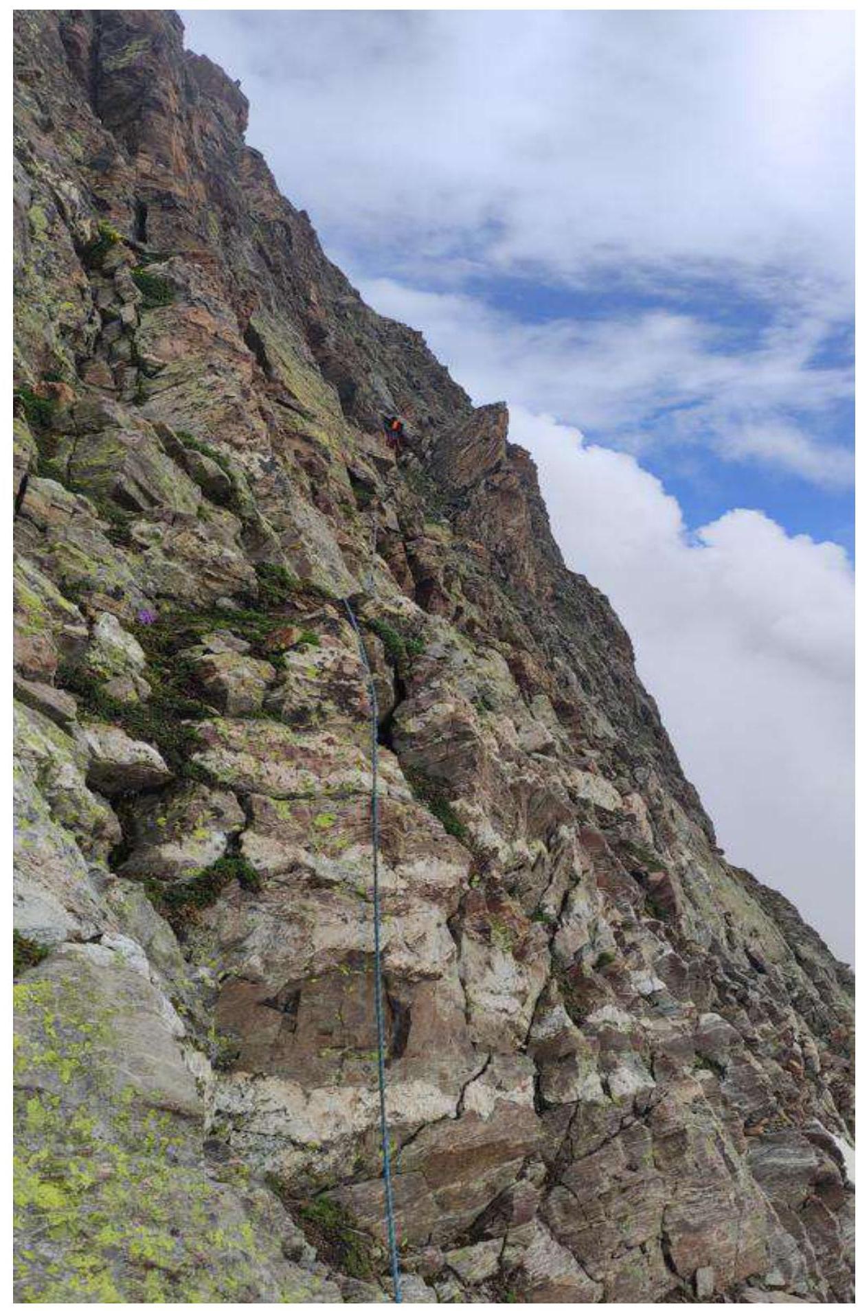
Photo №15. Section R5–R6.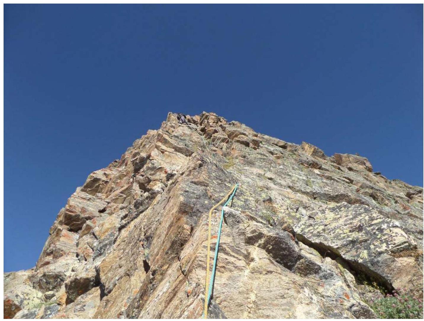
Photo №16. Section R6–R7.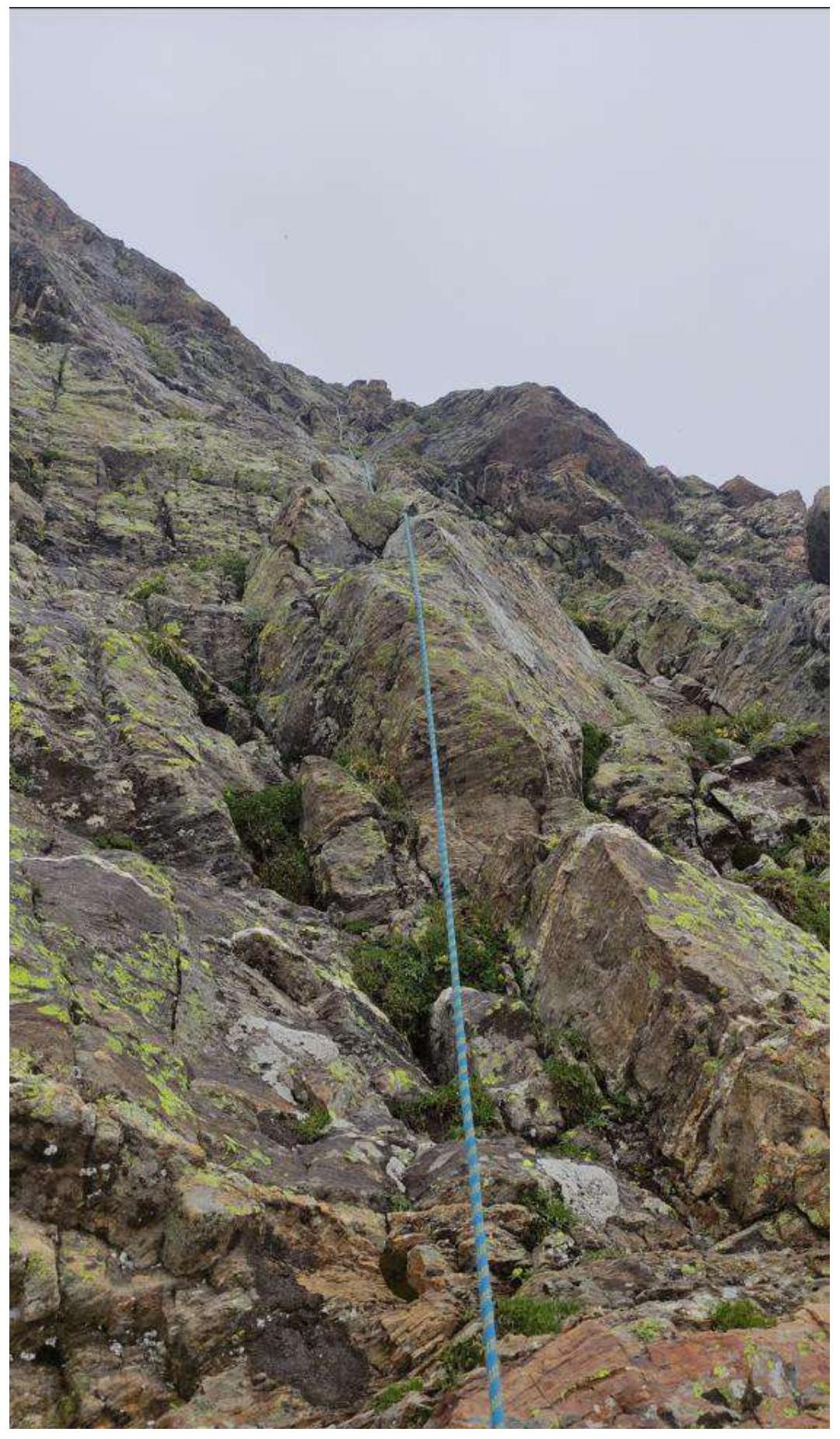
Photo №17. Section R7–R8.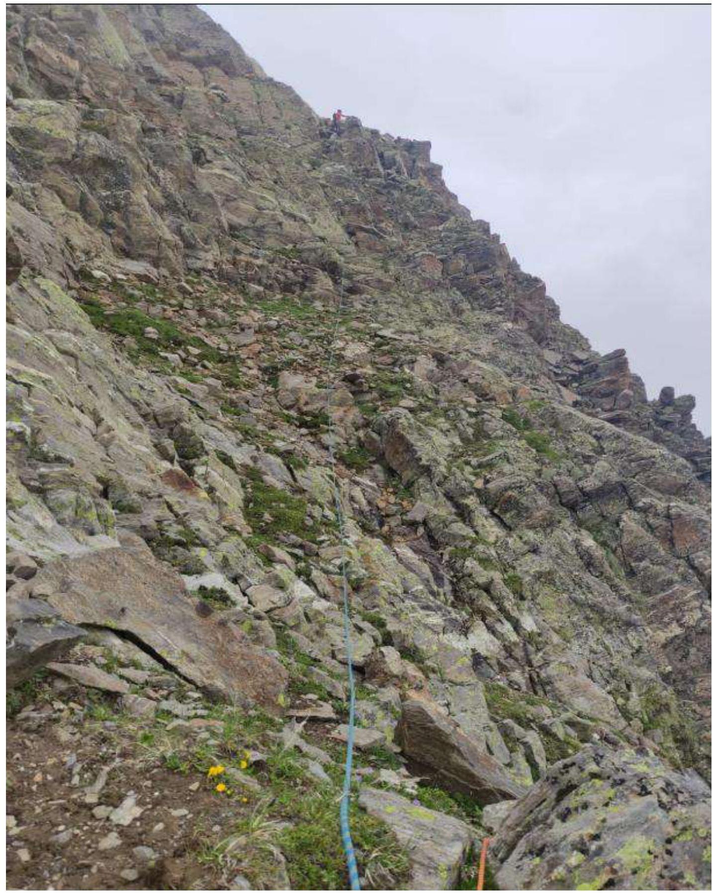
Photo №18. Section R8–R9.
Photo №19. Section R9–R10.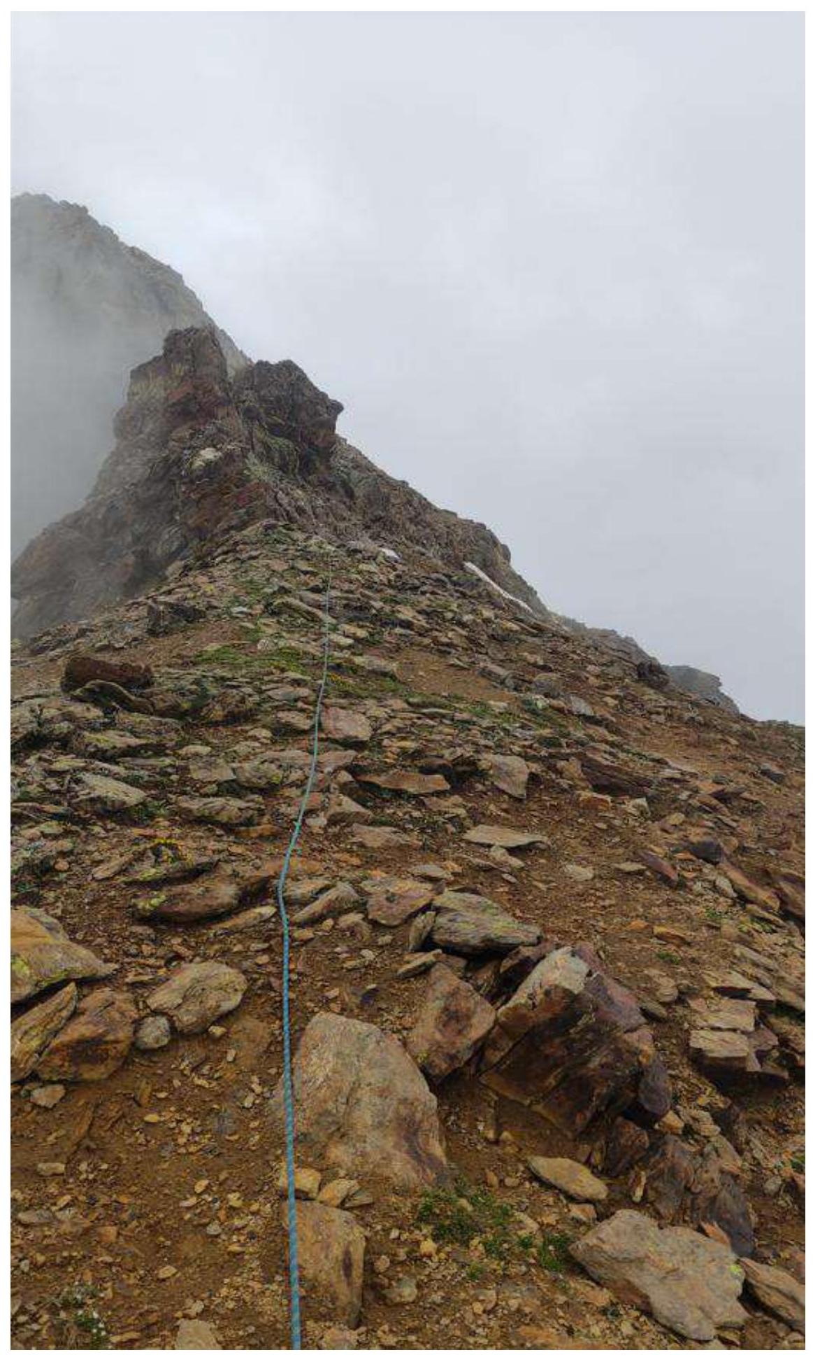
Photo №20. Section R10–R11.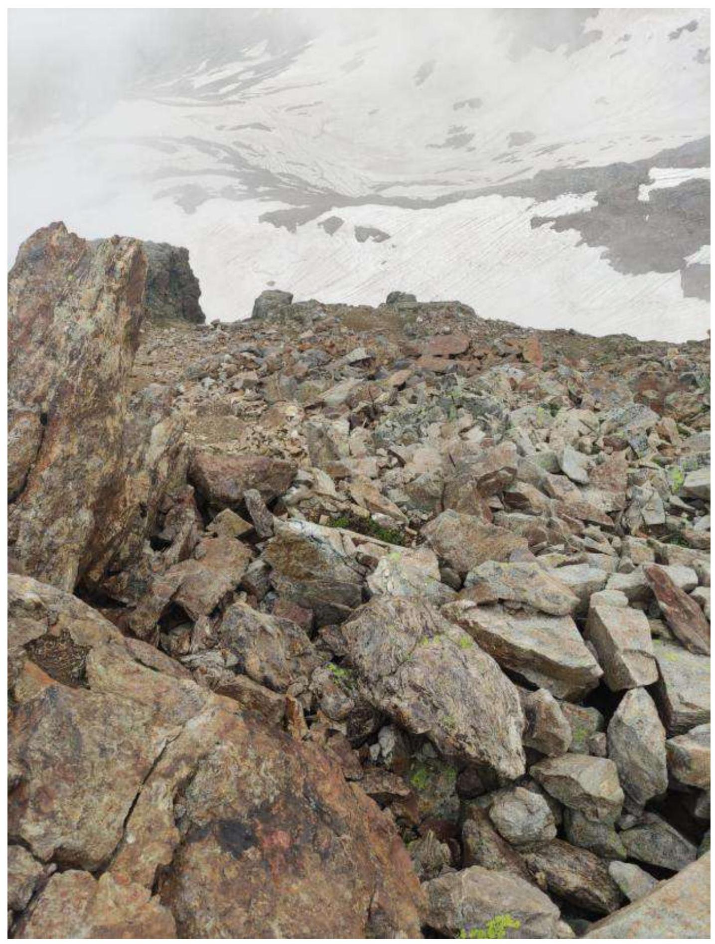
Photo №21. Section R11–R12.
Photo №22. Section R12–R13 Summit section.
Photo №23. Descent option (photo taken on 19.08.2023). Descent from the summit is done along large boulders towards Yuzhny Elektrik pass. Then, keeping close to the rocks, we descend along "goat trails" to the lake. The descent is clearly visible from the lake.
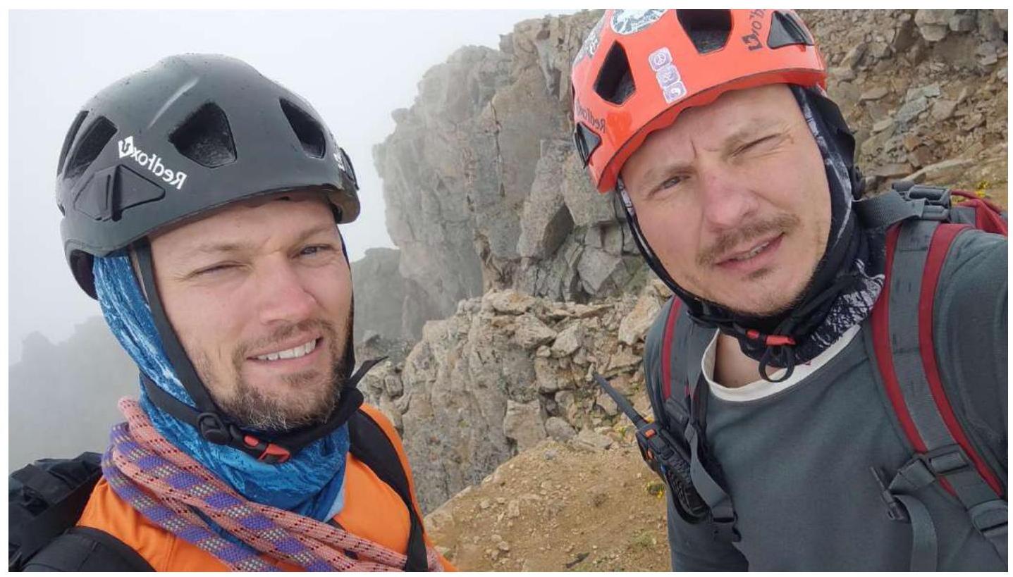 Photo №23. Team at the summit by the control cairn.
After completing the ascent, a debrief was conducted to assess the complexity of individual sections and the route as a whole. The route taken is considered safe. Taking into account experience from previous ascents to the peaks:
Photo №23. Team at the summit by the control cairn.
After completing the ascent, a debrief was conducted to assess the complexity of individual sections and the route as a whole. The route taken is considered safe. Taking into account experience from previous ascents to the peaks:
- Rassopova — 2B
- Zaymov Peak — 2B
- Taulan (3226) — 2B
- Dolomity, North — 3A
- Peak 3288 — 3A
- Taulan — 3A
- Dolomity, South — 3B
- Karadjasch — 4A
The route to Chirikol peak 3528 corresponds to category 3A.
Recommendations for climbers
When planning three ascents — to peak 3259 from the start of the cirque, to peak 3259 from Elektrik pass, and to Chirikol peak 3528 — it is advisable to set up a storm camp in the cirque, immediately after the ascent from the valley (Photo №3, 4, 6). For the route:
- 7 anchor hooks, a set of protection elements, and four large loops are sufficient.
- Water can be collected from the lake before the route.
- Mobile communication is absent throughout the entire route.