Report
ON THE FIRST ASCENT TO THE SUMMIT OF PIK 3090 (LOCAL NAME — "PIK OSMANA KASAEVA") VIA THE EASTERN RIDGE, cat. dif. 3A BY THE AUSB Uzunkol TEAM FROM STAVROPOL August 19, 2023
I. Ascent Passport
| №№ | 1. General Information | |
|---|---|---|
| 1.1 | Full name, sports rank of the leader | Olyunin Vladimir Yuryevich, 1st sports rank |
| 1.2 | Full name, sports rank of participants | Livinsky Sergey Alexandrovich, Candidate for Master of Sports |
| 1.3 | Full name of coach | Kobylyatsky Nikolai Grigoryevich |
| 1.4 | Organization | AUSB Uzunkol |
| 2. Characteristics of the Ascent Object | ||
| 2.1 | Region | Caucasus |
| 2.2 | Valley | Ullukam |
| 2.3 | Section number according to the 2020 classification table | 2.3 |
| 2.4 | Name and height of the summit | 3090 m (Pik Osмана Kasaeva) |
| 2.5 | Geographical coordinates of the summit (latitude/longitude), GPS coordinates | 43.292362/42.298774 |
| 3. Characteristics of the Route | ||
| 3.1 | Name of the route | Via the Eastern Ridge |
| 3.2 | Proposed category of difficulty | 3A |
| 3.3 | Degree of route development | First ascent |
| 3.4 | Nature of the route terrain | Rocky |
| 3.5 | Height difference of the route (according to altimeter or GPS data) | 340 m |
| 3.6 | Route length (in meters) | 775 m |
| 3.7 | Technical elements of the route (total length of sections of varying difficulty with indication of terrain type: ice-snow, rocky) | 2nd cat. dif. rocks — 380 m. 3rd cat. dif. rocks — 130 m. 3+ cat. dif. rocks — 110 m. 4th cat. dif. rocks — 45 m. 4+ cat. dif. rocks — 50 m. |
| 3.8 | Descent from the summit | Descent towards the South Panoramic Pass, via a 2A cat. dif. route, then to the right down a steep grassy slope into the cirque. Depending on the group's condition, 100 m of rope may be required |
| 3.9 | Additional characteristics of the route | There is no water on the route. Water should be collected at the base camp |
| 4. Characteristics of the Team's Actions | ||
| 4.1 | Time of movement (team's walking hours, in hours and days) | 13 hours 30 minutes |
| 4.2 | Overnights | Base camp |
| 5:00, August 19, 2023 | ||
| 4.3 | Start of the route | 7:30, August 19, 2023 |
| 4.4 | Reach the summit | 14:00, August 19, 2023 |
| 4.5 | Return to camp | 18:30, August 19, 2023 |
| 5. Responsible for the Report | ||
| 5.1 | Full name, e-mail | Olyunin Vladimir Yuryevich Prom_alp_stav@mail.ru |
II. Description of the Ascent
1. Characteristics of the Ascent Object
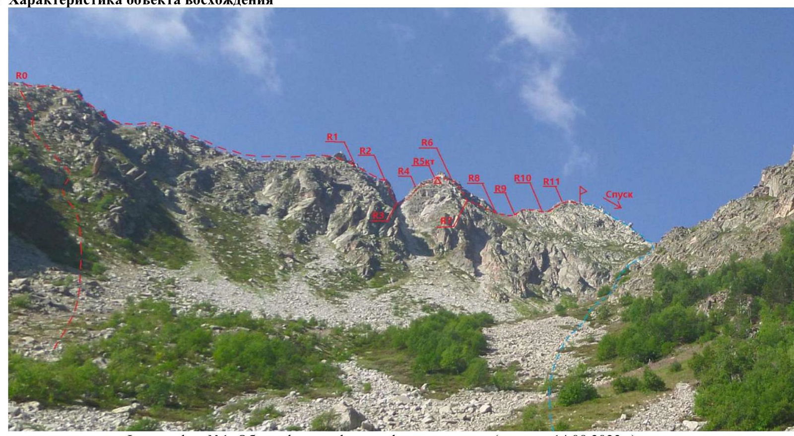
Photo №1. General photo of the route profile (taken on August 14, 2023)
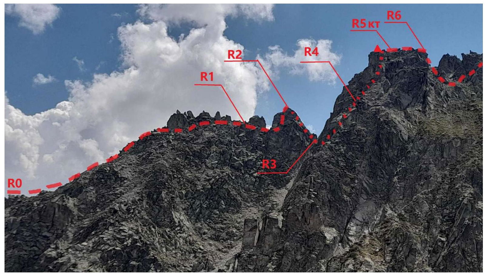
Photo №2. Sections of the route R0–R6.
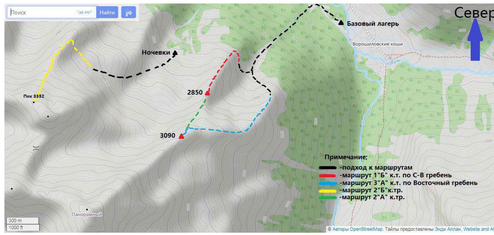
Photo №3. Map of the area (source https://www.openstreetmap.org↗) © OpenStreetMap contributors. Tiles provided by Andy Allan. Website and API
In August 2023, a group of climbers from AUSB Uzunkol from Stavropol, Olyunin V.Yu., Livinsky S.A., Grekova M.S., and Subbotina E.N., conducted a reconnaissance of the area. The results of the reconnaissance formed the basis for this first ascent.
The summit 3090 m (local name — "Pik Osмана Kasaeva") is located in the Karachayevsky district of the Karachay-Cherkess Republic in a spur of the Main Caucasian Range, situated between the rivers Vostochnyy Kichkinekol and Chirikol.
We set up our base camp at the confluence of the rivers Ullu-Kam (Kuban) and Vostochnyy Kichkinekol in the house of the director of a/l Uzunkol, Enver Khabchayev (43.30166, 42.31656).
From the village of Khurzuk, it is necessary to move along a dirt road towards the border post, the same road that leads to a/l Uzunkol. Immediately after the border post, there will be a fork. The road to the right leads to a/l Uzunkol, but we need to turn left into the Ullu-Kam (Kuban) valley, towards the Khotyatau Pass. The road is a bit worse than to a/l Uzunkol, and can only be traversed by an SUV. It is possible to arrange for a car transfer and accommodation in the house with Enver Khasanbiyevich Khabchayev (phone: 8 (928) 389-1972). The conditions are more than comfortable. The house is located 13.4 km from the border post.
Approach to the start of the route. From the base camp, we descend down the valley, along the left bank of the Kuban River to a stone scree (500 m). Then, along a dry stream bed, we ascend to a stone step. It is possible to climb it from the left through a "birch forest" or from the right via large stones. After ascending into the "cirque," we climb a grassy-stony slope to a ridge on the left. The approach from the base camp to the start of the route takes 2.5–3 hours.
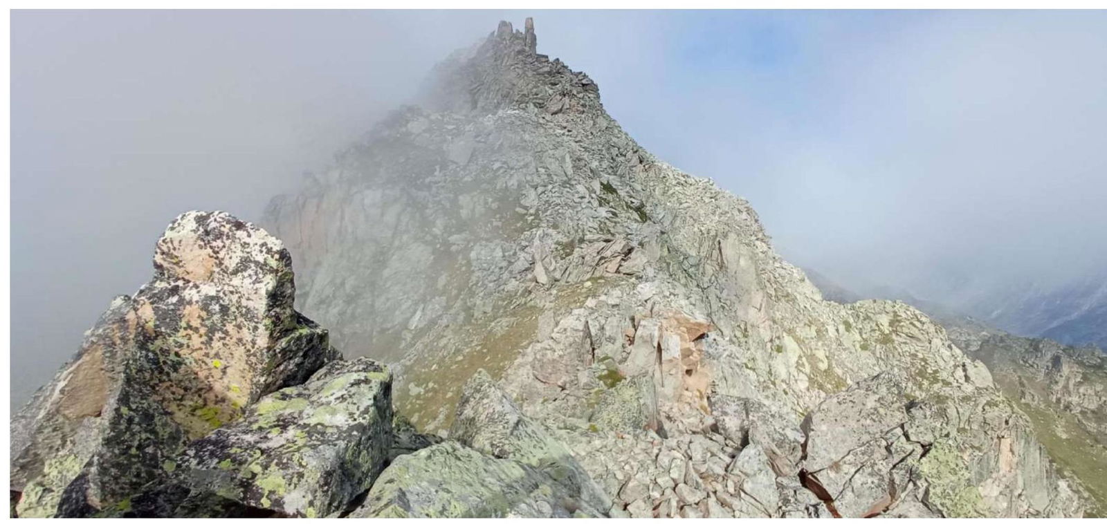
Photo №4. R0–R1. Rocky ridge.
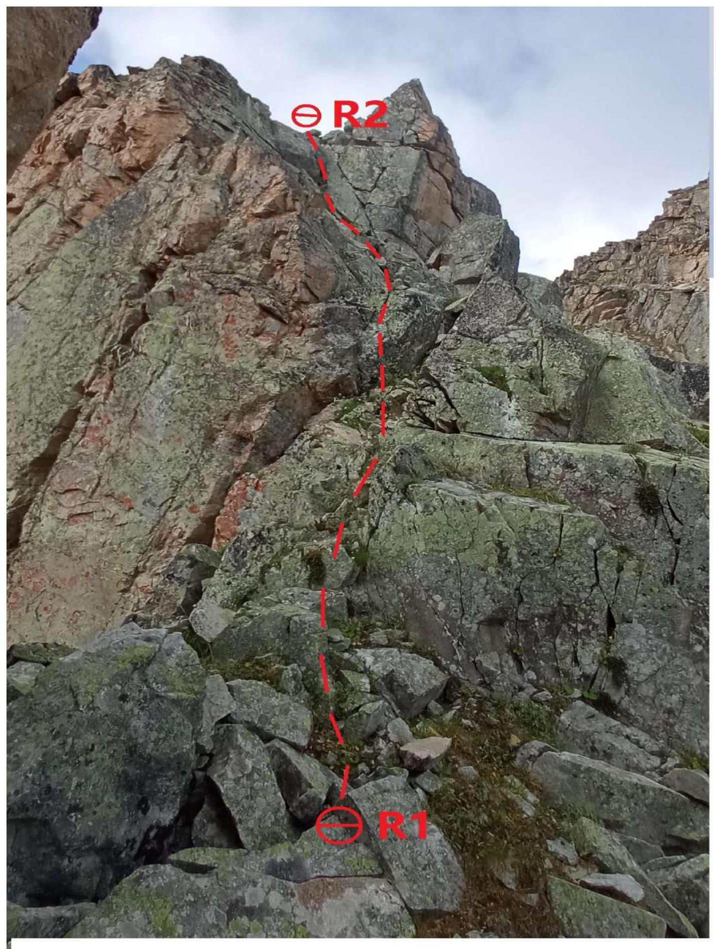
Photo №5. R1–R2. Inner corner
Photo №6. R3–R4–R5. Rocky wall.
(key to the route)

Photo №7. R4–R5
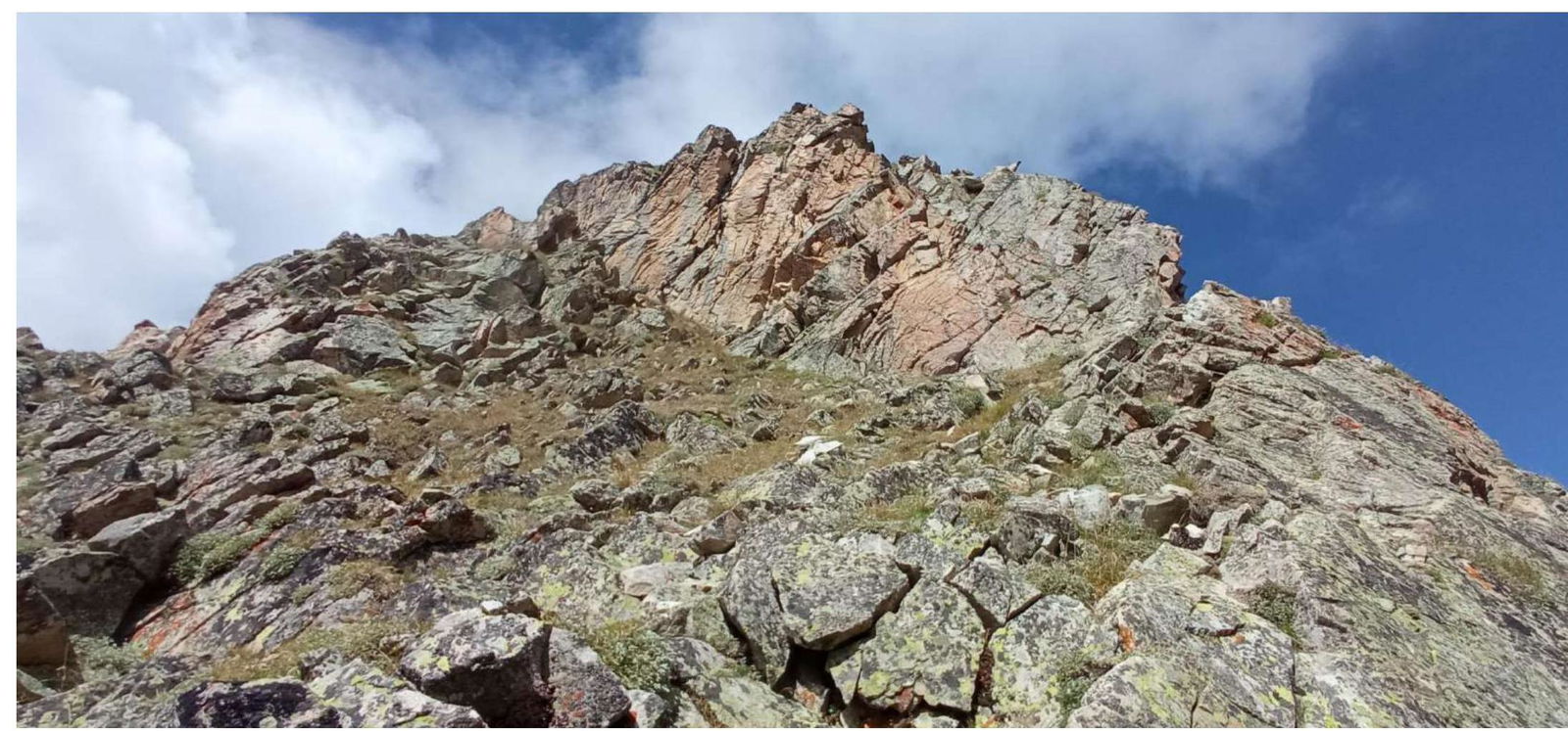
Photo №8. R6–R7. Dülfer
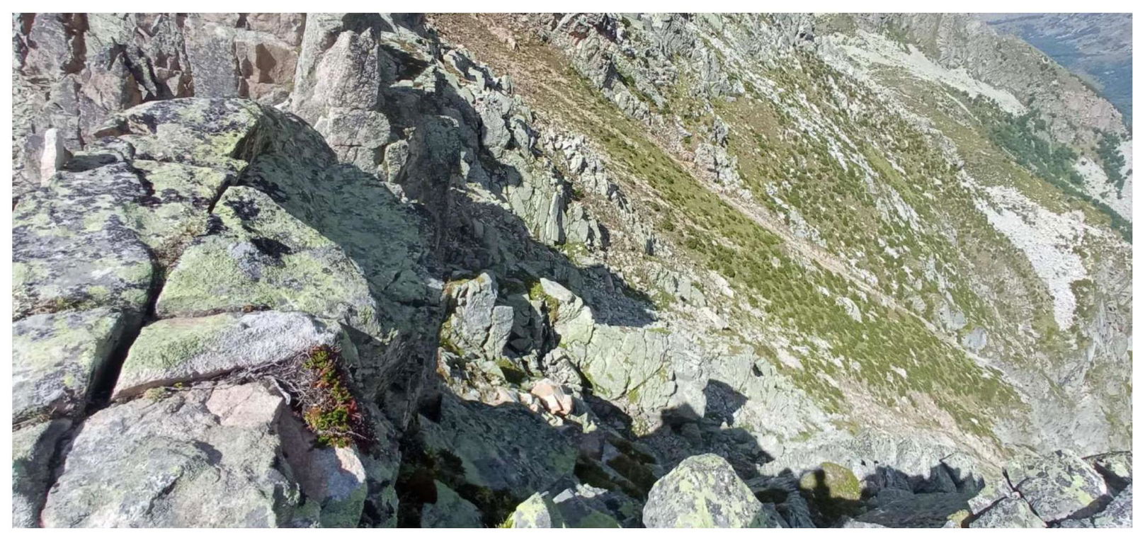
Photo №9. R9–R10–R11. Destroyed rocky wall.

2. Characteristics of the Route
Technical characteristics of the route sections
| Section | Nature of the terrain | Category of difficulty | Length, m | Type and number of hooks |
|---|---|---|---|---|
| R0–R1 | Rocky ridge | 2 | 350 | 0 |
| R1–R2 | Rocks, inner corner | 3, 4 | 20, 15 | 2 anchor hooks, 3 chocks |
| R2–R3 | Dülfer | 40 | ||
| R3–R4 | Rocky wall (key to the route) | 4+ | 50 | 2 chocks, 2 anchor hooks, 1 friend |
| R4–R5 | Rocky wall | 3 | 20 | 2 anchor hooks |
| R5–R6 | Ridge | 2 | 30 | 0 |
| R6–R7 | Dülfer | 40 | 0 | |
| R7–R8 | Ridge | 3+ | 40 | 2 chocks, 2 anchor hooks |
| R8–R9 | Ridge | 3 | 40 | 0 |
| R9–R10 | Destroyed rocky wall | 4, 3+ | 30, 20 | 2 chocks, 3 anchor hooks |
| R10–R11 | Exit to the ridge | 3 | 50 | 2 chocks, 1 anchor hook |
| R11–R12 | Pre-summit ridge | 3+ | 50 | 2 anchor hooks |
3. Characteristics of the Team's Actions
| Section | Description | Photo number |
|---|---|---|
| R0–R1 | Movement along the ridge. Simultaneous movement 350 m, 40°, 1 | Photo №4 |
| R1–R2 | Movement along the ridge, then up the inner corner. Movement with protection. 20 m, 65°, 3, 15 m, 80°, 4 | Photo №5 |
| R2–R3 | Dülfer 40 m, 90° | |
| R3–R4 | Movement with protection 50 m, 80°, 4+ (key to the route) | Photo №6 |
| R4–R5 | Movement up a grassy-rocky wall 20 m, 70°, 3. Alternating movement | Photo №7 |
| R5–R6 | Control turn. Movement along the ridge. Simultaneous movement 30 m, 50°, 2 | |
| R6–R7 | Dülfer 40 m, 90° | Photo №8 |
| R7–R8 | Movement up under the rocky wall with an exit to the ridge. Movement with protection 40 m, 75°, 3+ | |
| R8–R9 | Movement along the ridge, alternating movement 40 m, 70°, 3 | |
| R9–R10 | Movement up, left of the inner corner. Movement with protection 50 m, 80°, 4, 20 m, 70°, 3+ | Photo №9 |
| R10–R11 | Movement up easy rocks. Exit to the ridge. Alternating movement 50 m, 70°, 3 | Photo №10 |
| R11–R12 | Movement along the ridge to the summit. (ATTENTION! Psychological moment. Failure) At the summit, the route converges with the north-eastern ridge, along which a 2A cat. dif. route is laid, a control turn is made. Alternating movement 50 m, 75°, 3+ | Photo №11, №12 |
After completing the ascent, a debriefing was held, and the difficulty of individual sections and the route as a whole was assessed. The route taken is considered safe. Considering the experience of previous ascents to the summits:
- Krugozor "Myrdy" – 2A
- 3130 – 2A
- Zaimov Pik – 2B
- Taulan (3226) route through "Korona" – 3A
- Chat-Bashi – 3A
- Chat-Bashi – 3B
- Kara-Jash – 3B
- Dolomity, Yuzhnaya – 3B
- Dolomity Severnye – 4A
- Kirpich – 4B
- Dolomity Severnye – 5A
- Zamok – 5A
The route to the summit 3090 (Pik Osмана Kasaeva) via the eastern ridge corresponds to the 3A category of difficulty.
Recommendations for Climbers:
To complete the route, it is sufficient to have:
- 6 anchor hooks
- a set of chocks
- 2–3 small friends
- several large loops
It is also recommended to have 2–3 expendable loops, as there are two Dülfers on the route.
There is no water on the route. Mobile communication is absent throughout the entire route.