Report
On the first ascent to the summit 3090 (local name – «peak Osman's Kasaev») via the north-eastern ridge from the Southern Panoramic Pass, category 2A complexity, by the AUSB Uzunkol team from Stavropol on August 16, 2023.
I. Ascent Passport
| № | 1. General Information | |
|---|---|---|
| 1.1 | Full name, sports rank of the leader | Mukhin Igor Sergeevich, 2nd sports rank, February 18, 1996 |
| 1.2 | Full name, sports rank of the participants | Klimonov Kirill Artemovich, 1st sports rank, July 9, 1986; Kochergin Pavel Alexandrovich, 2nd sports rank, September 27, 1991; Mukhina Anna Sergeevna, 2nd sports rank, March 1, 1997 |
| 1.3 | Full name of the coach | Kobylyatsky Nikolai Grigorievich |
| 1.4 | Organization | AUSB Uzunkol |
| 2. Characteristics of the Ascent Object | ||
| 2.1 | Region | Caucasus |
| 2.2 | Gorge | Ullukam |
| 2.3 | Section number according to the 2020 classification table | 2.3 |
| 2.4 | Name and height of the summit | 3090 m («peak Osman's Kasaev») |
| 2.5 | Geographical coordinates of the summit (latitude/longitude), GPS coordinates | 43.292362, 42.298774 |
| 3. Characteristics of the Route | ||
| 3.1 | Name of the route | Via the north-eastern ridge |
| 3.2 | Proposed category of complexity | 2A |
| 3.3 | Degree of route development | First ascent |
| 3.4 | Character of the route terrain | Rocky |
| 3.5 | Height difference of the route (data from altimeter or GPS) | 300 m |
| 3.6 | Length of the route | 650 m |
| 3.7 | Technical elements of the route (total length of sections of various complexity categories with indication of terrain character) | I category, grassy slope/rocks — 300 m; II category, rocks — 100 m; IIb category, rocks — 100 m; III category, rocks — 100 m; IIIb category, rocks — 50 m. |
| 3.8 | Descent from the summit | Via the ascent route |
| 3.9 | Additional characteristics of the route | Water is absent on the route, many loose rocks |
| 4. Characteristics of the Team's Actions | ||
| 4.1 | Time of movement (team's working hours, indicated in hours and days) | 12 hours |
| 4.2 | Overnight stays | August 20, 2023 |
| 4.3 | Departure on the route | 5:00 AM, August 20, 2023 |
| 4.4 | Reaching the col | 6:40 AM, August 20, 2023 |
| 4.5 | Reaching the summit | 12:50 PM, August 20, 2023 |
| 4.6 | Returning to the camp | 5:00 PM, August 20, 2023 |
| 5. Responsible for the report | ||
| 5.1 | Mukhin I.S. | Mukhinigor@mail.ru |
II. Ascent Description
1. Characteristics of the Ascent Object
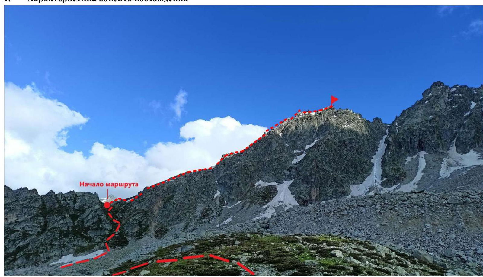
Photo №1. General photo of the summit (taken on August 16, 2023, from the overnight stay)

Photo №2. Photopanorama of the area (taken on July 11, 2021, from the slopes of the summit Kichkinokolskaya Bashnya)
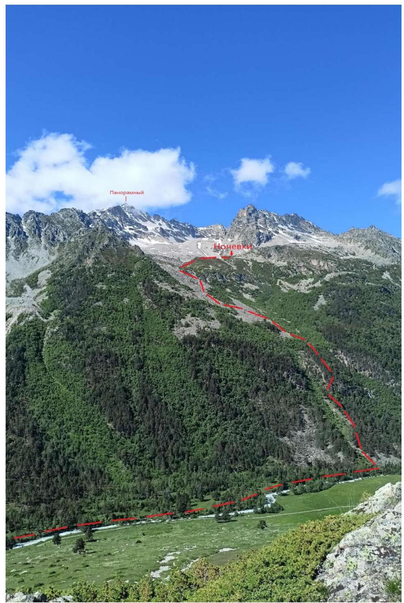
Photo №3. Ascent to the overnight stay
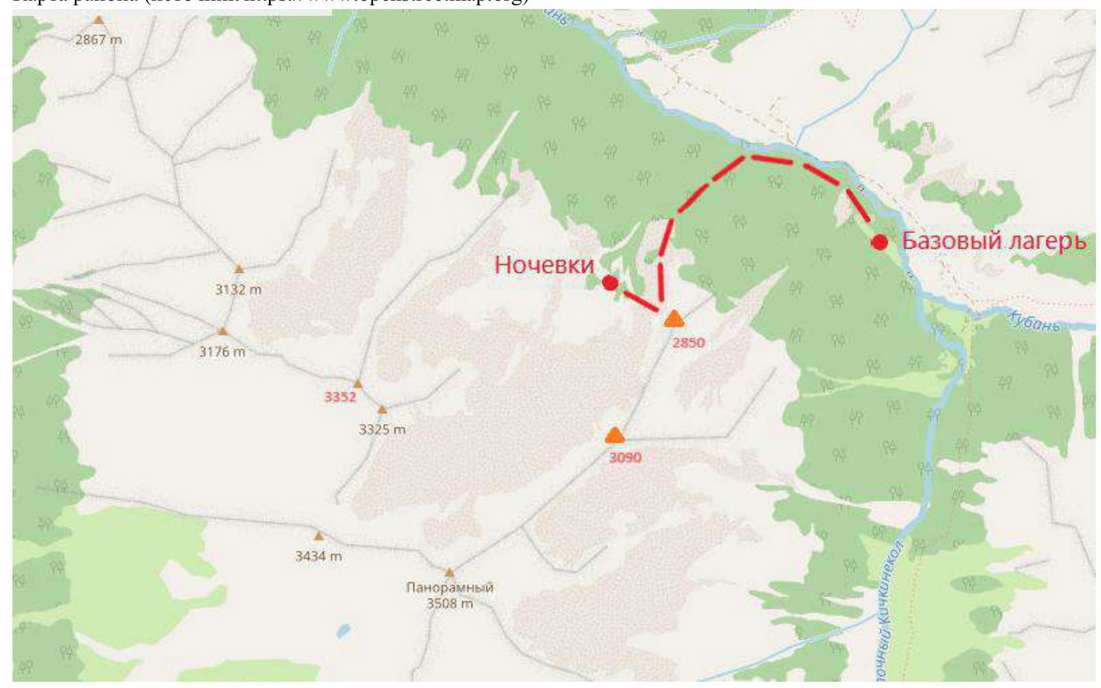
Map of the area (source https://www.openstreetmap.org↗)
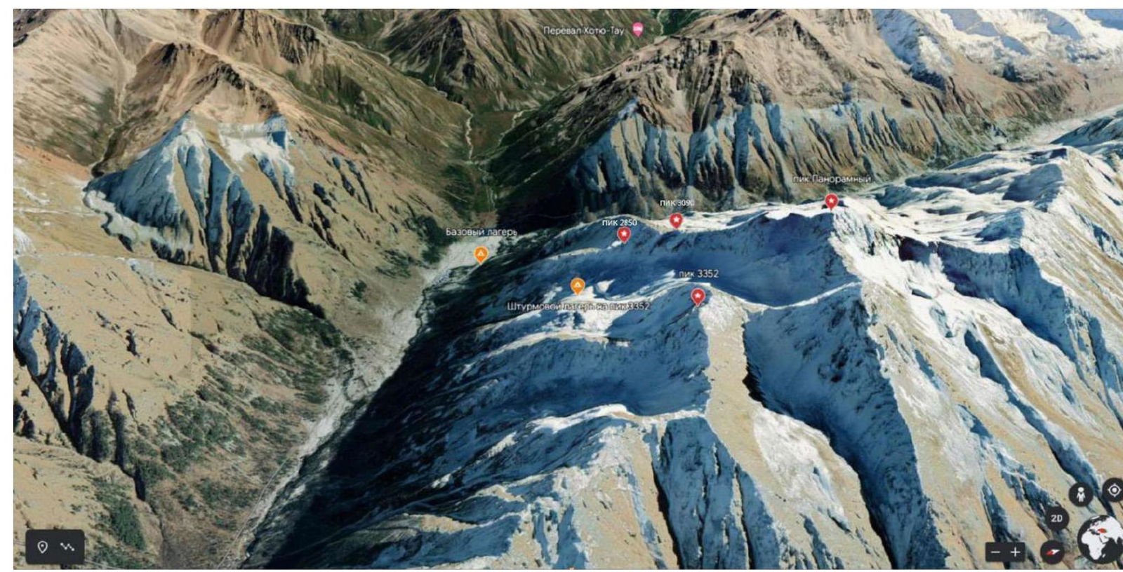
Panorama of the area.
The summit 3090 («peak Osman's Kasaev») is located in the Karachaevsky district of the Karachay-Cherkess Republic, in a spur of the Main Caucasian Range, situated between the rivers Vostochny Kichkinokol and Chirikol.
The summit is directly located on the north-eastern ridge of «Panoramnaya peak», which ends with the summit 3090 («peak Osman's Kasaev»). From the summit, in a north-eastern direction to the col between the summits 2850 (Maske) and 3090 («peak Osman's Kasaev») («Northern Panoramic Pass»), a ridge descends, along which the 2A category route is laid.
We set up the base camp at the confluence of the rivers Ullu-Kam (Kuban) and Vostochny Kichkinokol, near the house of the director of AUSB Uzunkol, Enver Khabchaev (43.30166, 42.31656).
From the village of Khurzuk, it is necessary to move along a dirt road towards the border post, the same road that leads to AUSB Uzunkol. Immediately after the border post, there will be a fork:
- Straight ahead, the road goes to AUSB Uzunkol;
- To the left — into the Ullu-Kam (Kuban) gorge, to the Khotyuta Pass.
The road to the left is slightly worse than to Uzunkol, and can only be traversed by an SUV. It is possible to arrange for a car pickup and accommodation at the house with Enver Khasanbievich Khabchaev (phone: 8-928-389-19-72), the director of AUSB Uzunkol. The house is located 13.4 km from the border post.
The approach to the start of the route is made along the left, orographically, bank of the river Ullu-Kam (Kuban). After about 1500 m, it is necessary to sharply turn left and go up along the boundary of the coniferous and fallen forest. There is no trail, but there are cairns to navigate by. After passing through the dense forest and rhododendron boundary — exit to the middle and large stone scree. Further movement is up and to the left along the cairns. At the end of the scree, there is a possibility to collect drinking water on the right.
Further — exit to the grassy slope along goat trails to the lower boundary of the terminal moraine of the former glacier. Place for organizing overnight stays (43.298095, 42.29541) (photo №3). From this place, in an easterly direction:
- exit to a clearly defined col between the summits 2850 (Maske) and 3090 («peak Osman's Kasaev») («Northern Panoramic Pass») along a steep grassy slope to the start of the route (photo №4);
- on the pass — a good place for preparing equipment and organizing rope teams.
2. Characteristics of the Route
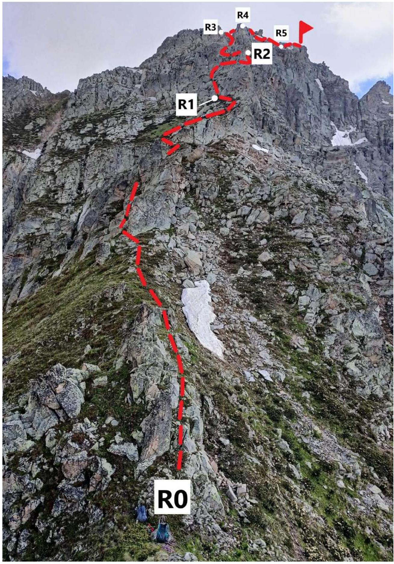
Photo №4. Technical photo of the route (taken on August 18, 2023, from the northern part of the ridge above the col)
2. Characteristics of the Route
| Section № | Character of the terrain | Category of complexity | Length, m | Types and quantity of protection |
|---|---|---|---|---|
| R0–R1 | Rocky-grassy slope | I | 300 | 0 |
| R1–R2 | Ridge | IIb | 100 | 4 stoppers, 3 anchor hooks |
| R2–R3 | Inclined wall | III | 100 | 3 stoppers |
| R3–R4 | Ridge | IIIb | 50 | 3 stoppers |
| R4–R5 | Ridge | II | 50 | 0 |
| R5–R6 | Inclined slab | II | 50 | 2 stoppers |
3. Characteristics of the Team's Actions
| Section № | Description | Photo number |
|---|---|---|
| R0–R1 | Movement up the steep slope from the col with exit to the ridge. Simultaneous movement 300 m, 30°–70°, I | Photo №5, Photo №6, Photo №7 |
| R1–R2 | Station on own points. Easy climbing with exit to a ledge and setting up a station on anchor hooks. Movement along the ridge, bypassing the rocky slab on the right. Convenient station on a rock. Alternating movement 100 m, 60°–70°, IIb | Photo №8 |
| R2–R3 | Movement along a steep stony slope and traverse of an inclined slab. Convenient station on a rock. Alternating movement 100 m, 50°–70°, III | Photo №9, Photo №10 |
| R3–R4 | Crossing a narrow col. Bypass on the left of a rocky slab with exit to a false summit (key to the route). Convenient station on a rock. Alternating movement 50 m, 70°–80°, IIIb | Photo №11 |
| R4–R5 | Movement along the ridge to the right and down, bypassing a rocky outcrop. Alternating movement 50 m, 0°, II | Photo №12 |
| R5–R6 | Movement along an inclined slab with a gap and exit to the summit. On the summit, a control cairn is built. Alternating movement 50 m, 50°–60°, II | Photo №13 |
| Descent via the ascent route |
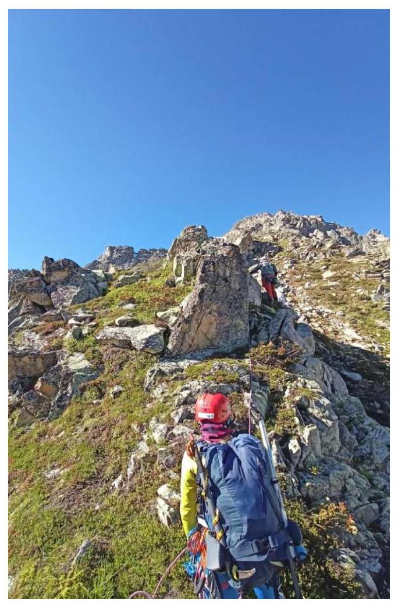
Photo №5. Section R0–R1
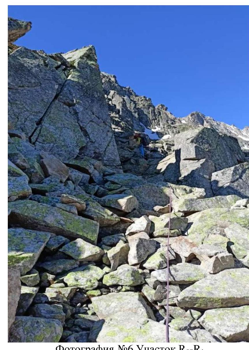
Photo №6. Section R0–R1
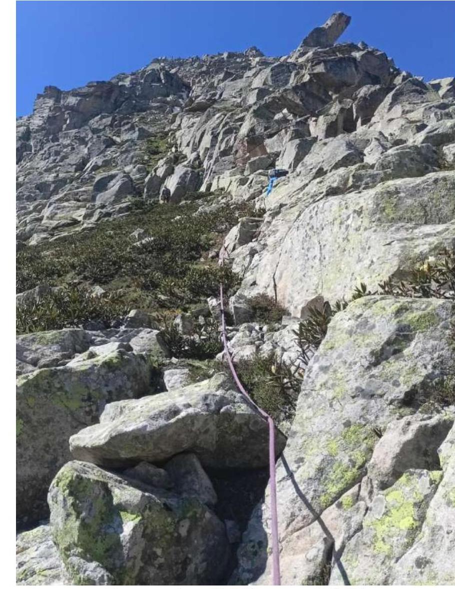
Photo №7. Section R0–R1
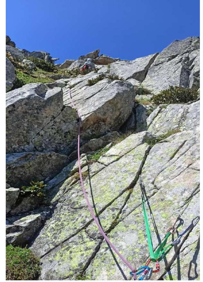
Photo №8. Section R1–R2
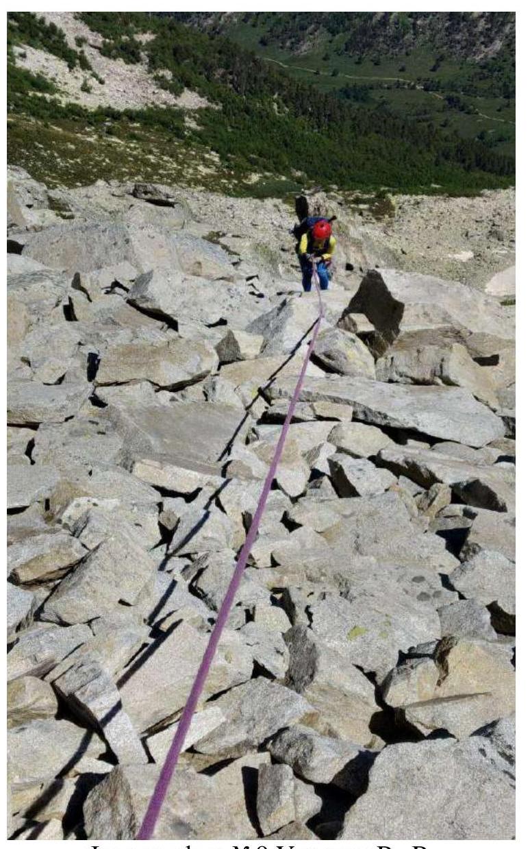
Photo №9. Section R2–R3
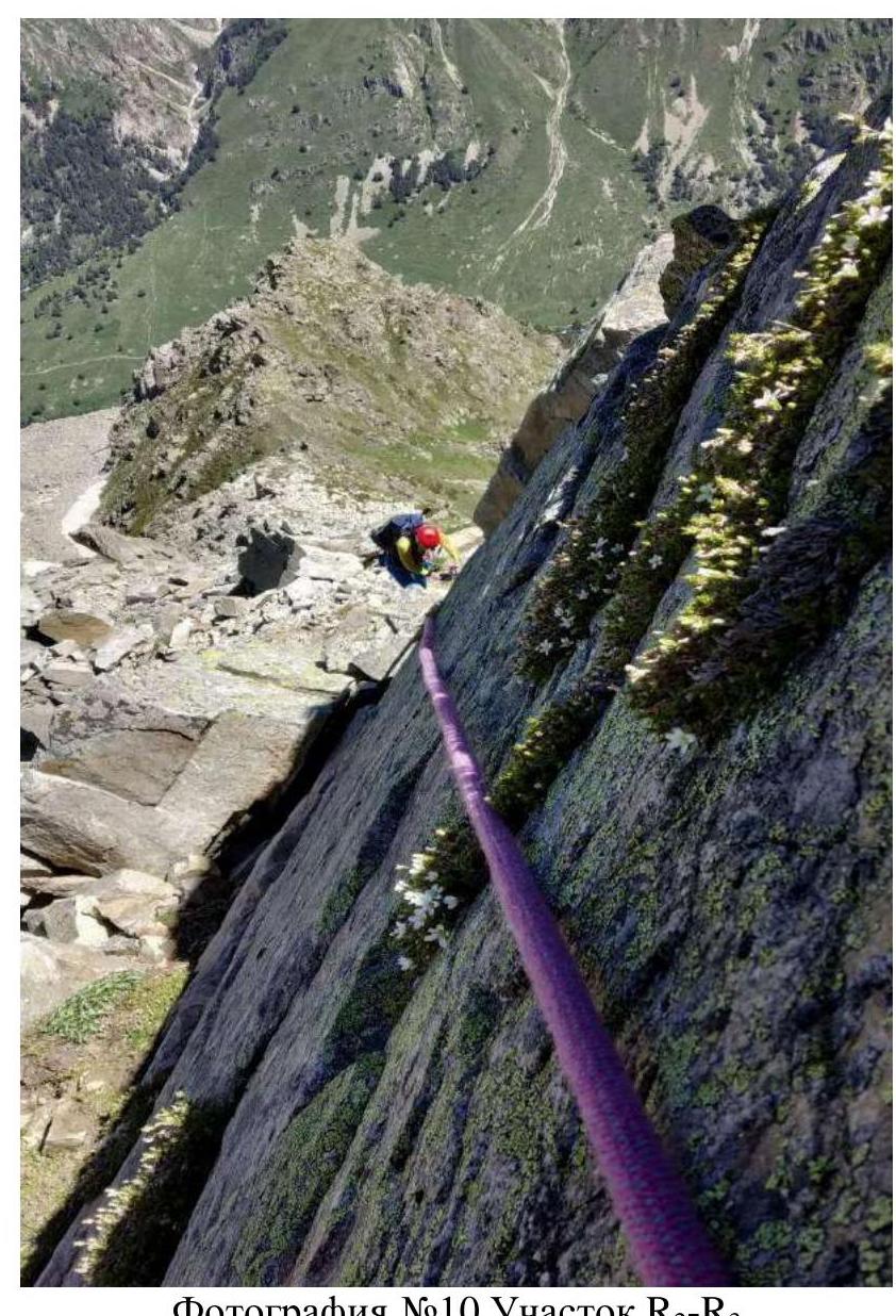
Photo №10. Section R2–R3
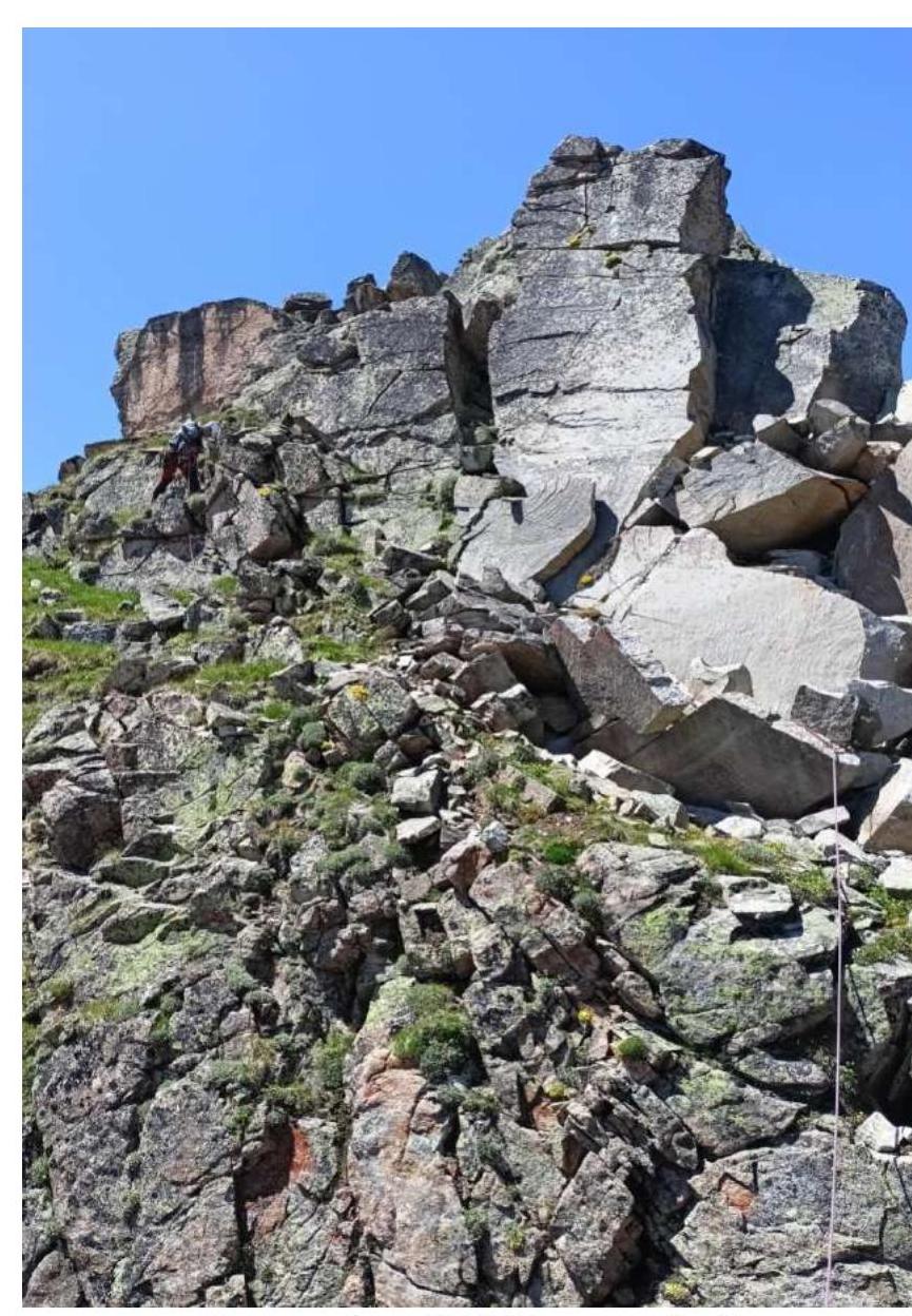
Photo №11. Section R3–R4
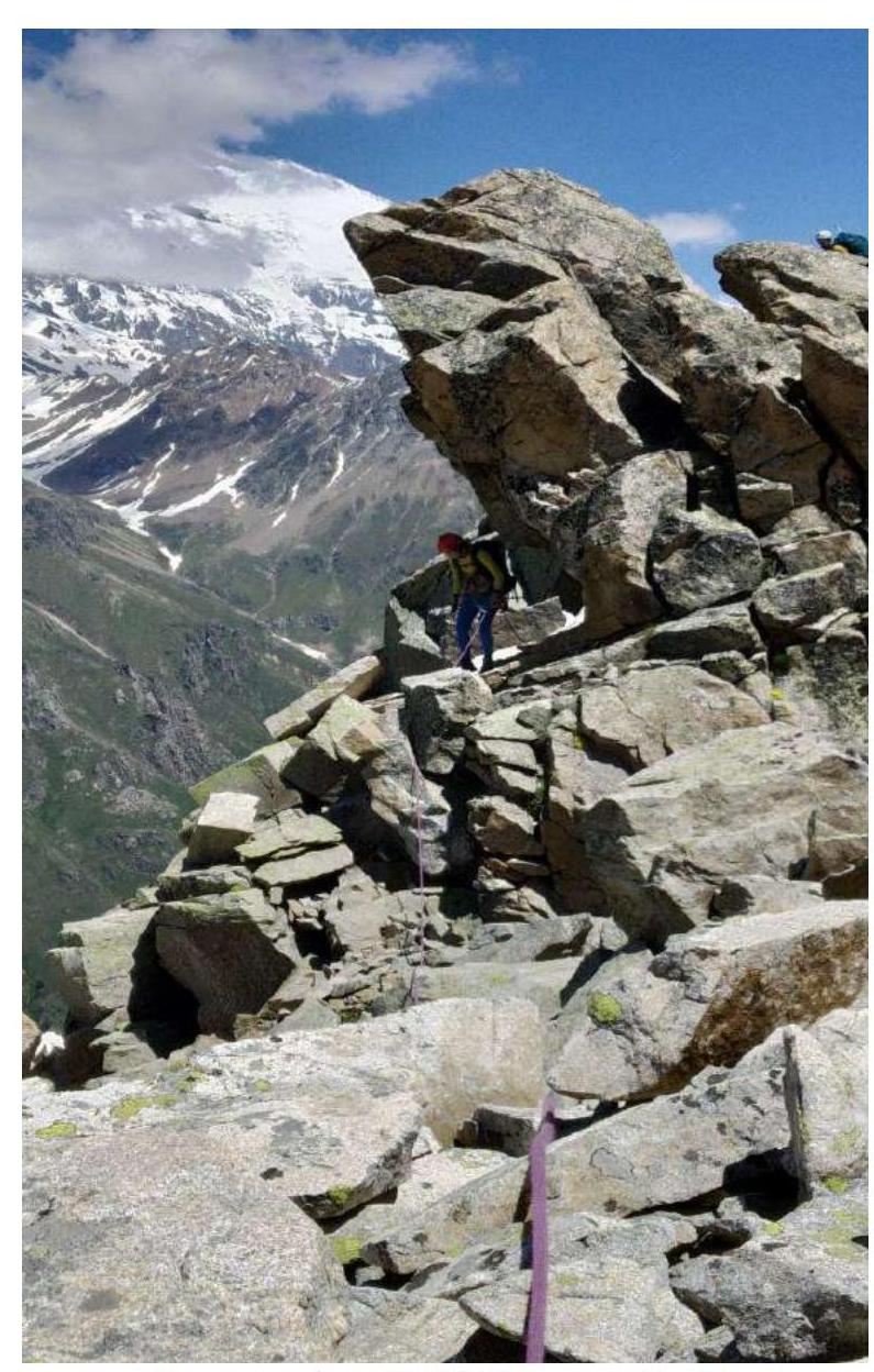
Photo №12. Section R4–R5
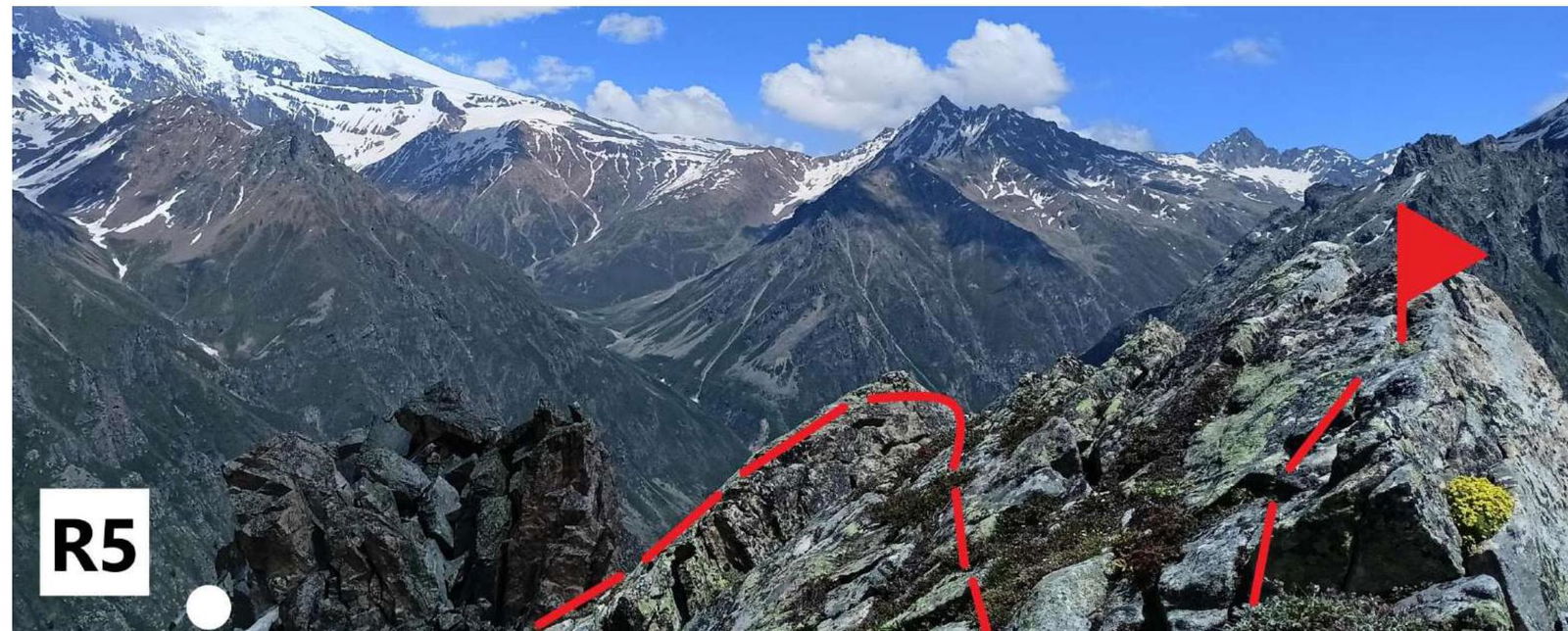
Photo №13. Section R5–R6. Inclined slab with a gap and exit to the summit. Upon completion of the ascent, a debriefing was conducted, and the complexity of individual sections and the route as a whole was evaluated. The route taken is considered safe. Considering the experience of previous ascents:
Orlyonok V – Orlyonok Ts traverse of summits – 2A; Taulan (Dimitriv-100) – 2B; Traverse of Northern Zubki from SE to NW – 2B; Peshtera – 2A; Peshtera – 2B*; Batak – 2A.
The route to the summit 3090 m («peak Osman's Kasaev») via the north-eastern ridge corresponds to category 2A.
Recommendations for Climbers:
To complete this route, it is sufficient to have:
- 4 anchor hooks;
- one set of stoppers;
- 3 large station loops;
- two expendable loops for descent.
On the descent from the col, it is recommended to organize a rope barrier, especially at the beginning of summer or in bad weather. There is no drinking water on the route. Mobile communication is absent throughout the entire route.