Report
On the first ascent to the summit of Peak 3352 "Altyn" via the North-Eastern ridge, category 2B, by the team of AUSB Uzunkol from Stavropol on August 14, 2023.
I. Ascent Passport
| № | 1. General Information | |
|---|---|---|
| 1.1 | Full name, sports rank of the leader | Klimonov Kirill Artemovich, 1st sports rank, July 9, 1986 |
| 1.2 | Full name, sports rank of the participants | Dumbrovsky Andrey Vladimirovich, 2nd sports rank, June 12, 1977 |
| 1.3 | Full name of the coach | Kobylatsky Nikolai Grigorievich |
| 1.4 | Organization | AUSB Uzunkol |
| 2. Characteristics of the Ascent Object | ||
| 2.1 | Region | Caucasus |
| 2.2 | Valley | Ullukam |
| 2.3 | Section number according to the 2013 classification table | 2.3 |
| 2.4 | Name and height of the summit | Peak 3352 m "Altyn" |
| 2.5 | Geographical coordinates of the summit (latitude/longitude), GPS coordinates | 43.25509° N 42.28223° E |
| 3. Characteristics of the Route | ||
| 3.1 | Name of the route | Via the North-Eastern ridge |
| 3.2 | Proposed category of difficulty | 2B |
| 3.3 | Degree of route development | First ascent |
| 3.4 | Character of the route relief | Rocky |
| 3.5 | Height difference of the route (altimeter or GPS data) | 290 m |
| 3.6 | Length of the route (in meters) | 465 m |
| 3.7 | Technical elements of the route (total length of sections of varying difficulty with relief character indication) | 2nd cat. diff. rocks — 150 m. 2nd cat. diff. rocks — 50 m. 3rd cat. diff. rocks — 90 m. 3rd cat. diff. rocks — 175 m. |
| 3.8 | Descent from the summit | Descent via the ascent route |
| 3.9 | Additional characteristics of the route | In mid-summer, there is no water on the route. Many streams on the way to the start of the route |
| 4. Characteristics of the Team's Actions | ||
| :----: | :------------------------------------------------------------ | :------------------------------------------------------------------------------------------------------- |
| 4.1 | Time of movement (team's walking hours, in hours and days) | 9 hours 30 minutes |
| 4.2 | Overnight stays | Site near a stream (upper overnight stays) |
| 4.3 | Start of the route | 5:30 August 14, 2023 |
| 4.4 | Reaching the summit | 12:00 August 14, 2023 |
| 4.5 | Return to camp | 15:00 August 14, 2023 |
| 5. Responsible for the Report | ||
| 5.1 | Full name, e-mail | Klimonov Kirill Artemovich, klimonov.dev@gmail.com |
II. Description of the Ascent
1. Characteristics of the Ascent Object
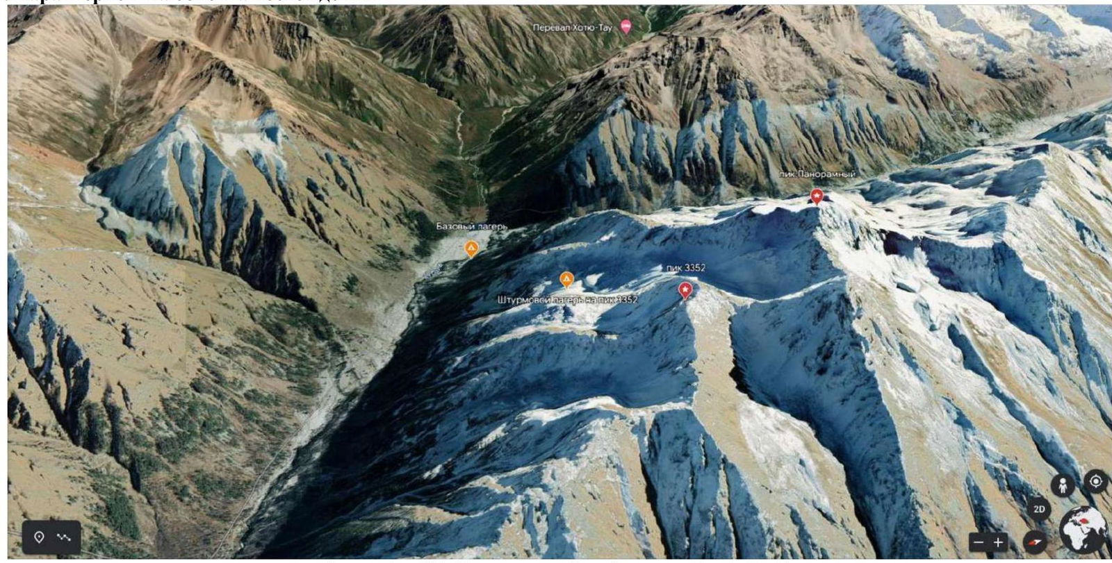
Photograph №1. Area map (source: Google Earth).
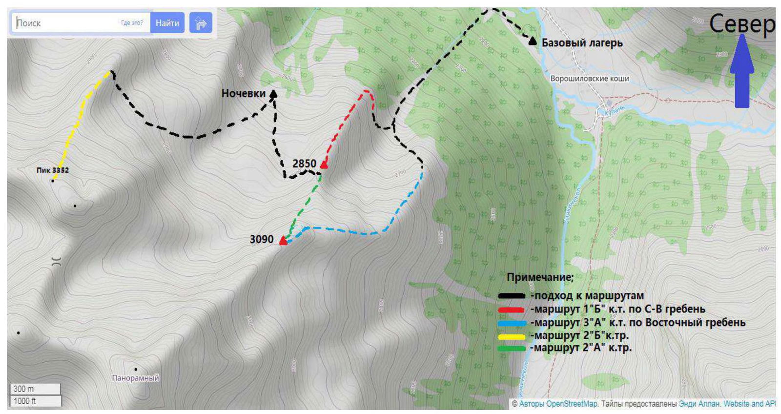
Photograph №2. Ascent area map (source: Google Earth). Peak 3352 "Altyn" is located in the Karachaevsky district of the Karachay-Cherkess Republic, in a spur of the Main Caucasian Range between the rivers Vostochny Kichkinekol and Chirincol.
We set up our base camp at the confluence of the rivers Ullu-Kam (Kuban) and Vostochny Kichkinekol, in the house of the director of AUSB Uzunkol, Habchaev Enver Hasanbievich (43.30166°, 42.31656°).
From the village of Hurzuk, one must move along a dirt road towards the border post, the same road that leads to AUSB Uzunkol. Immediately after the border post, there will be a fork:
- Straight on will be the road to Uzunkol.
- To the left — into the Ullu-Kam (Kuban) river valley, to the Khotyatau pass.
The road is slightly worse than to Uzunkol, and can only be traversed by an SUV. With Enver Hasanbievich Habuchaev (tel. 8 (928) 389–1972), one can arrange for a car drop-off and accommodation in the house. The conditions are more than comfortable. The house is located 13.4 km from the border post.
The approach to the start of the route is made along the orographic left bank of the Kuban River. The turn to the ascent to the overnight site is located approximately 20–25 minutes walk from the base camp and is marked by a landmark (a small tree lying in the direction of the ascent, crossing the trail along the river).
There is no trail to the overnight stays, but the ascent route is well-marked with cairns.
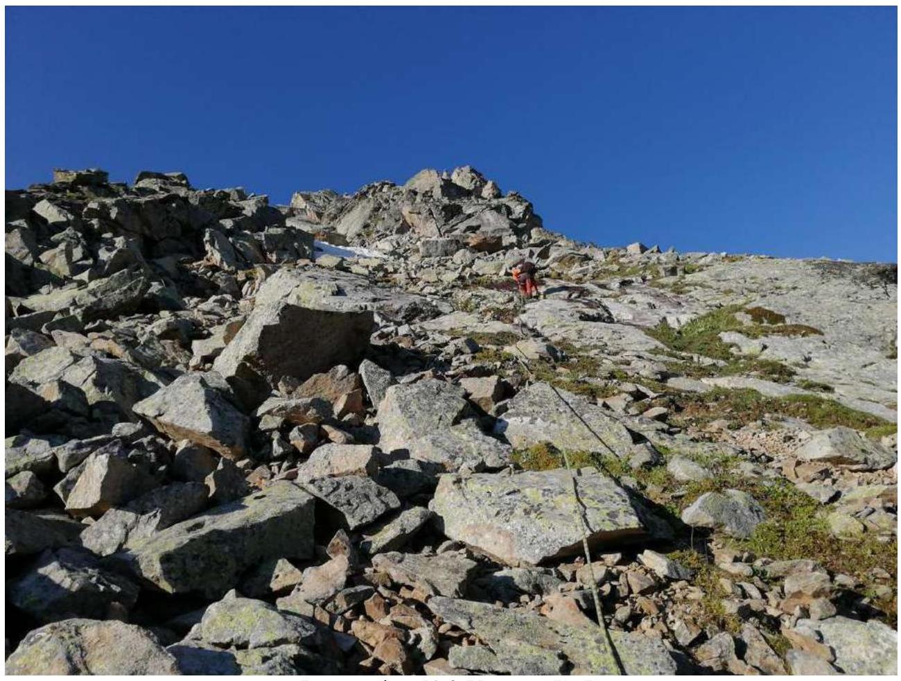
The ascent initially begins along a forested slope, winding between trees. Further, bypassing the rocky outcrops on the left and passing a significant distance along a stony moraine, we reach the overnight site (№ 43.29800° E 42.25548°), (assault camp). Ascent time: 2.5–3.5 hours from the base camp.
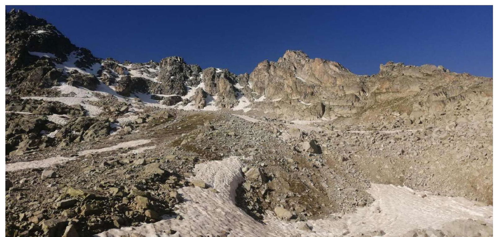
Photograph №3. Approach to the start of the route along a stony slope.
2. Characteristics of the Route
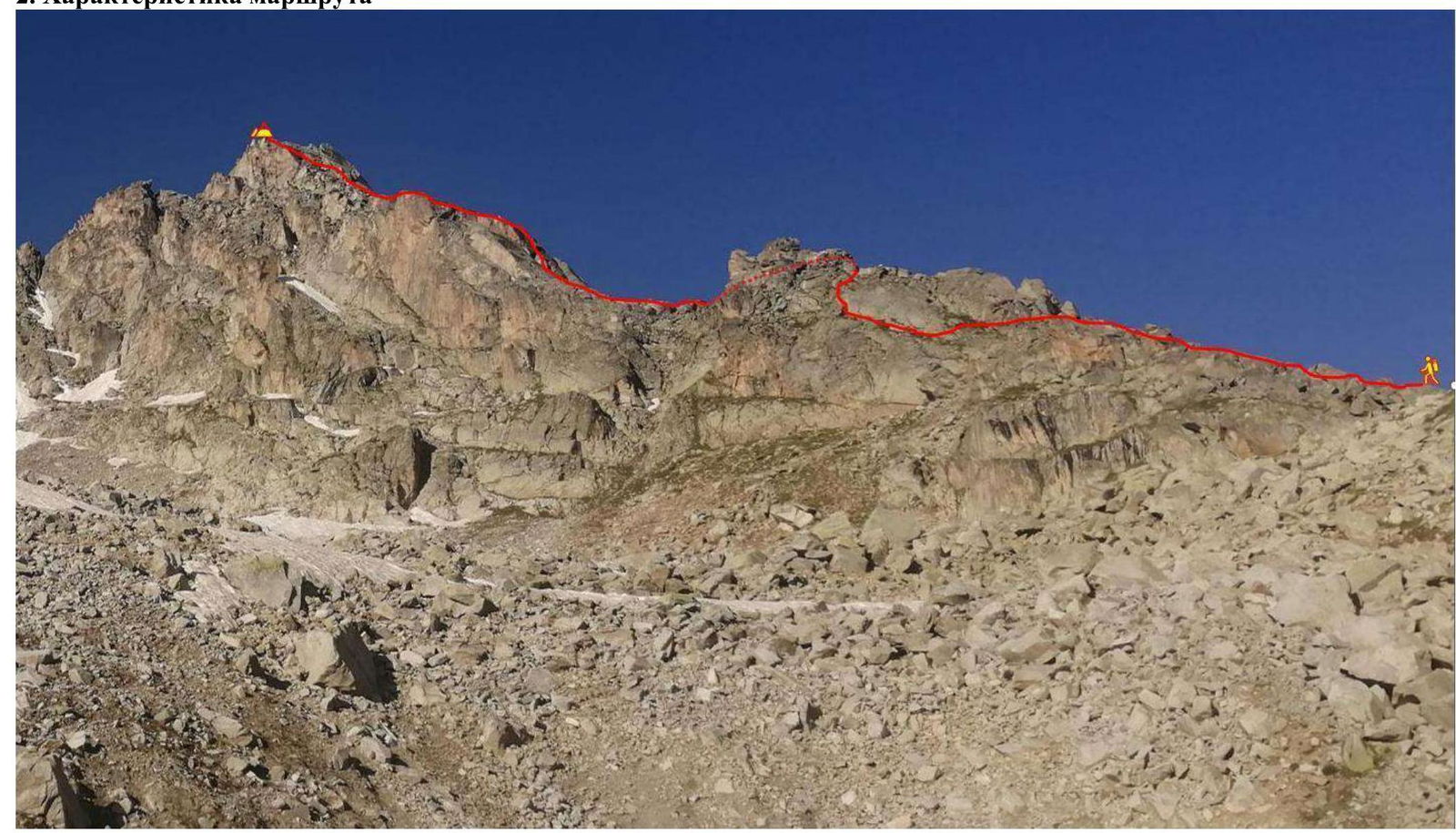
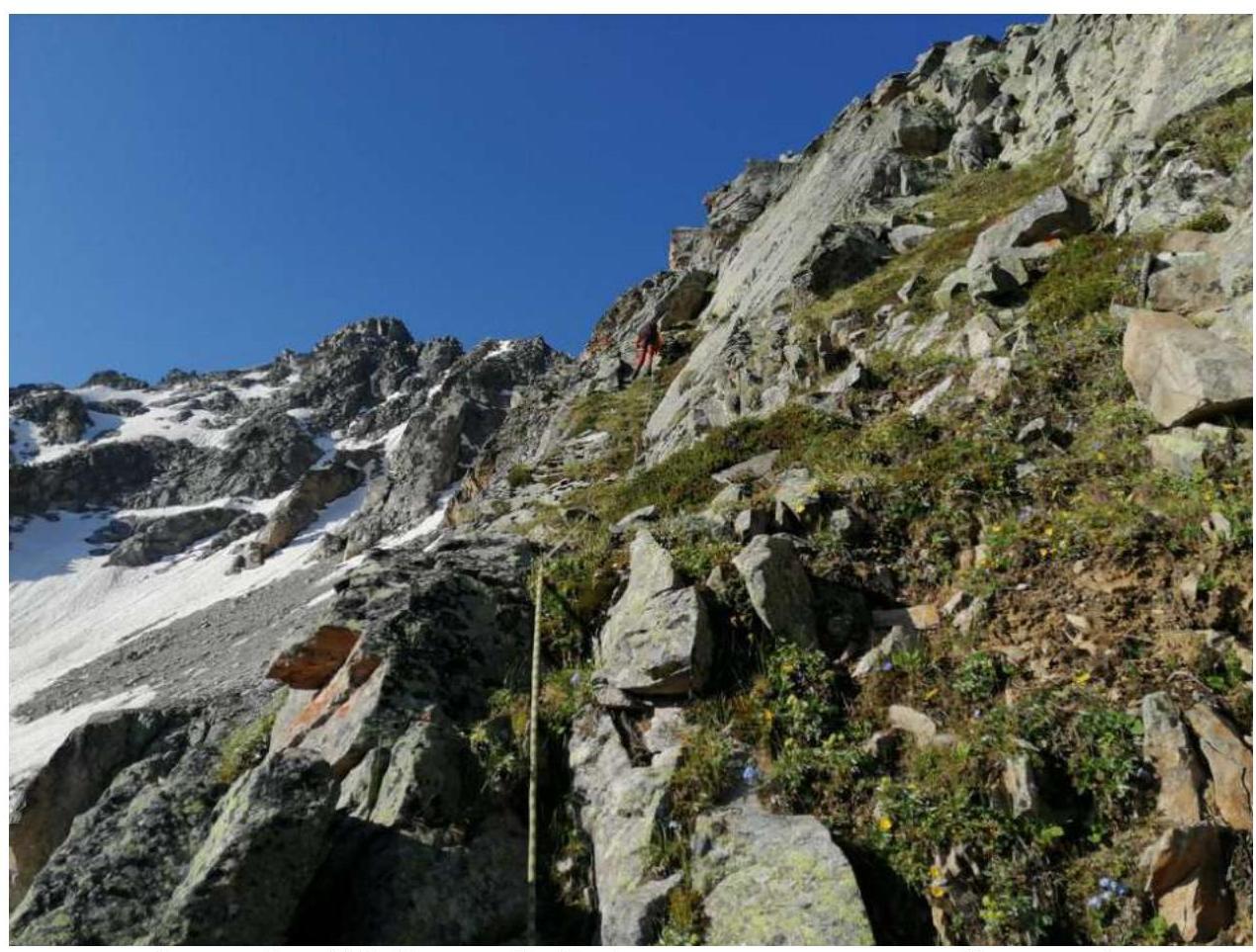
Photograph №4. Technical photograph of the route (taken on August 14, 2023, on the approach to the route).
Technical characteristics of the route sections
| Section № | Relief character | Cat. diff. | Length, m | Type and number of hooks |
|---|---|---|---|---|
| R0–R1 | Rocky ridge | 2 | 100 | 0 |
| R1–R2 | Rocky ridge | 2 | 50 | 0 |
| R2–R3 | Rocky wall with a chimney | 3 | 75 | 2 stoppers |
| R3–R4 | Rocky slabs | 3–2 | 40 | 2 stoppers |
| R4–R5 | Rocky wall (crack) | 3 | 40 | 1 stopper |
| R5–R6 | Ridge | 2 | 50 | 0 |
| R6–R7 | Ridge | 3 | 50 | 2 stoppers |
| R7–R8 | Ridge, internal corner | 3–3 | 60 | 3 stoppers |
3. Characteristics of the Team's Actions
| Section № | Description | Photo № |
|---|---|---|
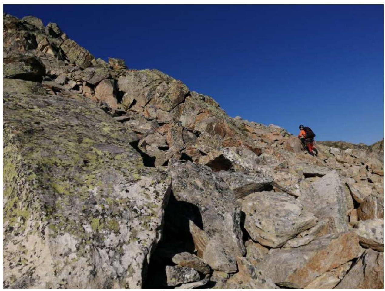
| R0–R1 | Movement along the ridge to the right across rocky terrain. Simultaneous movement. 100 m, 30°, 2. | Photograph №5 |
| R1–R2 | Movement to the left of the ridge along a grassy ledge and grassy rocks. Alternating movement. 50 m, 45°, 2. | Photograph №6, 7 |
| R2–R3 | From the station upwards along the internal corner, then bypassing the "gendarme" to the right across rocks along a large flat spall to two large stones. Movement continues between them through a chimney (2.5–3 m). Alternating movement 75 m, 50–60°, 3–3. | Photograph №8, 9 |
| R3–R4 | Movement across smoothed slabs towards the right crack. Station on a ledge before the crack. Alternating movement 40 m, 40–45°, 2–3. | Photograph №10 |
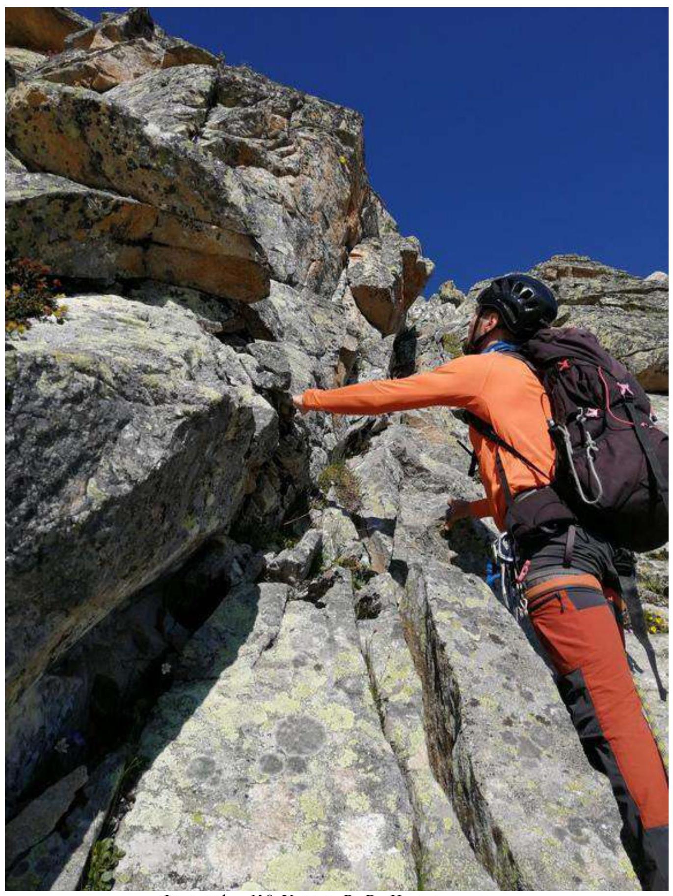
| R4–R5 | Climbing the crack, station on a stone. Alternating movement 40 m, 60°, 3. | Photograph №11 |
| R5–R6 | Movement along the ridge towards the summit. Alternating movement 50 m, 20°, 2. | — |
| R6–R7 | Movement along the ridge towards the summit. Alternating movement 50 m, 45°, 3. | — |
| R7–R8 | Climbing the internal corner with loose rocks and further to the summit. Alternating movement 60 m, 50–60°, 3–3. | Photograph №12, 13, 14 |
Photograph №5. Section R0–R1.
Photograph №6. Section R1–R2.
Photograph №7. Section R1–R2 (movement along a grassy ledge).
Photograph №8. Section R2–R3. Start of movement.
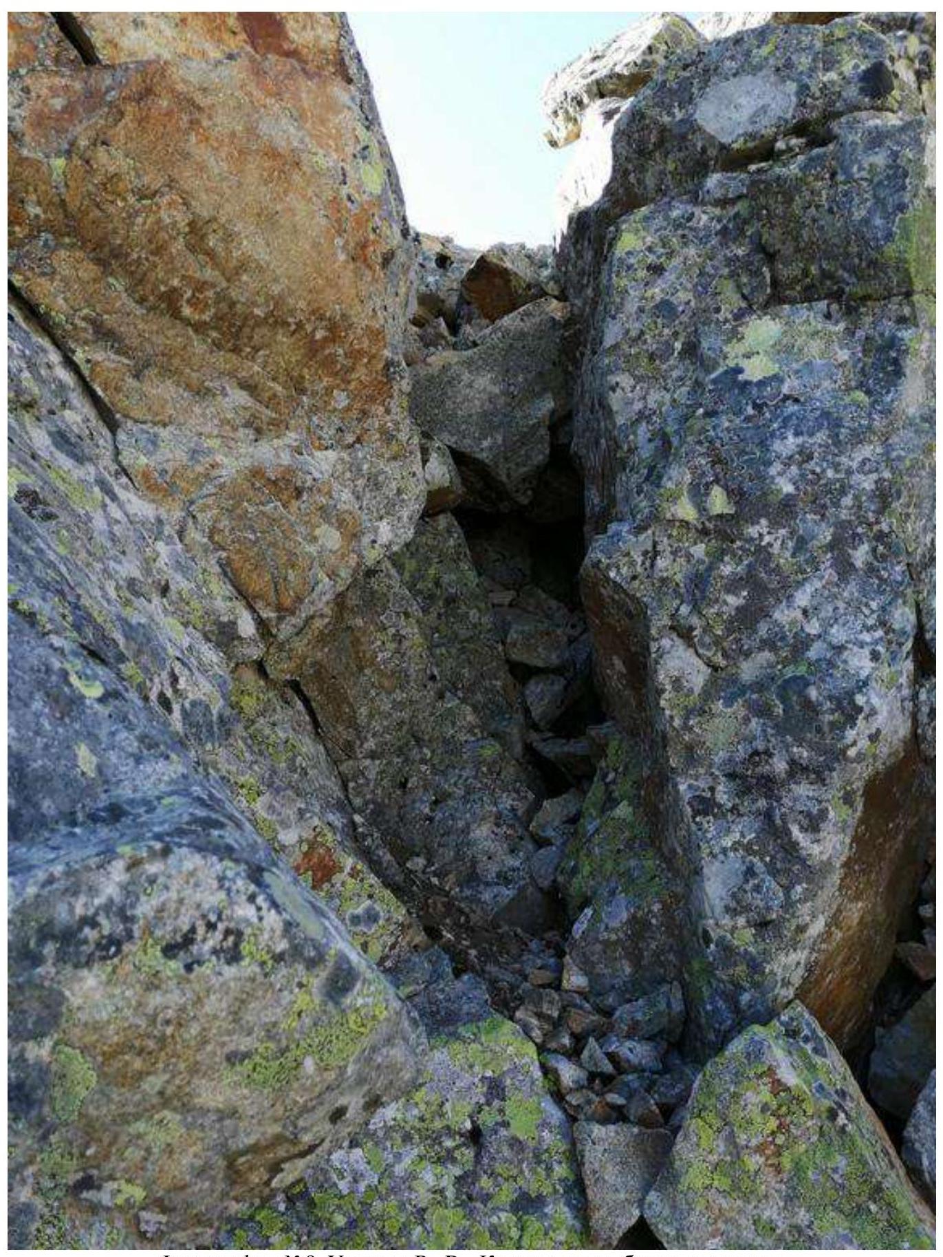
Photograph №9. Section R2–R3. Chimney after bypassing the "gendarme".
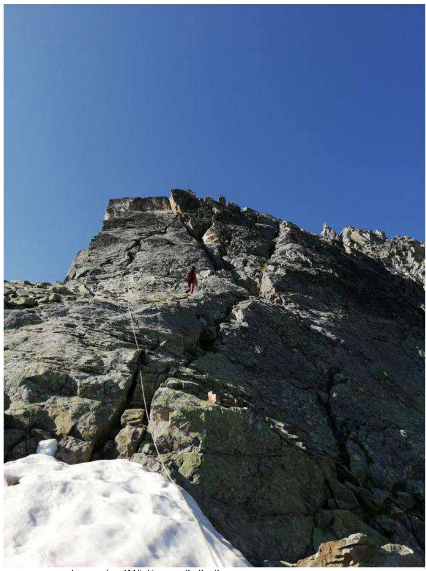
Photograph №10. Section R3–R4. Movement across smoothed slabs.
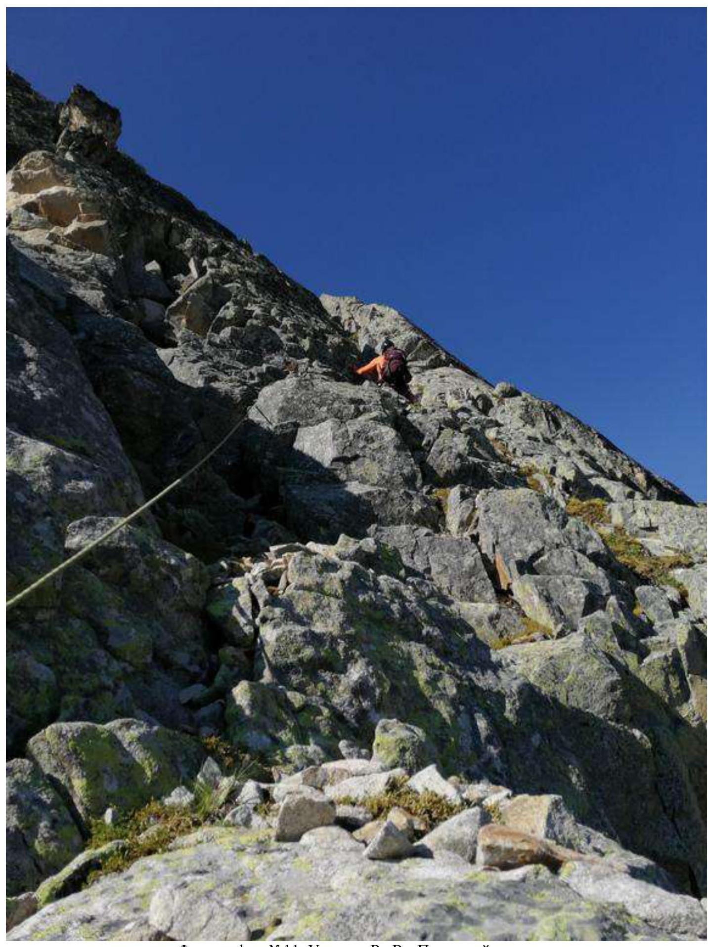
Photograph №11. Section R4–R5. Along the right crack.
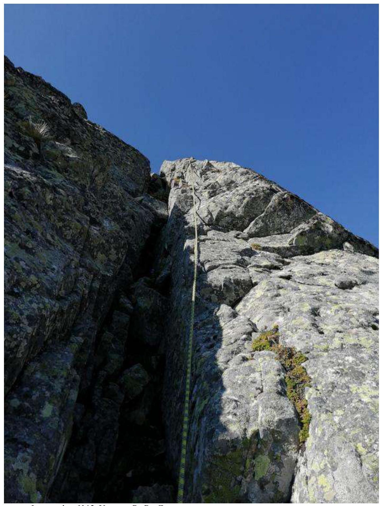
Photograph №12. Section R7–R8. Climbing the internal corner with loose rocks.
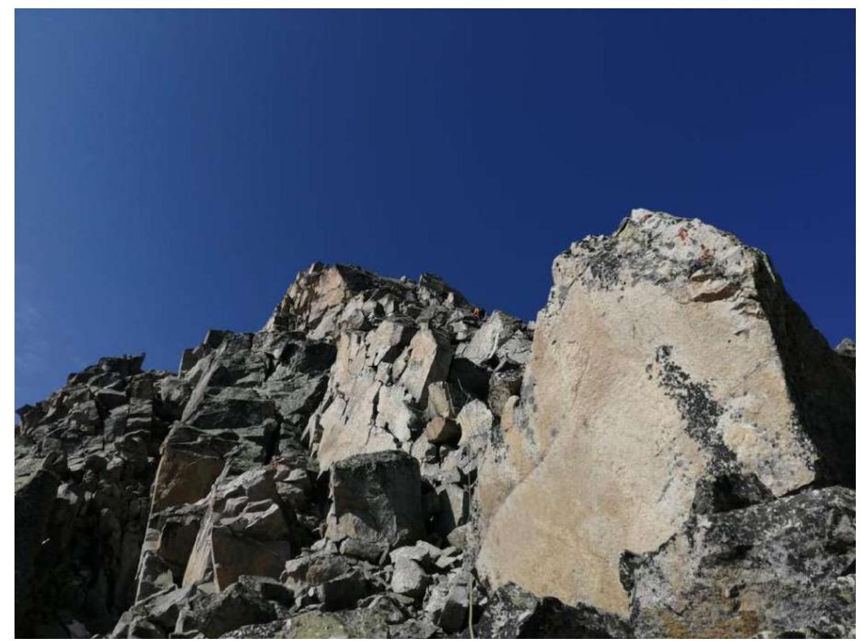
Photograph №13. Section R7–R8.
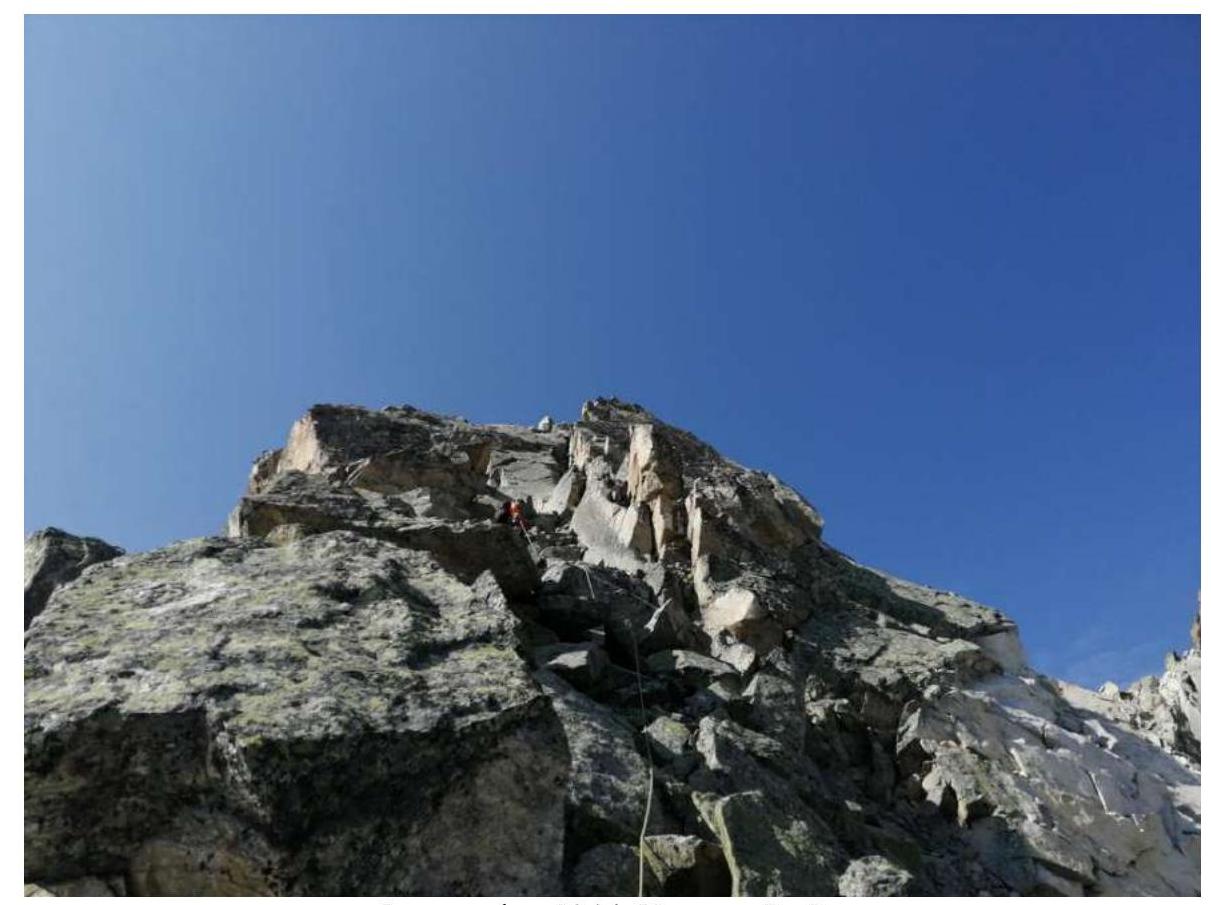
Photograph №14. Section R7–R8.
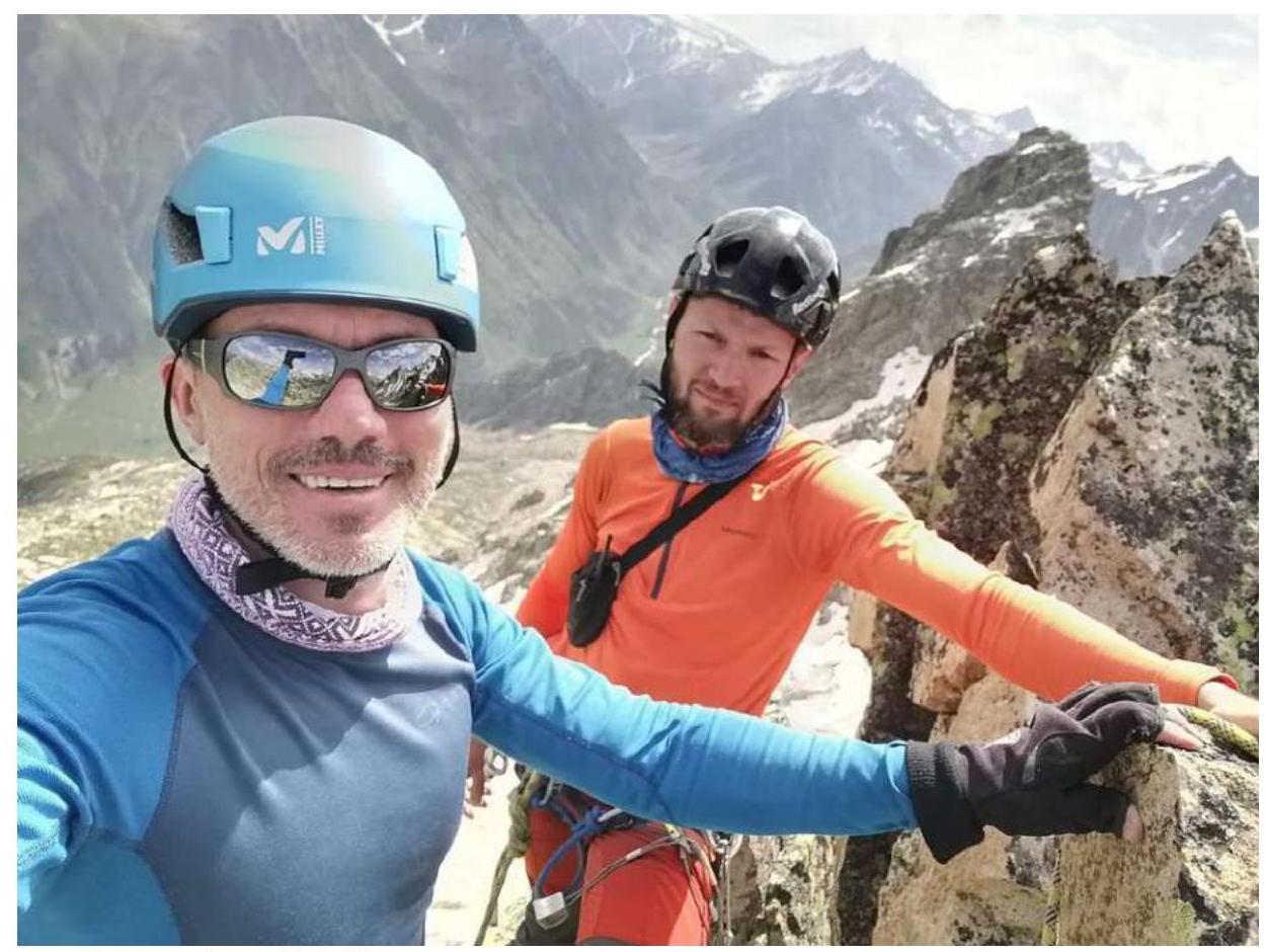
Photograph №15. Team at the summit by the control cairn. From left to right:
- Dumbrovsky A.V.
- Klimonov K.A.

Photograph №16. Descent via the ascent route (view from the pre-summit section).
Upon completion of the ascent, a debriefing was conducted, and the difficulty of individual sections and the route as a whole was assessed. The route taken is relatively safe.
Considering the experience of previous ascents to the summits:
- Kara-Djash (via the Northern ridge) — 4A
- Zaimov Peak — 2B
- Taulan (3226) route via the "Crown" — 3A
- Krugozor "Myrd" — 2A
- 3130 — 2A
- Chat-Bashi — 3B
- Dolomites, South — 3B
- Dalar "along the ridge" — 5A
The route to peak "3352" corresponds to category 2B.
Recommendations for Climbers:
When planning an ascent to peak 3352 "Altyn", it is advisable to set up an assault camp on a site near the stream.
For the passage of the route, a set of stoppers and several large loops is sufficient.
There is no water on the route. Mobile communication is absent throughout the entire route.