
Report
On the first ascent to the summit of Shokoladny Peak via the grooves of the southwest wall, Kurochkin route, category 5B, undertaken by the MPEI Alpine Club team from August 19 to 21, 2022.
I. Ascent Report
| 1. General Information | ||
|---|---|---|
| 1.1 | Full Name, Sports Rank of the Leader | Kurochkin Alexey Vitalievich, CMS |
| 1.2 | Full Name, Sports Rank of Participants | Markevich Konstantin Georgievich, MS, Yablokov Evgeny Alexandrovich, CMS |
| 1.3 | Full Name of Coach | Kutkin Sergey Anatolievich, CMS |
| 1.4 | Organization | MPEI Alpine Club |
| 2. Characteristics of the Climbing Object | ||
| 2.1 | Region | Karachay-Cherkessia, Gvandra Region |
| 2.2 | Valley | Uzunkol |
| 2.3 | Section Number according to the 2013 Classification Table | 2.3. From Nakhar Pass to Chiparazau Pass |
| 2.4 | Name and Height of the Summit | Shokoladny 3650 m |
| 2.5 | Geographical Coordinates of the Summit (latitude/longitude), GPS Coordinates (1) | |
| 3. Route Characteristics | ||
| 3.1 | Route Name | Via the grooves of the southwest wall, Kurochkin route |
| 3.2 | Proposed Category of Difficulty | 5B |
| 3.3 | Route Exploration Degree | First Ascent |
| 3.4 | Route Terrain Character | Rocky |
| 3.5 | Route Elevation Difference (altimeter or GPS data) | |
| 3.6 | Route Length (in meters) | 784 m |
| 3.7 | Technical Elements of the Route (total length of sections of various difficulty categories with terrain character indication (ice-snow, rocky)) | 1st cat. diff. ice/rock/combination — M. 2nd cat. diff. ice/rock/combination – 400 m. 3rd cat. diff. ice/rock/combination — M. 4th cat. diff. ice/rock/combination – 190 m. 5th cat. diff. ice/rock/combination – 40 m. 6th cat. diff. ice/rock/combination — M. Rock VI, A1 — M. Rock VI, A2 – 132 m. Rock VI, A3 – 22 m. Rock VI, A4 — M. |
| 3.8 | Average Route Steepness (2) | |
| 3.9 | Average Steepness of the Main Route Part (2) | 70° |
| 3.10 | Descent from the Summit | Via the Northeast Ridge towards Malaya Trapezia Peak. |
| 3.11 | Additional Route Characteristics | Lack of water |
| 4. Characteristics of Team Actions | ||
| 4.1 | Time of Movement (team's walking hours, in hours and days) | 18 hours, 3 days. |
| 4.2 | Overnight Stays | Platform, ledge, platform, hammock — (choose) |
| 4.3 | Route Preparation Time | 14 hours, 2 days. |
| 4.4 | Start of the Route | 9:00, August 19, 2022 |
| 4.5 | Summit Ascent | 9:40, August 21, 2022 |
| 4.6 | Return to Base Camp | 16:00, August 21, 2022 |
| 5. Weather Conditions Characteristics | ||
| 5.1 | Temperature, °C | |
| 5.2 | Wind Speed, m/s | |
| 5.3 | Precipitation | |
| 5.4 | Visibility, m | |
| 6. Responsible for the Report | ||
| 6.1 | Full Name, e-mail | Kurochkin A.V. pfk-mvo@yandex.ru |
II. Ascent Description
Climbing Object Characteristics
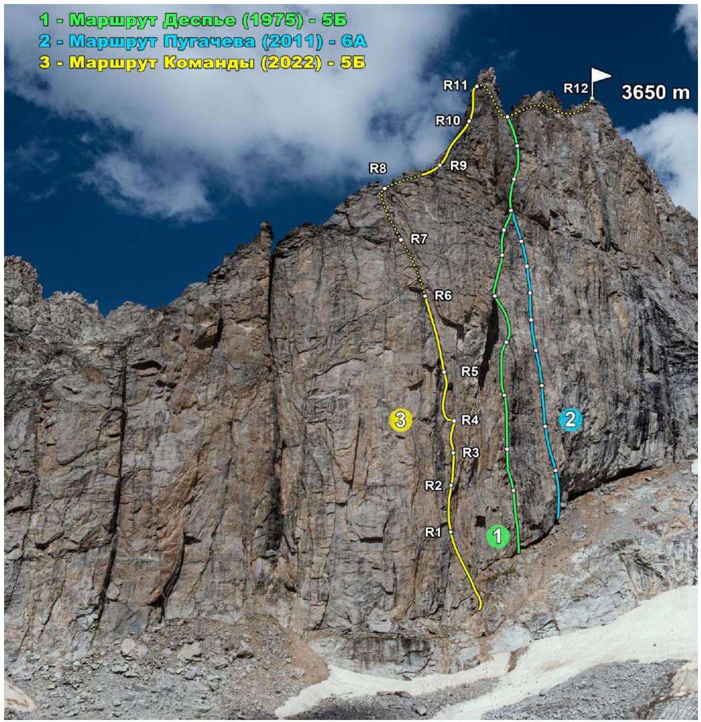
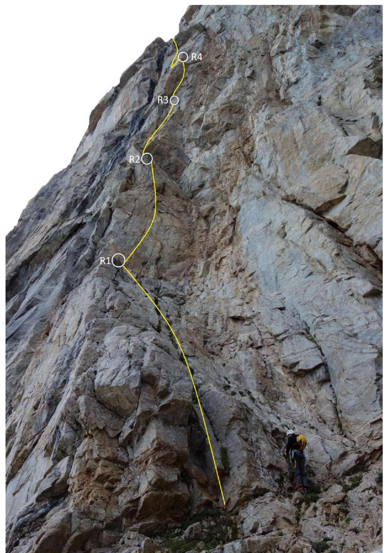
Photograph of the southwest wall of Shokoladny Peak from the Dallar Glacier on August 18, 2022.
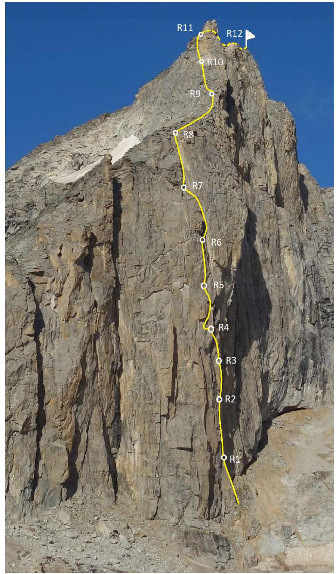
Route Profile Photo

Hand-drawn Route Profile
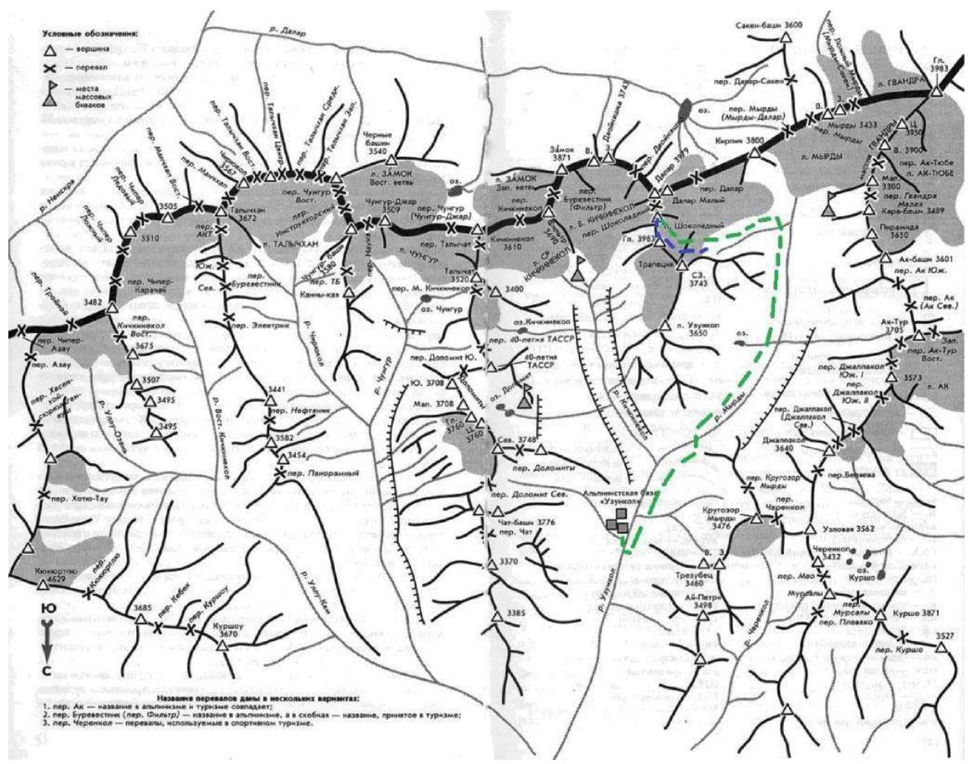
From Uzunkol Alpine Camp, the approach to overnight stays on the moraine of Dallar Glacier takes 4–6 hours. From Uzunkol Alpine Camp, cross the Myrdry River and move along the road alongside the river to the border post. After the post, continue along the road; after 20–30 minutes (after the confluence of the Myrdry and Kikchinekol rivers), there will be a wooden structure and a bridge to the opposite side of the Myrdry River.
Move along the orographically right bank alongside the riverbed towards Kirpich Peak for 15–20 minutes to the second wooden structure, then cross the Myrdry River via logs. Along the orographically left bank, move about 40 minutes along the trail. After crossing a large stream flowing down from the slopes of Pyramida Peak, look for a ford crossing the Myrdry River at its most branched point. In the middle of the crossing, there is a cairn.
Up to the "ford" crossing, the approach coincides with the approach to Myrdynskie overnight stays and under the Western wall of Kirpich Peak.
Further along the orographically right bank, head towards the northern wall of Kirpich Peak. Near Kirpich Peak, the trail will veer left onto a moraine ridge; to the left of it, there is a depression (most likely with snow). Move along the sharp moraine ridge towards:
- Dallar Peak
- Shokoladny Peak
Before reaching the "ram's foreheads" of Dallar Glacier, descend left into the depression and start climbing the slope at the most logical point. You should reach a flattening already after a large boulder field.
Further towards Shokoladny Peak, cairns are encountered along the way. At the overnight stay, there are several prepared platforms for tents.
Approach to the start of the route. From the overnight stay at "Dallar West" bivouac, move along rocks and sections of the glacier to the base of Shokoladny Peak. Then along scree and moraines to the start of the wall. The starting point of the route is marked by a diagonal fissure running through the entire wall of Shokoladny Peak. The start of the route is on the right side of a triangular rock adjacent to the beginning of the above-mentioned fissure — 40 minutes from the initial bivouac.
Route Characteristics
Route Scheme in UIAA Symbols
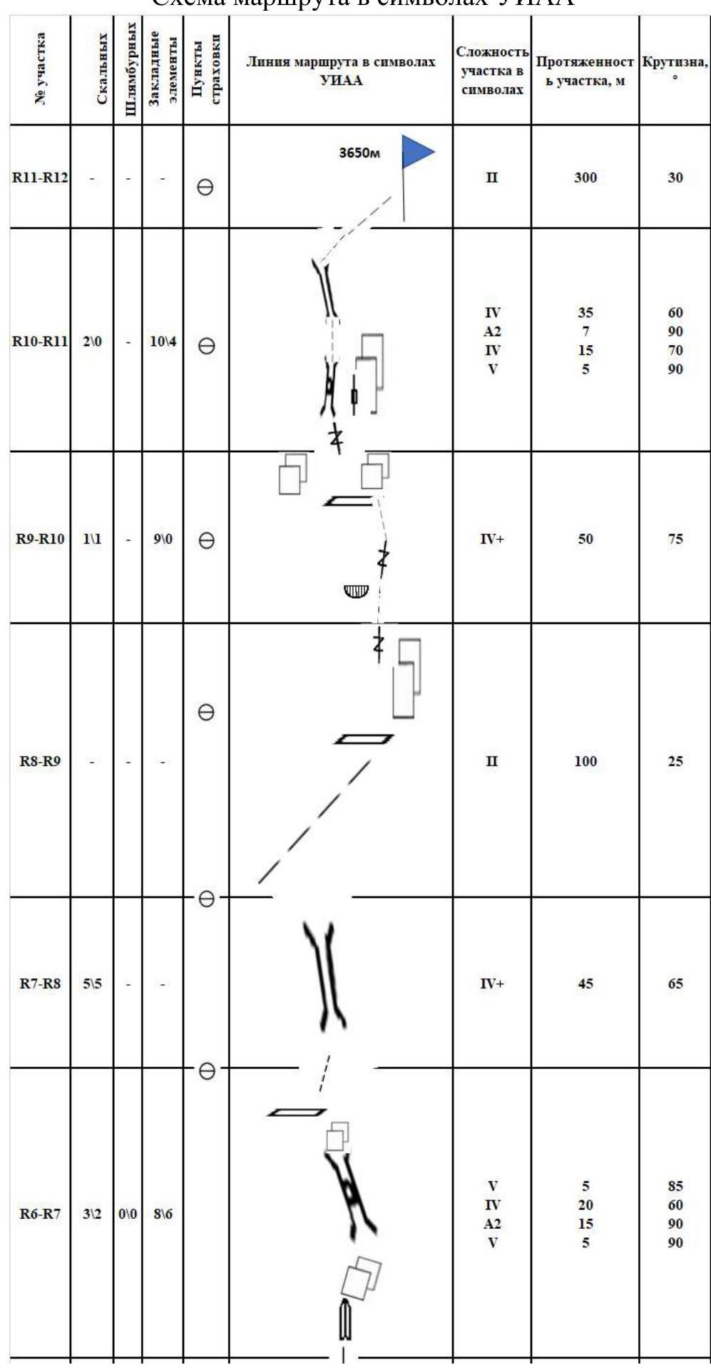
| Section # | Rock Climbing | Anchors | Bolts | Belay Points | Route Line in UIAA Symbols | Section Difficulty in Symbols | Section Length, m | Steepness, ° |
|---|---|---|---|---|---|---|---|---|
| R11–R12 | ⊗ | II | 300 | 30 | ||||
| R10–R11 | 2/0 | 10/4 | ⊗ | IV | 35 | 60 | ||
| A2 | 7 | 90 | ||||||
| IV | 15 | 70 | ||||||
| V | 5 | 90 | ||||||
| R9–R10 | 1/1 | 9/0 | ⊗ | IV+ | 50 | 75 | ||
| R8–R9 | ⊗ | II | 100 | 25 | ||||
| R7–R8 | 5/5 | ⊗ | IV+ | 45 | 65 | |||
| R6–R7 | 3/2 | 0/0 | 8/6 | ⊗ | ![img-6.jpeg] | V | 5 | 85 |
| IV | 20 | 60 | ||||||
| A2 | 15 | 90 | ||||||
| V | 5 | 90 | ||||||
| R5–R6 | 3/2 | 1/0 | 11/8 | ⊗ | A2 | 15 | 90 | |
| IV+ | 25 | 70 | ||||||
| A2 | 15 | 90 | ||||||
| R4–R5 | 8/8 | 1/0 | 9/9 | ⊗ | ![img-7.jpeg] | A2 | 28 | 90 |
| R3–R4 | 6/6 | 7/7 | ⊗ | ![img-8.jpeg] | A2–A2+ | 20 | 90 | |
| R2–R3 | 3/3 | 1/1 | 6/6 | ⊗ | ![img-9.jpeg] | A2 | 12 | 90 |
| 5/5 | ![img-10.jpeg] | A3e | 7 | 90 | ||||
| 7/7 | 1/1 | ![img-11.jpeg] | A2 | 10 | 90 | |||
| R1–R2 | 6/6 | 1/0 | 1/1 | ⊗ | ![img-12.jpeg] | A2 | 10 | 80 |
| 10/10 | 1/1 | ![img-13.jpeg] | A3 | 15 | 95 | |||
| R0–R1 | 7 | 2 | ⊗ | ![img-14.jpeg] | V | 25 | 70 |
Team Actions Characteristics
The route has a technically complex wall section with a large amount of climbing on IT. The most technically challenging sections are R1–R2 and R2–R3. A set of diverse equipment is required, both for monolithic terrain and for small and large vertical cracks. Despite the steepness of the terrain, stations on the route are located in convenient and safe places with ledges and under the cover of cornices. Most stations have one bolt installed.
| # | Description | Photo Number |
|---|---|---|
| R0–R1 | The start of the route is on the right side of a triangular rock 15 m to the right of the beginning of a huge fracture running through the entire western wall of Shokoladny Peak. Climbing (25 m, V). At the top of the triangular rock, a "local" loop is found. Station on the loop. | 1 |
| R1–R2 | Further, the terrain becomes significantly more complex and overhanging. Move up the wall with many small blind cracks on IT towards the left corner of the first cornice. Station under the cornice, there is a bolt (15 m A3, 10 m A2). | 2 |
| R2–R3 | Bypass the cornice on the left and move up the monolithic inner corner with blind cracks. Then, on the right side of the inner corner, there are three holes for skyhooks. Move to the left side of the corner and up the crack (10 m A2, 7 m A3e, 15 m A2). Station on a bolt and "cam №3". | 3,4,5 |
| R3–R4 | Up the inner corner under a small cornice (10 m A2). To the left of the cornice, there is an inclined ledge. Behind the cornice, there is a bolt "for passage". Further up the cracks on the left wall of the inner corner to the next narrow but long ledge (10 m A2). Station on a bolt and an anchor hook. | 6 |
| R4–R5 | From the station, left — a pendulum/traverse along the ledge 4 m (not entering the black inner corner). Then up the cracks (12 m A2) towards a clearly defined crack in the cornice. Through the crack in the cornice and up the dark rock (12 m A2), reach a convenient 1×1 m ledge. Station, there is a bolt. | 7,8 |
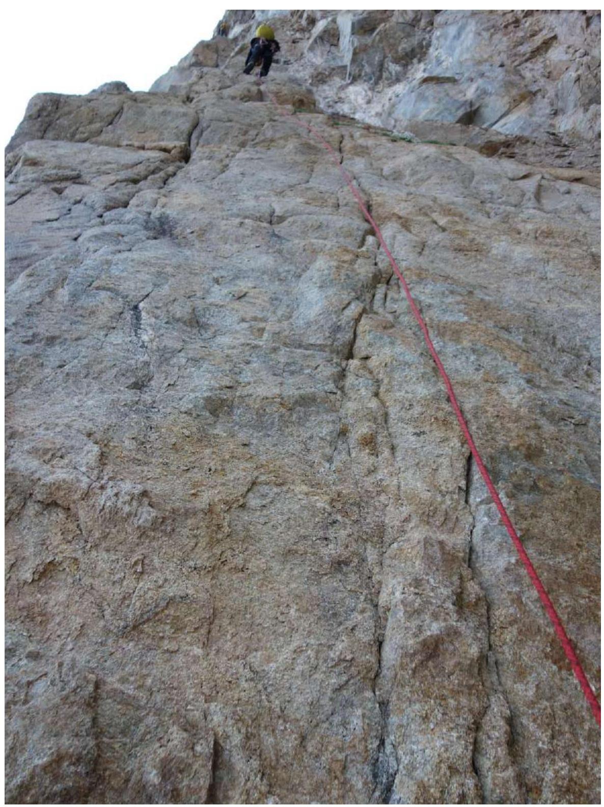
| R5–R6 | From the station, a short section of complex climbing, then on IT on the right side of the inner corner (15 m V A2), the terrain starts to flatten and veers right. Move to climbing and proceed up the wide inner corner (5 m V, 20 m IV+). The inner corner narrows and turns into a vertical crack, first under anchor elements and then under hooks. Up the crack under the cornice (15 m A2). Station under the cornice, there is a bolt. | 9,10,11 |
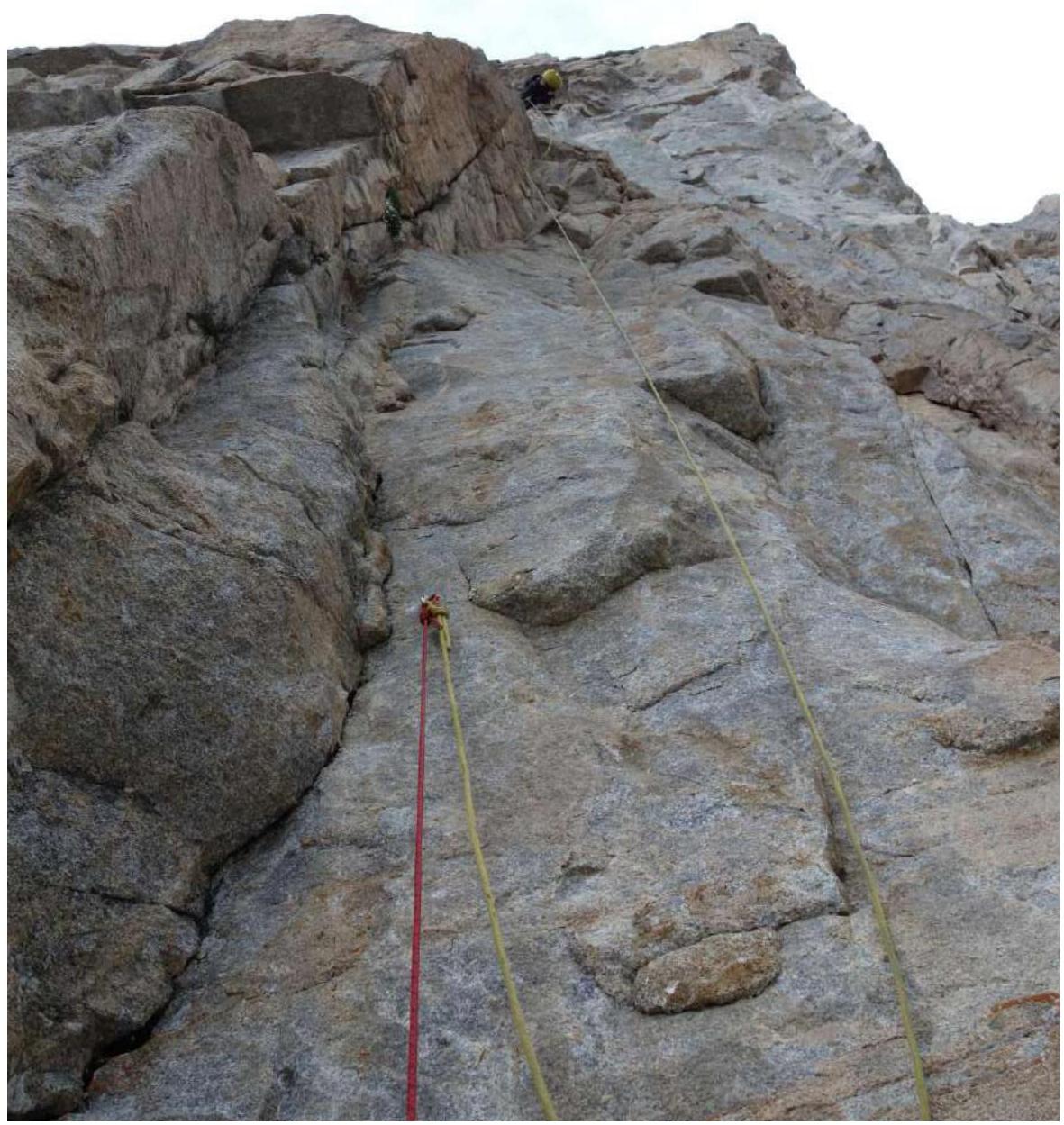
| R6–R7 | Overcome the cornice via a crack on its left side, then up the medium-sized crack. The crack closes, but the terrain becomes more gentle. Several steps on IT after the crack and then climbing into a large and wide inner corner (5 m V, 15 m A2). Inside the corner, there is a large "plug" wedged. Climb under the plug (20 m IV+) to a short complex wall. Climb the wall and reach a large ledge (V 5 m). On the ledge, there are loose stones! Station on own points, the terrain is not monolithic! | 12,13 |
| R7–R8 | From the station, right — into an inclined, narrowing chimney/inner corner. Climbing out onto the ridge, with sparse protection (45 m IV+). Station on the right, on a loop. | 14 |
| R8–R9 | Move on foot and with simple climbing along the ridge towards the pre-summit bastion wall (100 m II). On the ridge, there are many good ledges for overnight stays, including a large ledge under the wall of the pre-summit bastion where two climbing sections begin. | 15 |
| R9–R10 | Up the wall with a rich choice of terrain, oriented towards wide cracks (50 m IV+). Climb left onto a large ledge under the yellow-red wall of the "gendarme". | 16,17 |
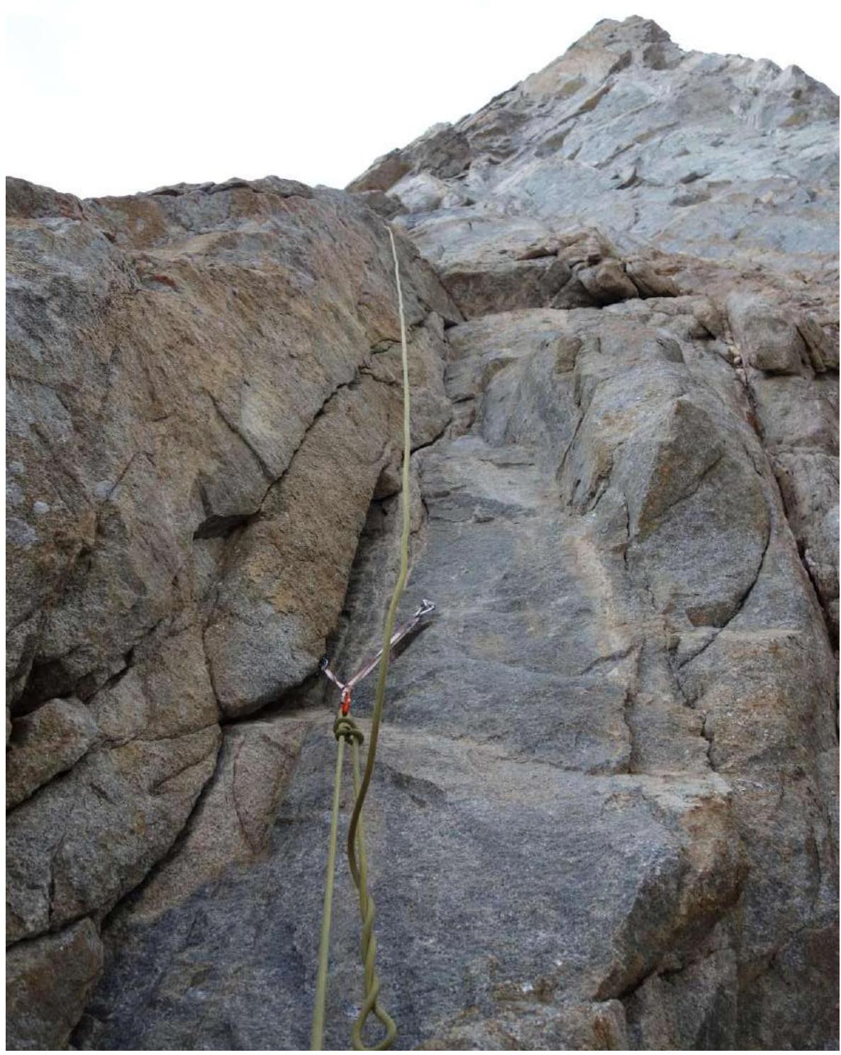
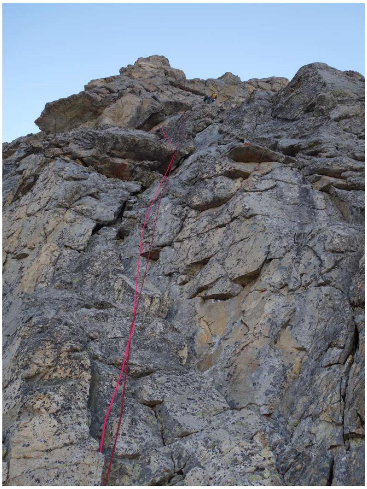
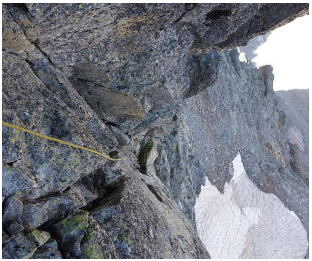
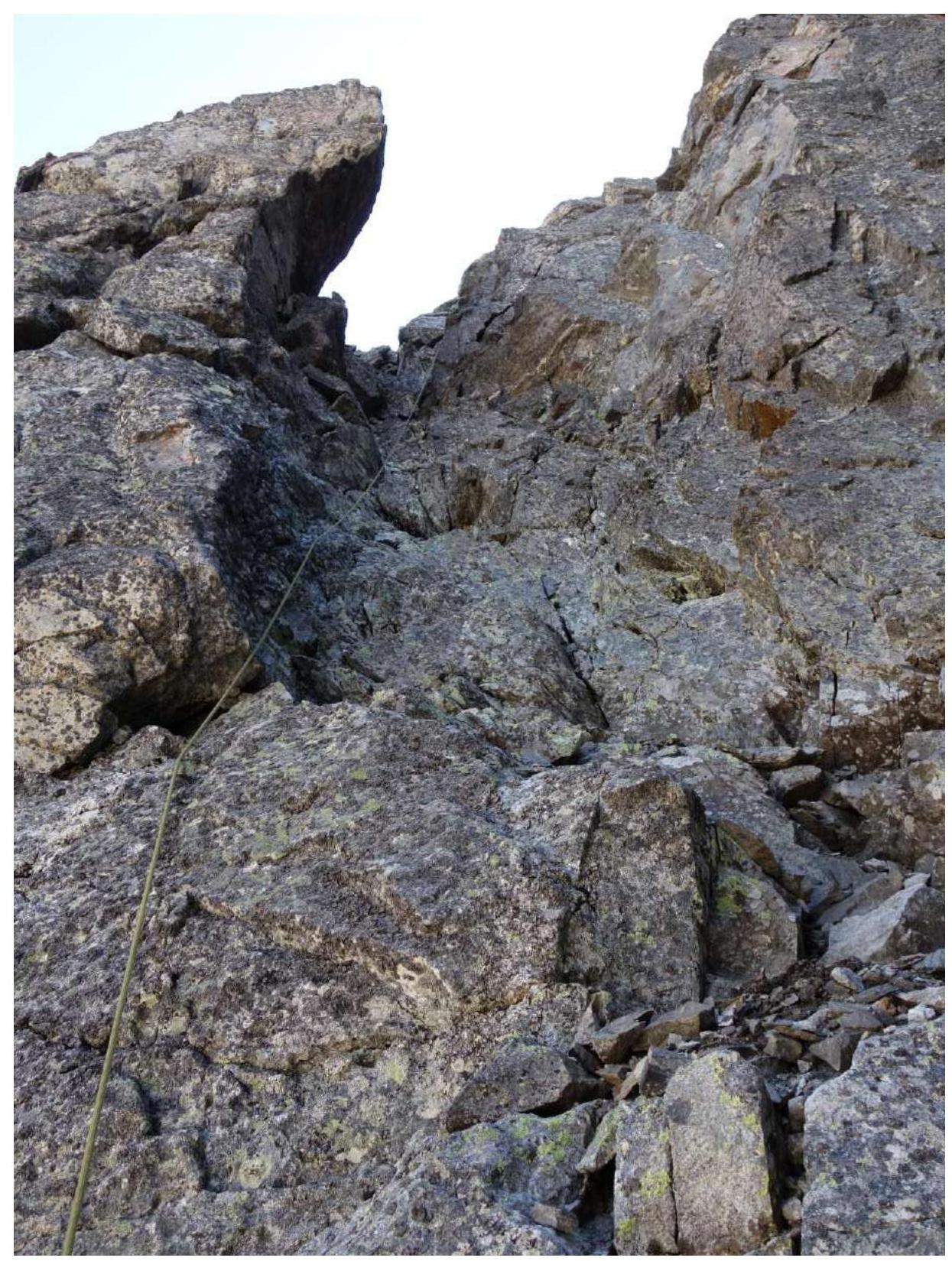
| R10–R11 | Via a wide crack (5 m V) roll left, then up into an inner corner with a "plug" (15 m IV). Due to uncertainty about the reliability of the plug, it was necessary to bypass it on the right via a crack (7 m A2). Upon subsequent inspection, the rock was found to be reliable. Future teams can climb through the plug, bypassing it on the left with climbing. Then up the inner corner, veering left (35 m IV). | 18,19,20 |
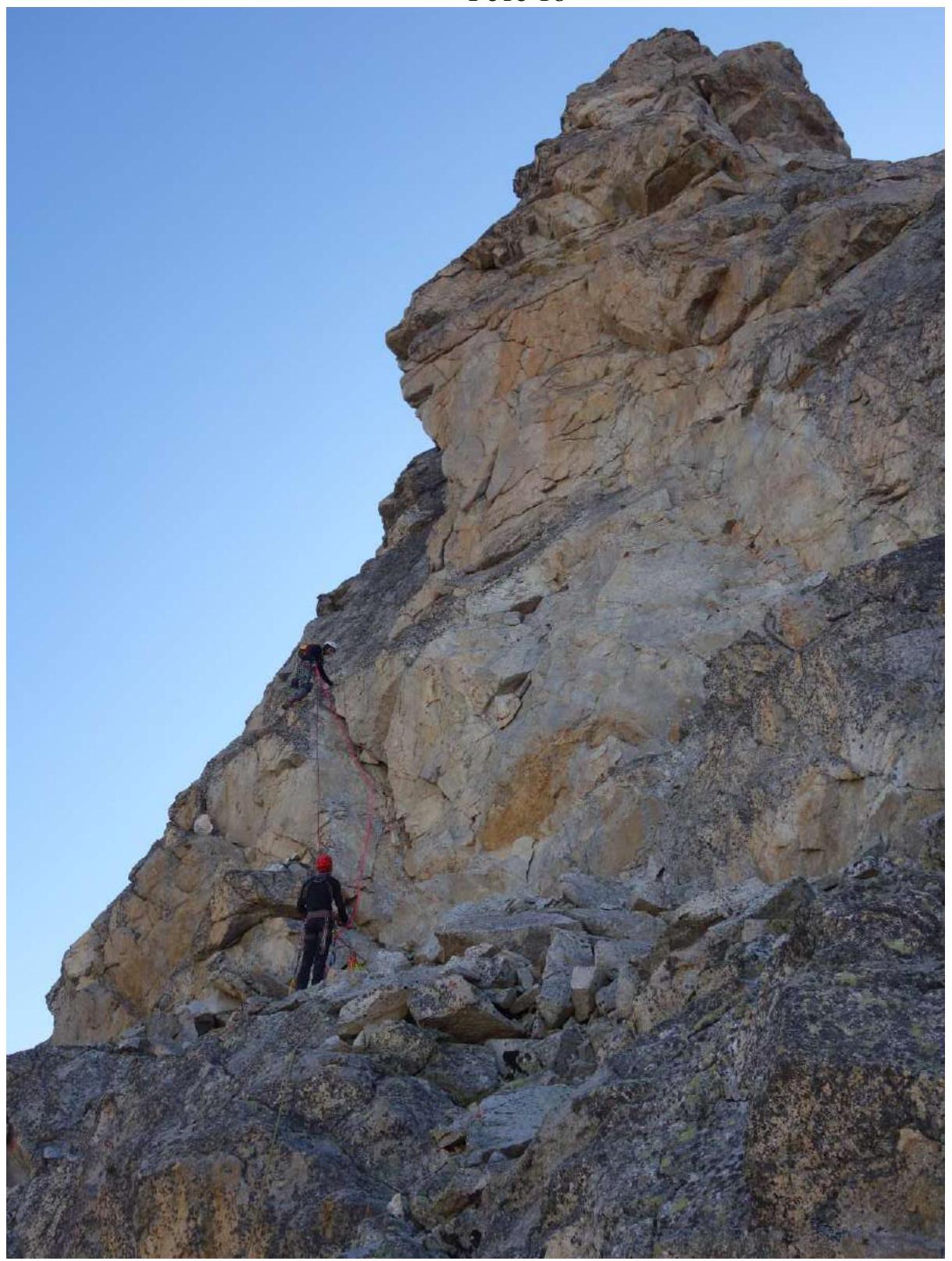
| R11–R12 | On foot and with simple climbing along destroyed rocks, move towards the summit (II 300 m). | 21 |
Photo 1
Start of the route. Sections R0–R4 are visible.
Photo 2
Section R1–R2.
Photo 3

Station R2 under the cornice, there is a bolt.
Photo 4
Inner corner on section R2–R3. Holes for skyhooks, bolt for passage.
Photo 5
Station R3.
Photo 6
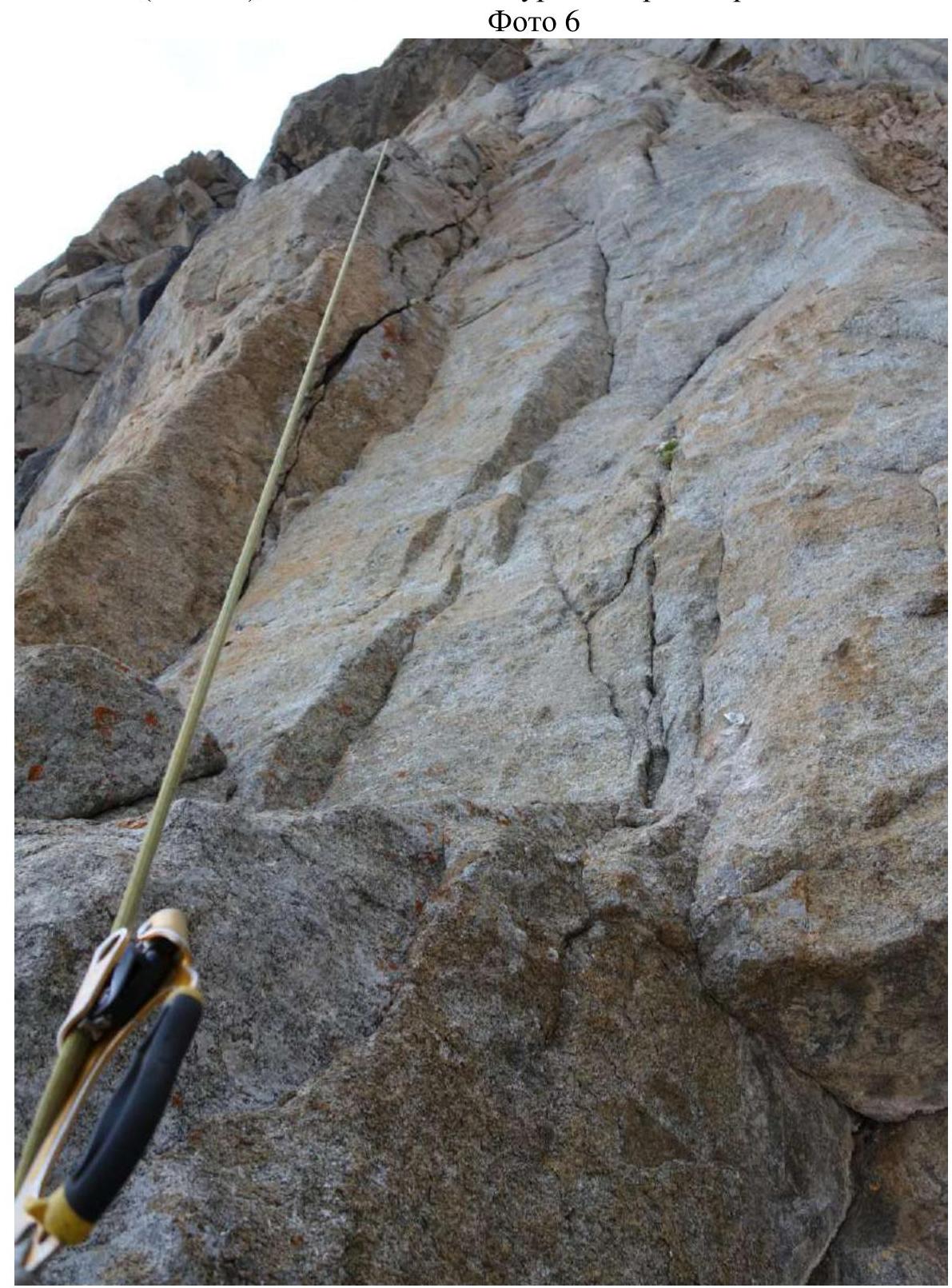
Passing through a small cornice on section R3–R4.
Photo 7
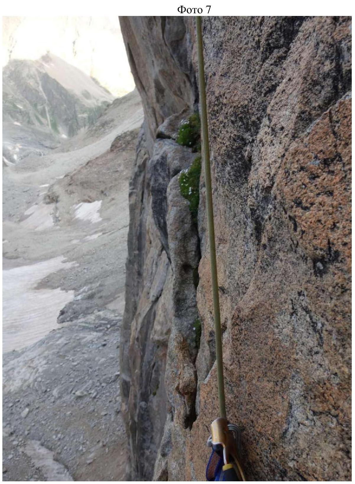
Photograph from station R4. From the station, traverse or pendulum along a narrow ledge.
Photo 8
Section R4–R5 after the pendulum, move up the cracks (on the right side of the photo) towards the crack in the cornice.
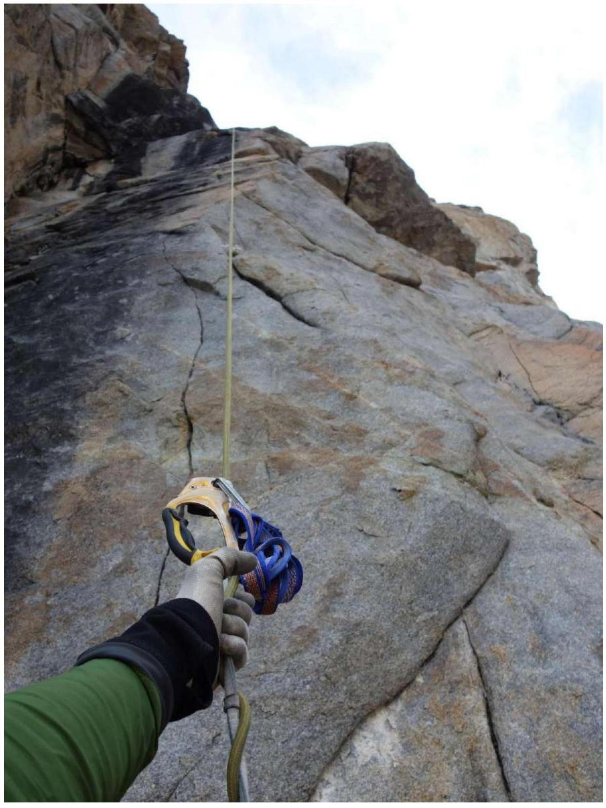
Photo 9
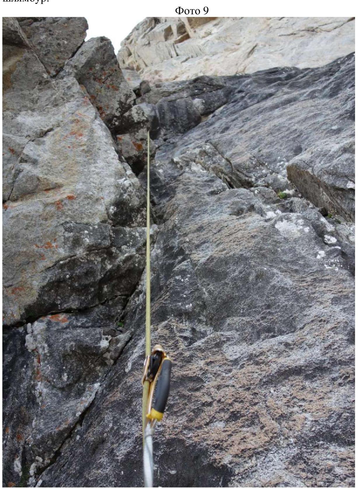
Photo from station R5.
Photo 10
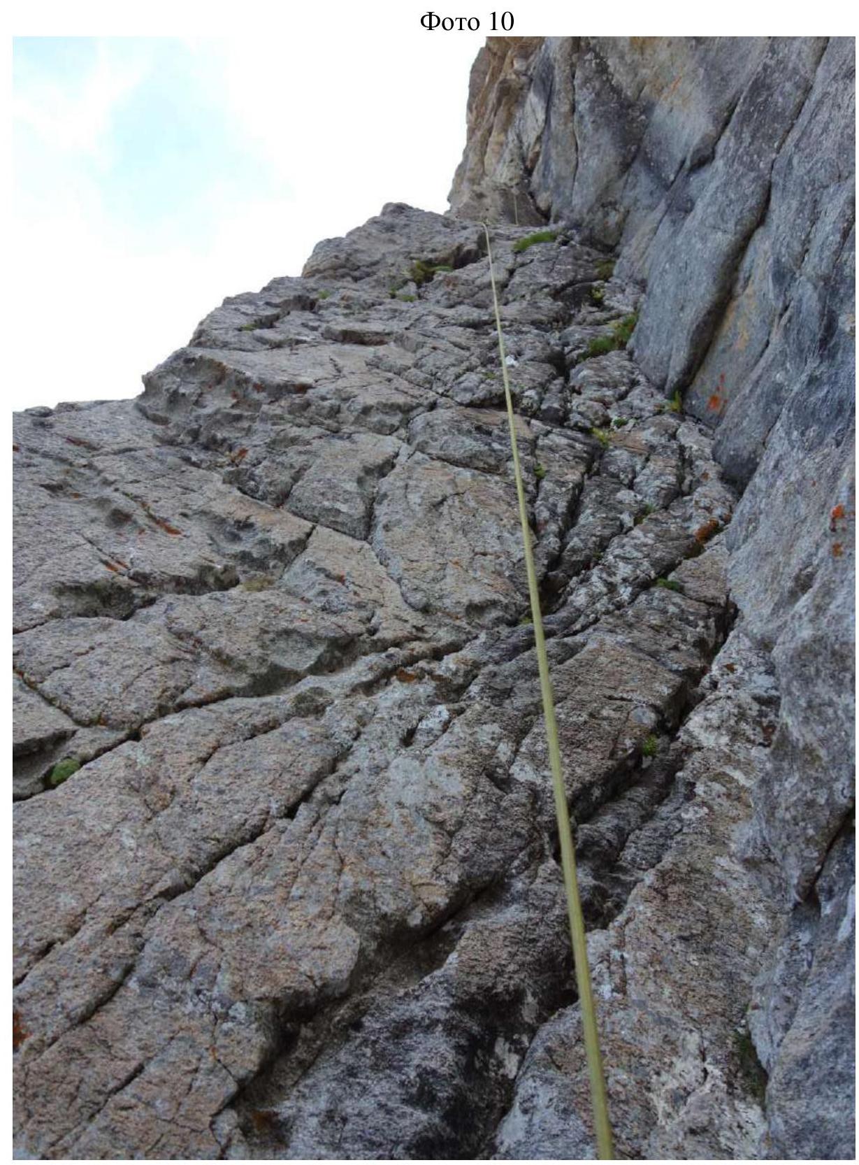
Wide inner corner on section R5–R6.
Photo 11
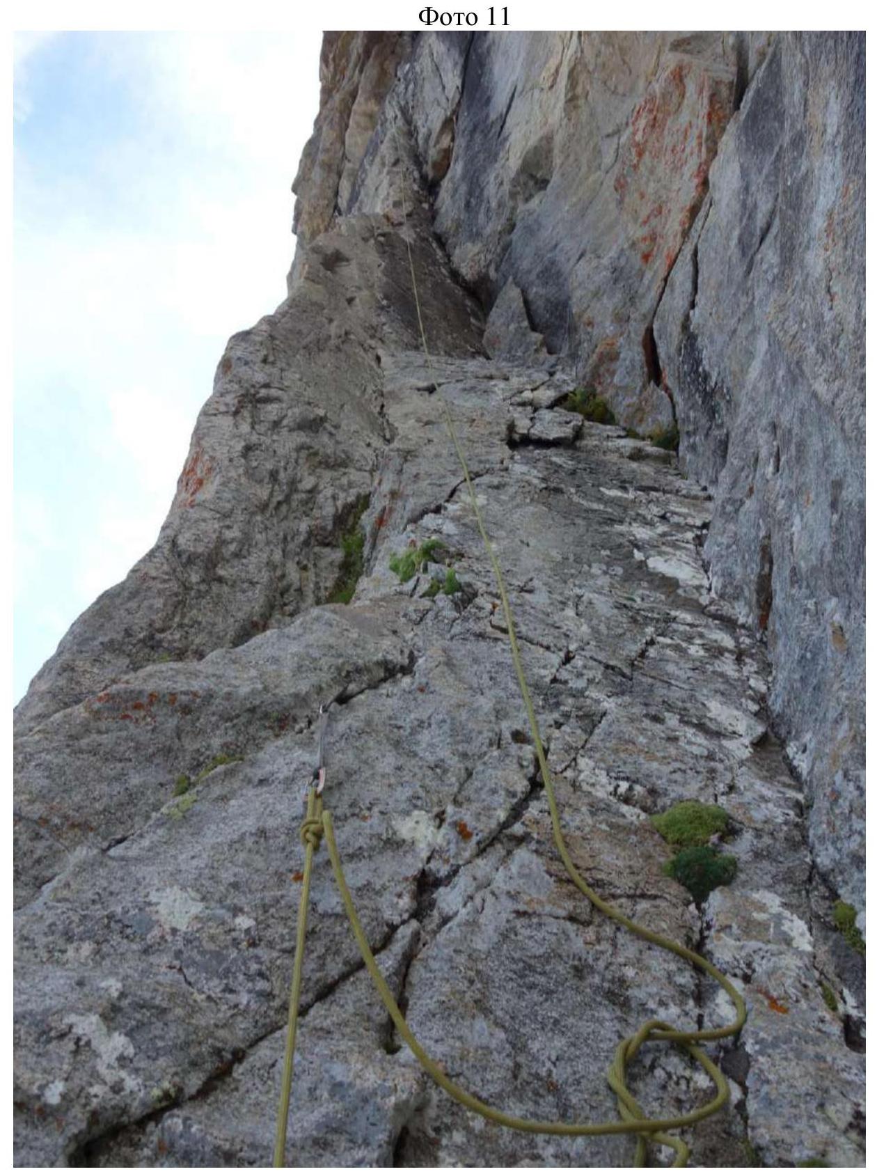
Inner corner turns into a crack passable on IT. Section R5–R6.
Photo 12
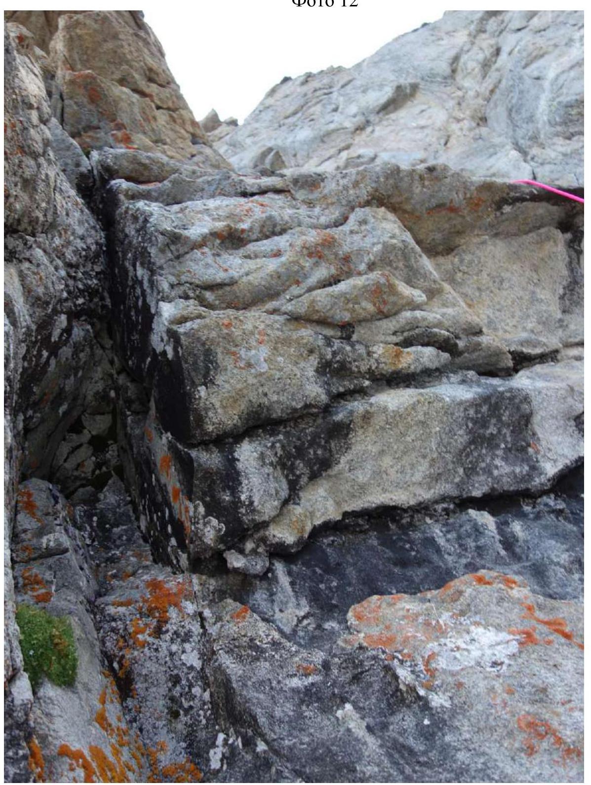
View from station R6. Movement through a crack in the cornice.
Photo 13
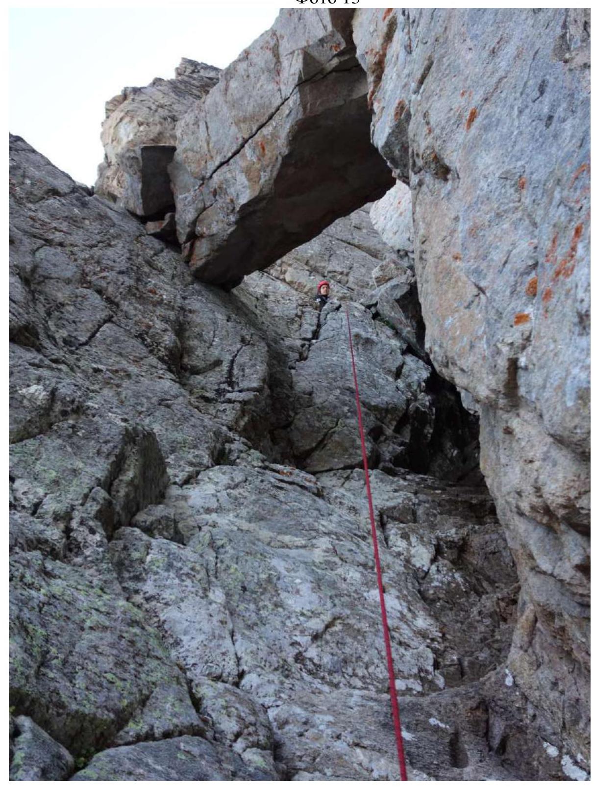
Markevich K. on station R7.
Photo 14
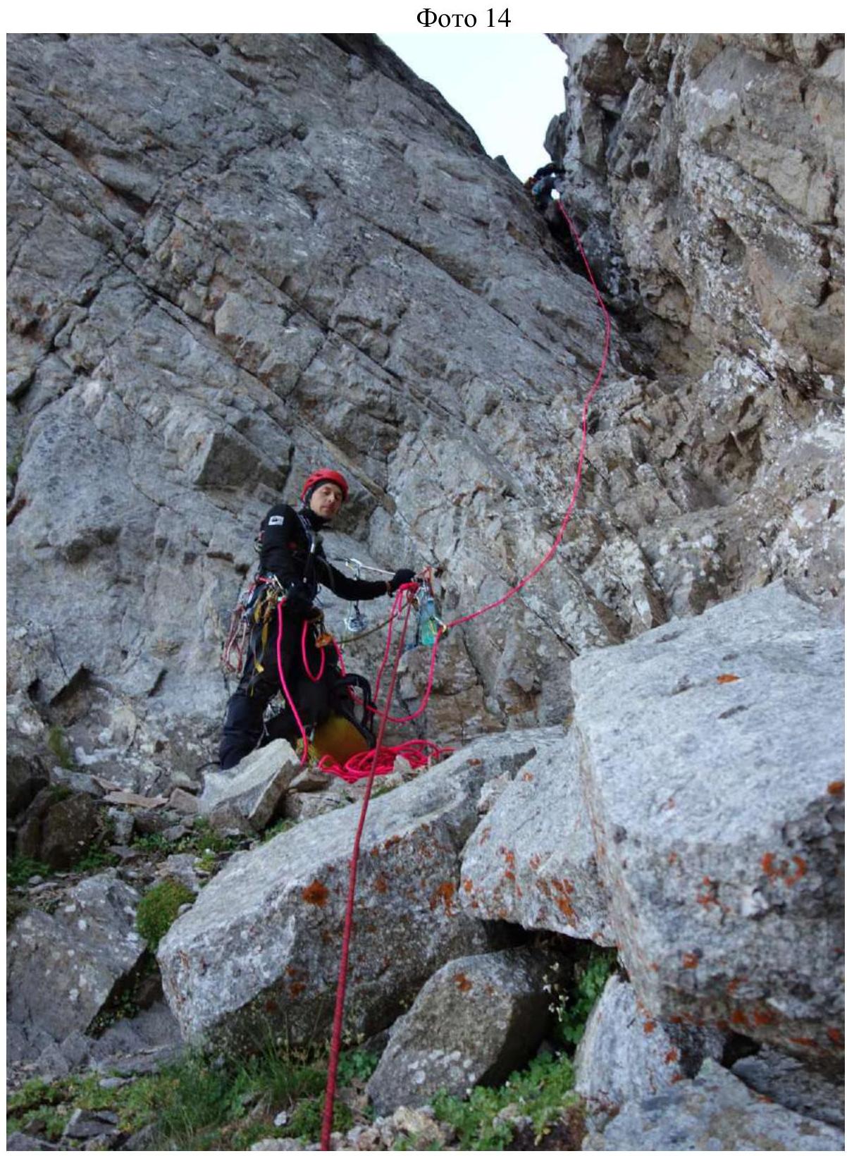
Chimney, section R7–R8.
Photo 15
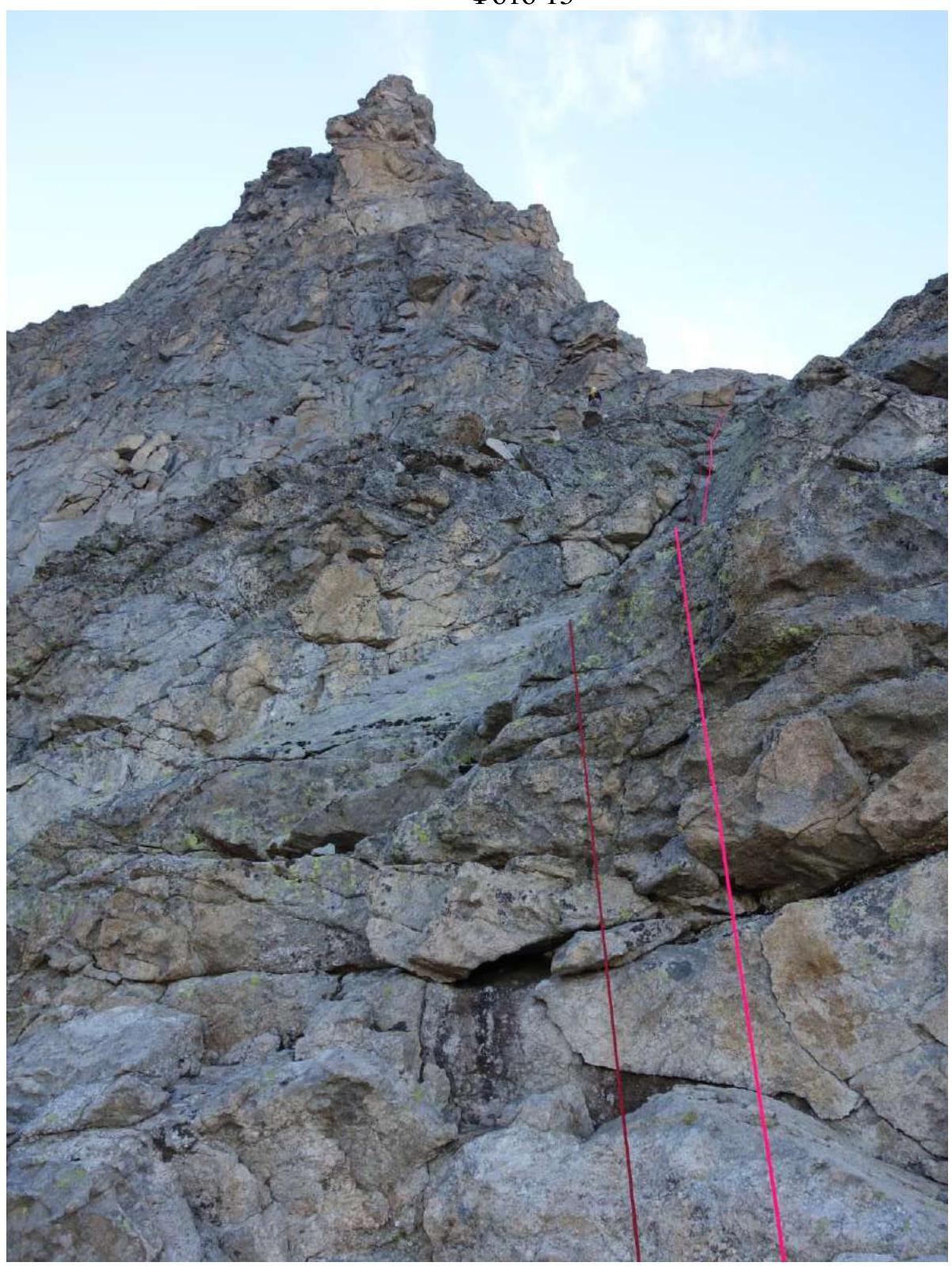
Wide ridge and pre-summit bastion. Section R8–R9.
Photo 16
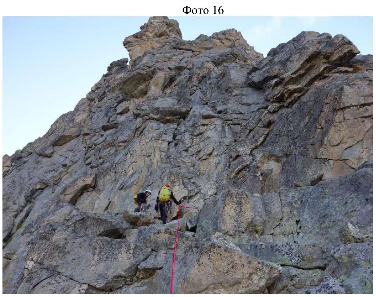
Ledge and station R9.
Photo 17
Section R9–R10.
Photo 18
Start of section R10–R11.
Photo 19
Rope lies on a stone "plug". Section R10–R11.
Photo 20
Exit to the ridge. Section R10–R11.
Photo 21
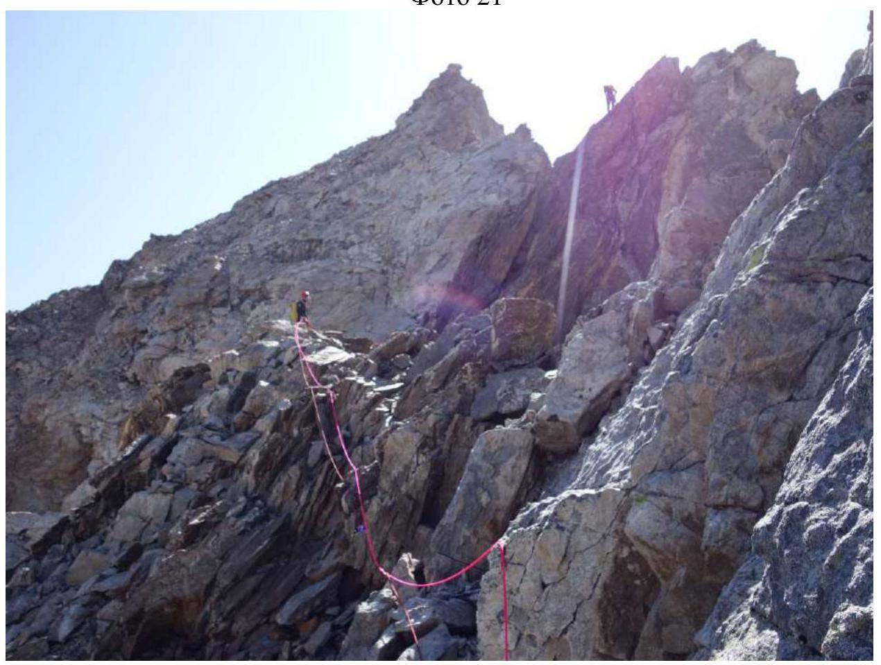
View of the summit. Section R11–R12. Descent from the summit left along the ridge.
Photo 22

Photograph at the summit.
The route is interesting due to its diverse monolithic terrain with sections of complex climbing on IT on the wall part of the route. The line of the route is logical and follows the terrain, leading into numerous inner corners of the western wall. The route is entirely rocky, with a monolithic character. "Live" stones are found only on the R8 ledge and on gentle sections of the ridge. On the ridge, there are places suitable for overnight stays. There is no water on the route, but snow patches are present on the ridge. Communication with Uzunkol Alpine Camp is weak; relay from Myrdynskie overnight stays is necessary.
Descent from the summit:
- Along the wide ridge and rocks of I–II category difficulty towards Malaya Trapezia Peak, to a wide scree couloir (20–30 minutes).
- Down the logical scree terrain towards the glacier.
- 40–50 meters before reaching the snowfield, the steepness increases; turn right along the wall of Trapezia Peak.
- On foot down the destroyed inner corner to the snow.
The route has a slightly lower meterage of sections of V–VI category difficulty compared to the Pugachev route 6A and is recommended for technically prepared teams with experience in IT climbing. It is suitable for technical training and preparation for routes of 6th category difficulty in the Uzunkol Alpine Camp area.
Comments
Sign in to leave a comment