Report
ON THE FIRST ASCENT TO THE SUMMIT 3259 m VIA THE SOUTHEAST RIDGE ROUTE, CATEGORY 2B, BY THE TEAM OF THE STAVROPOL TERRITORIAL FEDERATION OF ALPINISM ON JULY 6, 2021
I. Ascent Report
| № | 1. General Information | |
|---|---|---|
| 1.1 | Full name, sports rank of the team leader | Kirill Artyomovich Klimonov, 1st sports rank |
| 1.2 | Full name, sports rank of the participants | Dmitry Viktorovich Romakh, 2nd sports rank |
| 1.3 | Full name of the coach | Vladimir Ilyich Enin |
| 1.4 | Organization | Stavropol Territorial Federation of Alpinism |
| 2. Characteristics of the Ascent Object | ||
| 2.1 | Region | Caucasus |
| 2.2 | Valley | Ullukam |
| 2.3 | Section number according to the 2013 Classification Table | 2.3 |
| 2.4 | Name and height of the summit | 3259 m |
| 2.5 | Geographical coordinates of the summit (latitude/longitude), GPS coordinates | 43.254733, 42.308138 |
| 3. Characteristics of the Route | ||
| 3.1 | Name of the route | Via the Southeast Ridge |
| 3.2 | Proposed category of difficulty | 2B |
| 3.3 | Degree of route development | First ascent |
| 3.4 | Character of the route terrain | Rocky |
| 3.5 | Height difference of the route (altimeter or GPS data) | 300 m |
| 3.6 | Length of the route (in meters) | 390 m |
| 3.7 | Technical elements of the route (total length of sections of various difficulty categories with indication of terrain character: ice-snow, rocky) | Category I: grassy slope/rocks – 90 m. Category II: rocks – 170 m. Category III: rocks – 15 m. Category III+: rocks – 115 m. |
| 3.8 | Descent from the summit | Descent via the couloir between the summit and the pre-summit tower to the south |
| 3.9 | Additional characteristics of the route | In mid-summer, there is no water on the route. Many streams on the way to the start of the route |
| 4. Characteristics of the Team's Actions | ||
| :-- | :----------------------------------------------------------- | :-------------------------------------------------------------------------------------------------------------------------------------------------------------------------------------------------------------------------------------------------------------------------------------------------------------------------: |
| 4.1 | Time of movement (team's walking hours, in hours and days) | 6 h 30 min |
| 4.2 | Overnight stays | Upper campsite |
| 4.3 | Departure on the route | 8:20 on July 6, 2021 |
| 4.4 | Reaching the summit | 14:25 on July 6, 2021 |
| 4.5 | Return to the camp | 16:45 on July 6, 2021 |
| 5. Responsible for the Report | ||
| 5.1 | Full name, e-mail | Kirill Artyomovich Klimonov, klimonov.dev@gmail.com |
II. Description of the Ascent
1. Characteristics of the Ascent Object

Photograph №1. General photograph of the summit (taken on July 6, 2021, from the lake at the foot of Mt. Chirincol)
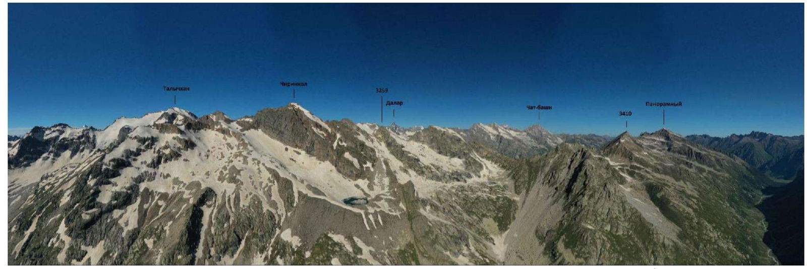
Photograph №2. Photopanorama of the area (taken on July 11, 2021, from the slopes of the Kikchinekolskaya Bashnya summit).
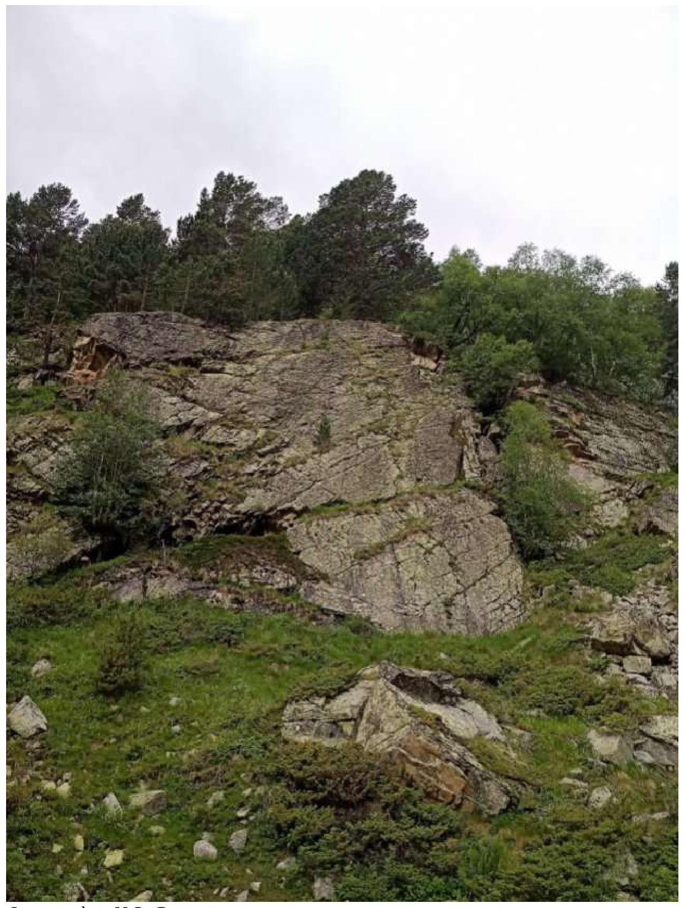
Photograph №3. Rocky wall
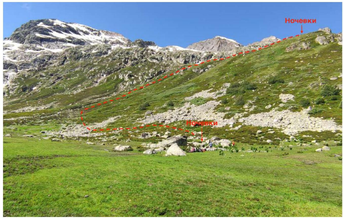
Photograph №4. Overnight stay. Ascent to the pass
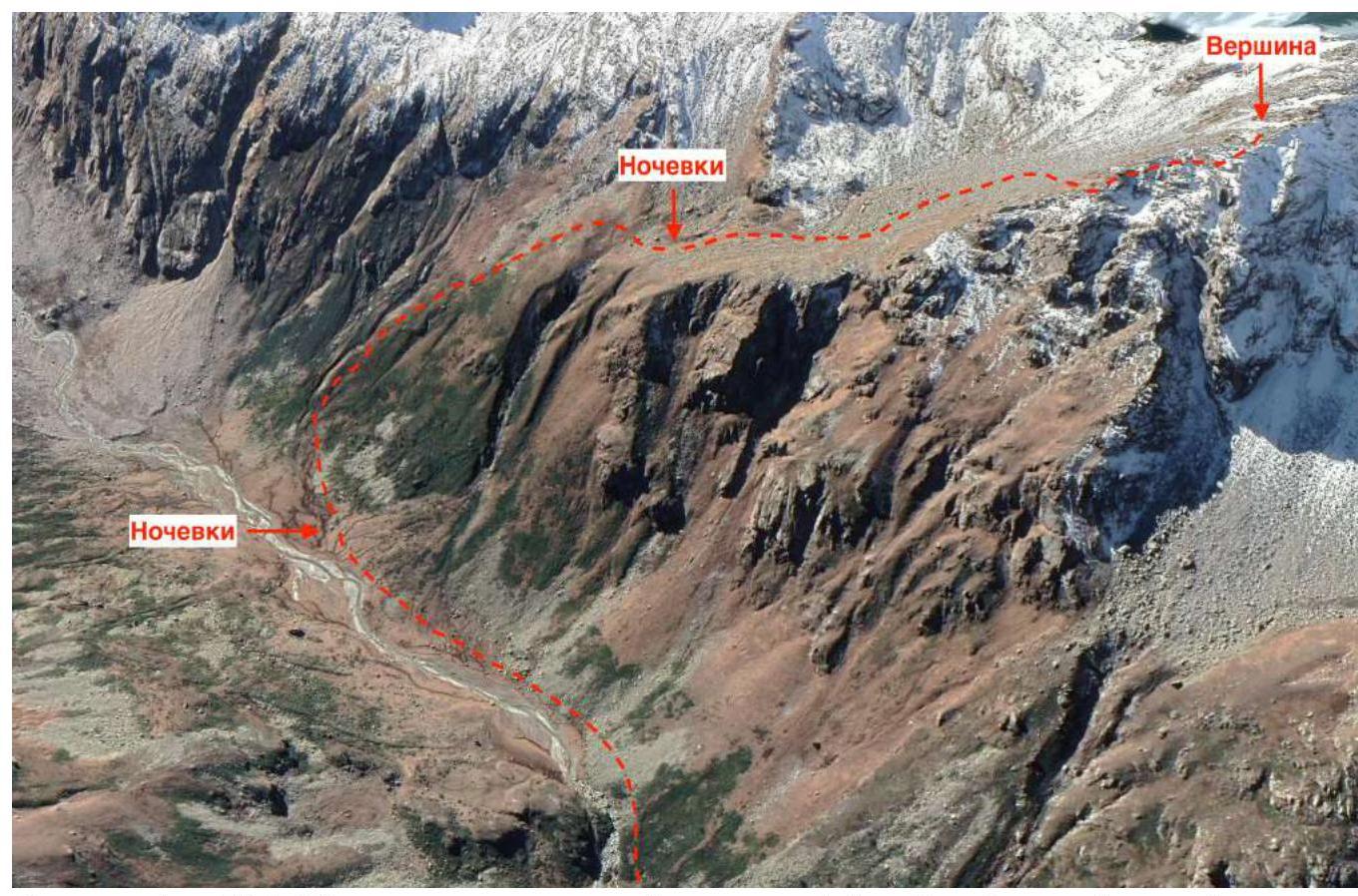
Photograph №5. Overnight stay and the summit (source: https://earth.google.com/↗)
Map of the area (source: https://www.openstreetmap.org↗)
Photograph №6. Approach from the cirque to the start of the route
Photograph №7. Landmark for the start of the route (Section R0–R1).
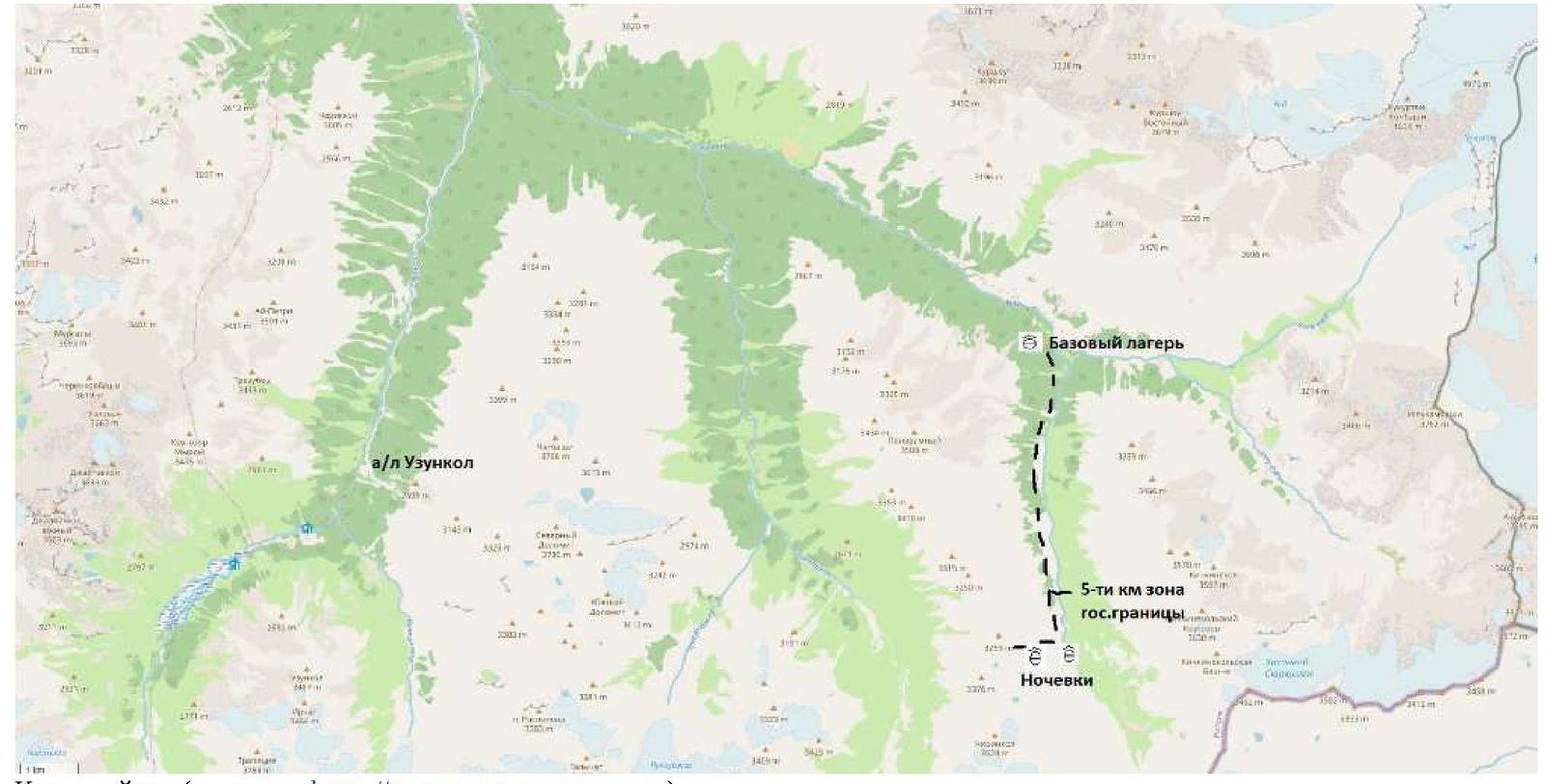
In July 2020, a group of climbers from the Stavropol Territorial Federation of Alpinism, consisting of Kireev E.T., Zorina L.G., and Karpov S.A., conducted a reconnaissance of the area. The results of the reconnaissance formed the basis for this first ascent. Peak 3259 is located in the Karachaevsky district of the Karachay-Cherkess Republic, in a spur of the Main Caucasian Range, situated between the rivers Eastern Kikchinekol and Chirincol. We set up our base camp at the confluence of the rivers Ullu-Kam (Kuban) and Eastern Kikchinekol, in the house of the director of the Uzunkol tourist center, Enver (43.30166, 42.31656).
From the village of Khurzuk, it is necessary to move along a dirt road towards the border post, the same road that leads to the Uzunkol tourist center. Immediately after the border post, there will be a fork. The road straight ahead leads to the Uzunkol tourist center; we need to turn left into the Ullu-Kam (Kuban) gorge, towards the Khotytau pass. The road is a bit worse than the one to Uzunkol; it can only be traversed by an off-road vehicle. It is possible to arrange for a car pickup with Enver (phone: 8 (928) 389–1972) and accommodation in the house. The conditions are more than comfortable. The house is located 13.4 km from the border post.
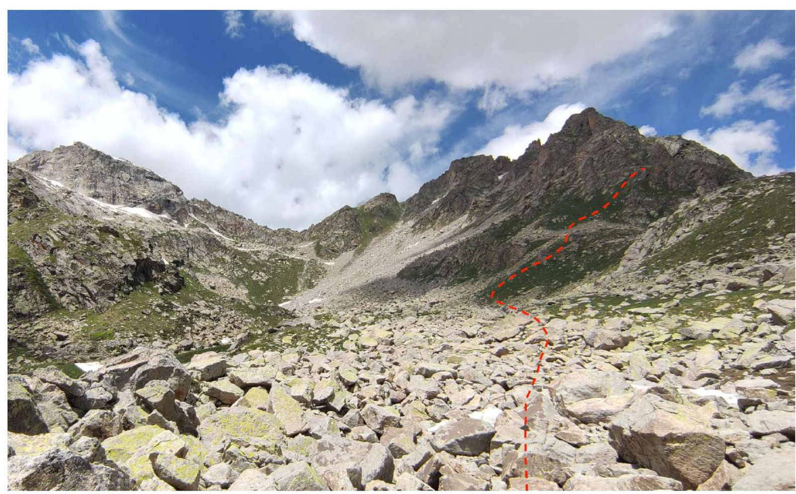
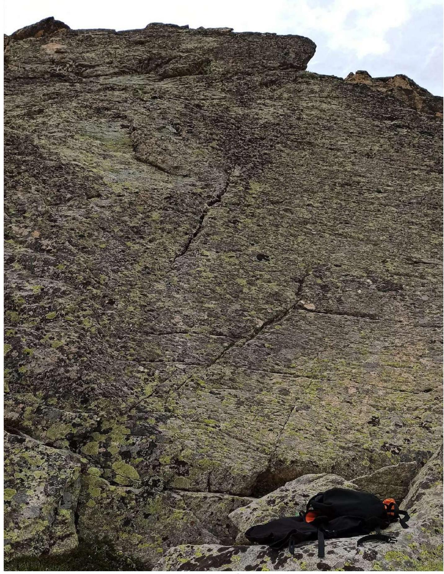
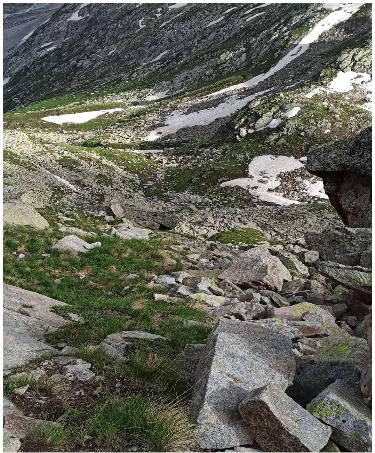
The approach to the start of the route is made along the left bank of the Eastern Kikchinekol River. The trail periodically disappears, but there are cairns to navigate by. In 1.5–2 hours (3.5 km) from the base camp, on the right-hand side, we pass a rocky wall (Photograph №3) — a good place to organize a rock climbing area (35–45 m, 70–80°).
After another 1.5–2 hours (3.4 km) of walking, we reach a large boulder where we can set up an overnight stay (coordinates 43.24991, 42.321587), or we can organize overnight stays after a steep ascent (coordinates 43.24956, 42.314773). From the large boulder, start veering right and upwards, on the right side of the river (Photograph №4, Photograph №5). In summer, there is water at both overnight stay locations.
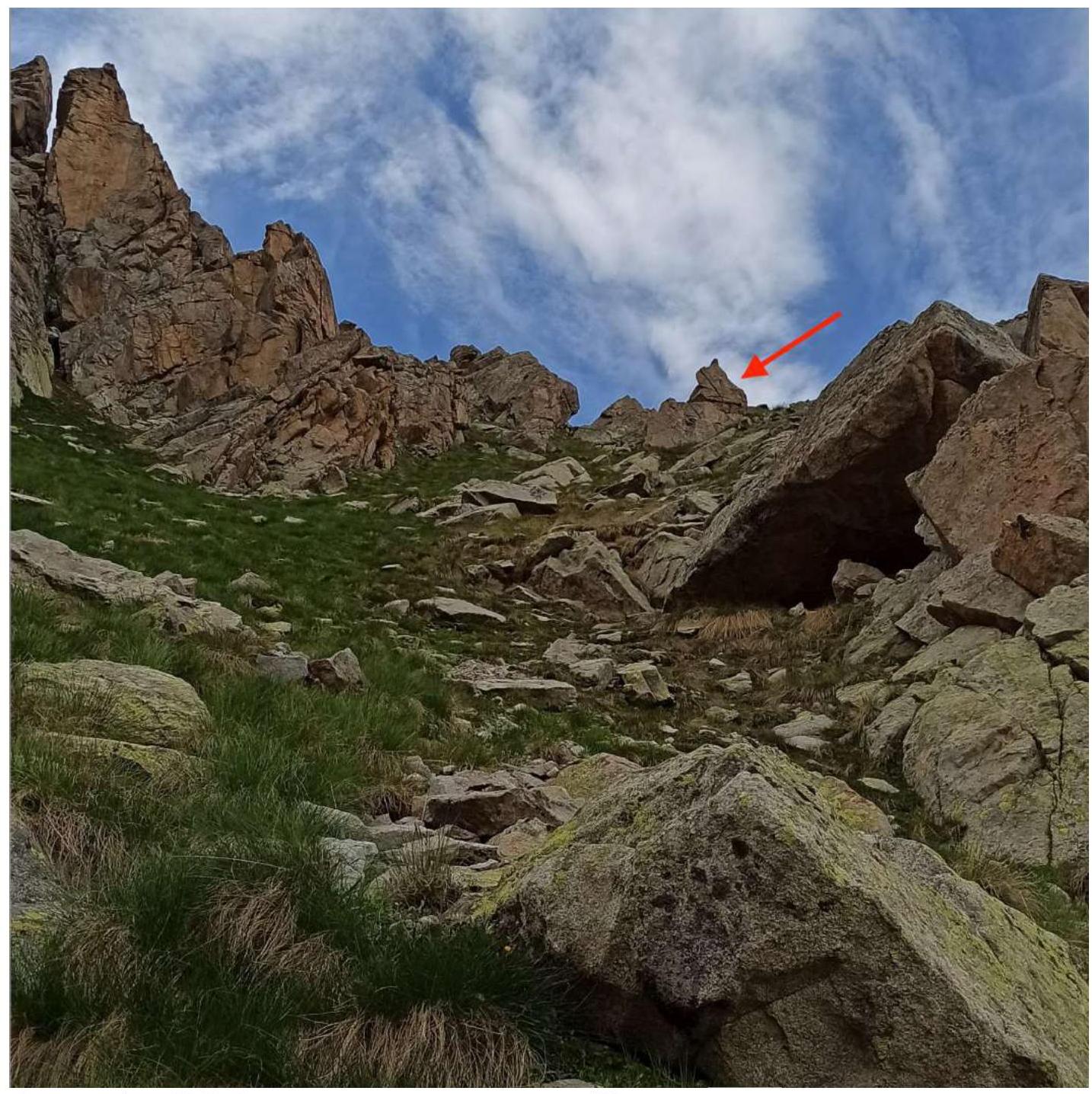
Upon reaching the pass, staying to the right side of the cirque, we approach the start of the route (Photograph №6). The landmark is a stone in the shape of a Budyonovka cap (Photograph №7).
2. Characteristics of the Route
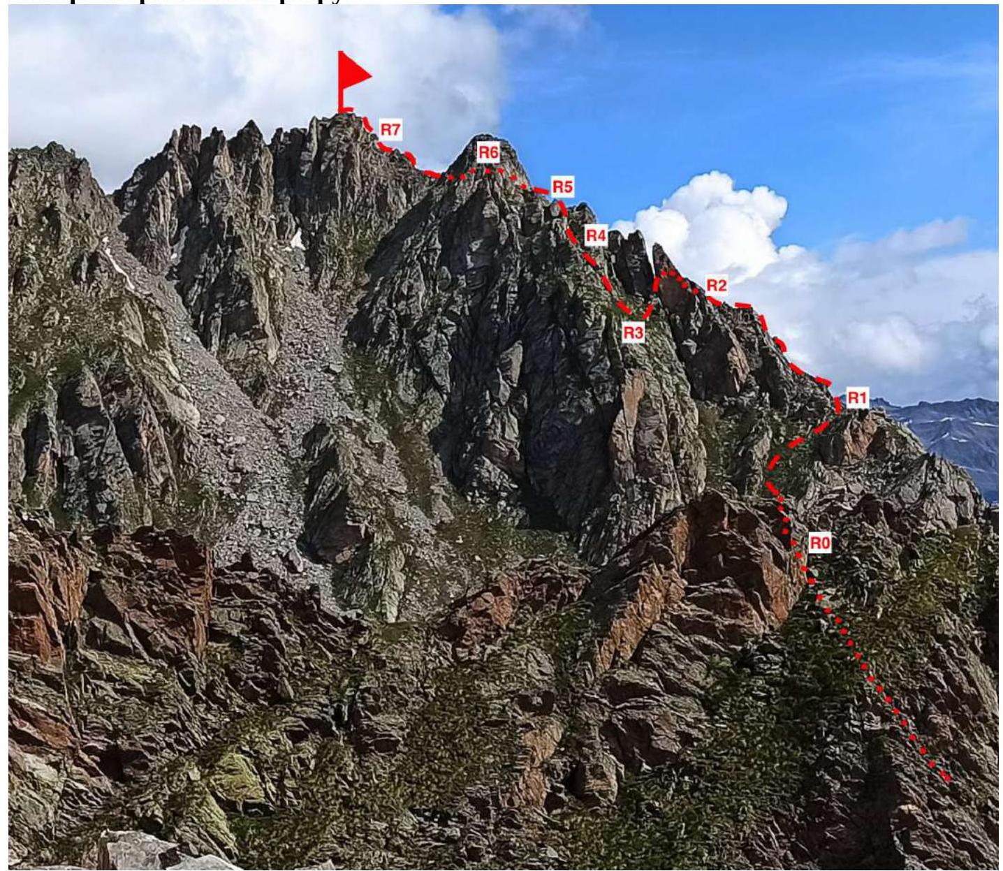
Photograph №8. Technical photograph of the route (taken on July 6, 2021, from the lake at the foot of Mt. Chirincol)
| Section № | Terrain Character | Difficulty Category | Length, m | Type and Number of Anchors |
|---|---|---|---|---|
| R0–R1 | Rocky-grassy slope | 1 | 80 | 0 |
| R1–R2 | Ridge | 3+ | 75 | 3 chock stones |
| R2–R3 | Descent into a crevice | 1, 3+ | 30 | 1 anchor hook |
| R3–R4 | Inner corner | 3 | 15 | 0 |
| R4–R5 | Large scree | 2 | 35 | 0 |
| R5–R6 | Ridge | 3+, 2 | 40 | 0 |
| R6–R7 | Ridge | 2 | 55 | 0 |
| R7–R8 | Large scree | 2 | 60 | 0 |
3. Characteristics of the Team's Actions
| Section № | Description | Photograph № |
|---|---|---|
| R0–R1 | Movement from the cirque up a steep grassy slope. The landmark for reaching the ridge is a stone in the shape of a Budyonovka cap. Simultaneous movement. 80 m, 55°, 1. | Photograph №9 |
| R1–R2 | Movement along the right side of the ridge, initially. Convenient belay station on a boulder. Alternating movement. 75 m, 50°–65°, 3+. | Photograph №10 |
| R2–R3 | Upon reaching a smooth wall, bypass it on the right for 10 m, then descend to the left (towards the cirque) into a crevice, and then exit onto a grassy ledge. Simultaneous movement for 10 m, 5°, 1. Alternating movement for 10 m, 50°, 3+. | Photograph №11, Photograph №12 |
| R3–R4 | Inner corner, the one further from the crevice, the smaller one. Alternating movement. 15 m, 55°, 3. | Photograph №13 |
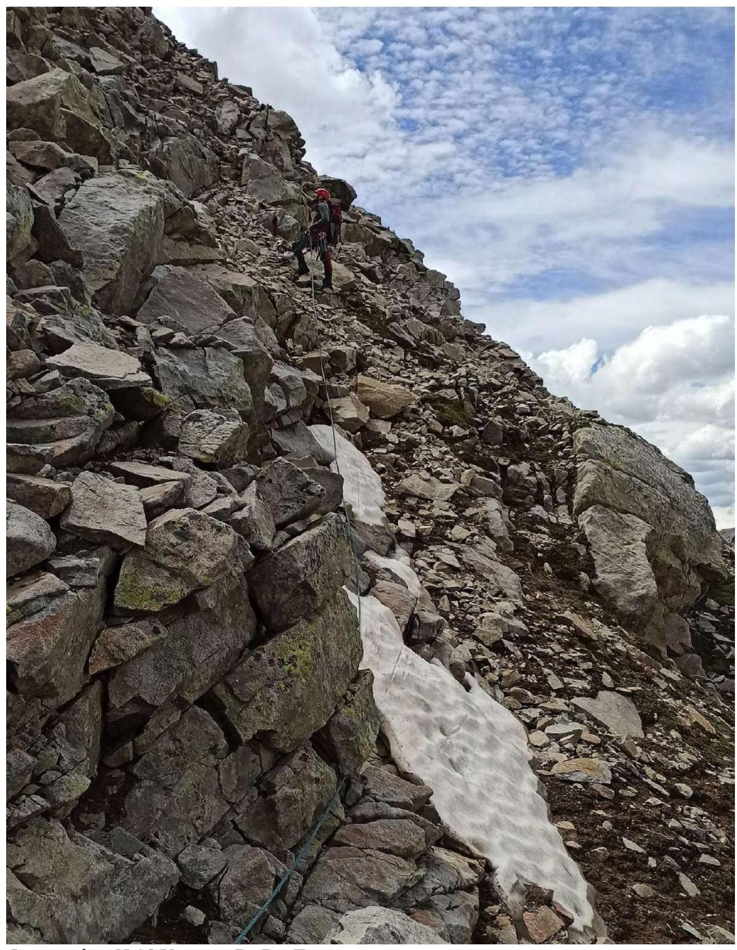
| R4–R5 | The next wall is bypassed on the right; movement is across large scree. Convenient belay station on a large boulder. Simultaneous movement. 35 m, 45°, 2. | Photograph №14 |
| R5–R6 | Movement along the ridge until reaching the pre-summit tower. Alternating movement for 20 m, 55°, 3+. Simultaneous movement for 20 m, 45°, 2. | Photograph №15 |
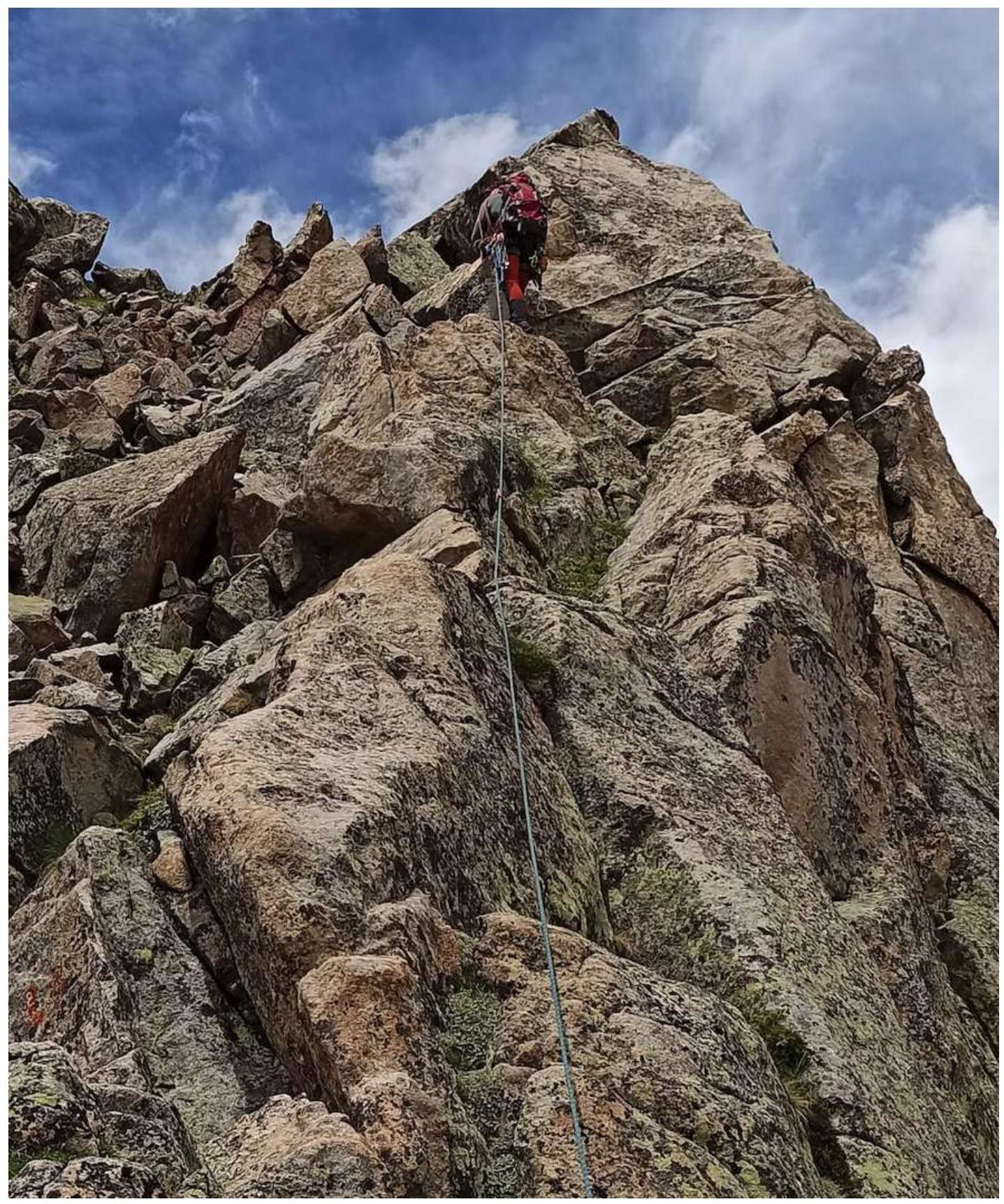
| R6–R7 | Along the pre-summit tower, movement until the start of the ascent to the summit. Simultaneous movement. 55 m, 15°, 2. | Photograph №16 |
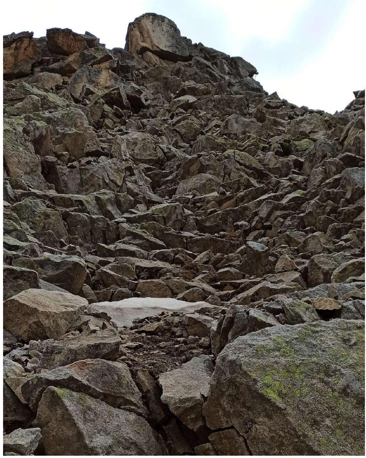
| R7–R8 | Movement across large to medium scree until reaching the summit. There is a risk of dislodging rocks onto those below. Convenient belay station on a large boulder. Alternating movement. 60 m, 55°–70°, 2. | Photograph №17 |

Photograph №9. Section R0–R1.
Photograph №10. Section R1–R2.
Photograph №11. Section R2–R3. The wall is bypassed on the right.

Photograph №14. Section R4–R5. Movement across large scree.

Photograph №15. Section R5–R6. Reaching the pre-summit tower.
Photograph №16. Section R6–R7. Movement until the start of the ascent to the summit.
Photograph №17. Section R7–R8. Ascent to the summit.
Photograph №18. Descent via the couloir between the summit and the pre-summit tower.
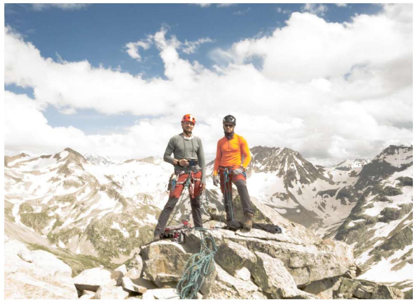
Photograph №19. Team at the summit by the control post.
Upon completion of the ascent, a debrief was conducted, assessing the complexity of individual sections and the route as a whole. The route taken is considered safe. Taking into account the experience of previous ascents to the summits:
- Kruzgor Myrdy — Category 2A
- Raspopova — Category 2B
- Raspopova — Category 2A
- Zaimov Peak — Category 2B
- Taulan (3226) — Category 2B
- Orlyonok — Category 2A
- 3130 — Category 2A
- 40 years of TASSR — Category 2A
The route to Peak 3259 corresponds to Category 2B.
Recommendations for Climbers:
When planning three ascents: to Peak 3259 from the beginning of the cirque, to Peak 3259 from the Elektrik pass, and to Peak Chirincol, it is advisable to set up a storm camp in the cirque, immediately after the ascent from the valley (Photograph №5).
For the route, the following will be required:
- 4 anchor hooks
- half a set of chock stones
- several large slings
Water can be collected from streams before the start of Section R0.
Mobile communication is absent throughout the entire route.