Report
ON THE FIRST ASCENT TO THE SUMMIT 3259 M VIA THE ROUTE FROM ELECTRIC PASS ALONG THE SOUTHERN RIDGE, CATEGORY 2A DIFFICULTY, BY THE TEAM OF THE STAVROPOL REGIONAL FEDERATION OF ALPINISM July 9, 2021
I. Ascent Passport
| № item | 1. General Information | |
|---|---|---|
| 1.1 | Full name, sports rank of the team leader | Kirill Artyomovich Klimonov, 1st sports rank |
| 1.2 | Full name, sports rank of the participants | Dmitry Viktorovich Romakh, 2nd sports rank |
| 1.3 | Full name of the coach | Vladimir Ilyich Enin |
| 1.4 | Organization | Stavropol Regional Federation of Alpinism |
| 2. Characteristics of the Ascent Object | ||
| 2.1 | Region | Caucasus |
| 2.2 | Valley | Ullukam |
| 2.3 | Section number according to the 2013 classification table | 2.3 |
| 2.4 | Name and height of the summit | 3259 m |
| 2.5 | Geographical coordinates of the summit (latitude/longitude), GPS coordinates | 43.255112, 42.305992 |
| 3. Characteristics of the Route | ||
| 3.1 | Route name | Along the Southern Ridge |
| 3.2 | Proposed category of difficulty | 2A |
| 3.3 | Degree of route exploration | First ascent |
| 3.4 | Nature of the route terrain | Rocky |
| 3.5 | Height difference of the route (altimeter or GPS data) | 215 m |
| 3.6 | Route length (in meters) | 495 m |
| 3.7 | Technical elements of the route (total length of sections of varying difficulty with terrain characteristics) | 1st cat. difficulty grassy slope—rocky terrain – 295 m. 2nd cat. difficulty rocky terrain – 150 m. 3+ cat. difficulty rocky terrain – 50 m. |
| 3.8 | Descent from the summit | Descent via the ascent route towards the circus |
| 3.9 | Additional route characteristics | In mid-summer, there is no water on the route. Many streams along the way to the start of the route |
| 4. Characteristics of the Team's Actions | ||
| 4.1 | Time of movement (team's walking hours, in hours and days) | 4 h 10 min |
| 4.2 | Overnight stays | Upper campsite |
| 4.3 | Start of the route | 10:20 July 9, 2021 |
| 4.4 | Reaching the pass | 11:40 July 9, 2021 |
| 4.5 | Reaching the summit | 15:28 July 9, 2021 |
| 4.6 | Return to camp | 17:35 July 9, 2021 |
| 5. Person Responsible for the Report | ||
| 5.1 | Full name, e-mail | Kirill Artyomovich Klimonov, klimonov.dev@gmail.com |
II. Ascent Description
1. Characteristics of the Ascent Object
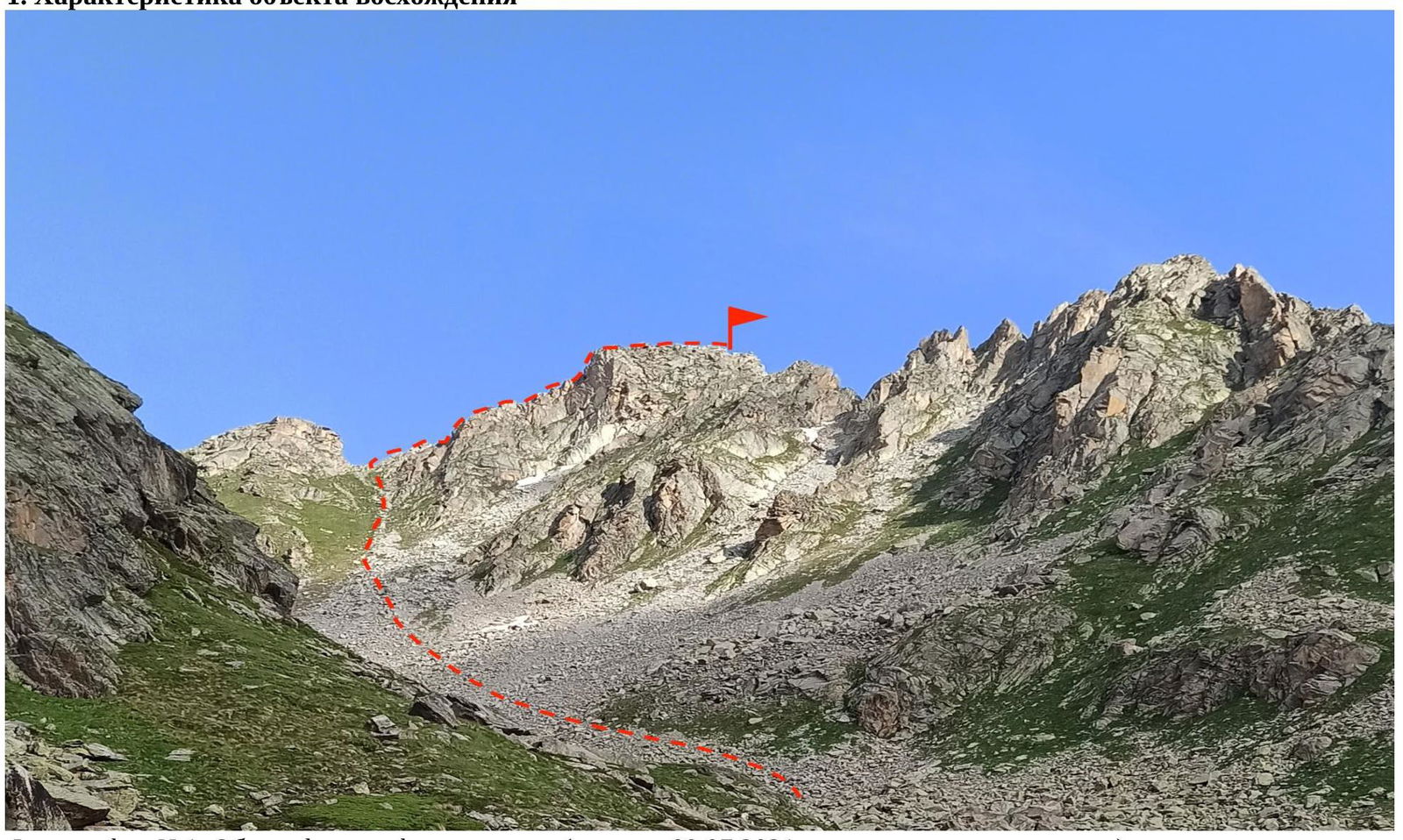
Photograph №1. General photograph of the summit (taken on July 9, 2021, from the upper campsite in the circus).
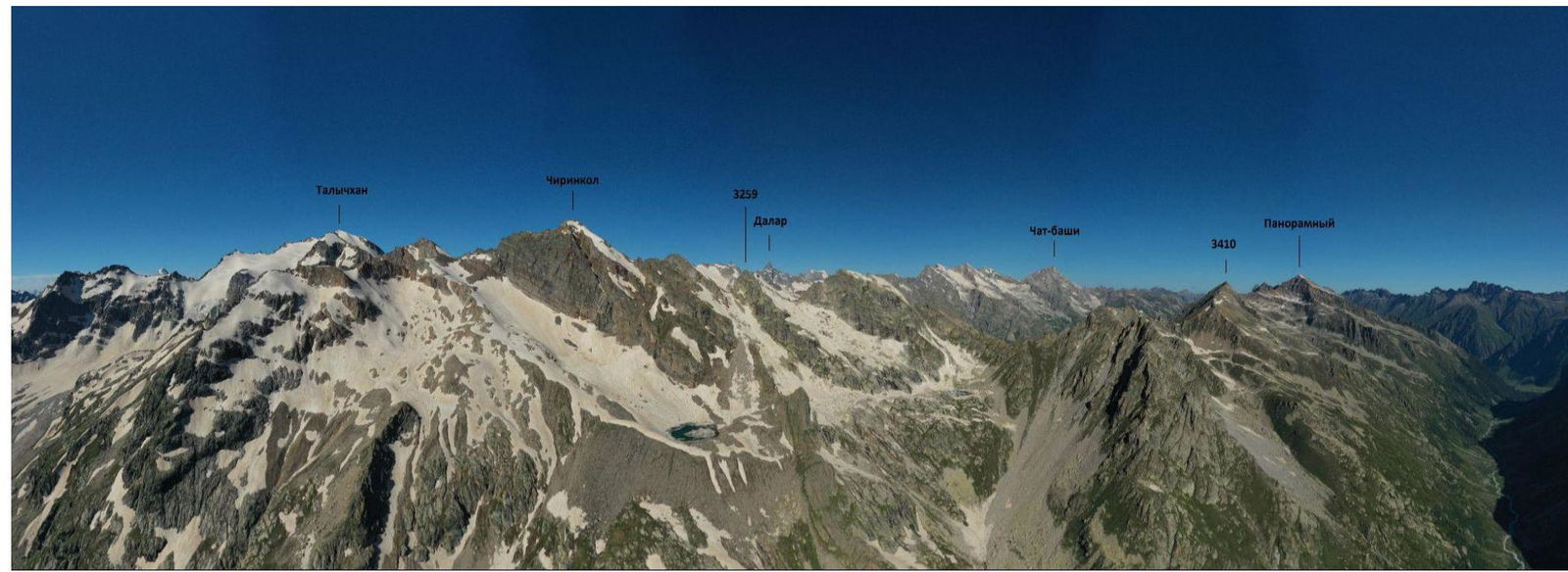
Photograph №2. Panoramic photograph of the area (taken on July 11, 2021, from the slopes of the Kichkinekolskaya Banya peak).
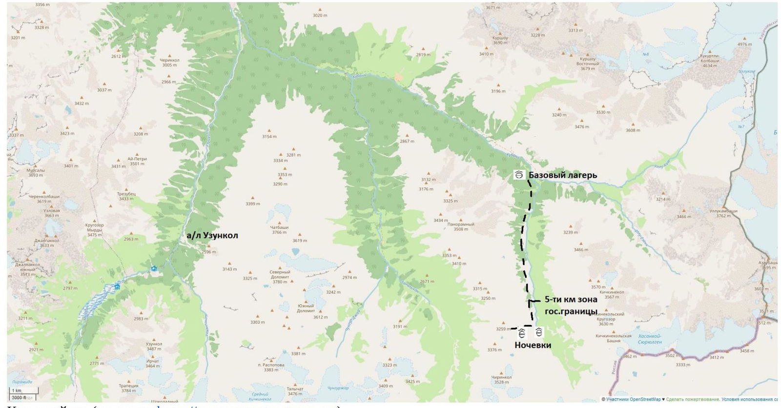
Map of the area (source https://www.openstreetmap.org↗)
In July 2020, a group of climbers from the Stavropol Regional Federation of Alpinism, consisting of E.T. Kireev, L.G. Zorina, and S.A. Karpov, conducted a reconnaissance of the area. The results of this reconnaissance formed the basis for this first ascent.
Peak 3410 is located in the Karachaevsky district of the Karachay-Cherkess Republic, in a spur of the Main Caucasian Range, situated between the rivers Vostochny Kichkinekol and Chirincol.
We set up our base camp at the confluence of the rivers Ullu-Kam (Kuban) and Vostochny Kichkinekol, in the house of the director of the Uzunkol Alpine Camp, Enver (43.30166, 42.31656).
From the settlement of Khurzuk, one must travel along a dirt road towards the border post, the same road that leads to the Uzunkol Alpine Camp. Immediately after the border post, there is a fork: the road straight ahead leads to the Uzunkol Alpine Camp, but we need to turn left, into the Ullu-Kam (Kuban) valley, towards the Khotyatau pass. The road is somewhat worse than the one to the Uzunkol Alpine Camp, and only an SUV can pass through. It is possible to arrange for a car to transport gear and accommodation at Enver's house (phone: +7 (928) 389–19–72). The conditions are more than comfortable. The house is located 13.4 km from the border post.
The approach to the start of the route is made along the left (orographic) bank of the Vostochny Kichkinekol river. The trail periodically disappears, but there are cairns to navigate by. 1.5–2 hours from the base camp, on the right-hand side of the path, there is a rock wall (Photograph №4), a good place to set up a rock climbing training area (35–45 m, 70–80°). After another 1.5–2 hours (3–4 hours from the base camp), we reach a large boulder where we can set up camp (coordinates 43.24991, 42.321587). From the large boulder, start moving to the right and upwards, on the right side of the river (Photograph №4, Photograph №5). After a steep ascent, another campsite can be set up (coordinates 43.24956, 42.314773) (1.5–2 hours from the lower campsite at the large boulder). In the summer, there is water at both campsites.
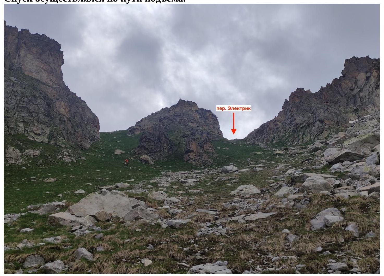
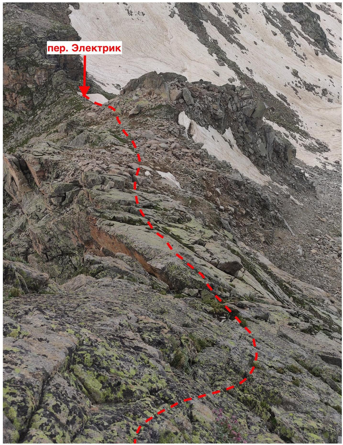
After the steep ascent, move towards the far part of the circus, in the direction of Electric Pass (Photograph №1) (2 hours from the upper campsite after the steep ascent).
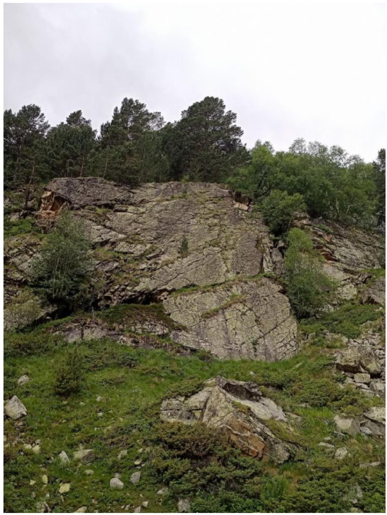
Photograph №3. Rock wall.
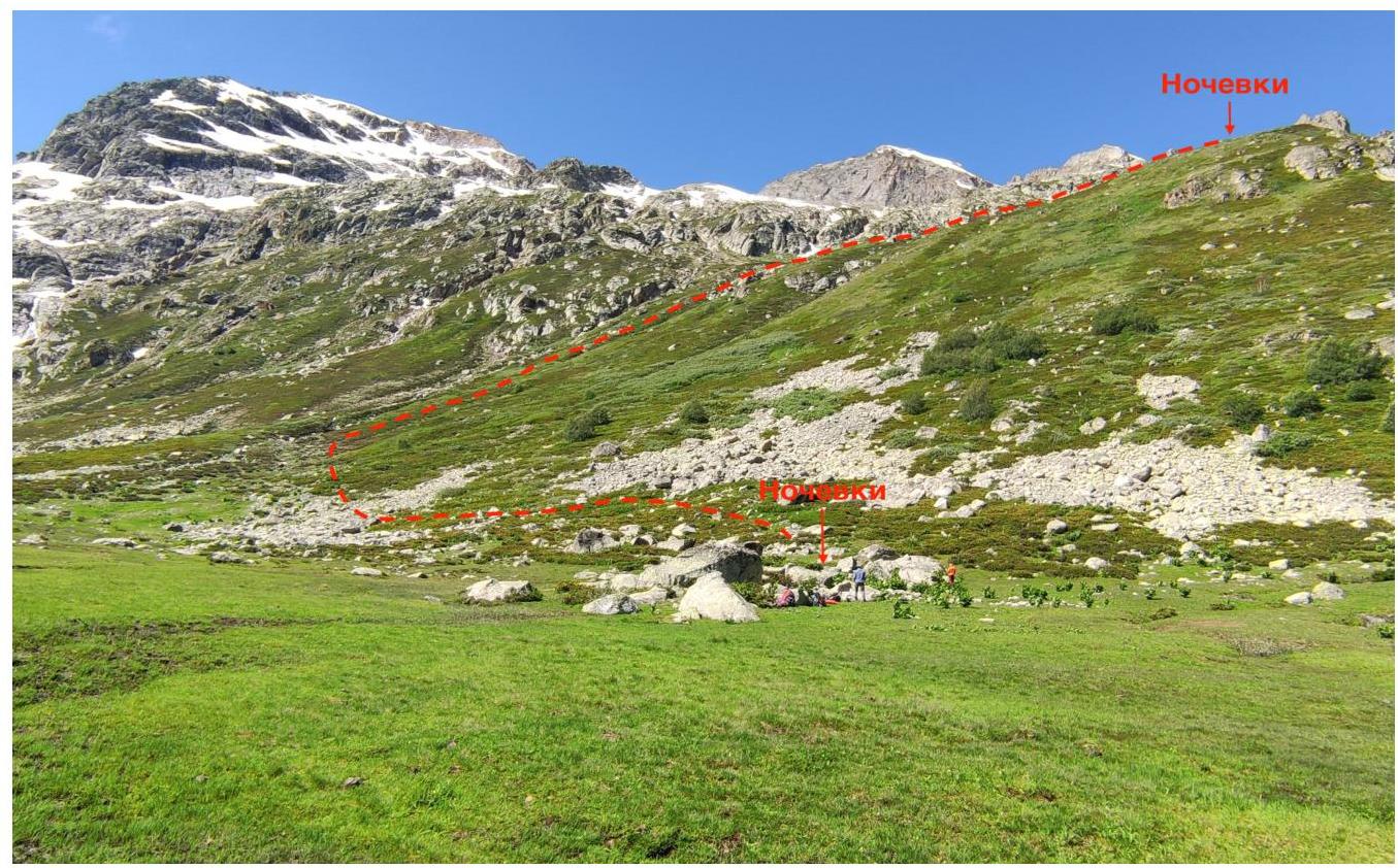
Photograph №4. Campsites. Ascent to the pass.
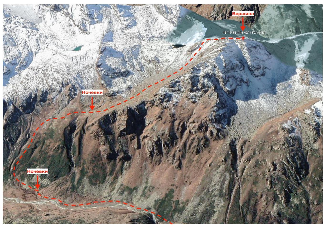
Photograph №5. Campsites and the summit (source https://earth.google.com/↗).
2. Characteristics of the Route
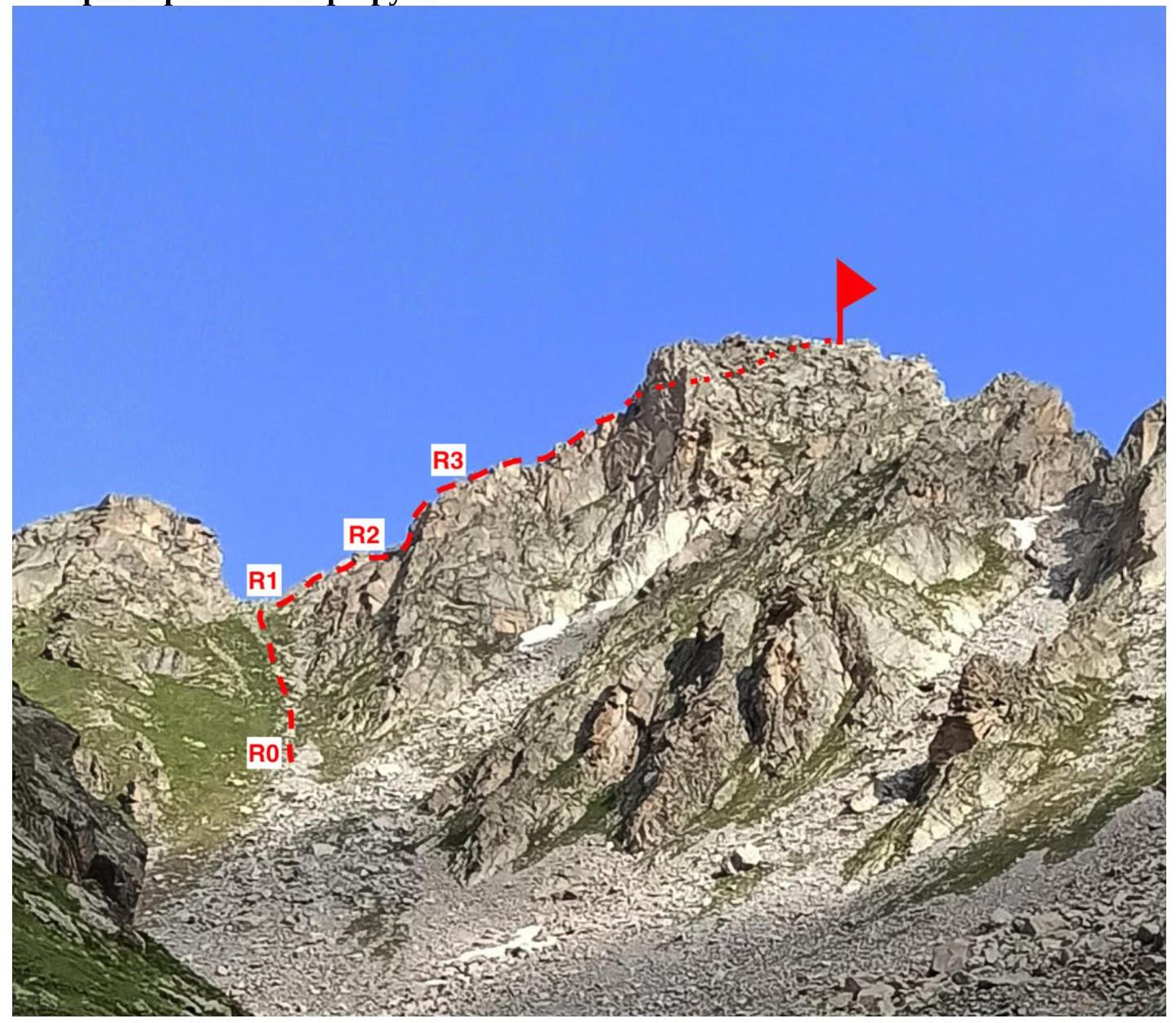
Photograph №6. Technical photograph of the route (taken on July 6, 2021, from a lake at the foot of Chirincol peak).
| № section | Terrain characteristics | Category of difficulty | Length, m | Type and number of anchors |
|---|---|---|---|---|
| R0–R1 | Rocky-grassy slope | 1 | 225 | 0 |
| R1–R2 | Ridge | 1 | 70 | 0 |
| R2–R3 | Inclined wall | 3+ | 50 | 1 anchor hook, 2 chocks |
| R3–R4 | Internal corner | 2 | 150 | 0 |
3. Characteristics of the Team's Actions
| № section | Description | Photograph number |
|---|---|---|
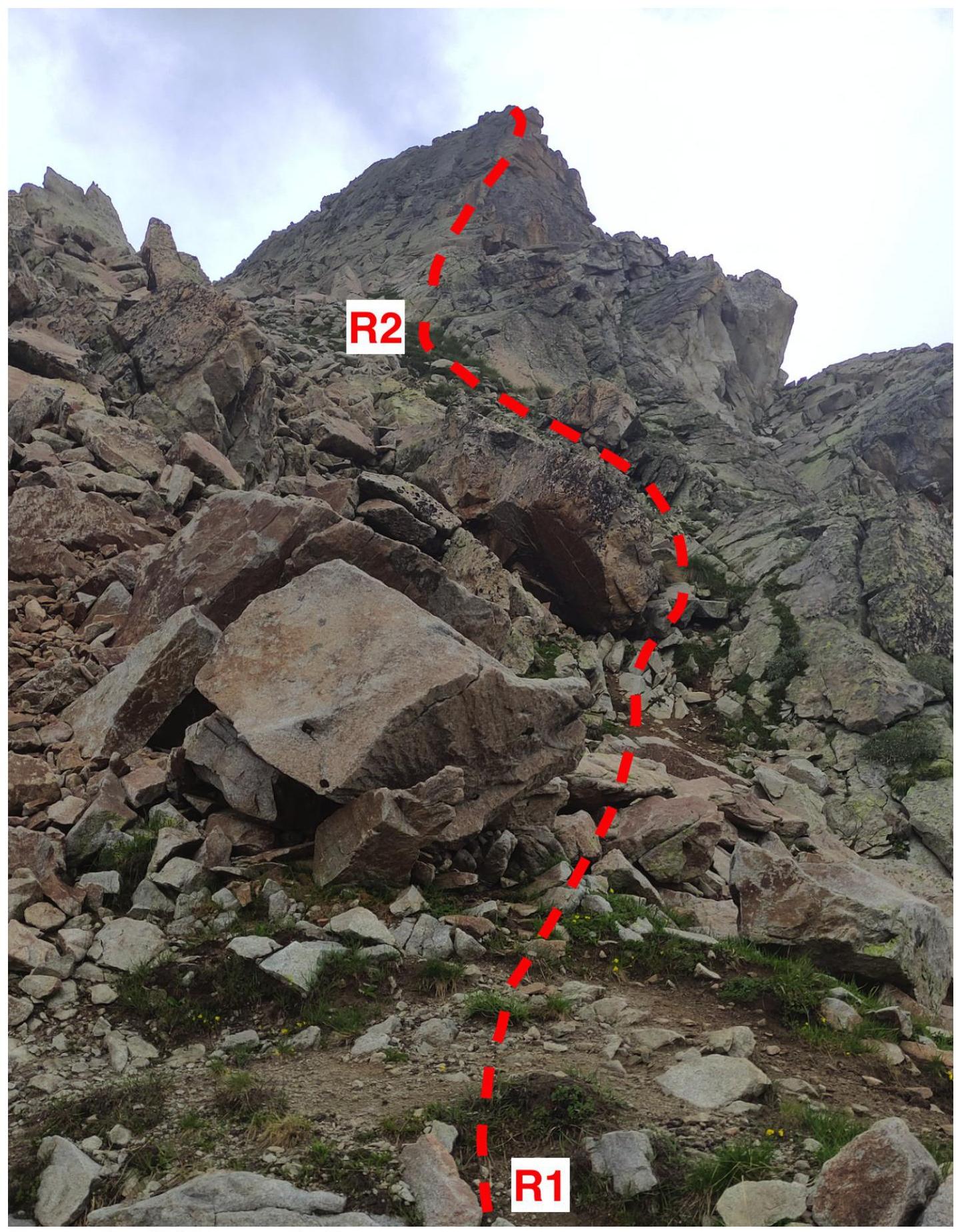
| R0–R1 | Movement from the circus up a steep grassy slope. Approaching the pass from the right side of the tower. Simultaneous movement. 225 m, 55–65°, 1. | Photograph №7 |
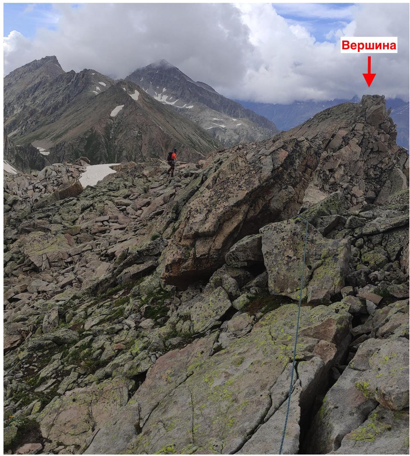
| R1–R2 | Movement along the ridge to the start of the inclined wall. Convenient belay station on a rock. Simultaneous movement. 70 m, 50–65°, 2. | Photograph №8, Photograph №9 |
| R2–R3 | Movement up the inclined wall diagonally. Convenient belay station on a rock. Alternating movement. 50 m, 75–75°, 3+. | Photograph №9, Photograph №10 |
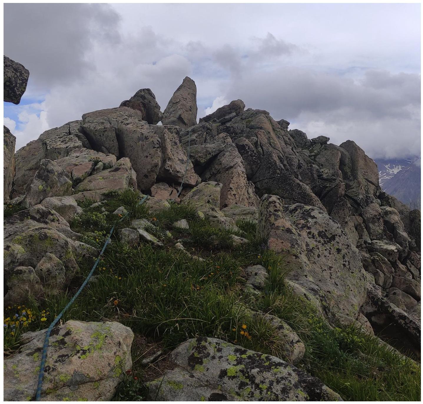
| R3–R4 | Movement along the ridge to the summit. Alternating movement. 150 m, 55–65°, 2. | Photograph №11, Photograph №12 |
The descent was made via the ascent route.
Photograph №7. Section R0–R1.
Photograph №8. Section R1–R2.
Photograph №9. Sections R1–R2 and R2–R3.
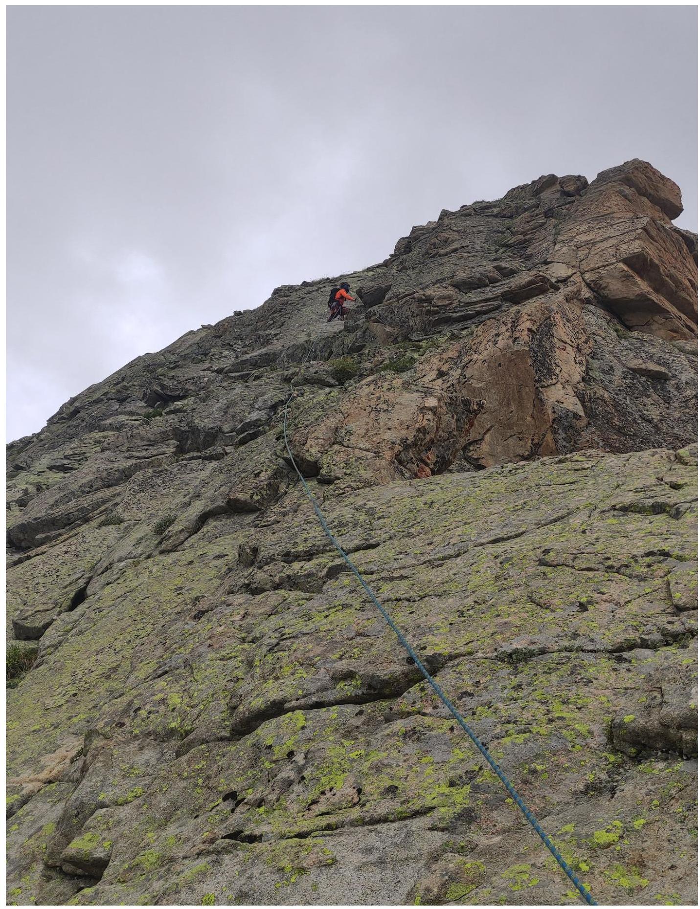
Photograph №10. Section R2–R3. Inclined wall (key section of the route).
Photograph №11. Section R3–R4. First part of the section.
Photograph №12. Section R3–R4. Second part of the section.
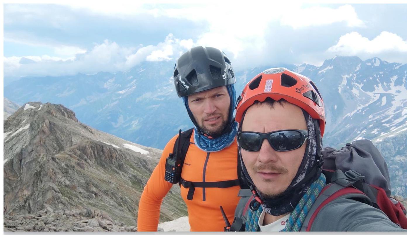
Photograph №13. Team at the summit by the control cairn. Upon completing the ascent, a debrief was conducted, assessing the difficulty of individual sections and the route as a whole. The route taken is considered safe. Considering the experience of previous ascents to the summits:
- Krogzor Myrd — 2A
- Raspopova — 2B
- Raspopova — 2A
- Zaimov Peak — 2B
- Taulan (3226) — 2B
- Orlyonok — 2A
- 3130 — 2A
- 40 years of TASSR — 2A
The route to peak 3259 corresponds to category 2A difficulty.
Recommendations for Climbers
The reverse side of the summit (facing the valley) is heavily eroded and not recommended for ascent. The cairn with a note is located a couple of meters below the summit. When planning three ascents: to peak 3259 from the start of the circus, to peak 3259 from Electric Pass, and to Chirincol peak, it is advisable to set up a storm camp in the circus immediately after the ascent from the valley (Photograph №3, №4). For the route, 4 anchor hooks, half a set of chocks, and several large slings are sufficient. Water can be collected from streams before the start of section R0. Mobile phone coverage is absent throughout the entire route.