
Report
on the ascent route to Shokoladny peak (3650 m) via the "mirrors" of the Southwest wall (6A cat. difficulty), made by the team of .......... alpinism federation
Leader: ANDREEV A.B., CMS. Coach: DMIITRIENKO E. 2020
Ascent Passport
- Russia, Caucasus.
- Rock class.
- Western Caucasus, Gvandra district.
- Peak: Shokoladny peak (3650 m), via the "mirrors" of the Southwest wall, rock, 6A cat. difficulty.
- Route characteristics: height difference – 460 m; route length – 700 m; average steepness – 76°; average steepness of the wall bastion – 84°; length of sections with 5 cat. difficulty – 135 m; 6 cat. difficulty – 247 m.
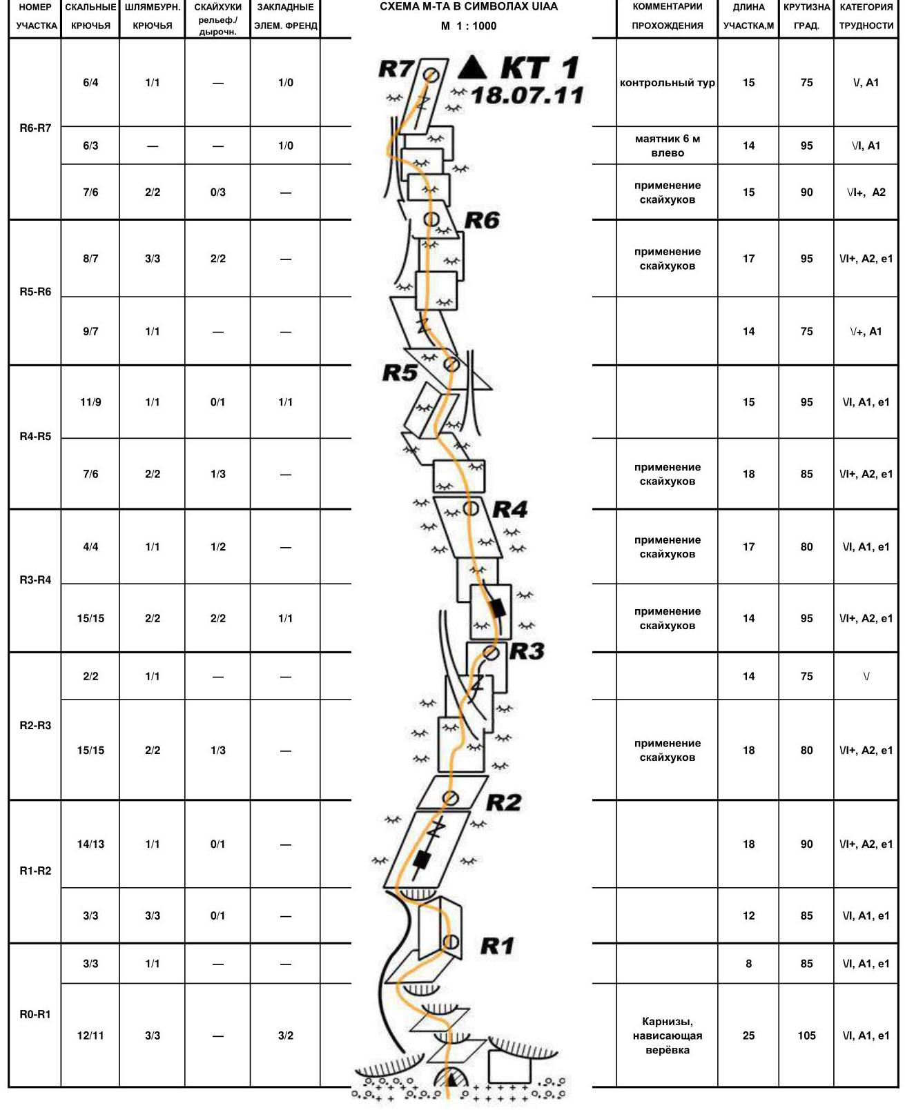
- Pitons driven (including in the denominator for ITO): rock ice bolt pitons wired cams skyhooks 150/75 0/0 0/0 20/10 6
- Climbing hours 17, days – 2 (1 day for reconnaissance, on the approach day);
- Leader: Andreev Arkadiy Borisovich – CMS;
participants:
- Korzhakov Nikolay Yuryevich – CMS;
- Lonchinskiy Aleksey Sergeyevich – MS.
- Team coach: Dmitrienko E., MS
- Departure from "Uzunkol" tourist center on August 17, 2020, reconnaissance on 3.5 ropes; ascent on August 18, 2020.
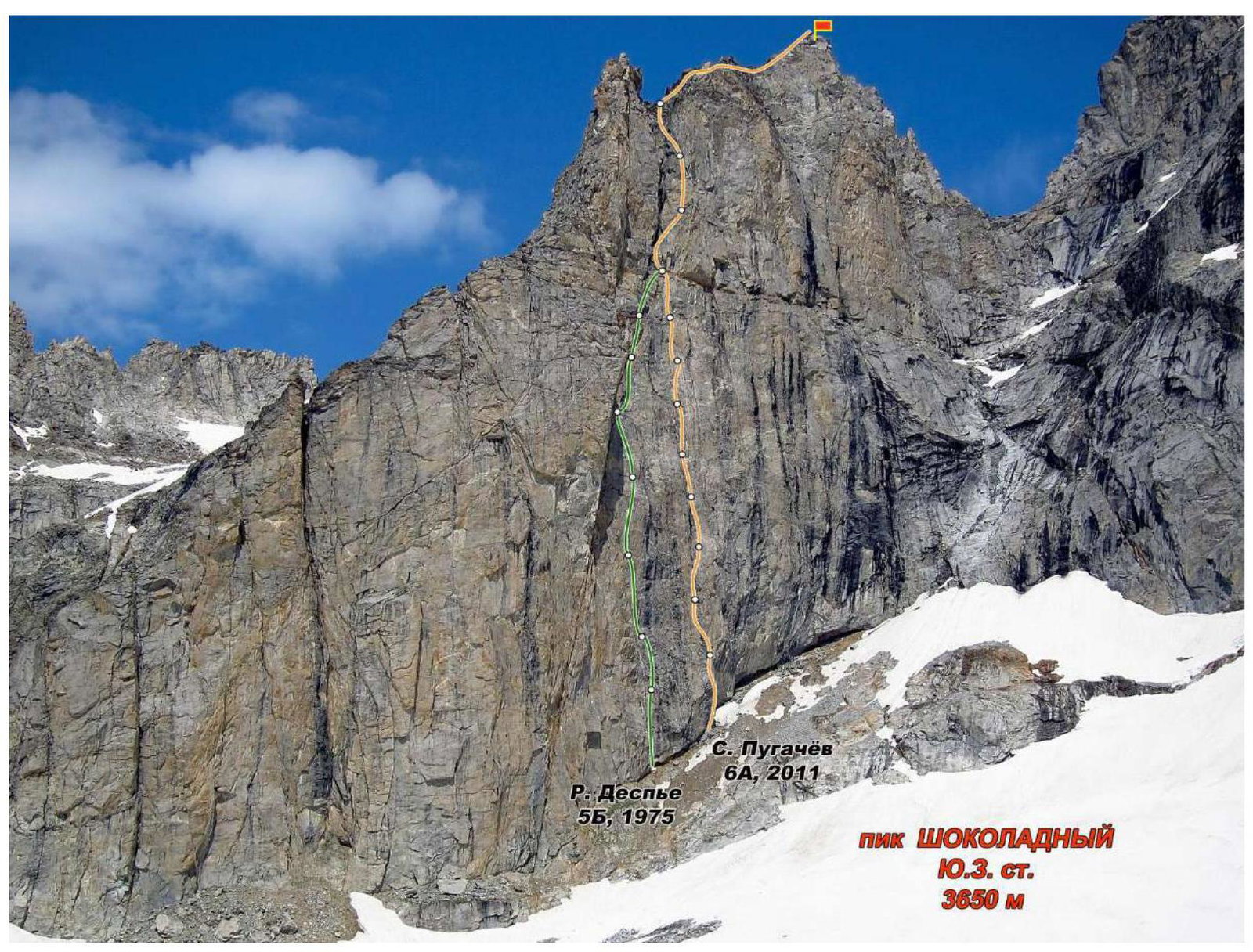
Photo 1. General photo of Shokoladny peak (3650 m), Southwest wall

Photo 2. Technical photo of the route to Shokoladny peak (3650 m) via the "mirrors" of the Southwest wall, taken by the first ascenders led by Pugachev S.
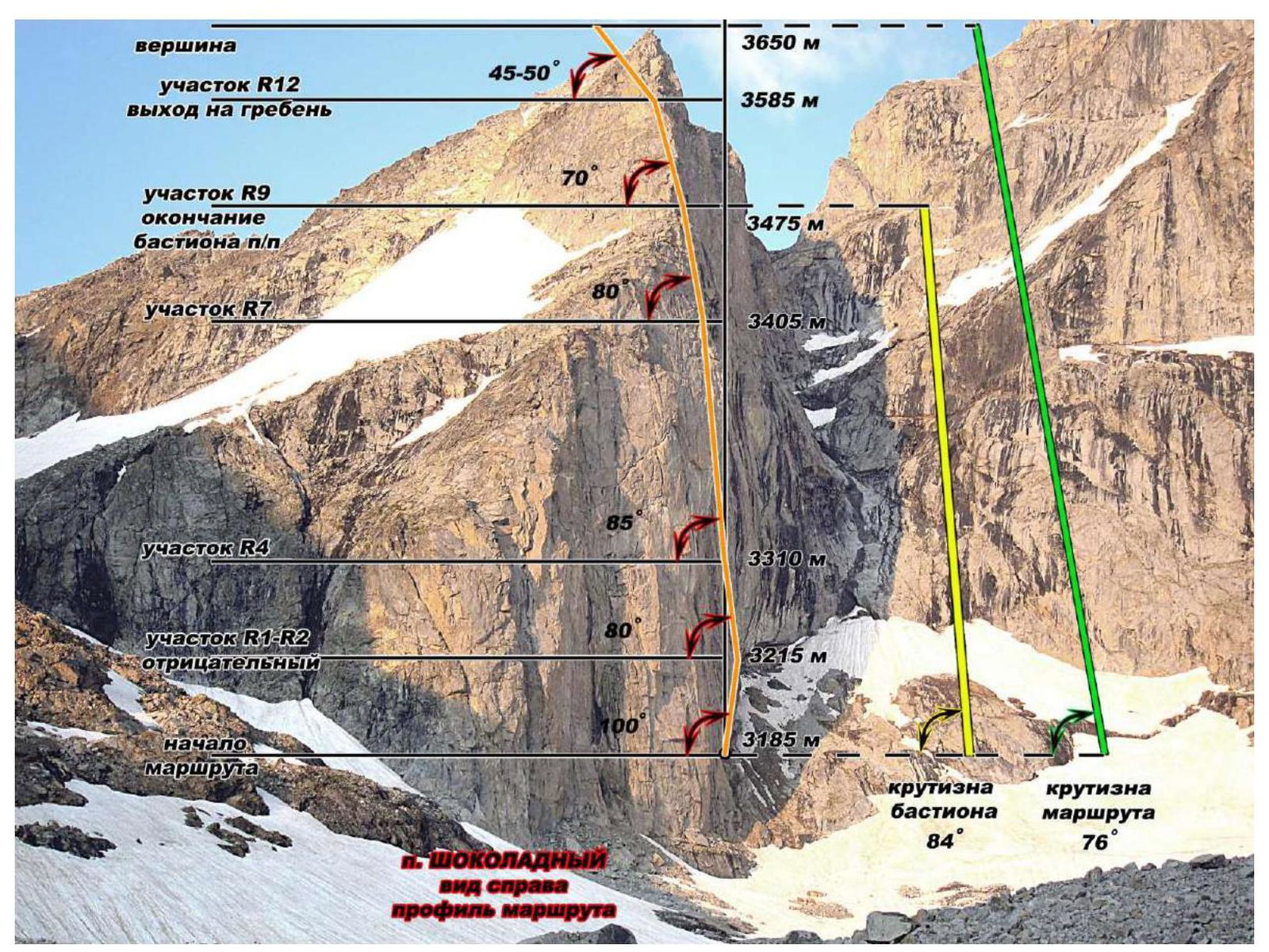
Photo 3. Route profile, Shokoladny peak (3650 m) via the "mirrors" of the Southwest wall by S. Pugachev
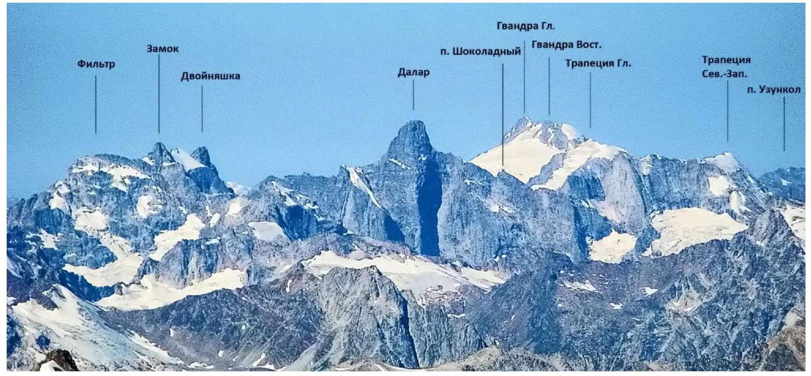
Photo 4. Photopanorama of the ascent area
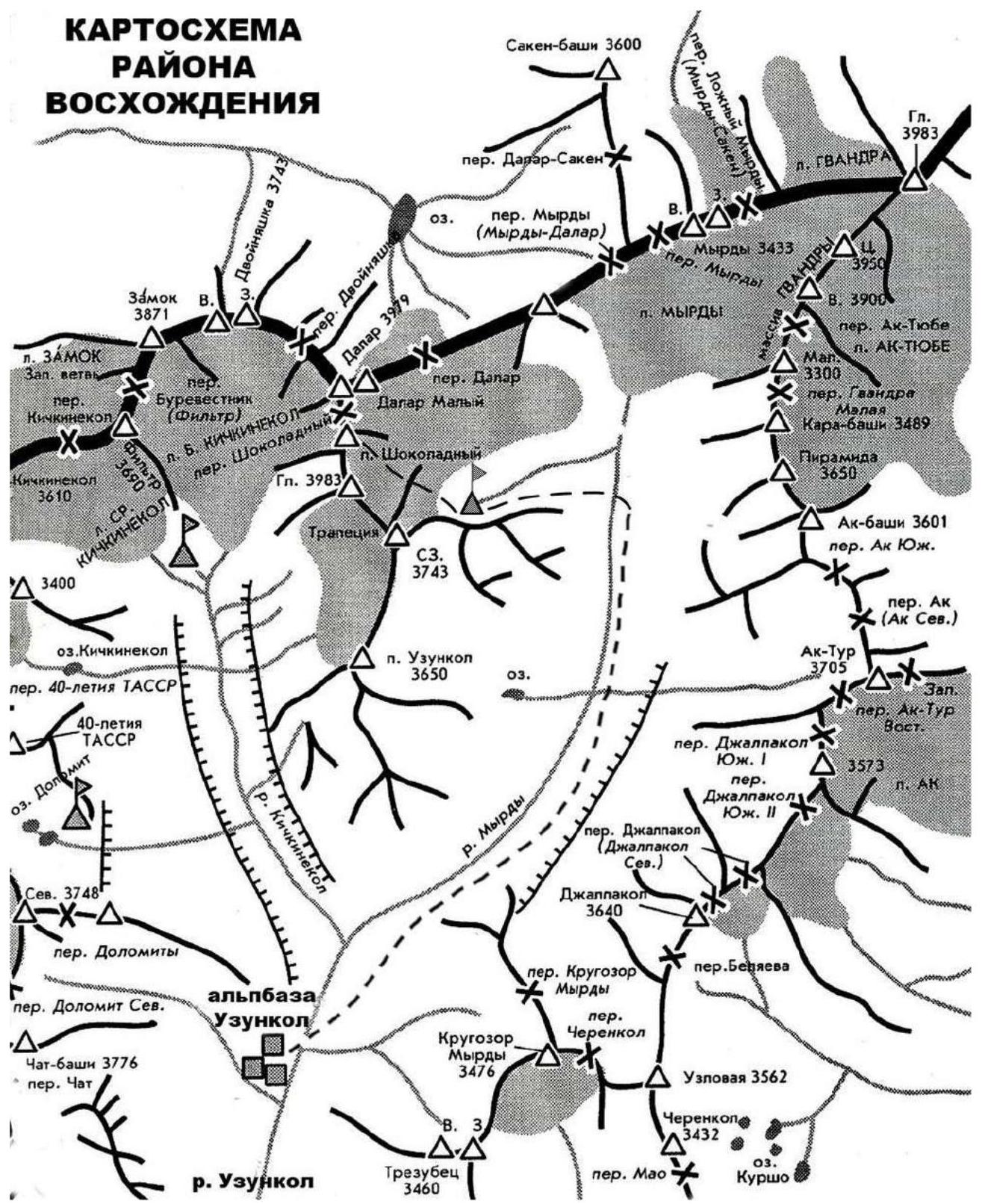
Ascent area map
Route diagram in UIAA symbols
Shokoladny peak, 3650 m, via the "mirrors" of the SW wall, first ascent, 6A cat. difficulty (proposed)
Safety equipment usage table
Part 1
 Start of the route – a large niche under the wall with a standing stone. 50 minutes from the initial bivouac on the Zapadny Dalar glacier. Start 60 m to the right of the Despье route (1975).
Part 2
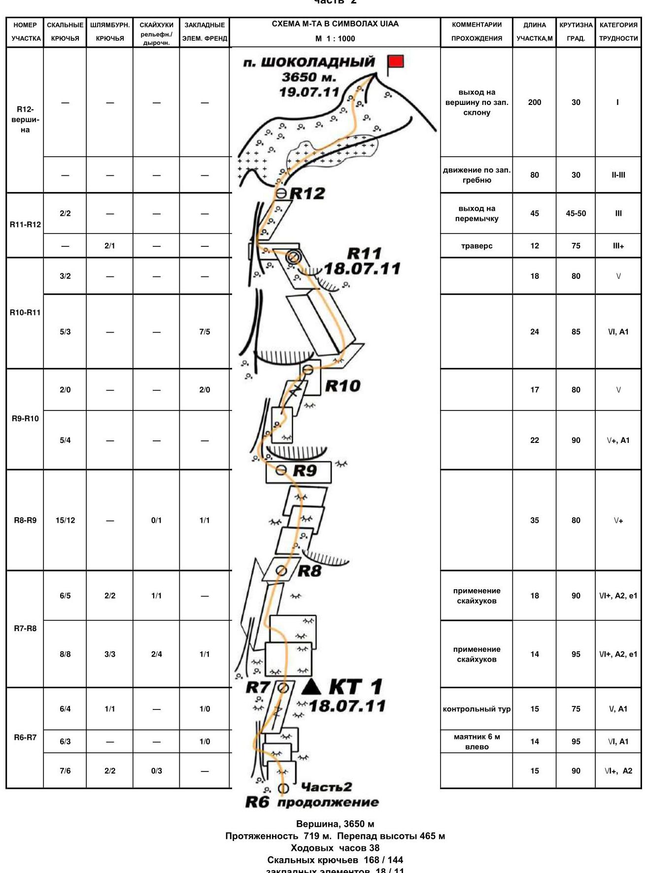 Summit, 3650 m. Length 719 m. Height difference 465 m. Climbing hours 38. Rock pitons 168/144, wired cams 18/11, total bolt pitons 31/30, including 8 at belay stations.
Route description by sections
Route description. The ascent of the SW wall of Shokoladny peak is characterized by complex rock work throughout this 500-meter wall. The route is characterized by great steepness, presence of extended slab sections and "mirrors". The route includes drainage gutters and couloirs that significantly complicate belaying and force a change in direction. Visible cracks from below turn out to be shallow and do not allow for reliable belaying or movement. The ascent involves significant use of ITO and is associated with high psychological tension.
Approach to the route. From the bivouac on the "Dalar Zapadny" moraine, ascend the glacier snow to the base of Shokoladny peak. Then follow the talus and moraines to the start of the wall. The starting point is marked by a large niche with a vertical stone, 60 m to the right of the large internal angle – the start of the Despье route (5B), 50 minutes from the initial bivouac.
R0–R1 The start involves a series of vertical cornices and inclined slabs. Exit into a subtle internal angle.
R1–R2 The angle is blocked by a cornice. Bypass it to the left, crossing the edge. Then follow a diagonal crack to the right and "mirrors" on ITO.
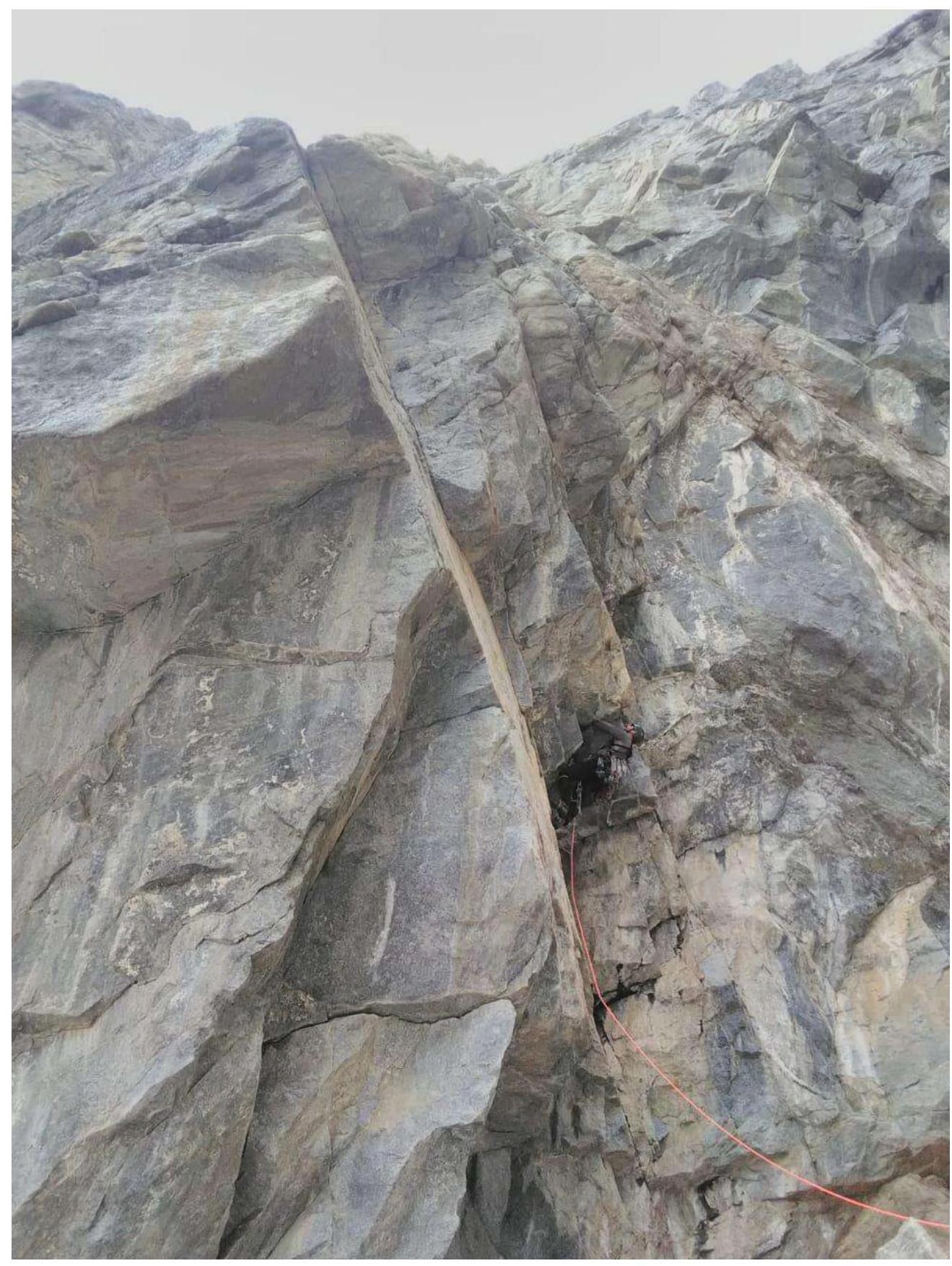
R2–R3 Ascend a vertical slab transitioning into a system of vertical cracks along black chimneys to the right. Cross the chimney and continue up it. Belay station on a large block.
R3–R4–R5 Ascend vertical slabs, then cross a subtle drainage couloir to the left. Follow a нависающей crack to the left wall of an internal angle, нависающего at the top.
R5–R6 Move from the belay station bolts left-up into climbing. Exit left onto a sloping ledge. Move left under a vertical wall. Preferably, belay ropes should be straightened. Climb on ITO up slabs transitioning into an internal angle on the left.
R6–R7 Make a pendulum swing to the left and follow a ledge to the base of a vertical internal gutter. Climb the gutter to the right and inclined slabs to the belay station. Control tour.
R7–R8 Ascend in the direction of a нависающего internal angle. Continue up the internal angle, starting on ITO (anchors), several live slabs (bypass via bolt pitons – 2 pcs.), the upper нависание is passed left-up.
This section is dangerous due to live blocks!
R8–R9 A series of small alternating slabs and minor cornices veering to the right. Exit onto a narrow ledge, unsuitable for a bivouac tent but suitable for a sitting bivouac.
R9–R10 Climb wet rocks mainly via free climbing on the right side of a crack-chimney (water flows at the bottom). Many "live" stones in the chimneys; the last chimney should be climbed directly up the center (possible bypass to the right via a monolithic нависающей crack). Then move right onto inclined "mirrors" of medium difficulty.
R10–R11
- The first climber moves around the angle.
- Then follow the internal angle transitioning into a нависание.
- Bypass a cornice to the left.
- Climb a gutter and inclined slabs to the bivouac.
On sections R9–R11, visual and vocal communication is difficult. From R11, traverse left into an talus-filled couloir. Ascend the couloir to a saddle on the pre-summit ridge.
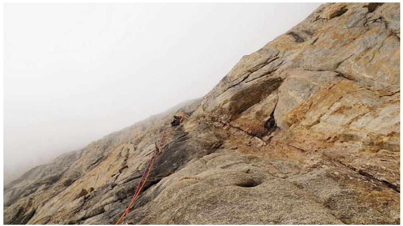
R12 is suitable for a tent bivouac. Then ascend a 200-meter snow slope and simple rocks on the ridge, large block rocks, slab-like rocks, and talus slopes via free climbing to the summit. Simultaneous movement, 1–2 cat. difficulty.
Descent from the summit follows simple rocks and snow-talus slopes towards the Malaya Trapezia, then down the slopes of the peak. Exit from rocks onto a snow slope involves a 50-meter rappel. Then descend the snow slope and talus slopes to the initial bivouac on the Zapadny Dalar glacier moraine (50 minutes from the wall).
Recommendations for climbers
The route is recommended for well-prepared teams with experience in several ascents of 6th category difficulty. The team should have a full set of mountaineering equipment, including skyhooks.
The lack of good bivouac sites throughout the bastion (before R9) requires reconnaissance or the use of hammocks. Preliminary reconnaissance up to R3 is preferred, followed by an ascent without an intermediate bivouac to R8–R9.
Further bivouac sites are limited; a tent site is possible only on R11 (or separate sitting bivouacs).
On section R1 during reconnaissance, it is better to leave intermediate points for subsequent work due to the нависание of the section. On sections R2–R3, R7–R8, R9–R10, R10–R11, it is recommended to straighten belay ropes for subsequent movement.
On most sections, it is necessary to return and remove equipment due to a lack of uniform belay points. The presence of intermediate bolt pitons at belay stations allows this.
There is no water throughout the route. Approximately 2 liters per person per day are required.
The absence of snow on the "roof" and the steepness and smoothness of the wall reduce the likelihood of falling stones.
Bivouacking after reaching the ridge during a thunderstorm is not recommended.
Team's tactical actions
Following recommendations from Dmitrienko E., the team departed from the "Uzunkol" tourist center on August 17, 2020, and began route reconnaissance at 13:00. They fixed 3.5 ropes.
The next day, August 18, they started the ascent at 5:00. They reached the summit at 18:00. Descent followed simple rocks without rappels.
Technical sections of the ascent
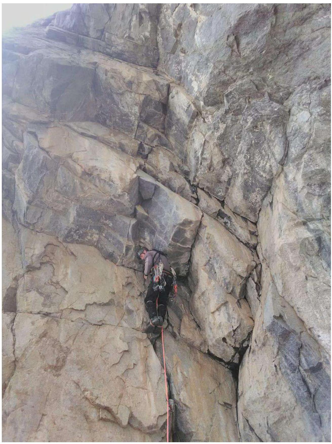
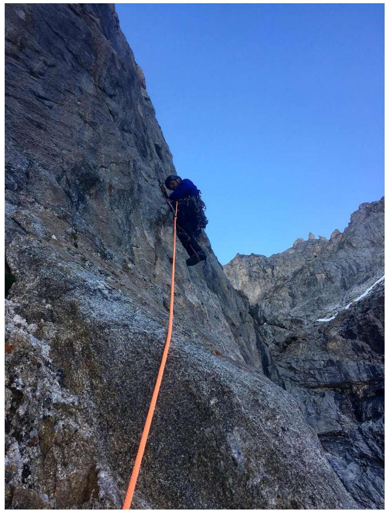
Korzhakov N. Section R0–R1 (first cornice)
Climbing on R0–R1 (Korzhakov N. second cornice)
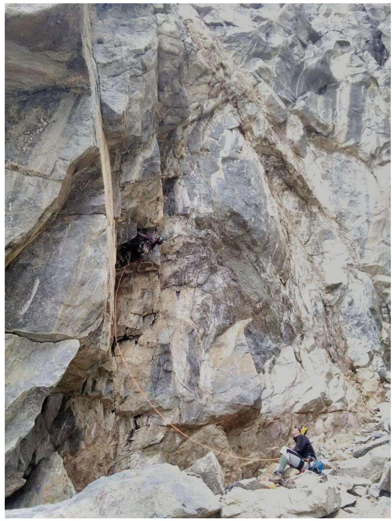
Climbing on R0–R1 (Korzhakov N., Andreev A.)
Climbing on R0–R1 (Andreev A. third cornice)
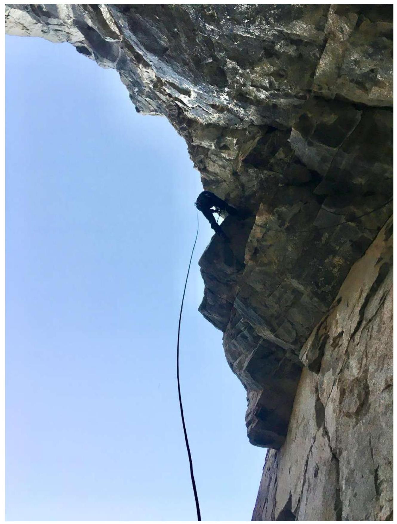
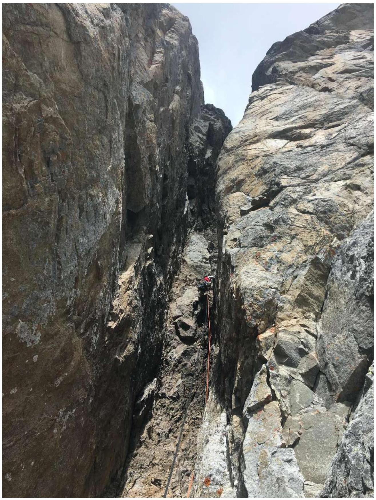
R3 (Lonchinskiy A.)
R3
R3–R4 Korzhakov N.
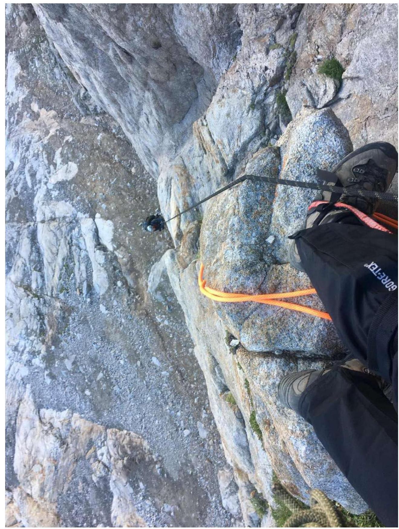
Exit to the ridge (Lonchinskiy A.)
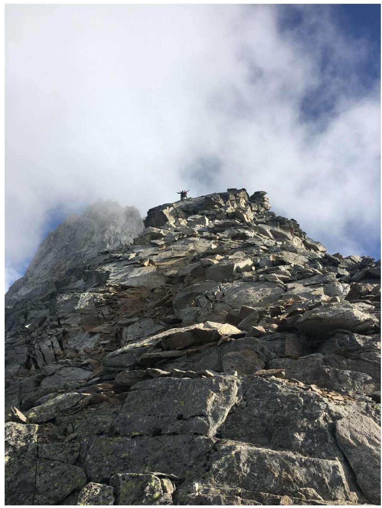
Photo on the summit (Korzhakov N. and Lonchinskiy A.)
Comments
Sign in to leave a comment