St. Petersburg Alpine Climbing Championship, Technical Class
2018
Description of the Ascent to Mt. B. Nakhar (3784 m) via the Right Part of the SE Wall (First Ascent)
Proposed category of difficulty: 5A
The route was completed by a team from St. Petersburg
Team captain: Viskov Igor Vladimirovich. Team coach: Timoshenko Tatiana Ivanovna.
I. Ascent Passport
1. General Information
| 1.1 | Full name, sports rank of the team leader | Viskov Igor Vladimirovich, Master of Sports |
|---|---|---|
| 1.2 | Full names, sports ranks of the team members | Agamova Elena Alexandrovna, 2nd sports rank; Kananykhin Igor Vladimirovich, 1st sports rank; Kerov Andrey Sergeevich, 1st sports rank |
| 1.3 | Full name of the coach | Timoshenko Tatiana Ivanovna, Master of Sports |
| 1.4 | Organization | St. Petersburg Alpine Federation |
2. Characteristics of the Ascent Object
| 2.1 | Region | Western Caucasus, Starokarachaevsky district |
|---|---|---|
| 2.2 | Valley | Uchkulan valley, between the rivers Makhar and Gondaray |
| 2.3 | Section number according to the classification table | 2.3. |
| 2.4 | Name and height of the peak | Nakhar (B), 3784 m |
| 2.5 | Geographical coordinates of the peak (latitude/longitude), GPS coordinates | — |
3. Route Characteristics
| 3.1 | Route name | Right part of the SE wall |
|---|---|---|
| 3.2 | Proposed category of difficulty | 5A |
| 3.3 | Degree of route exploration | The route is unexplored; there are no signs of previous groups up to the ridge leading to the summit |
| 3.4 | Relief characteristics of the route | Rock climbing |
| 3.5 | Elevation gain of the route (altimeter or GPS data) | 640 m |
| 3.6 | Route length (in meters) | 800 m |
| 3.7 | Technical elements of the route (total length of sections with different categories of difficulty and relief type) | III category, rock — 300 m; IV category, rock — 100 m; V category, rock — 370 m; VI category, rock — 30 m. |
| 3.8 | Average steepness of the route (°) | approximately 70° |
| 3.9 | Average steepness of the main part of the route (°) | approximately 85° |
| 3.10 | Descent from the summit | Along the destroyed Western ridge, followed by 6 rappels to the southern side, descent into the Makhar valley. |
| 3.11 | Additional route characteristics | Lack of water on the route, highly unreliable terrain on sections R4–R6 and on the northern side of the ridge. |
4. Team Tactics
| 4.1 | Time taken (team's total climbing hours, in hours and days) | 12 hours, 2 days |
|---|---|---|
| 4.2 | Route preparation time | No preparation |
| 4.3 | Departure for the ascent with overnight stay in the cirque | 05:00 on August 7, 2018 |
| 4.4 | Start of the route | 06:00 on August 7, 2018 |
| 4.5 | Reaching the summit | 07:00 on August 8, 2018 |
| 4.6 | Completion of the descent | 13:00 on August 8, 2018 |
5. Technical Actions of the Team
| 5.1 | Pitons left on the route | None |
|---|---|---|
| 5.2 | Pitons used on the route: | |
| — stationary drill pitons | Not used | |
| — removable drill pitons | Not used | |
| — for artificial climbing techniques (ACT) | Not used | |
| 5.3 | Protection points used: | |
| — rock pitons | About 20 | |
| — anchor placements | About 20 | |
| — ice axes as protection (camalots) | About 30 |
6. Weather Conditions
| 6.1 | Temperature (°C) | 10–20°C |
|---|---|---|
| 6.2 | Wind speed (m/s) | — |
| 6.3 | Precipitation | Thunderstorm on August 7, 2018, from 16:00 |
| 6.4 | Visibility (m) | Excellent |
7. Report Author
| 7.1 | Full name, e-mail | Kananykhin I.V., i.v.kananykhin@gmail.com |
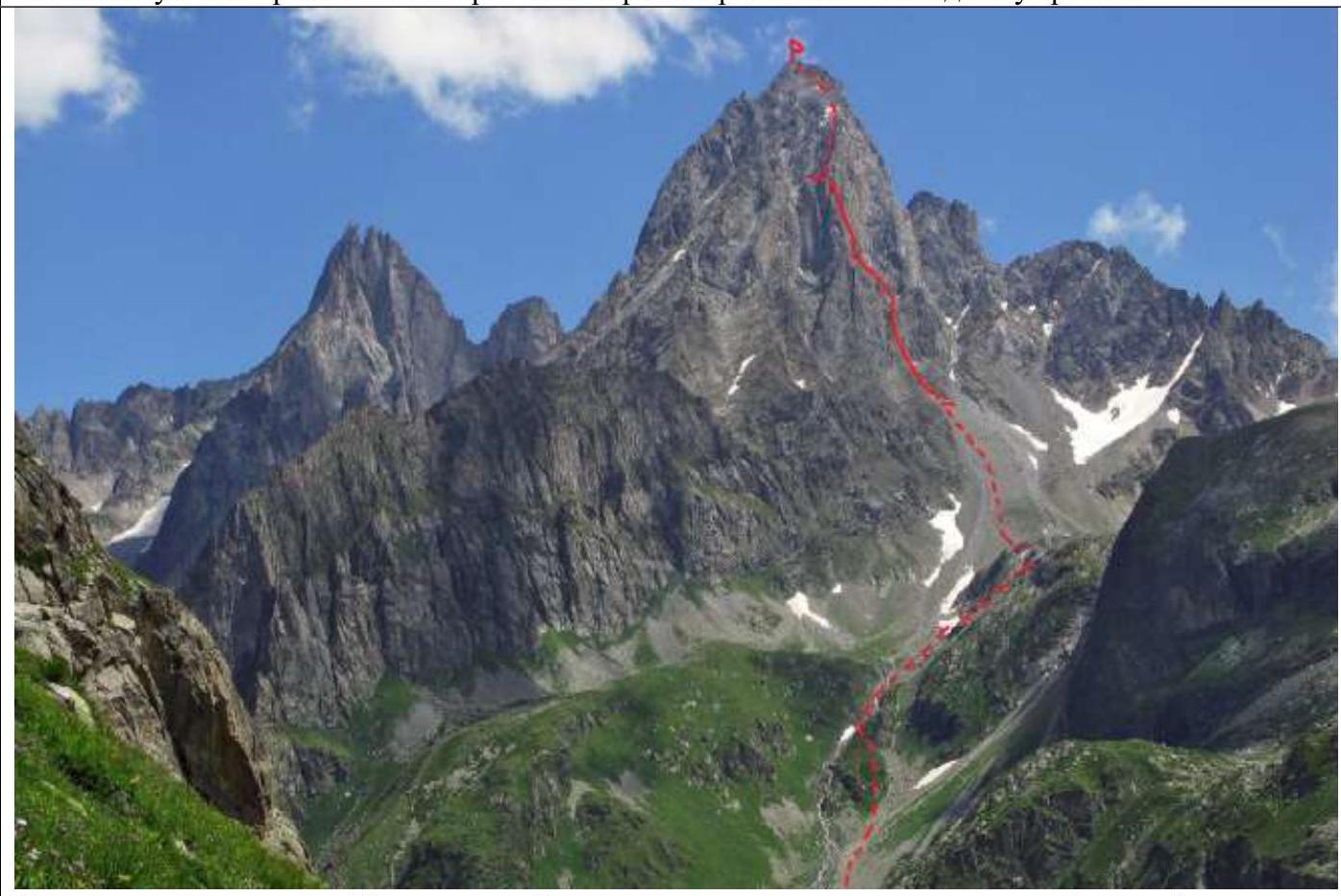
II. General Summit Photograph
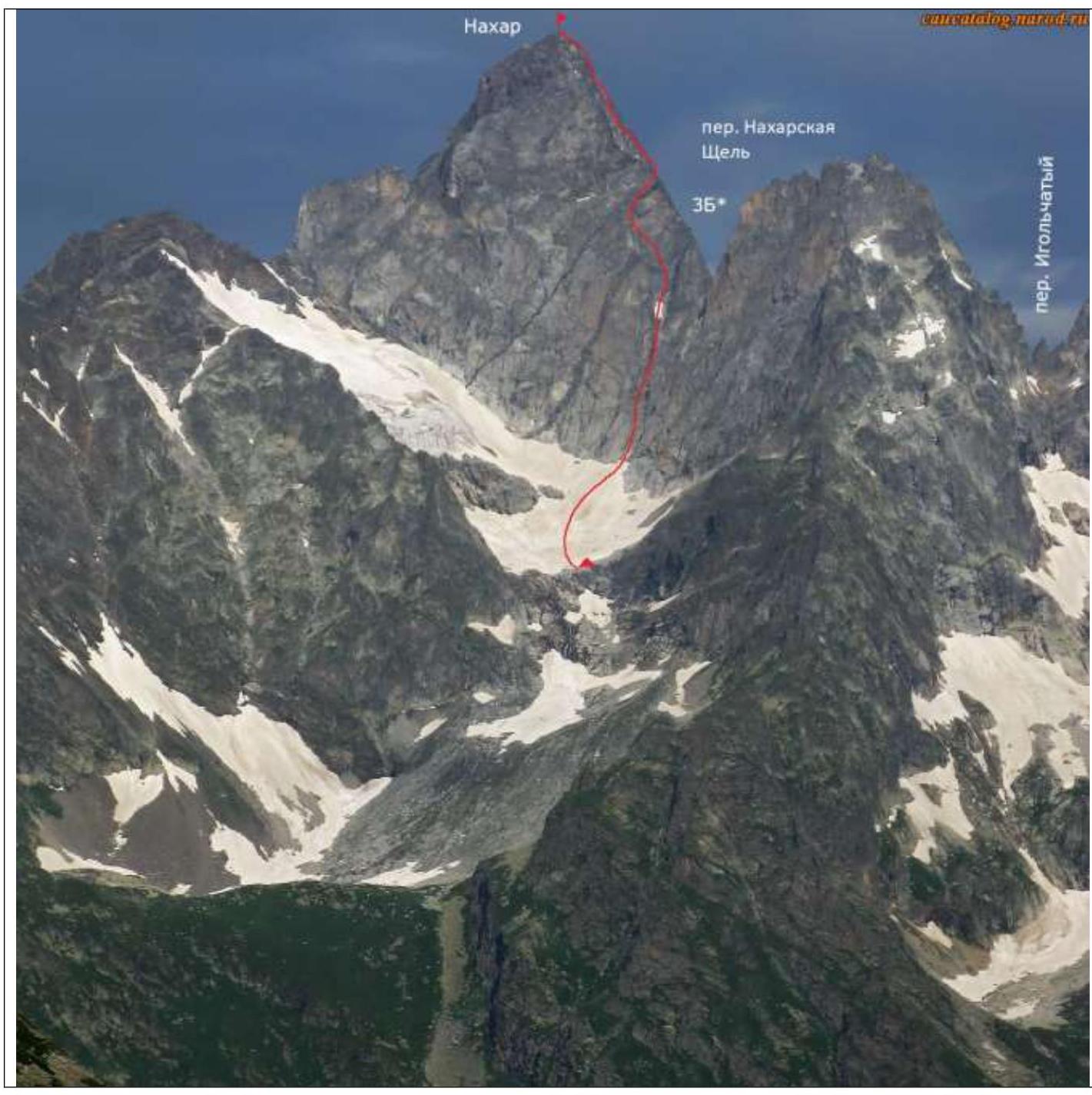
The route taken by the group is marked with a red line.
III. Brief Description of the Ascent Area
1. Panorama of the Area
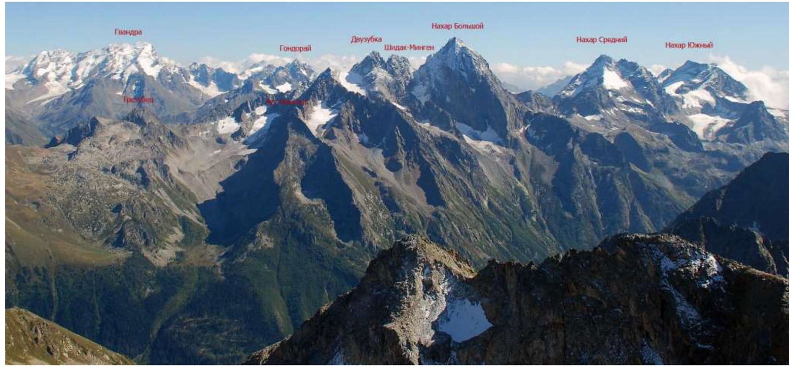
The photograph is taken from the site http://vgora.ru/nachar3.htm↗
2. Area Map
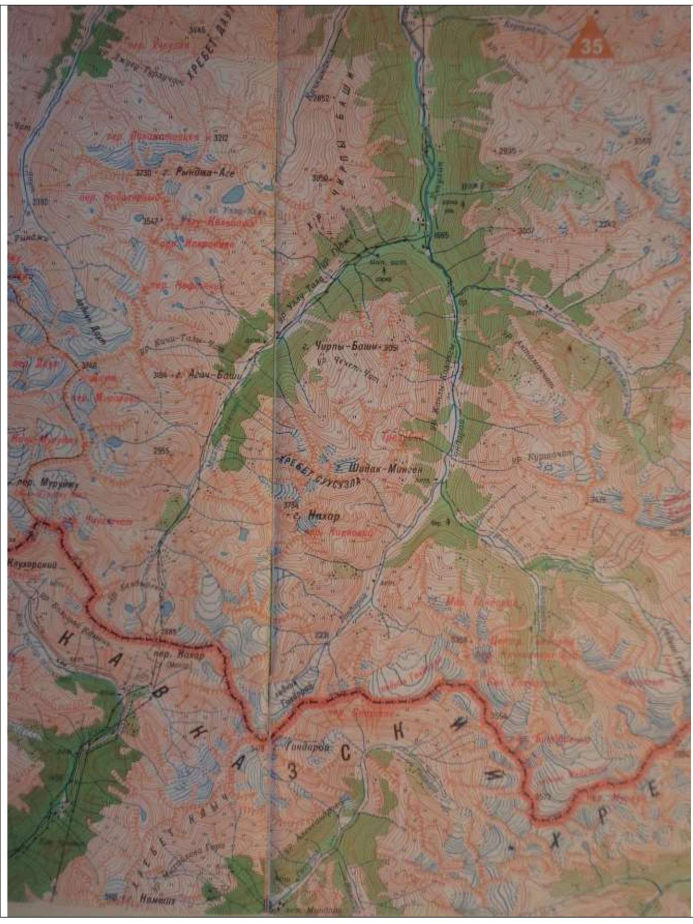
Fragment of a 1:100,000 topographic map.
3. Ascent Object
The peak B. Nakhar is located in a small ridge branching off the Main Caucasian Ridge to the north-northeast, between the passes Nakharskaya Shchel (3B?) and Kievsky (2A). This rocky ridge separates the hydrographic system of the river Gondaray from the system of the river Nakhar (Makhar-Su) and is crucial for maintaining the water balance of these rivers, as small glaciers at the base of the ridge feed these rivers.
4. Approach Route
The nearest settlement to the object is the village of Uchkulan. From Uchkulan, there is a dirt road leading to the border checkpoint (BCP), located on the right bank of the river Nakhar, about 5 km from the confluence of the rivers Gondaray and Nakhar. Several tourist bases are located near the confluence.
From the BCP, a vehicle can proceed further towards the Nakhar campsite: one needs to drive past a log pedestrian bridge, directly along the river, and then upstream along the Nakhar river until a stream flowing from the aforementioned cirque is reached. Then, follow the stream up to the campsite located on the left lateral moraine of the Nakhar glacier.
The campsite is situated in the upper part of the moraine, where it widens. A memorial stone with plaques commemorating climbers who perished in winter 2006 is located there. The site is convenient but prone to avalanches in winter.
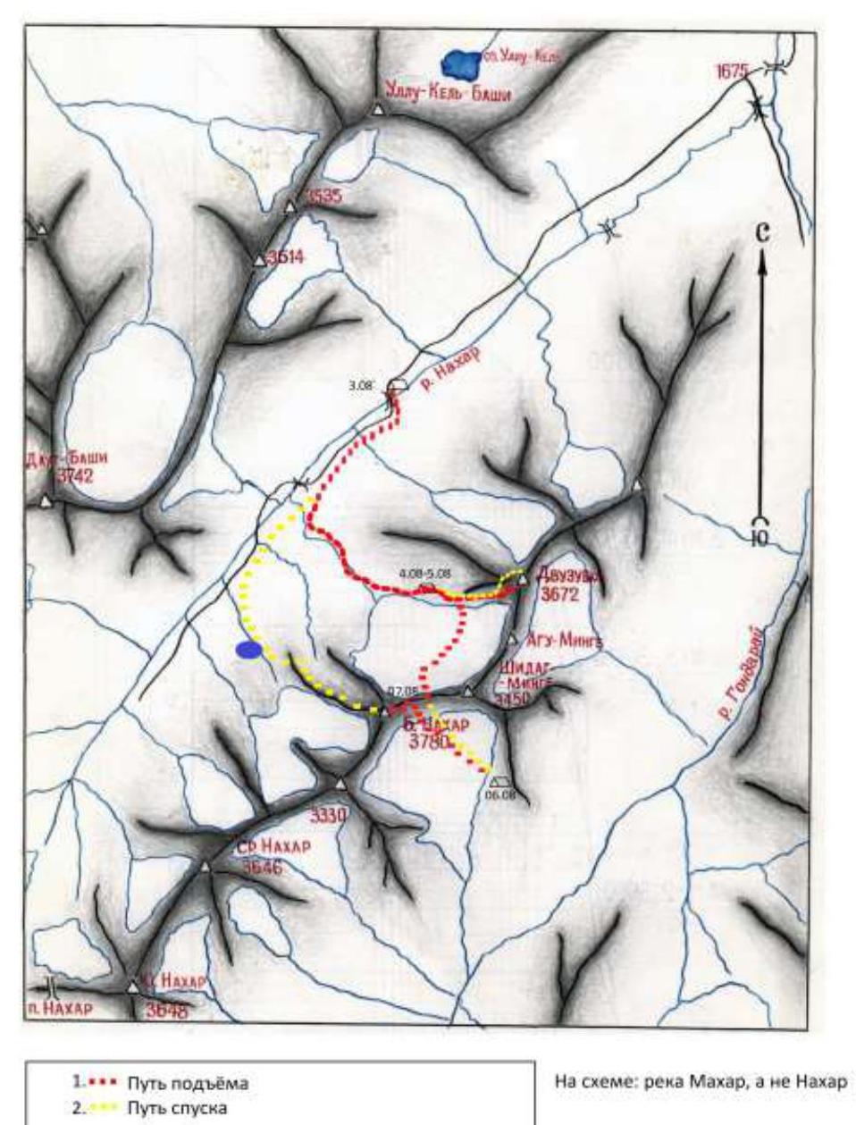

Our path to the bivouac under Dvuzubka.
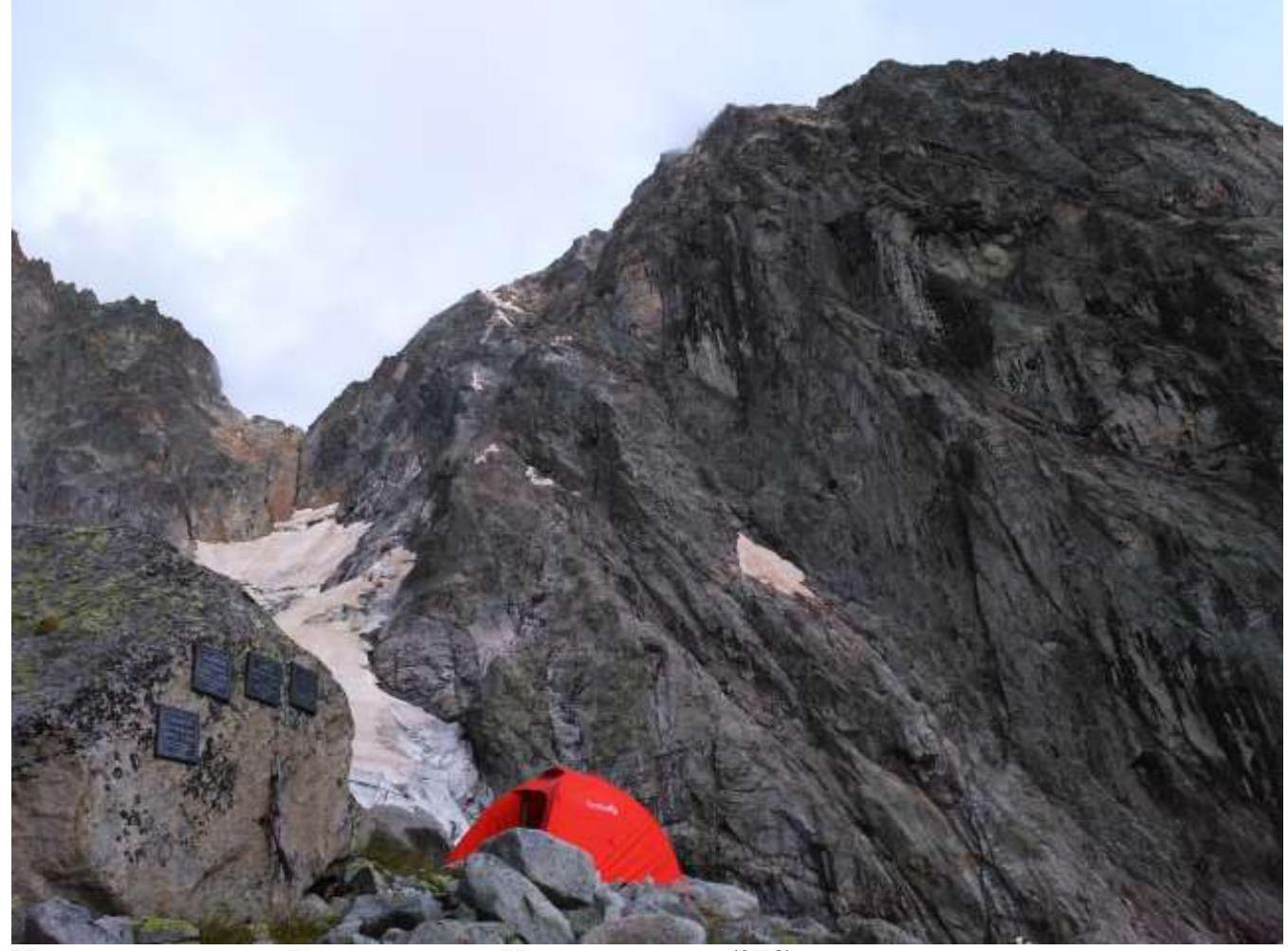
Nakhar campsite. View of the Nakharskaya Shchel pass (3B?). From the campsite, through the Nakharskaya Shchel pass, one needs to descend into the southern cirque of B. Nakhar. A convenient bivouac site is located on the upper tier of the cirque, on the moraine at the foot of the glacier. Our group has equipped two good spots for tents there. Water is nearby.

Path through the pass.
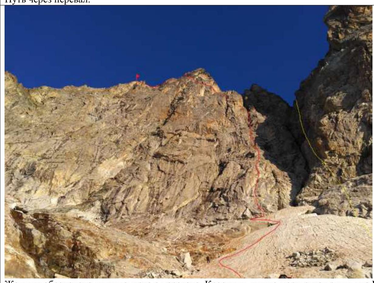
The yellow line marks the descent from the pass. The red line indicates the group's route on B. Nakhar.
There might be a simpler path into the southern cirque of B. Nakhar from the Gondoray valley. We did not consider this option as it contradicted our mission objectives. It is worth noting that when viewed from above, no obvious path was visible; instead, smooth, glacier-polished "ram's foreheads" were seen.
5. Relief Features
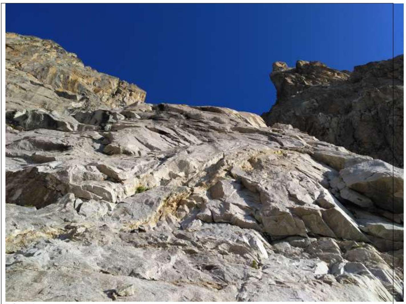
The southern wall of B. Nakhar is composed of granites and is generally monolithic, but isolated cracks and chips do exist, posing a risk of rockfall due to external factors.
The rock formations are diverse and require the application of all free climbing techniques. Despite the significant steepness, the entire route can be climbed using free climbing techniques (even overhanging sections), provided one has excellent rock climbing skills.
6. Climatic Conditions
The weather in the Dvuzubka-Nakhar area is similar to the conditions in the Uzunkol area. A distinctive feature of the climatic conditions for ascending B. Nakhar via the SE wall is the heat and complete lack of water on the route during good weather. By the second half of July, there are no signs of moisture on the wall.
It can be assumed that in May and June, small accumulations of snow may still be found on the northern part of the summit ridge.
In the autumn-winter period, snow and ice can be found on the ledges of the route.
7. Communication
Cellular communication is absent in the area. We used satellite communication.
IV. Route Description
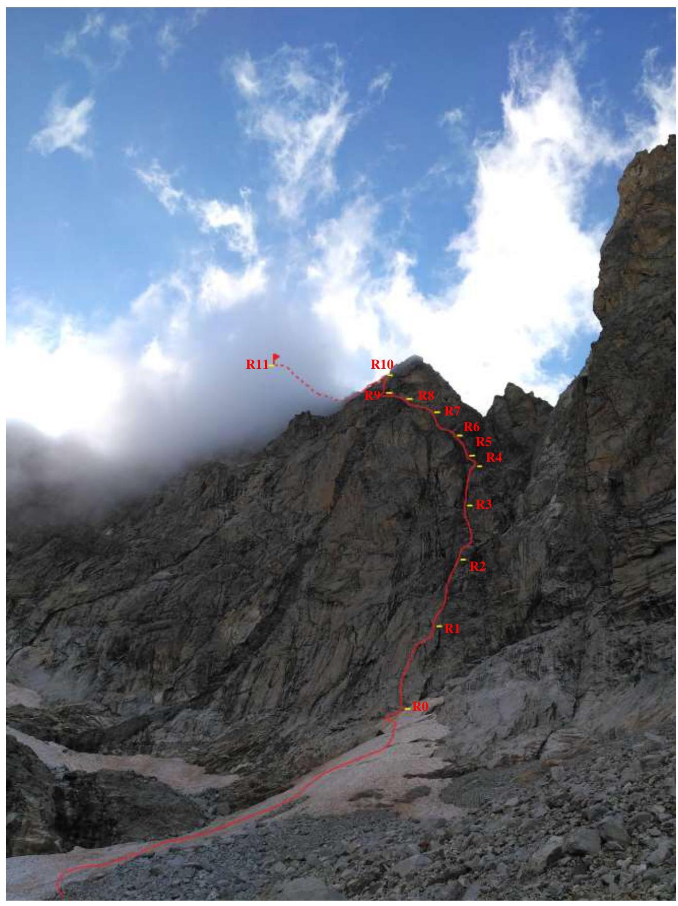
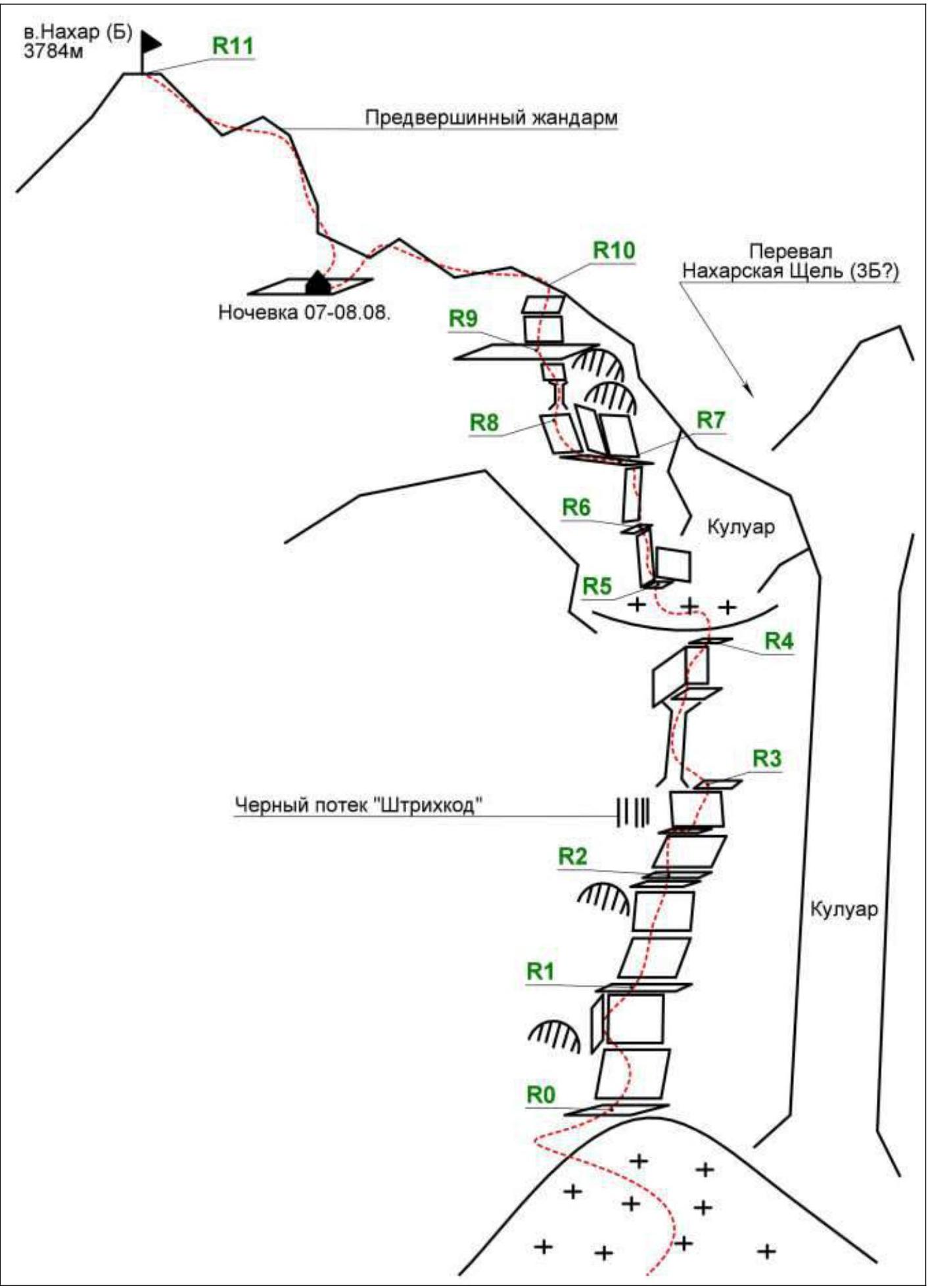
1. Technical Photograph of the Route
2. Route Diagram in UIAA Symbols
3. Route Description by Sections
The approach to the route from the campsite is made along a gentle snow-ice slope, leading to a rock shelf to the left of the starting point.
R0–R1 (50 m, V/V+, 75–80°). The R0 station is under a small overhang. From there, climb vertically up white slabs, following the left edge of the slab. Insignificant rock blocks are overcome head-on. The station is on a large, convenient ledge.
R1–R2 (50 m, V, 75–80°). Move vertically upwards towards the overhang. The overhang is bypassed on the right via an angle. The station is on a ledge.
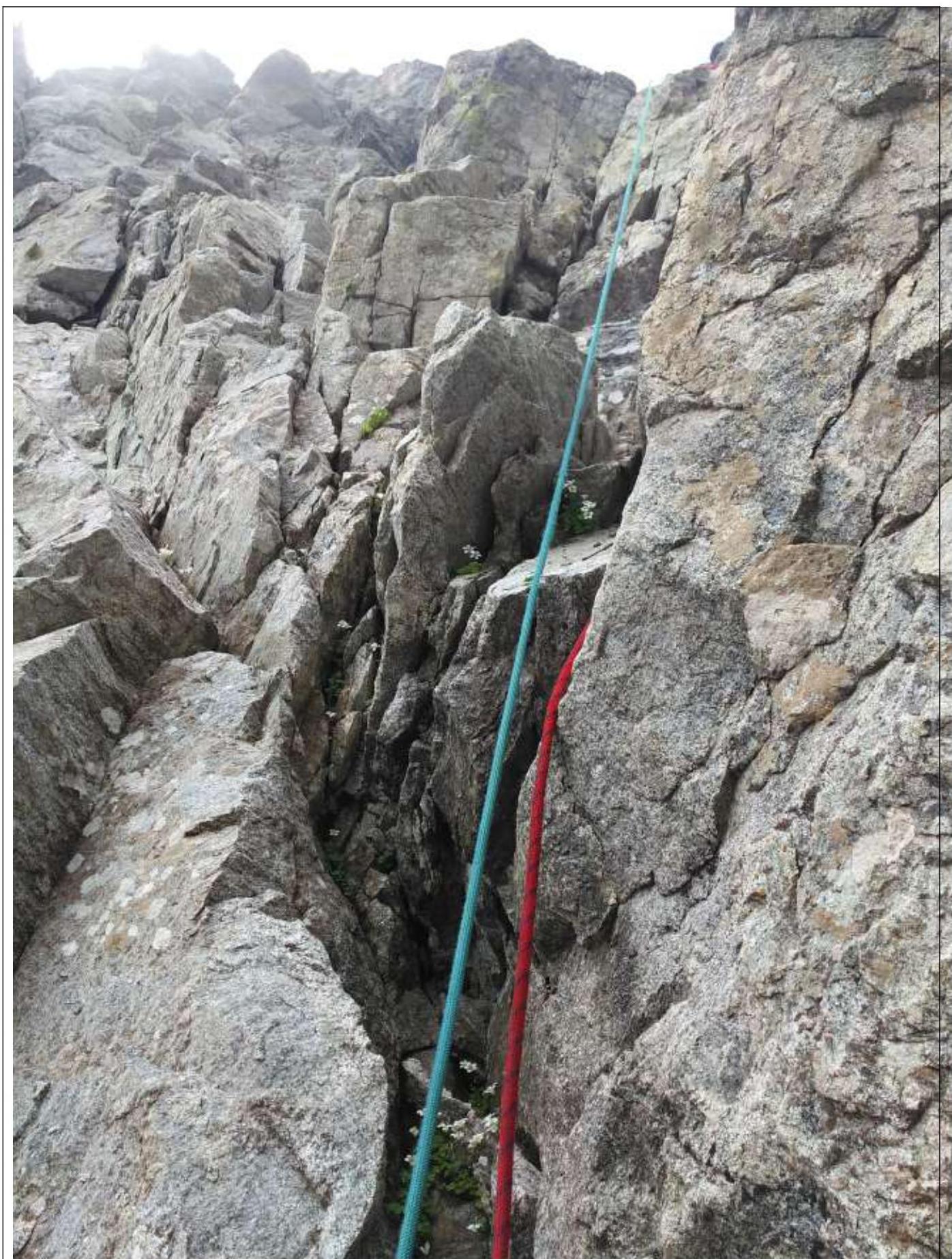
R2–R3 (40 m, V; 10 m, IV, 80°). Climb upwards towards the large dark streak ("barcode"). It is bypassed on the right: from the ledge, via difficult rocks upwards. The station is at the base of a large chimney, on the right, under the protection of a rock outcrop.
R3–R4 (10 m, IV; 30 m, V; 10 m, IV, 70–80°). From the station, climb into the chimney. The plug is overcome head-on. Difficult, strenuous climbing, with challenging belay organization at the key point. On exiting the chimney, there is a large, flat ledge. To maintain verbal contact with partners, it is reasonable to establish an intermediate station here. Above is a black, vertical 5-meter crack leading into a large, scree-filled couloir. The station is on a small ledge to the right of the scree.
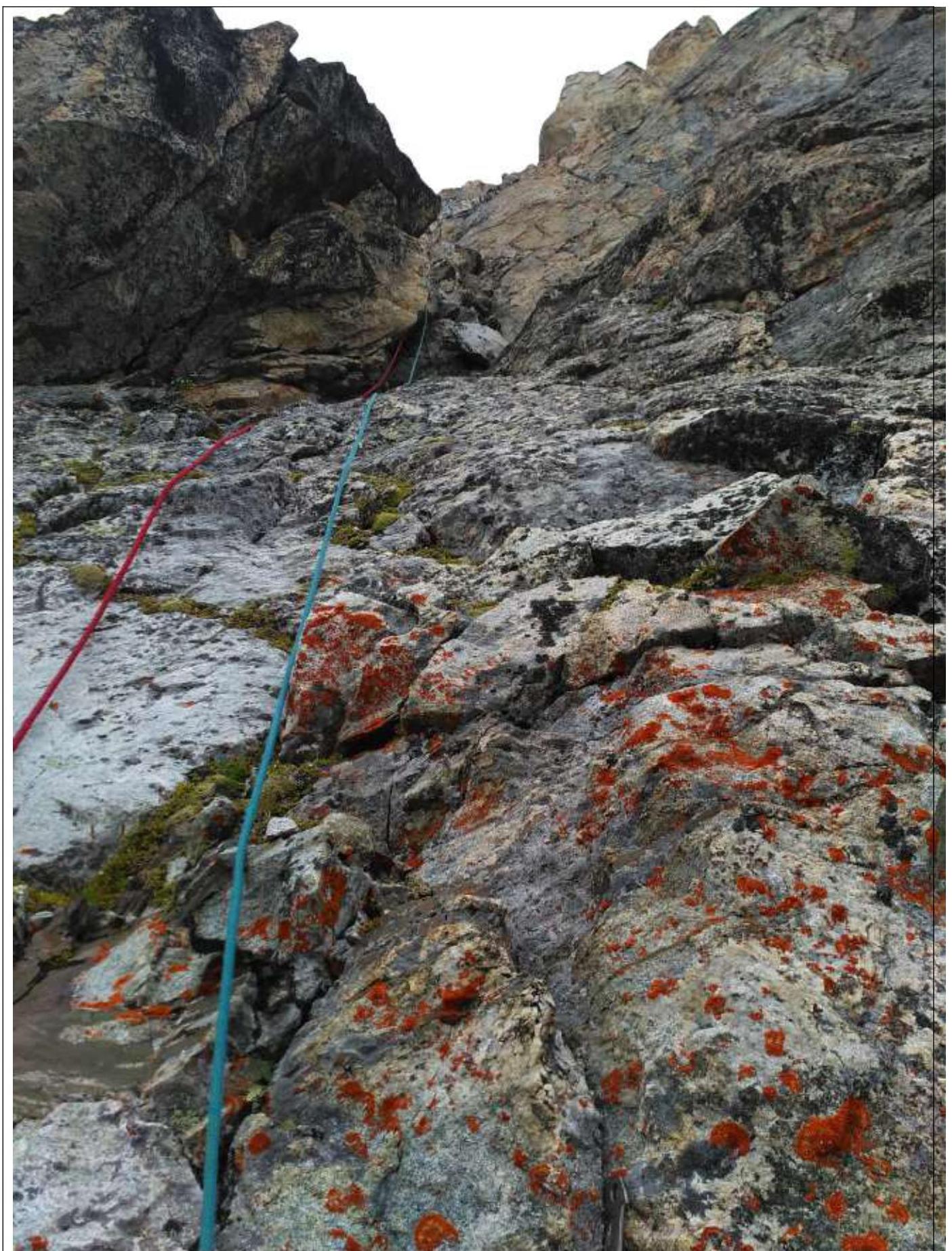
R4–R5 (50 m, III, 45–60°). Carefully cross the couloir. Loose rocks, difficult movement. The station is on a step in the corner, under a large slab, to the left of the scree-filled gully.
R5–R6 (50 m, V, 75°). Climb vertically upwards towards large overhangs, choosing monolithic terrain. Many loose rocks. The station is on an inclined ledge.
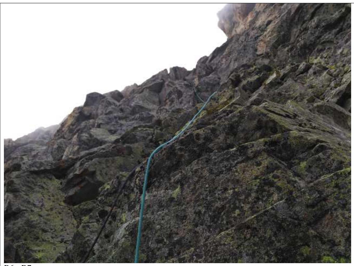
R6–R7 (50 m, V, 75–80°). Continue climbing upwards towards large overhangs. The terrain is interesting and varied. Many large, protruding slabs. The station is on a ledge before a large, vertical slab.
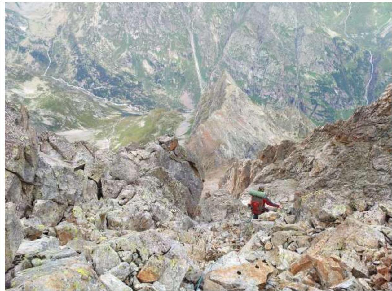
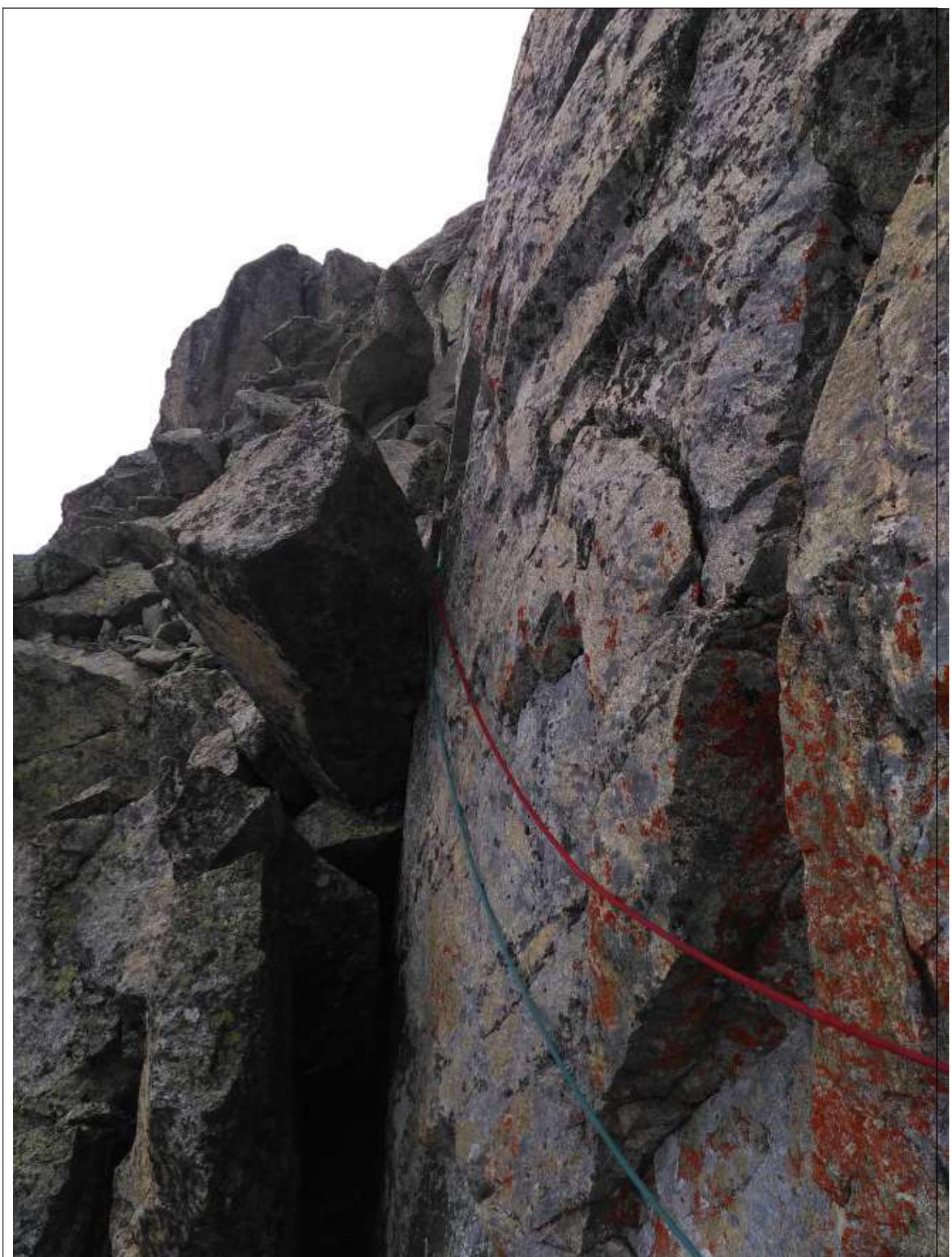
R7–R8 (20 m, III; 30 m, IV+, 70°). Move 20 m to the left, bypassing overhangs, then climb vertically upwards. Verbal contact is lost around the corner.
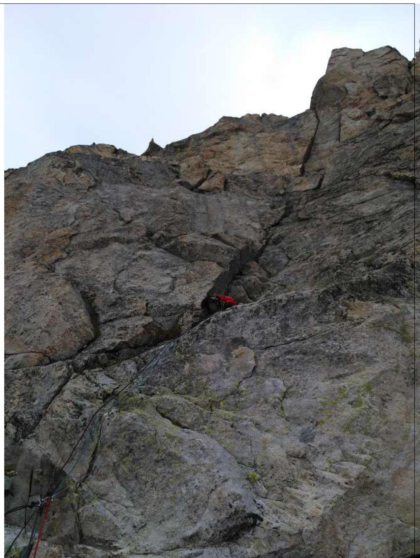
R8–R9 (35 m, IV–V, 75°). Climb upwards via mossy rocks, bypassing a large, overhanging block on the right via a chimney. The station is on a wide ledge under the wall.
R9–R10 (40 m, V+, 80°). Climb vertically upwards to the ridge. The rocks are monolithic, with deep cracks. It is not always possible to organize a belay where desired. The station is on the ridge.
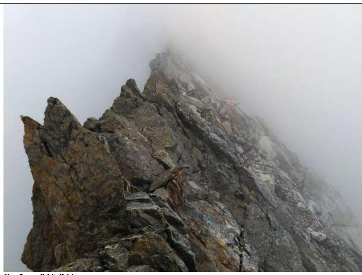
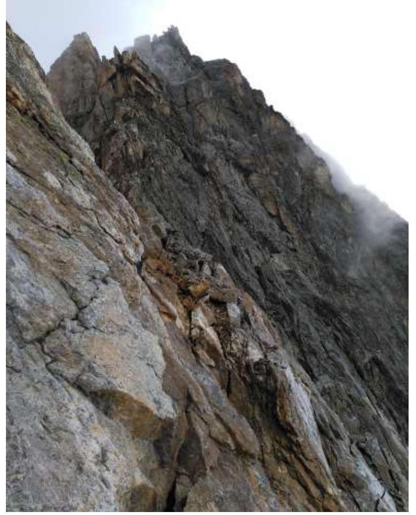
R10–R11 (350 m, III–IV, 45–75°). Move along the ridge, trying to stay on the left (monolithic) side where possible. The summit is not visible from the ridge; a gendarme is visible ahead. There is a suitable bivouac site under the gendarme, to the left of the ridge. It takes 30 minutes to reach the summit from there.
Begin the descent from the summit in the direction of the Western ridge. Details are well described in the "Team Tactics" section.
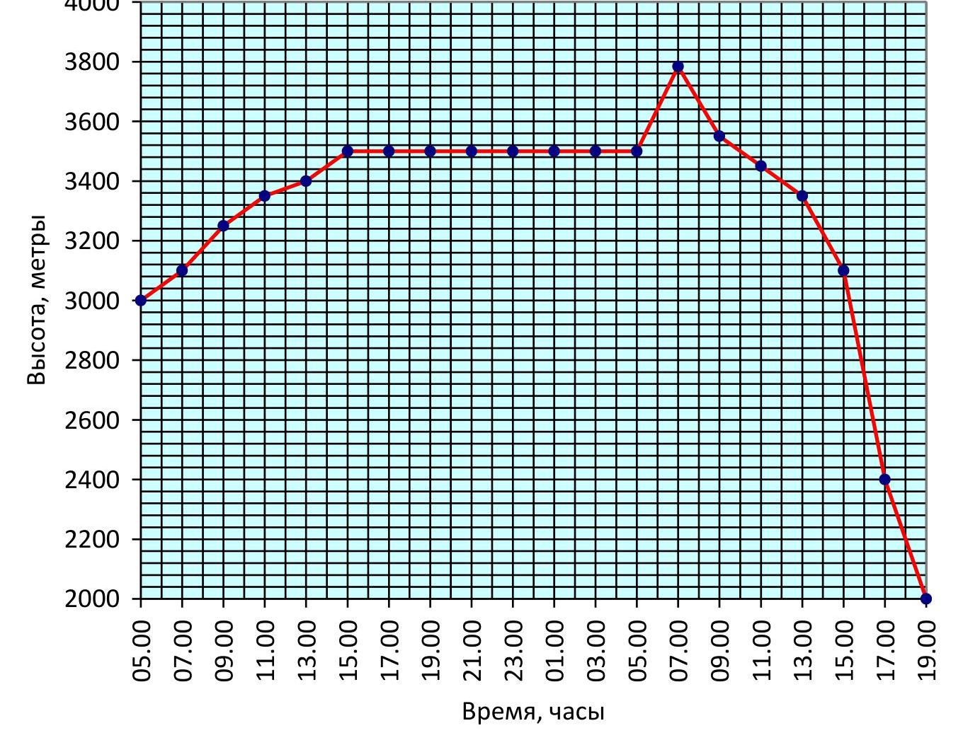
4. Altitude Gain Chart
Altitude gain chart for the group from 09:00 on August 7 to 18:00 on August 8, 2018.
5. Descent from the Summit
Start of the descent from the summit of B. Nakhar. Orientation is easy using the Western ridge.
Descent path from the summit. The dotted line indicates the walking part, the solid line represents the rappels.
V. Team Tactics
On August 3, 2018, our team arrived in the area by evening. An intermediate bivouac was set up near the log pedestrian bridge. The weather was cloudy with drizzle.
On August 4, 2018, it was drizzling in the morning, and the mountains were in fog. The team ascended to the Nakhar campsite and established a camp near the large stone with memorial plaques. In the evening, the clouds cleared, and we examined the wall and descent options.
On August 5, 2018, we climbed Dvuzubka via route 6A (Nepomnyashchikh's route). This ascent is not directly related to this report but was part of the group's plans, determining our approach to the eastern wall of B. Nakhar. The weather stabilized, and we decided to proceed through the Nakharskaya Shchel pass to the eastern wall of Nakhar the following day.
On August 6, 2018, the cirque under the eastern wall is small and enclosed, accessible only via the Nakharskaya Shchel pass, which is uncharted (at least, there is no tourist information about its passage) and has a maximum category of 3B (opinion). If anyone had been under the eastern wall before, it was a long time ago, and we found no information.
We departed from the campsite near the stone at 07:00. Kerov Andrey led. At 10:00, we overcame a difficult bergschrund, at 12:00 we were in the "rancluf," and at 14:00 on the saddle (3300 m), and at 17:00 we descended.
We exited the pass to the left and above the saddle, as it was easier than attempting to go directly to the saddle. We did not traverse the saddle; instead, we began descending immediately. When viewed from above, we moved along the left side of the couloir, constantly veering left. We completed 6 nearly vertical rappels. The rocks were, on average, category V. The descent was relatively safe in terms of rockfall hazard. The couloir constantly veers left, allowing for high anchor points.
We set up camp at the end of the glacier on the scree. The altitude, according to the altimeter, was 3050 m. The day was challenging, comparable to the first. Heavy backpacks were the most inconvenient. To lighten our load, we decided to eat as much as we could.
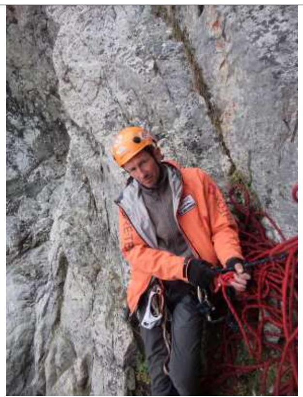
On August 7, 2018, we broke camp at 05:15 and departed. We reached the wall by 06:00. The first ropes of the route follow light, monolithic rocks of medium to higher complexity. Kananykhin Igor led. The climbing was easy, with rich terrain allowing for comfortable belaying.
At 09:00, we approached the key section of the route, R3–R4: a dark, overhanging chimney with a plug. Late in the season, when all the snow had melted, it was easy to climb in the warm, sunny weather. R4–R5, a highly destroyed section, was also traversed slowly and carefully. Above, the rocks regained their monolithic nature, and large blocks appeared.
At 12:30, we reached a large ledge under the ridge. By moving left along the ledge, one can survey the entire ridge to the summit. It is possible to move along the ledge and exit onto the ridge higher up, but the rocks appear highly destroyed there, so we climbed vertically upwards.
At 13:30, we reached the ridge. The weather deteriorated, with the sun disappearing, and the summit becoming shrouded in fog. At 14:30, we stopped to eat and slightly redistribute our gear.
At 16:00, rain began, accompanied by thunder. We decided to wait it out. We sat, sheltered by a tent, until 17:00, when it became clear that the weather would not improve soon. We prepared a bivouac site and settled in for the night. Due to the lack of visibility, we could not assess our location. The altitude was 3450 m. The storm did not fully materialize; it thundered, lightning flashed, rain poured down, hail fell, and by night, it subsided.
On August 8, 2018, it was noticeably colder in the morning, with heavy clouds covering the sky. It was clear that there would be no sunshine. The sun's disk was only vaguely discernible in the leaden sky. However, the rocks had dried, so we could proceed. We began moving towards the summit at 06:00. Kerov Andrey led. We reached the summit at 07:00, finding an old tin can. We took it with us, leaving our plastic container with a note. We took photographs and began our descent at 07:30.
We started descending via the Western ridge, or rather, in its direction. The ridge was sharp and jagged; we moved along the scree to the right of it. Initially, we found a cairn, but later lost all landmarks. Our movement was extremely cautious, as everything around was loose and crumbling. We avoided couloirs, occasionally having to overcome small rock walls. By 10:30, having lost approximately 300 m of elevation, we reached a gentle rock outcrop. From here, there was no path; we had to set up rappels. We chose to rappel down a monolithic, vertical wall rather than follow the ridge. We completed 6 rappels to reach the scree. By 13:30, we were at the bottom. By 14:30, we were having lunch at a large lake.
At 15:30, we began our descent along the stream flowing from the lake. We followed it until we reached a large green terrace. Beyond this point, the stream gained strength, becoming a turbulent flow that dropped off into a waterfall among steep rocks. To the right of the riverbed, we found a faint trail and followed it. Soon, the trail disappeared, and we were forced to descend via wet, clayey landslides — remnants of spring snow on grassy slopes. The descent was challenging due to the slippery terrain, but we could see the road ahead — the road home.
At 17:00, we reached the road along the river Makhar. We would follow it directly to our vehicle.
By 18:30, we were packing our gear, preparing to return to St. Petersburg. The weather had deteriorated further, with rain pouring down.
Throughout the trek, the team maintained contact with the coach via satellite phone. The team was registered with the Ministry of Emergency Situations and the border guard unit. All team members had the necessary medical and transport insurance.
VI. Route Photographs
R0–R1.
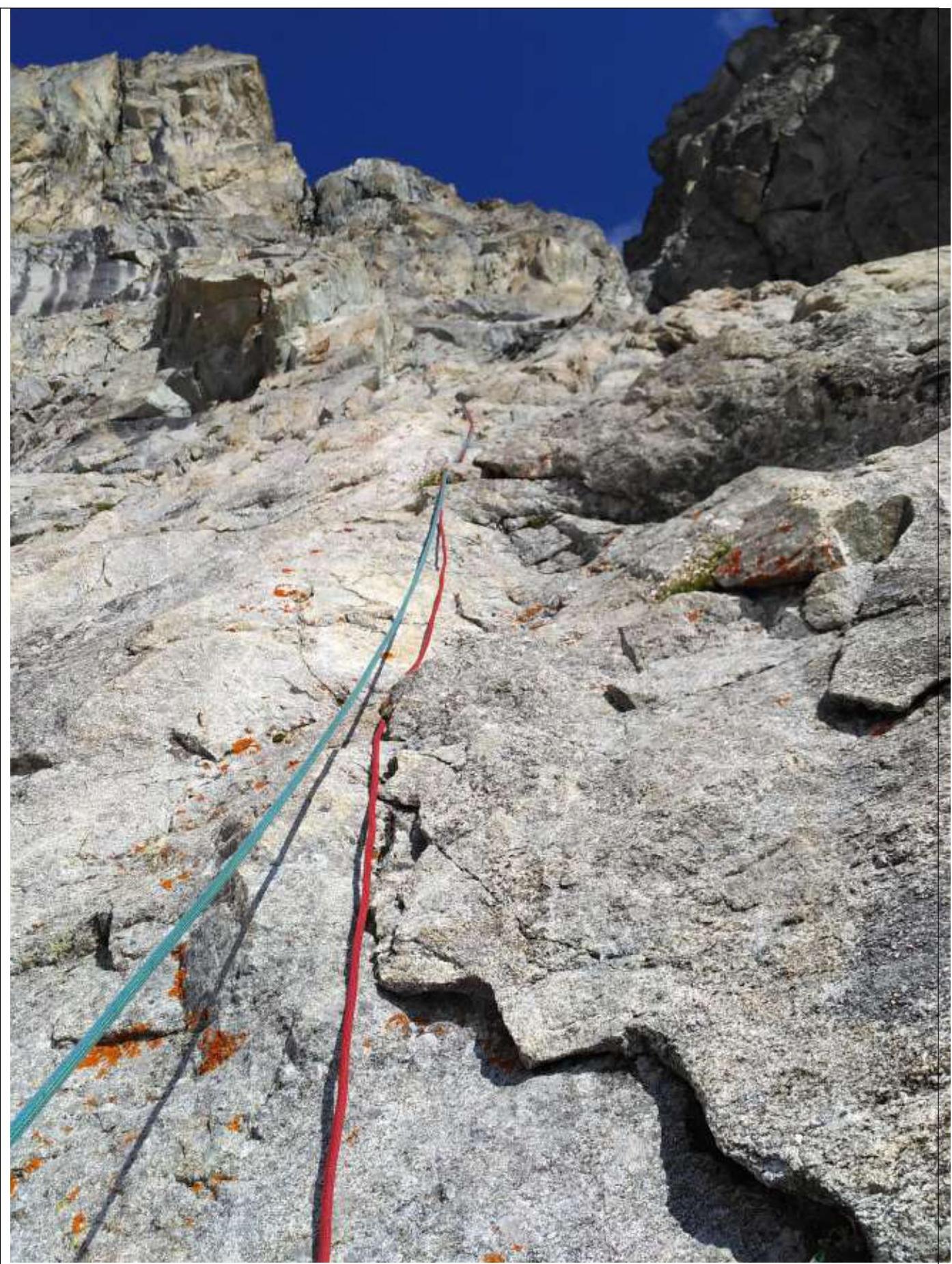
R1–R2.
R2–R3.
R3–R4.
R4–R5.
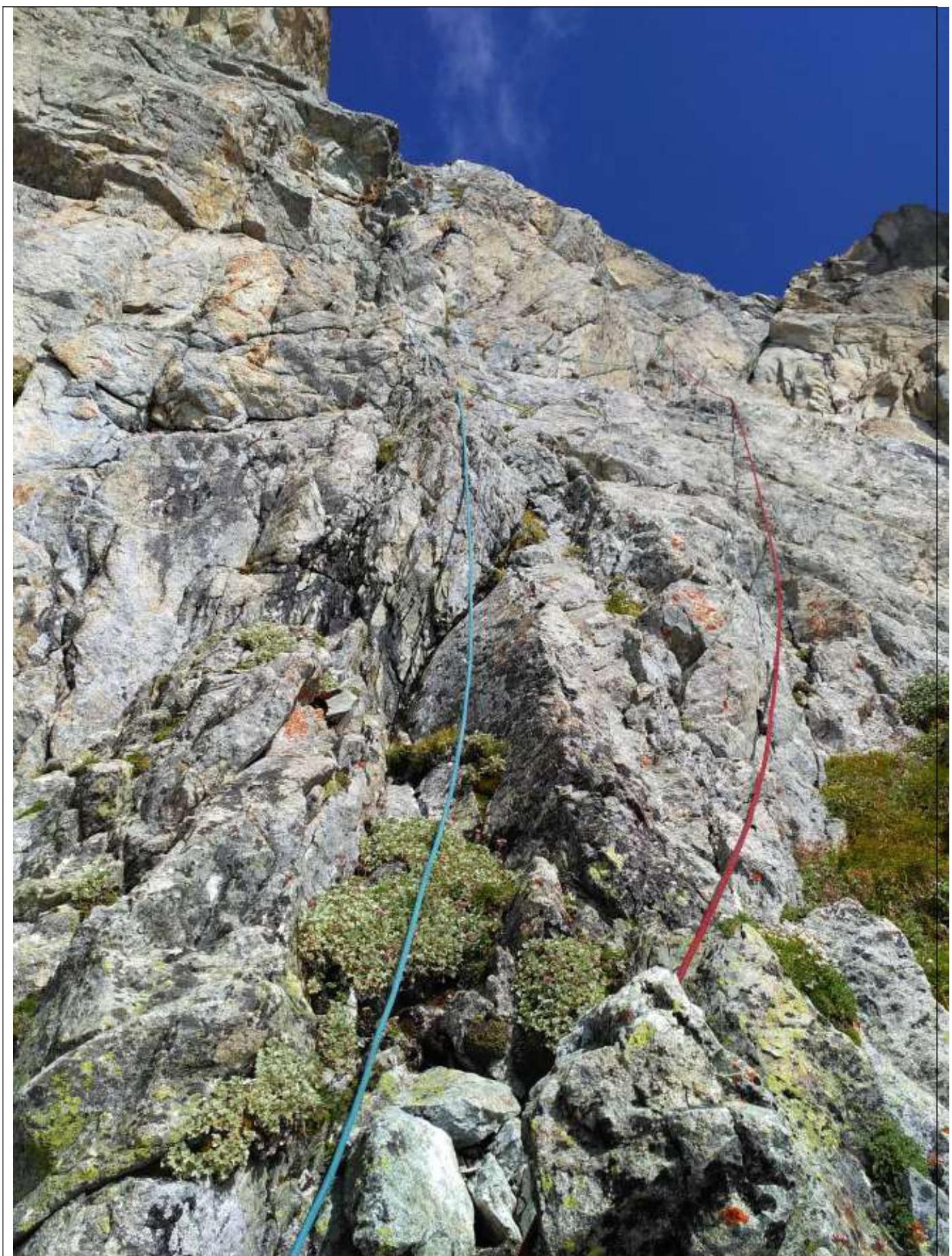
R5–R6.
R6–R7.
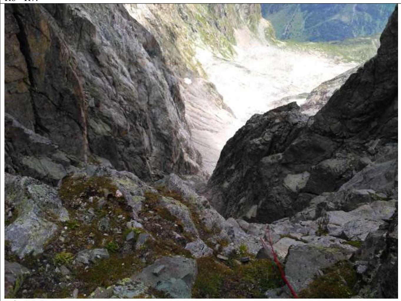
R6–R7. View downwards.
R7–R8.
R8–R9.
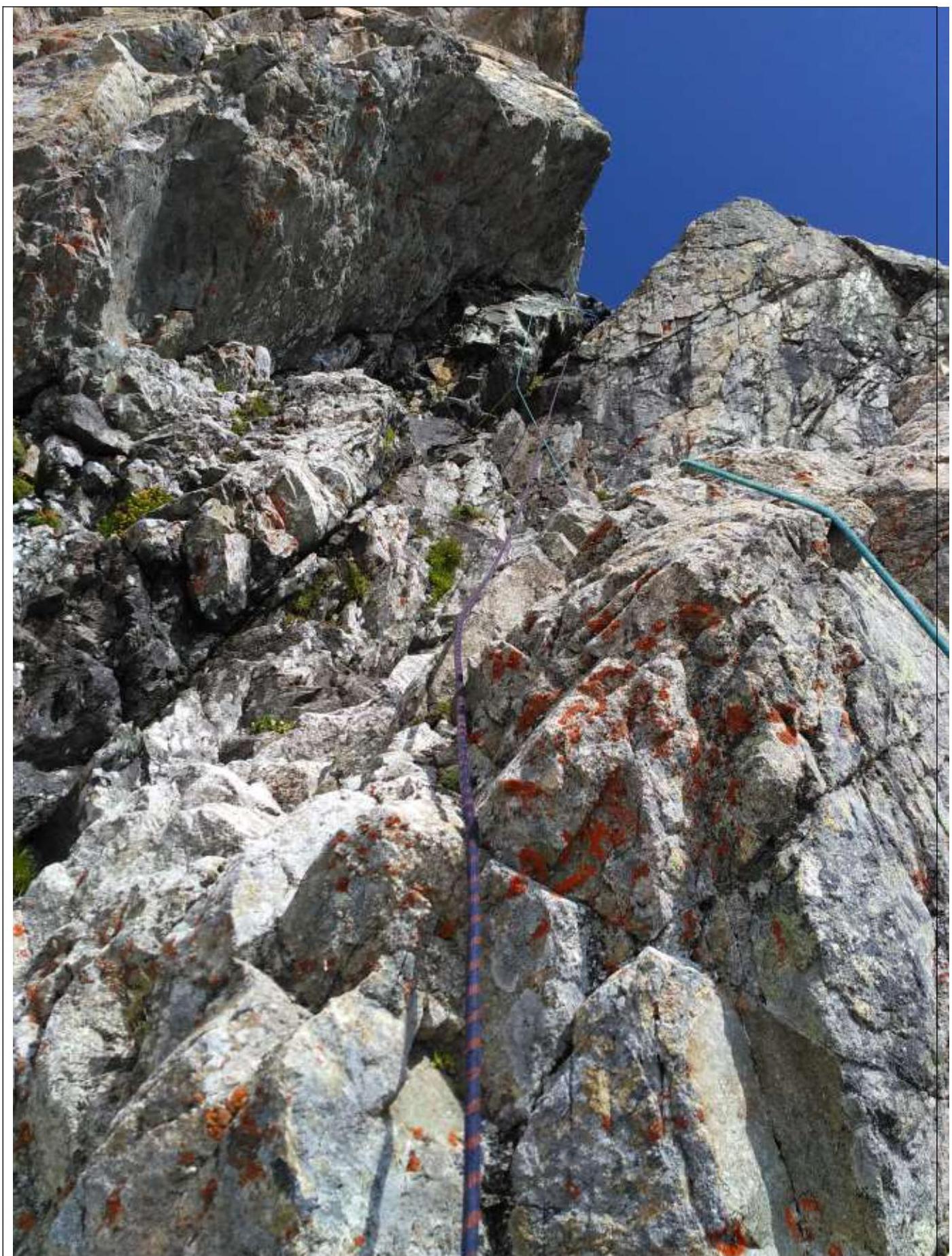
R9–R10.
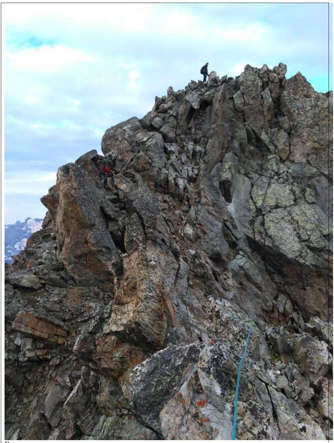
Ridge R10–R11.
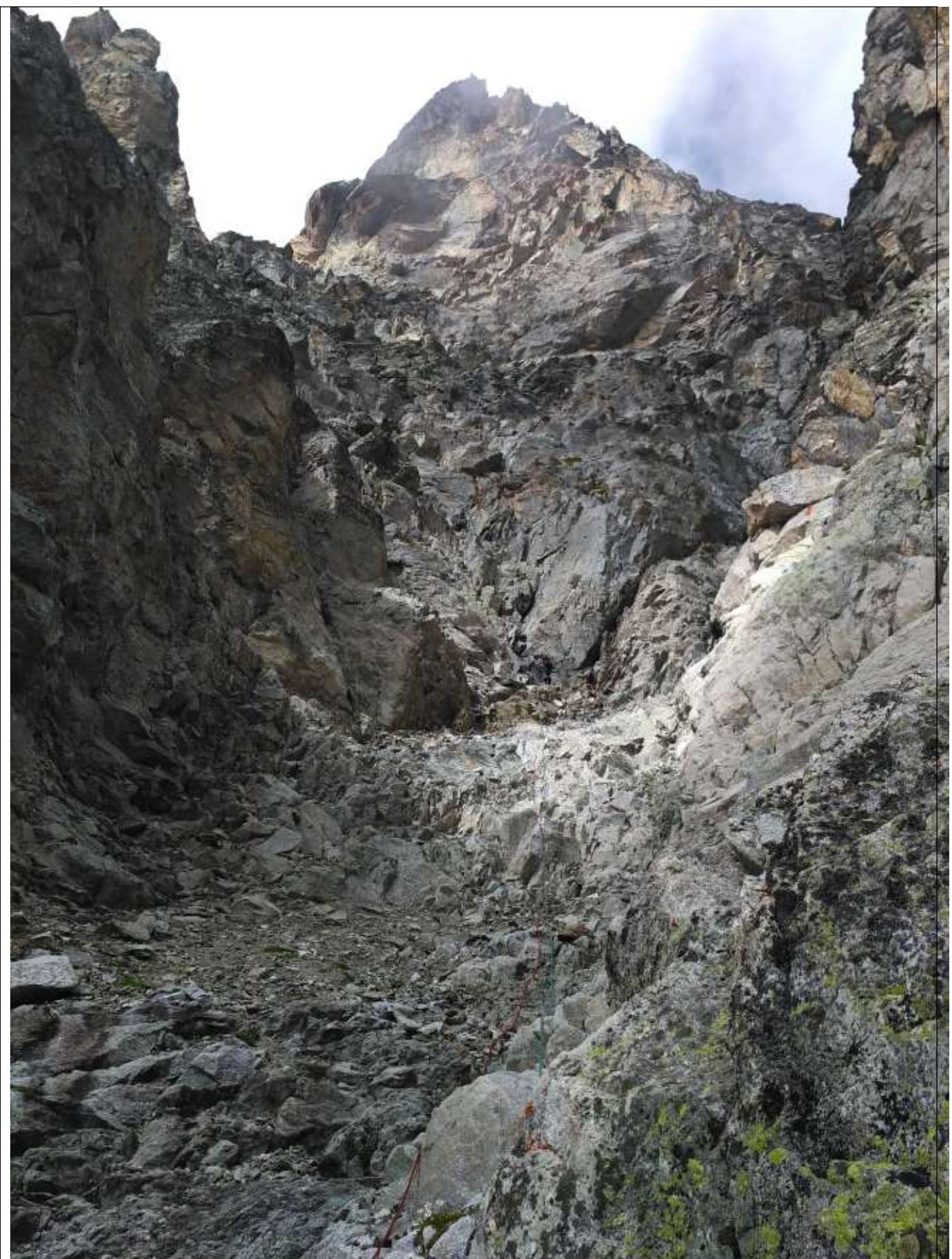
Ridge R10–R11. View of the pre-summit gendarme.
Approach to the summit.
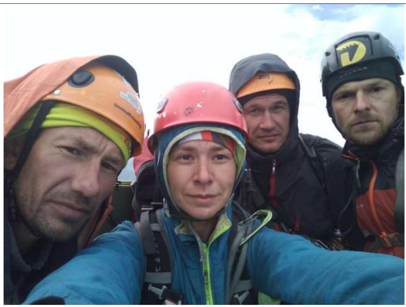
Summit photograph.
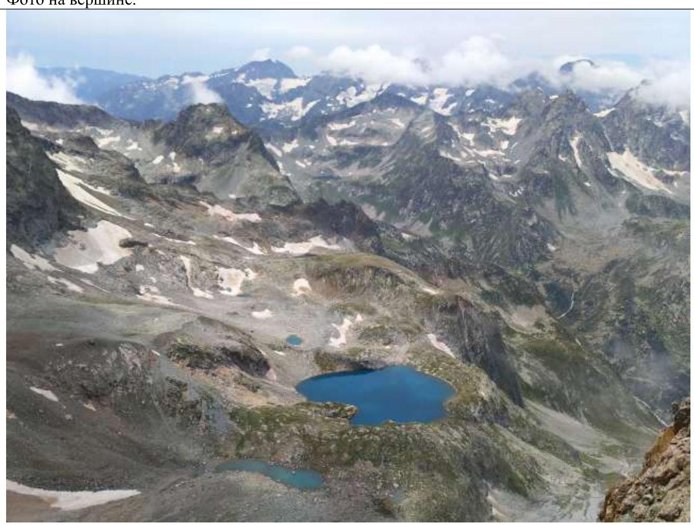
Large, beautiful lake — our descent landmark.
VII. Ascent Participants
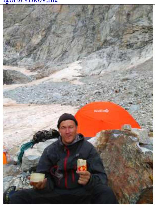
Viskov Igor Vladimirovich, Master of Sports (team leader) +7 911 246-07-84, igor@viskov.me
Kerov Andrey Sergeevich, 1st sports rank +7 906 278-89-69, andrey_kerov@mail.ru
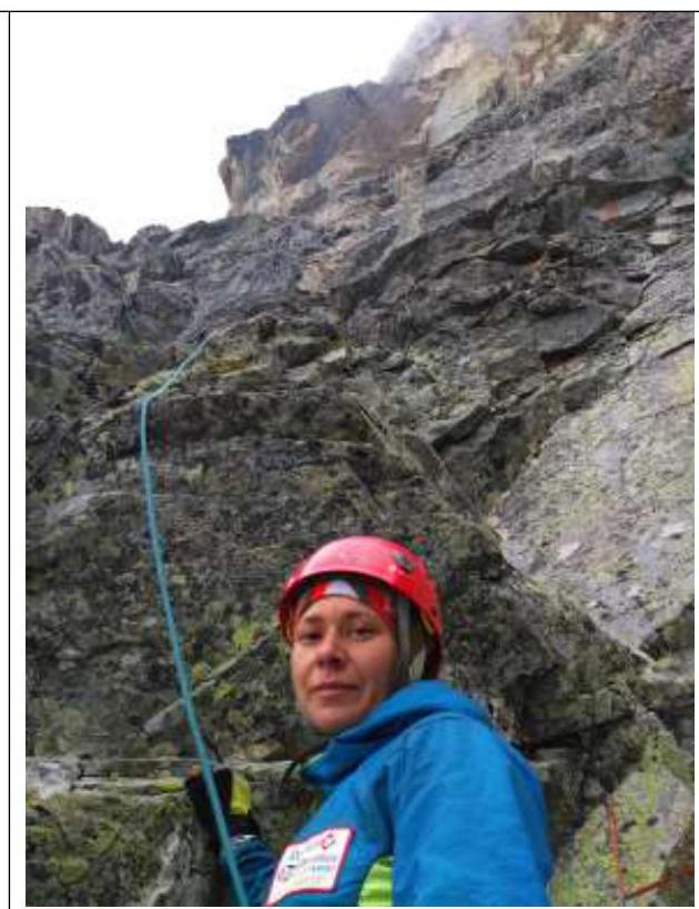
Agamova Elena Alexandrovna, 2nd sports rank +7 921 583-43-26, agamovaelena@gmail.com
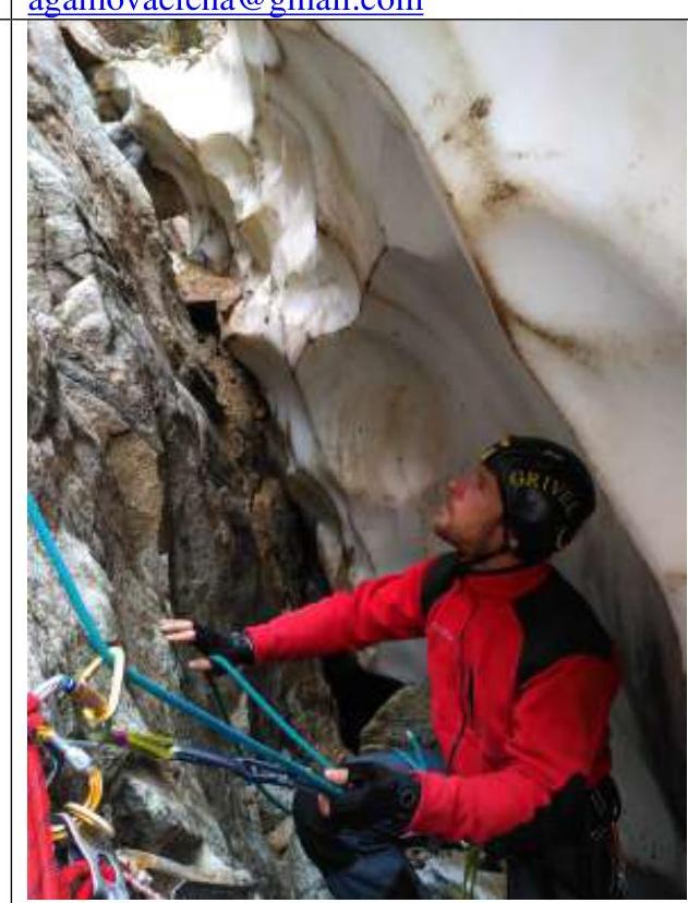
Kananykhin Igor Vladimirovich, 1st sports rank +7 952 214-47-78, i.v.kananykhin@gmail.com