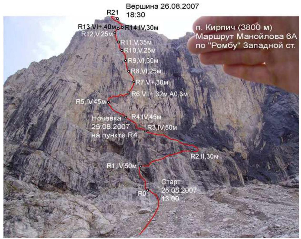
Kirpich, Manoylov's Route, 6A
Ascent Passport
-
Technical class
-
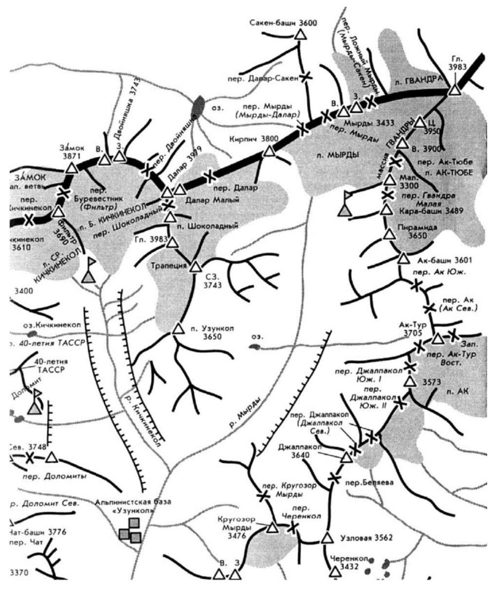
Caucasus, Uzunkol gorge
-
Kirpich peak (3800 m), via the "diamond" of the West wall, Manoylov's route.
-
6A cat. difficulty.
-
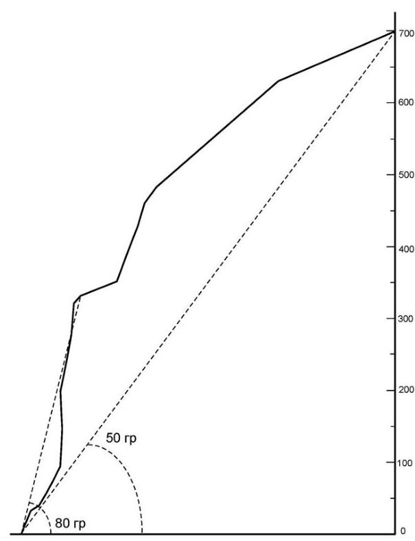
Height difference 700 m, length 1060 m, length of climbing sections V (4c–5a) (1) cat. difficulty – 160 m, length of climbing sections VI (5b–6a) cat. difficulty – 95 m, length of climbing sections VII+ (6c) cat. difficulty – 32 m, A0 – 3 m. Average slope of the route – 50°, slope of the wall section – 80°.
-
Pitons driven: rock: wired/stoppers: bolted: 0/15* 30/0 0/25* * — previously driven
-
Team's working hours 17 h, 2 days, ascent, descent on the day of reaching the summit.
-
Overnight stays: one semi-reclined.
-
Team leader Sushko Denis Sergeyevich, 1st sports category, Moscow.
Participants:
- Belousov Vladimir Alexandrovich, Candidate Master of Sports, Odintsovo
- Novikov Alexander Viktorovich, Candidate Master of Sports, Moscow
-
Coach Kauts Leonid Sergeyevich, Candidate Master of Sports, Moscow.
-
Approach to the route on August 25, 2007, summit on August 26, 2007, return on August 26, 2007.
-
Climbing and Mountaineering Section of Bauman MSTU.
1 — Climbing difficulty categories are given according to the UIAA system (French equivalents are in parentheses).
Description of the Area
The Uzunkol area is well-known and visited by athletes of various levels. Objects for ascents can be chosen for both beginners and experienced athletes. Relatively low altitudes, short approaches, picturesque gorges. Many lakes, streams, and waterfalls. Despite the relatively low heights (mainly up to 4 thousand m), the area has significant glaciation. The most challenging routes are laid on the peaks Kirpich, Dallar, and Zamok.
Kirpich has extensive rocky walls on the southern and western sides. The southern wall of Kirpich is located on the territory of Georgia. Several routes of the 5th category of difficulty and one sixth category "A" are laid along the western wall. Manoylov's route is deservedly very popular as it is purely rock climbing and relatively safe. It is possible to pass without an overnight stay. The wall has a slight overhanging angle, and the central part of the route is protected from falling stones. Monolithic rocks provide climbers with excellent opportunities for natural protection. A few small ledges allow a small group to spend the night in almost any part of the wall.
There is water on the wall. The route crosses a spot that is watered from above, where it is convenient to replenish the water supply.
The goal of our ascent is to climb by free climbing a beautiful route on a steep and fairly long wall. Due to the limited stay at the "Uzunkol" tourist center to two full days, it was decided to climb Manoylov's route via the "diamond" of Kirpich's western wall. The route was completed without falls or relearning sections. The leader moved up the wall without using technical means and relied solely on climbing skills and the ability to organize proper protection when overcoming key sections. The exception is 3 m on the section R5–R6, where the leader held onto protection points (2 pcs.).
The ascent was made as part of the 2007 Moscow Alpine Championship.
Map-Scheme of the Ascent Area
General Photo of the Wall
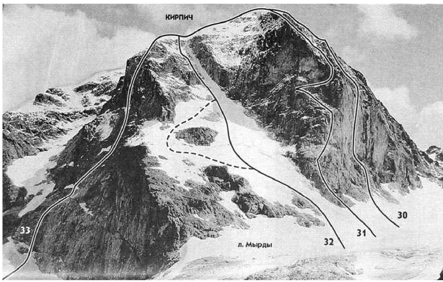
30 — Manoylov's route 6A (cat. difficulty) 31 — route ... 32 — route ... 33 — route ... In the photo, the descent goes to the left of the summit — towards the Dallar pass via route 1B cat. difficulty.
PHOTO of the route in profile 
Technical and Tactical Actions of the Team
On the night of August 24-25, the group arrived at the "Uzunkol" tourist center. Leaving the camp at 7:00 on August 25, the group was under the route by 12:00.
Weather — variable cloudiness. The weather forecast (source GISMETEO) reported possible precipitation at night and on Sunday, the 26th.
They started at 13:00. The first five ropes were worked by Novikov A. The rocks are mostly simple and of medium difficulty. Around 15:00, there was a change, and sections R5–R8 were worked by Belousov V. At 18:30, having straightened the passed ropes, the group descended to the area of point R4, where a ledge was previously spotted. A semi-reclined overnight stay was organized on it.
For the overnight stay, they had:
- 2 sleeping bags for three people
- sleeping mats
Before bed and in the morning — hot food and drinks.
There was a thunderstorm with precipitation at night. By morning, the clouds had cleared, and the rocks had dried by the time they started working on the route. At 8:00 on August 26, having passed the rope sections (100 m), Sushko D. started moving forward. At 13:30, the group reached the "roof." At the same time, the weather turned bad again: hail, rain, and wind. They did not stop moving, but the speed decreased. The rocks became slippery, and they had to be even more cautious. At 16:00, the storm front passed, and by 17:00, they were already on a simple ridge. At 18:30 on August 26, the group reached the summit.
The descent was made via route 1B cat. difficulty, towards the Dallar pass.
List of Equipment Used
- Rope — 2 pcs.
- Stoppers — 10 pcs.
- Camalots Black Diamond — 10 pcs.
- Pitons — 2 pcs.
- Anchor pitons — 2 pcs.
- Rock hammer — 1 pc.
- Quickdraws — 16 pcs.
- Screwgate carabiners — 8 pcs.
- Jumars — 3 pcs.
- Backpack — 3 pcs.
- Sleeping bag — 2 pcs.
- Burner — 1 pc.
- Gas cylinder — 1 pc.
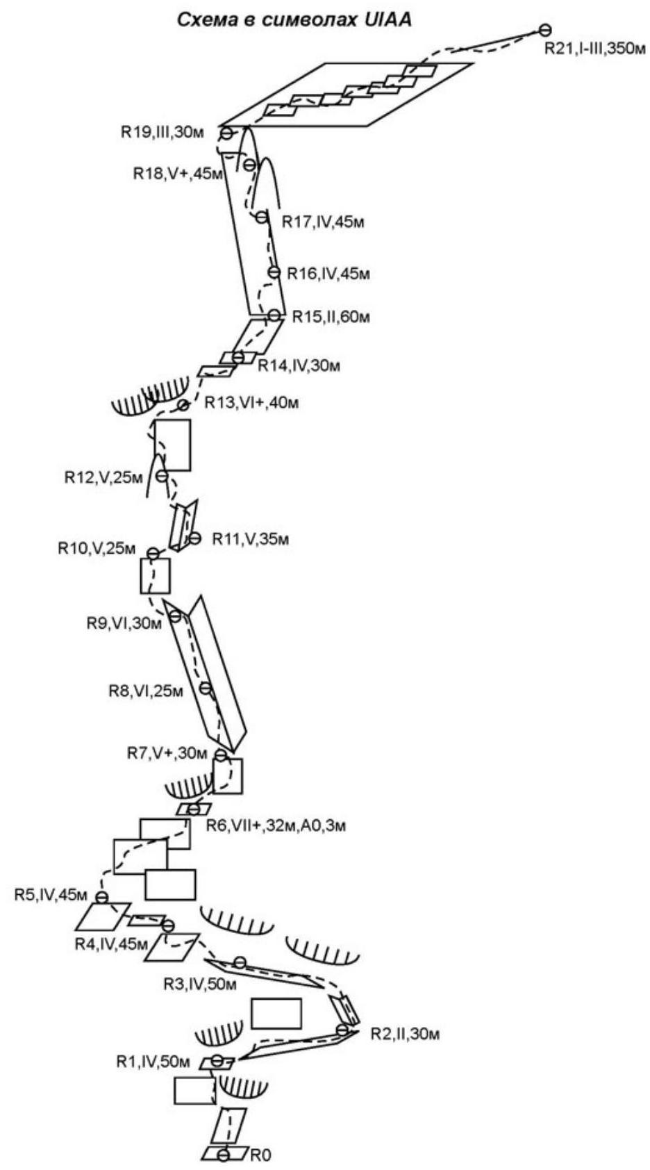
Description of the Route by Sections
R0–R1: From a ledge under a wide inclined slab straight up under the overhang. Bypass the overhang on the left along the wall. (50 m, 70°, IV).
R1–R2: Traverse right along ledges. (30 m, 30°, II).
R2–R3: Straight up through large-block rocks and then left to a large inclined ledge under a rusty overhang. (50 m, 60°, IV).
R3–R4: Up and left through rocks of medium difficulty through a steep rock gully. (45 m, 60°, IV).
R4–R5: Up and left through rocks of medium difficulty under the vertical wall rise. (45 m, 60–70°, IV).
R5–R6: Along a smooth slab with bolted pitons, traverse (difficult climbing) to the right. Station in a small grotto. (32 m, 80°, VII+, 3 m, 90°, A0).
R6–R7: From the grotto, up and right along "ladder" rocks, then through a difficult wall to the base of a huge overhanging internal corner. (30 m, 80°, V+).
R7–R8: Climbing the corner is mainly in an off-width position, with good holds. The corner is often bolted, and many abandoned pitons and stoppers are encountered. Station on a very narrow ledge. (25 m, 85°, VI).
R8–R9: Continue moving up the corner; the nature of the climbing does not change. Station on a sloping ledge. (30 m, 85°, VI).
R9–R10: From the station, the wall has good holds. Small internal corners. (25 m, 75°, V).
R10–R11: Corners alternate with walls. There are many holds, and there are ample opportunities for protection. (35 m, 75°, V).
R11–R12: A series of walls and corners lead to the base of the "Finger" outcrop. Station on bolts wedged between the wall and the outcrop. (25 m, 70°, V).
R12–R13: Up through complex rocks under the cornices and then right along the cornices to an inconvenient station. (40 m, 85°, VI+).
R13–R14: From the station, 15 m up rocks of medium difficulty, and then traverse 15 m along simple rocks to the exit onto the "roof". (30 m, 60°, IV).
R14–R15: Up and right to the beginning of a not clearly defined ridge-counterfort. (60 m, 40°, II).
R15–R16: Up the rise of the ridge, first up and then, bearing right, to a narrow oblique short ledge. (45 m, 70°, IV).
R16–R17: Straight up a vertical corner, then right of the corner onto a slab and up to the left onto a small ledge. Station on an outcrop. (45 m, 70°, IV).
R17–R18: From the ledge up under the vertical wall of a gendarme, which is then bypassed on the left with a difficult traverse. Exit to a wall with outcrops and climb onto simpler rocks of the gendarme. (45 m, 75°, V+).
R18–R19: Bypass the next gendarme of the ridge on the left and exit onto the slopes of the main ridge leading to the summit. (40 m, 60°, III).
R19–R20: The next 250 m, moving with simultaneous protection along a rocky slope with short, not steep walls towards the summit. Exit onto the ridge. (250 m, 30°, II–III).
R20–R21: Up a large and medium talus to the summit. (100 m, 20°, I).
UIAA Symbol Scheme
Technical Photo of the Route
Drawn Profile of the Route
Photos from the Route
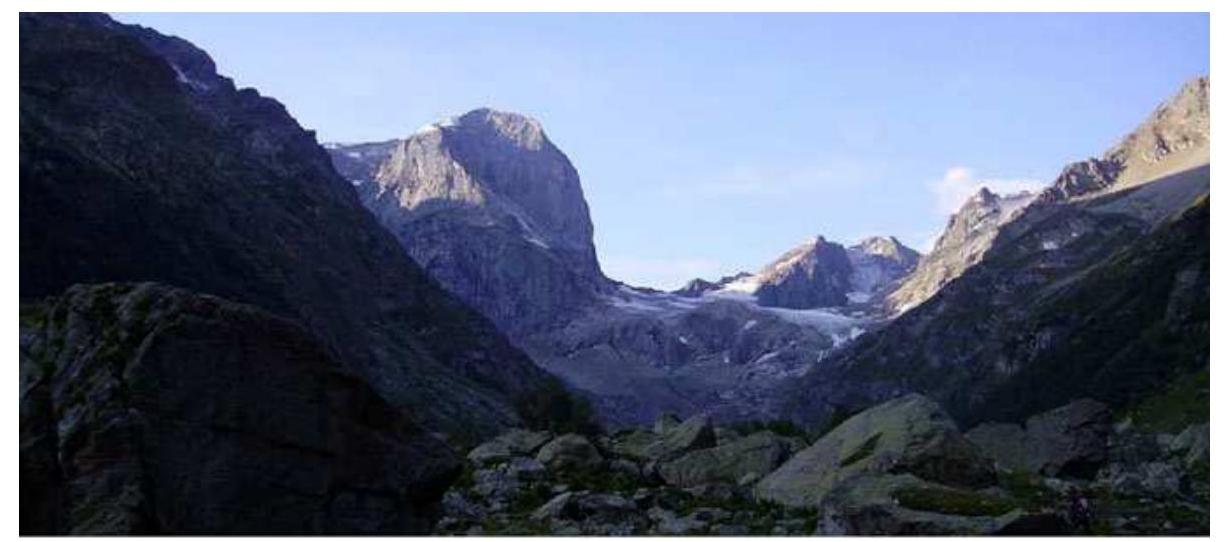
PHOTO 1: View from the valley to Kirpich.
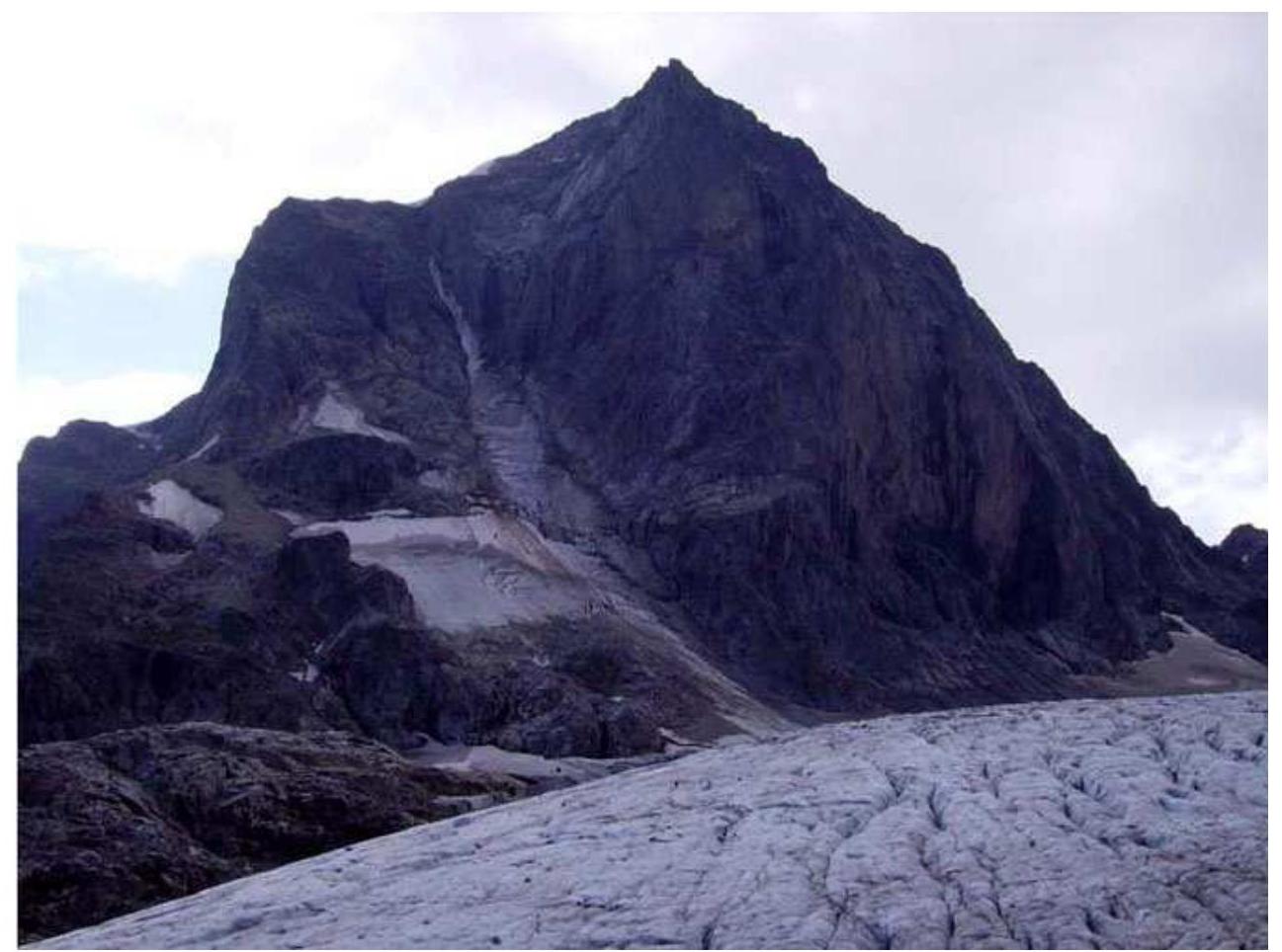
PHOTO 2: View of Kirpich peak from the approach.
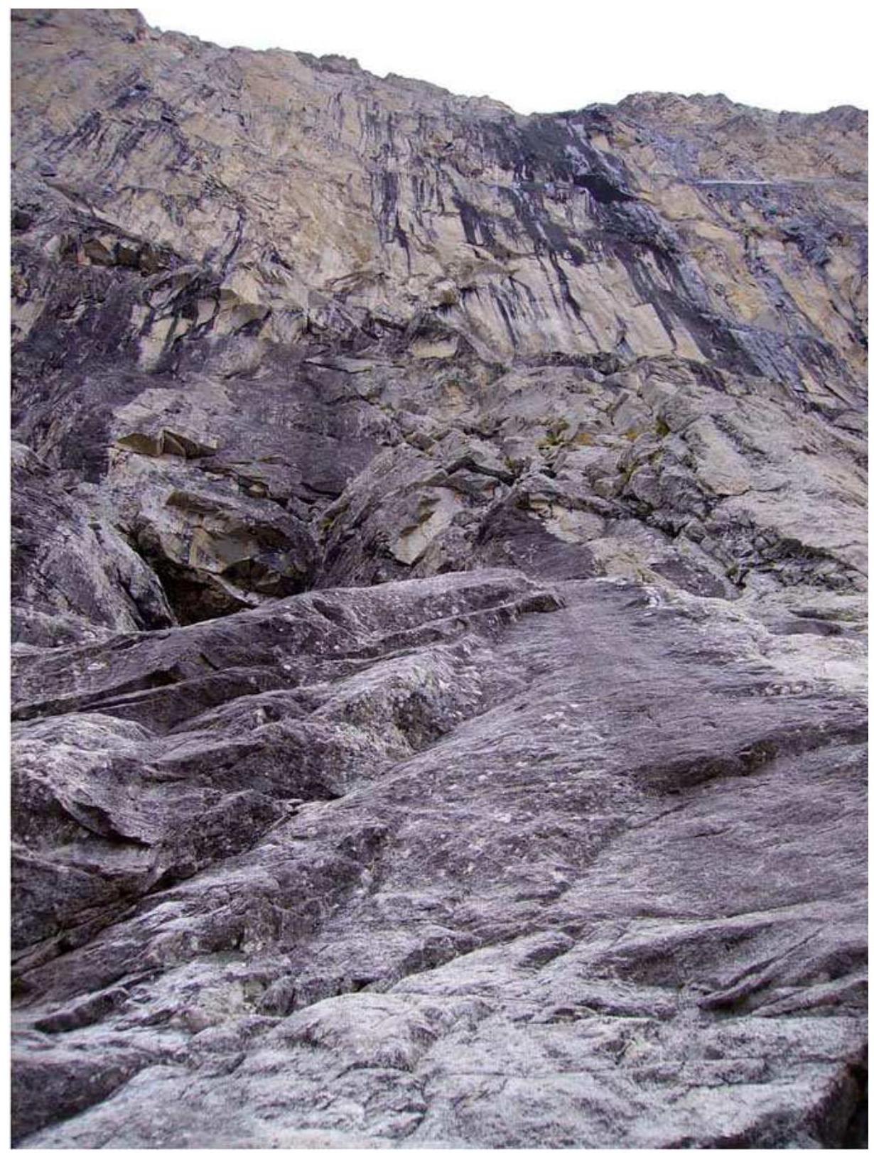
PHOTO 3: Sections R0–R2. Visible are the smoothed slabs and niche.
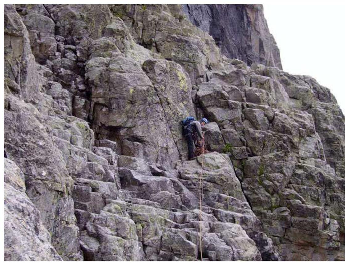
PHOTO 4: Station R3.
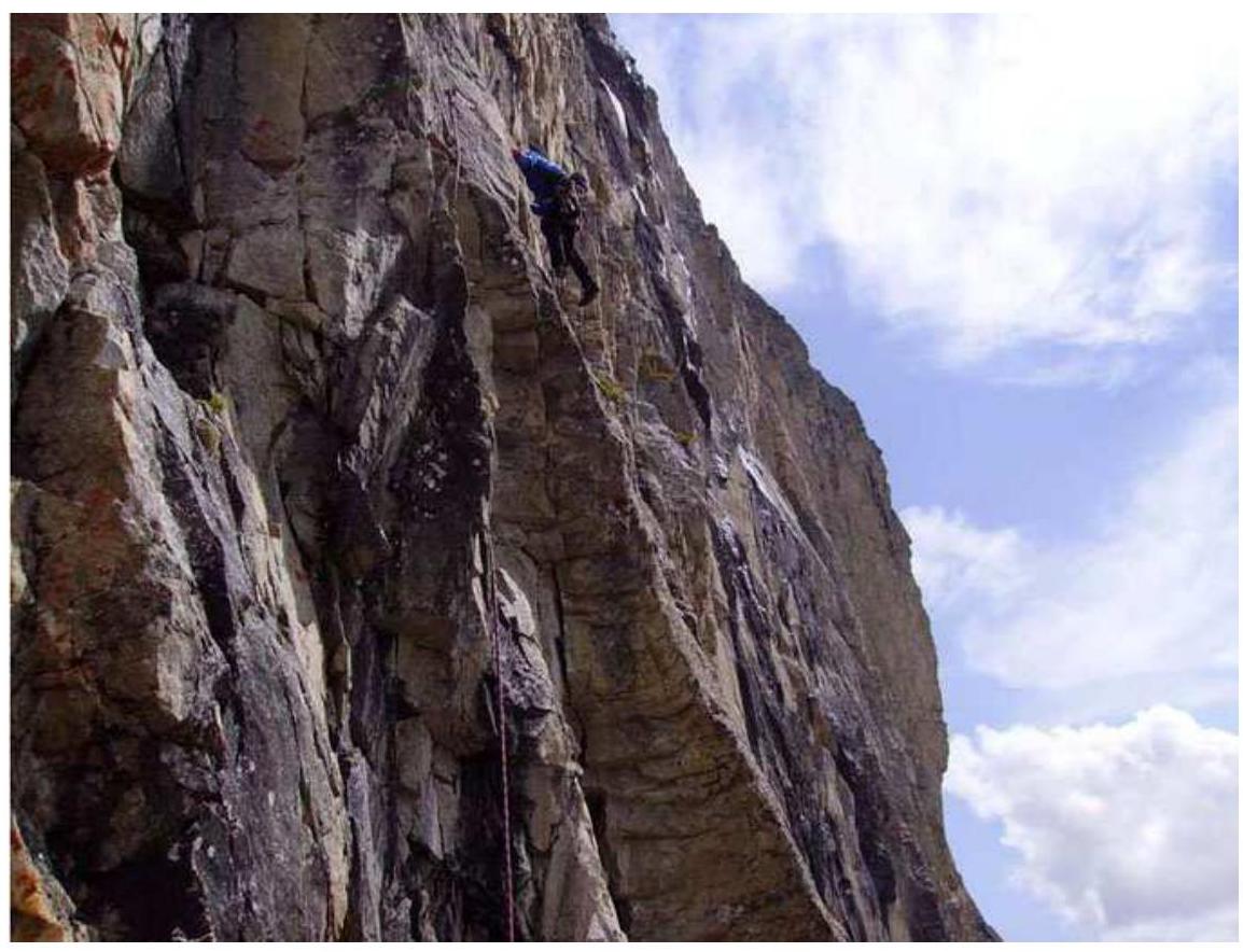
PHOTO 5: Difficult climbing on section R5–R6.
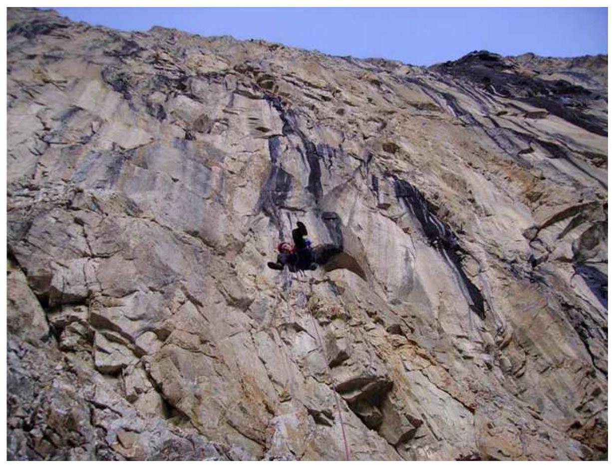
PHOTO 6: Rappelling down the straightened ropes to R4.
PHOTO 7: Preparing for a bivouac.
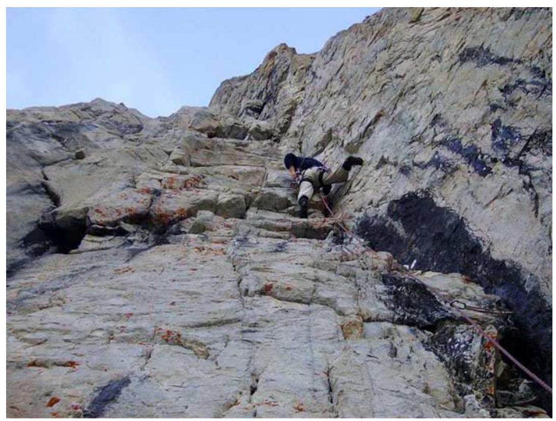
PHOTO 8: On section R8–R9.
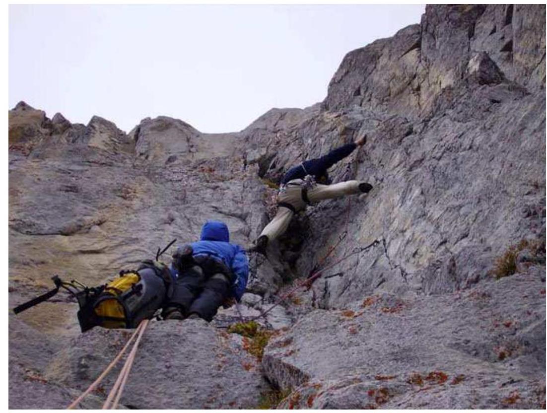
PHOTO 9: On section R10–R11.

PHOTO 10: On section R11–R12.
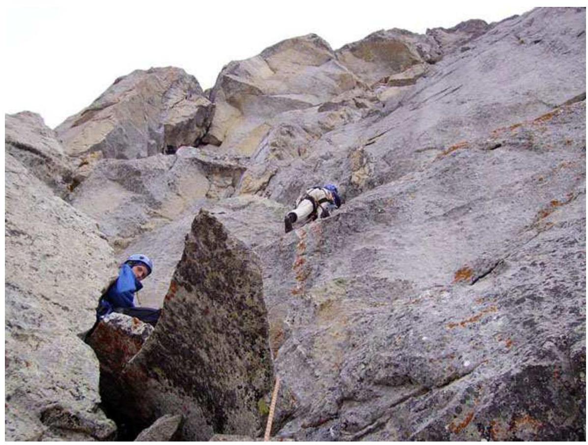
PHOTO 11: Section R12–R13.
"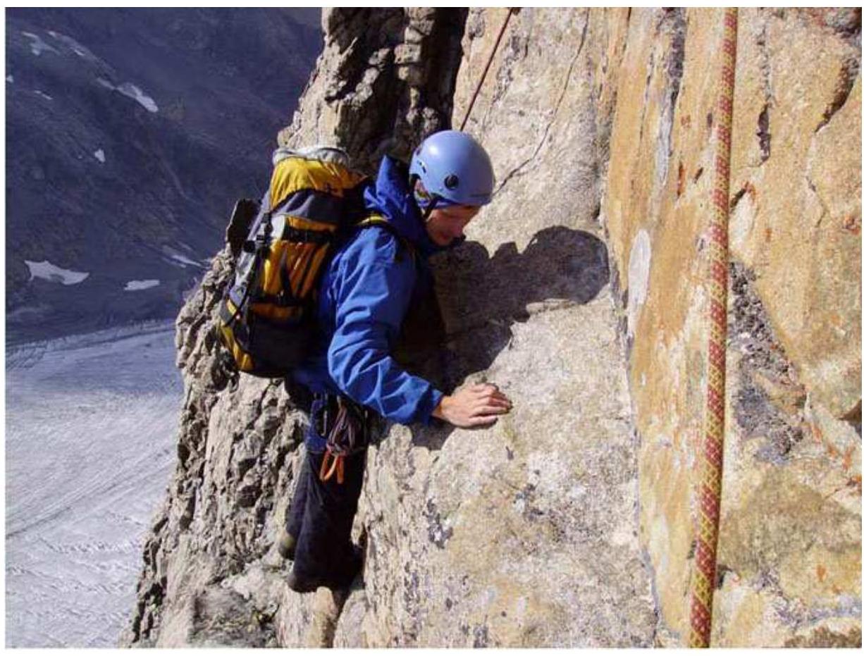
PHOTO 12: On section R17–R18.
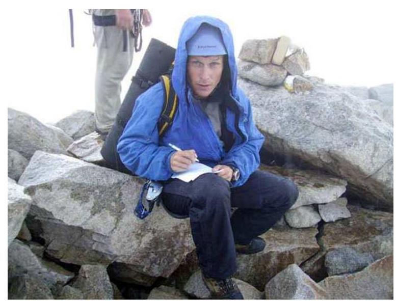
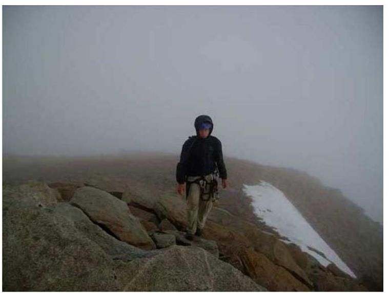
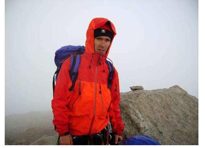
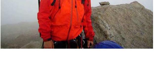
Table Comparing Climbing Difficulty Categories
| UIAA | French system |
|---|---|
| I | I |
| II | II |
| III | III |
| IV– | 4a |
| IV | 4b |
| V | 4c |
| V+ | 5a |
| VI– | 5b |
| VI | 5c |
| VI+ | 6a |
| VII– | 6a+ |
| VII | 6b |
| VII+ | 6b+ |
| 6c | |
| VIII– | 6c+ |
| VIII | 7a |
| 7a+ | |
| VIII+ | 7b |
| IX–/IX | 7b+ |
| 7c | |
| IX/IX+ | 7c+ |
| IX+/X– | 8a |
| 8a+ | |
| X | 8b |
| 8b+ | |
| X+ | 8c |
| 8c+ | |
| XI | 9a |
Author: Vladimir Belousov, October 5, 2007