Report
ON ASCENDING KIRPICH PEAK VIA THE NORTH-WEST FACE, CATEGORY 5A ROUTE BY THE KAIS MPEI ALPCLUB TEAM FROM AUGUST 13 TO AUGUST 15, 2022
I. Climbing Report
| 1. General Information | ||
|---|---|---|
| 1.1 | Full Name, Sports Rank of the Leader | Proskurin S.G., 1st sports rank |
| 1.2 | Full Name, Sports Rank of the Participants | Troitskiy N.V., 2nd sports rank |
| 1.3 | Full Name of the Coach | Kutkin S.A. |
| 1.4 | Organization | KAIS MPEI |
| 2. Characteristics of the Climbing Object | ||
| 2.1 | Region | Uzunkol |
| 2.2 | Valley | Myrdy |
| 2.3 | Classification Table Section Number (2013 edition) | 66 |
| 2.4 | Name and Height of the Peak | Kirpich 3751 m |
| 3. Route Characteristics | ||
| 3.1 | Route Name | Via NW face |
| 3.2 | Proposed Category of Difficulty | 5A |
| 3.3 | Degree of Route Exploration | - |
| 3.4 | Terrain Characteristics | Rock climbing |
| 3.5 | Elevation Gain | 1000 m |
| 3.6 | Route Length | 1210 m |
| 3.7 | Technical Elements of the Route | 1–2 cat. diff. rocks — 360 m. 3 cat. diff. rocks — 345 m. 4 cat. diff. rocks — 215 m. 5 cat. diff. rocks — 80 m. Rocks 6, A1 — 6 m Rocks 6, A2 — 95 m. Wall section 880 m |
| 3.8 | Average Steepness of the Route, (°) | 55.7° |
| 3.9 | Average Steepness of the Main Part of the Route, (°) | 68.7° |
| 3.10 | Descent from the Summit | Via category 1B to Myrdy valley |
| 3.11 | Additional Route Characteristics | No water |
| 4. Characteristics of the Team's Actions | ||
| 4.1 | Time of Movement (team's walking hours, indicated in hours and days) | 22 h, 3 days |
| 4.2 | Overnight Stays | Site |
| 4.3 | Time Spent on Route Preparation | - |
| 4.4 | Start of the Route | 7:55, August 13, 2022 |
| 4.5 | Reaching the Summit | 6:00, August 15, 2022 |
| 4.6 | Return to the Base Camp | 14:50, August 15, 2022 |
| 5. Person Responsible for the Report | ||
| 5.1 | Full Name, e-mail | Proskurin S.G., rd3wae@sporadic.ru |
II. Climbing Description
1. Characteristics of the Climbing Object
1.1. Photo of the Route Taken by the Team
The photo of the route taken by the team is shown in Figure 1. The route taken is marked with a red line. The photo was taken on August 14, 2022, from the Myrdy glacier. The distance from the wall is 2000 m.
To the left is the category 3B route along the western slope via the "tie." The route is marked with a green line. To the right is the category 6A route along the left part of the western wall ( Pugachev). The route is marked with a yellow line.
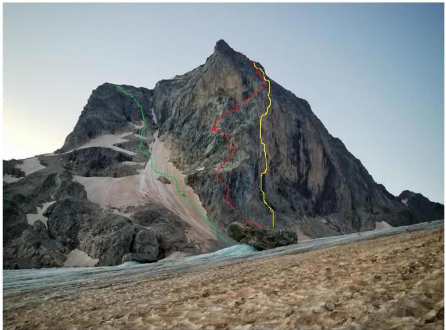
Figure 1 — Route taken by the team (highlighted in red)
1.2. Photo of the Route Profile
A photo of the route profile is not available for the following reasons. On the day before the ascent, there was bad weather, rain, and fog. As a result, it was not possible to take quality photos of the route profile. On the internet (at the time of report preparation), suitable photos were also not available. Available photos did not allow for a quality representation of the route profile and were misleading.
1.4. Panoramic Photo of the Area
A panoramic photo of the area is shown in Figure 2.
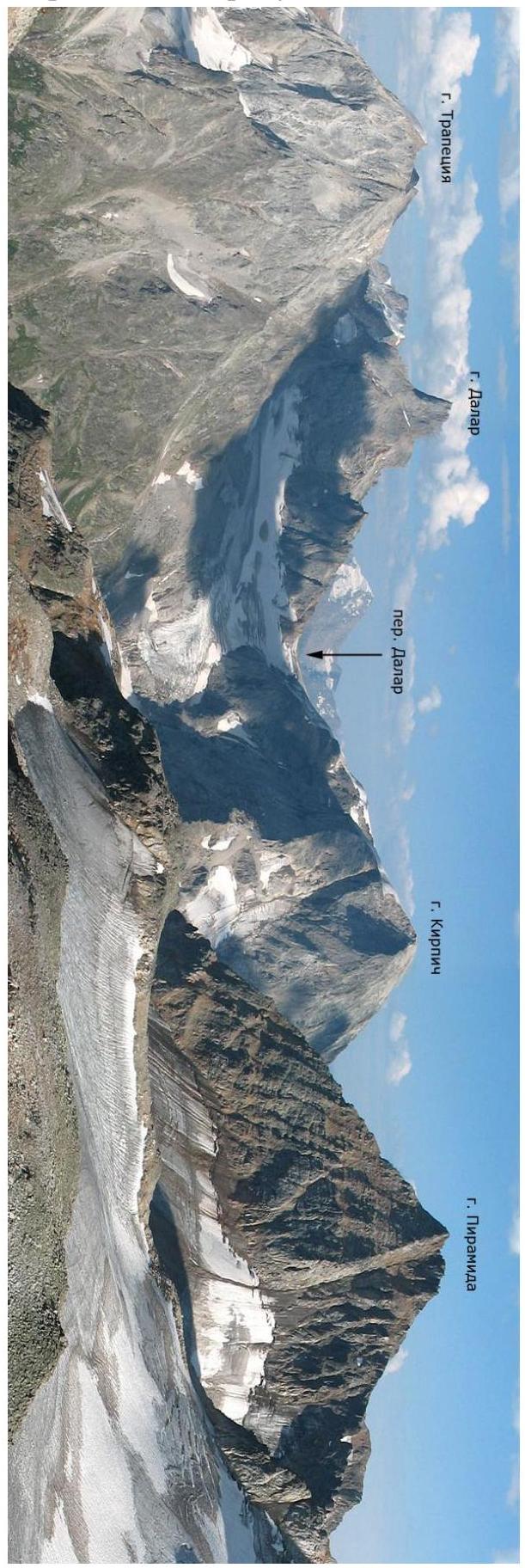
Figure 2 — Panoramic photo of the area
1.5. Map of the Area
A map of the area is shown in Figure 3.
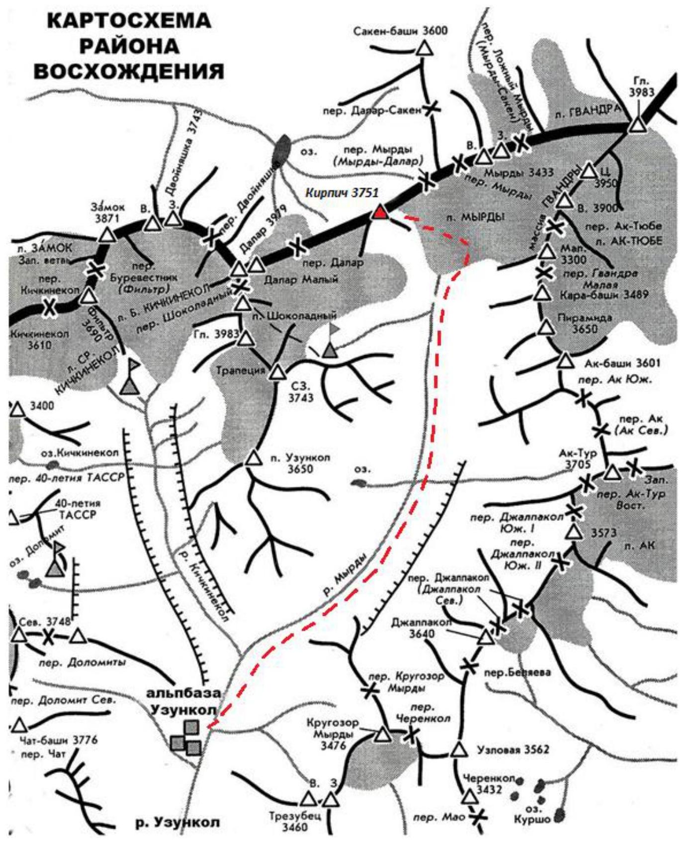
Figure 3 — Map of the area
2. Route Characteristics
2.1. Technical Photo of the Route
A technical photo of the route is shown in Figure 4.
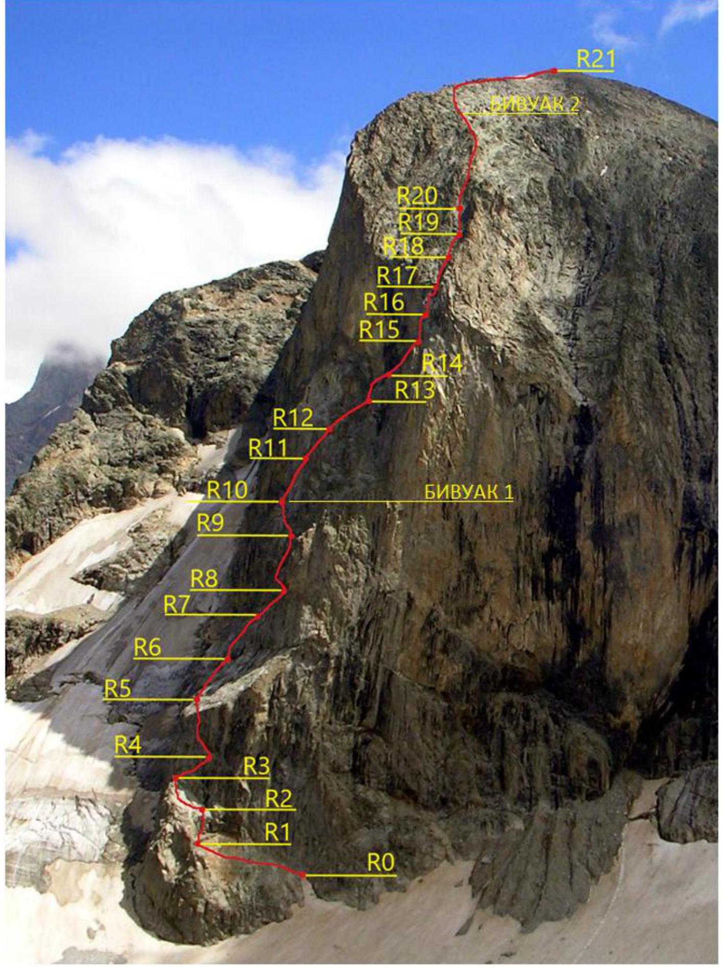
Figure 4 — Technical photo of the route
2.2. Route Diagram in UIAA Symbols
| Section # | cams | nuts | anchors | bolts | Insurance points, characteristics in symbols | Route line in UIAA symbols | Section difficulty in symbols | Section length, m | Steepness° |
|---|---|---|---|---|---|---|---|---|---|
| R20–R21 | 0 | 0 | 0 | 0 | I–II | 250–300 | 15° | ||
| R19–R20 | 5 | 3 | 0 | 0 | III | 50 | 50–60° | ||
| R18–R19 | 5 | 3 | 0 | 0 | III | 50 | 50–60° | ||
| R17–R18 | 5 | 2 | 0 | 0 | III | 50 | 50–60° | ||
| R16–R17 | 4 | 4 | 5 | 0 | V | 40 | 70° | ||
| R15–R16 | 3 | 4 | 8 | 0 | VI, A2 | 35 | 90–95° | ||
| R14–R15 | 4 | 3 | 3 | 0 | III–IV | 50 | 50–85° | ||
| R13–R14 | 4 | 3 | 3 | 0 | 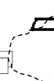 | III–IV | 50 | 60–75° | |
| R12–R13x | 3 | 2 | 5 | 0 |  | VI, A1, III | 10, 35 | 70° | |
| R11–R12 | 5 | 0 | 6 | 0 | 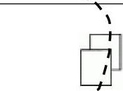 | IV | 50 | 70° | |
| R10–R11 | 4 | 2 | 5 | 0 |  | IV | 50 | 60° | |
| R9–R10 | 3 | 4 | 0 | 0 |  | III | 40 | 45–50° | |
| R8–R9 | 4 | 2 | 6 | 0 |  | III, VI, A2 | 50 | 70–80° | |
| R7–R8 | 3 | 2 | 6 | 0 | III, IV, VI, A2 | 30 | 45–80° | ||
| R6–R7 | 0 | 0 | 8 | 0 | III | 50 | 60° | ||
| R5–R6 | 0 | 0 | 6 | 0 | III–IV | 50 | 45–60° | ||
| R4–R5 | 2 | 2 | 7 | 0 | III, VI, A2 | 50 | 45–85° | ||
| R3–R4 | 1 | 2 | 9 | 0 | IV–V | 50 | 70–80° | ||
| R2–R3 | 0 | 0 | 3 | 0 | II | 40 | 30–45° | ||
| R1–R2 | 5 | 2 | 8 | 0 | III, VI, A2 | 40 | 85° | ||
| R0–R1 | 0 | 0 | 0 | 0 | I–II | 70 | 30–45° |
3. Characteristics of the Team's Actions
3.1. Brief Description of the Route Passage
A brief description of the route passage is given in Table 1.
Table 1 — Description of the route passage
| Section # | Description | Photo # |
|---|---|---|
| R0–R1 | After the snow, follow category 1–2 rocks to approach the arch. To the right of it, 20–25 m away is a good place for insurance. 70 m. | Figure 5, Figure 6 |
| R1–R2 | To the right of the arch, move right 10 m, category 3 rocks along a ledge, then straight up through a crack 25 m, ITO A2, then beyond the bend, after 5 m, station on smooth rocks with anchors. | Figure 5 |
| R2–R3 | Under the wall, 40 m, category 2 rocks. | |
| R3–R4 | Straight up 10 m, category 4 rocks, then right — up 40 m, category 5 rocks. Little insurance, mostly anchors. | |
| R4–R5 | Left along a ledge 10–15 m, category 3 rocks, then straight up, ITO A2 15 m, then beyond the bend, rocks like "ram's foreheads" 10 m, category 3 rocks, lots of debris, be careful, can knock down to the partner. | |
| R5–R6 | Straight up through "ram's foreheads" 50 m, category 3–4 rocks, little insurance, anchors. | Figure 7 |
| R6–R7 | Right — up 50 m, category 3 rocks. Station on a comfortable ledge with grass. | |
| R7–R8 | Right — up 15 m, category 3 rocks, then up 5–6 m, and then traverse left 4–5 m, category 4 rocks. Then up 10 m, ITO A2. Rope is short, but with big bends. Station on an old large channel and anchors. | |
| R8–R9 | Left — up 5–6 m, category 3 rocks, then straight up, ITO A2 10 m. Small ledge. Then easier. Along the left part of the gully-couloir 35 m, category 4 rocks. Large beige blocks on the right. Station on medium cams. | |
| R9–R10 | Left — up beyond the bend 40 m, category 3 rocks onto a debris ledge. Overnight stay site. Lots of small debris. Had to clear the site. Site is generally safe. The wall protects from rocks falling from above. | |
| R10–R11 | From the overnight stay, straight up 50 m, category 4 rocks. | Figure 8 |
| R11–R12 | Right — up around the corner 50 m, category 4 rocks, rocks are strong. | |
| R12–R13 | Right — up through a crack 5–6 m, ITO A1, then pendulum right along an inclined slab 5 m, then right up 35 m, category 3 rocks. The second climber feels uneasy on the pendulum. | |
| R13–R14 | Straight up, category 3 rocks 20 m, then slightly left — up 10 m, category 4 rocks, and then traverse right 20 m, category 3 rocks under the yellow triangular wall along a ledge. | |
| R14–R15 | Right — up along a ledge under black streaks 35 m, category 3 rocks. Passed a suitable overnight stay site (platform laid out). Then up 15 m, category 4 rocks through a chip — approach to the key | |
| R15–R16 | ITO A2, 30–35 m straight up, then exit right through a wall onto an inclined slab. Station on anchors and small cams. | Figure 9 |
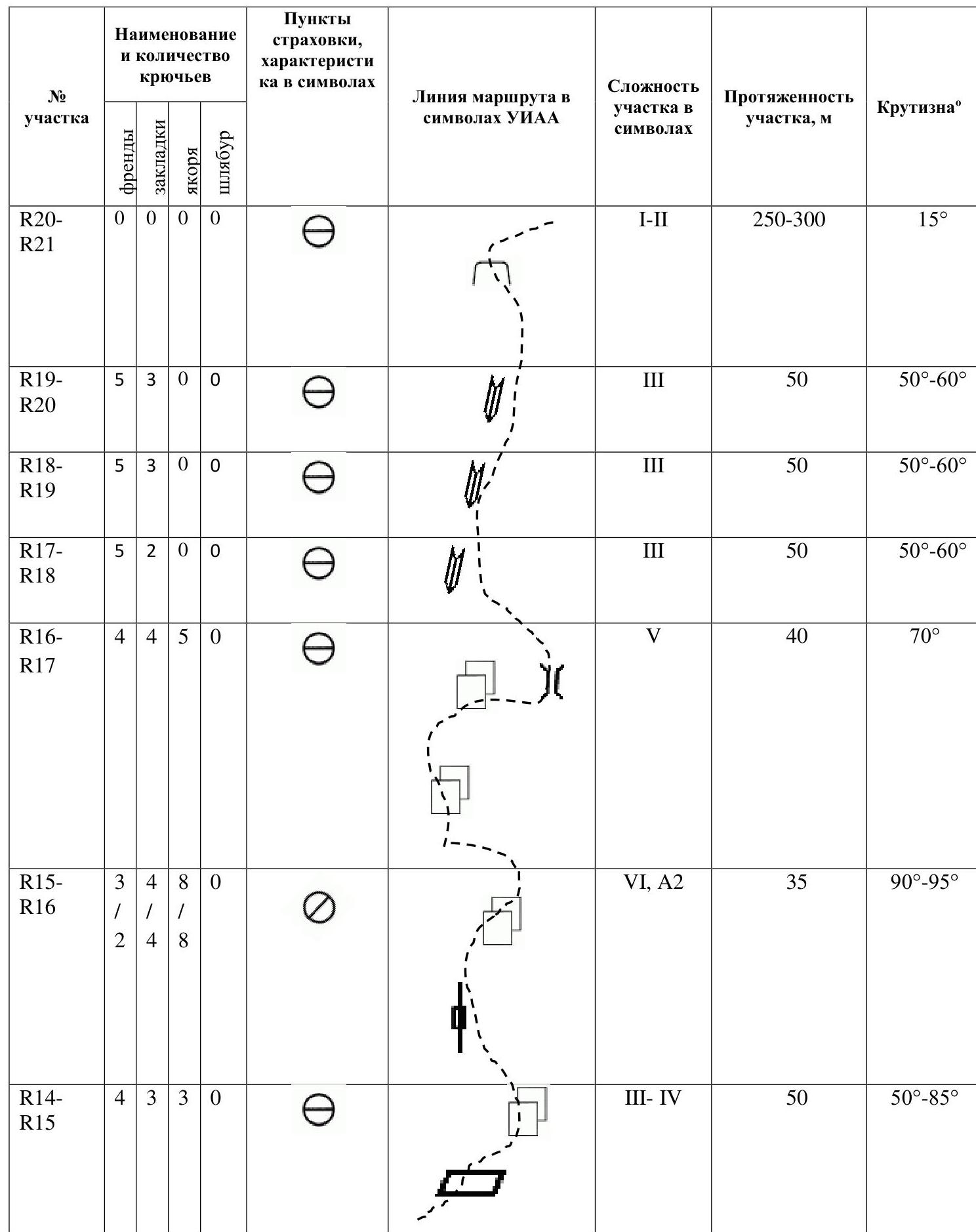
| R16–R17 | Straight up 15 m, category 5 rocks, then right 15 m to a chimney, then into the chimney 10 m. Climbing on this section is tense, rocks are smooth. | Figure 10 |
| R17–R20 | Along a rock gully up 150 m, category 3 rocks, rocks are monolithic, climbing is pleasant. | Figure 11 |
| R20–R21 | Then along the ridge for 45 min to the summit, 250–300 m, category 1–2 rocks. |
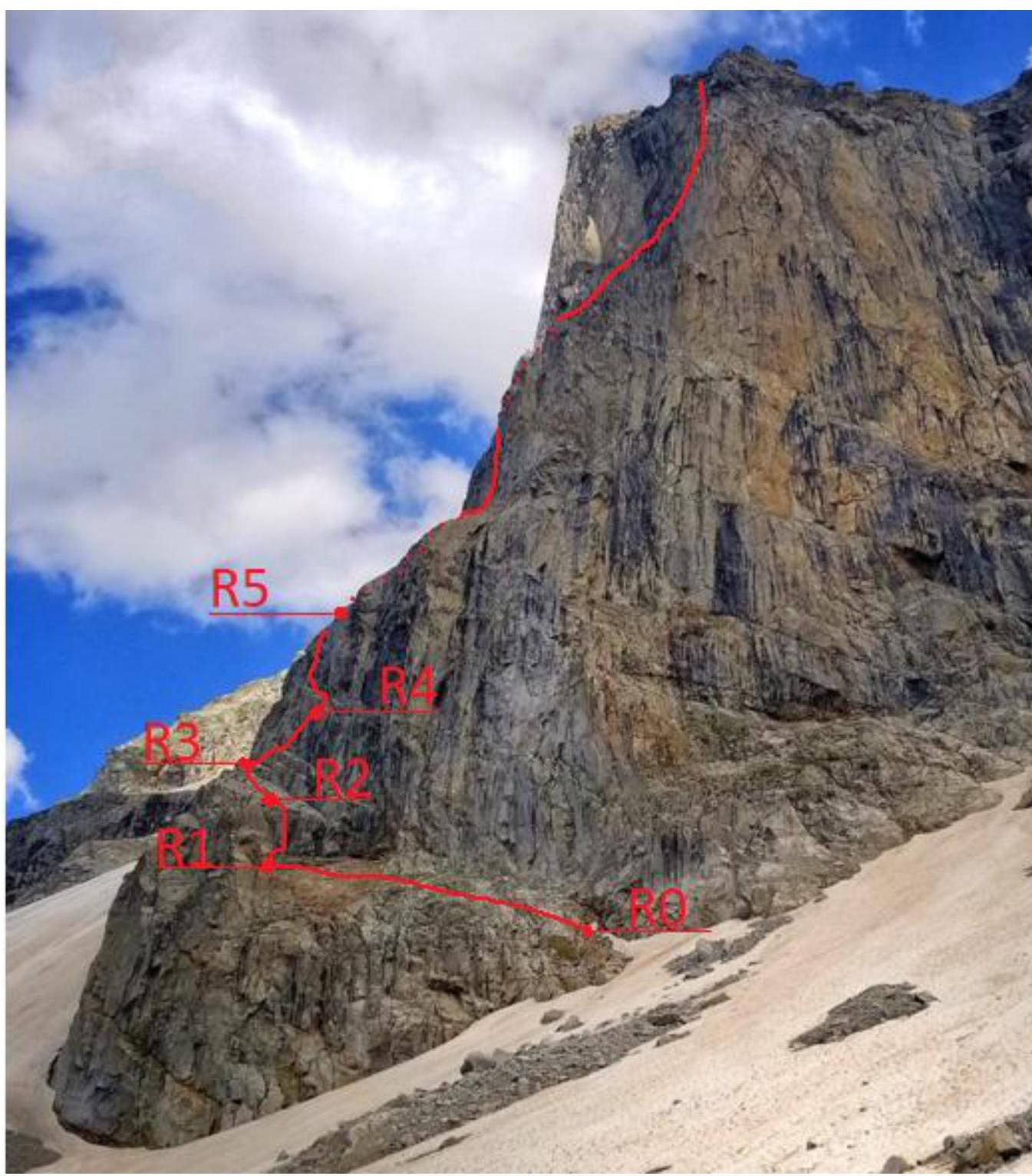
Figure 5 — Lower part of the route, sections R0–R5 (photo from the internet)
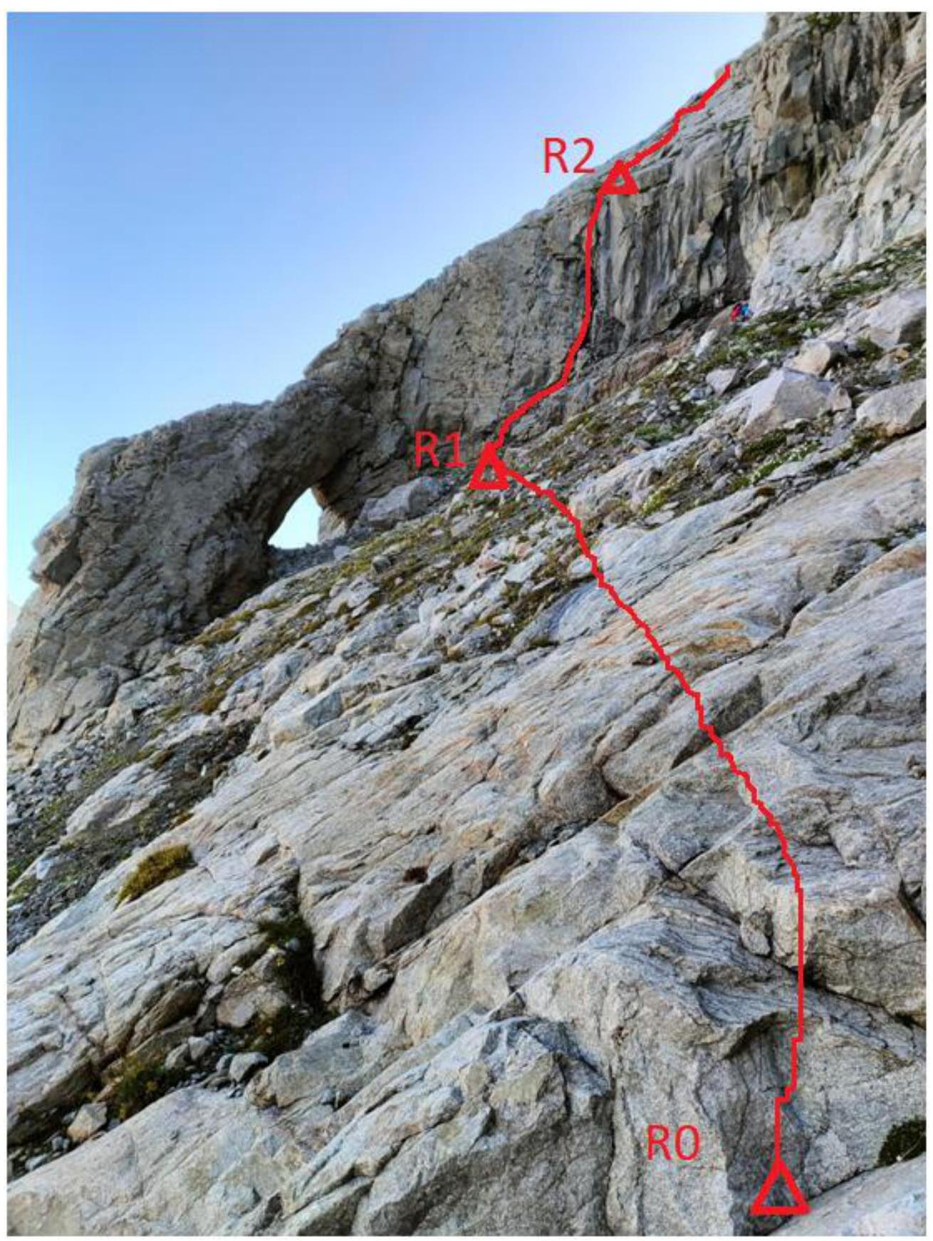
Figure 6 — Section R0–R1
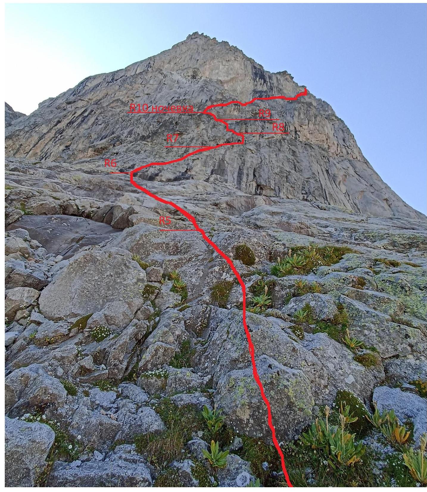
Figure 7 — Sections R5–R10 (photo from the internet)

Figure 8 — Start of section R11

Figure 9 — Troitskiy's passage of section R15–R16

Figure 10 — Passage of section R16–R17

Figure 11 — Start of section R17, first rope in the rock gully
3.2. Photo of the Team at the Summit with the Control Tour
A photo of the team at the summit is shown in Figure 12.
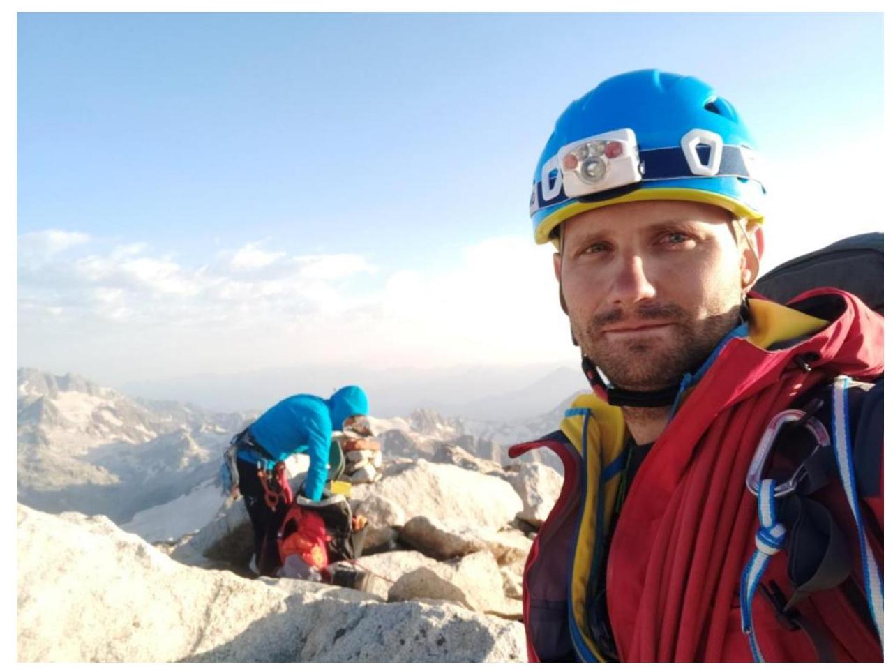
Figure 12 — Photo of the team at the summit
3.3. Additional Route and Ascent Characteristics
Overall, the route is safe. Mostly monolithic. No rockfall was recorded during the ascent.
On gentle slopes, there is debris, which requires careful work from the leader.
The leader worked with a double rope throughout. With a good radio station, communication with the Uzunkol camp is stable (the team had a Yeasy VX-6R radio (5 W), Diamond 1/4 wave antenna). In other cases, a repeater is required (for example, from overnight stays under Trezubets).
There is no water on the route! Near the summit, there are snowfields. Suitable overnight stay sites — after section R10 (needs to be cleared, a large tent won't fit) and before section R16 (platform laid out), then on the ridge after section R20 and under the summit.
The most convenient descent from the route is via category 1B. At the end of summer, when descending from the Dalar pass to the glacier (August 15 and later), the bridge over the bergschrund may collapse.
Compared to other category 5A routes climbed by the team, this route is more challenging than 5A Dzhailyk (via "monk"), 5A Dalar (Kavunenko), 5A Zamok via the 3rd wall (Fann Mountains). However, the route is easier than 5A on Chapdara peak via the S ridge. The route is not recommended as a first 5A.
The route was completed in 22 hours, which is an average result.
The purpose of this report was to create a modern description of the category 5A route on Kirpich peak via the NW face. Before the ascent, writings from the FAP website from 1969 and 1974 were studied. Photos of the route and text description needed clarification.
Outdated information in the old descriptions includes the indication of water on the route. In fact, there is no water in a usable form on the route. Consultation on the route at the alpine camp was not possible, as the head of the training department, Sitnik M.A., said the route had not been visited for several years.
The weather at the beginning of August 2022 was unstable. Forecasts predicted rain in the second half of the day with high probability. For this reason, the following were taken on the route:
- tent,
- food supplies for the case of bad weather.
The priority of the ascent was safety. Overnight stays began at 18:00. An exception was not made, despite being close to the summit on the second day of the ascent. In fact, it was 20 minutes of walking from the second overnight stay to the summit.
We believe our report will be useful, and the route will become more popular among climbers.