Report
On the ascent to Dolomit Centralny peak via the route along the Western wall edge ("Мечта" or "Dream"), rock climbing, category 4B, by the "BARS" team from August 8, 2020 to August 8, 2020.
I. Climbing Report
| 1. General Information | ||
|---|---|---|
| 1.1 | Full name, sports rank of the team leader | Dusheiko Alexander Sergeevich, 1st sports rank |
| 1.2 | Full name, sports rank of the participants | Belyankina Natalia Pavlovna, 2nd sports rank |
| 1.3 | Full name of the coach | Semiletkin Sergey Alekseevich, Master of Sports |
| 1.4 | Organization | Alpclub SPbSU "BARS" |
| 2. Characteristics of the Climbing Object | ||
| 2.1 | Region | Uzunkol |
| 2.2 | Valley | Kichkene-Kol valley |
| 2.3 | Number of the section according to the 2013 classification table | 46 |
| 2.4 | Name and height of the peak | Dolomit Centralny, 3760 m |
| 3. Route Characteristics | ||
| 3.1 | Route name | Along the edge of the Western wall ("Мечта" or "Dream") |
| 3.2 | Proposed category of difficulty | 4B |
| 3.3 | Degree of route development | - |
| 3.4 | Relief characteristics of the route | Rock climbing |
| 3.5 | Altitude difference of the route (data from altimeter or GPS) | 600 m |
| 3.6 | Route length (in meters) | 1105 m |
| 3.7 | Technical elements of the route (total length of sections with different categories of difficulty, indicating the nature of the terrain (ice-snow, rock)) | 1st cat. diff. rocks — 80 m. 2nd cat. diff. rocks — 490 m. 3rd cat. diff. rocks — 145 m. 4th cat. diff. rocks — 40 m. 5th cat. diff. rocks — 90 m. 6th cat. diff. rocks — 45 m. |
| 3.8 | Average steepness of the route, ° | - |
| 3.9 | Average steepness of the main part of the route, ° | - |
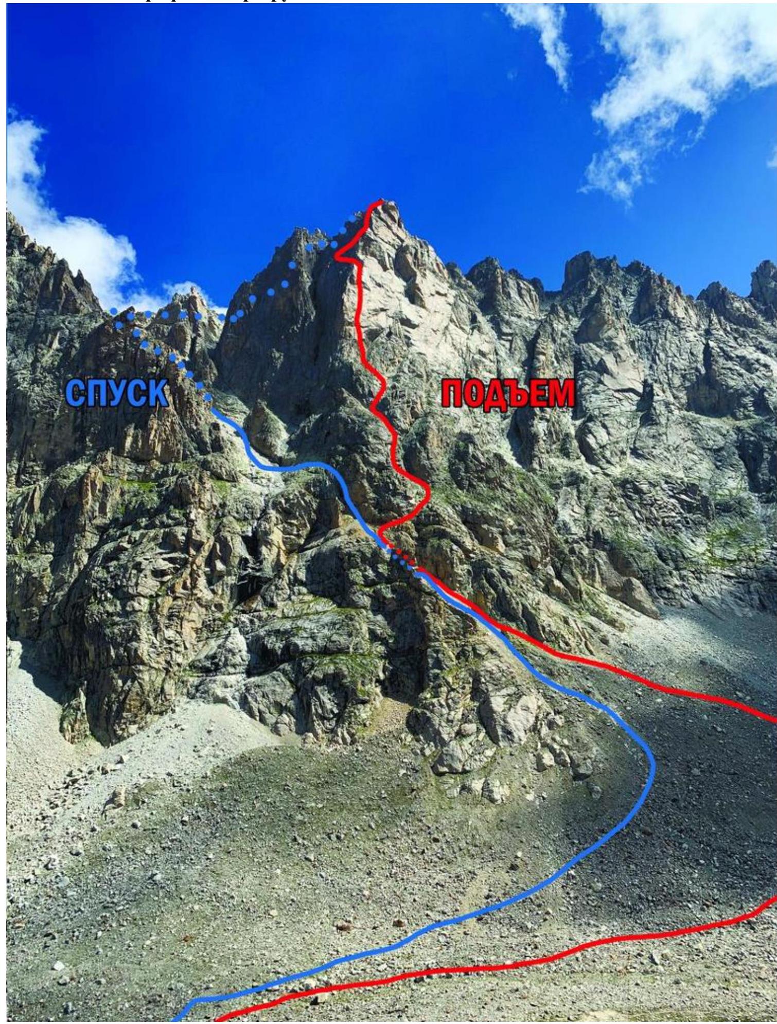
| 3.10 | Descent from the peak | Via 2A cat. diff. to Kichkene-Kol valley |
| 3.11 | Additional route characteristics | Presence of water: absent throughout the entire route |
| 4. Characteristics of the Team's Actions | ||
| 4.1 | Time of movement (team's climbing hours, in hours and days) | 8.5 hours |
| 4.2 | Overnight stays | - |
| 4.3 | Time spent on route development | - |
| 4.4 | Departure on the route | 4:30 AM, August 8, 2020 |
| 4.5 | Arrival at the peak | 2:25 PM, August 8, 2020 |
| 4.6 | Return to the base camp | 4:30 PM, August 8, 2020 |
| 5. Weather Conditions | ||
| :--: | :------------------------------------------------------------------------------------------------------: | :-----------------------------------------------------------------------------------------------: |
| 5.1 | Temperature, °C | - |
| 5.2 | Wind speed, m/s | - |
| 5.3 | Precipitation | - |
| 5.4 | Visibility, m | - |
| 6. Person Responsible for the Report | ||
| 6.1 | Full name, e-mail | Belyankina Natalia Pavlovna, info@alp-school.com, 8 800 700 5642 |
II. Climbing Description
1. Characteristics of the Climbing Object
The Dolomites are a rocky massif located in the northern spurs of the Main Caucasian Range. The name was given by the first ascender to the North peak, B. N. Delaunay, due to the external similarity of the massif to the Italian Dolomites. There are many interesting and popular routes here, mostly of a rocky nature.
The group of peaks known as the Dolomites is consistently popular among mountaineers in the Uzunkol region. 11 routes have been laid out to the peaks of the massif (including traverses), 10 of which are classified. The routes are characterized by very difficult climbing (for their category of difficulty), but are not long, and ascents typically take no more than 6-10 hours.
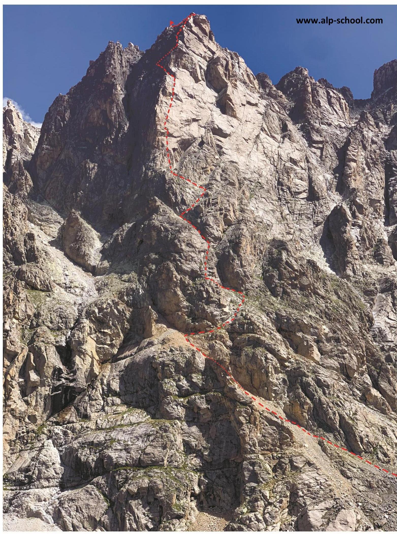
1.1. General photo of the Western wall of Dolomit Centralny peak with the route line and lines of other climbed routes
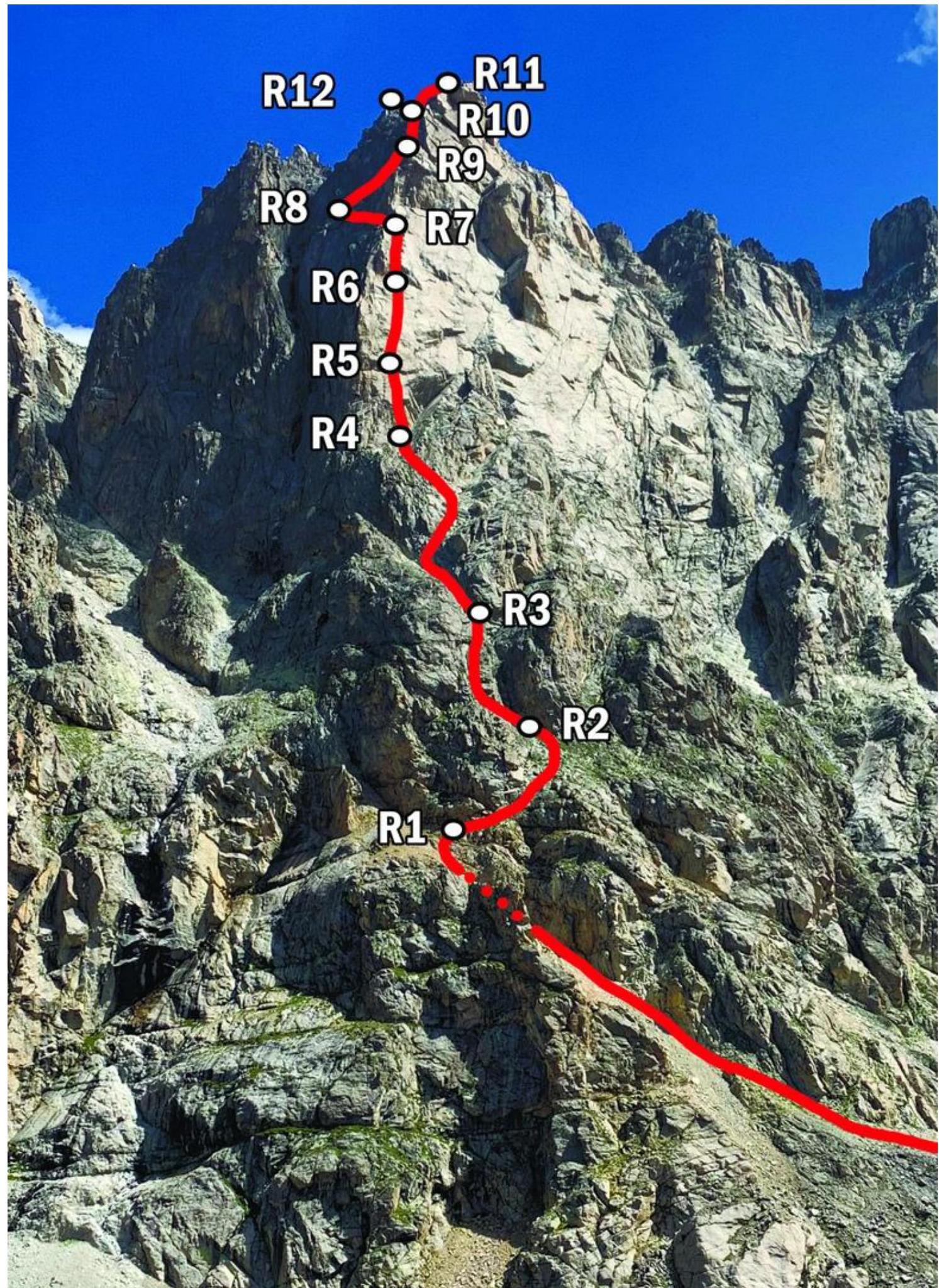
1.2. Photo of the route profile.
2. Route Characteristics
2.1. Route scheme in UIAA symbols

2.2. Technical photograph of the route
3. Characteristics of the Team's Actions
Approach: from the base camp on the Stlanikovaya River opposite Admiral Makarov peak to the start of the route via animal paths takes 2 hours. Climb towards Kart peak, veering left from the hill. Pass the lake and approach the bastion. The starting point of the route is marked by slabs with black streaks.
| Section | Description | Photo Number |
|---|---|---|
| R0–R1 Н/К 300 м | Along a wide scree couloir to a place where you can climb up simple rocks to the right, under the base of a wide internal corner "Книга" or "Book" (landmark for the lower part of the route). In June-July, there may be snow in the couloir. | 1 |
| R1–R2 3 30 м 45° | Climb up simple rocks to a wide scree terrace under "Книга". | 1 |
| R2–R3 5 40 м 70° | Up the left "page of the Book". After about 20 m, move to the right and exit onto a ledge under a large plug wedged in the upper part of the internal corner "Книга". | 2,3 |
| R3–R4 1–2 120 м | From the plug, climb up to the left onto a wide scree ledge and along it for about 80 m until a logical ascent to the right to the base of a large inclined internal corner, under the cliffs of the Western wall. | |
| R4–R5 5 35 м 70° | From the base of the large internal corner, climb up through a crack under a belt of overhanging rocks. | 4,5 |
| R5–R6 6 40 м 70°–90° | First key rope of the route. From the belay station, climb up through the internal corner via cornices (8 m, 6, 90°). Then, via a system of cracks, to a flake (15 m, 5, 80°). Through the flake, exit onto a flattening (5 m, 6, 80°) and climb up via simpler terrain to the edge of the Western wall. | 6,7 |
| R6–R7 4–5 40 м 70° | From the belay station, climb up through a crack and internal corner along the edge of the Western wall, beyond a bend, onto a small ledge. | 8 |
| R7–R8 3 70 м 50° | From the ledge, climb up along the edge of the Western wall under a steep wall, then traverse along a ledge to the left. To the next wide ledge with large blocks. | 9 |
| R8–R9 1–2 50 м | Along the wide ledge with large blocks to the right, to the edge of the Western wall. | 10 |
| R9–R10 5 30 м 80° | Second key rope of the route. On the left side of the edge of the Western wall, through a small internal corner, exit onto a monolithic slab. | 11 |
| R10–R11 4 40 м 50° | Up the slab and then along the rocks of the ridge for about 20 m. Then, climb up onto the ridge. | 12,13 |
| R11–R12 2–3 300 м | Continue moving first to the left, then to the right along the rocks of the ridge to the peak. | 14,15 |
3.2. Photos from the route
Photo 1
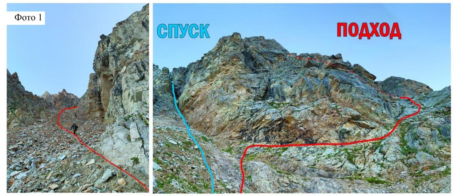
Photo 2 Photo 3
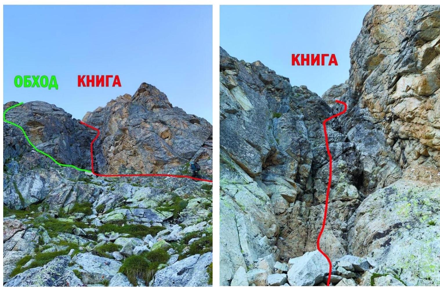
Photo 4 (R4–R5) Approach to key 1
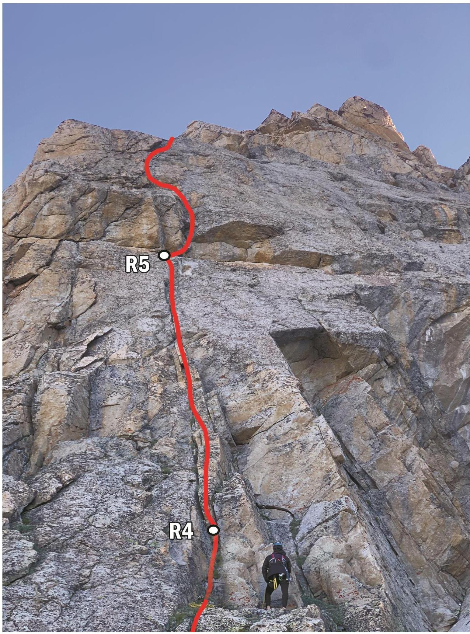
Photo 5 (R4–R5) Approach (R5–R6) KEY 1
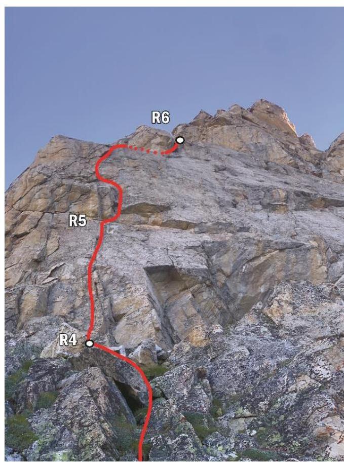
Photo 7 (R5 continuation, FIRST KEY, flake)
Photo 6 (R5 start, FIRST KEY, cornice)
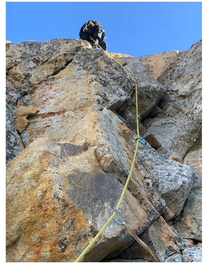
Photo 8 (R6–R7) end, FIRST KEY)
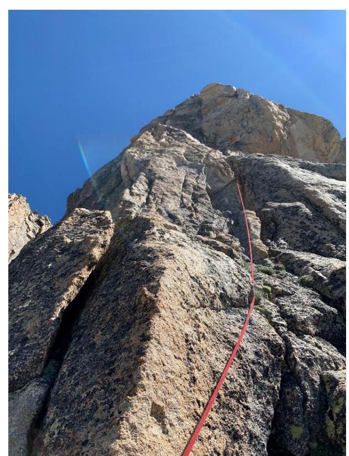
Photo 9 (R7–R8) end of key
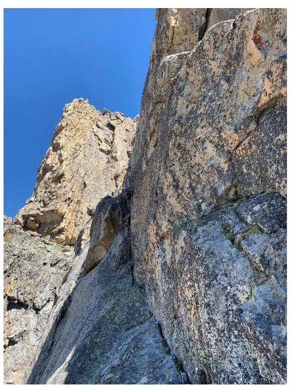
Photo 11 (R9–R10) SECOND KEY
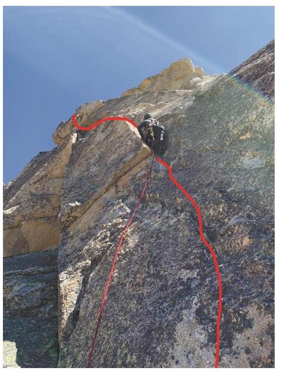
Photo 10 (R8–R9) end of key)
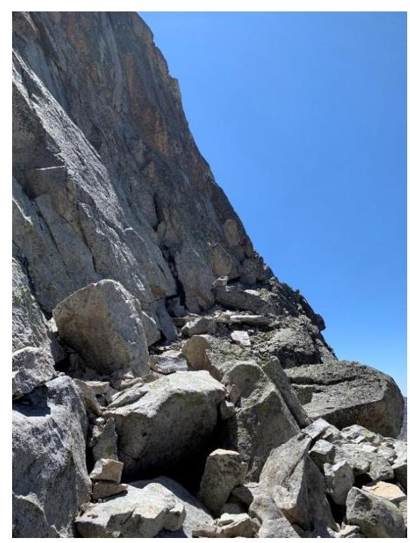
Photo 12 (R10–R11) exit to the ridge
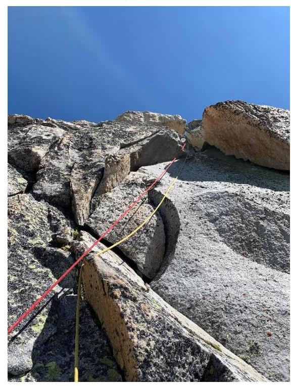
Photo 13 (R10–R11) exit to the ridge
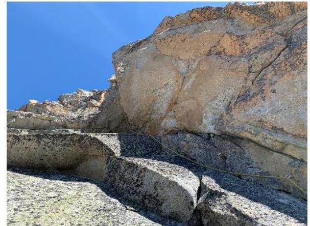
Photo 14 (R11–R12) left of the ridge
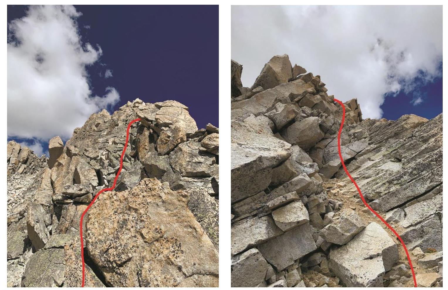
Photo 15 (R11–R12) right of the ridge
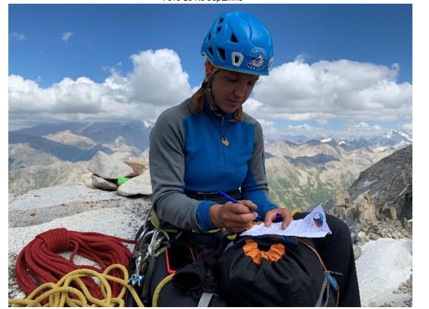
Photo 16 At the summit
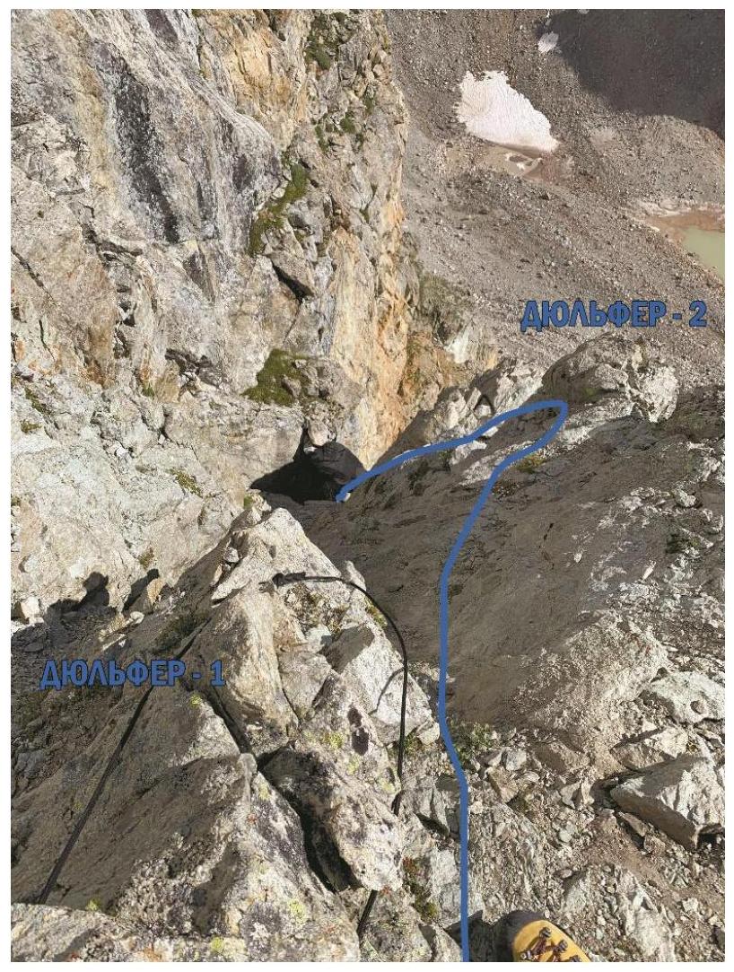
Photo 17 DESCENT
Photo 18 DESCENT
Photo 19 DESCENT
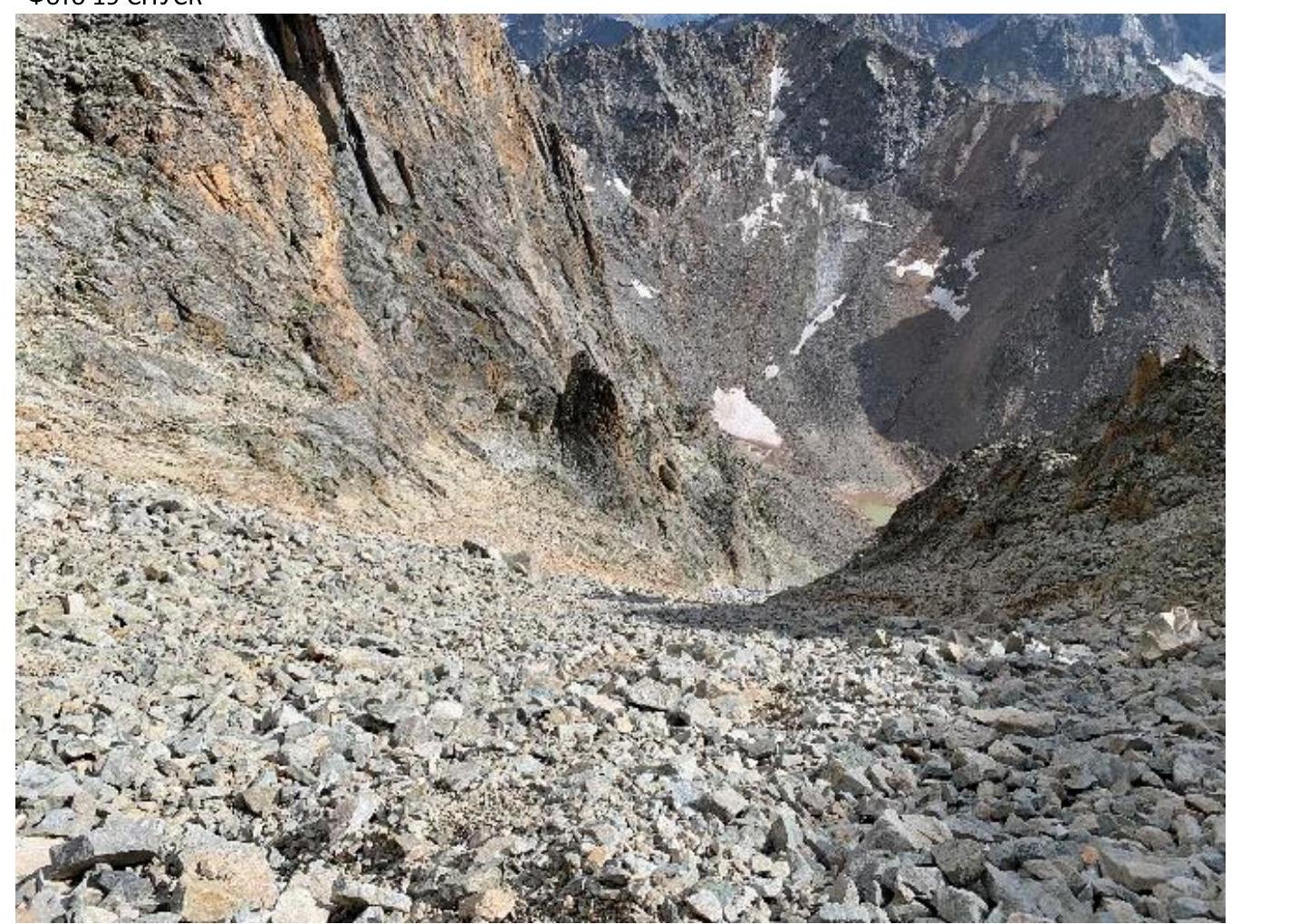
Photo 20 DESCENT
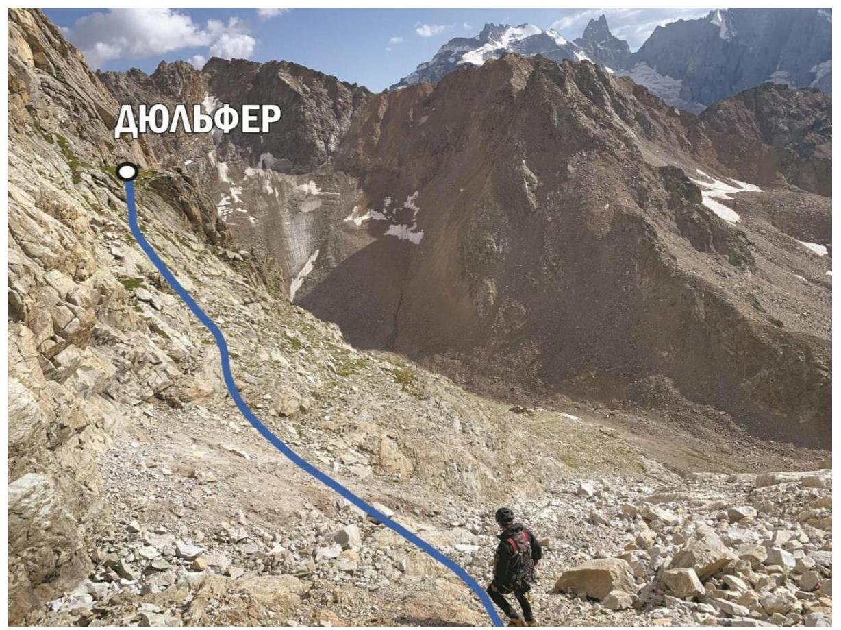
Photo 21 RAPPEL
More photos from the route and comments in the group: https://vk.com/alp_school_spb↗