CHAMPIONSHIP OF THE VOLGA AND URAL FEDERAL DISTRICTS IN ALPINISM TECHNICAL AND ALTITUDE CLASS
REPORT
ON THE ASCENT TO THE SUMMIT DALAR (3988 m) VIA THE NORTH-EAST FACE OF THE EASTERN SHOULDER, CATEGORY 5B COMPLEXITY (POROKHNI YU.I. ROUTE) BY THE TEAM FROM SAMARA REGION AND PERM TERRITORY
FOR THE PERIOD FROM AUGUST 16 TO 17, 2024
I. Ascent Passport
| 1. General Information | ||
| 1.1 | Full name, sports rank of the team leader | Zankina Daria Viktorovna, 1st sports rank |
| 1.2 | Full name, sports rank of the participants | Goryaev Yuri Nikolaevich, 1st sports rank |
| 1.3 | Full name of the coach | Klimov Sergey Aleksandrovich |
| 1.4 | Organization | Samara Region Alpine Federation, Perm Territory Youth Public Organization – Alpine and Climbing Federation |
| 2. Characteristics of the Ascent Object | ||
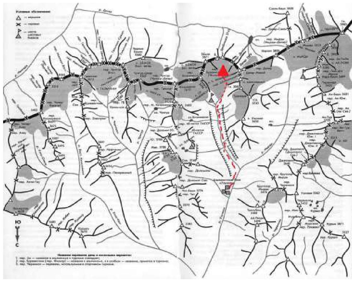
| 2.1 | Region | Caucasus, from Nakhar Pass to Chiperazau Pass (Uzunkol alpine camp) |
| 2.2 | Valley | Kichkinkol |
| 2.3 | Section number according to the 2013 Classification Table | 2. CAUCASUS 2.3. From Nakhar Pass to Chiperazau Pass |
| 2.4 | Name and height of the summit | Dalar, 3988 m |
| 3. Characteristics of the Route | ||
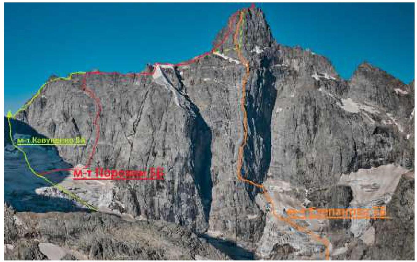
| 3.1 | Route name | via NE face of E shoulder |
| 3.2 | Proposed category of complexity | 5B |
| 3.3 | Degree of route exploration | — |
| 3.4 | Relief characteristics of the route | Combined |
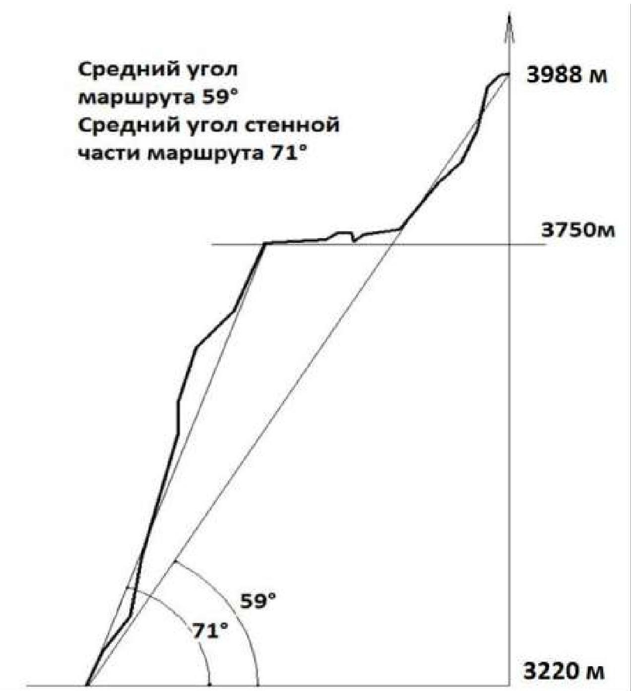
| 3.5 | Height difference of the route (altimeter or GPS data) | 768 m |
| 3.6 | Route length (in meters) | 1880 m |
| 3.7 | Technical elements of the route (total length of sections of various complexity categories with relief characteristics) | – 1B cat. comb. — 410 m – 2B cat. comb. — 590 m – 3B cat. comb. — 195 m – 4B cat. rock — 200 m – 5B cat. rock — 465 m – 6B cat. rock — 20 m |
| 3.8 | Average steepness of the route, ° | 59° |
| 3.9 | Average steepness of the main part of the route, ° | 71° |
| 3.10 | Descent from the summit | via the bastion using rappel stations |
| 3.11 | Additional route characteristics | |
| 4. Characteristics of the Team's Actions | ||
| 4.1 | Time of movement (team's walking hours, in hours and days) | 14 h 05 min, 2 days |
| 4.2 | Overnight stays | One, on a ledge after section R9–R10 |
| 4.3 | Route processing time | The route was not processed |
| 4.5 | Time of departure from the base camp | 5:00, August 16, 2024 |
| 4.6 | Time of starting work on the route | 10:15, August 16, 2024 |
| 4.7 | Reaching the summit | 11:20, August 17, 2024 |
| 4.8 | Return to the base camp | 21:00, August 17, 2024 |
| 5. Meteorological Conditions | ||
| 5.1 | Temperature, °C | — |
| 5.2 | Wind speed, m/s | — |
| 5.3 | Precipitation | — |
| 5.4 | Visibility, m | — |
| 6. Person Responsible for the Report | ||
| 6.1 | Full name, e-mail | Zankina Daria Viktorovna, dar.zankina@gmail.com |
Description of the Ascent
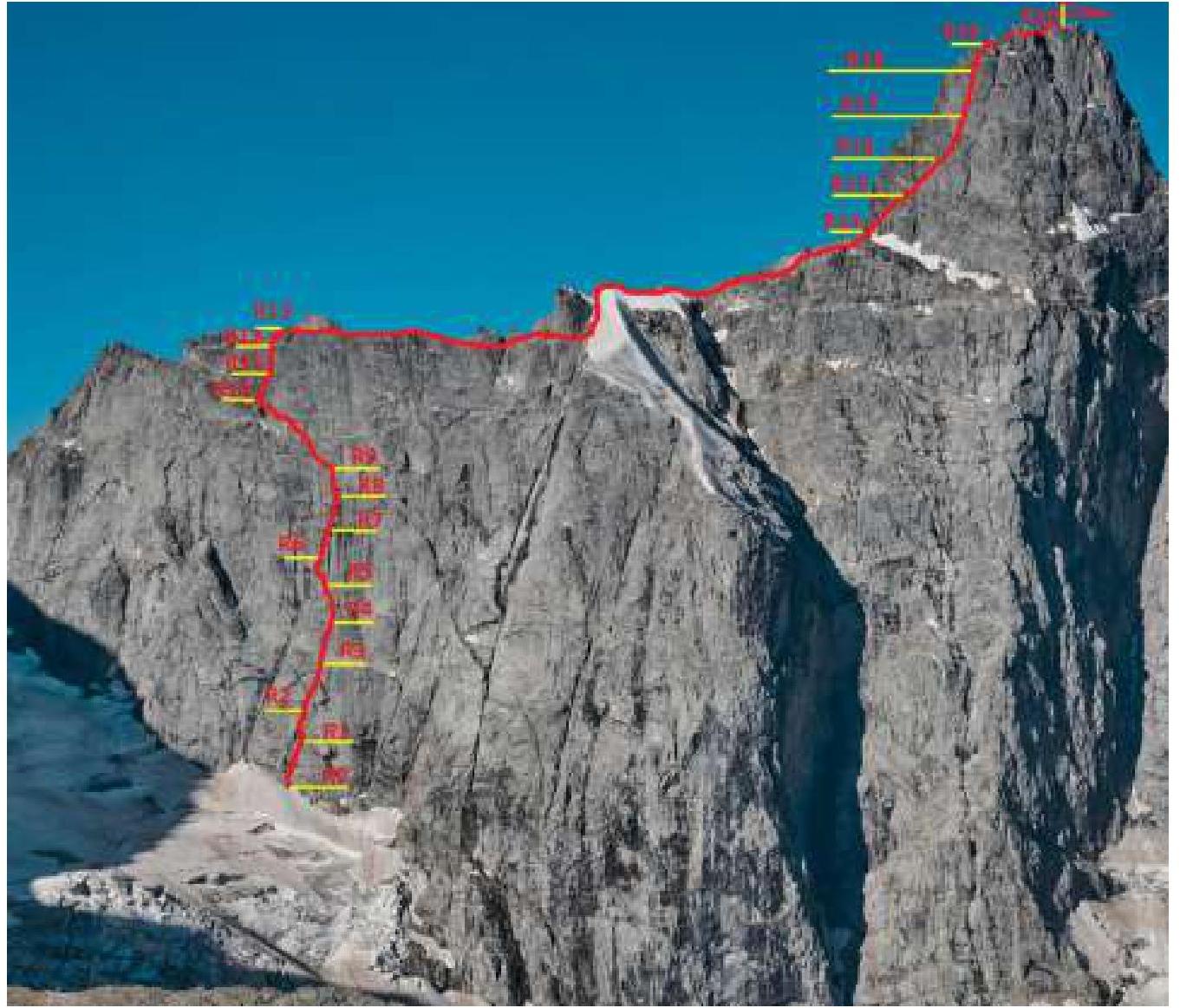
General photo of the summit
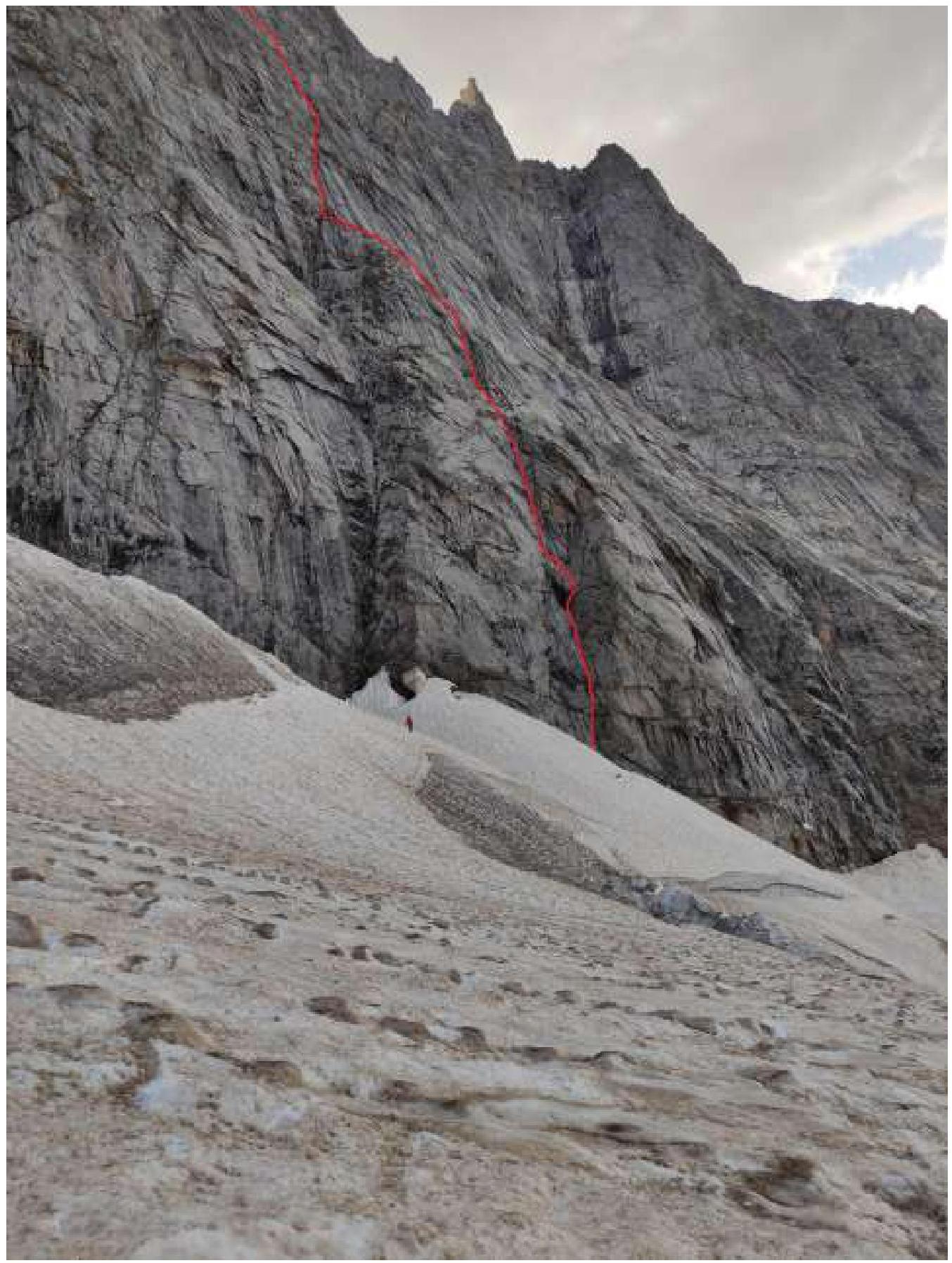
 Profile of the wall part of the route
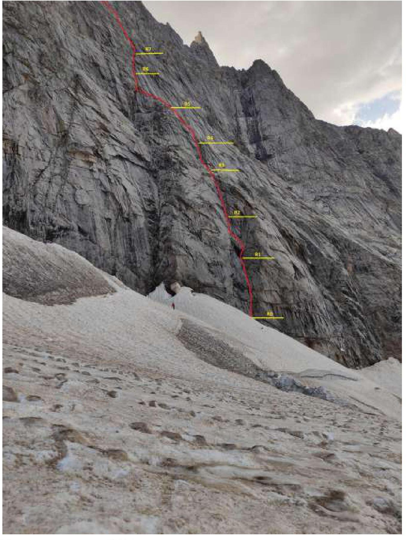
Route Profile
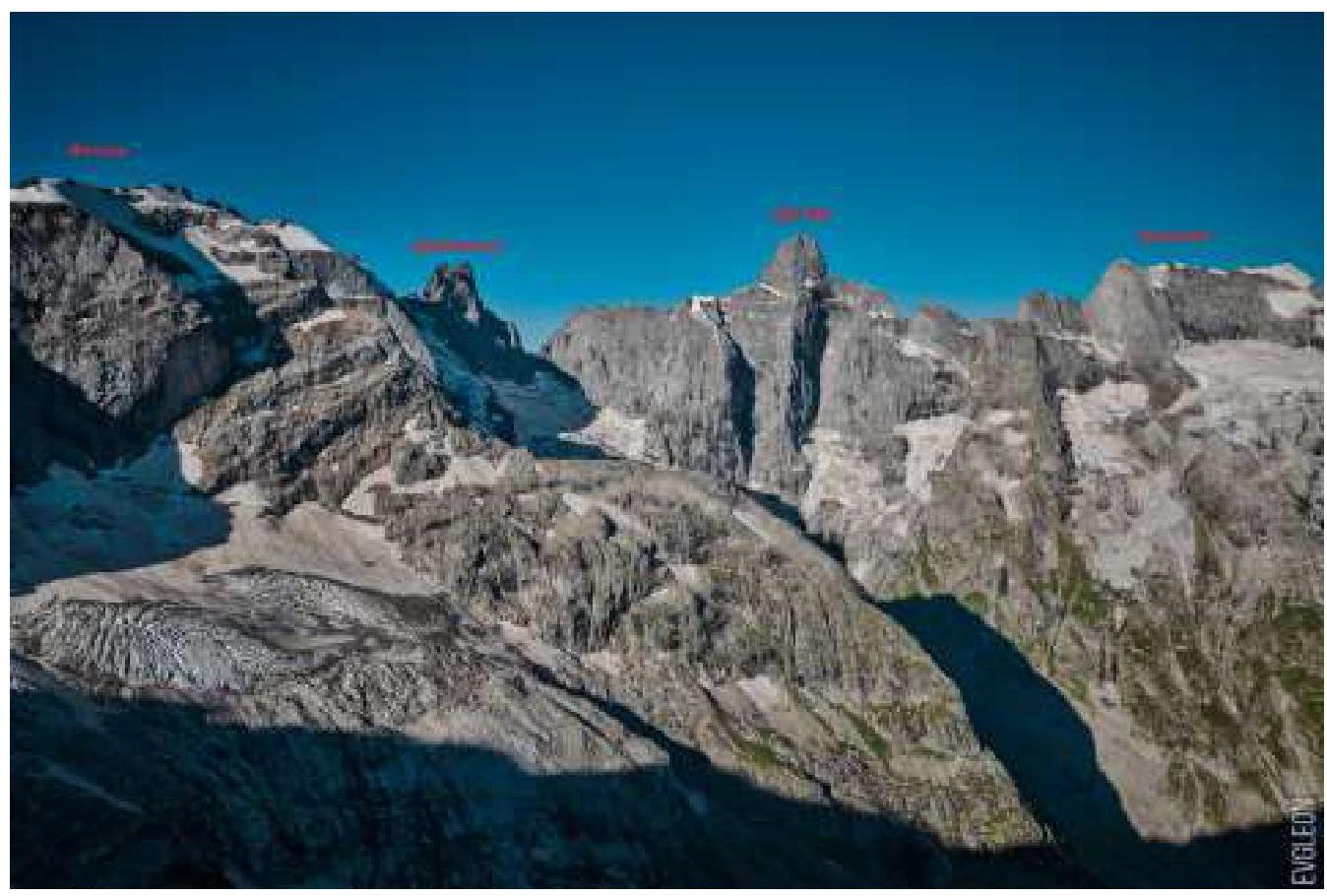
Photopanorama of the Area
Map of the area
Description of the Area
Located in the Western Caucasus region of the Greater Caucasus mountain system. The translation of the hydronym is based on the Karachay words "uzun" — "long" and "kol" — "valley". Usually, it refers to the section of the Main Caucasian Range and its northern spurs, forming the basin of the rivers: – Myrd – Kichkinekol – Uzunkol
Uzunkol is formed by the confluence of two rivers: Myrd (6 km) and Kichkinekol (4 km). This place is called the Uzunkol Plain. The rivers flowing from the slopes to the north are the sources of the Kuban River. The rivers Uzunkol and Ullukam (15 km), merging, form the Kuban. To the east, the area borders with the Elbrus region, to the west — with the Federal Reserve Dautsky of the Teberda Reserve (beyond which is Dombay). The highest point of the area is Gvandra.
Technical photo of the route.
Technical photo of the wall part
Route in UIAA symbols
| Section № | Name and number of protection points | Route line in UIAA symbols | Section complexity in symbols | Section length, m | Steepness, ° |
|---|---|---|---|---|---|
| R19–R20 | 4 | III, II, V, IV, V+ | 4 | 50, 150, 10, 15, 50 | 15, 75, 80 |
| R18–R19 | 1 | V, IV | 2 | 10, 15 | 75 |
| R17–R18 | 4 | V+ | 5 | 50 | 80 |
| R16–R17 | 3 | V+, IV | 4 | 20, 25 | 85 |
| R15–R16 | 1 | IV+ | 3 | 45 | 65 |
| R14–R15 | 1 | IV+ | 3 | 45 | 65 |
| R13–R14 | 1 | III, II, I | 1 | 130, 400, 310 | 10 |
| R12–R13 | 1 | V | 3 | 25 | 75 |
| R11–R12 | 2 | V+ | 4 | 40 | 80 |
| R10–R11 | 1 | V, IV | 4 | 30, 20 | 85 |
| R9–R10 | 3 | II, I | 1 | 25, 100 | 15 |
| R8–R9 | 3 | VI, V | 5 | 20, 30 | 75 |
| R7–R8 | 1 | V+ | 1 | 30 | 80 |
| R6–R7 | 1 | V | 3 | 30 | 75 |
| R5–R6 | 3 | V, III, II | 2 | 20, 15, 15 | 50 |
| R4–R5 | 2 | V+ | 5 | 50 | 75 |
| R3–R4 | 2 | V, IV | 3 | 15, 15 | 70 |
| R2–R3 | 2 | V, IV | 6 | 50, 5 | 75 |
| R1–R2 | 3 | V, IV | 4 | 10, 30 | 70, 40 |
| R0–R1 | 2 | V | 6 | 55 | 75 |
Characteristics of the Team's Actions
On August 16, 2024, at 5:00, the team departed from the Uzunkol alpine camp and by 10:00 approached the start of the route. At 10:15, they began working on the route. The weather was clear and windless. At 17:00, they reached the first control point (R5). At 19:00, they stopped for an overnight stay on a ledge after section R9–R10.
On August 17, 2024: – At 6:00, they continued their movement along the route. They reached the summit at 11:20. – At 11:40, they began their descent from the summit. – At 18:00, they descended to the glacier. – By 21:00, they returned to the Uzunkol alpine camp.
| Section № | Description |
|---|---|
| R0–R1 | The start of the route is well-marked. An internal corner is located 100 m to the right. A large internal corner is visible in the photo. Through a rancalft to a ledge formed by a rock separation at the base of the internal corner. Up the corner, "pleasant and interesting climbing," a station on anchors under an overhang forming a small niche. |
| R1–R2 | From the station, move up and to the right, bypassing the overhang along the wall to the right, then left onto a diagonal ledge (a lying internal corner), along the ledge to the left into an internal corner, which sometimes turns into a chimney. An old piton is found on the section. The station is in the corner-chimney slightly above the piton, with local iron. |
| R2–R3 | Up the corner-chimney, exiting onto a wide ledge, station. Overnight stay is possible on the ledge, but there is no water. It is possible to divert to the left along the ledge into the Large Internal Corner. |
| R3–R4 | From the station up through walls-ledges into a corner, along the right side of the corner into a ledge, where a station is organized. The section is short, with a whole rope length to the next convenient ledge. |
| R4–R5 | Further up the corner, the clear corner ends, continuing along the wall with cracks and a separation, staying to the left, exiting onto a ledge. The station is in a corner with a large wedged block. To the left is a platform for an overnight stay. Control point. |
| R5–R6 | From the station up short walls, moving left onto a narrow ledge, along the ledge to the left into an internal corner, which is a continuation of the Large Internal Corner. It was not possible to organize a station before the corner, so the leader continued movement along the corner through a small overhang. Above the overhang, to the left of the corner on an uncomfortable ledge, a station was organized. |
| R6–R8 | Continue movement up the corner, station R7 on a convenient ledge. On section R7–R8, the corner turns into a wall with cracks, with local iron and old pitons. |
| R8–R9 | From the station, move up and to the right 10–15 m, then up, veering left along a system of walls, corners, bypassing small cornices, onto a wall like "ram's foreheads," along which we climb onto an osypnaya ledge. Live rocks! The section can be passed by continuing movement up and to the right. |
| R9–R10 | Careful movement left along the osypnaya ledge to local points, закладки and anchors installed on the wall. There is a platform for a tent on the ledge, and no water was found in late August. We did not find a control point on this section. In old descriptions: "K.T. under an overhang, but it's unclear which one." It's easy to knock stones down from the osypnaya ledge, which is important to consider if another group follows you! |
| R10–R13 | Movement from the ledge initially to the right and up, then more vertically up, with rich relief, easy climbing, choosing the most logical path, encountering live rocks, all stations on convenient ledges. |
| R13–R14 | Movement passes along a ridge, simultaneously, all gendarmes are bypassed to the right along ledges, the gendarm before the snowy "knife" is bypassed to the right along a narrow ledge! After the snow-ice section of the ridge — a "failure," here rappel loops are found, it is possible to descend by climbing. Further along the destroyed ridge, we exit under the base of the summit tower. (On the ridge, there are platforms for overnight stays (Photo 9), in the second half of summer, snow on the ridge in the area of the "knife") |
| R14–R16 | Further movement passes along the right side of the eastern ridge of the summit tower. The first two ropes are not difficult. Movement passes along walls with ledges in a direction up and to the right. Old rappel loops and "local" iron are encountered. |
| R16–R17 | The start of the rope is not difficult, up and to the right in the direction of a vertical internal corner with complex climbing. Station on a ledge. (After section R14–R16, multiple internal corners are visible, we chose the least vertical one, to the right of our variant there are more corners, further to the right is a chimney on Stepanov's route, it's possible to choose a variant along the ridge of the tower, which seemed more complex to us). |
| R17–R18 | Further up the internal corner, there are complex areas. From the corner to the right, we exit onto a ledge. Old Soviet pitons are found. |
| R18–R19 | From the ledge, along a short wall, we exit onto a large inclined ledge under the ridge. From the inclined ledge, along a vertical wall, we climb onto a ledge on the summit ridge. |
| R19–R20 | Further, we move simultaneously along the ridge, bypassing steep obstacles to the left along ledges. We climb to the summit Dalar along a beaten path! |
Photos from the Route
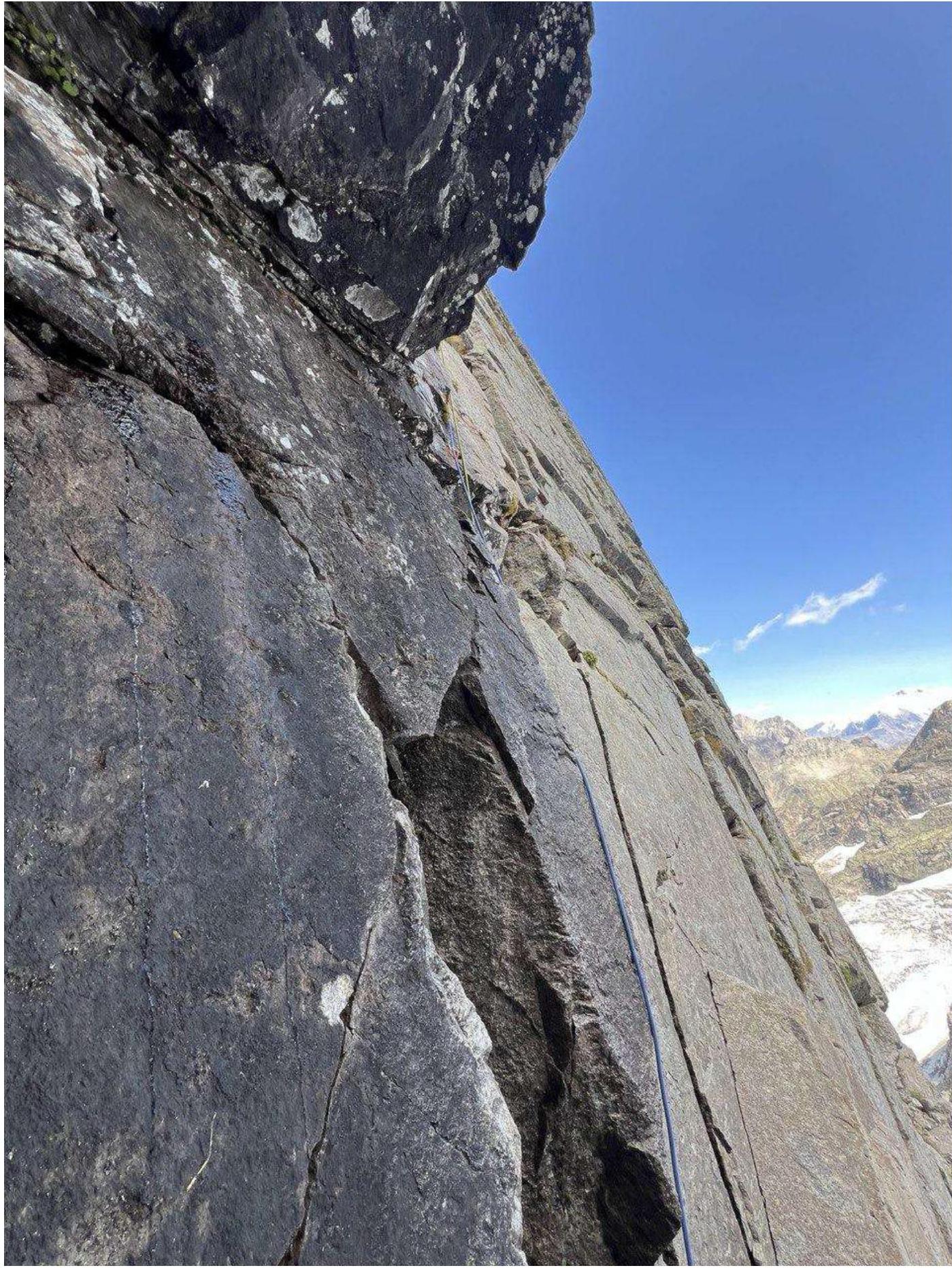
Photo 1 — Section R1–R2
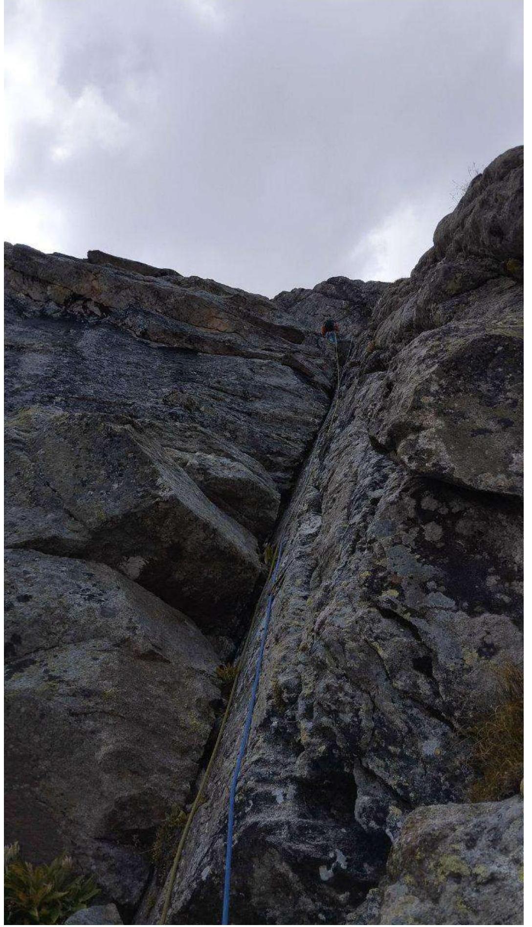
Photo 2 — Leader's work on section R2–R3

Photo 3 — Second climber on R2–R3
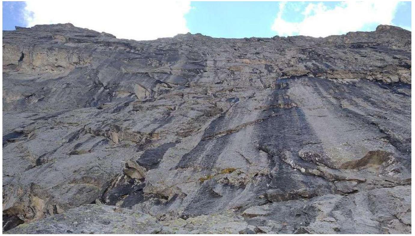
Photo 4 — Section R5–R6
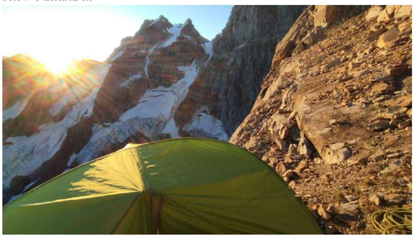
Photo 5 — Overnight stay on the ledge after R10
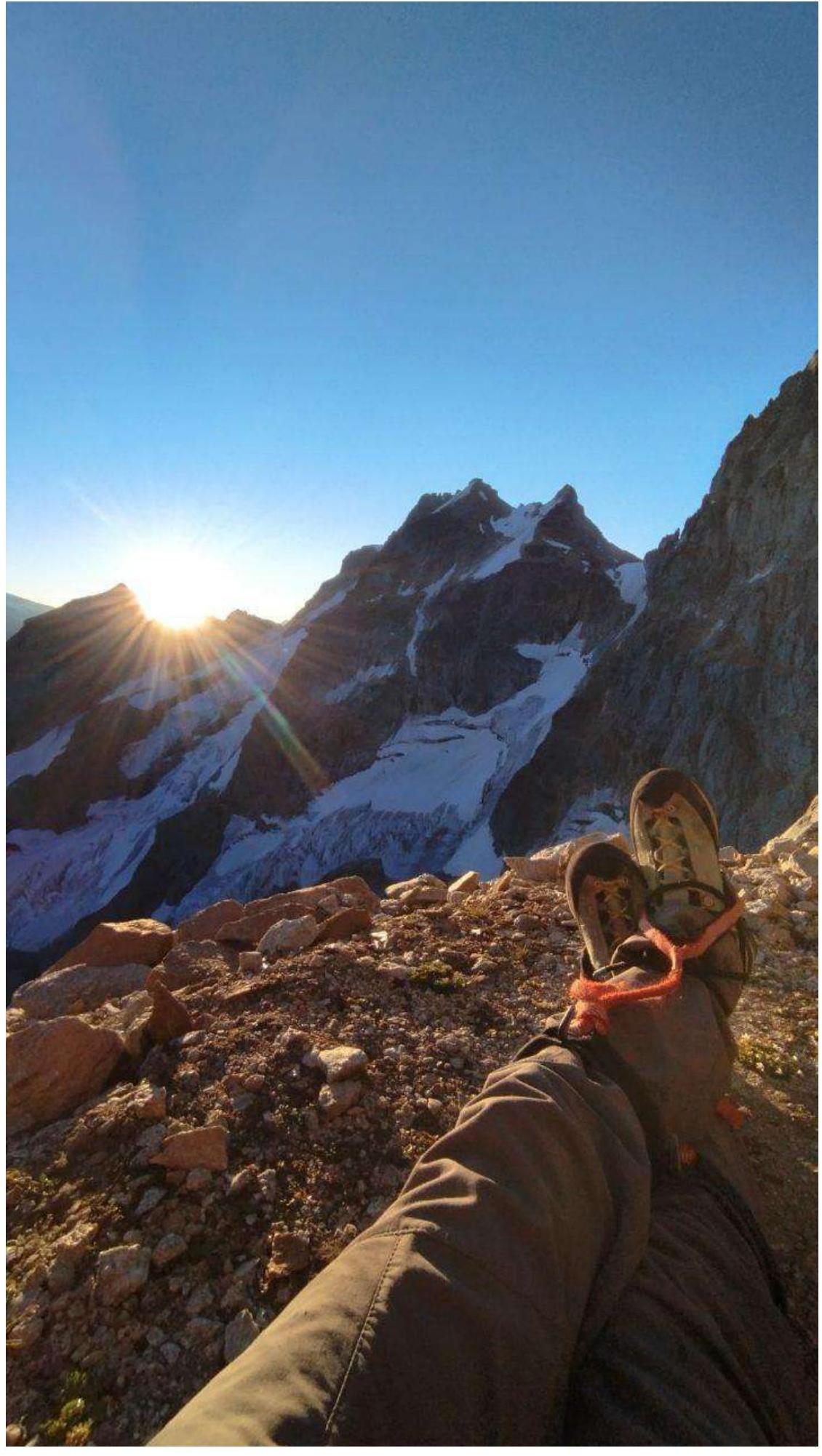
Photo 6 — Overnight stay on the ledge after R10
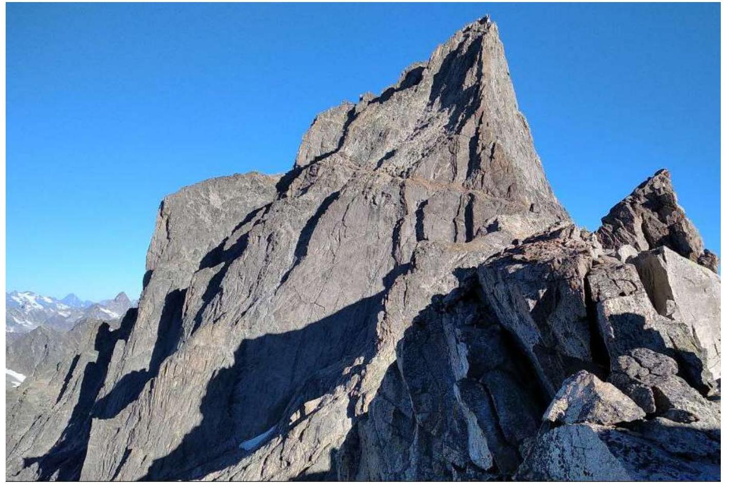
Photo 7 — Ridge, section R12–R13
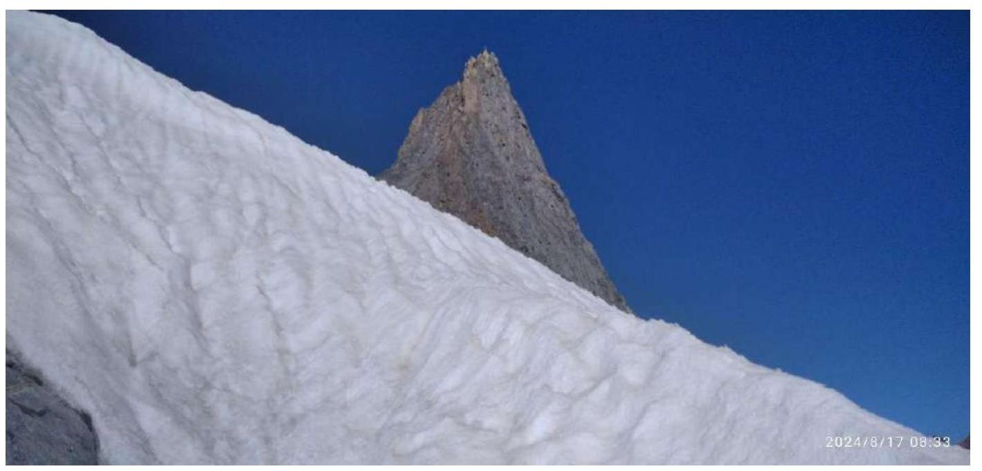
Photo 8 — Section R13–R14
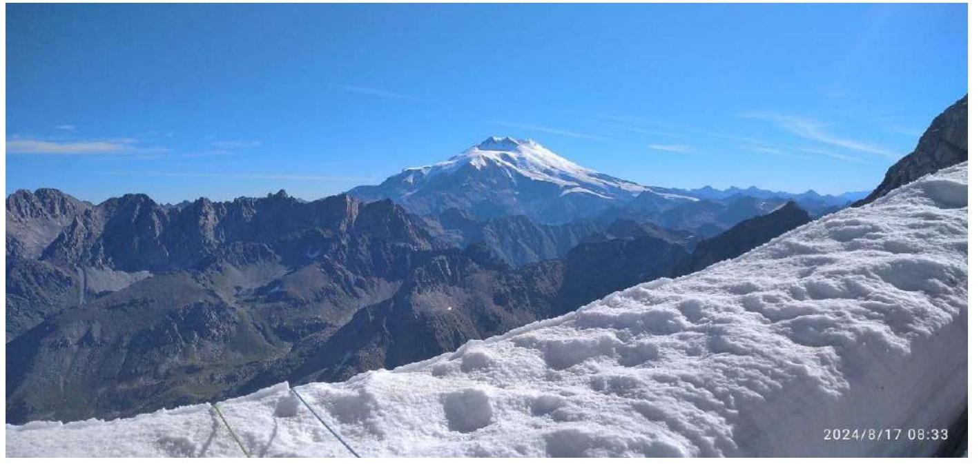
Photo 9 — Section R13–R14
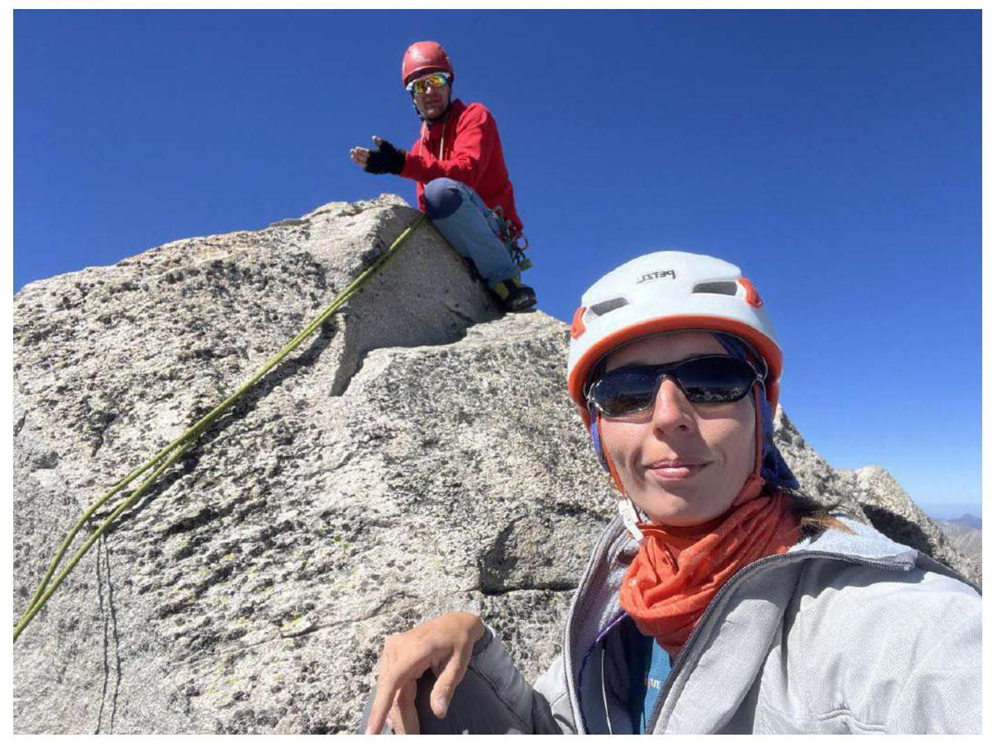
Photo 10 — Team on the summit
Safety Assessment of the Route
The route is logical, generally safe, and considered classic for its category. The relief is quite monolithic and rich for setting protection points. Climbing is interesting and varied. The level of climbing complexity is not more than 6A–6B free climbing category in some places, mainly climbing is of V technical category.
If there is snow on the ledges or after rains, free climbing of complex sections will be difficult. The team passed the route without using artificial climbing techniques.
Also, during active snowmelt, rocks can fall from the R9–R10 ledge. No rockfall was observed during the team's ascent.
Since the route includes a snow-ice section, it is strongly recommended to have ice climbing equipment, which will also be useful on the approach to the route across the glacier with open and closed crevasses. Towards the end of the season, many bridges become unreliable or may melt altogether, making them difficult to cross. During the ascent, the glacier was heavily broken, and it was necessary to cross crevasses using one-way fixed bridges.
The route has several convenient places for overnight stays, both on the wall part (possible overnight stays at R3, R5, R10) and on the ridge of the Eastern shoulder, on the summit ridge. Overnights on the ridge during a thunderstorm are not safe; there are places in natural niches under a gendarm (Photo 9), which protects from wind and rain. Water is not available at all overnight stays, especially towards the end of the season. The team carried water with them since there was no snow on the ledge after R9–R10. Water is always available on the ridge near the snowy "knife".
Radio communication on the route is stable due to almost direct visibility from the Uzunkol alpine camp. Cellular network and internet from operators Megafon, Beeline, and MTS are also available in some places on the ridge.
The weather during the entire ascent was good. Clear sky in the morning, variable cloudiness after lunch and until evening. Moderate wind blew from the southwest in the evening. In late August, the NE face of the Eastern shoulder is fully lit by the sun between 7–8 am.
Descent options: – 3–4 sections from the Summit tower to the south along established stations, then from the Eastern ridge near the "knife," the descent passes along the "Bastion" (equipped with rappel stations) to the glacier, approximately 18 sections, starting from the ridge. – It is also possible to descend via the Kavunenko route, category 5A — this route is longer, but after descending from the tower, it is mostly walked; there are 3 rappels along the ridge to the pass and 4 rappels from the pass to the glacier (equipped with fresh pitons).
It is worth noting that the descent from the Dvoinyashki pass is potentially rockfall-prone, and crossing the bergschrund at the end of the season can be difficult and dangerous due to ice avalanches. Tactically, the team chose to descend via the rappel stations on the bastion as the most short and safe option. In the team's opinion, the route corresponds to category 5B complexity.