
REPORT
On the ascent of the KCR team to the summit of Pik Ine 3455 m
via the south ridge. Confirmed 3B category of difficulty. Restore justice - return the forgotten route to the classifier.
Semenov M. A. - CMS Popov A. Yu. - 3rd sports category
Date of report: November 2019
2. Caucasus
2.2. From Marukh pass to Nakhar pass.
Climbing participants
- Leader - Semenov Mikhail Alexandrovich, CMS. Coach - Shipilov V. A. Participants: Popov Andrey Yuryevich, 3rd sports category Coach - Semenov M. A. Address: 144001, Elektrostal, Oktyabrskaya st., 8, apt. 117. Phone: +7 (906) 724-94-53. Email: aravigehc@mail.ru
Ascent passport
- Western Caucasus, Dombay region, section 2.2 of the classifier of routes to mountain peaks.
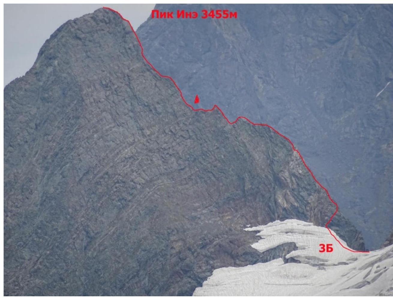
- Pik Ine 3455 m. Via the south ridge of the wall.
- 3B category of difficulty. Ascent.
- Route: Rocky.
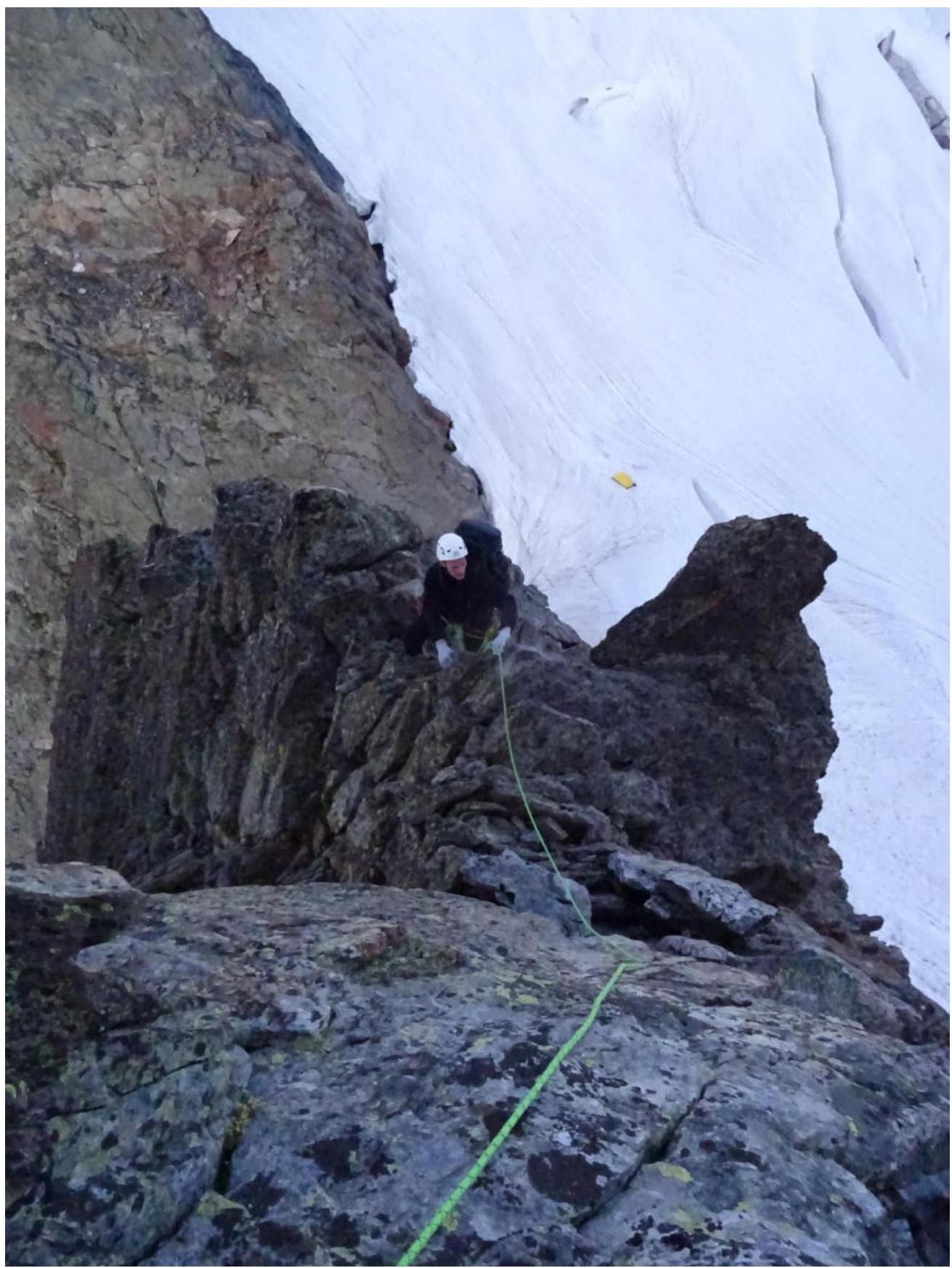
- Height difference: 255 m. Route length: 400 m. Length of sections with 2nd category of difficulty: 30 m Length of sections with 3rd category of difficulty: 350 m Length of sections with 4th category of difficulty: 20 m
Average steepness: 60°. 6. Number of pitons left on the route: 0 7. Team's travel time: 4 h 40 min, 1 day. 8. Descent from the summit via rappelling along the south ridge. 9. Leader: Semenov Mikhail Alexandrovich, CMS; coach: Shipilov V. A. 10. Start of the route: 04:30 June 27, 2019 Reached the summit: 09:50 June 27, 2019 11. Alpkлуб "Gornoye Bezumiye" 12. Responsible for the report: Semenov M. A. aravigehc@mail.ru
Description of the climbing area
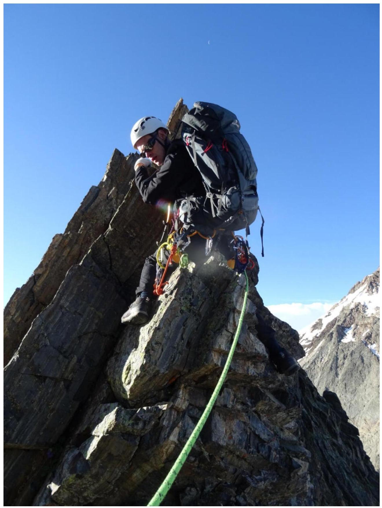
Pik Ine 3455 m is a peak located on a spur of the Main Caucasian Range and is one of the iconic peaks of Dombay.
Approach description
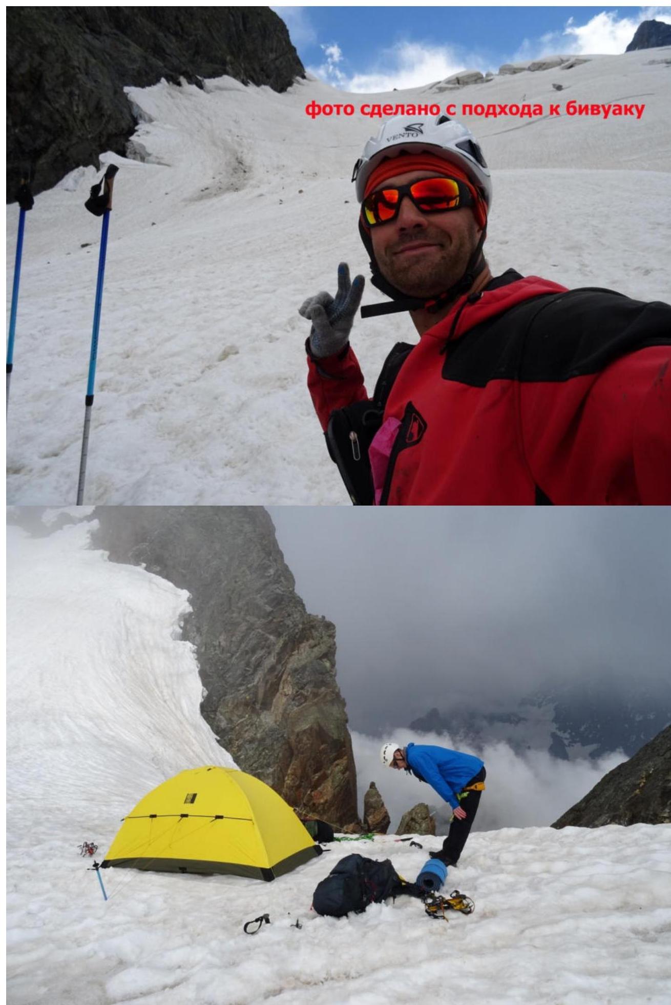
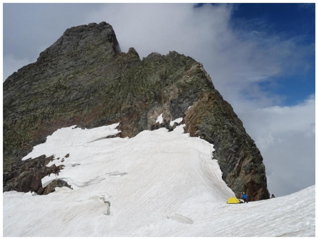
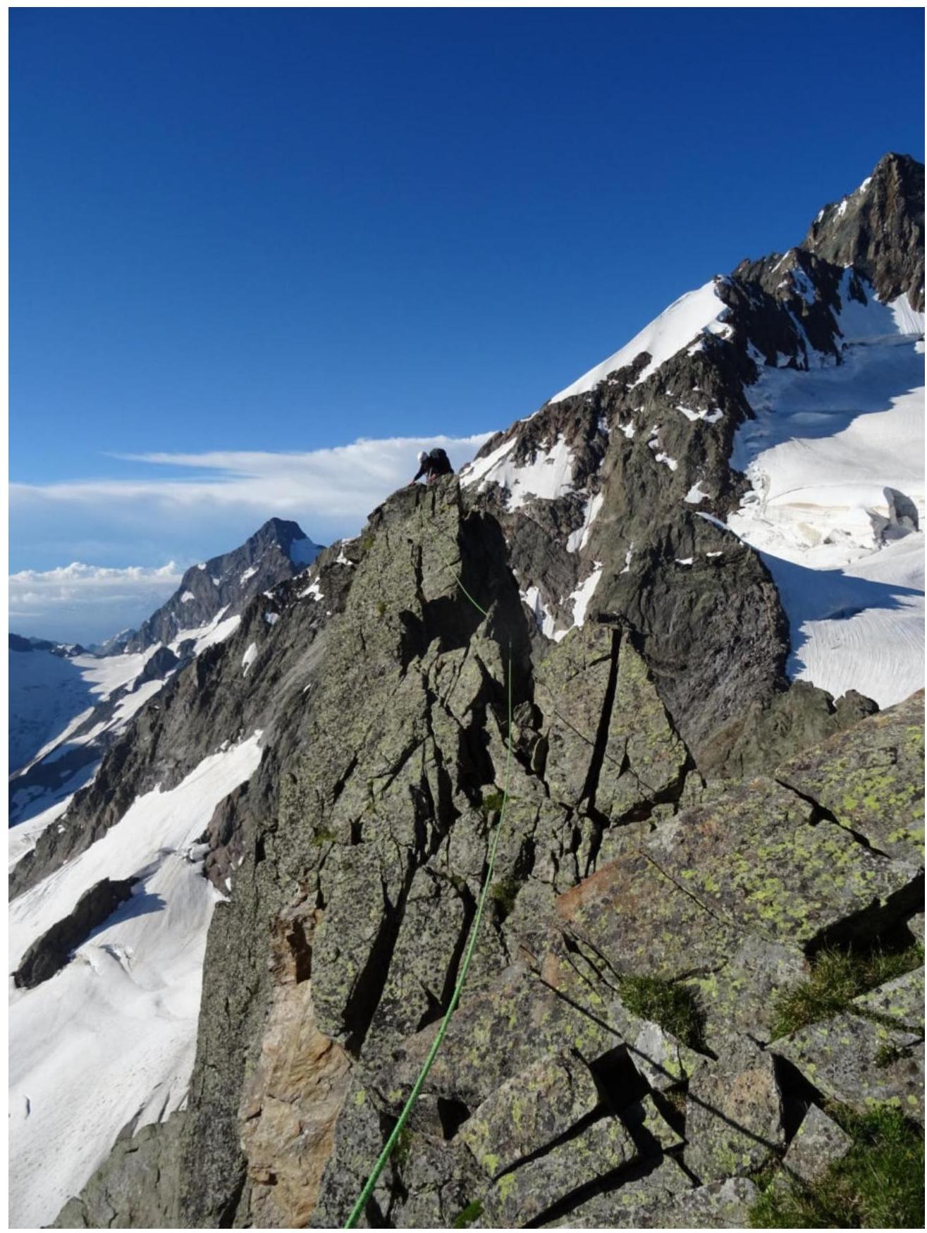
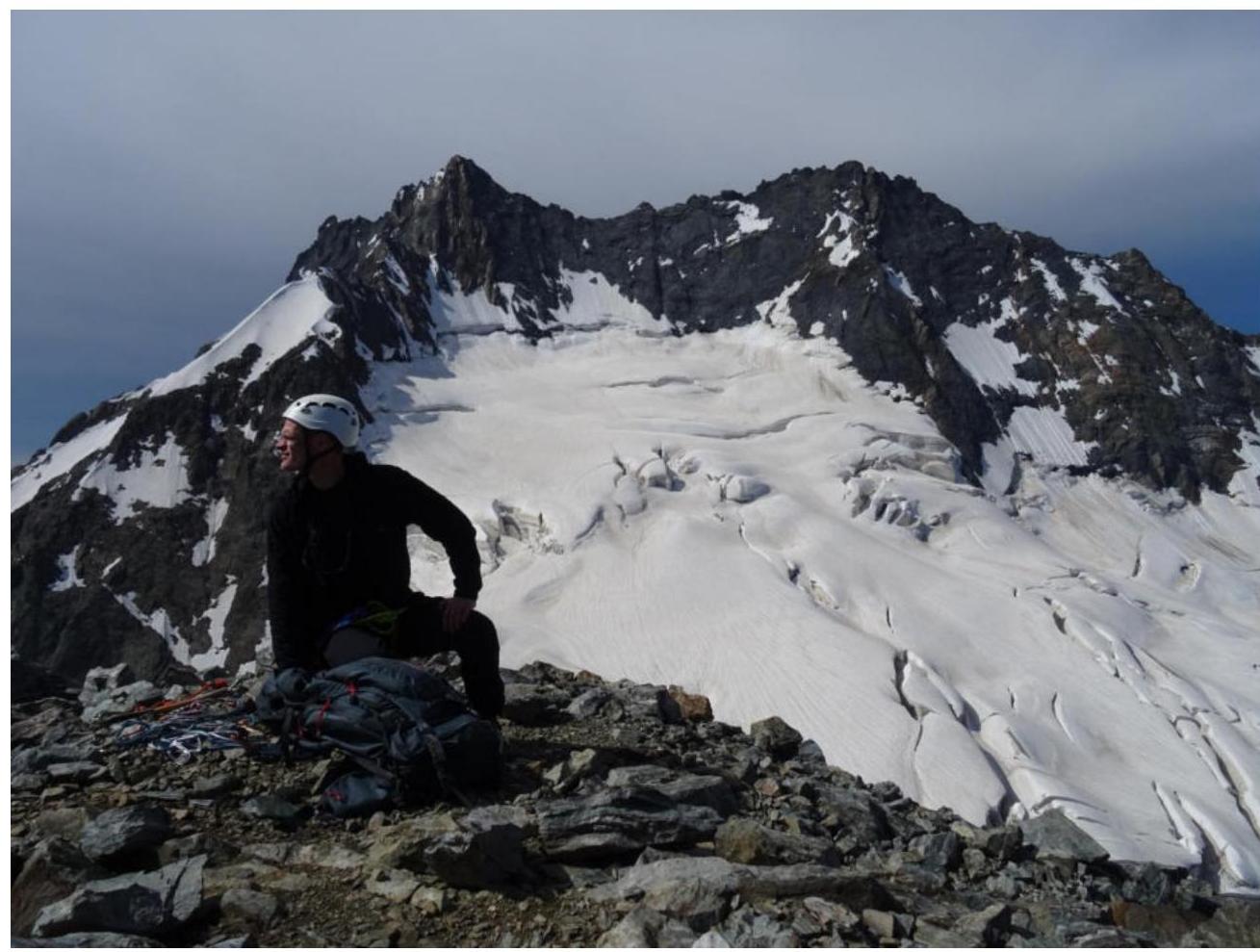
From Dombay plain, follow the trail to Dombay valley to Russkaya plain. On Russkaya plain, there is a large square stone near the confluence of the stream flowing from the Dzhegutorluchat waterfall. A crossing is stretched over the river. If the crossing is destroyed, there are wide river stretches about 1 km upstream that can be forded. Follow the left side of the stream flowing from the Dzhegutorluchat cirque (Dzhegutorluchat waterfall), upwards to the "sheep's foreheads" and grassy slopes upwards. Pass by the fork leading to the start of the 4A direction, also upwards to the Dzhegutorluchat glacier, and follow it, staying closer to the slopes of Pik Ine, towards the col between Pik Ine and Eastern Dzhegutorluchat. There is a bivouac site on the snow in the col.
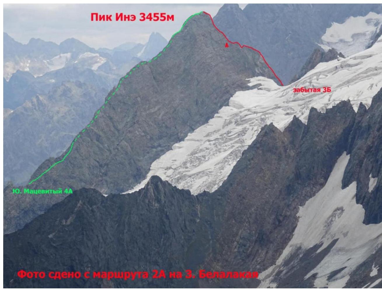
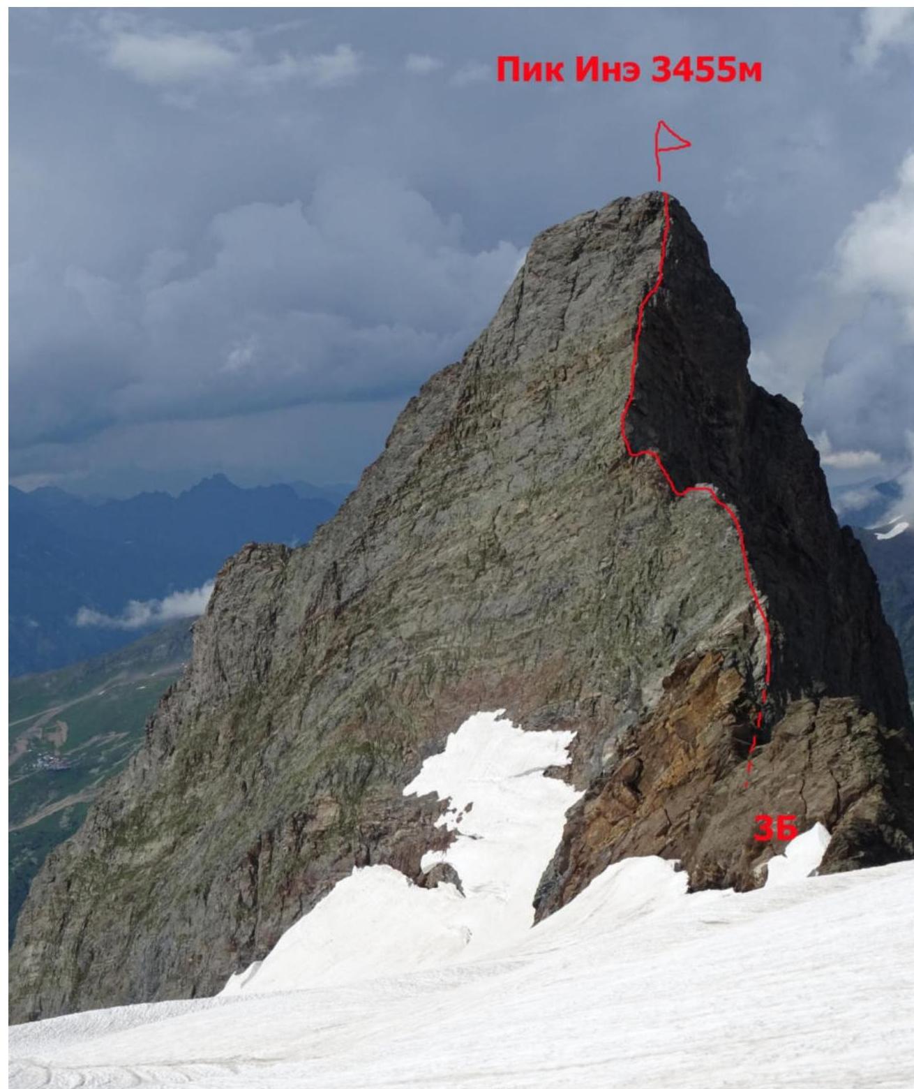
Photo taken from the Dzhegutorluchat glacier
For routes with 1B-3B category of difficulty.
| Section # | Length | Steepness | Terrain type | Category of difficulty | Number of pitons |
|---|---|---|---|---|---|
| 400 m | 60 | Rocky | 3B | 0 |
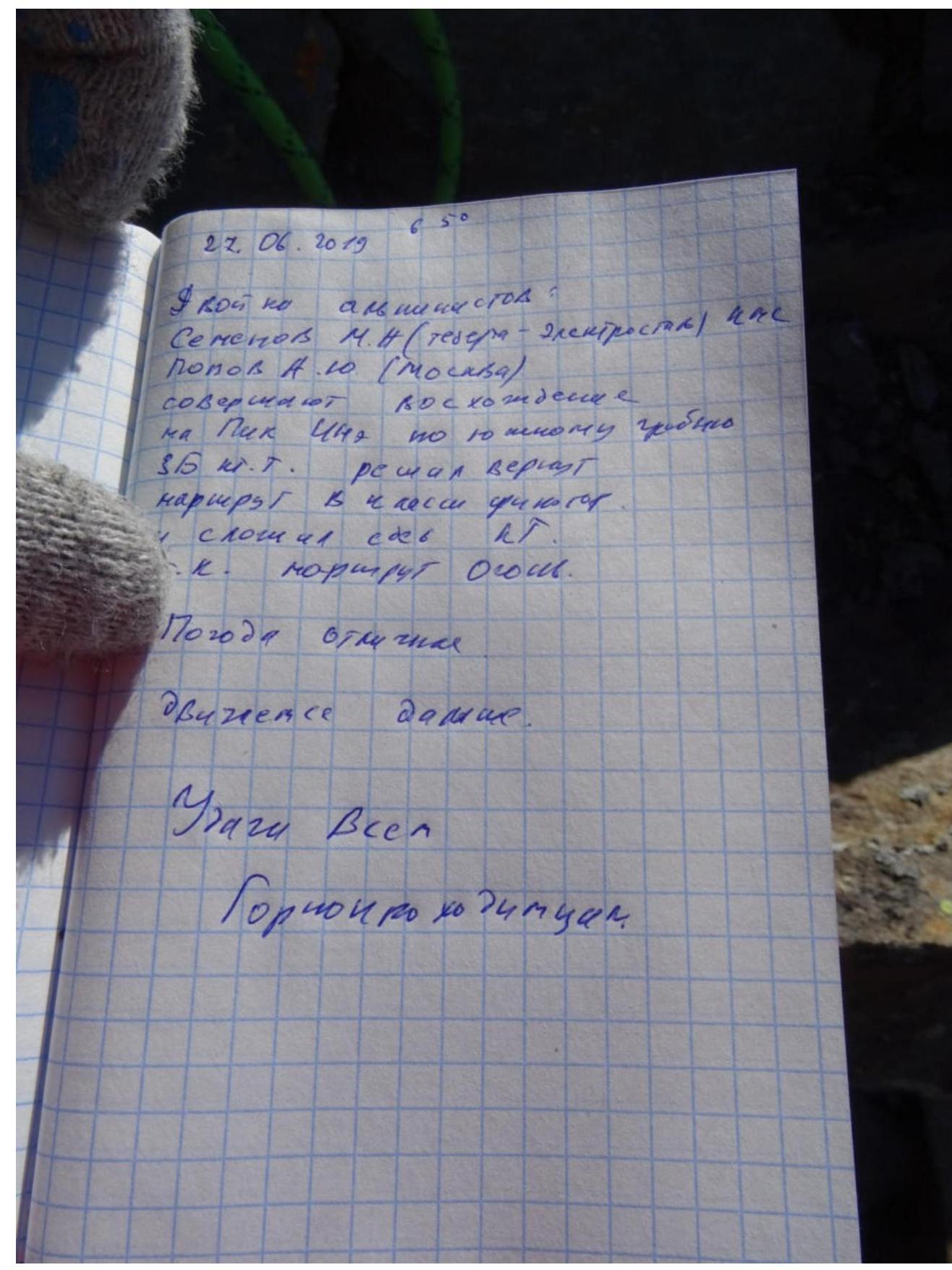
I had heard about this 3B from older comrades a long time ago. Very technical, though short. I almost completed it for the first time when I went with Alexey Ankudinov on the pseudo-Rybakov route 3B - which turned out to be a first ascent, and it led to this south ridge about 1.5 rope lengths from the start of this route. It was already dark, late autumn, snow on the route - we climbed in complete darkness with flashlights. In principle, the route was fully known to me ±. But still interesting. There were no descriptions in the sources available to me. I got a nasty instructor job. We completed 2 routes in one outing from the same bivouac: 3B on Ine and 3B on Eastern Dzhegutorluchat. I just want to restore justice:
Return this route to the classifier (it's a great route!!! And really 3B). So that Andrey can confidently record it in his climber's book (actually, I recorded it for him anyway - you can shoot me), so that it's all official.
Descent from the summit by the shortest path to the glacier. First, rappelling from the summit on the 3B route, then rappelling to the right of the ridge, a total of about 6 rappels.
I have completed all previously known routes on this mountain. Made 2 first ascents: Eastern edge 4B and South-eastern counterfort (erroneously attributed to the storyteller Rybakov, who didn't climb it, but just described it, looking through binoculars). In general, most likely, the lines on this mountain are exhausted, as it's a small mountain and it's hard to come up with something logical. Plus, at the time of writing the report, I have the most experience in this region. There aren't many good 3B routes in Dombay, many 3B routes are iffy (but, as my comrade said: "that would be a whole different story"). This route is a really good, technical 3B that requires climbing skills. The entire route logically follows the south ridge, about bypassing gendarmes I can only say that I like to do it head-on ±.
Taking into account all the above information, I believe that the route is a worthy 3B category of difficulty.
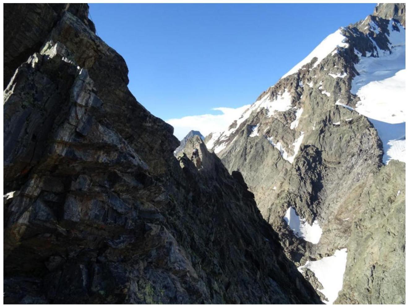
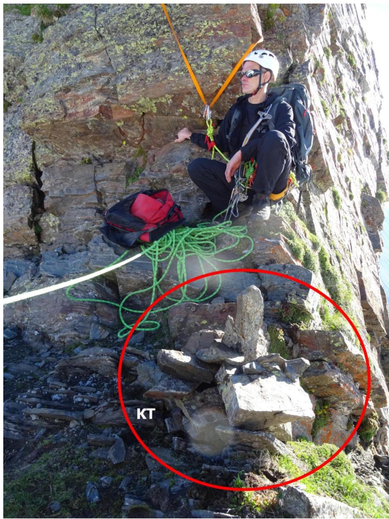
View from the CP upwards along the route

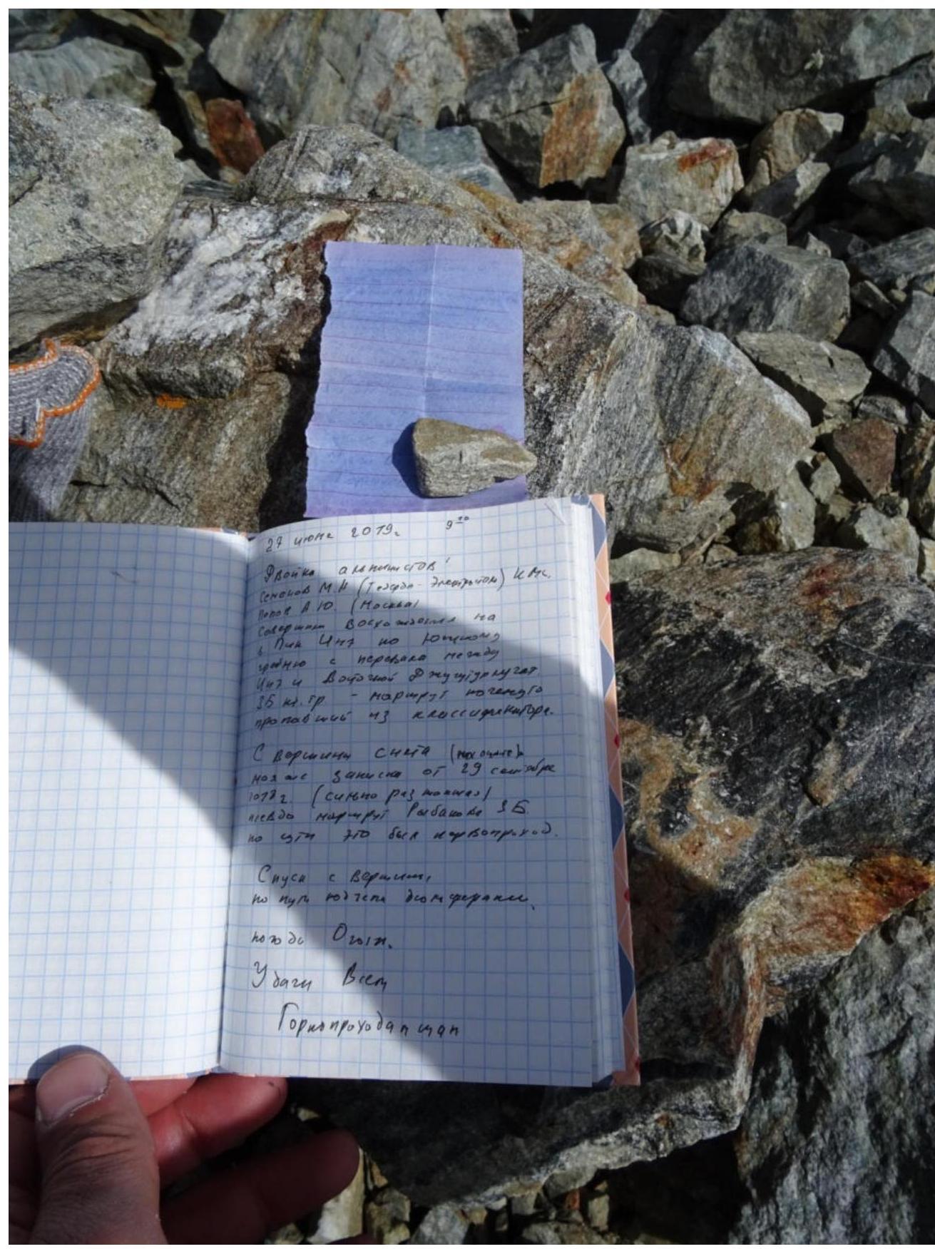
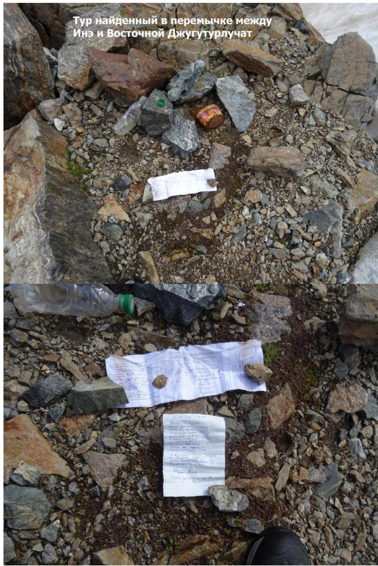
my soggy note after the first ascent of the "pseudo-Rybakov" route
Words of gratitude for help in preparing the report:
- Shipilov Vyacheslav Alexandrovich
- Gubanov Roman Yuryevich
- Kuznetsova Ekaterina Alexandrovna
- And to everyone who didn't interfere ☺))))
Ascent leader: Semenov M. A. Participants: Popov A. Yu.
Coaches: Shipilov V. A. Semenov M. A.
Comments
Sign in to leave a comment