
 RUSSIAN MOUNTAINEERING FEDERATION
①
Class. 5А+1
protocol No. 3 dated 22/XI–46
123
TOURIST CLUB
READING ROOM No. 797
RUSSIAN MOUNTAINEERING FEDERATION
①
Class. 5А+1
protocol No. 3 dated 22/XI–46
123
TOURIST CLUB
READING ROOM No. 797
RECORD TRAVERSE
PTYSH—DJUGUTURLUCHAT
GROUP COMPOSITION:
- NESTEROV V.F. — Master of Sports of the USSR
- GUBANOV YU.N. — Master of Sports of the USSR
- KROPF F.A. — Master of Sports of the USSR
- VOLZHIN A. — Senior Instructor
August 1–9, 1946 www.alpfederation.ru ↗

PTYSH—DJUGUTURLUCHAT TRAVERSE
The record traverse "PtySh—Dzhuguturlyuchat" was approved for the group by the All-Union Committee for Physical Culture and Sports for July-August 1946.
Location of the traversed peaks: Western Caucasus. The Akbek ridge stretches from east to west, approximately 5 km long. The Akbek ridge adjoins the horseshoe of Dzhuguturlyuchat (Dzhugi) at the Uzlovaya peak. The horseshoe of Dzhugi is internally facing west. The peaks of Dzhugi are located starting from the southern end of the horseshoe: Main peak, Uzlovaya, Mitnikov Peak, Eastern, Western.
The entire traverse can be divided into two main sections, based on the time required to overcome them, technical difficulty, and geographical location:
- From PtySh peak to Uzlovaya peak, the so-called Akbek ridge, previously uncharted by anyone.
- Five peaks of the Dzhugi horseshoe. The traverse was done only once by a group led by Honored Master of Sports of the USSR Evgeny Abalakov in 1944 and was classified as the highest category of difficulty — the fifth.
The length of the Akbek ridge is approximately equal to that of Dzhugi. In terms of time: the group spent 5 days (including one day of approach) to overcome the Akbek ridge and 4 days for the Dzhugi horseshoe. The technical difficulties of the Akbek ridge are no less than those of Dzhugi. There are no peaks on the ridge. The ridge is very jagged. In the Central Caucasus, the Ulu-Tau-Chana ridge can be compared to the Akbek ridge, which is shorter and technically less complex.
ROUTE DESCRIPTION
Departed on August 1 at 7:00 from Dombai plain. After 12 hours of work, reached the rocks just before the Akbek ridge. The path mostly coincided with the usual route to PtySh peak, only after the glacier we deviated to the right onto the Akbek ridge, a three-hour walk along the ridge.
On August 2, reached the Akbek ridge and conducted a reconnaissance of the path in both directions along the ridge.
On the third day, ascended PtySh peak and returned back. From 2:00 PM, the weather deteriorated, further movement was impossible. The section of the Akbek ridge covered that day requires protection with pitons in some places. The fourth day was marked by very bad weather. During the preliminary reconnaissance on August 2, it was established that a nearly vertical 35-meter gendarme had to be overcome, which required 5 pitons without backpacks and in climbing shoes; moreover, there was no good bivouac nearby. As a thunderstorm could erupt at any minute, moving along the ridge did not bode well. Therefore, a path along the snowfield was chosen to bypass the next two large gendarmes. Descending from the gendarmes at 12:00, the group was forced to set up a bivouac as a thunderstorm with heavy snowfall began.
On the fifth day, the weather was good, but up to 20 cm of snow had fallen on the rocks, making movement difficult. The group covered the remaining part of the Akbek ridge and reached under Uzlovaya Dzhugi.
Overcoming one gendarme on this section of the Akbek ridge presented significant technical difficulties:
- Gendarme height is 40 m.
- The path is not clearly defined.
- Requires the use of 4 pitons for protection.
General conclusion on the Akbek ridge: The ridge is mainly rocky. The complexity of the rocks is equal to peaks of the 3rd category of difficulty. Moreover, four gendarmes require good rock climbing with thorough piton protection. The height of these gendarmes ranges from 20 to 50 m.
These four gendarmes are located: two in the first part of the path, one in the middle of the ridge, and one in the second half of the ridge.
On the sixth day, at 6:00 AM, began to bypass Uzlovaya peak to reach the ridge of Dzhugi between the Main peak and Uzlovaya. The bypass took 4 hours. The path lies through severely damaged rocks with a high risk of rockfall and, when crossing a steep snowfield in a couloir, there is a risk of avalanches. Therefore, bypassing Uzlovaya should be done as early as possible in the morning. By 18:00, the group ascended the Main peak of Dzhuguturlyuchat and returned.
The path to the Main peak lies along a rocky ridge that drops almost vertically to the southeast and has a steep 45° snow slope to the northwest. The rocks are very solid, with rare exceptions. Pitons are not required for protection, although there are sections of challenging rock climbing.
On the seventh day, ascended Uzlovaya peak via challenging rocks in three hours. The descent from the peak to the saddle towards Mitnikov Peak can be done in two ways. It was possible to start descending directly from the peak, but that would have required rappelling. Instead, the group descended two rope lengths back and then traversed the peak to the saddle via a helical path. Traversing the peak almost entirely requires piton protection. Descending a snow couloir three rope lengths down from the saddle, traversed Mitnikov Peak on the normal route.
On the eighth day, ascended Mitnikov Peak in 3 hours. Ascended the Eastern peak in 4 hours. Descended to the saddle between the Eastern and Western peaks in 4 hours. The path from Mitnikov to the Eastern peak is characterized by a large number of gendarmes 10 to 20 m high. These gendarmes are not particularly challenging, although there are sections of complex rock climbing.
The descent from the Eastern peak is somewhat more complicated, requiring two or three pitons for protection and one 10-meter rappel.
On the tenth day, reached the Western peak in three hours and began descending the wall to the glacier, which took 5 hours. Piton protection is necessary in some places, and the upper part of the wall is better descended via rappel, although it can be done by straightforward climbing.
The Akbek ridge was attempted to be traversed by German mountaineers in 1932, who wrote in their report that: "The Akbek ridge is one of the unresolved problems of the Western Caucasus."
According to the group's overall conclusion, the traverse of the Akbek ridge should be classified as 5A category of difficulty.
Completing the entire traverse requires 9–10 days. The path is mainly rocky, requiring exceptional rock climbing skills. The group considers the "PtySh—Dzhuguturlyuchat" traverse to be of the highest category of difficulty, 5B.
PREPARATION PERIOD
Having set out to accomplish such a complex traverse, the group conducted all preparatory work before departing to the mountains, which included:
- Physical training of participants.
- Studying materials related to the traverse.
- Sewing, making, and selecting necessary equipment.
- Selecting food supplies.
In the mountains, the group members underwent good physical training. During training ascents, all objects of their traverse were studied, and the plan for executing it was finalized.
Food was cached in the area between the Main peak of Dzhugi and Uzlovaya. Food was taken at a rate of 1 kg per person per day, totaling 40 person-days, with 10 kg cached in advance.
20 rock pitons, 5 ice axes, 10 carabiners, 3 rock hammers, 1 primus stove, and dry alcohol were taken. The rest of the equipment was standard for any ascent.
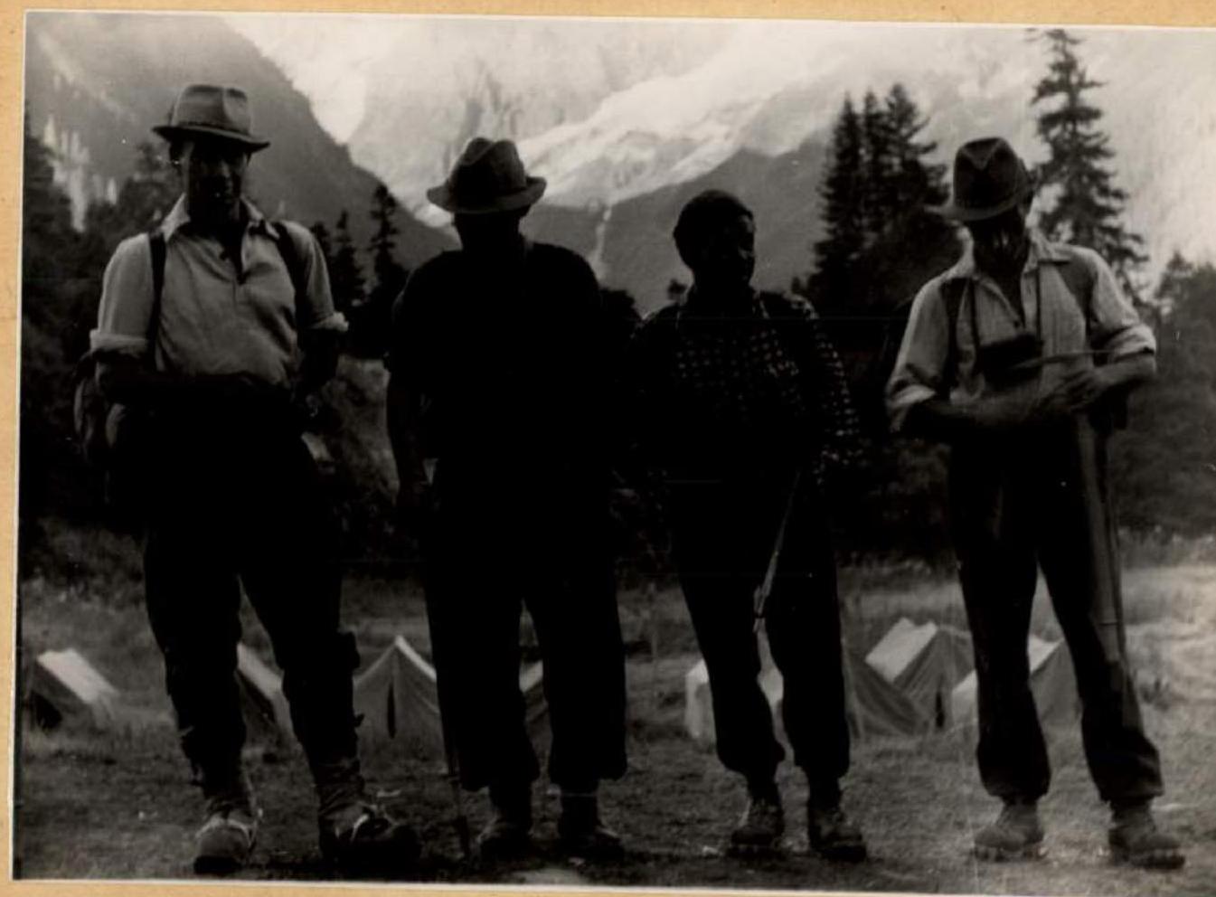
 Before departure
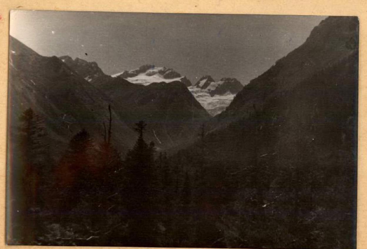
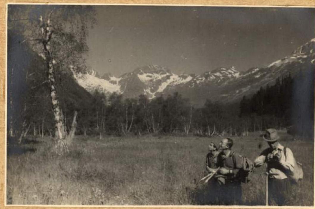
 Glade in the forested zone of the Dombai valley.
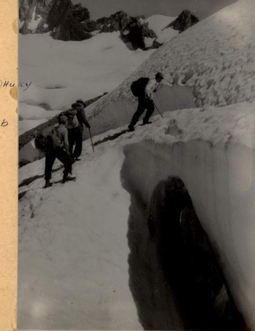
 Across the PtySh glacier to the Akbek ridge
 On one of the gendarmes of the Akbek ridge on the way to PtySh peak

 Some sections of the Akbek ridge have to be traversed without backpacks and in climbing shoes due to the high complexity of the route.
 The weather was not always favorable… Morning after a night snowfall on the Akbek ridge.
 Across the snow-covered rocks of the Akbek ridge.
 Along the Akbek ridge, getting closer and closer to Uzlovaya peak of Dzhuguturlyuchat.
 Half the job is done. The Akbek ridge is traversed. Five days of travel behind us. First overnight stay on the Dzhuguturlyuchat ridge.
 Uzlovaya peak is taken, a note from Honored Master of Sports Evgeny Abalakov is retrieved from the cairn.
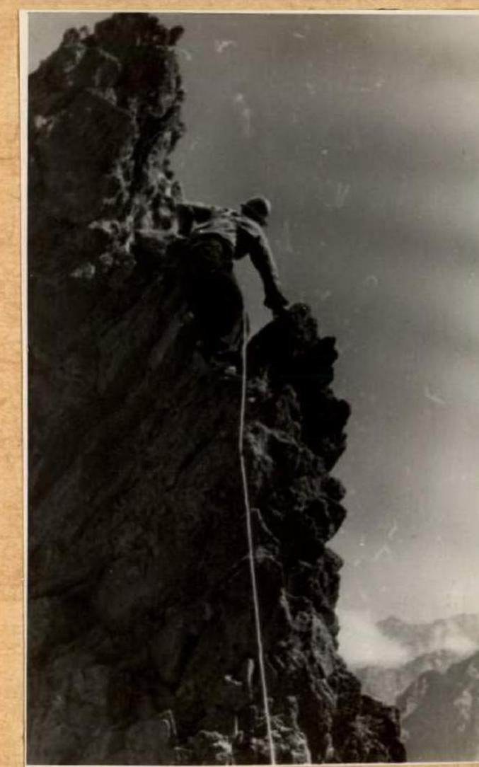
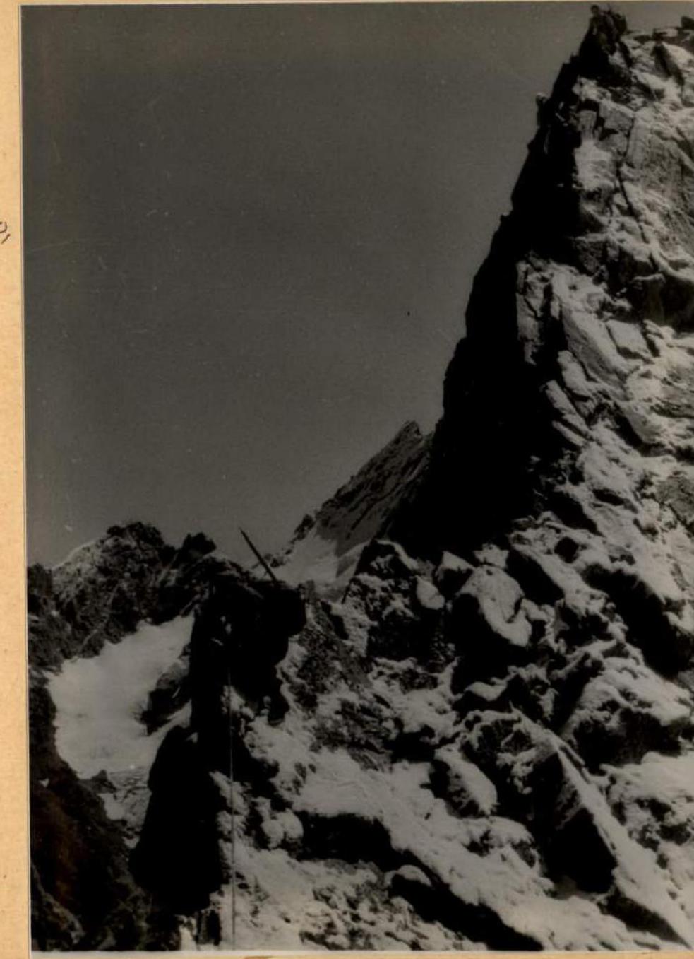
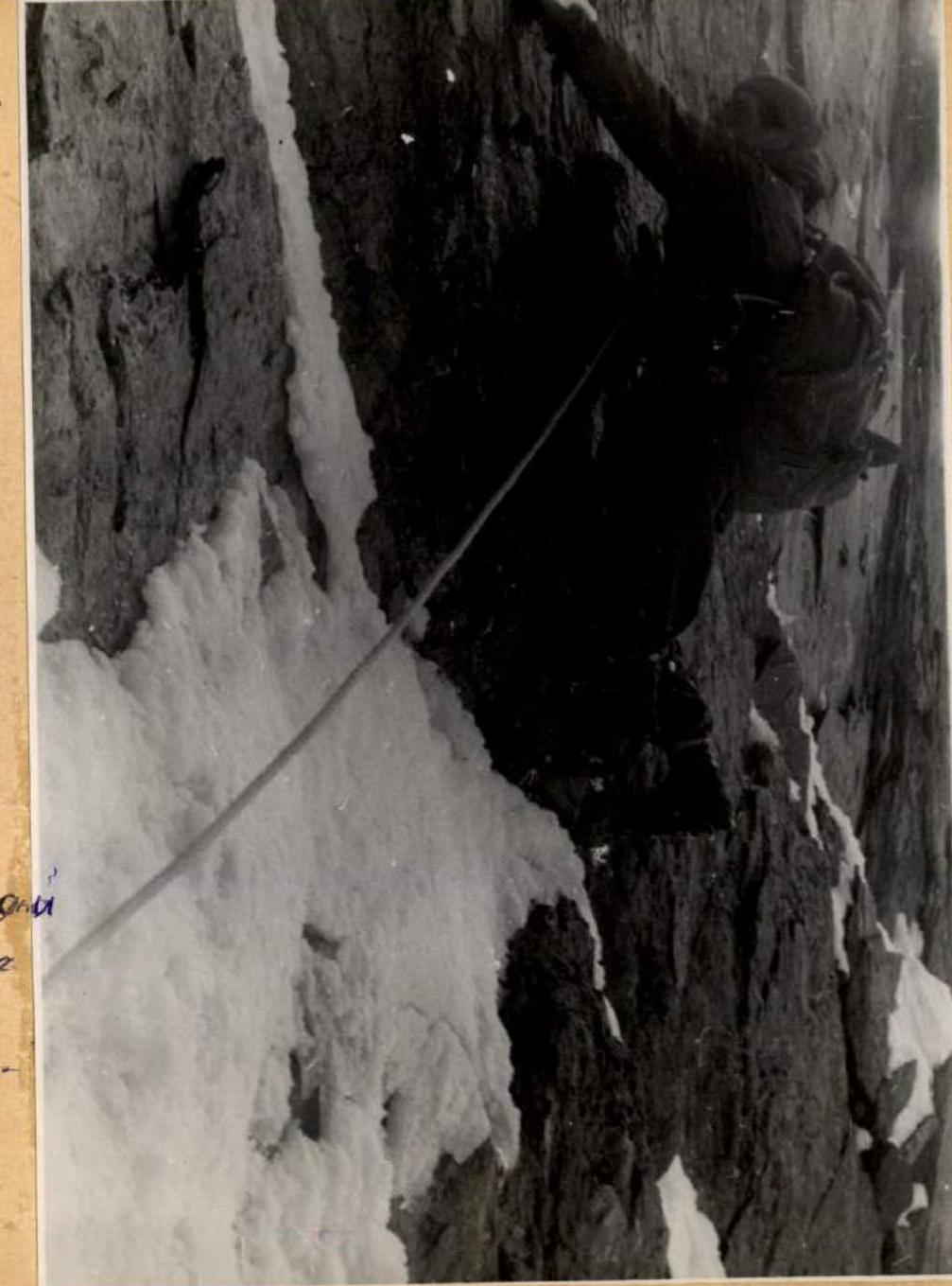
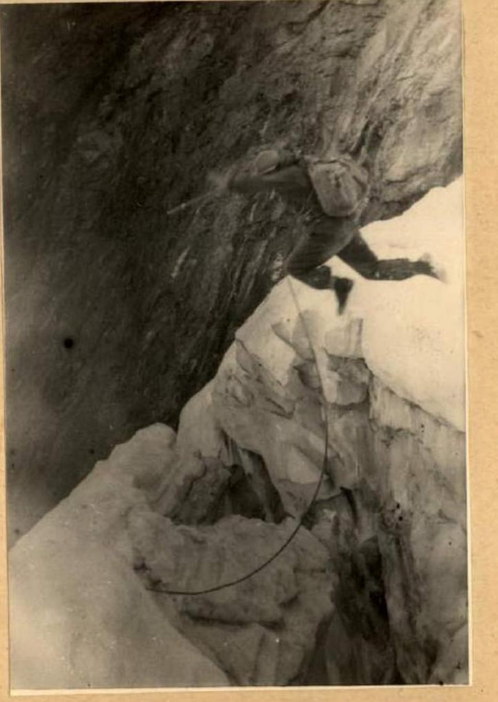
Traversing the western wall of Uzlovaya 300 m above the glacier requires great self-control and high technique.
Uzlovaya peak is taken, a note from Honored Master of Sports Evgeny Abalakov is retrieved from the cairn.
Traversing the western wall of Uzlovaya 300 m above the glacier requires great self-control and high technique.
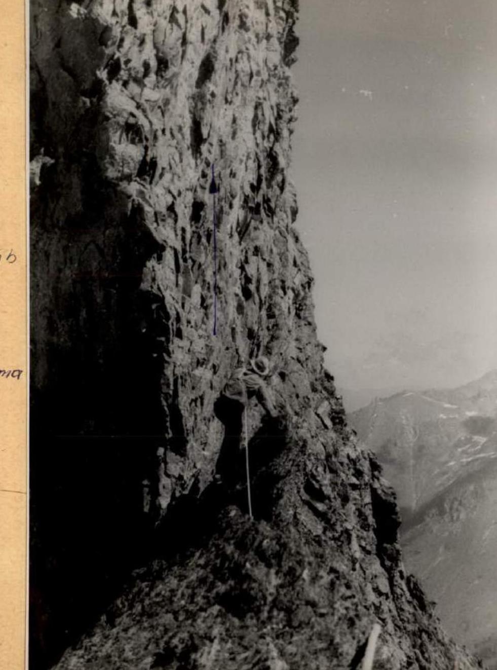
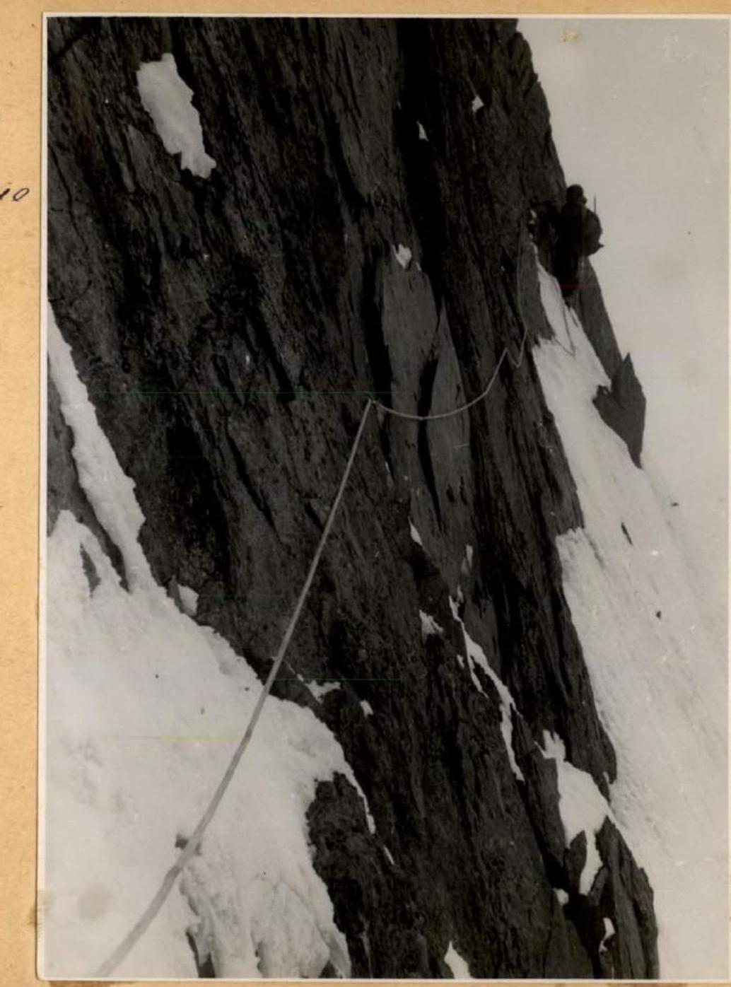
 Protection only with pitons. Further and further along the wall.
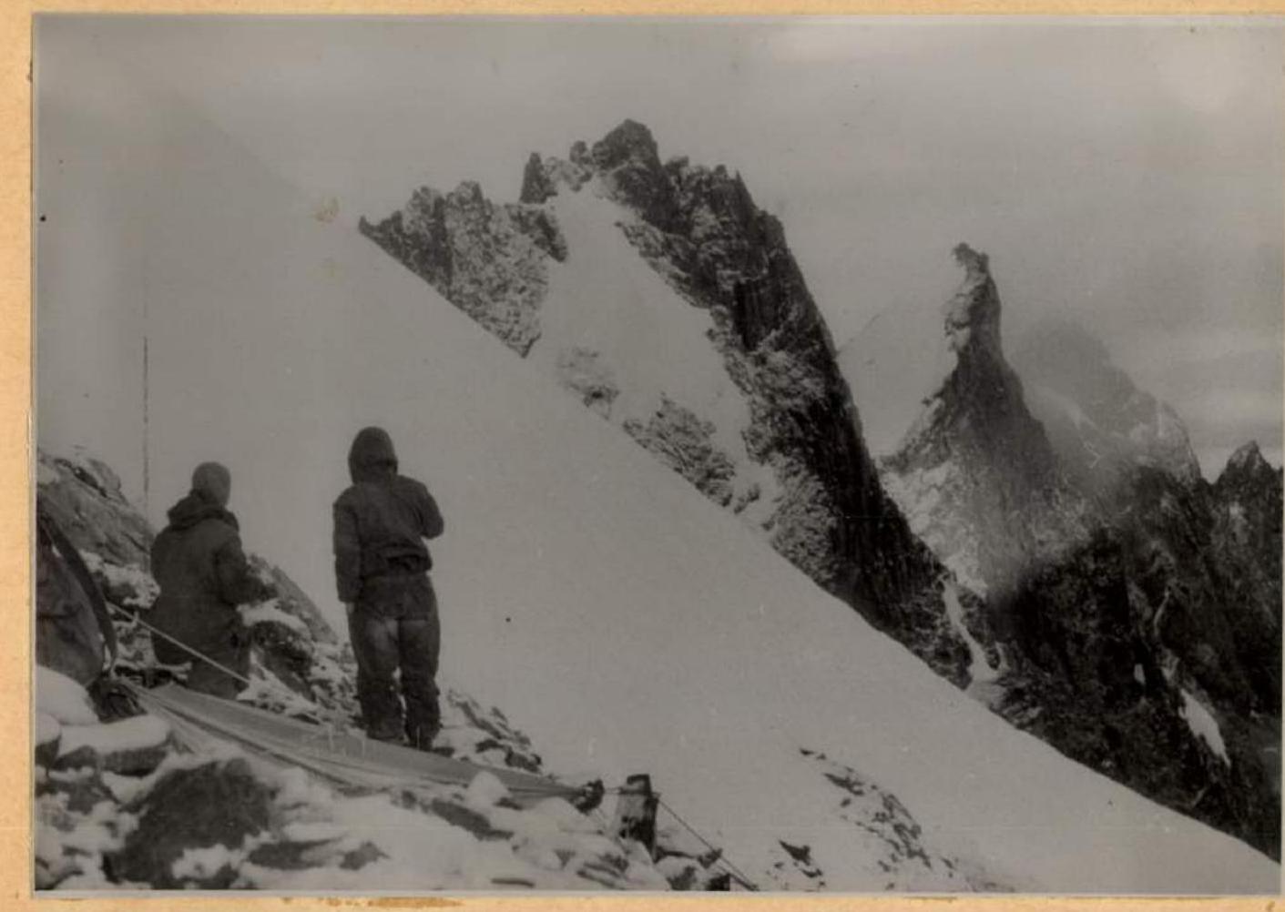
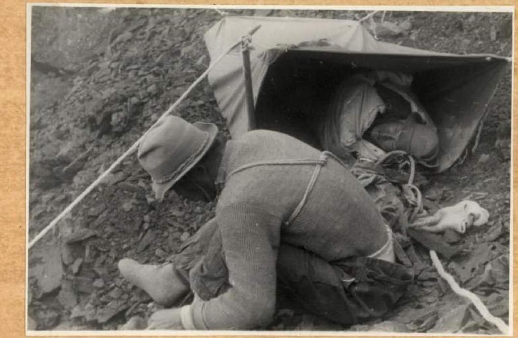
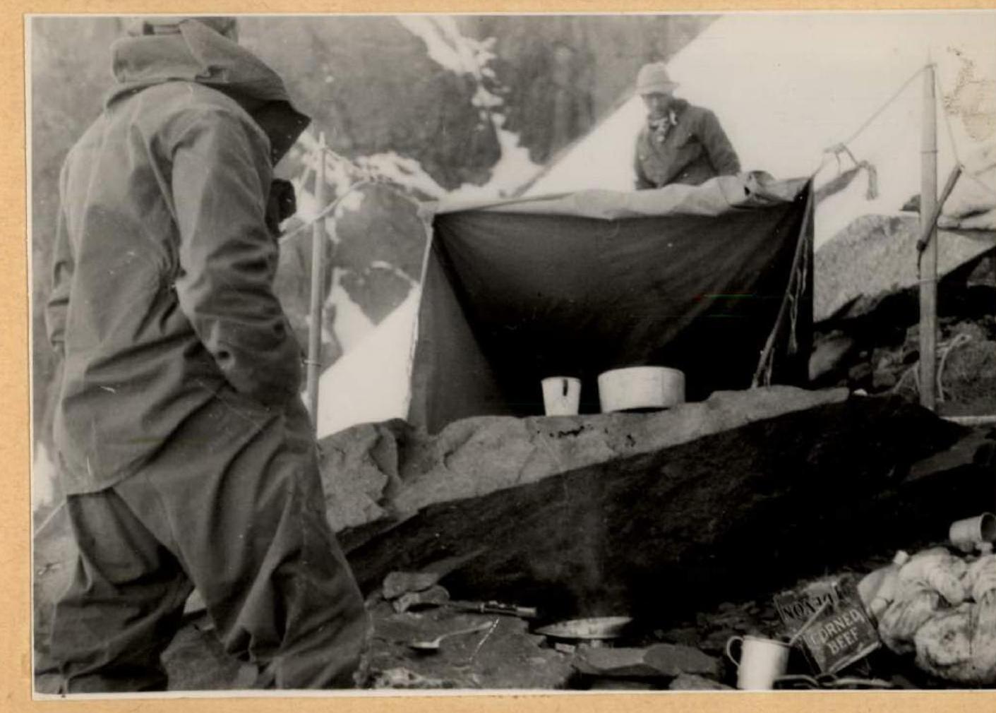
 Bivouac near Mitnikov in Mitnikov Peak. Snow all around, but in the tent set up on a rock slab, it is significantly warmer.
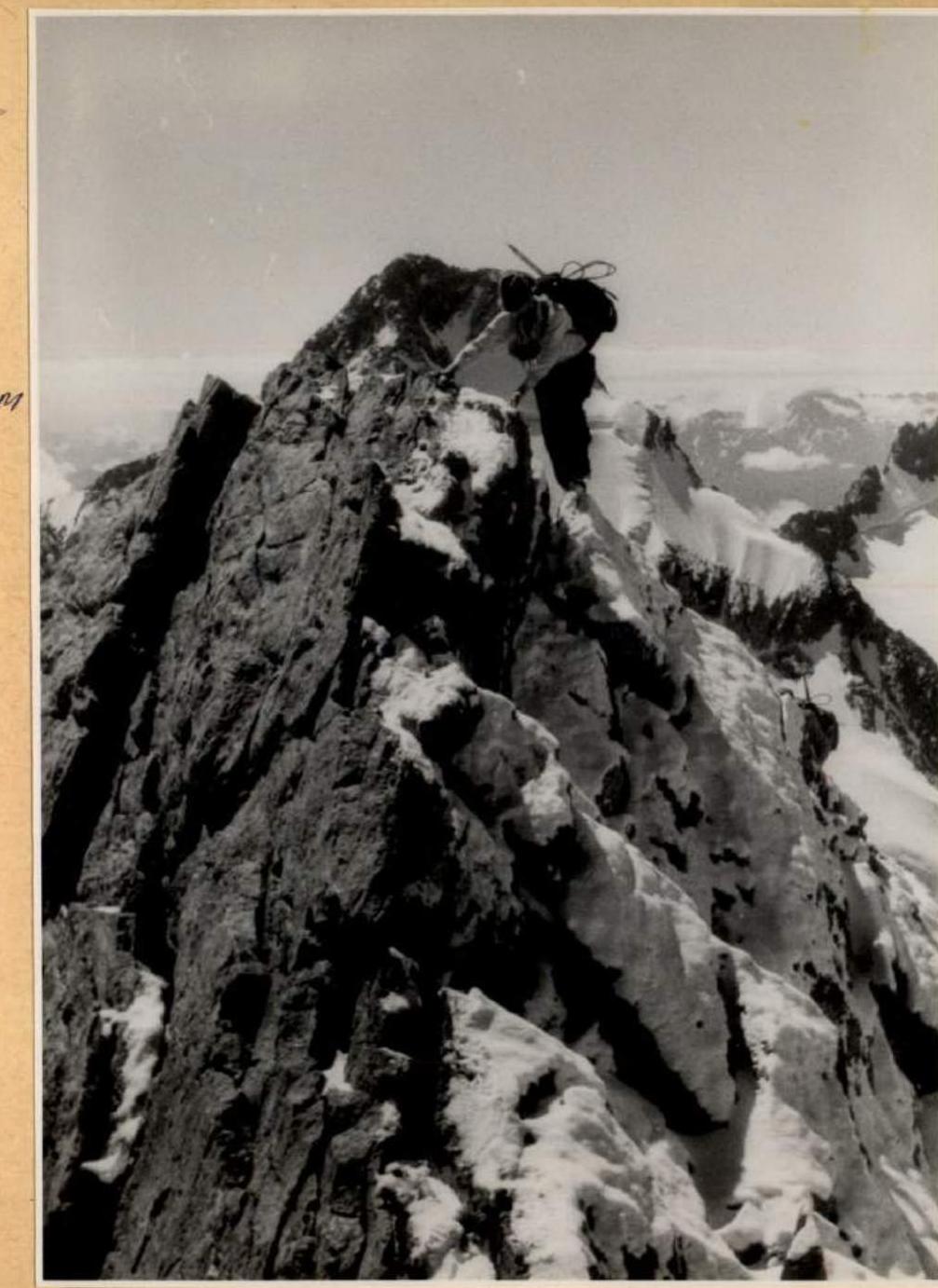
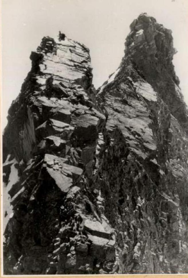
 Mitnikov Peak is passed. Moving along the rock "saw" to the Eastern peak.
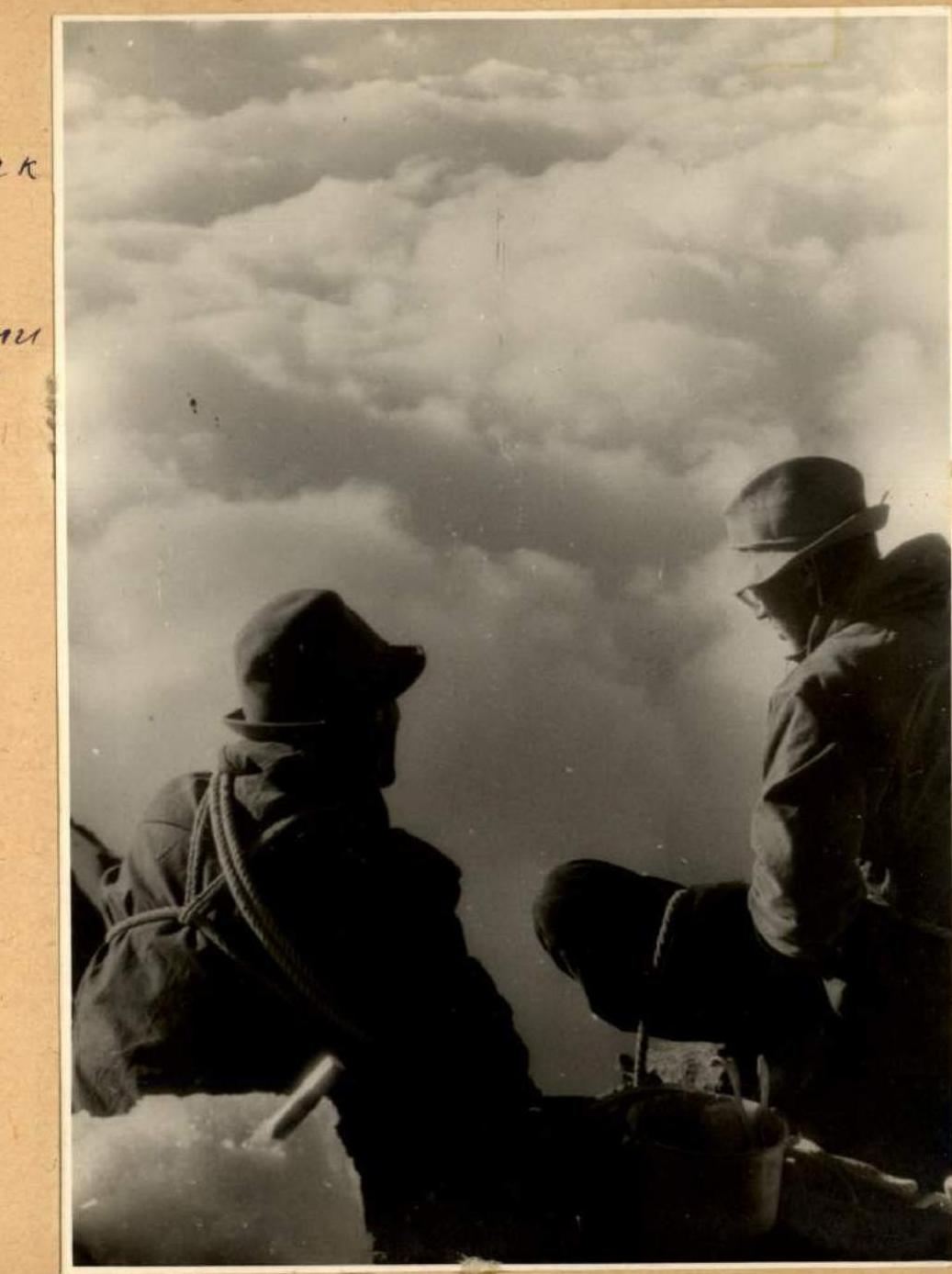
 Last bivouac on the ridge. Below, under the clouds, is the "Lightning" camp and friends.
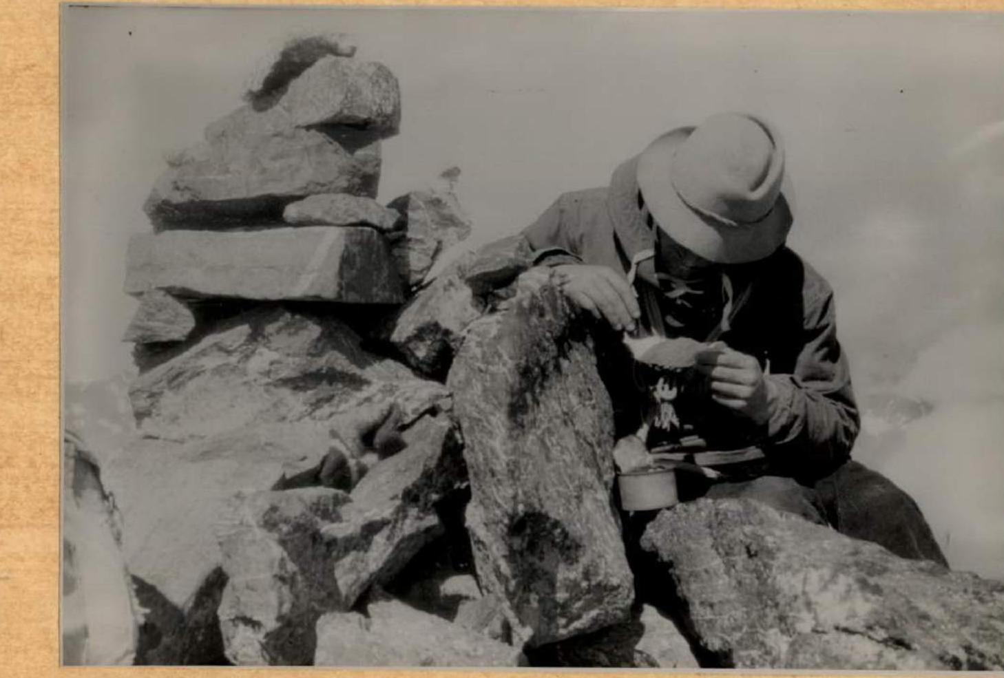
 At the last cairn. The sixth and final note is retrieved. Now down.
 But the difficulties are not over yet.
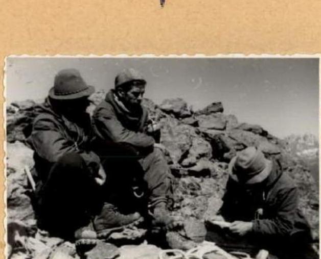
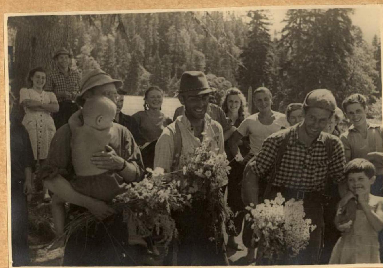
 Again we are in the camp with family, friends, and relatives.
Comments
Sign in to leave a comment