
Ascent Passport
- Western Caucasus, Daut valley, classification table number 2.2
- Peak Kyshkadzher 3837 m (by GPS), via the 3rd ridge
- Category of difficulty — 4A (presumably), first ascent
- Route character — rocky
- Height difference of the route — 260 m
Route length — 760 m. Average steepness of the route — 28°
- Total equipment used:
Rock pitons — 7, Nuts — 37
- Left on the route during descent — 1 bolt piton
- Climbing hours — 4 hours
- Leader: Artem Kukharin, 1st sports category
Participants:
- Anton Khashabaev, Candidate Master of Sports
-
Coach: Andrey Grigorov, Master of Sports
-
Approach to the route — 8:20
To the summit — 12:10. Return to the bivouac — 14:35
Valley Overview
Daut — Turkic variant of the name "David"
Daut River Valley
The Daut River Valley, bounded by the Kyshkadzheri and Daut ridges, stretches from northeast to southwest for 42 km (from the tongue of the Bolshoy Daut glacier to its confluence with the Kuban River).
From the confluence point (where there is a stationary automobile bridge over the Kuban) upstream, there is a fairly good road that ends at a dairy farm (8 km from the mouth).
The road then becomes a dirt road, which, passing by:
- a geological station,
- a sheep farm on the right bank of the Daut,
- a non-operational tourist base on the left bank, ends at a practically uninhabited settlement Daut (24 km from the mouth).
Just above the settlement, on the right bank of the Daut, there are forest developments that trucks can normally reach.
Another 10 km upstream, the Dzhilkau tract is located. It is possible to drive here with cargo vehicles or UAZ vehicles.
Here, at the end of the road, there is a shepherd's hut where it is possible to arrange for horse transportation of cargo to the Bolshoy Daut glacier (8 km from the tract), more precisely to the confluence of the Ryndzhi and Daut rivers.
In the Dzhilkau tract, it is possible to organize a base camp.
Further passage is problematic because the Daut river valley is heavily bogged and even a short rain will make this path impassable. However, along the entire Daut valley, there are trails on both banks:
- The trail on the left bank is more trodden and convenient (except for the uppermost part, above the confluence of the Ryndzhi River);
- The trail on the right bank is sometimes absent, weakly expressed.
It is possible to cross the Daut in the middle part on rafts, as well as on bridges that are found near the shepherd's huts.
Five kilometers upstream from the Dzhilkau tract is the confluence of the rivers:
- Ryndzhi (the Ryndzhi valley goes to the right);
- Daut (going to the left).
In a cozy pocket of a grassy old moraine above the confluence point, there is a small lake with fairly warm water, near which there are also good places for organizing a base camp.
However, a more optimal location is a wide, flat, grassy terrace on the right bank of the Daut River at the confluence of a stream flowing from under the Iskrovtsev and Nadozerny passes.
Here, there are many convenient sites, and there is clean water in the stream. However, livestock sometimes graze here.
From the fork of the Ryndzhi and Daut rivers, trails lead here (though very conditional, often lost on the talus) on both banks of the river (orographically right bank — the trail is better).
It is possible to cross the Daut:
- just above the confluence point (fording);
- directly opposite the base camp (on a stone plug with climbing elements).
Brief route description and GPS coordinates
The approach from the Kyshkadzher bivouac is to the left of the moraine, then under the wall of the standing ridge to the left, from here the exit to the saddle of the Western ridge of Kyshkadzher mountain — 1–1.5 hours.
From the saddle:
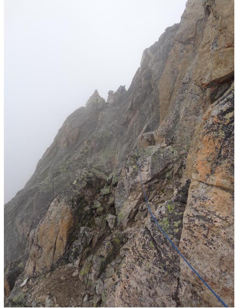
- straight along the ridge on simple rocks and large stony talus directly towards the rocky wall;
- having reached it, go left along the ledge and then up the internal angle (ATTENTION!!! Do not go into the left couloir — it is stone-dangerous!);
- from the internal angle at the top, go left along the ridge;
- then bypass the gendarme on the left along the ledge to the oblique slab;
- up it to the crevice between two large stones;
- having reached the small ledge, go right along the wall to the ridge;
- then exit to the center of the gendarme on the ridge;
- having descended from it to the ledge to the right of the ridge, go along it to the oblique slab on the left;
- along the cracks, ascend to the couloir, sticking to the right side — exit to the ridge;
- then along the ridge for about 150 m to the summit.
Descent — via the ascent route.
It is possible to approach from the Dzhilkau bivouac in 2–2.5 hours. Having reached the pass and then going to the right, passing along the ridge the Severny Dzhilkau pass, from the stone post go to the right of the ridge on a goat trail, it will lead by a traverse to the saddle.
Base camp 2075 m. N 43° 23.450′ E 041° 55.732′
Bivouac under Dzhilkau pass 2999 m. N 43° 22.875′ E 041° 53.161′
Kyshkadzher bivouac 3101 m. N 43° 23.862′ E 041° 53.717′
Kyshkadzher saddle (start of the route) 3577 m. N 43° 24.476′ E 041° 53.416′
Kyshkadzher summit 3837 m. N 43° 24.441′ E 041° 53.394′
| № | UIAA Symbol Scheme | Length | Difficulty | Placement elements / Pitons |
|---|---|---|---|---|
| 15 | 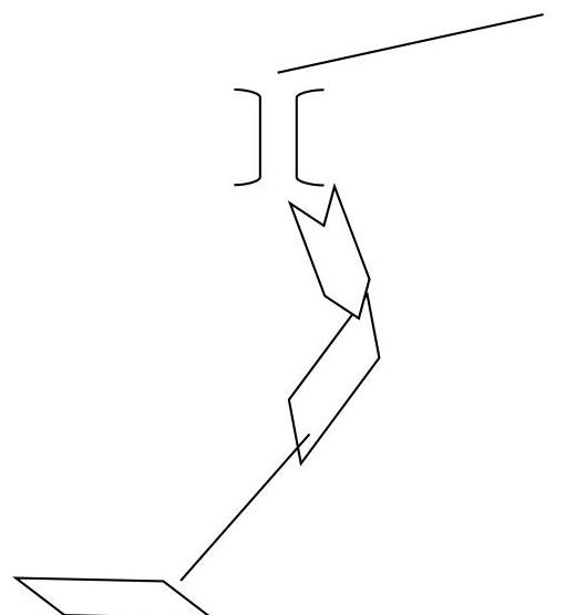 | 140 | III | 9\2 |
| 14 | 65 | II | 1\2 | |
| 13 | 15 | III | 3\1 | |
| 12 | 25 | II+ | - - | |
| 11 | 45 | II | 3 | |
| 10 | 10 | II | 3 | |
| 9 | 15 | IV | 2 | |
| 8 | 50 | II | 3 | |
| 7 | 25 | III | 3\1 | |
| 6 | 15 | III+ | 2 | |
| 5 | 9 | IV | 2\1 | |
| 4 | 8 | V | 2 | |
| 3 | 8 | II | 1 | |
| 2 | 35 | III | 3 | |
| 1 | 290 | I–II | - - |
Section 8
Comments
Sign in to leave a comment