
Ascent Passport
-
Ascent class — rock climbing
-
Ascent area — Western Caucasus from Marukh pass to Nakhara pass
-
Peak, height, ascent route — Dzhalovchat (Uzlovaya), 3680 m, via the northeast ridge, combined, first ascent.
-
Proposed category of difficulty — 2B
-
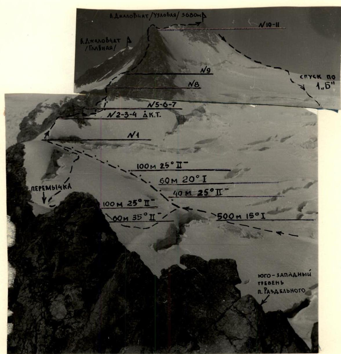
Route characteristics: height difference — 480 m, length of sections: category I difficulty — 1240 m, category II difficulty — 830 m, category III difficulty — 60 m, Total — 2130 m, average steepness of the ridge section — 35°
-
Pitons hammered: rock, ice, bolt, placed elements.
| for belay | 6 | 1 | - | 10 |
|---|---|---|---|---|
| for AID | - | - | - | - |
-
Number of climbing hours — 6 h
-
Number of nights and their characteristics — none.
-
Full name of the leader, participants, their qualifications:
-
Shvyrev Andrey Glebovich — Candidate Master of Sports
-
Mangilev Valery Georgievich — II sports rank
-
Team coach — Gorbachevsky A.D.
-
Date of departure and return — August 6, 1987
Route via NE ridge ~ 2B category difficulty. Classified route category I difficulty.
Ascent diagram to Dzhalovchat (Uzlovaya) peak via the northeast ridge

Brief description of the approach to the route
From Alibek ASB along the trail to Turye Lake. Camping. From the campsite, ascend to the moraine descending from under the Dvuyazychny glacier. From the moraine, exit to the "ram's foreheads" and then to the Dvuyazychny glacier. From the plateau, ascend along the center of the glacier to the Dzhalovchat pass (left of Kvadratny peak). Before the last ice-snow ascent to the pass, turn left towards the rock island. Bypass the island from below.
From Alibek ASB, the approach to the start of the route takes 4–5 h.
Brief explanation of the diagram
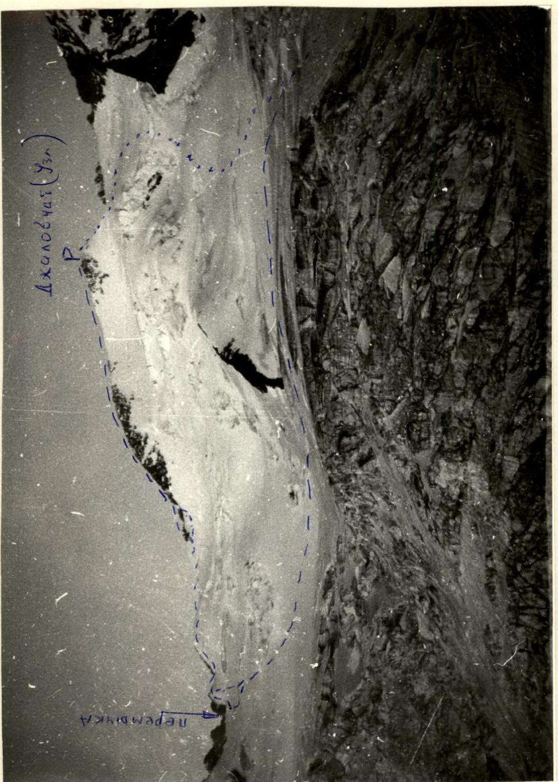
From the rock island, ascend to the saddle between Razdelny peak and Dzhalovchat (Uzlovaya) peak along the snowy slope.
Then, to the right along the steep snowy ridge with two ascents to the rocky ridge. Along the rocky ridge with two difficult walls, approach the start of the key section of the route. Control cairn.
Passing the first rope of the key section is possible in two ways:
- 1st option — ascend along the rocky wall to a ledge and then to the base of the chimney. Climbing is of average difficulty, piton belay.
- 2nd option — to the right of the rocky wall, ascend directly into the face along a very steep snow-ice slope to the base of the chimney.
The second rope of the key section passes through the chimney, exits to a ledge, and from the ledge along the wall exits to the ridge. Climbing is of average difficulty, piton belay.
Along the ridge with difficult walls, approach the snow-ice knife. Along it, exit to the rocks of the pre-summit ridge. Along simple snowy rocks, ascend to the summit.
From the rock island, the ascent to the summit takes 5–6 h. Descent via category 1B trail.
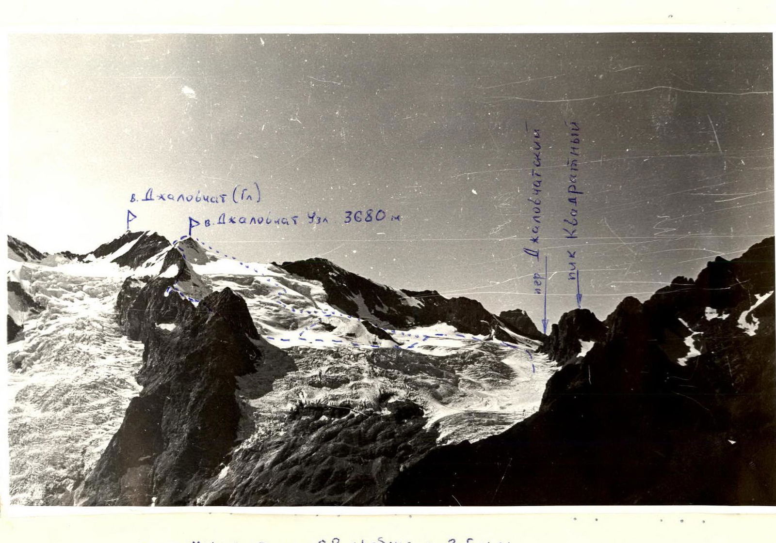
General view photo of Dzhalovchat (Uzlovaya) peak
 First ascent route via NE ridge.
Photo taken from SW ridge of Razdelny peak.
First ascent route via NE ridge.
Photo taken from SW ridge of Razdelny peak.
Photo of sections R5, R6, R7 on the route to Dzhalovchat (Uzlovaya) via NE ridge
 Photo taken from the control cairn (section R4).
Route profile
Comments
Sign in to leave a comment