- Class — technical.
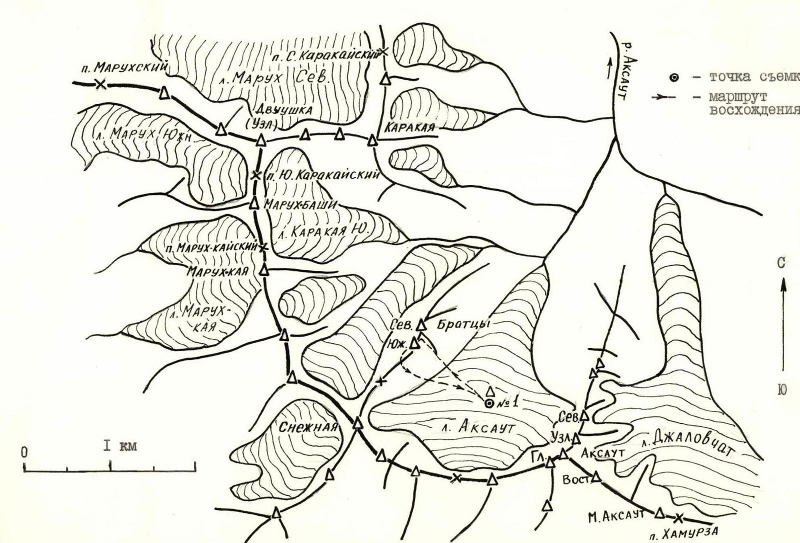
- North Caucasus, Aксаут gorge.
- Peak Yuzhnye Bratcy via left eastern counterfort.
- Proposed — Category 2B difficulty, first ascent.
- Height difference — 600 m, length — 880 m.
The average steepness of the route is 45°; maximum steepness in areas — up to 70°.
- Pitons were not left on the route.
- Climbing hours on the route — II.
- Overnight stays on the route — none.
- Leader: Timonin Sergey Nikolayevich, 2nd sports category.
Participants: Vorontsov Vladimir Viktorovich, 2nd sports category, Bykov Andrey Gennadyevich, 2nd sports category, Goloviznina Svetlana Anatolyevna, 1st sports category, Fomchenko Alyona Mikhailovna, 3rd sports category.
- Coach: Korenev Eduard Anatolyevich.
- Approach to the route: May 4, 1992. Summit: May 4, 1992. Return: May 4, 1992.
- Organization — Kaliningrad City Alpine Club "Edelweiss" of Moscow Region.
The shooting was done from the Aксаут glacier from the bivouac site (shooting point No. 1); camera — "Smena-8", distance — 1 km.
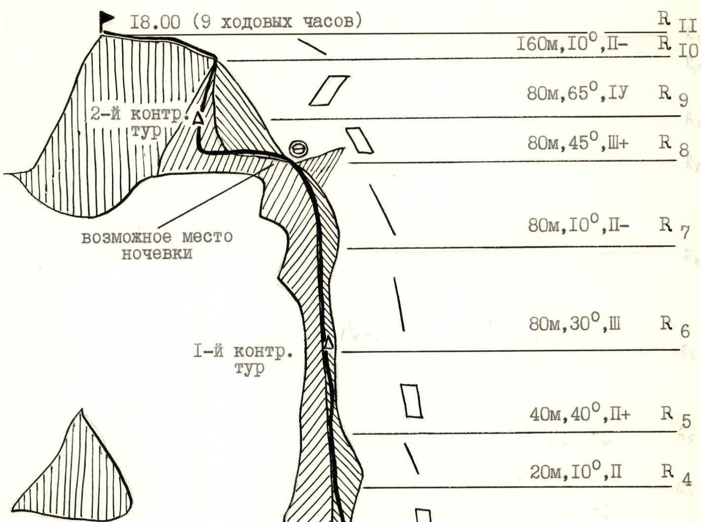
Route description by sections
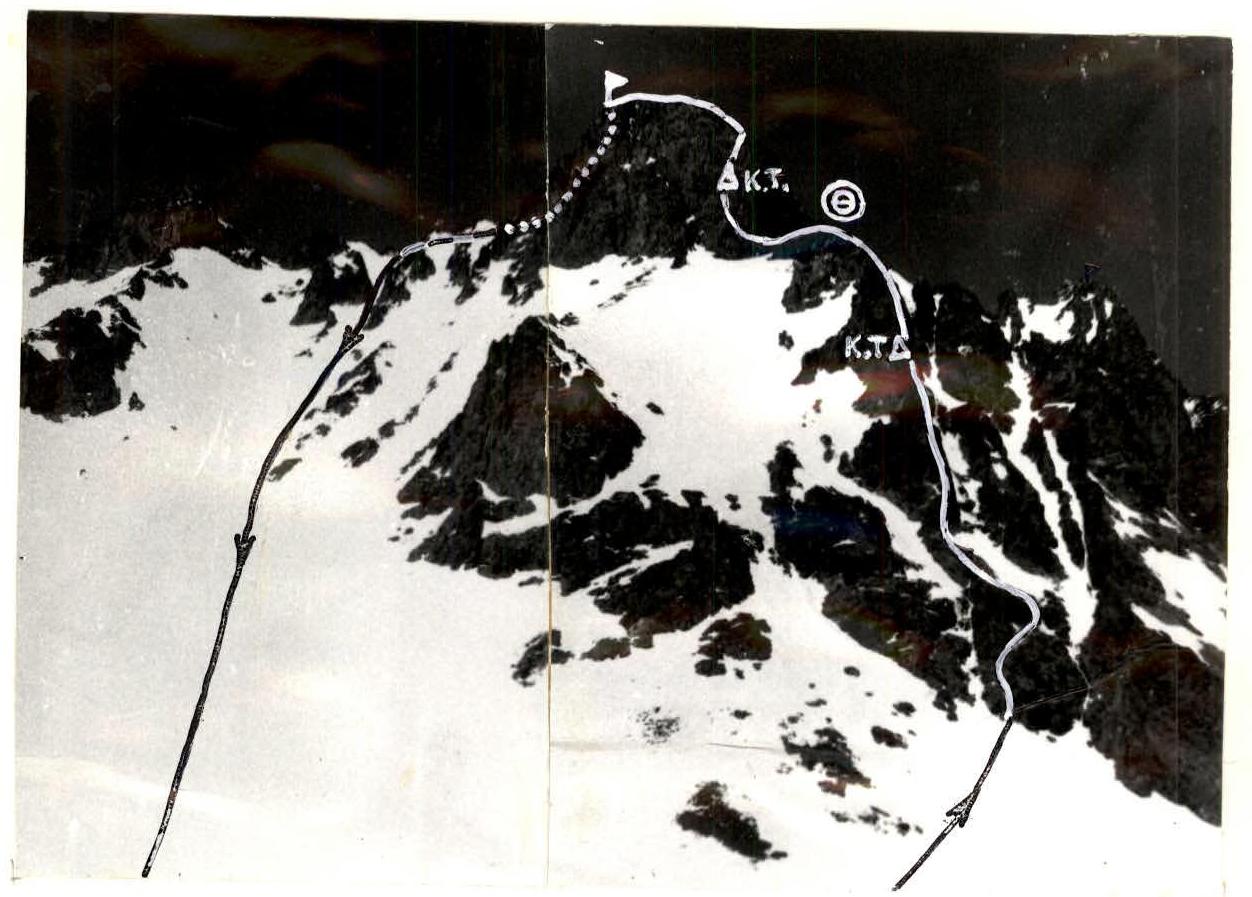
The initial bivouac is located on the Aксаут glacier opposite peak 3100 (Yuzhnye Bratcy).
On the section from R1 to R9, the route is characterized as a ridge route with sections of category 2 and 3 difficulty. Overall, these sections represent a category 3A route. Photographs 1–3 show characteristic segments of the route. Control cairns are installed:
- At the end of section R6
- In the middle of section R9–R10
The section R9–R10 corresponds to a category 4A route.
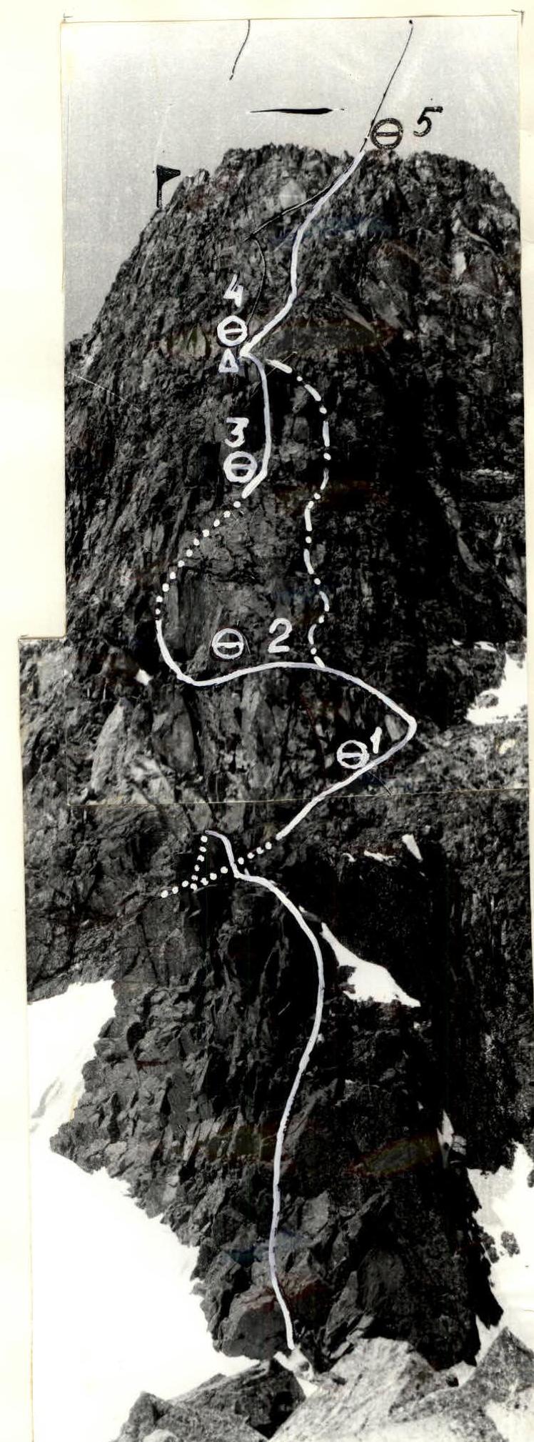
Photograph 4 shows the upper section of the route. In the foreground (lower part of the photograph) is a bridge. From belay point 1 to belay point 3 is the section R8–R9. Photograph 5 shows one of the characteristic segments of the route.
From belay point 3 to belay point 5 is the key section of the route R9–R10. Photograph 6 shows a segment of the section from belay point 3 to belay point 4. The group that made the second ascent of the route passed to the right here (shown by a dash-dot line), assessing the difficulty of the section as 2.
The section R10–R11 is a ridge route and corresponds to category 2A.
To climb the route, it is advisable to have:
- a set of protection equipment (9 pcs.)
- extension slings (10 pcs.)
- several rock pitons of various types and sizes.
A convenient place for an overnight stay is located at the end of section R7–R8. The descent from the summit is along the ridge, initially heading west, and after 40 m turning south towards the bridge and then down to the Aксаут glacier.
Overall, the route can be classified as category 3B. Route diagram