
Rostov Region Climbing and Mountaineering Federation
Report
on the ascent to the summit Baduk-bashi 3588 m via the eastern ridge presumably category 2B, first ascent
2014
Climbing Passport
-
Region: Western Caucasus, Aksaut area, Bolshaya Marka gorge, section 2.2 of the mountain route classifier.
-
Summit: Baduk-bashi, via the eastern ridge.
-
Proposed category: 2B, first ascent.
-
Route type: rock climbing.
-
Elevation gain: 260 m (GPS reading)
Route length (technical part): 480 m. Length of category 3 sections: 200 m. Average slope of the technical part: 45°.
-
Pitons left on the route: 0
"Pitons" used on the route: 19 (protection gear, slings). No drill pitons or ITO were used.
-
Total time: 12 hours, 1 day.
-
Descent from the summit via the ascent route.
-
Leader: Andrey Dergachev, 1st sports category, instructor 3rd category.
Participants:
- Alexander Dudka, 1st sports category
- Alexander Konkov, 1st sports category
-
Date of ascent: July 24, 2012.
Departure from base camp: 6:15 — reaching the ridge (start of the route): 8:30 — reaching the summit: 13:00 — return to base camp: 18:00
-
Rostov Region Climbing and Mountaineering Federation.
-
Responsible for the report: Andrey Dergachev aderg@narod.ru
Fig. 1. General view of the ridge from the southwest. August 1, 2006 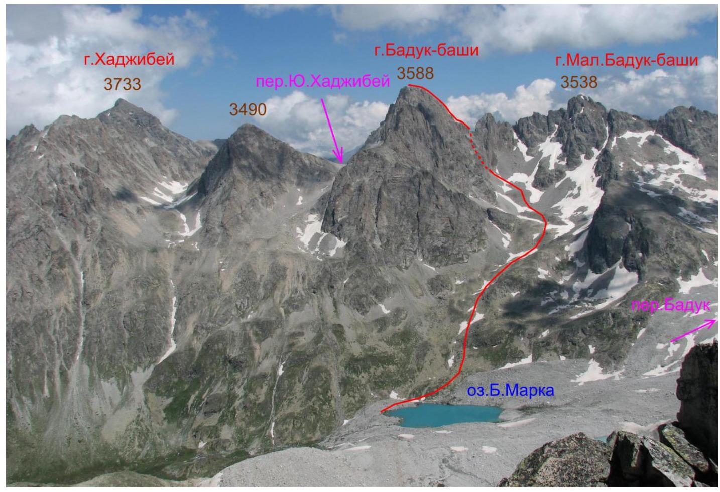
Fig. 2. General view of the ridge from the northeast. July 27, 2012 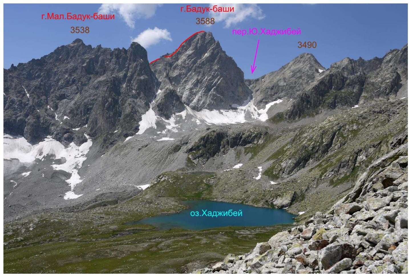
Geographic description of the area and the ascent object
The ascent object is the summit Baduk-bashi (Baduk, Badukbashi North) with an elevation of 3588 m, located in the Zelenchuksky district of the Karachay-Cherkess Republic, in the Teberda ridge of the Western Caucasus. On many maps, the location of Baduk-bashi is incorrect, although the summit was mentioned in mountaineering literature as early as the 1930s (V.M. Bronner, 1934; B.N. Delaunay, 1938). The confusion regarding the summit's location and name has led to it being marked twice on some maps in different locations (both incorrect) as Baduk-bashi and as "Baduksky Peak". In fact, Baduk-bashi is a key summit where the Teberda ridge meets the Baduk (or Khadzhibeysky on some maps) ridge to the east, which includes several other summits: Baduk-bashi Maly and Badukskie Paltsy. On V. Lyapin's map (2013 edition), Baduk-bashi and Baduk-bashi Maly are marked as "north" and "south".
The ascent was made from the Bolshaya Marka river gorge, a right tributary of the Aksaut river. The base camp was located near Lake Bolshaya Marka, from which the right source of the eponymous river flows.
The base camp is most conveniently reached by following the Bolshaya Marka gorge from the village of Krasny Karachay (16 km, one day's journey). There are shepherd's camps in the Bolshaya Marka gorge, and good trails exist (except for the upper part, about 3 km). There is a dirt road to Krasny Karachay along the Aksaut valley. The nearest settlement with regular bus service is the stanitsa of Kardonikskaya, 40 km from Krasny Karachay.
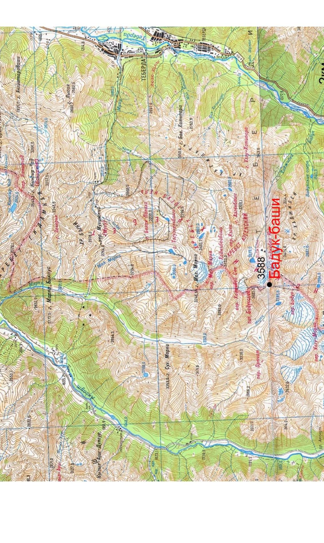
Fig. 3. Overview map of the area
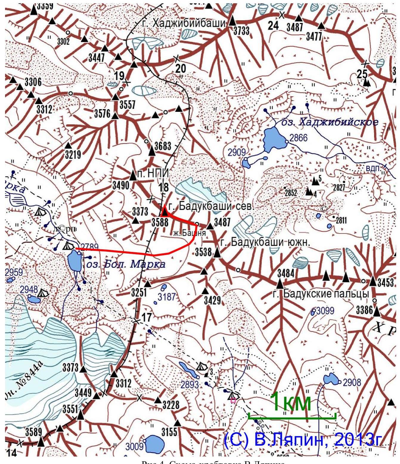
Fig. 4. V. Lyapin's ridge diagram
Table 1. List of technical sections of the route
| Section # | Length, m | Angle, degrees | Terrain characteristics | Category | # of pitons |
|---|---|---|---|---|---|
| R0–R1 | 100 | 35 | Scree slope | 2 | 0 |
| R1–R2 | 20 | 65 | Rock wall, ledges | 4 | 4 |
| R2–R3 | 50 | 30 | Scree ledges | 2 | 2 |
| R3–R4 | 250 | 45 | Rock ridge, inclined slabs | 3 | 10 |
| R4–R5 | 60 | 10 | Rock ridge | 3 | 3 |
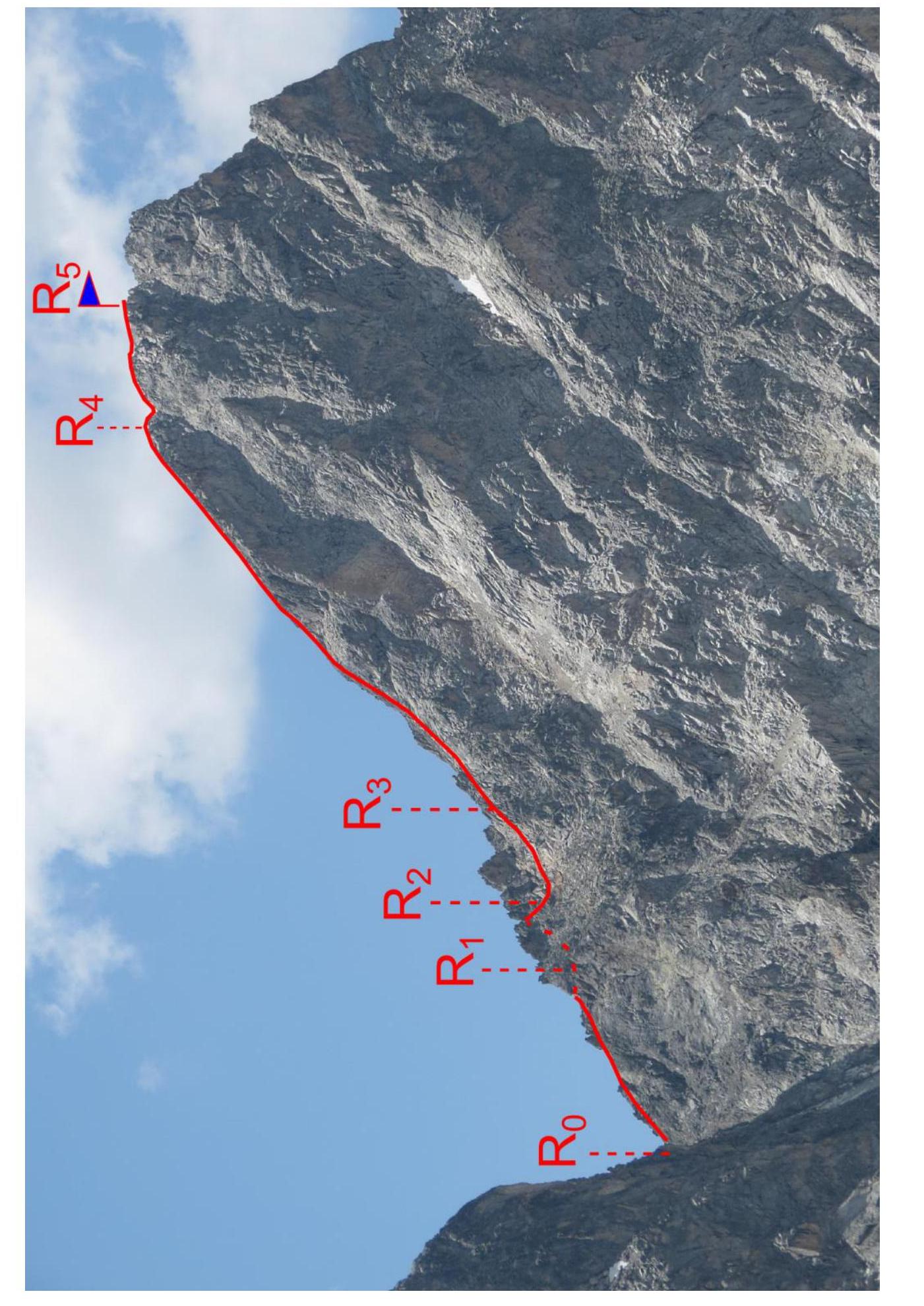
Fig. 5. Route photo
Description of the approach to the start of the technical part of the route
The summit Baduk-bashi (Main) is visible to the east from the base camp near Lake B. Marka. Climb the grassy-scree slope to the right of the summit, into the cirque between the Main and Maly Baduk-bashi. In the upper part of the cirque, turn left into the scree couloir between Baduk-bashi and the gendarme Bashnya. The start of the route is on the ridge. 2–2.5 hours from the base camp.
Description of the route passage
Section R0–R1. From the ridge, ascend the scree ridge with outcrops of broken rocks to a scree ledge to the left of the ridge. 100 m, 2.
Section R1–R2. Ascend the rock wall at 60–70° to a gap in the ridge and move to scree ledges to the right of the ridge. 20 m, 3–4.
Section R2–R3. Traverse scree ledges to the ascent of the ridge. 50 m, 1–2.
Section R3–R4. Ascend inclined (35–50°) rock slabs on the ridge. Solid granite, many rock outcrops for protection, cracks for medium and large protection gear. 250 m, 3.
Section R4–R5. Traverse along the sharp, broken rock ridge to the summit. 60 m, 2–3.
Descent via the ascent route
Route photos
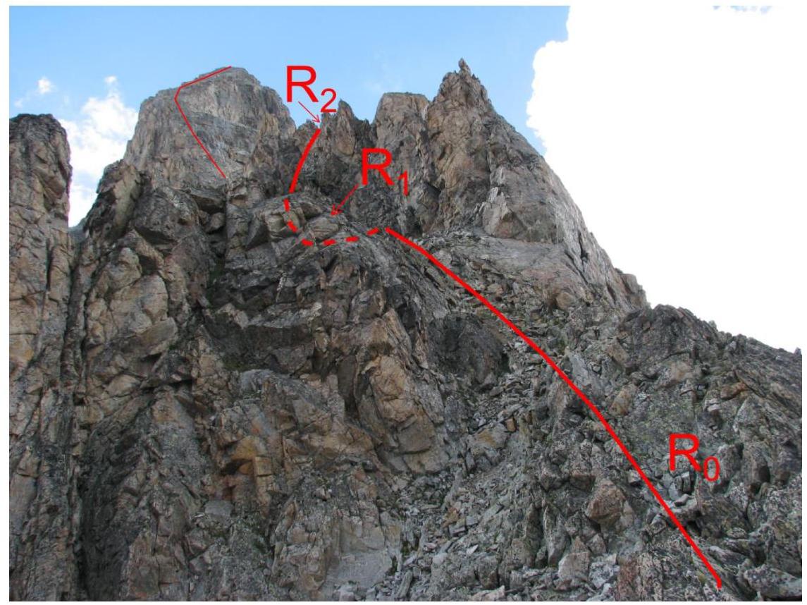
Fig. 6. Sections R0–R1–R2

Fig. 7. Sections R2–R3–R4
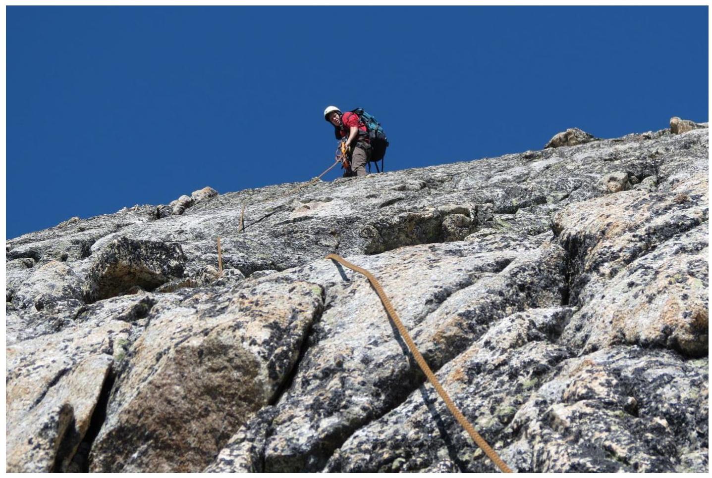
Fig. 8. Section R3–R4 (upper part).

Fig. 9. Section R4–R5 (summit).
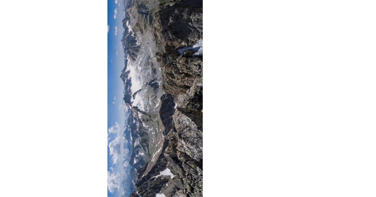
Fig. 10. Photopanorama from the summit
General conclusions
This route was previously climbed by us on August 3, 2006, also under the leadership of A. Dergachev (group members: junior climbers A. Smolin, S. Nefedov, E. Nesterova, A. Bolesov, V. Rogachev, A. Ponomarev). A cairn and a rusty, melted tin can without a note were found on the summit. No information about the climbers was found. The report is compiled based on the 2012 ascent, as it is more recent.
The nearest classified route in the area is category 1B to the summit B. Marka. A similar route in terms of difficulty is the traverse of Sulakhat, category 2A, but it is clearly easier. More suitable analogues: category 2B on Panagyurishte (Arkhyz) or category 2B on Chegetkar (Prielbrusye).
Based on the objective difficulty of the technical part of the route to Baduk-bashi via the eastern ridge and comparing it with other routes climbed by the participants, we propose to classify it as category 2B.
Comments
Sign in to leave a comment