Report
ON THE ASCENT TO THE SUMMIT OF AKSAUT NORTH VIA THE NORTHERN RIDGE, CATEGORY 2B DIFFICULTY
MULTIPROFILE ALPINISM CLUB "FRILINE"
12.06.2018
Ascent Passport
| № | 1. General Information | |
|---|---|---|
| 1.1 | Full name, sports rank of the leader | Donskov Andrey Mikhailovich, 1st sports rank |
| 1.2 | Full name, sports rank of participants | - |
| 1.3 | Full name of the coach | Motienko Nikolai Ilyich |
| 1.4 | Organization | MAK "FRILINE" Essentuki |
| 2. Characteristics of the Ascent Object | ||
| 2.1 | Region | Karachay-Cherkess Republic, Zelenchuksky district |
| 2.2 | Valley | Aksaut |
| 2.3 | Section number according to the 2013 classification table | 2.2. From Marukh pass to Nakhar pass |
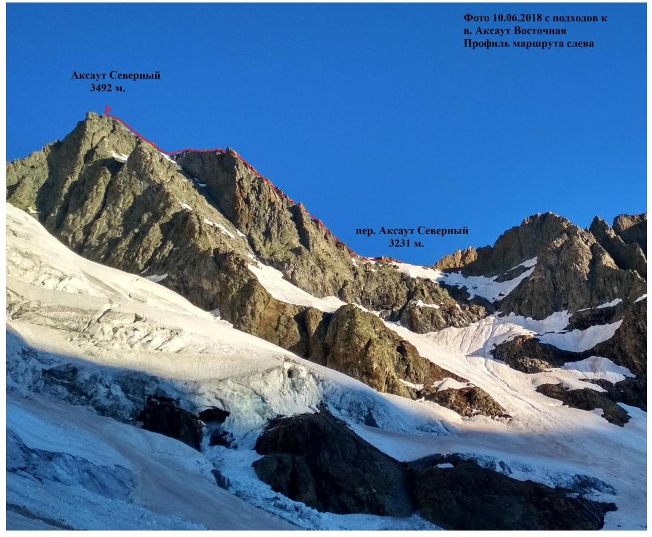
| 2.4 | Name and height of the summit | Aksaut, North (3492 m) |
| 3. Characteristics of the Route | ||
| 3.1 | Route name | Via the Northern Ridge |
| 3.2 | Category of difficulty | 2B |
| 3.3 | Degree of route exploration | Repeat ascent via N. Popov's route, category 2B, from the Северо-Aксаутский pass |
| 3.4 | Terrain characteristics of the route | Combined |
| 3.5 | Height difference of the route | 261 m |
| 3.6 | Route length | 550 m |
| 3.7 | Technical elements of the route | II category, combined - 300 m. III category, rock - 250 m. Movement on a closed glacier - 700 m. |
| 3.8 | Descent from the summit | Via the ascent route to the Aksaut North pass |
| 3.9 | Additional route characteristics | Water in the form of snow is present on the route year-round |
| 4. Characteristics of the Team's Actions | ||
| 4.1 | Movement time | 4 hours |
| 4.2 | Overnight stays | - |
| 4.3 | Departure on the route | 4:30 June 12, 2018 |
| 4.4 | Reaching the summit | 7:00 June 12, 2018 |
| 4.5 | Return to the base camp | 8:30 June 12, 2018 |
| 5. Responsible for the Report | ||
| 5.1 | Full name, e-mail | Donskov Andrey Mikhailovich donskov91@mail.ru |
General photo of the summit, panoramic photo of the area
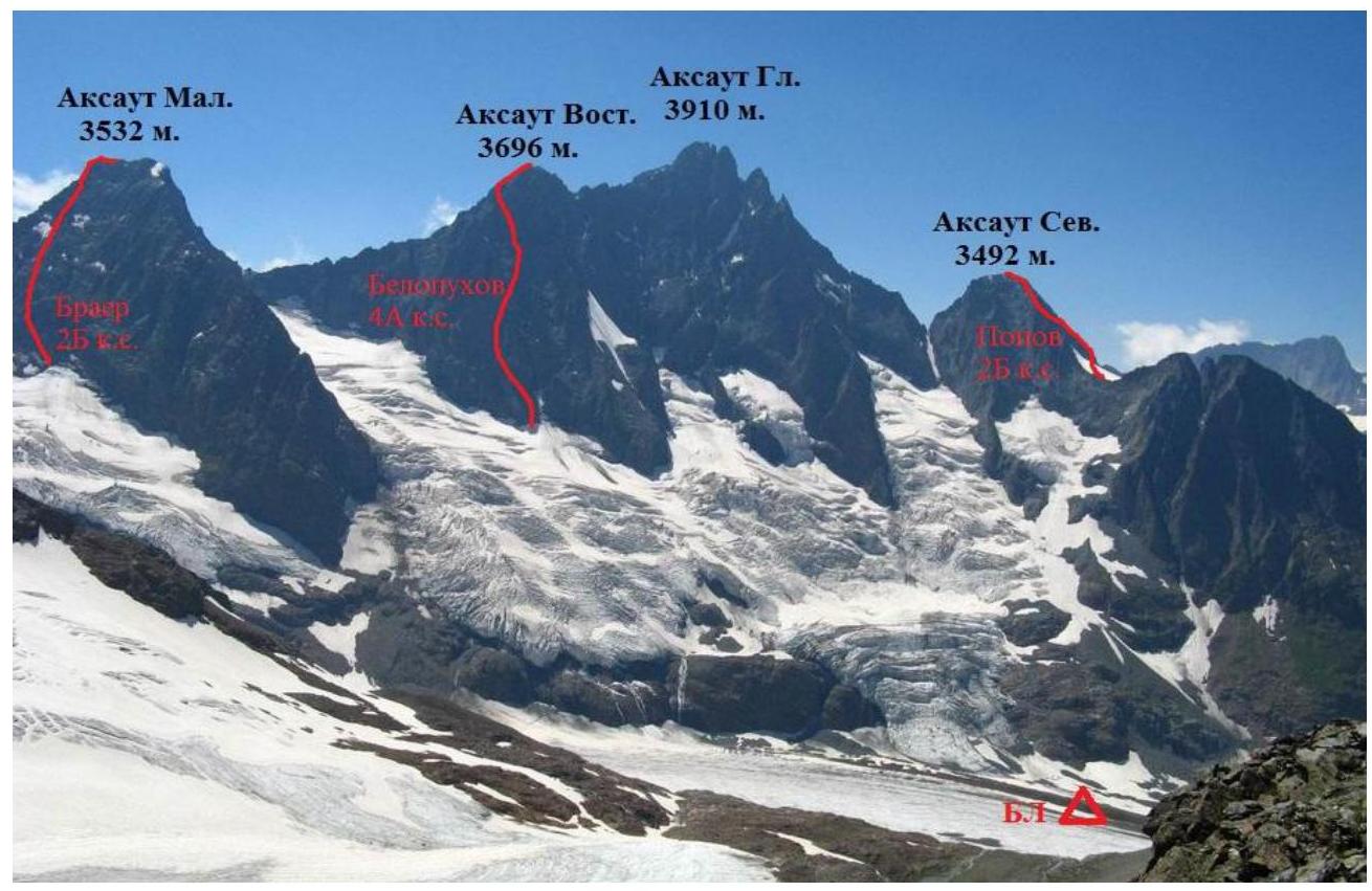 (*) Several traverses have been made on the Aksaut summit array, which are not marked on the photo.
Photo of the route profile on the left
Description of the area, approach to the route
A 1:100000 scale map and a 3D relief model of the Aksaut, Jalovchat, and Karakaya summits are provided, viewed from the south at an altitude of 5 km. The area is rarely visited due to the lack of good access; the last village at the entrance to the Khasaut-Grecheskoye valley is 50-60 km from the abandoned mine, where the approach to the base camp begins. The road is only passable by off-road vehicles and takes at least 4 hours.
From the clearing where the Rudnichy settlement was once located, the road winds upward. At the 21st turn, the path to the Jalovchatsky glacier begins, where the base camp is located. The height at the start of the path is higher than the base camp; the path traverses the slope and leads to the river, crossing it, and then descends along the moraine, losing about 200 m in height. Further movement is towards the glacier tongue and up to the middle moraine to the overnight stay sites. The approach time to the base camp from the start of the path is 3-4 hours.
Mobile communication at the base camp is available with "Megafon" (unstable). All summits are within a 5 km zone from the state border, and a permit is required to visit them.
The approach to the Aksaut North summit begins by bypassing the "ram's foreheads" to the right, followed by movement towards the Aksaut North pass. Depending on the time of ascent, the "ram's foreheads" may be exposed before reaching the pass, with a climbing difficulty of up to category II+.
Conclusions and Recommendations
N. Popov's category 2B route to the Aksaut North summit (3492 m) corresponds to the specified category, is logical, and is the simplest option for ascending to the summit. In its upper third, it has a pronounced ridge character, which creates an increased thunderstorm danger in case of worsening weather conditions.
Descent from the summit is via the ascent route to the Aksaut North pass.
The terrain is more than averagely destroyed and requires increased attention to movement from the climbers.
Route Characteristics
| Section № | Terrain characteristics | Category of difficulty | Length, m | Type and quantity of pitons |
|---|---|---|---|---|
| R0–R1 | Firn, snow | II | 70 | - |
| R1–R2 | Rocky ridge | II+ | 230 | - |
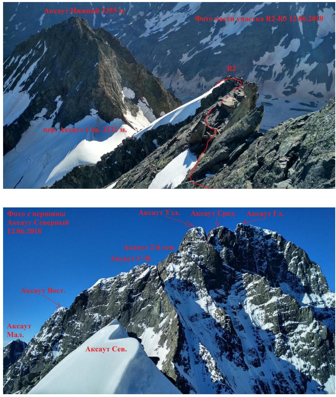
| R2–R3 | Rocky ridge | III | 250 | - |
| Section № | Description | Photo № |
|---|---|---|
| R0–R1 | From the Aksaut North pass, upwards to the right, crossing the snowy slope, exit to a heavily destroyed counterfort. | |
| R1–R2 | Destroyed rocks of the counterfort lead to the pre-summit ridge. Be cautious of loose stones when moving along the counterfort. | |
| R2–R3 | Along the rocky, slab-like ridge - movement towards the summit. Movement on this section is dangerous during thunderstorms. |

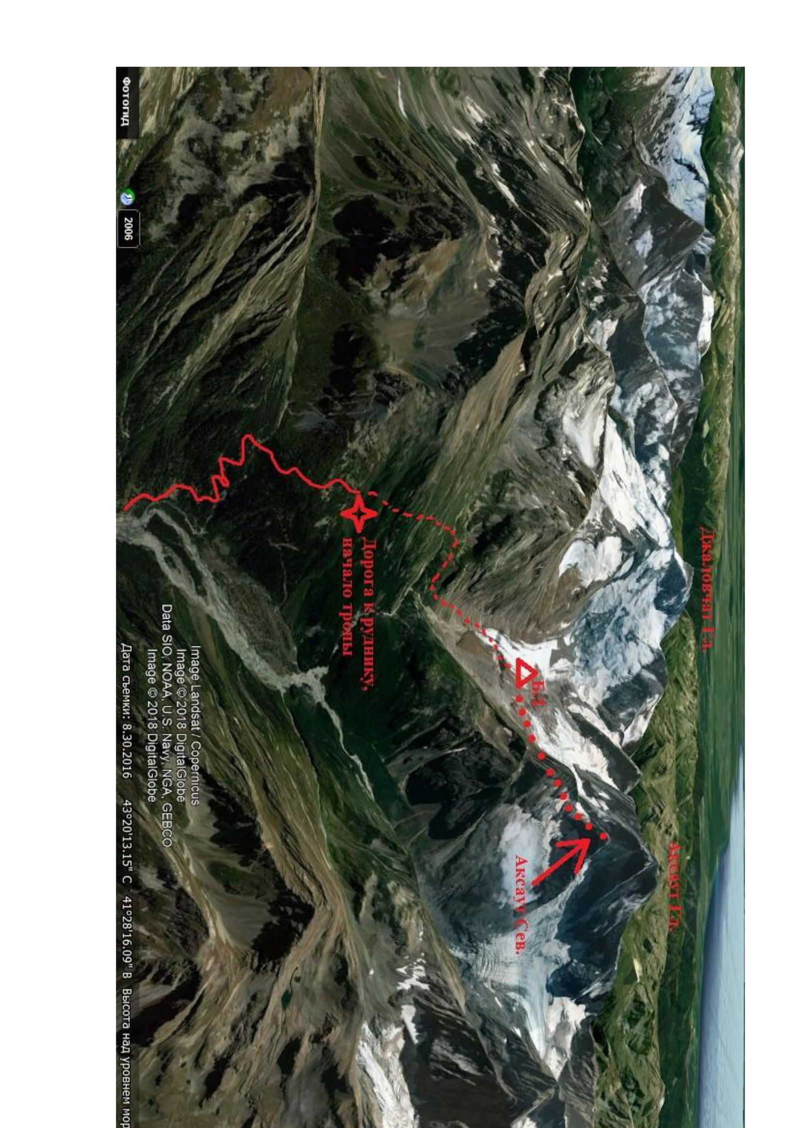
Image Landsat / Copernicus
Image © 2018 DigitalGlobe
Data SIO, NOAA, U.S. Navy, NGA, GEBCO
Image © 2018 DigitalGlobe
Date of survey: August 30, 2016 43°20′13.15″ N 41°28′16.09″ E. Height above sea level
Photos of Route Sections
Photo from the Aksaut North pass on June 12, 2018
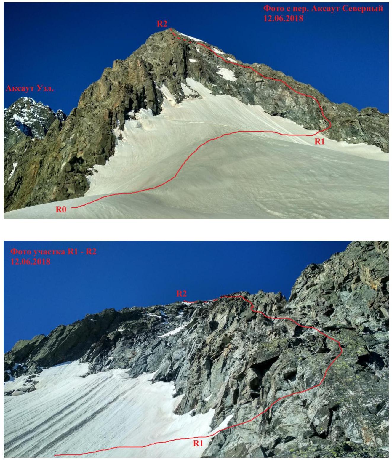
Photo of section R1–R2 on June 12, 2018