Report
ON THE FIRST ASCENT TO THE SUMMIT 2321 (PSHEKHO-SU SOUTHWEST) VIA THE SOUTHWEST WALL ROUTE, CATEGORY 4B, BY THE TEAM OF THE STAVROPOL KRAI ALPINISM FEDERATION ON JULY 2, 2023.
I. Climbing Report
| № | 1. General Information | |
|---|---|---|
| 1.1 | Full name, sports rank of the leader | Glushnev Alexander Nikolaevich, 2nd sports rank |
| 1.2 | Full name, sports rank of the participants | Iver Evgeny Vasilievich, CMS, instructor 3rd category (cert. №898) Shpilevoy Yuri Valerievich, 2nd sports rank |
| 1.3 | Full name of the coach | Enin Vladimir Ilyich |
| 1.4 | Organization | Stavropol Krai Federation of Alpinism |
| 2. Characteristics of the Climbing Object | ||
| 2.1 | Region | Caucasus |
| 2.2 | Valley | Pshekha river valley |
| 2.3 | Section number according to the 2013 classification table | 2.1 |
| 2.4 | Name and height of the summit | 2321 (Pshekho-Su SW) |
| 2.5 | Geographic coordinates of the summit (latitude/longitude), GPS coordinates | 43.9830091, 39.8822775 |
| 3. Characteristics of the Route | ||
| 3.1 | Name of the route | via the southwest wall |
| 3.2 | Proposed category of difficulty | 4B |
| 3.3 | Degree of route development | First ascent |
| 3.4 | Nature of the route terrain | Rock |
| 3.5 | Height difference of the route (altimeter or GPS data) | 586 m |
| 3.6 | Length of the route (in meters) | 603 m |
| 3.7 | Technical elements of the route (total length of sections of various difficulty categories with terrain type indication) | 1st cat. rock — 45 m. 2nd cat. rock — 50 m. 3rd cat. rock — 87 m. 4th cat. rock — 210 m. 5th cat. rock — 135 m. 6th cat. rock — 76 m. |
| 3.8 | Average steepness of the route, (°) | 65° |
| 3.9 | Average steepness of the main part of the route, (°) | 71° |
| 3.10 | Descent from the summit | via the Pshekho-Su summit, then towards the Maykop Pass |
| 3.11 | Additional characteristics of the route | Water is absent on the route. |
| 4. Characteristics of the Team's Actions | ||
| :----: | :-----------------------------------------------------------: | :--------------------------------------------------------------------: |
| 4.1 | Time of movement (team's walking hours, in hours and days) | 21 h 35 min |
| 4.2 | Overnight stays | Site near a large stone under the Vodopadny waterfall (base camp) |
| 4.3 | Start of the route | 9:25 on July 1, 2023 from the base camp |
| 4.4 | Stop for overnight stay | 19:30 on July 1, 2023 at section R9 |
| 4.5 | Resumption of work | 5:30 on July 2, 2023 |
| 4.6 | Reaching the summit 2321 (Pshekho-Su SW) | 8:45 on July 2, 2023 |
| 4.7 | Reaching the Pshekho-Su summit | 11:00 on July 2, 2023 |
| 4.8 | Return to the base camp | 17:00 on July 2, 2023 |
| 5. Responsible for the Report | ||
| 5.1 | Full name, e-mail | Iver Evgeny Vasilievich, evgeniy.iver@gmail.com |
II. Description of the Ascent
1. Characteristics of the Climbing Object
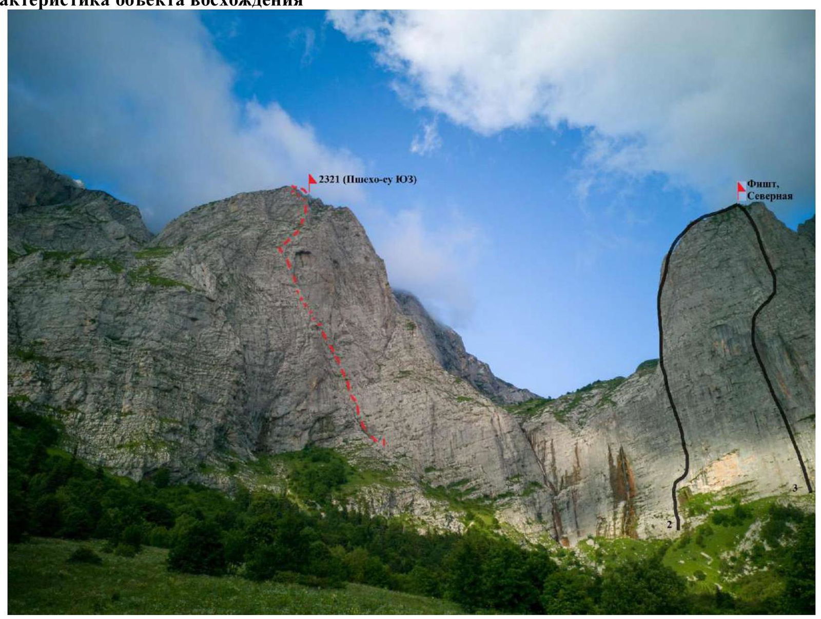
Photograph № 1. General photograph of the summit (taken on July 2, 2023 from the side of the Vodopadisty tourist base). 1 — route climbed by the team; 2 — route to Fisht, North via the NW edge of the 3rd wall, category 5A; 3 — route to Fisht, North via the 3rd wall, category 5A.
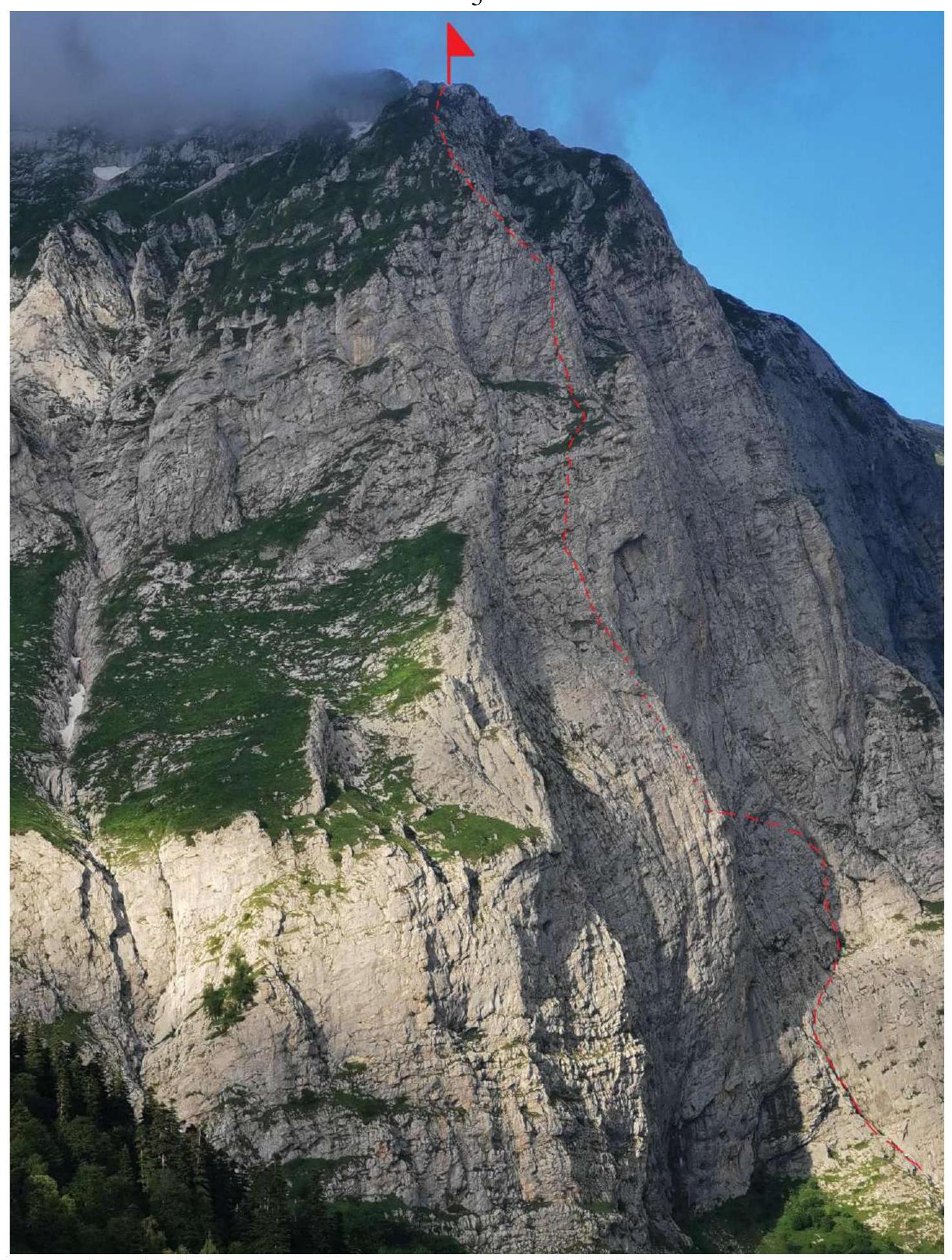
Photograph № 2. Profile of the route (taken on July 2, 2023 from the road when approaching the Vodopadisty tourist base).
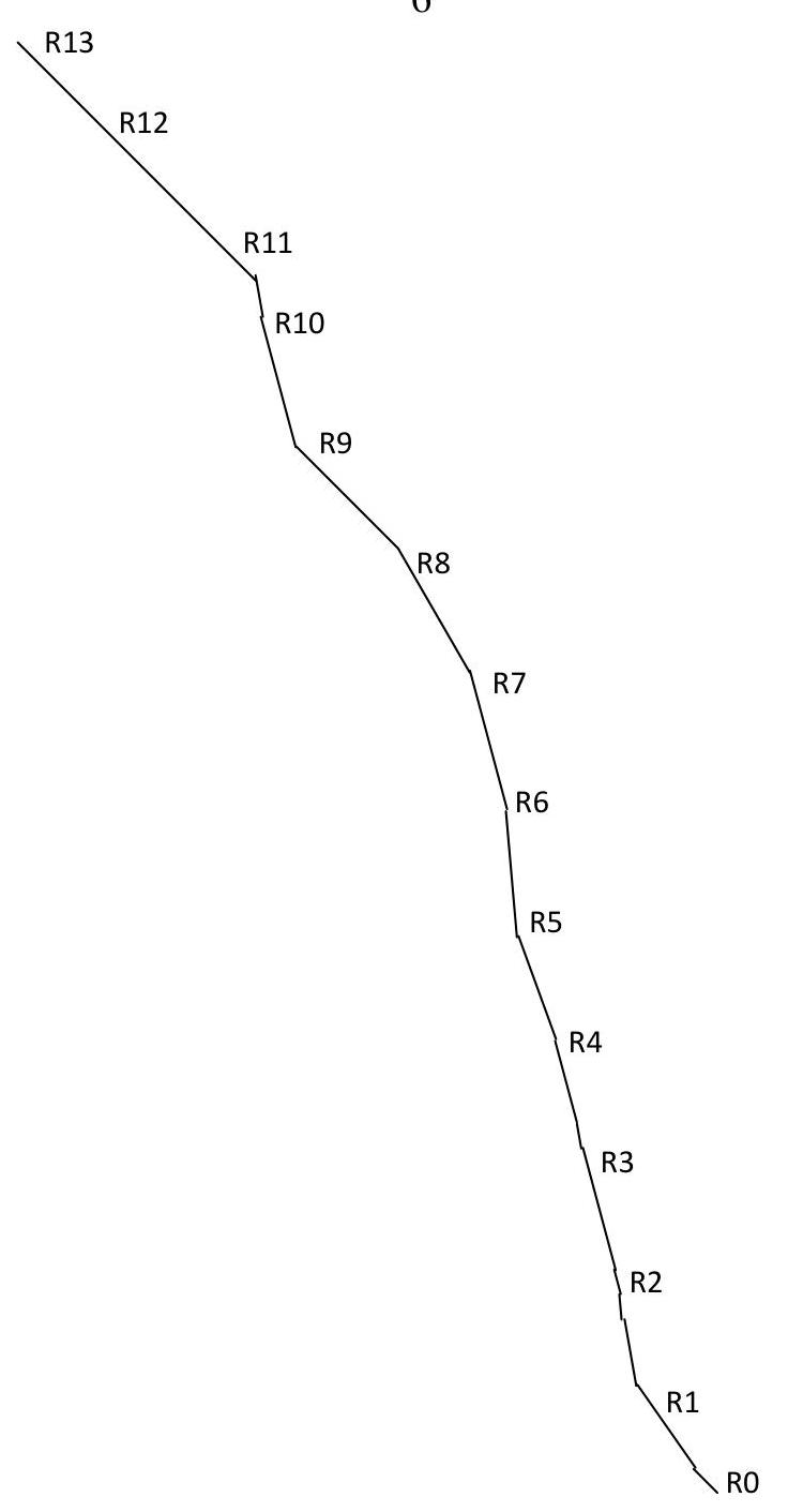
Diagram 1. Hand-drawn profile of the route
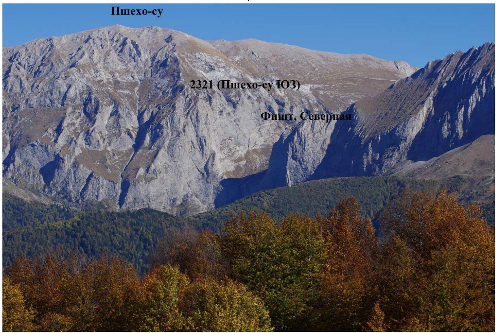
Photograph № 3. Photopanorama of the area (taken in October 2015 from the side of the Khuko summit).
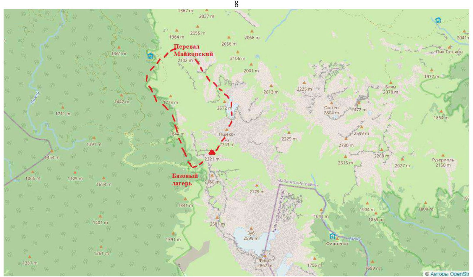
Map of the area (source https://www.openstreetmap.org↗). The idea of climbing this route belongs to Glushnev A.N. In June 2023, a trip was made to assess the route. Peak 2321 (Pshekho-Su SW) is located in the Maykop district of the Republic of Adygea in the Pshekho-Su massif.
From the village of Chernigovskoe, one needs to move along the road towards the settlement of Otdalenny and after about 28 km turn left from the main road towards the Vodopadisty tourist base.
As of summer 2023, the remaining 14 km of the road are not asphalted. Road conditions:
- The road is periodically washed away.
- Passage is only possible with a four-wheel-drive vehicle.
Near the Vodopadisty tourist base, there is a large area where one can leave their car.
The base camp can be set up at the Vodopadisty tourist base or in its surroundings.
To organize a stay, it is necessary:
- Book cottages by phone +7 928 426-39-67.
- Purchase a pass to visit the Caucasian State Natural Biosphere Reserve named after Kh.G. Shaposhnikov on the website: www.kavkazzapoved.ru↗.
The approach to the start of the route is done via a trail from the Vodopadisty tourist base. After reaching the waterfalls, one needs to cross to the right bank of the river and then move along the wall to the start of the route. The approach takes 30–40 minutes from the Vodopadisty tourist base.
2. Characteristics of the Route
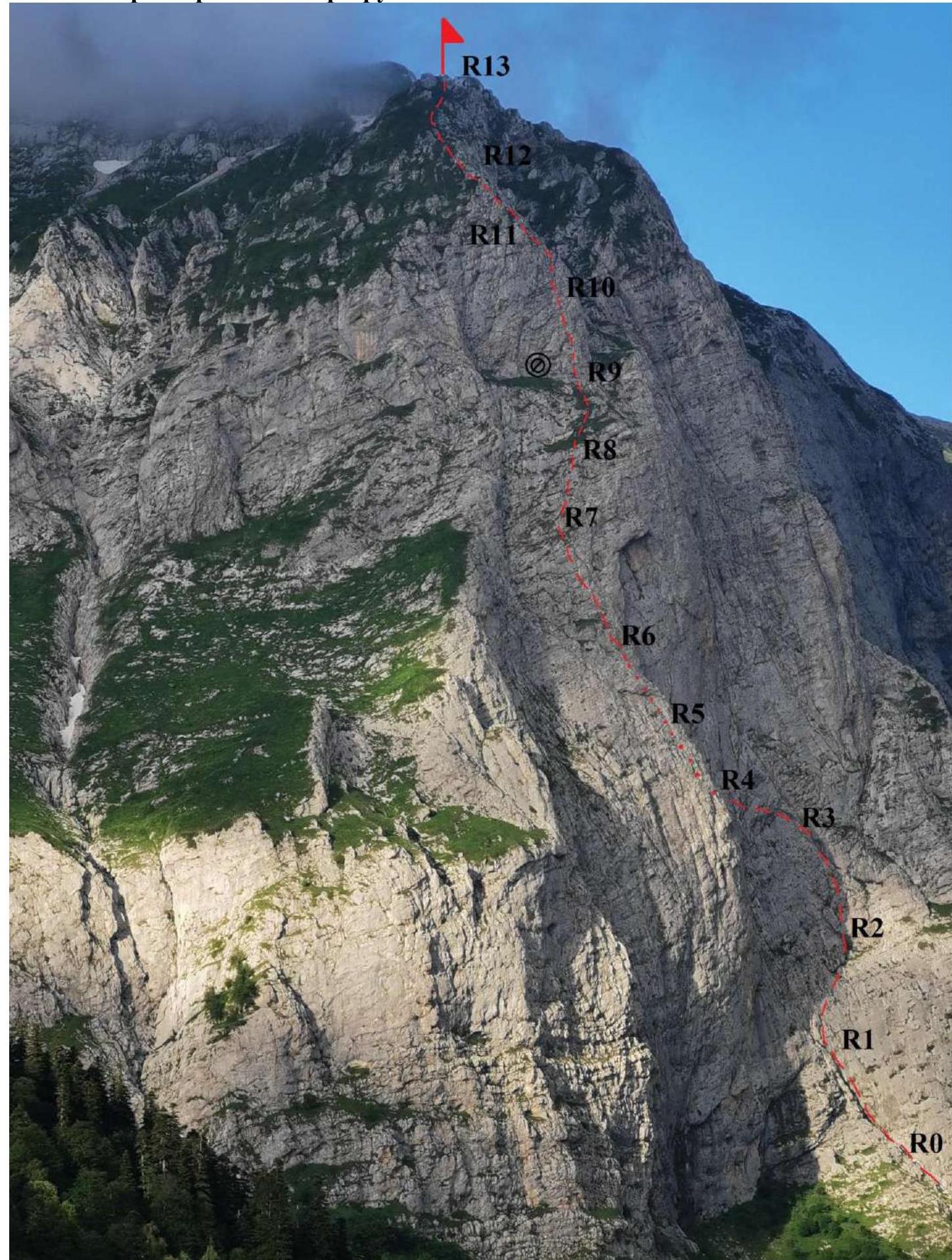
Photograph № 4. Technical photograph of the route (taken on July 2, 2023 from the road when approaching the Vodopadisty tourist base).
Technical characteristics of the route sections
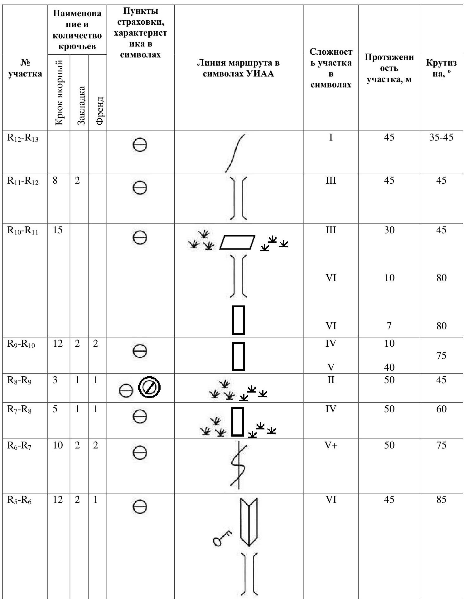
| Section № | Anchor Hook | Nut | Friend | Section Difficulty | Section Length, m | Steepness, ° |
|---|---|---|---|---|---|---|
| R12–R13 | 1 | 45 | 35–45 | |||
| R11–R12 | 8 | 2 | 3 | 45 | 45 | |
| R10–R11 | 15 | 3, 6, 6 | 30, 10, 7 | 45, 80, 80 | ||
| R9–R10 | 12 | 2 | 2 | 4, 5 | 10, 40 | 75, 75 |
| R8–R9 | 3 | 1 | 1 | 2 | 50 | 45 |
| R7–R8 | 5 | 1 | 1 | 4 | 50 | 60 |
| R6–R7 | 10 | 2 | 2 | 5 | 50 | 75 |
| R5–R6 | 12 | 2 | 1 | 6 | 45 | 85 |
| R4–R5 | 12 | 1 | 2 | 4 | 40 | 70 |
| R3–R4 | 13 | 2 | 1 | 4, 6, 5 | 30, 4, 10 | 75, 85, 80 |
| R2–R3 | 9 | 2 | 2 | 4 | 45 | 75 |
| R1–R2 | 10 | 2 | 1 | 5, 6, 5 | 10, 10, 25 | 75, 85, 80 |
| R0–R1 | 10 | 1 | 4, 3 | 35, 12 | 55, 45 |
3. Characteristics of the Team's Actions
| Section № | Description | Photo № |
|---|---|---|
| R0–R1 | Movement along slabs between two large crevices. 47 m, 45–55°, 3–4 | Photograph № 5 |
| R1–R2 | Right onto the wall. 45 m, 75–85°, 5–6 | Photograph № 6 |
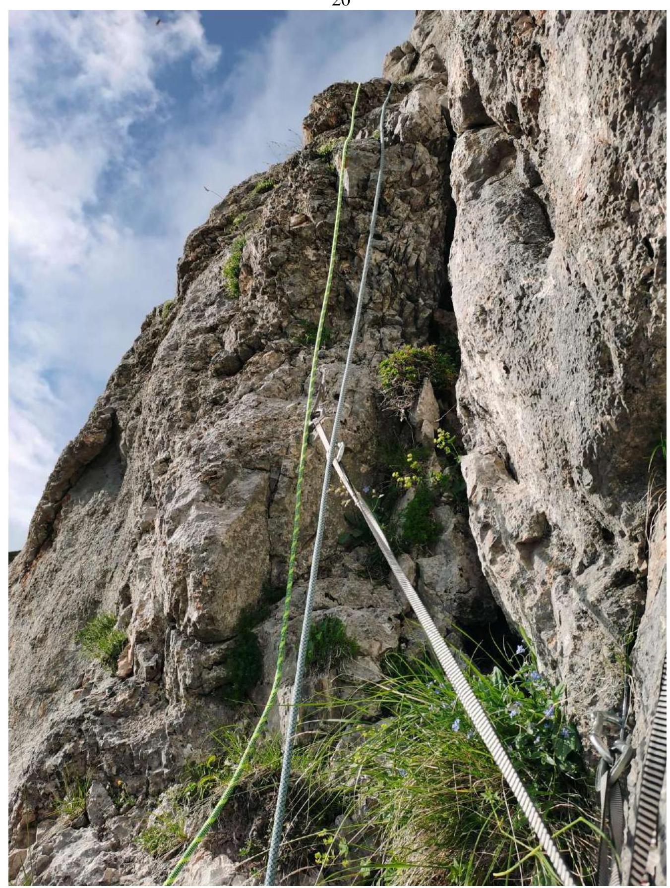
| R2–R3 | Movement along a crack turning into an internal corner. 45 m, 75°, 4 | Photograph № 7 |
| R3–R4 | Start along a small chimney turning into an internal corner and transition to the left side of the internal corner. 44 m, 75–85°, 4–6 | Photograph № 8 |
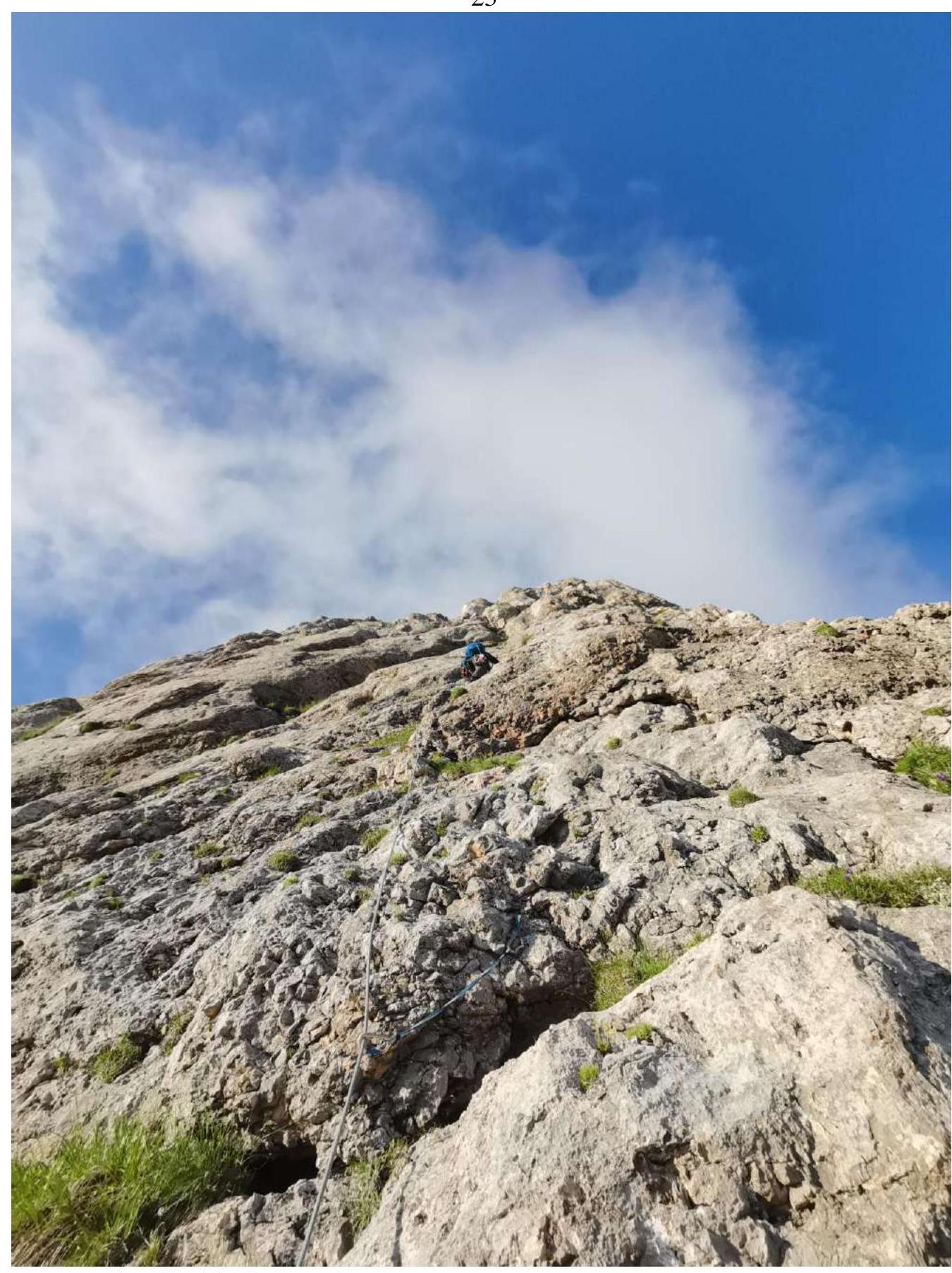
| R4–R5 | Movement along a chimney | 40 m, 70°, 4 |
| R5–R6 | The key to the route. Start by moving 7 m along the chimney, then right into the internal corner, bypassing the overhang. Then along the internal corner, we go behind the bend. 45 m, 85°, 6 | Photograph № 10 |
| R6–R7 | Movement along a crevice going left. 50 m, 75°, 5 | Photograph № 11 |
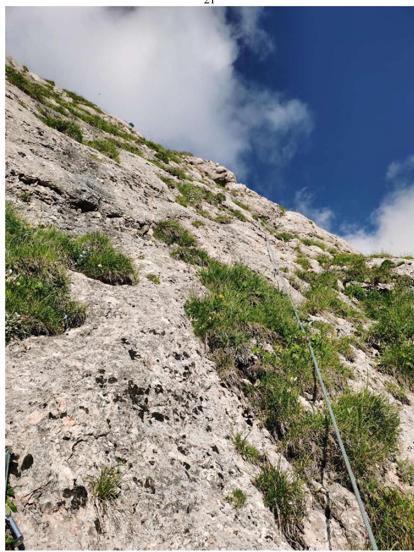
| R7–R8 | Movement right along slabs with grassy ledges and islands. 50 m, 60°, 4 | Photograph № 12 |
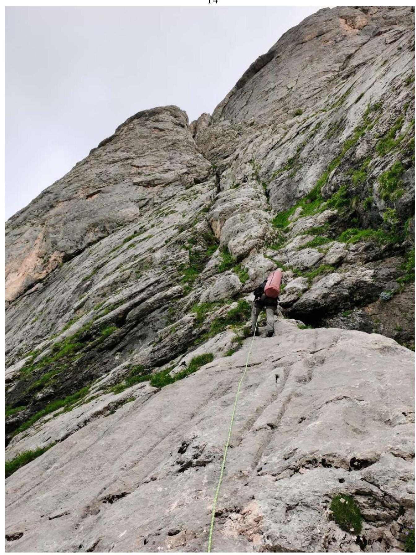
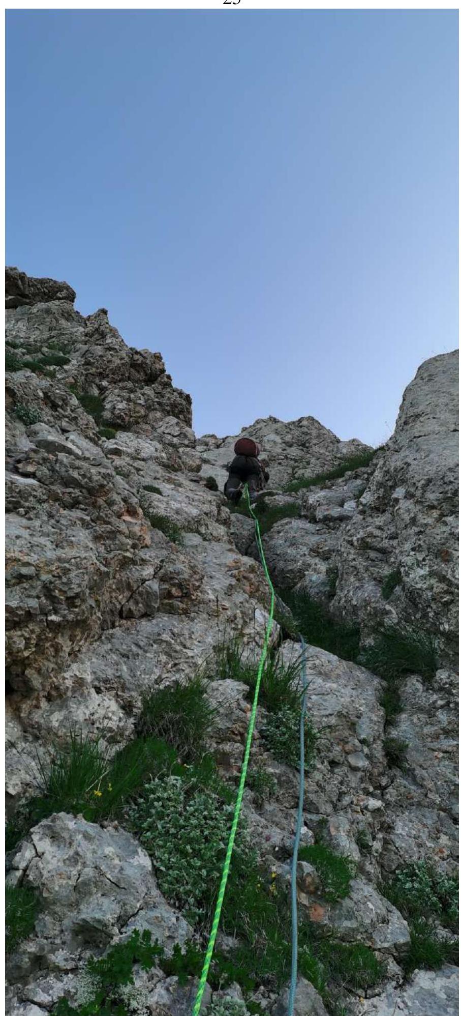
| R8–R9 | Movement along a grassy slope towards the right tower (from this section, it visually appears as a tower, but is actually a wall turning into a ridge). 50 m, 45°, 2. On section R9, a sitting overnight stay is possible under the wall. | Photograph № 13 |
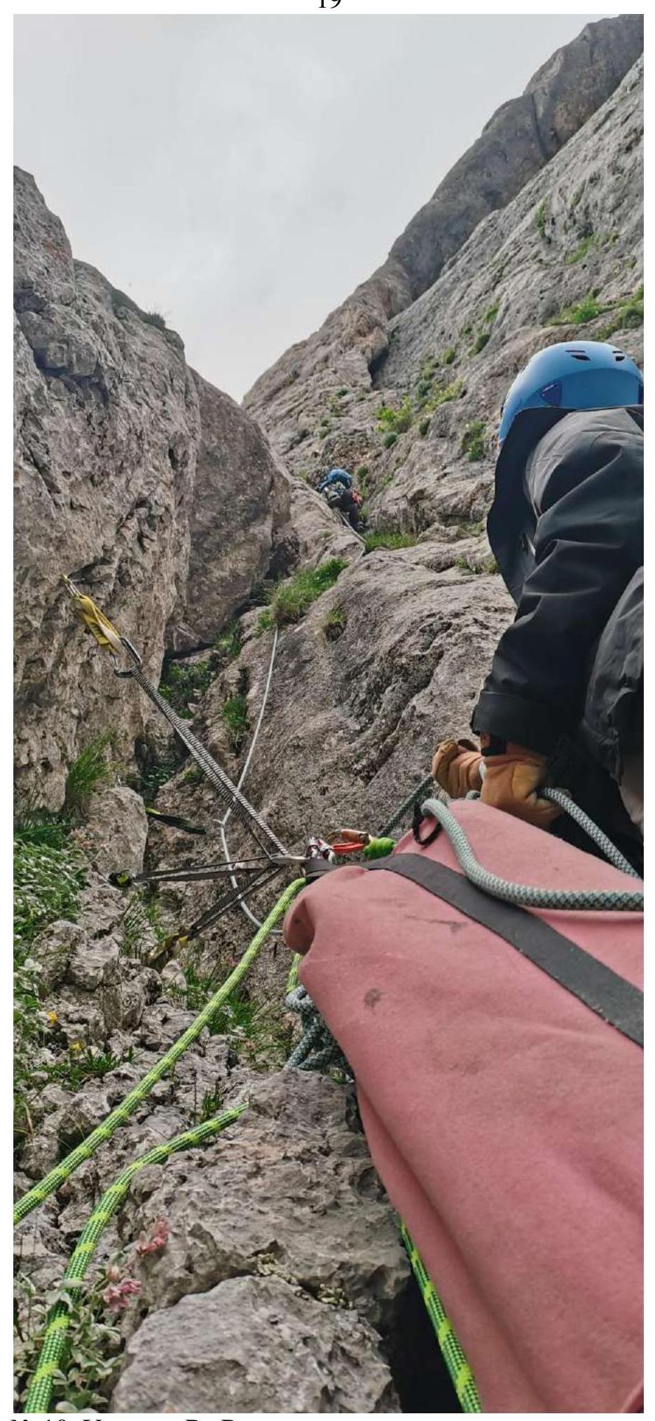
| R9–R10 | Movement onto the right tower. 50 m, 75°, 4–5 | Photograph № 14 |
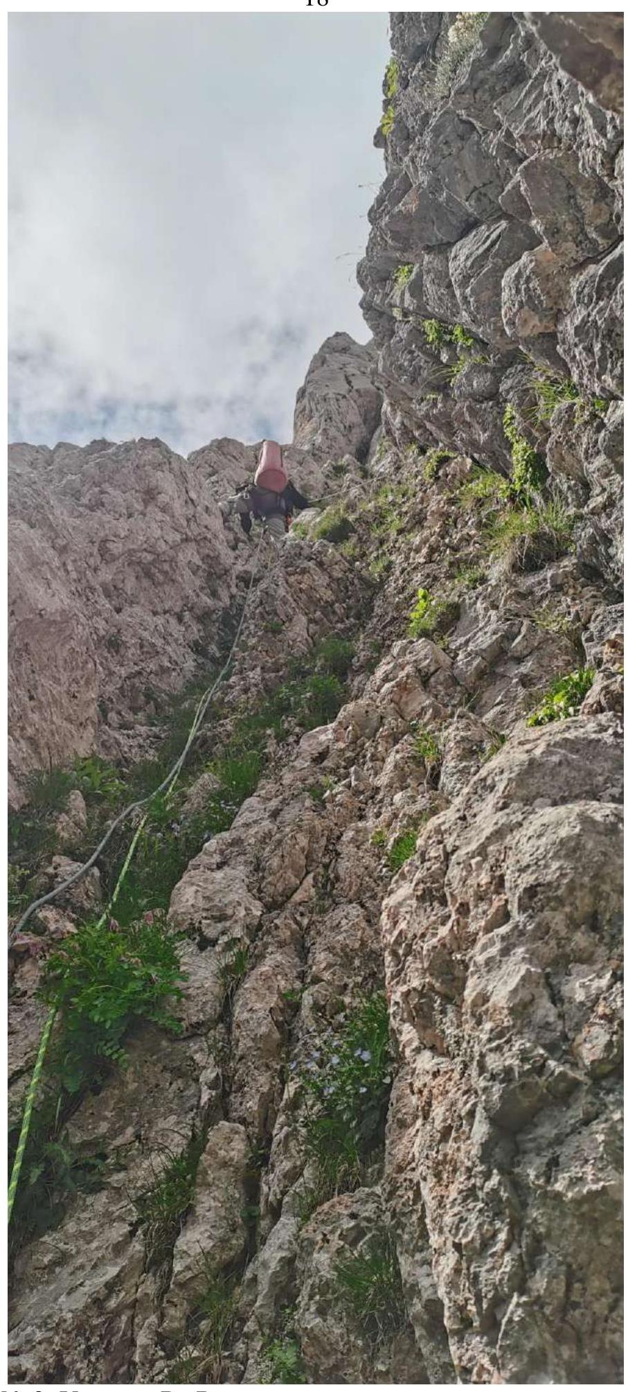
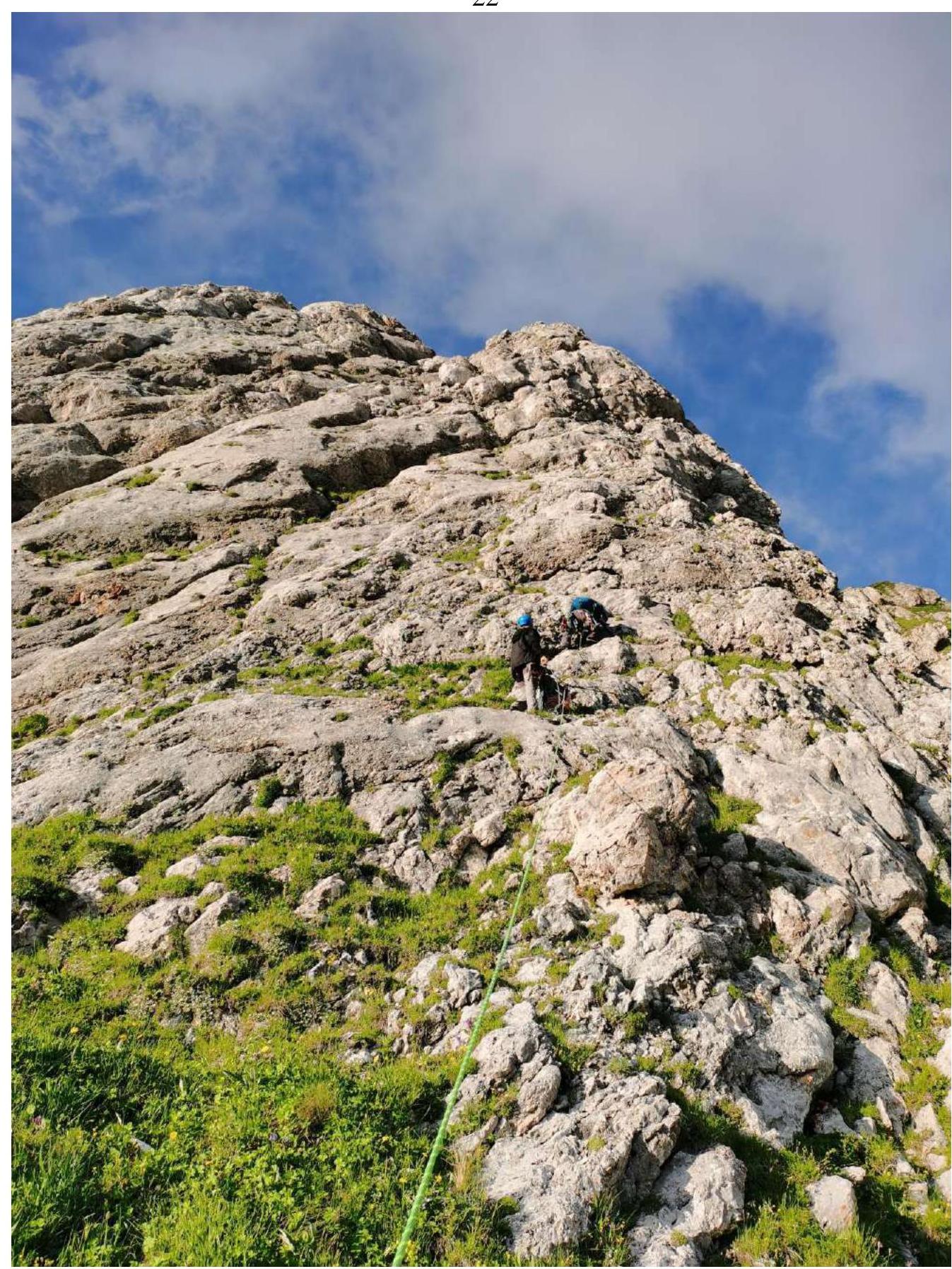
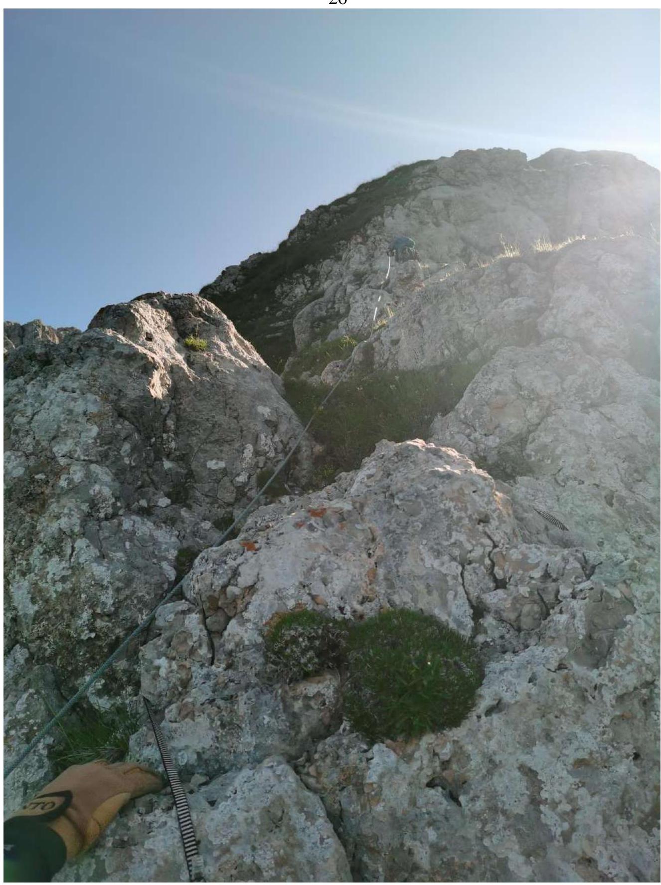
| R10–R11 | Movement upwards 7 m along the wall to the left of the chimney, then transition right into the chimney. Further along grassy ledges, exit onto the counterfort. 47 m, 45–80°, 3–6 | Photograph № 15 |
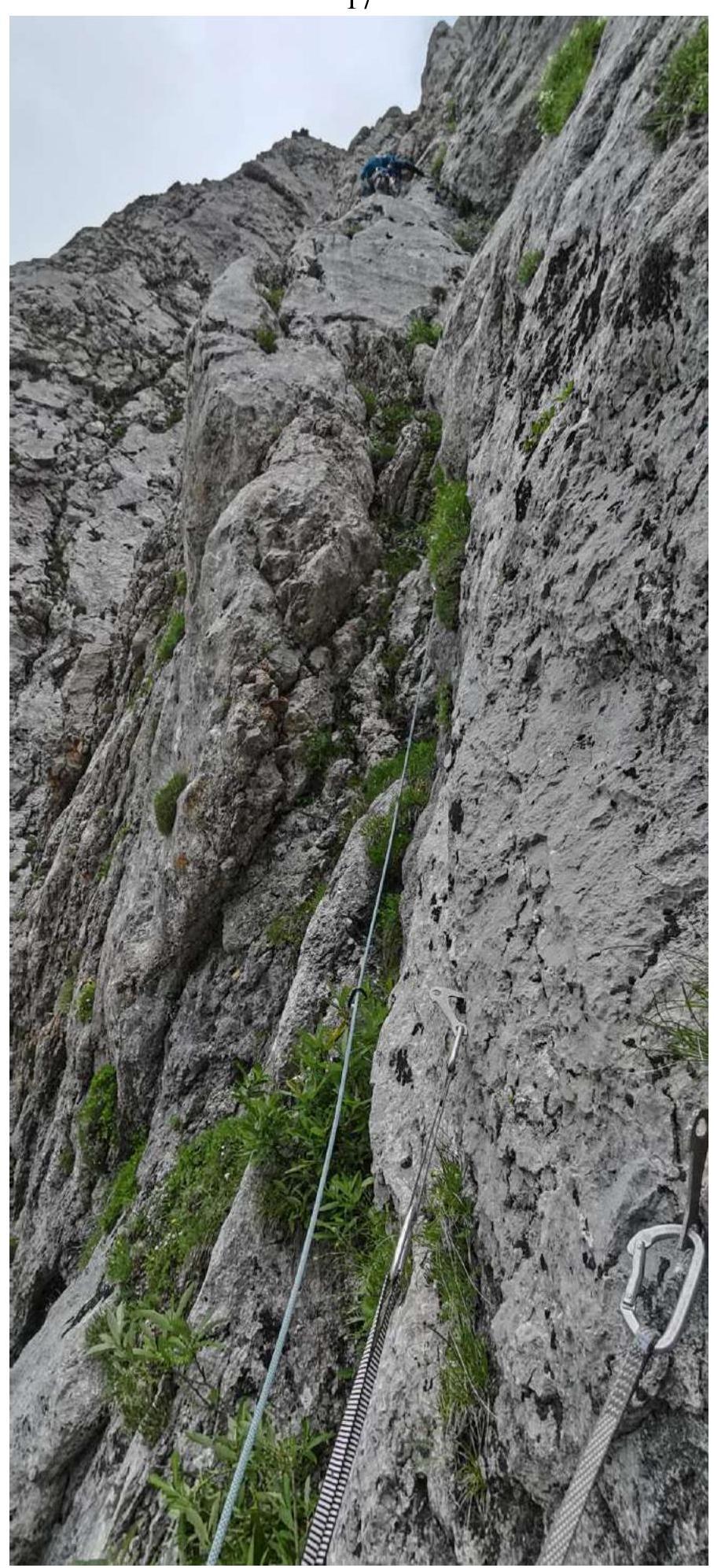
| R11–R12 | Movement along the chimney towards the main ridge. 45 m, 45°, 3 | Photograph № 16 |
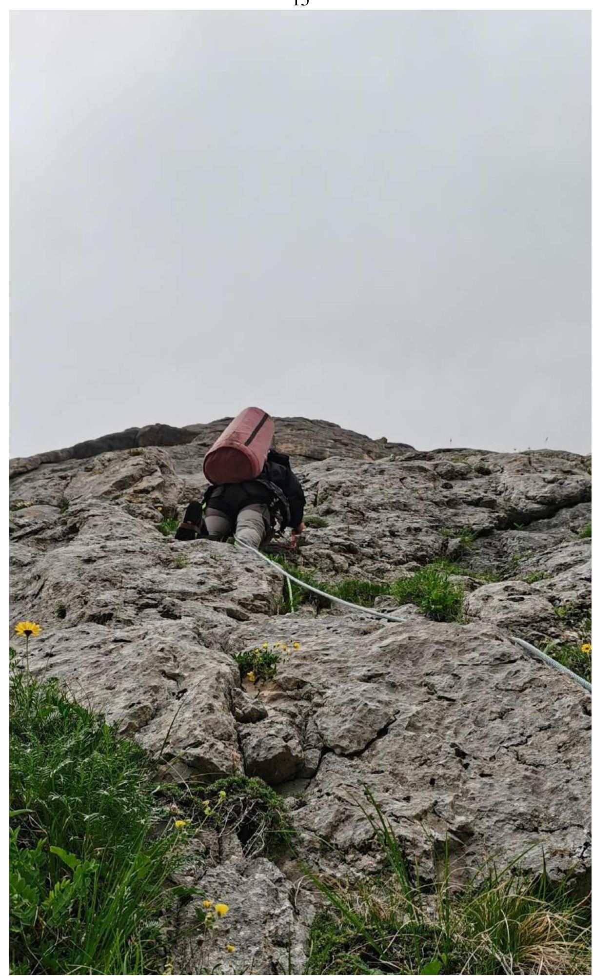
| R12–R13 | Movement along the ridge along the boundary between rocks and the grassy slope to the summit. The summit is located to the right of the direction of movement, aside from the ridge, and rises above the ridge by 5 m. 45 m, 35–45°, 1 | Photograph № 17 |
Descent from the route is done via the Pshekho-Su summit and then along the trail towards the Maykop Pass.
Photograph № 5. Section R0–R1.
Photograph № 6. Section R1–R2.

Photograph № 7. Section R2–R3.
Photograph № 8. Section R3–R4.
Photograph № 9. Section R4–R5.
Photograph № 10. Section R5–R6.
Photograph № 11. Section R6–R7.
Photograph № 12. Section R7–R8.
Photograph № 13. Section R8–R9.
Photograph № 14. Section R9–R10.

Photograph № 15. Section R10–R11.
Photograph № 16. Section R11–R12.
Photograph № 17. Section R12–R13.
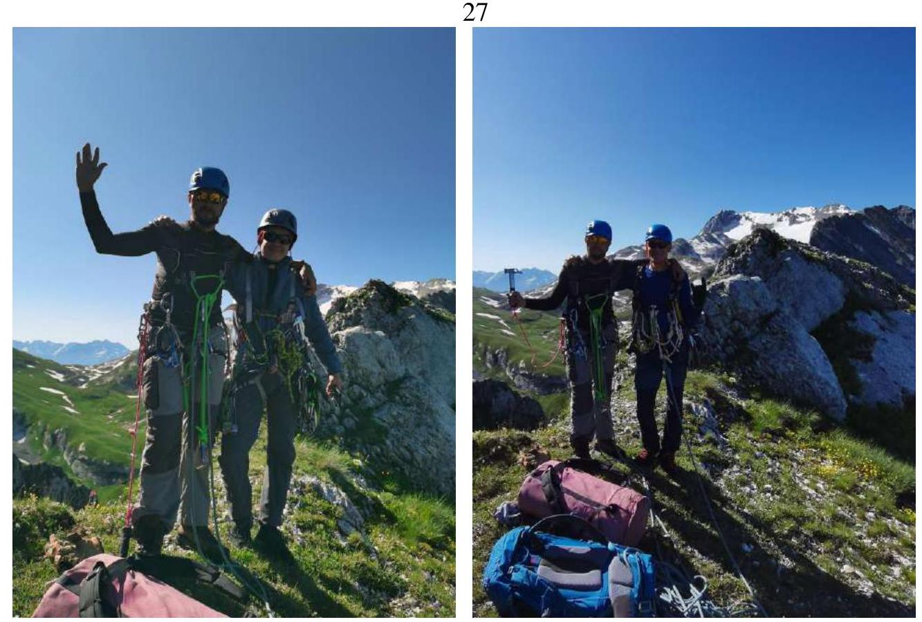
Photograph № 18–19. Group on the summit.
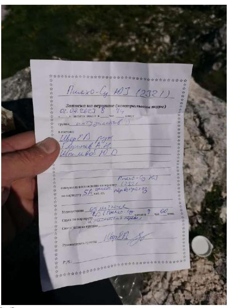
Photograph № 20. Note on the summit. After completing the ascent, a debrief was conducted, and the difficulty of individual sections and the route as a whole was assessed. The route climbed is safe. Considering the experience of previous ascents to summits: Dolomites, Central via the edge of the 3rd wall — 4B Dolomites, North centre of the 3rd wall — 5A Dolomites, Central on the 3rd wall («Book») — 4B 2871 (60 years of KChAO) via the NE ridge — 4B Bela-Kaya via the 3rd ridge — 4B Dombay-Ulgen, West from the Dombay Pass — 5A Kirpich via the NW wall — 5A Tytyu, West via the S wall — 5A
and also taking into account the categories assigned to routes on Fisht North, the route to peak 2321 (Pshekho-Su SW) corresponds to category 4B.
Recommendations for Climbers
Water is absent throughout the entire route. On section R9, a sitting overnight stay is possible. The route was climbed entirely using free climbing. Anchor hooks were predominantly used. The simplest (hiking) descent path from the route goes via the Pshekho-Su summit and then towards the Maykop Pass. The disadvantage of this descent option is that it takes 7–8 hours. In the case of classifying this route, it is planned to organize a descent along the ascent path using bolted hooks down to section R9, and then along the line of falling water to the right of the large cornice to section R3. It is possible to lay out another 2–3 routes to this summit.