ALPINISM FEDERATION OF KRASNODAR TERRITORY
Report
On the ascent to the summit of Kara-Dzhash (3171 m) via the route of the left buttress of the Western wall, approximately 4B cat. diff. (second ascent) by the team of the alpinism club "Shтурm", Krasnodar, on September 2, 2022.
I. Ascent Passport
| 1. General Information | ||
|---|---|---|
| 1.1 | Full name, sports rank of the leader | Kotlyarov Dmitry Viktorovich, 1st sports rank |
| 1.2 | Full name, sports rank of participants | Ivashchenko Mikhail Nikolayevich, CMSR |
| 1.3 | Full name of the coach | Kapustin Andrey Evgenyevich |
| 1.4 | Organization | RPO "Alpinism Federation of Krasnodar Territory", Alpinism club "Shтурм" Krasnodar |
| 2. Characteristics of the ascent object | ||
| 2.1 | Region | Western Caucasus, Krasnodar and Stavropol territories up to Marukh pass, Arkhyz |
| 2.2 | Valley | Sofia |
| 2.3 | Number according to the classification table of 2013 | 2.1 |
| 2.4 | Name and height of the summit | Kara-Dzhash (3171 m) |
| 2.5 | Geographical coordinates of the summit (latitude/longitude), GPS coordinates | 43.4714721 N, 41.2117445 E |
| 3. Characteristics of the route | ||
| 3.1 | Name of The route | Along the left buttress of the W wall |
| 3.2 | Proposed category of difficulty | 4B |
| 3.3 | Degree of route exploration | 2nd ascent (first ascent made in 2011) |
| 3.4 | Character of the route relief | Rock climbing |
| 3.5 | Height difference of the route (altimeter or GPS data) | 530 m |
| 3.6 | Length of the route (in meters) | 750 m |
| 3.7 | Technical elements of the route (total length of sections of various difficulty categories with indication of relief type (ice-snow, rock)) | 1 cat. diff. rock — 133 m, 2 cat. diff. rock — 315 m, 3 cat. diff. rock — 189 m, 4 cat. diff. rock — 73 m, 5 cat. diff. rock — 40 m |
| 3.8 | Average steepness of the route, (°) | 46° |
| 3.9 | Average steepness of the main part of the route, (°) | 53° |
| 3.10 | Descent from the summit | Along the S ridge and SE couloir to the valley of Gammesh-Chat river |
| 3.11 | Additional characteristics of the route | Water and snow are absent in summer and autumn |
| 4. Characteristics of the team's actions | ||
| :---: | :--------------------------------------------------------------------------------------------------------------------------: | :----------------------------------------------------------------------------------------------------------------------------------: |
| 4.1 | Time of movement (team's walking hours, in hours and days) | 16 h Taulu bivouac – summit – Taulu bivouac (incl. 7 h R0 – summit), 1 day |
| 4.2 | Overnight stays | Without overnight stays |
| 4.3 | Time of route processing | - |
| 4.4 | Start of the route | 07:05, September 2, 2022 |
| 4.5 | Reaching the summit | 17:40, September 2, 2022 |
| 4.6 | Return to the base camp | 22:55, September 2, 2022 |
| 5. Characteristics of weather conditions | ||
| 5.1 | Temperature, °C | - |
| 5.2 | Wind speed, m/s | - |
| 5.3 | Precipitation | - |
| 5.4 | Visibility, m | - |
| 6. Responsible for the report | ||
| 6.1 | Full name, e-mail | Kotlyarov Dmitry Viktorovich, dimon-91_91@list.ru |
II. Ascent Description
1. Characteristics of the Ascent Object
1.1. General Photo of the Summit
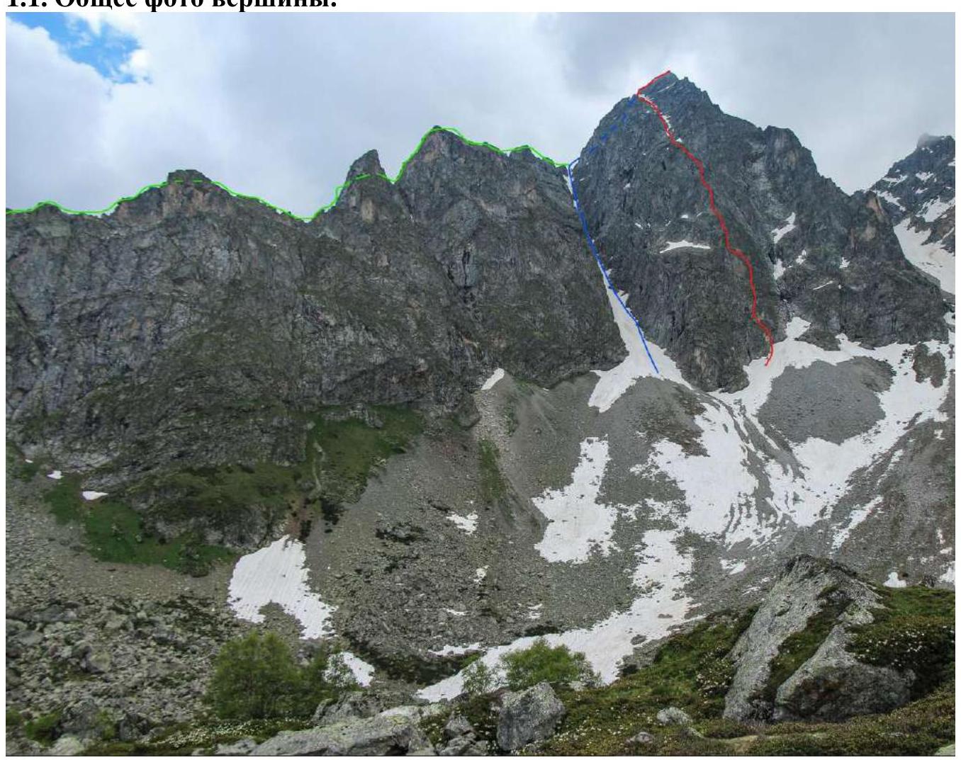
Photo №1 — general photo of Kara-Dzhash summit (3171 m). The photo is taken from the internet as there were no suitable photos for the report.
- route along the NW couloir and S ridge (V.V. Babkin, 2011), 3A cat. diff.
- route along the S ridge (V.V. Babkin, 2013), 4A cat. diff.
- team's route — along the left buttress of the W wall (V.V. Babkin, 2011), approx. 4B cat. diff.
1.2. Photo of the Route Profile
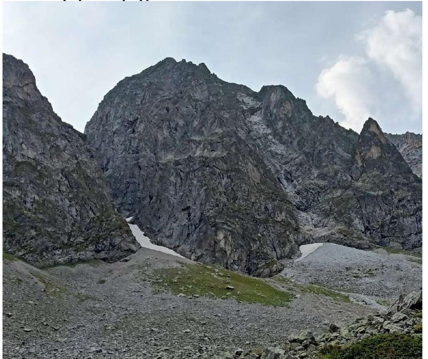
Photo №2 — photo of the route profile. More detailed photo of the route profile of the wall of the northern ridge of Kara-Dzhash summit is not possible.
1.3. Drawn Profile of the Route
The profile was not made as the proposed category of the route is below 5A cat. diff.
1.4. Photopanorama of the Area
The photopanorama is not provided as Kara-Dzhash summit (3171) is included in the Electronic Russian Classifier of Routes to Mountain Summits.
1.5. Map-Scheme of the Ascent Object. Approach Description
Kara-Dzhash summit (3171 m) is a nodal summit of the Kara-Dzhash mountain massif. It is located on the territory of the SKFO RF, in the Karachay-Cherkess Republic, Arkhyz mountain region (Orlenok gully), between the rivers Psysh and Sofia.
The ascent was made from Taulu glade back to Taulu glade, but it can be made from any overnight stays in the lower cirque of Orlenok gully.
Path of movement:
- From Taulu glade, cross the bridge over Sofia river and move along the trail along the stream to Orlenok gully (1.5–2 hours to overnight stays on the glade above the waterfall).
- Further along the trail in the direction of Gnor pass (Kara-Dzhash East), then towards the NW couloir of Kara-Dzhash peak.
- Ascend along the rock scree to the mulde to the right of the NW couloir.
- From overnight stays above the waterfall, another 1–1.5 hours. Here you can organize rope teams.
In May, the approach time may be longer due to the large amount of snow in Orlenok gully.
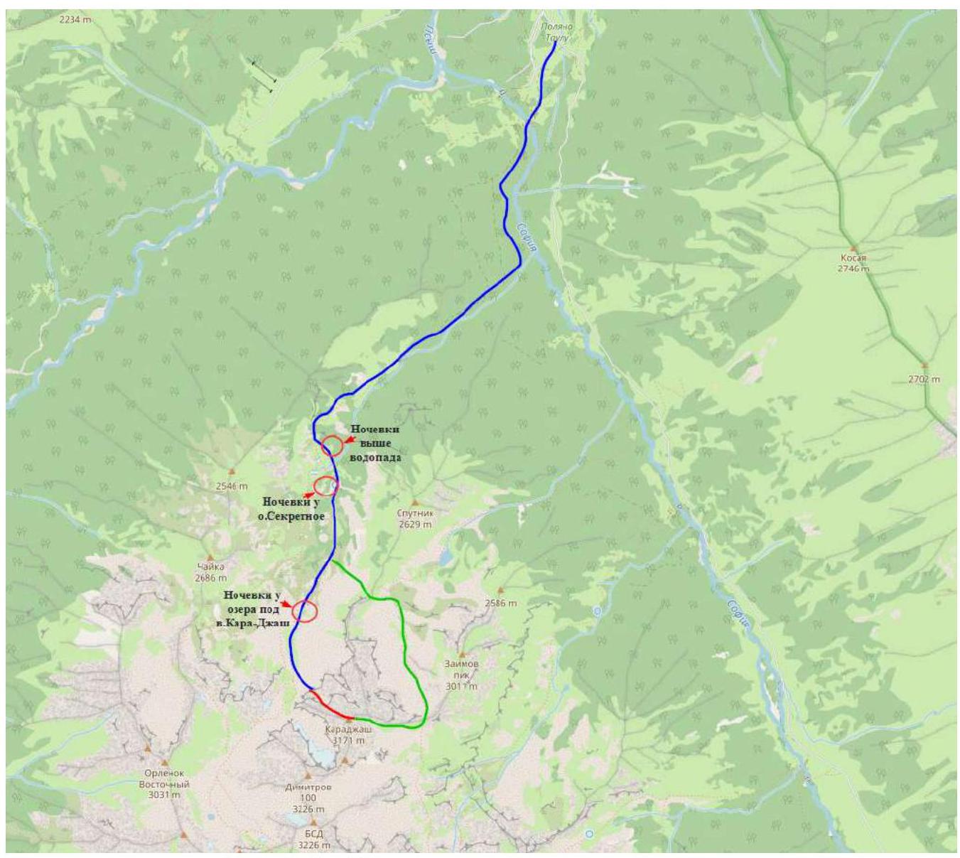
Photo №3 — Map-scheme of the approach to the route.
- approach to the route from Taulu glade — team's route
- descent from the route and return to the glade
2. Characteristics of The Route
2.1. Technical Photograph of The Route
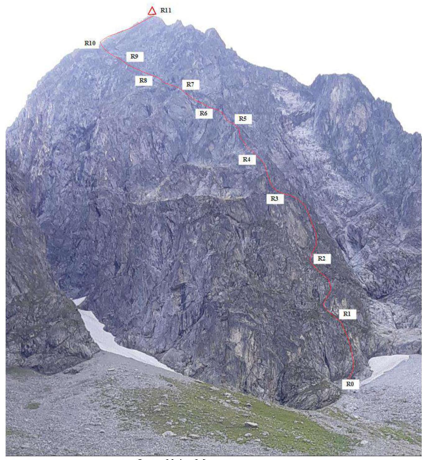
Photo №4 — Team's route
2.3. Scheme of The Route in UIAA Symbols
*number of pitons without counting points for station organization.
| Section № | Insurance points, characteristics in symbols | Route line in UIAA symbols | Difficulty of section in symbols | Length of section, m | Steepness, ° | ||
|---|---|---|---|---|---|---|---|
| R10–R11 | 0 / 0 | 3 / 0 | 0 / 0 | 3 | 70 m | 50° | |
| R9–R10 | 0 / 0 | 0 / 0 | 2 / 0 | 1–2 | 80 m | 30° | |
| R8–R9 | 0 / 0 | 3 / 0 | 4 / 0 | 2–3+ 3+ 1 | 135 m 8 m 7 m | 45° 60° 15° | |
| R7–R8 | 0 / 0 | 0 / 0 | 0 / 0 | 1 | 53 m | 25° | |
| R6–R7 | 0 / 0 | 2 / 0 | 3 / 0 | 4 1 | 50 m 8 m | 65° 20° | |
| R5–R6 | 0 / 0 | 3 / 0 | 2 / 0 | 1–2 2–3 3 | 35 m 15 m 8 m | 60° 50° 60° | |
| R4–R5 | 0 / 0 | 2 / 0 | 3 / 0 | 4–5 5+ 5 2+ | 10 m 10 m 25 m 10 m | 60° 75° 60° 45° | |
| R3–R4 | 0 / 0 | 4 / 0 | 2 / 0 |  | 2–3 3+ 2 | 30 m 10 m 15 m | 55° 70° 40° |
| :--: | :--: | :--: | :--: | :--: | :--: | :--: | :--: |
| R2–R3 | 1 / 0 | 2 / 0 | 2 / 0 |  | 3 4+ 2–3 | 8 m 8 m 42 m | 30° 75° 50° |
| R1–R2 | 0 / 0 | 2 / 0 | 3 / 0 |  | 2+ 3–3+ 1 | 33 m 15 m 10 m | 50° 60° 30° |
| R0–R1 | 0 / 0 | 3 / 0 | 3 / 0 |  | 4–4+ 2–2+ | 10 m 45 m | 80° 40–50° |
3. Characteristics of The Team's Actions
3.1. Brief Description of The Route Passage. Photo Illustrations
| Section № | Description | Photo № |
|---|---|---|
| R0–R1 | You can link up in a convenient rock mulde, then bypass the "ram's foreheads" and approach R0. Move up along simple rocks with grass to the right for about 15 meters, then up until the relief becomes vertical. Slightly to the right in an inner corner overgrown with grass. Along the corner up to a grassy ledge. Convenient station. | №5 |
| R1–R2 | Along a grassy slope along the wall to the left up in the direction of the wall with black streaks. Further up to the right along the wall to bypass the overhang. Along simple rocks and slabs, ascend to a slanting ledge with grass. Convenient station. | №6 |
| R2–R3 | Slightly to the right and up along simple rocks with grass, bypassing the red wall. It's hard to organize insurance. Not reaching the vertical gray wall, traverse to the left to a small outcrop, then up to the left to an inner corner. Along the left wall of the corner up and then along a slab and simple rocks to the left to a recumbent inner corner. Convenient station. | №7, №8 |
| R3–R4 | Along a slab with grass in the direction of a chimney. Up the chimney, then first to the left, then to the right, exit to the station on the left side of the outer corner of the key section of the route. Convenient station. | №9, №10 |
| R4–R5 | Key section of the route. From the station to the right, then along a monolithic wall and outer corner to the left up to an overhang. Few handholds, a lot of lichen, it's hard to organize insurance. Difficult transition under the overhang to the left to an inner corner overgrown with grass. Along the corner up, then along the wall up and to the left to the station. Inconvenient station on a small ledge, maximum for two people. Can be organized 5 m below in a more convenient place, but then there will be bends and not enough rope to the next station under the overhang (can be organized less conveniently on the wall of the ridge of section R5–R6). | №11, №12 |
| :--: | :--: | :--: |
| R5–R6 | Slightly to the left to a small inner corner. Along it to the right up. Then along the wall to exit to a sharp rock ridge, and along its right wall move to the station under the overhang. If necessary, you can organize a convenient recumbent bivouac under the overhang for 2–3 people. Convenient station. | №13–№15 |
| R6–R7 | From the station under the overhang to the right, then along the wall to the left up — exit to an osypy polka with grass. Convenient station. | №16, №17 |
| R7–R8 | Along simple rocks up and to the left to the middle osyp. From station R7 in dry weather, you can start simultaneous movement with organization of intermediate insurance points. | №18 |
| R8–R9 | Cross to the left to a chimney. Up the chimney and to the right, then along simple destroyed rocks up and slightly to the left, choosing the easiest and safest path. General direction towards the saddle in the S ridge. Having passed about 150 m, you can organize a station and bivouac on a good flat ledge. | №19, №20 |
| R9–R10 | From the ledge to the left up along simple destroyed rocks, choosing the easiest and safest path to the saddle in the S ridge. | №21 |
| R10–R11 | Along rocks of medium difficulty of the S ridge, ascend to Kara-Dzhash summit (3171 m). | №22–№26 |
The photographs do not mark the start and end points of the sections and the team's movement lines to avoid cluttering the images. Necessary explanations are given in the captions for the photographs.
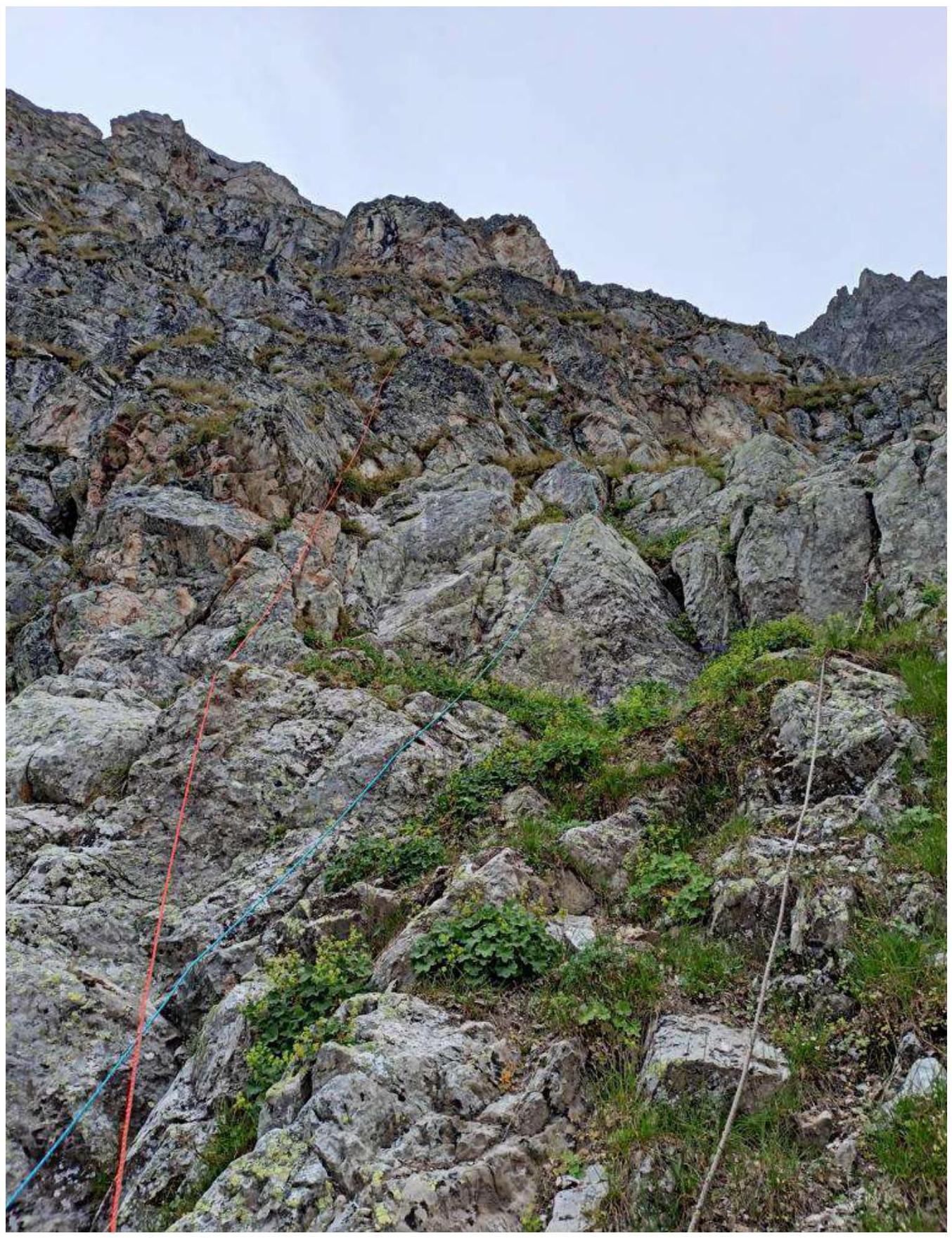
Photo №5 — R0–R1. Simple rocks turning into a vertical wall with a slanting inner corner overgrown with grass.
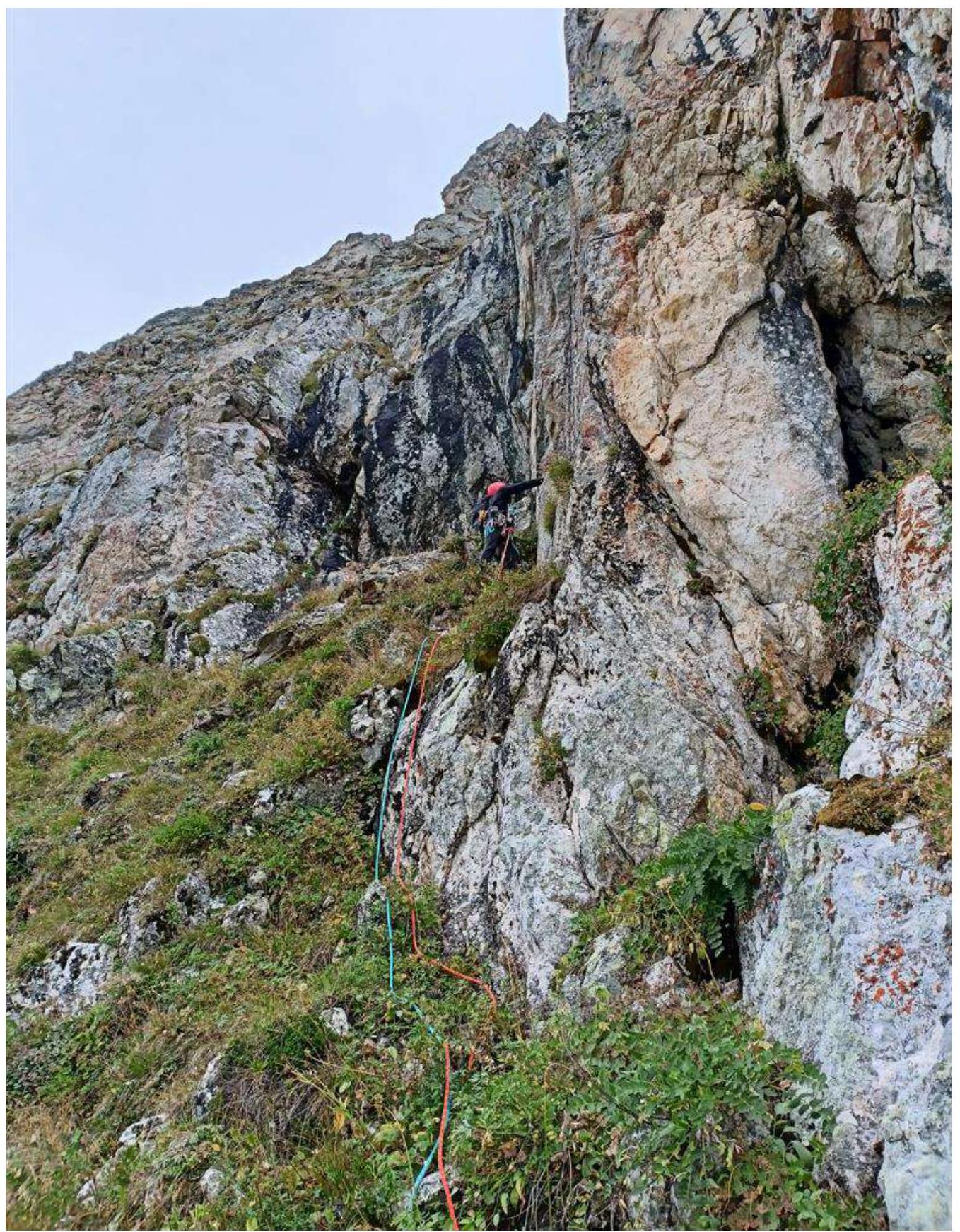
Photo №6 — Start of R1–R2.
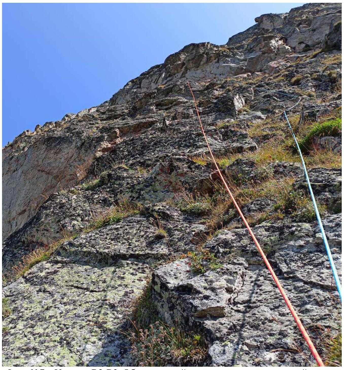
Photo №7 — Section R2–R3. Bypassing the red wall towards the gray wall.
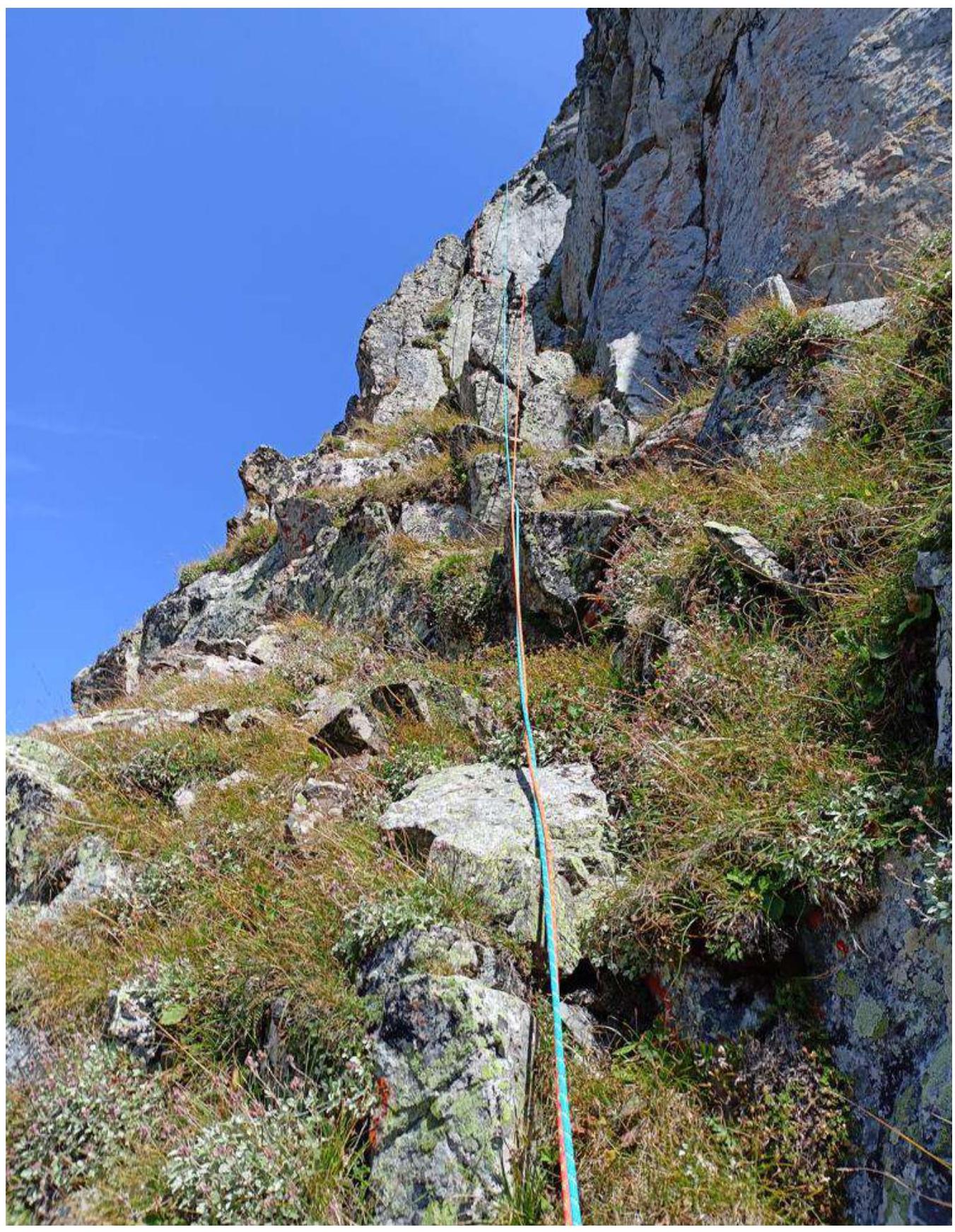
Photo №8 — R2–R3 movement towards the inner corner.
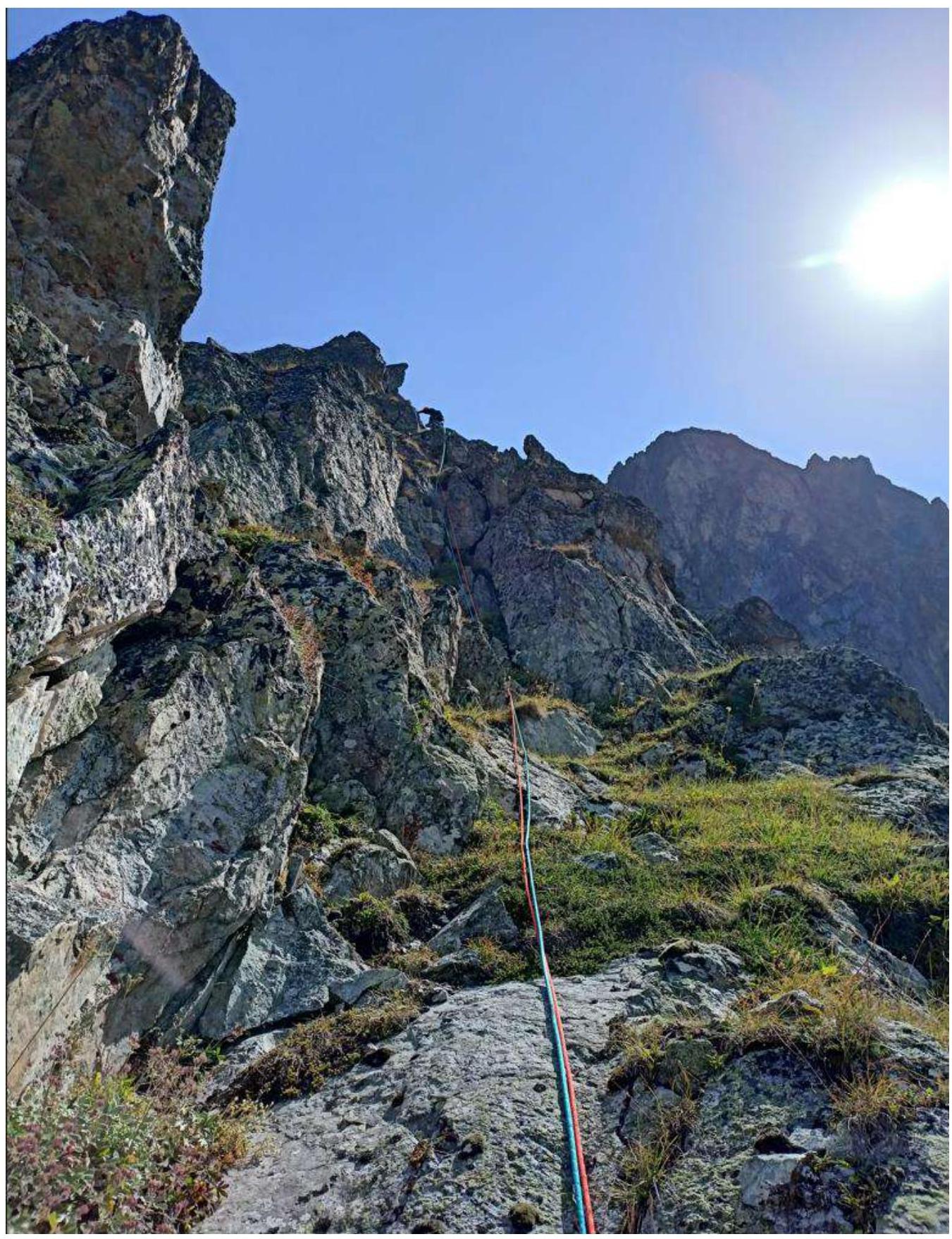
Photo №9 — R3–R4 passing the chimney.
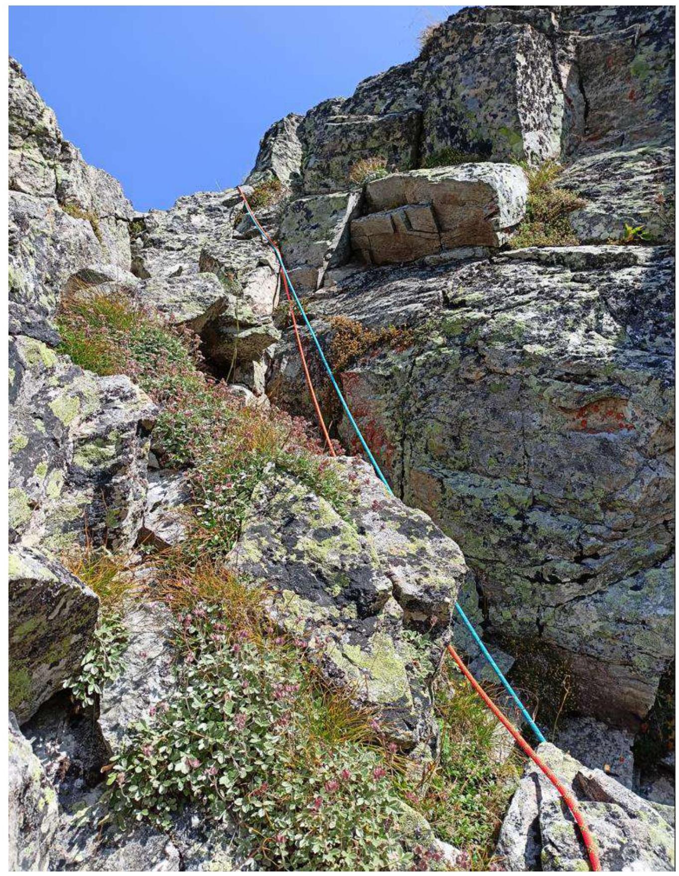
Photo №10 — R3–R4 exit from the chimney towards station R4.
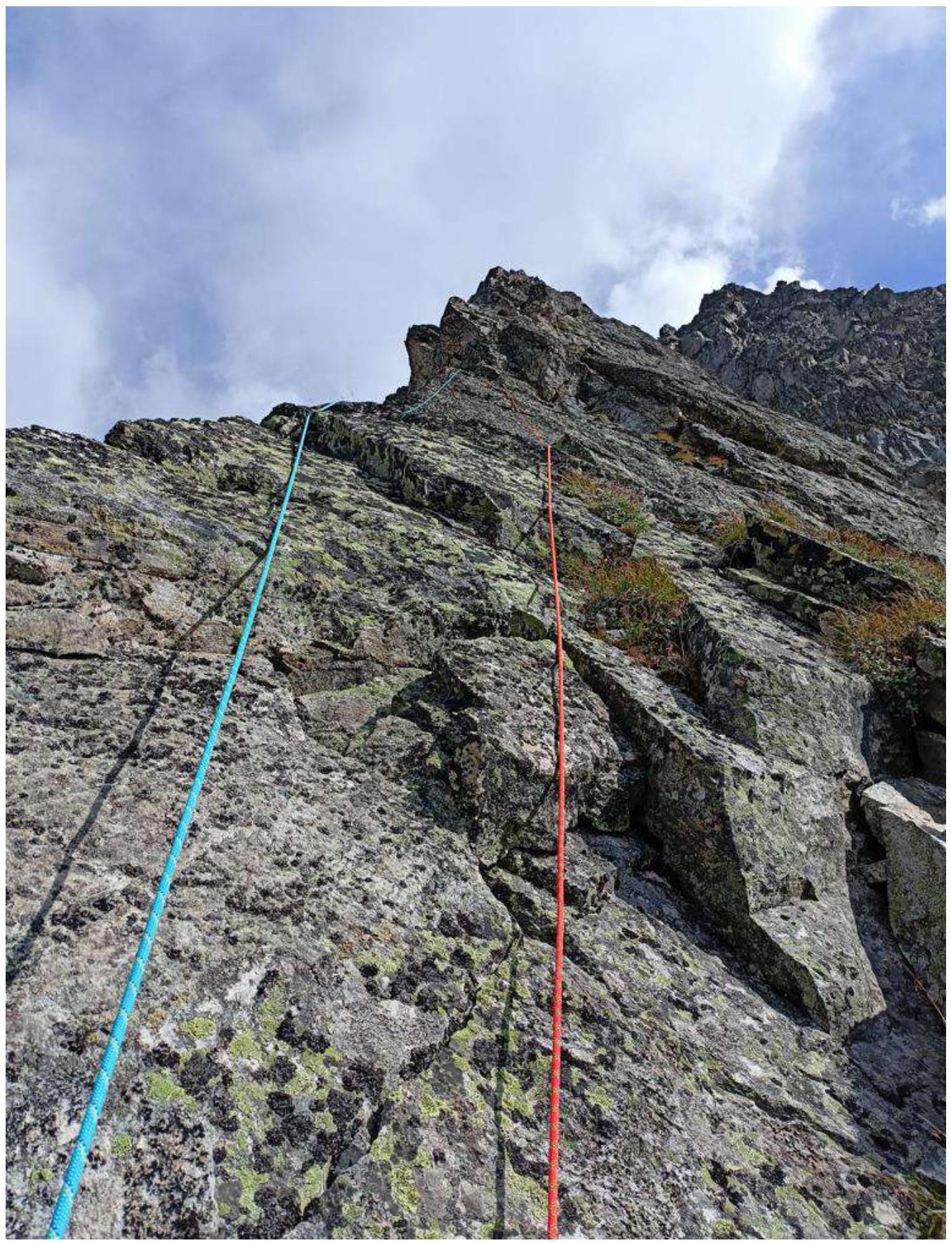
Photo №11 — Start of key section R4–R5.
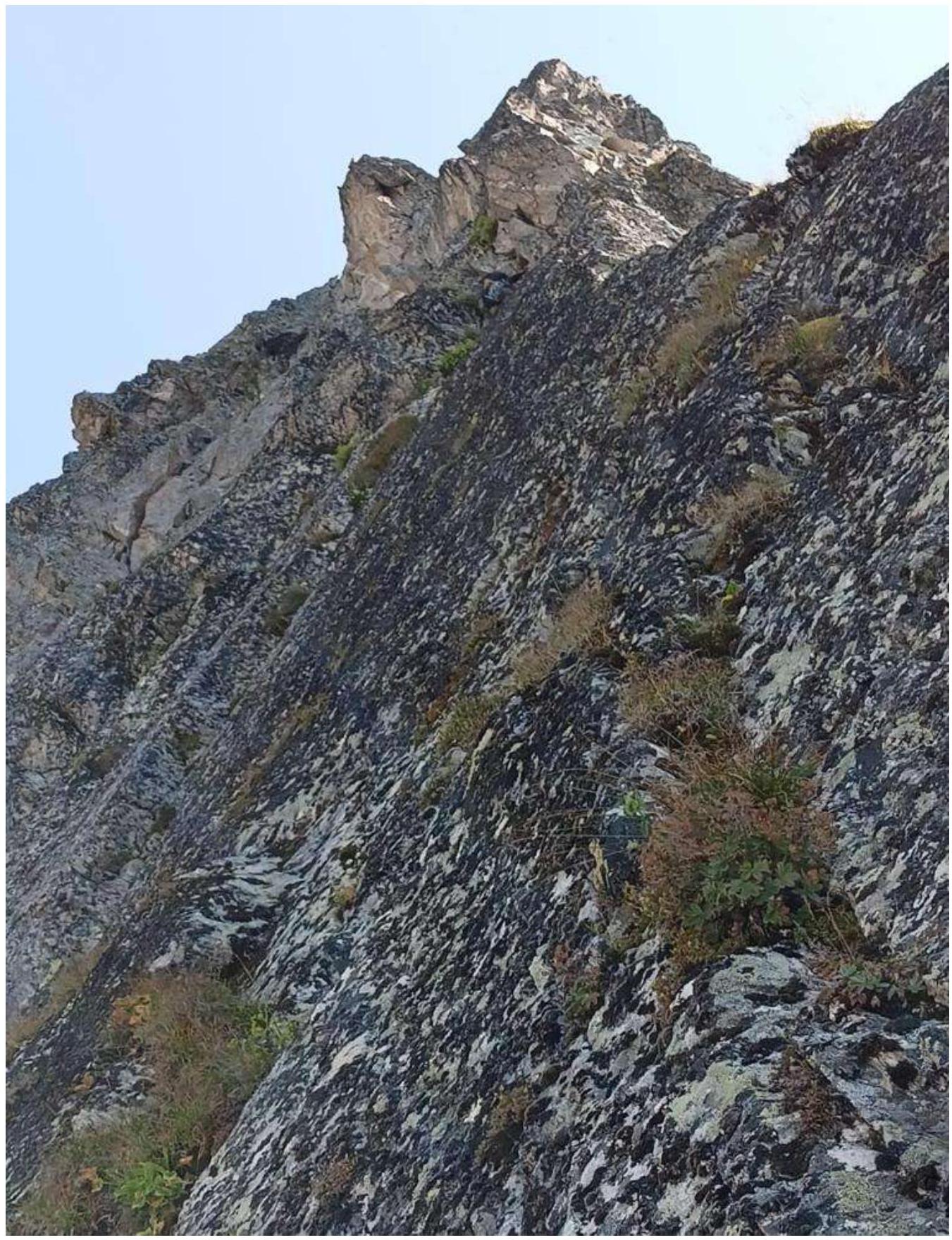
Photo №12 — Difficult transition to the inner corner and further to station R5.
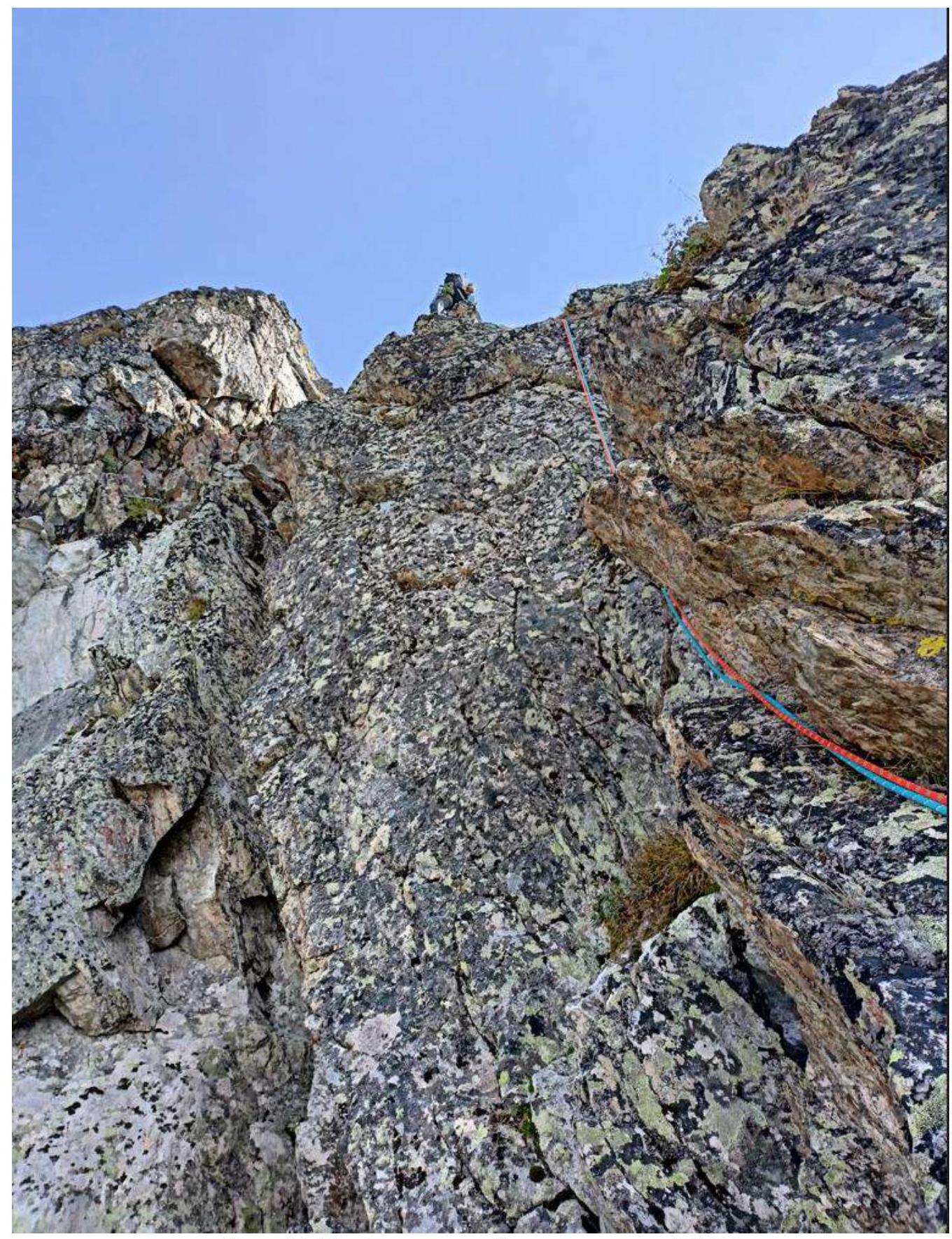
Photo №13 — Inner corner of section R5–R6.
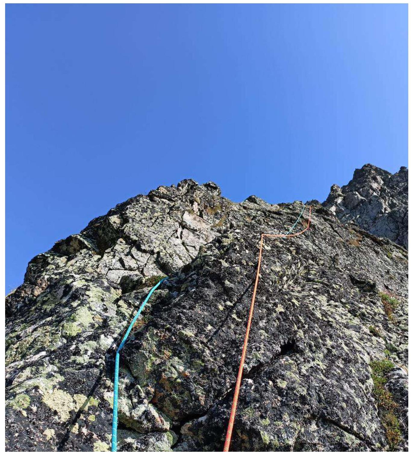
Photo №14 — Section R5–R6.

Photo №15 — Rock wall R6–R7.
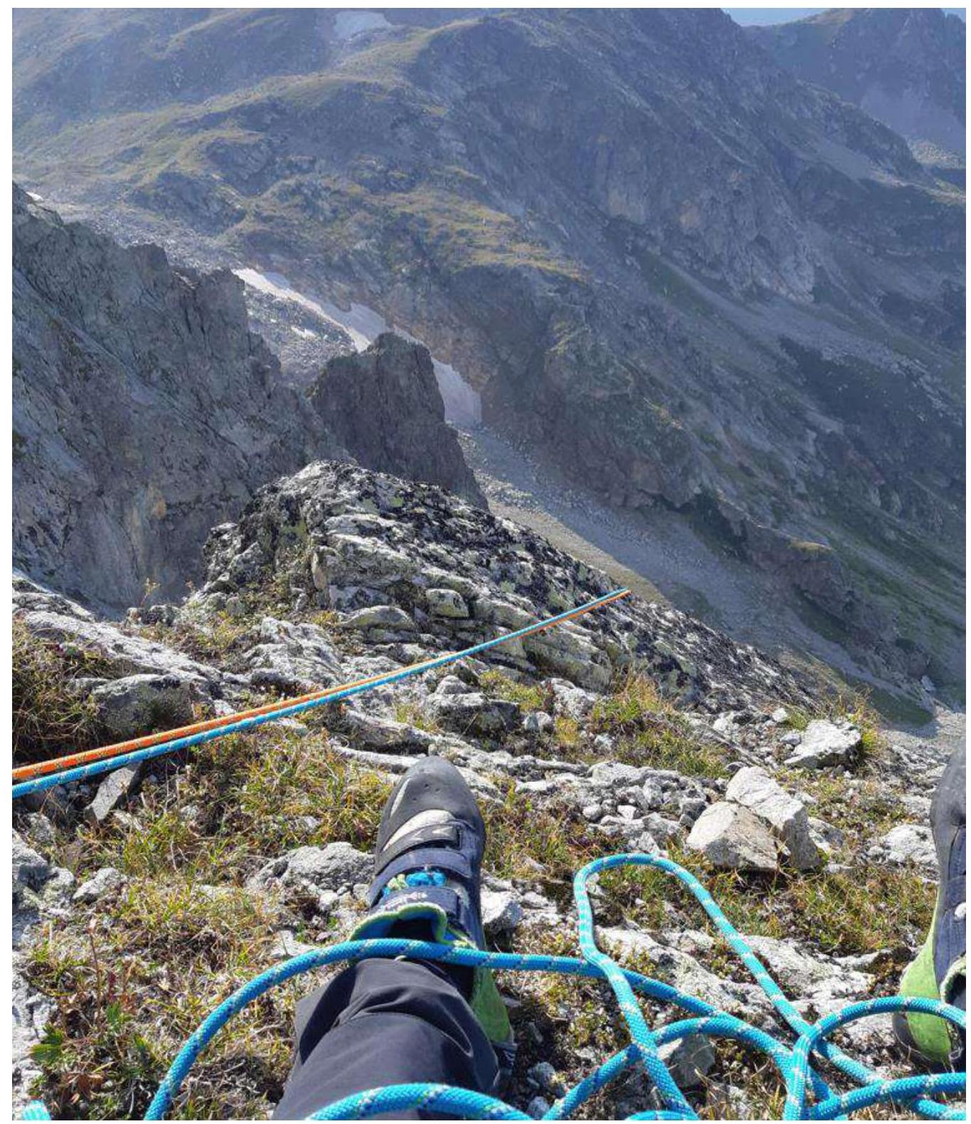
Photo №16 — Exit to station R7. Many "living" stones.
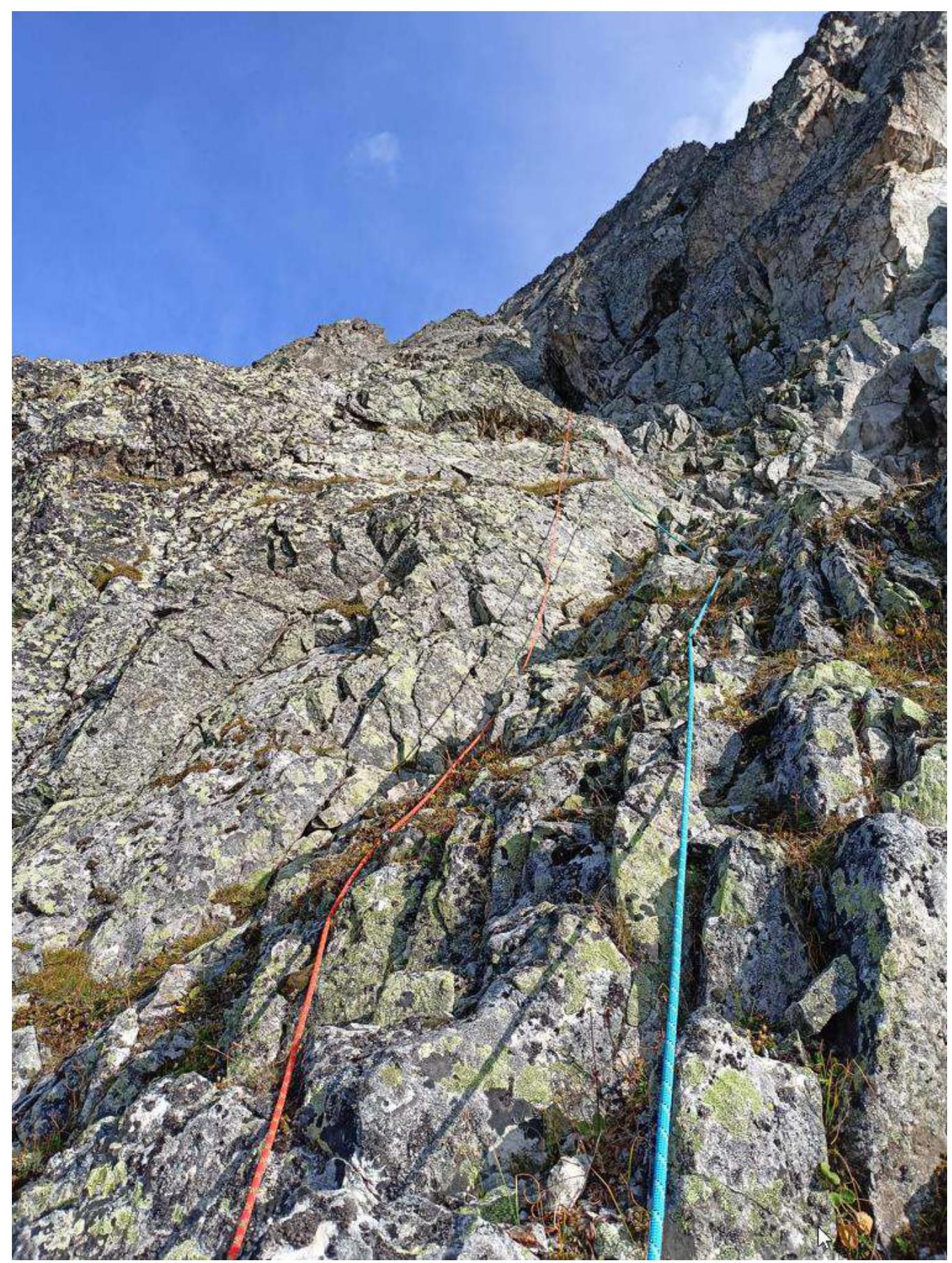
Photo №17 — Section R7–R8.
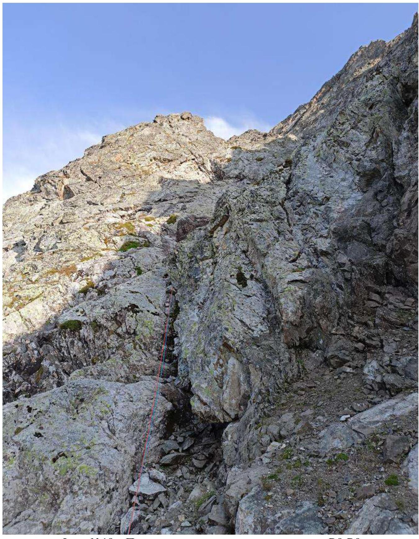
Photo №18 — Passing the chimney at the start of section R8–R9.
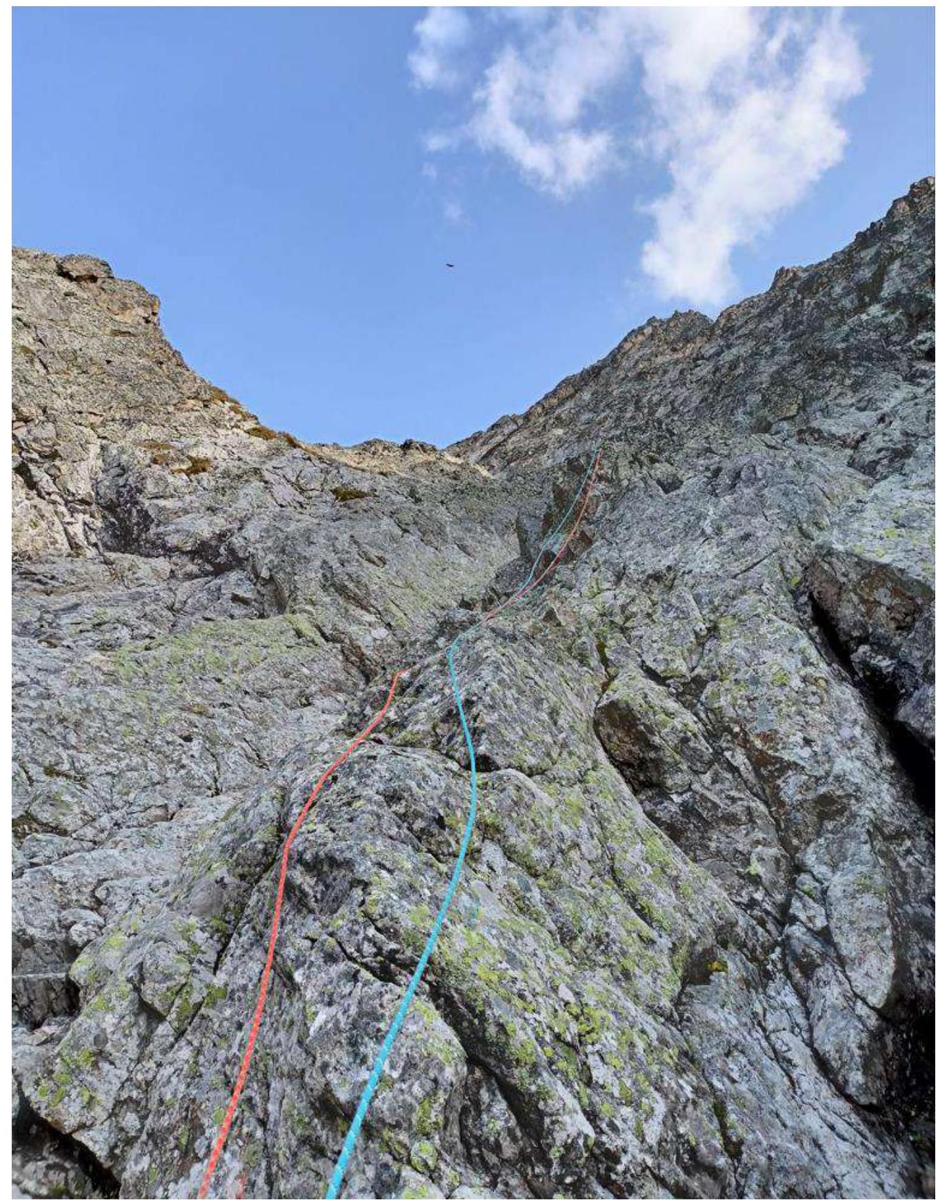
Photo №19 — Section R8–R9.
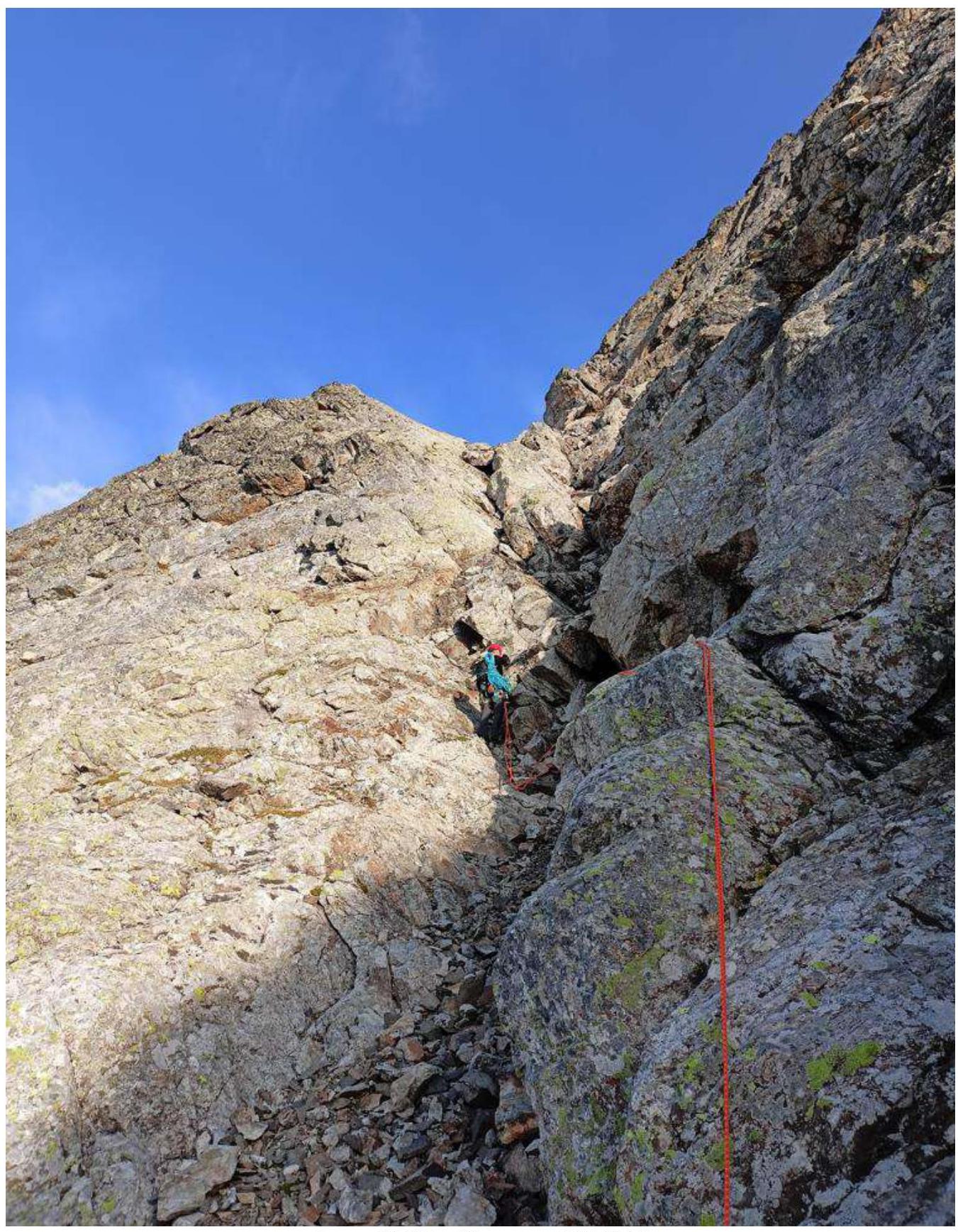
Photo №20 — Section R9–R10.

Photo №21 — Start of section R10–R11, meeting with locals (photo taken on descent from the summit).
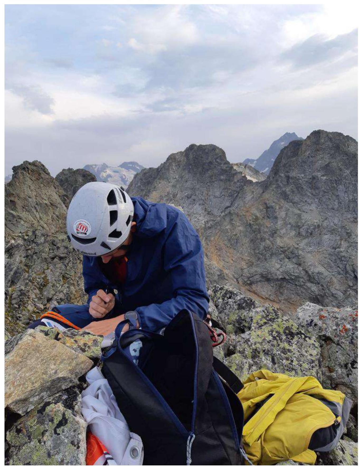
Photo №22 — Control tour R11 on Kara-Dzhash summit (3171 m).
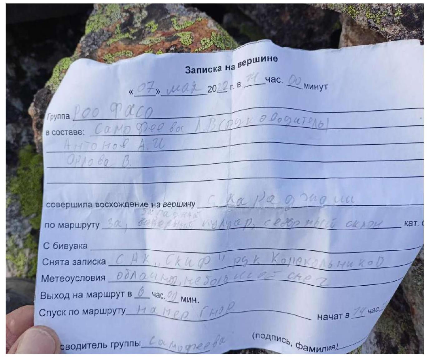
Photo №23 — Found a note from the previous group.
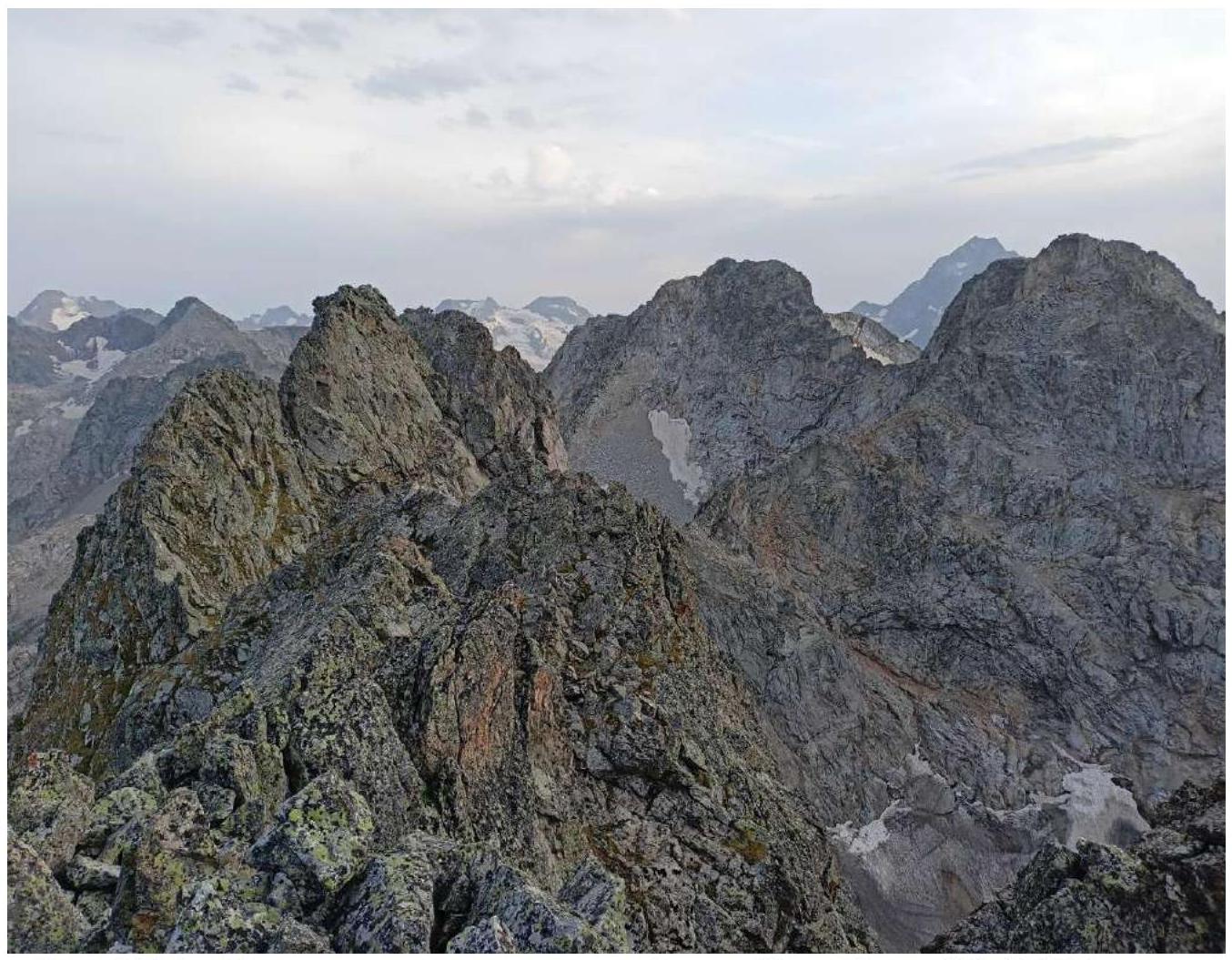
Photo №24 — View from the summit on the "zhendarmer" (also Kara-Dzhash (E) 3207 m), further:
- Kara-Dzhash (S) 3201 m (also 40 years of NRB)
- to the right Kara-Dzhash (Taulan) (also Dimitrov-100)
- through the saddle Kara-Dzhash (BSD) (also nameless 3226 m)
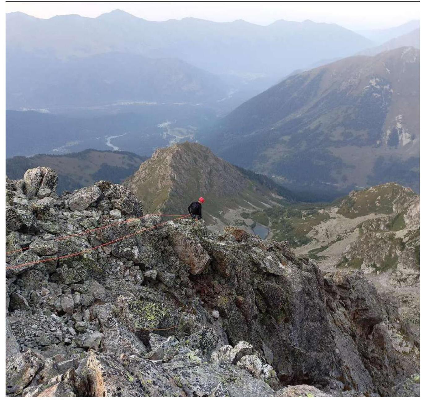
Photo №25 — Start of descent from the summit along the S ridge to the saddle, then along the SE couloir to the valley of Gammesh-Chat river.
3.2. Photo of The Team on The Summit at The Control Tour
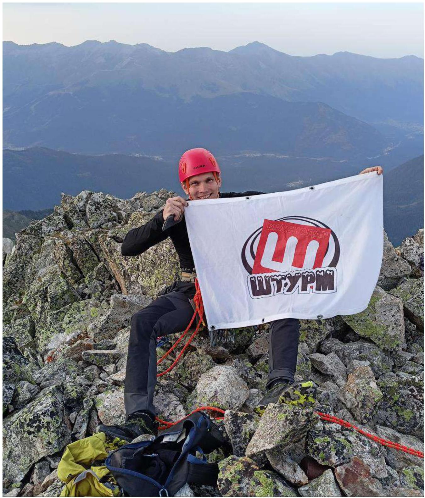
Photo №26 — Team member, Kotlyarov D., at the control tour on the summit.
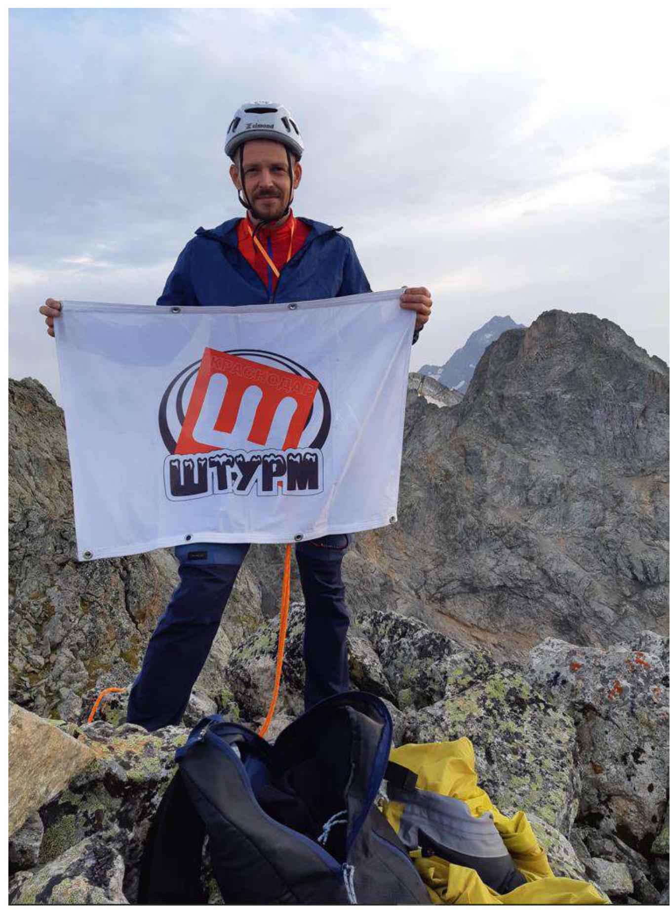
Photo №27 — Team member, Ivashchenko M., at the control tour on the summit.
3.3. Assessment of Route Safety. Communication on The Route. Recommendations for Subsequent Climbers. Information on Descent from The Summit. Conclusion on Preliminary Route Assessment
The main part of the route (key and rope above) is quite safe, stations are to the side or closed by rocks. "Living" stones are present as the route is unclimbed.
On the route, there are many sections with grass, which will significantly complicate or make it unsafe to move:
- in spring and early summer when there is a lot of snow;
- after rains.
The upper part of the route — destroyed rocks, many "living" stones that can be brought down by a rope. In May, the second half of the route will likely have snow. It is not recommended to pass the route in a group of more than 3–4 people.
Visual control over the leader is not possible in many places, so it is recommended to use radios between team members on a significant part of the route. On the summit, there is possible phone connection with operators:
- Megafon
- Beeline
For insurance on the route, anchor pitons (about 10 pcs.) and friends are well suited:
- BD №2,3
- Vertical №3,6
- Totem №0.65, 0.8, 1, 1.25
You can do without cams. Old, not very reliable pitons are occasionally found locally. All stations are on their own points. Before making a station on a flake, you need to double-check its reliability several times.
On the first part of the route, it is recommended to use rock shoes as there are slabs and local difficult underclimbs. The second part of the route can be passed in boots with simultaneous insurance with a rope folded double.
Places for overnight stays: there are many places on the route to organize a sitting or lying bivouac.
- You can place a tent on a large ledge 1 rope below and to the left of the station before the key section of the route
- Also on the saddle of the S ridge between Kara-Dzhash (NE) and Kara-Dzhash (3171)
In summer and autumn, water is absent on the route. In spring, there may be snow.
Descent from the summit is made first along the S ridge to the saddle separating Kara-Dzhash (NE) and Kara-Dzhash (3171). Further along the SE couloir down to the valley of Gammesh-Chat river.
Further, two descent options are possible:
- Along the trail along the stream, descend to the valley of Sofia river, cross the river along a log bridge or ford, then descend along a dirt road to Taulu glade.
- Through Dzhipik pass first to Gnilaya gully, then to Gnor pass (Kara-Dzhash East) to Orlenok gully and along the trail along the stream return to Taulu glade.
To assess the complexity of the route, the team used the experience of previous ascents of a similar category of difficulty to the summits:
- Fizht along the center of the W wall (A. Spesivtsev, 2011) 4A cat. diff.
- Dolomites (C) along the 3rd wall ("book") (A. Fesenko, 1959) 4B cat. diff.
- Kara-Dzhash (C) along the S ridge (V.V. Babkin, 2013), 4A cat. diff.
- Kara-Dzhash (S) along the SSW wall (combination) (V.P. Shamalo, 2013) 4A cat. diff.
- 2871 (60 years of KChAO) along the NE buttress (E.V. Iver, 2013) 4B cat. diff. This route is more complex than 4s in the given area. The key section along a monolithic smooth wall with minimal relief and the number of intermediate insurance points requires good climbing skills. The route is logical.
After analyzing these routes, taking into account the proposal of the first ascenders and the peculiarities of the area, the team came to the conclusion that the route passed is not inferior to the routes of 4B cat. diff. and surpasses the routes of 4A cat. diff.
4. Characteristics of Weather Conditions
4.1. Weather conditions during the ascent — excellent. Confirmation of data is not required.