ASCENT PASSPORT
I. ASCENT CLASS — technical
-
ASCENT AREA, RANGE — Caucasus, Krasnodar Krai up to Marukh pass, Main Caucasian Range.
-
PEAK, ITS HEIGHT, ASCENT ROUTE — Kardyvach (Main), 3105 m, via the southern counterfort.
-
PROPOSED DIFFICULTY CATEGORY — 3A
-
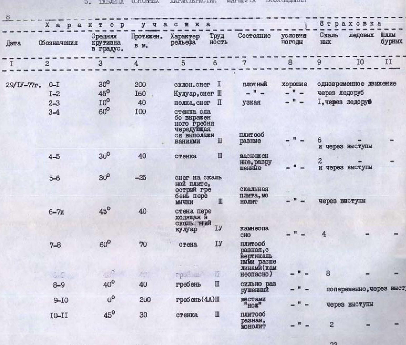
ROUTE CHARACTERISTICS:
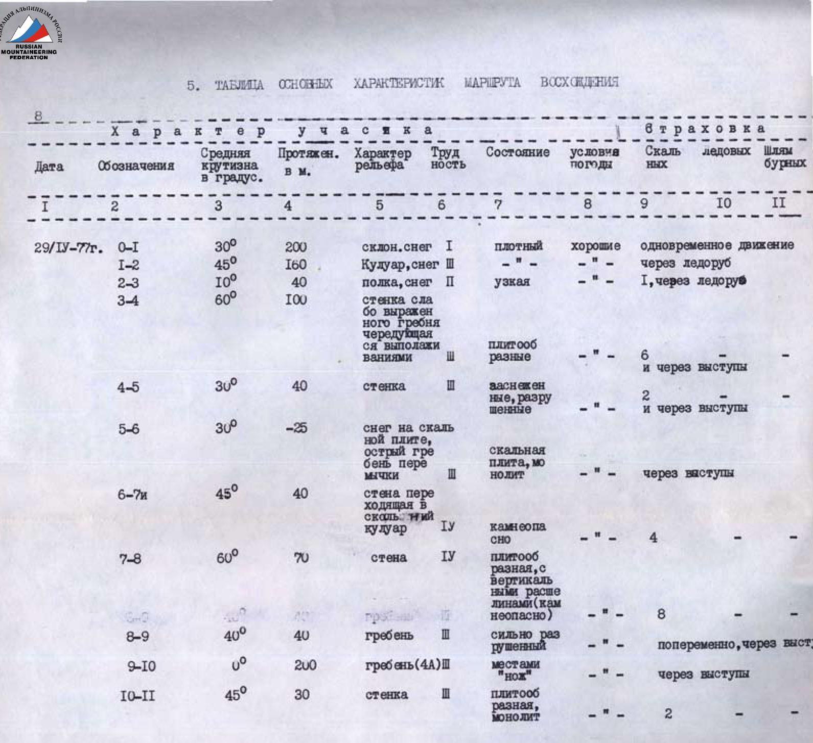
length of sections R1–200 m; R2–40 m; R3–595 m; R4–110 m. elevation gain — 385 m. average slope — 42°
- NUMBER OF PITS ON: for protection and belay, for artificial climbing holds.
rock — 23, ice — 0, bolt — 0
-
TOTAL CLIMBING TIME — 7 h 15 min
-
NUMBER OF NIGHTS AND THEIR CHARACTERISTICS — none.
-
LAST NAME, FIRST NAME, PATRONYMIC NAME OF LEADER, PARTICIPANTS, AND THEIR QUALIFICATION:
leader: Gorbachevsky Alexander Dmitrievich (no sports rank); participants: Pogosyan Fedor Lvovich, Candidate Master of Sports; Khak Bangur Chimetovich, Candidate Master of Sports; Yakovlev Sergey Efimovich, Candidate Master of Sports; Krivov Vasily Nikolaevich, 1st sports rank; Shchutov Sergey Trofimovich, 1st sports rank.
-
TEAM COACH — Kisel Sergey Yakovlevich, Master of Sports.
-
DATE OF DEPARTURE ON THE ROUTE AND RETURN — April 29, 1977.
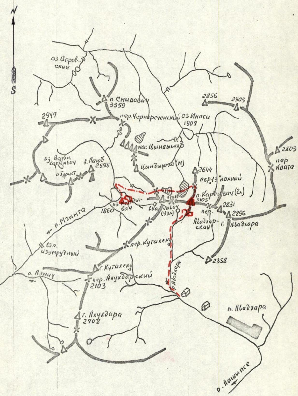
3. ASCENT AREA MAP
4. Brief description of the approach to the route
4.1 Approach option from Avadhara settlement
From the trading kiosk 1 km from Avadhara settlement upstream along the right (orogr.) bank of the Avadhara river, left of the "ram's foreheads" into a large wide cirque between Kardyvach (node) peak and Kardyvach (Main) peak — 3.5 h.
From the cirque, up the snowy slope, sticking to its middle, up to the level of the "13-ti" pass and traverse right to the "southern bivouac" — 1 h.
4.2 Approach option from the base camp at Kardyvach lake
- Via Kutatekho pass into the cirque between Kardyvach (node) peak and Kardyvach (Main) peak — 3–4 h;
- Further to the "Southern bivouac" (see above).
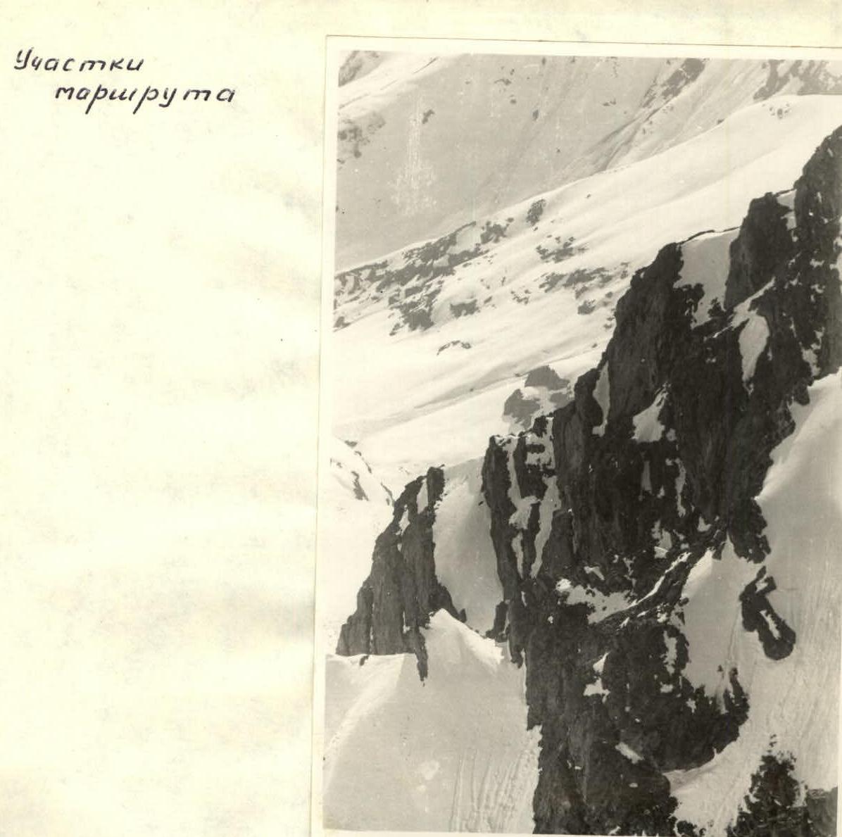
Route sections
 (sections 3–4)
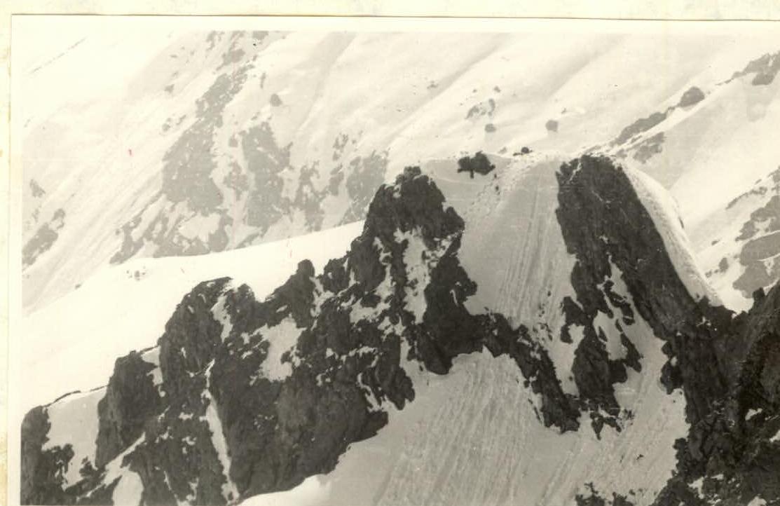
 (sections 4–5–6)
5. Table of main characteristics of the ascent route