Krasnodar Krai Alpinism Federation
Report
on the ascent to Fisht North-West (2581 m) via the western wall (V. Shipilov, 2009), second ascent, approximately 4B cat. diff., made by the "Shturm" alpinism section team
Krasnodar, 2017
Ascent Passport
- Western Caucasus, Krasnodar Krai, 2.1
- Fisht peak (NW) (2581 m). Route via the western wall (V. Shipilov, 2009)
- Proposed — 4B cat. diff., second ascent
- Route type: rock
- Route height difference — 500 m
Route length — approx. 800 m
Wall section length — 220 m
Section lengths:
- IV — 90 m
- V — 80 m
- VI (A1) — 6 m Average steepness of the wall section — 70° Total route — 40°
- Pitons left on the route: 0.
- Team's climbing hours (to the summit): 8.5 h, 1 day
- Descent from the summit: via the ascent route.
- Leader: Ivaschenko Mikhail Nikolayevich, CMS Participants: Barabash Anatoly Sergeyevich, 2nd sports category Spesivtsev Artem Alekseyevich, CMS
- Coach: Shaulsky Dmitry Sergeyevich, CMS
- Approach to the route: 7:30, September 16, 2017 Summit reached: 16:00, September 16, 2017 Return to base camp: September 16, 2017
- Organization: "Krasnodar Krai Alpinism Federation" NGO, "Shturm" Alpinist Club, Krasnodar
- Report responsible: Ivaschenko M.N. indeeccc@gmail.com
Report Notes
This report is largely based on the first ascenders' report. However, some significant adjustments were made:
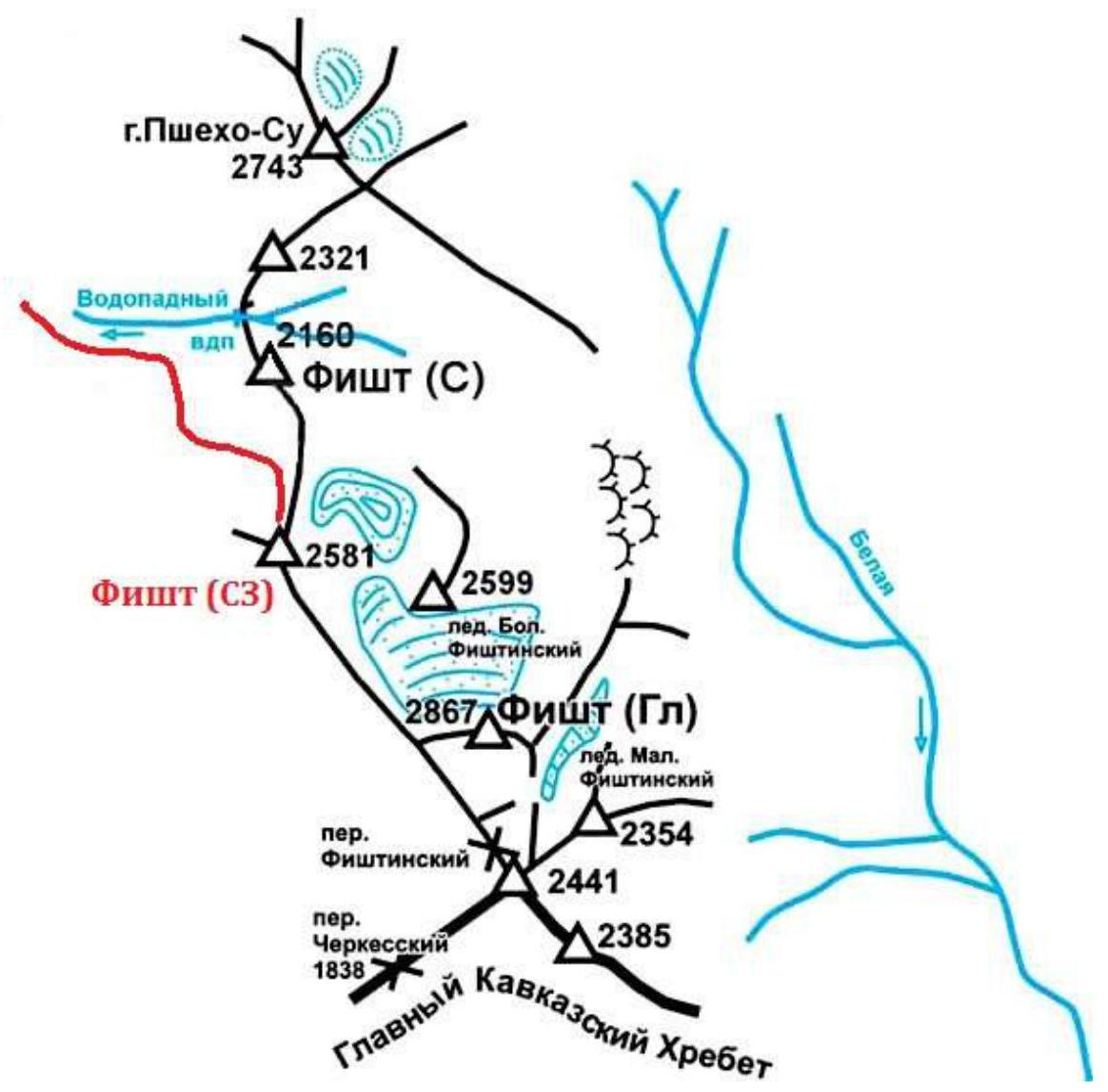
— The name of the peak has been clarified. The elevation chosen by the route authors as the peak and named Fisht 2nd NW is, in our opinion, incorrect, as there is only one elevation on this section of the ridge that can be fully considered a peak, making the "2nd NW" designation inaccurate. The actual peak is located slightly southwest and meets all peak criteria: marked on maps as peak 2581 m; has a height difference with neighboring cols of over 100 m; is a nodal point on the ridge (has clear ridge branches diverging from the main ridge near the peak). Peak coordinates: 43°57′52.51″N, 39°53′03.80″E.
— The route name has been adjusted. The route name given by the authors, as well as that of A. Antoshin's route, is, in our view, somewhat ambiguous and contributes to confusion. The western side of the peak has a distinct relief consisting of (from right to left): — the western ridge branching off from the peak; — a couloir left of the western ridge; — the western wall, bounded by the couloir and a bastion. Thus, the western wall can be considered a standalone, clearly defined relief feature. Both routes (V. Shipilov's and A. Antoshin's) follow this wall, through its central and right parts, respectively. Therefore, we propose naming this route "via the western wall."
— Data on section lengths has been clarified. In the UIAA scheme, section lengths and the difficulty of the key section were refined.
— The route description has been clarified. The route description has been slightly refined and expanded.
General photo of the peak
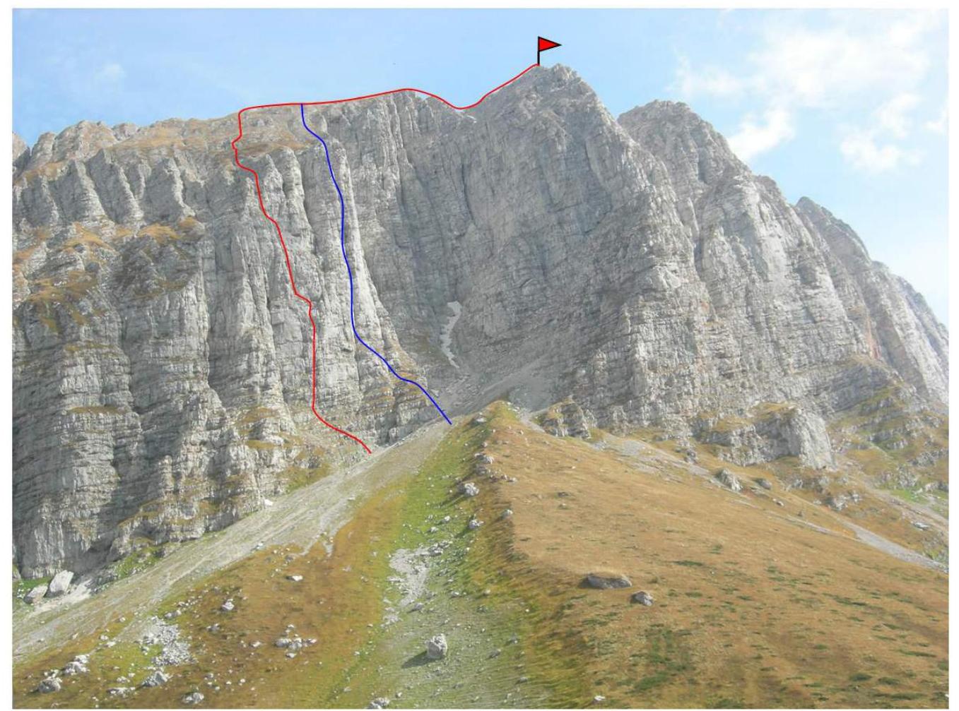 Fisht peak (NW) (2581 m) from the west
— via the western wall (V. Shipilov, 2009), approx. 4B cat. diff. (unclassified)
— via the right part of the western wall (A. Antoshin, 2009), approx. 4B cat. diff. (unclassified)
Fisht peak (NW) (2581 m) from the west
— via the western wall (V. Shipilov, 2009), approx. 4B cat. diff. (unclassified)
— via the right part of the western wall (A. Antoshin, 2009), approx. 4B cat. diff. (unclassified)
- Route names are given according to our team's proposal.
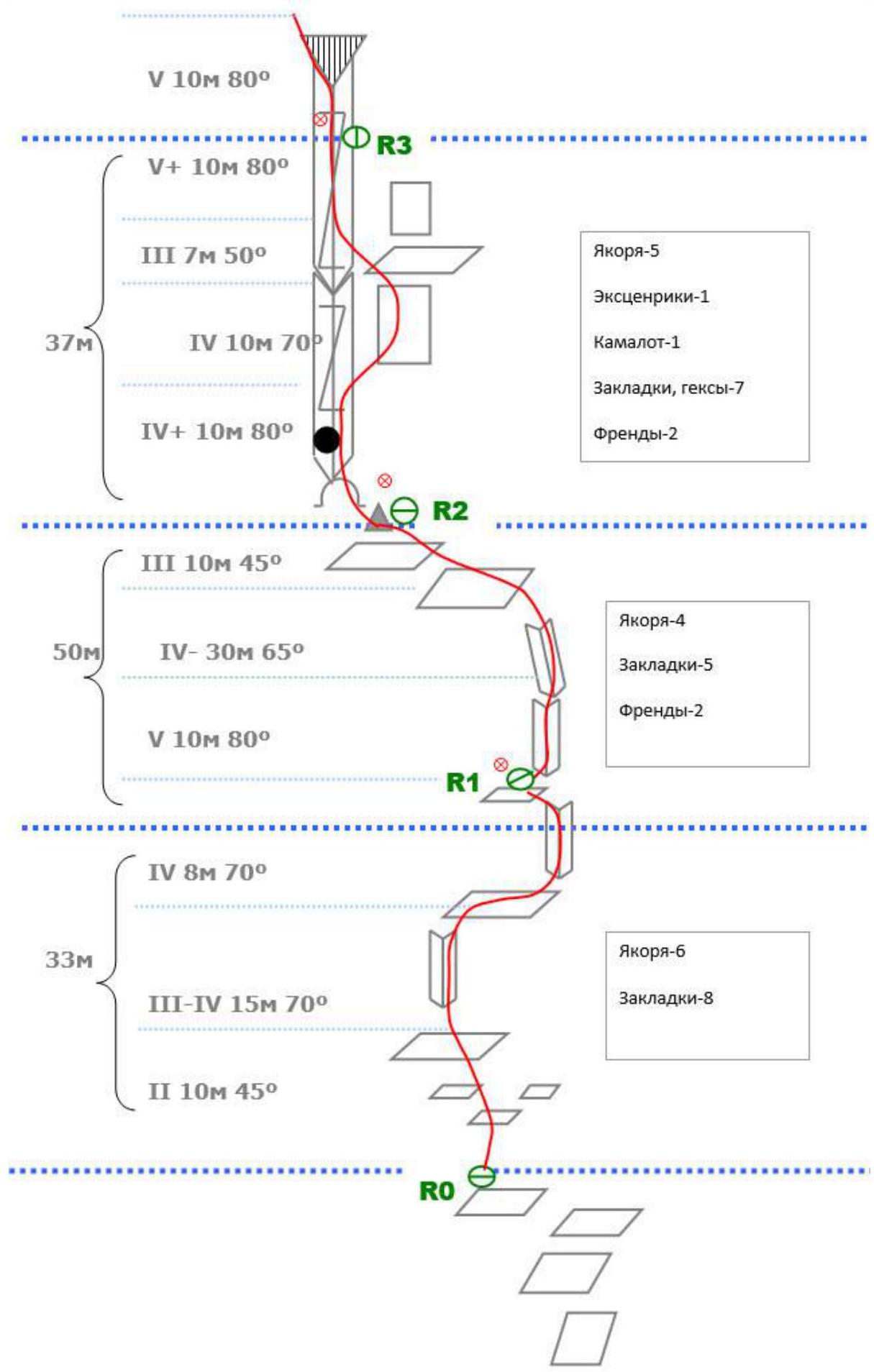
Hand-drawn profile of the wall section of the route
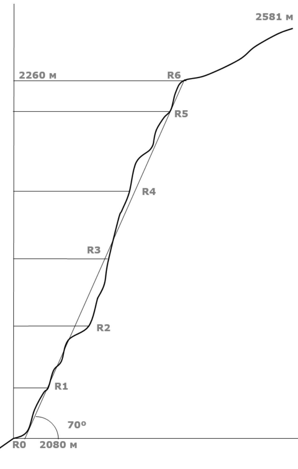 A photo of the wall profile was not taken due to its location between the NW bastion and W ridge, making it quite challenging.
Photo panorama of the massif
 Figure 3 — Photo of the Fisht massif from the west
Map of the ascent area
Route scheme in UIAA symbols
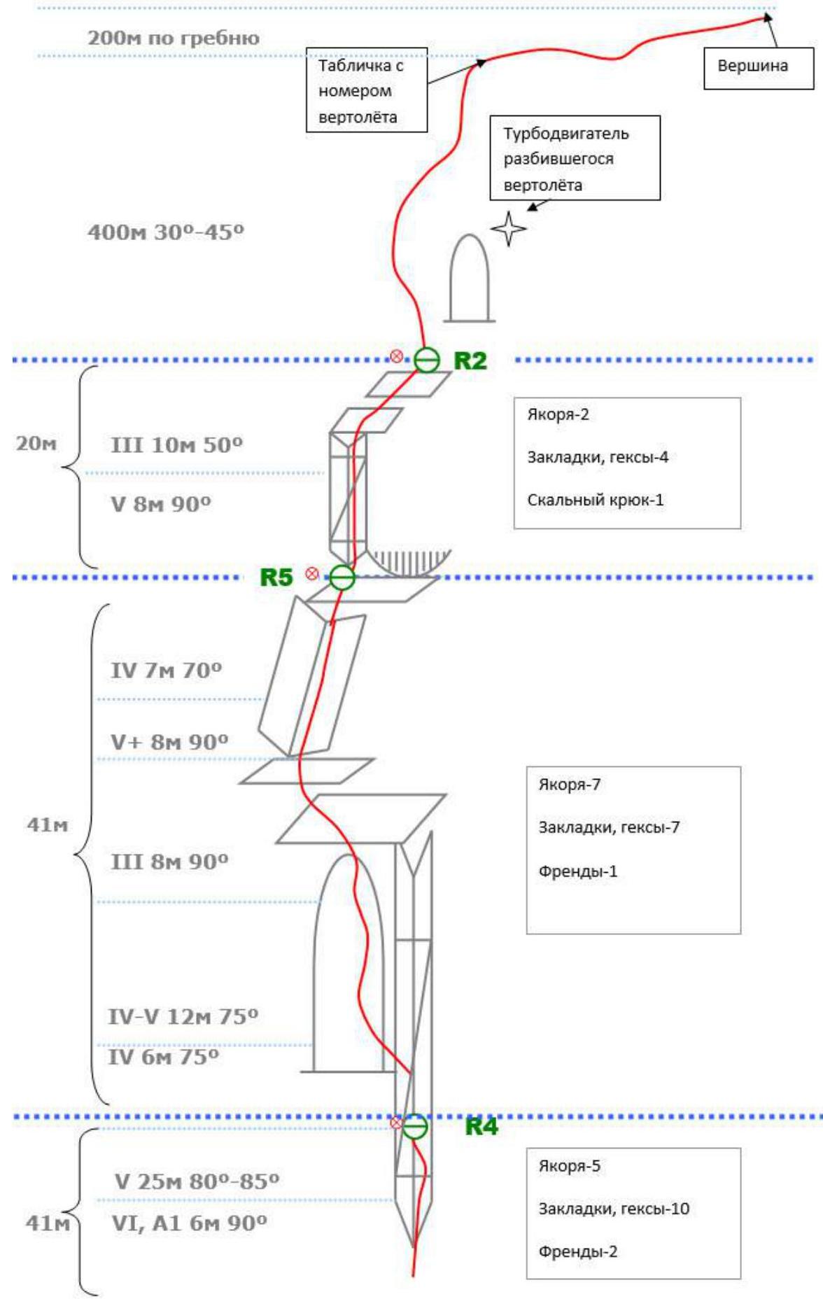
Technical photo of the route
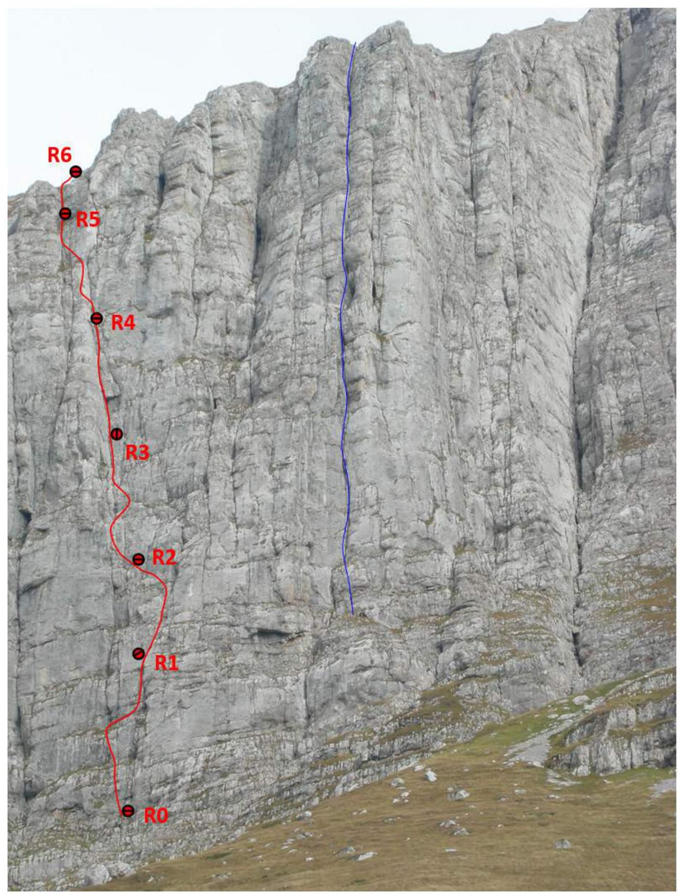 Figure 4 — Technical photo of the route via the western wall
Route description
The approach to the route start from Vodopadnaya Polyana takes about 1.5 hours. From the clearing, move along the trail southward (toward the Cherkessky Pass), then turn onto a grassy slope and approach the start of the wall section via inclined grassy ledges and rock outcrops. The route starts right of a large internal corner-chimney (right of the bastion). Ascend through broken rocks of medium difficulty to a series of internal corners. Follow them, bypassing overhangs on the left, to a steeply inclined ledge. Move up the ledge to the left to the start of a large cleft on the left. The cleft, sometimes widening to 1 m and sometimes narrowing, goes up to the "roof" (the route exits it in the upper part). After passing a jammed section, continue through the cleft. Bypass a destroyed, grass-covered overhang on the right via slabs, then return to the cleft. The next anchor is a bolt on the left on a slab (on the left wall of the cleft), 10 m from a triangular cornice (R3). The cornice is traversed on the left via a crack. The crack becomes more destroyed and steeper further on. The next bolt is also on the left on a slab (R4). Continue a few more meters through the cleft, then exit left onto a bastion. Ascend via minute holds, on friction, to the top of the bastion, then to a ledge. Then, into a cleft — an internal corner on the left above. 8 m of strenuous climbing through the cleft. Then, follow a recumbent, destroyed corner to an indistinct grotto with an upward-extending crack. 7 m of difficult climbing or artificial aids via the crack. Exit onto the "roof." A bolt is placed on slabs to the right. Then — ascend via a grassy gully, transitioning to the left counterfort. Move slightly right, then ascend steep grassy slopes. Crampons may be very useful in case of rain or icing. Ascend directly up to the ridge, passing right of concrete structures. Then, follow the ridge to the right. 200 m from a helicopter tail number sign, reach a small peak with a cairn. Attention! Key turns and junctions during the ascent to the ridge should be marked with cairns (especially when turning right). Descending in the dark may make it difficult to find the exit point. Descent is via the ascent route, with five and a half ropes down the wall (each station has a bolt).
Notes:
- Station R3 is inconvenient (semi-pendant) and is in a potentially rockfall-prone area. If possible, it's advisable to set up a station higher, on a ledge below the cornice.
- Anchor pitons are very useful on the route; it's recommended to have at least 10.
- The route passes through the site of a Ka-32S helicopter crash that occurred on September 4, 2003, near the "roof." Debris from the helicopter and cargo is scattered over a large area in this location.
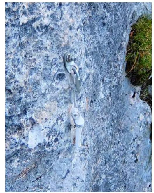
Note from the summit
The note at the control cairn on section R2 was not found. A syringe was used as a container for the note, tied to a bolt with a cord; however, the syringe body was missing, only the plunger remained, and the note had fallen out:
 The first ascenders' note was retrieved from the summit. Photo of the note at the summit:
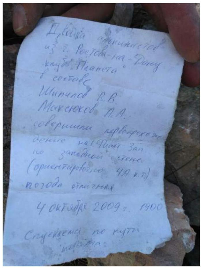 Two alpinists
from Rostov-on-Don
"Planeta" club
team:
Shipilov V.V.
Maksyukov A.A.
made the first ascent to Fisht West
via the western wall
(approximately 4B cat. diff.)
excellent weather.
October 4, 2009, 19:00.
Descending via the ascent route.
Two alpinists
from Rostov-on-Don
"Planeta" club
team:
Shipilov V.V.
Maksyukov A.A.
made the first ascent to Fisht West
via the western wall
(approximately 4B cat. diff.)
excellent weather.
October 4, 2009, 19:00.
Descending via the ascent route.
Photo illustrations
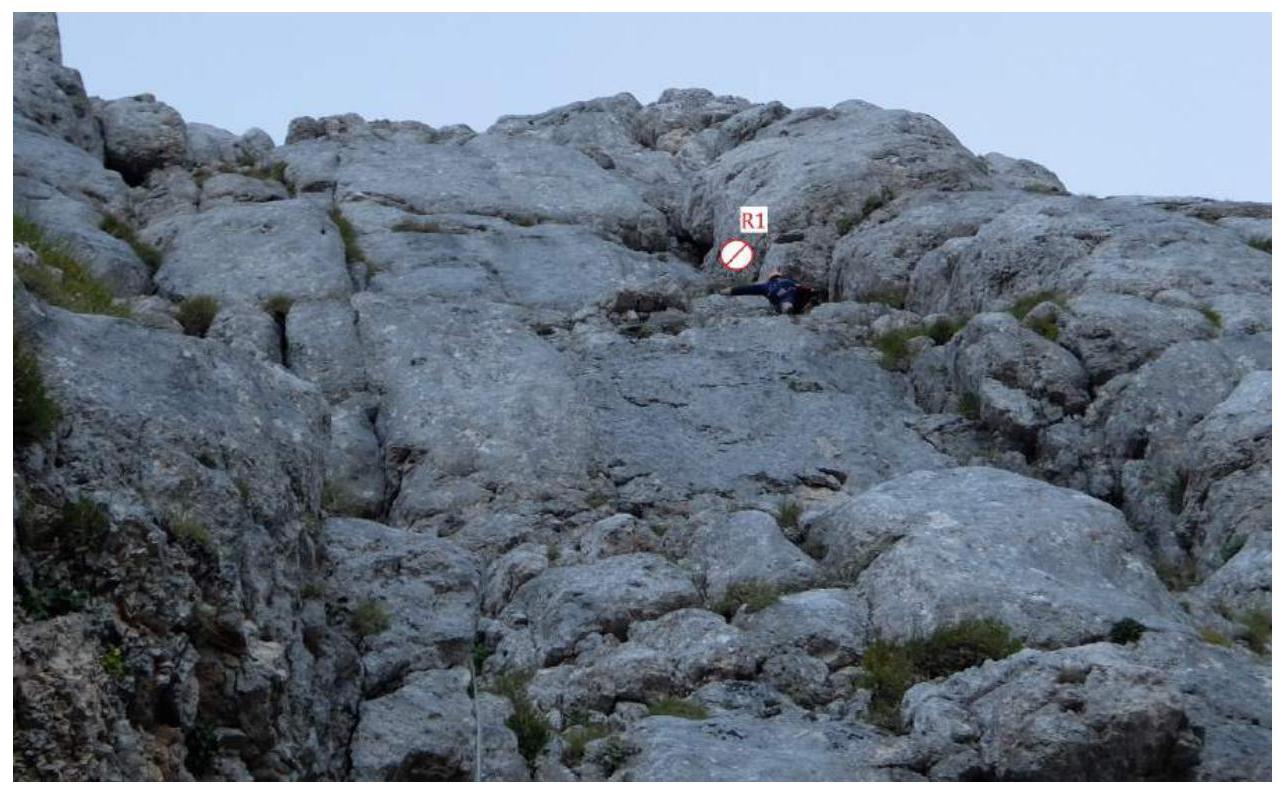 Photo 1 — Section R0–R1.
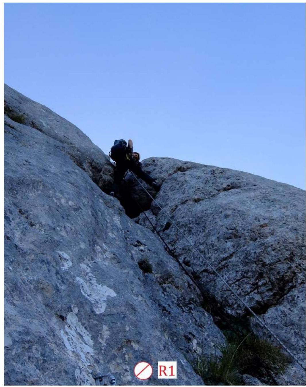 Photo 2 — Lower part of section R1–R2.
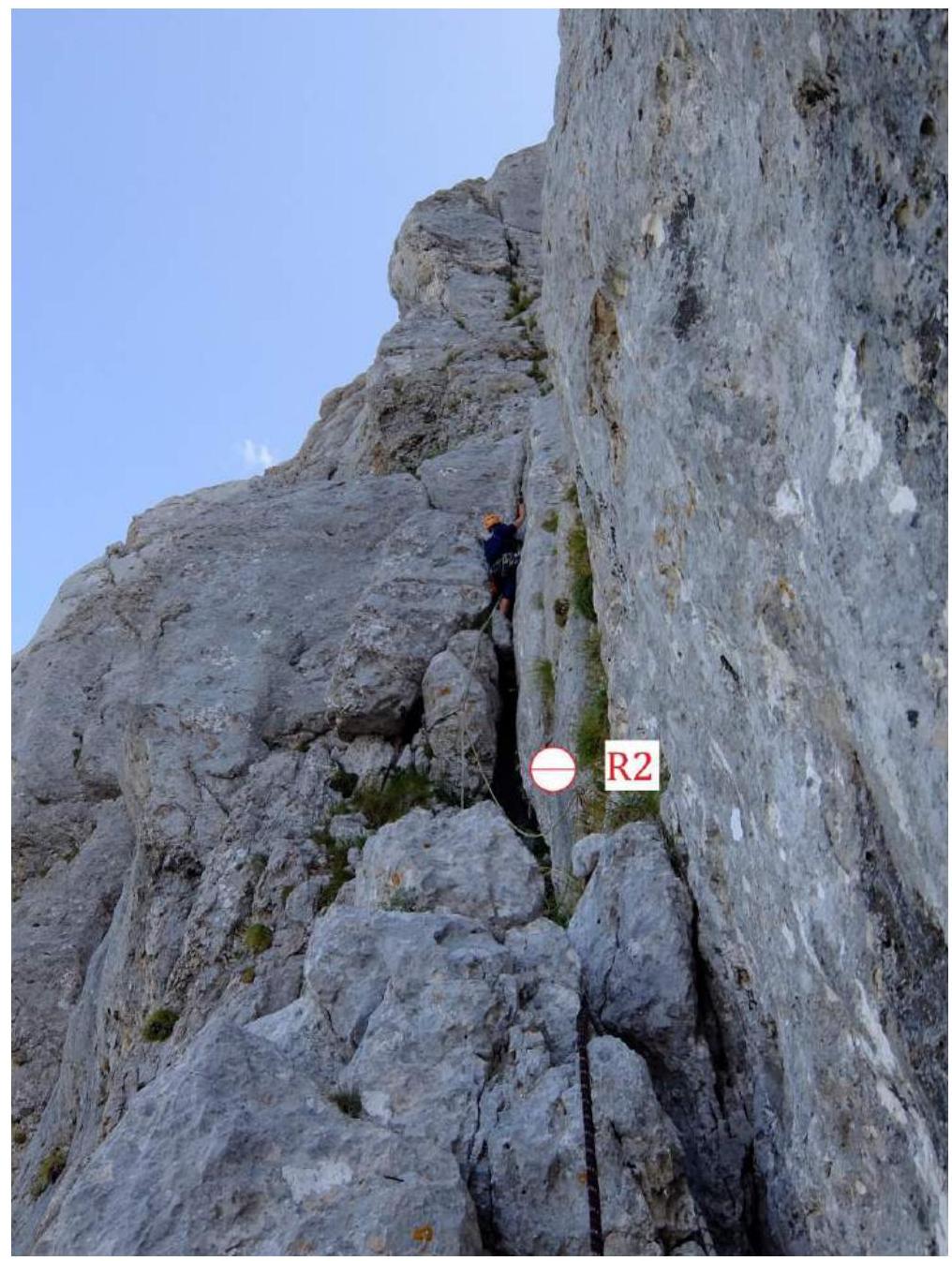 Photo 3 — Lower part of section R2–R3.
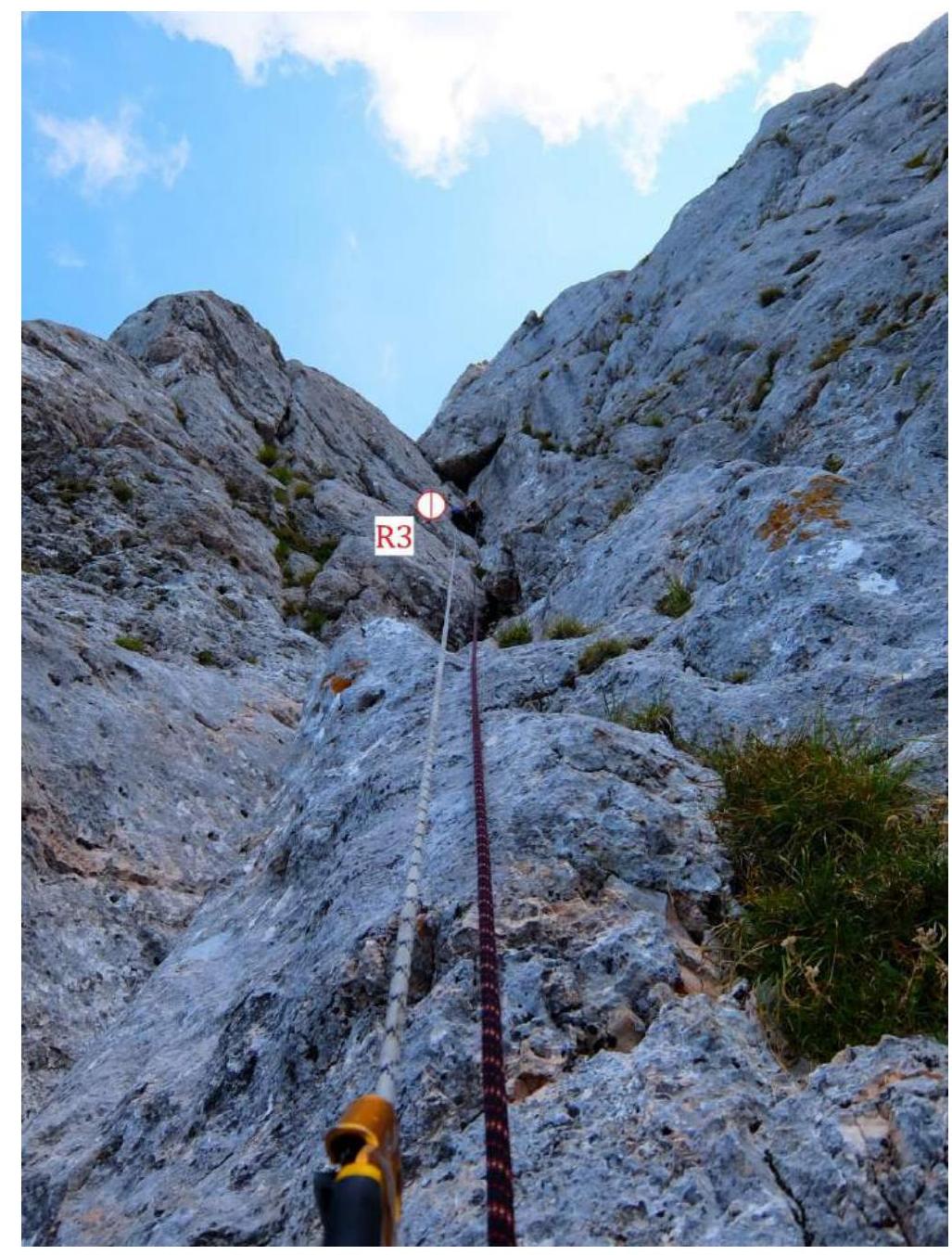 Photo 4 — Upper part of section R2–R3.
 Photo 5 — Section R3–R4. Passage of the key section.
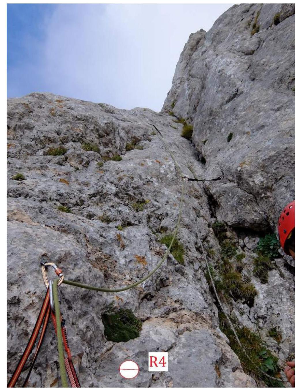 Photo 6 — Lower part of section R4–R5.
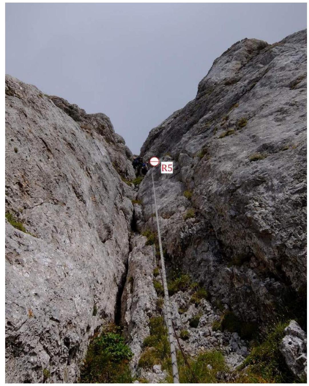 Photo 7 — Upper part of section R4–R5.
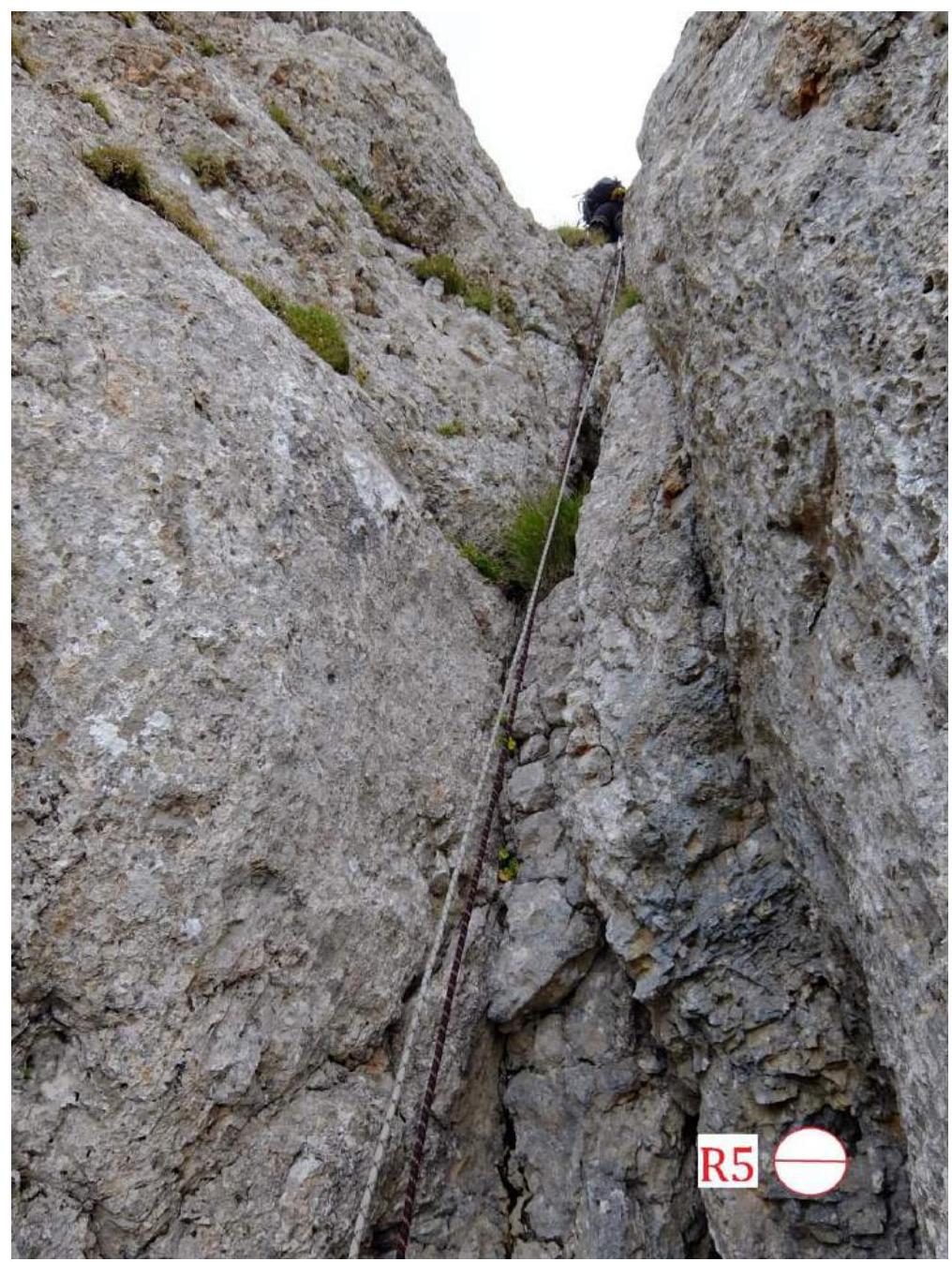 Photo 8 — Section R5–R6.
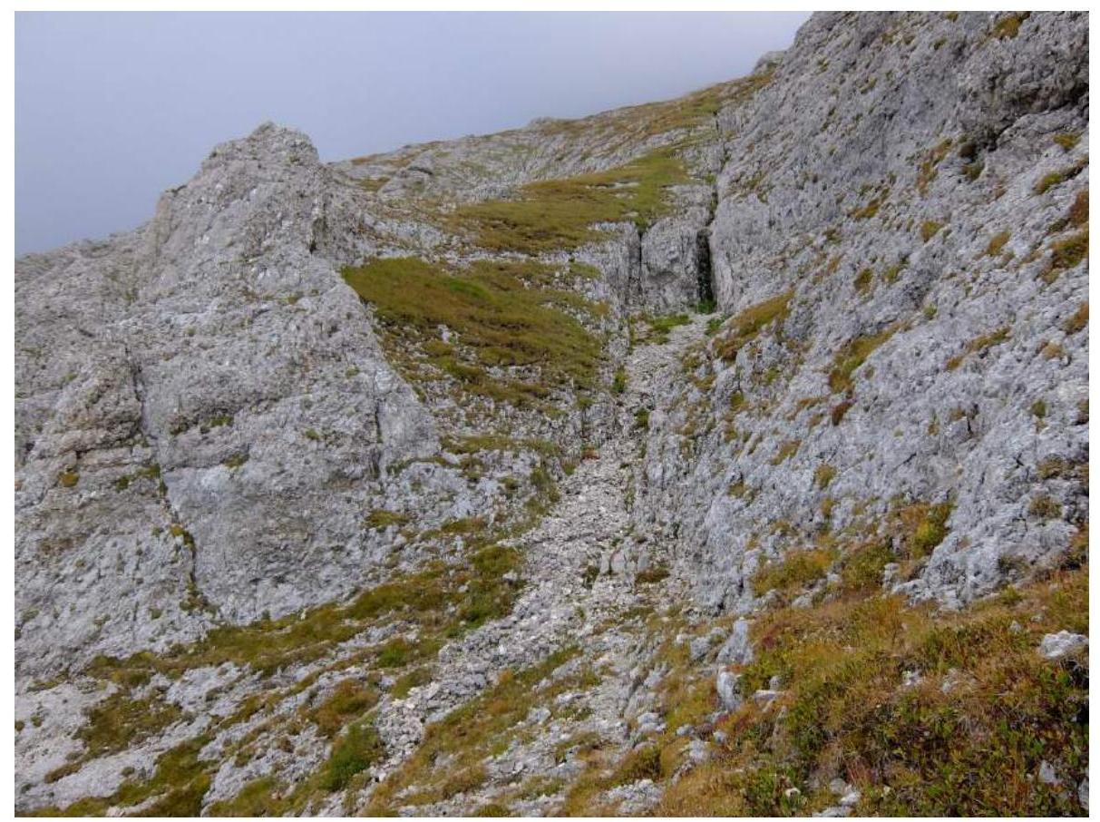 Photo 9 — Start of the "roof."
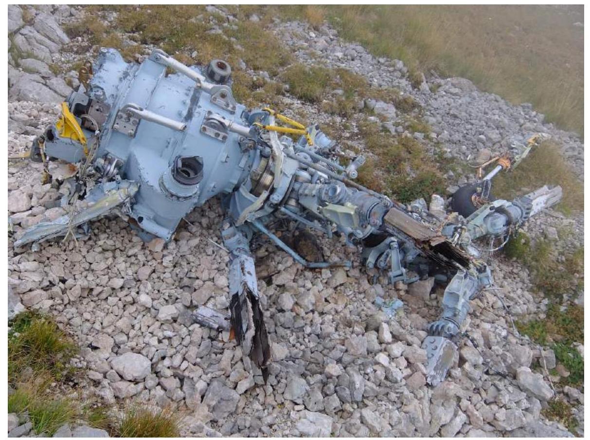 Photo 10 — Helicopter debris on the "roof."
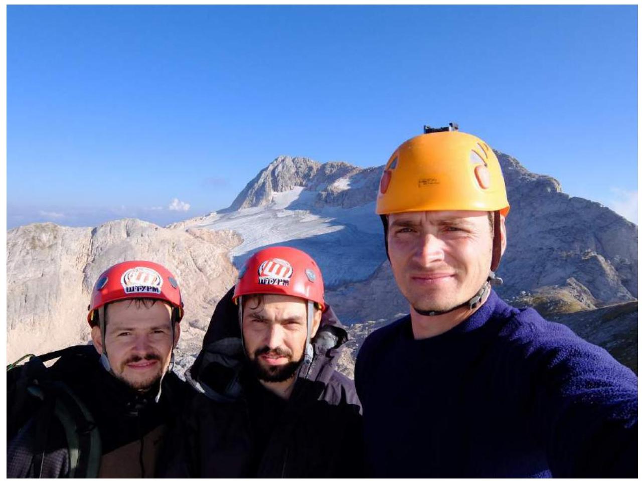 Photo 11 — Team photo at the summit. In the background, Fisht peak (Main).
Left to right: Ivaschenko Mikhail, Spesivtsev Artem, Barabash Anatoly.
Photo 11 — Team photo at the summit. In the background, Fisht peak (Main).
Left to right: Ivaschenko Mikhail, Spesivtsev Artem, Barabash Anatoly.