Report
on the ascent of Mt. Fisht (2867 m) via the Southwest Ridge, first ascent, approximately category 3B, made by the team of the KubSTU "Shтурм" Alpinism Section, Krasnodar, 2012.
Ascent Passport
- Western Caucasus, Krasnodar Krai, 2.1
- Fisht peak (2867 m) via the Southwest Ridge
- Proposed category: 3B, first ascent
- Route type: rock
- Height difference: 630 m
Route length: 1180 m. Section lengths:
- Category IV: 90 m
- Category V: 50 m. Average steepness:
- Main part of the route: 55 degrees
- Entire route: 40 degrees
- Pitons left on the route: 0.
- Team's moving hours: 8 hours, 1 day.
- Descent from the summit: via route 1B category, North slope.
- Team leader: Ivaschenko Mikhail Nikolaevich, CMS
Team members:
- Gorodishchensky Roman Rinatovich, CMS
- Spesivtsev Artem Alekseevich, CMS
- Fetisov Alexander Robertovich, 2nd sports category
- Coach: Krivov Vasily Nikolaevich, CMS, instructor 1st category.
- Departure for the route: 6:00 AM, June 11, 2012.
Reached the summit: 2:00 PM, June 11, 2012. Returned to "Fisht" shelter: 6:00 PM, June 11, 2012.
-
Organizing body: Krasnodar Regional Alpinism Federation, Krasnodar, KubSTU "Shтурм" Alpinism Section, Krasnodar
-
Responsible for the report: Ivaschenko M.N. indeeccc@gmail.com
General photo of the summit
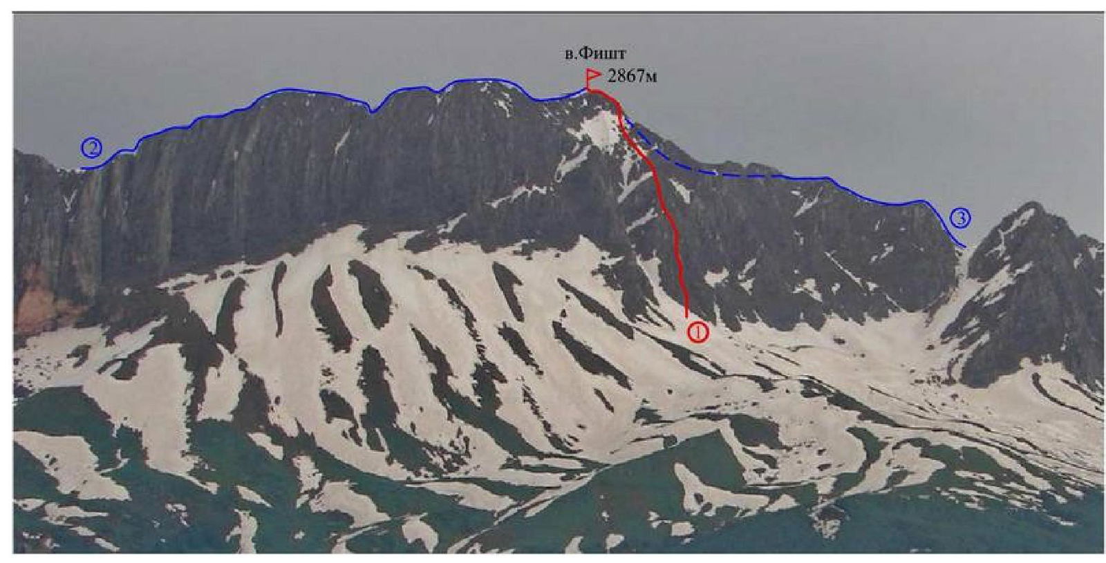
Figure 1 — Fisht from the west (photo taken from the Khuko ridge)
- 1 — SW ridge, approximately 3B — route climbed by the team
- 2 — NW ridge, 2A (Skripchenko)
- 3 — SE ridge, 2A (Taranenko, 1984)
Route profile photo
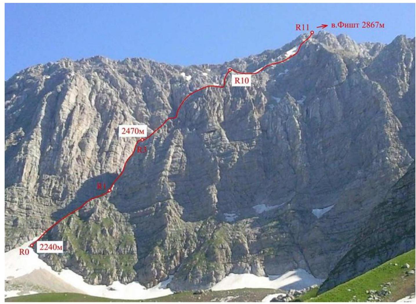
Figure 2 — Photo of the Southwest Ridge from the right (taken from under the route on June 10, 2012)
Panoramic photo of the area
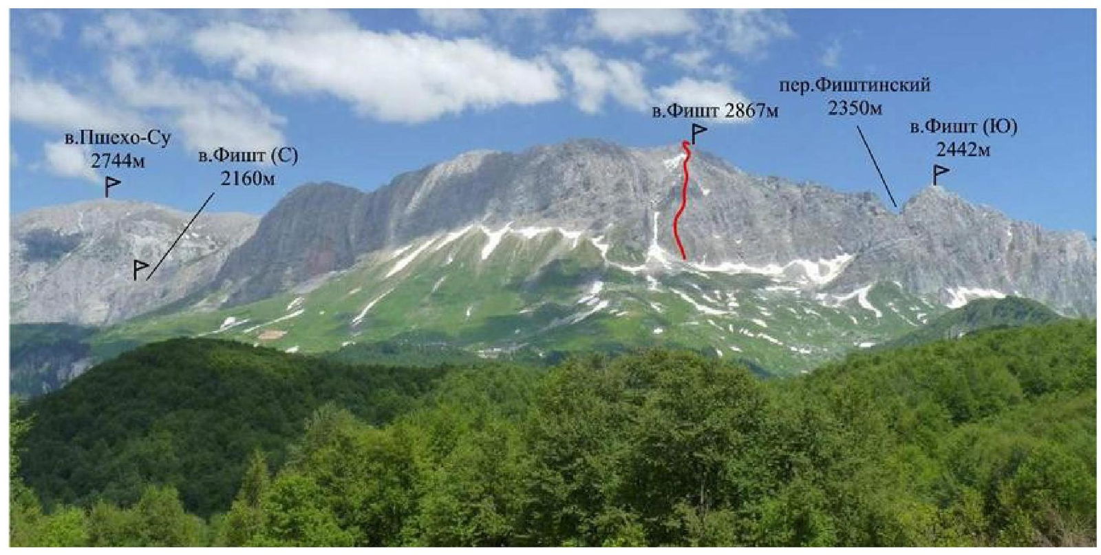
Figure 3 — Fisht massif from the southwest (taken from the Cherkessky ridge on August 11, 2012)
Description of the approach to the route
The ascent to Mt. Fisht from the south can start from either the "Fisht" shelter or the "Vodopadisty" shelter.
Option 1. From "Fisht" shelter. It's more convenient to get here via Guzeripl settlement. Upon entering the settlement, turn right at the first T-junction before the river Zholobnaya and follow the asphalt road past the "Parizhskaya Polyana" shelter until it ends (about 18 km). Then, proceed on foot along the marked trail through the passes:
- Guzeripl,
- Armenian, bypassing the slopes of Mt. Oshten to the left, to the "Fisht" shelter. 3–4 hours from the road (11 km).
From "Fisht" shelter, follow the marked trail towards the Belorechensky pass. Then, without reaching the Cherkessky pass, turn right under the southern walls of Fisht. After passing the couloir descending from the Fishtinsky pass, approach the base of the Southwest Ridge. 3–4 hours from "Fisht" shelter.
Option 2. From "Vodopadisty" shelter
From Chernigovskoe village:
- 5 km on asphalt road
- 37 km on dirt road to the gully on the road
Then, 1 hour on foot to "Vodopadisty" shelter.
From the shelter, follow along the western and southern walls of Fisht towards the Cherkessky pass. Without reaching the Fishtinsky pass, turn left under the base of the Southwest Ridge. 3–4 hours from Vodopadisty.
It's also possible to approach the route from Babuk-Aul. The descent from the summit can be done via several options, depending on the base camp location:
-
Option 1
-
Option 2
-
Option 3
-
to "Fisht" shelter — via the North slope, category 1B
-
to "Vodopadisty" shelter — via the Southeast ridge, category 2A to the Fishtinsky pass, then descent south towards the Cherkessky pass.
Area map
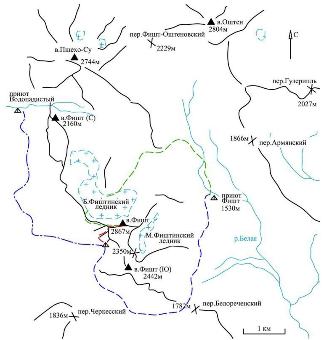
Legend:
-
- approach
-
- route
-
-
descent
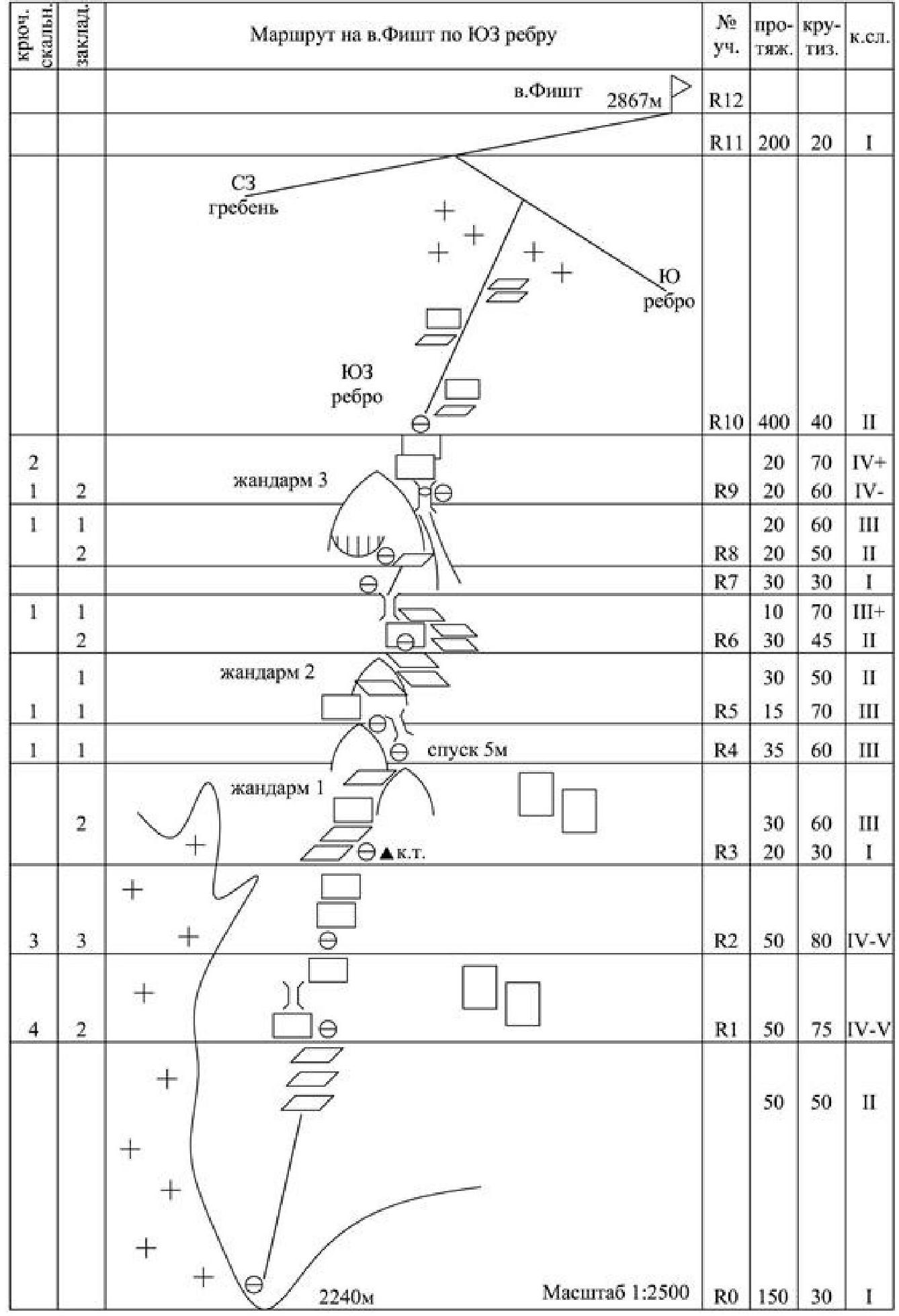
Route diagram in UIAA symbols
-
Technical photo of the route
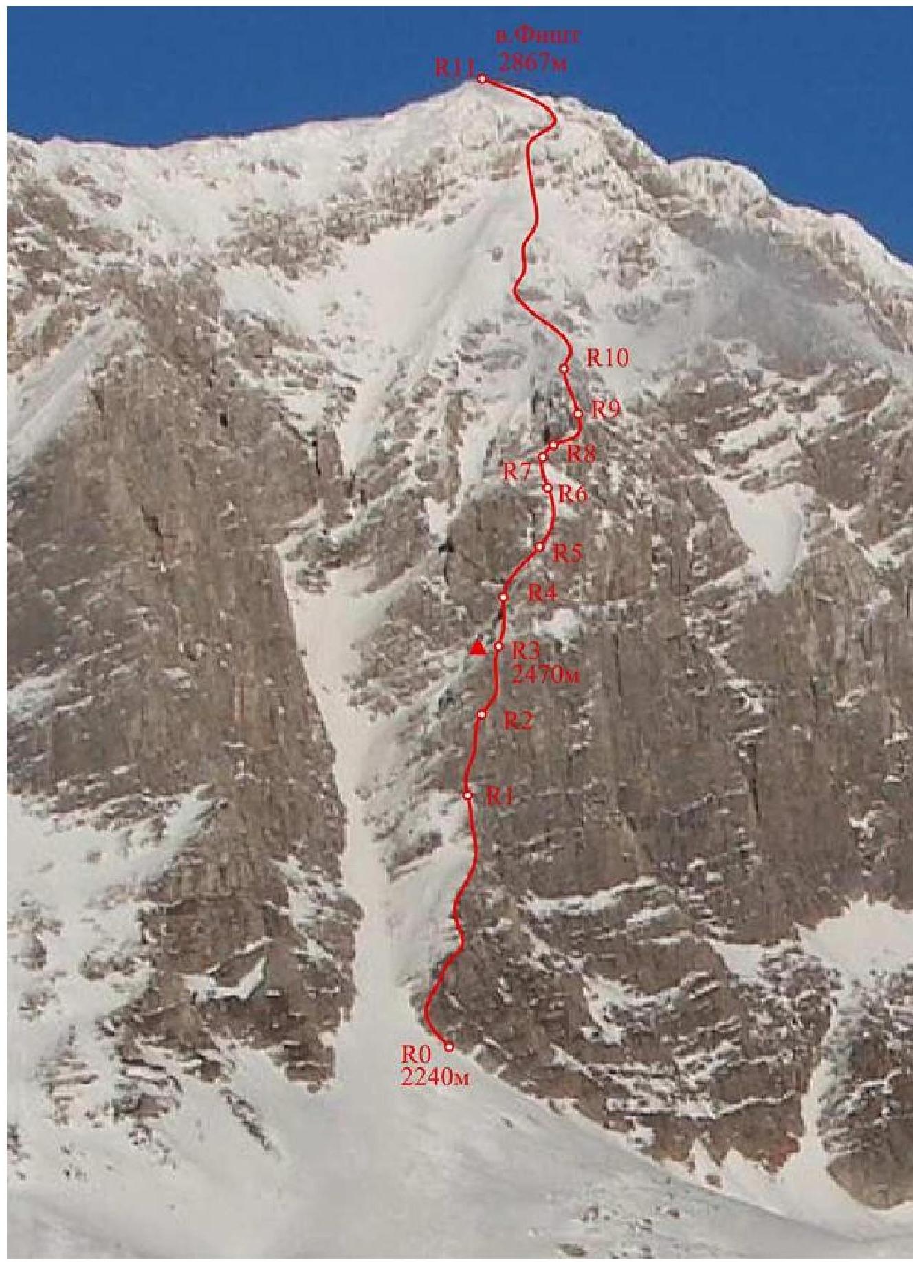
Figure 4 — Technical photo of the route on the Southwest Ridge (taken from the Cherkessky ridge)
Route description
Ascent to the base of the Southwest Ridge via a snow-gravel slope. Exit to the ridge from the left side slightly above its base. Bypassing the first step of the ridge via the couloir is not safe.
R0–R1 — 150 m, 40°, I; 50 m, 50°, II. Along the grassy slope to the base of the ridge's rock step. R1–R2 — 50 m, 75°, IV–V. Upwards-right through difficult walls and chimneys to a small ledge. R2–R3 — 50 m, 80°, IV–V. Through a difficult wall with a slight overhang to a flattening on the ridge (loose rocks!). Control cairn on the platform.
R3–R4 — 20 m, 30°, I; 30 m, 60°, III
Along a simple ridge to a pinnacle. Ascend to the pinnacle's ledge from the left.
R4–R5 —
- 5 m, 60, III
- 15 m, 70, III
- 15 m, 50, II
Descend (5 m) from the ledge to the right. Then, ascend via the chimney on the right side of the pinnacle.
R5–R6 —
- 15 m, 70, III
- 30 m, 50, II
Ascend to the pinnacle from the left via the wall, then traverse right. Bypass the pinnacle from the right via ledges.
R6–R7 —
- 30 m, 45, II
- 10 m, 70, III+
Bypass the wall from the right, then upwards-right under a chimney. Ascend via the chimney to the ridge.
R7–R8 — 30 m, 30, I
Along a simple ridge, approach the third pinnacle (landmark — a red wall with an overhang).
R8–R9 — 20 m, 50, II; 20 m, 60, III
Bypass the pinnacle from the right via a ledge, then via a groove turning into a chimney (loose rocks!). Station in the chimney under a large rock plug.
R9–R10 — 20 m, 60°, IV–; 20 m, 70°, IV+
Bypass the plug from the right via the wall. Then, upwards-right through two walls, exit to the ridge.
R10–R11 — 400 m, 40°, II
Along a broad ridge-slope, exit to the pre-summit Northwest ridge.
R11–R2 — 200 m, 20°, I
Along a simple ridge, exit to the summit.
Route characteristics
The route follows the Southwest Ridge, to the right of the large couloir on the western wall, and exits to the Northwest ridge of the summit. The start of the route is at the base of the Southwest Ridge.
The route thread follows the edge of the ridge along the most logical and simple sections.
The Southwest Ridge has three steps of rock walls with steepness up to 80°, alternating with more gentle ridge sections with steepness of 40–50°.
Key sections of the route require good belaying and climbing skills.
Bypassing the first rock step from the left via the couloir is not safe. In the lower part of the route, ledges contain a large amount of:
- grass.
Notes from control cairns and the summit
A control cairn was left on the route — on the ridge at section R3 after the key ropes.
No notes were found in the control cairn on the summit.
Photo illustrations
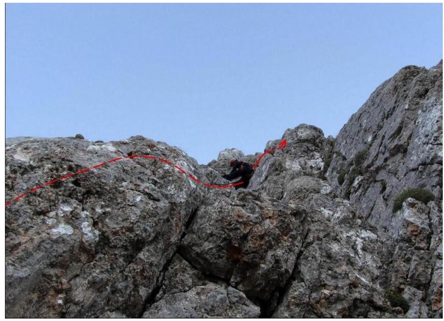
Photo 1 — Section R1–R2. Spesivtsev passing the first wall.
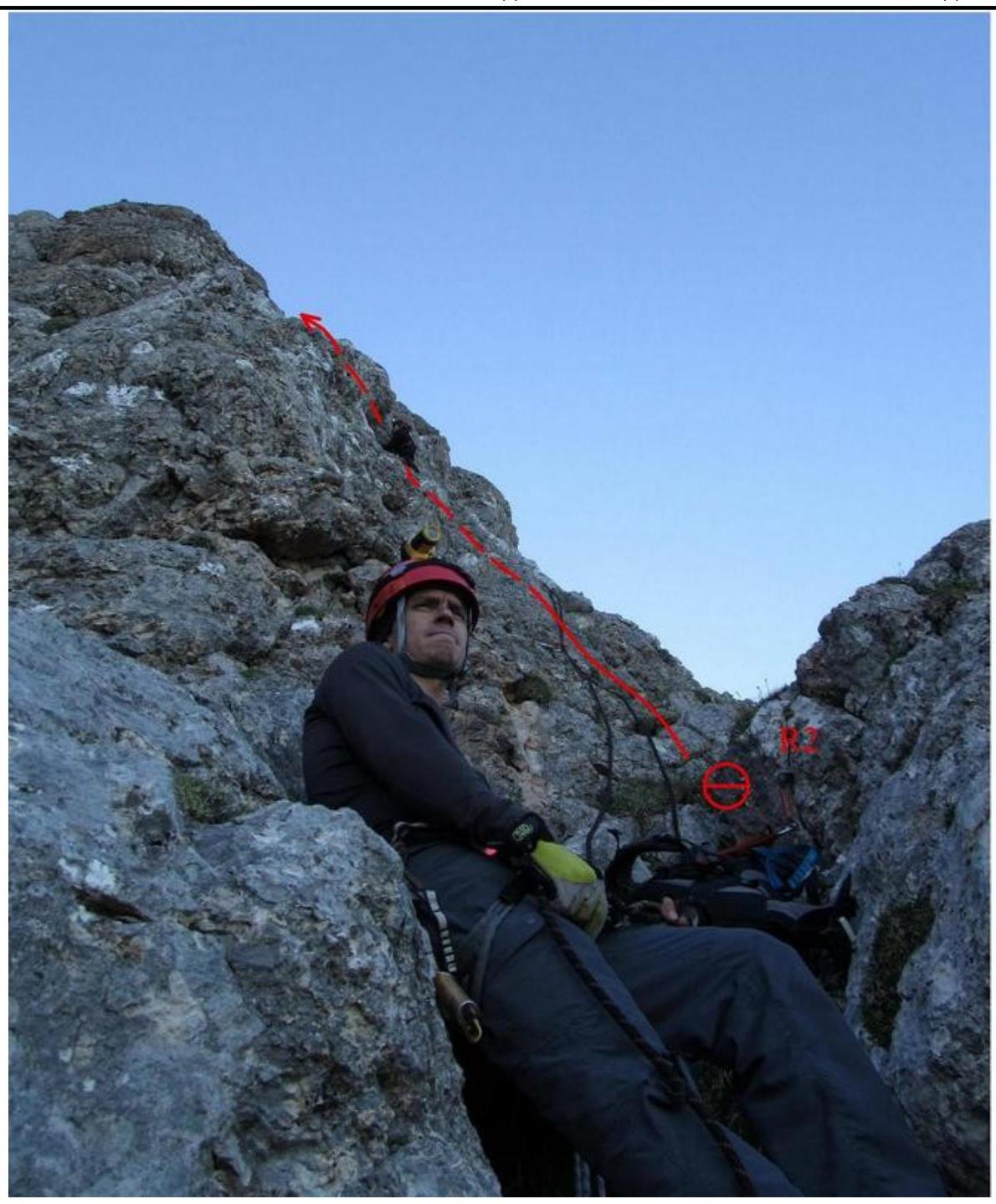
Photo 2 — Section R2–R3. Spesivtsev working on the second key rope. Gorodishchensky belaying.
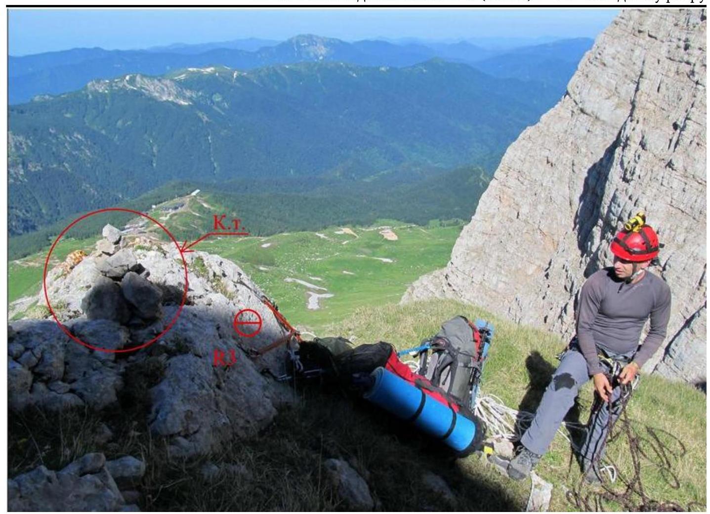
Photo 3 — Station R3. Control cairn.

Photo 4 — Section R3–R4. Gorodishchensky and Fetisov bypassing the pinnacle.
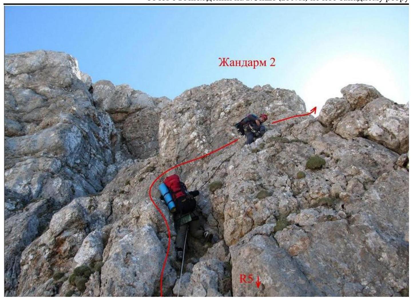
Photo 5 — Section R5–R6. Traverse of the second pinnacle.
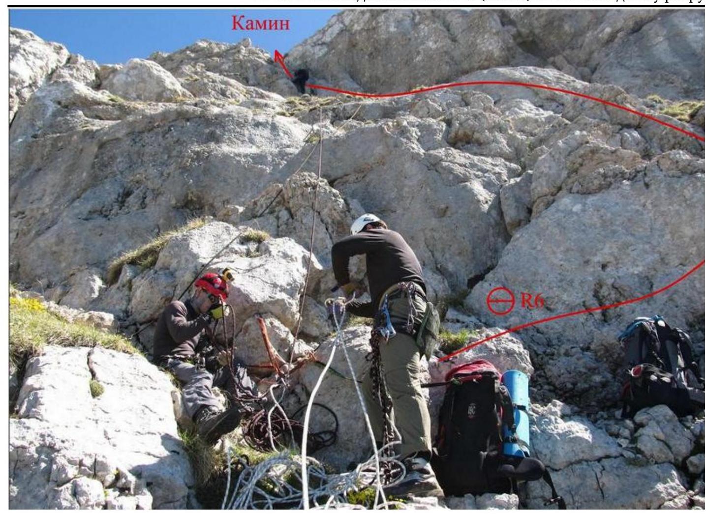
Photo 6 — Section R6–R7. Spesivtsev passing a short chimney.
)
Photo 7 — Section R10–R11. View from above on the Southwest Ridge.
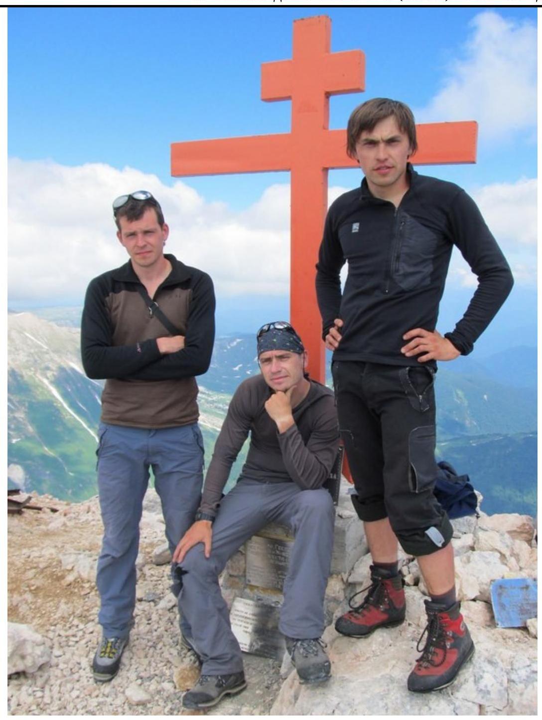
Photo 10 — Summit. Left to right:
- Ivaschenko Mikhail
- Gorodishchensky Roman
- Spesivtsev Artem taking a photo of Fetisov Alexander
General conclusion on the route
When determining the route's difficulty, the team used the experience of previous ascents:
Fisht via the SE wall, category 3A; Adyrsu, 3rd category, S ridge, category 3A; Vil's NW ridge, category 3B; Dzhantugan via the NW ridge, category 3B; MNR (C) via the S ridge, category 3B; MNR (NE) via the S ridge, category 3B.
After analyzing these routes, the team concluded that the route on Fisht via the Southwest Ridge exceeds the difficulty of category 3A routes and is comparable to category 3B routes.
The route is characterized by sufficient length, difficult climbing on key sections, and challenging terrain. To pass the key sections of the route, the following skills are required:
- good climbing skills
- good belaying organization skills.
Based on the above, the team proposes to classify this route as a category 3B route.