Ascent Passport
- Ascent area: Western Caucasus, Main Caucasus Range, Belaya River valley
- Peak, route: p. Fisht (2867), via NW ridge (via "Crocodile")
- Estimated category of difficulty: 2A, first ascent
- Route length: 1400 m Average slope of the route: 30°
- Number of walking hours/days: 3/0.1
- Leader: Skripchenko A. V. Participants: Yakunina Yu. A., Foigel M. R.
- Departure to the route: September 6, 2002
Summit: September 6, 2002
Return: September 6, 2002
- Peaks, ridges
- Trails, routes
- 2599 — Elevations in meters
- X — Passes
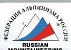
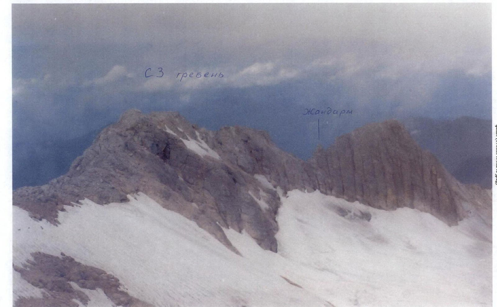
Photo from the summit
Route Description
From the Fisht tourist base, follow the trail to "Red Rocks." Bypass the rocks on the left and follow the trail, partially on simple rocks, to the northern slope. Then turn left and move towards the summit, bypassing a rocky tooth on the left. On the glacier (Bolshoy Fishtinsky), turn right and traverse to the clearly defined saddle of the NW ridge. From the Fisht tourist base — 3–4 hours.
From the saddle, ascend simple rocks to the NW ridge. Then continue up the simple ridge for about 500 m to its depression. Here, make a sporting descent of 8 m, then ascend to a gendarme and rappel 20 m from it. Continue up the ridge. Bypass the ridge ascent on the left via ledges and continue along the simple ridge (700 m) to reach the summit. From the saddle — 2.5–4 hours.
Descent via the 1B category route to the Fisht tourist base — 2–3 hours.
Recommendations for climbers:
- Bring crampons, they may be useful on the approach.
- The description was compiled by the first ascenders based on the route's condition in September 2002; in the winter-spring period, the condition changes and the difficulty increases.
- During fog, it is very difficult to navigate on the descent!!! "panorama 1" (5640×1308×24b jpeg)
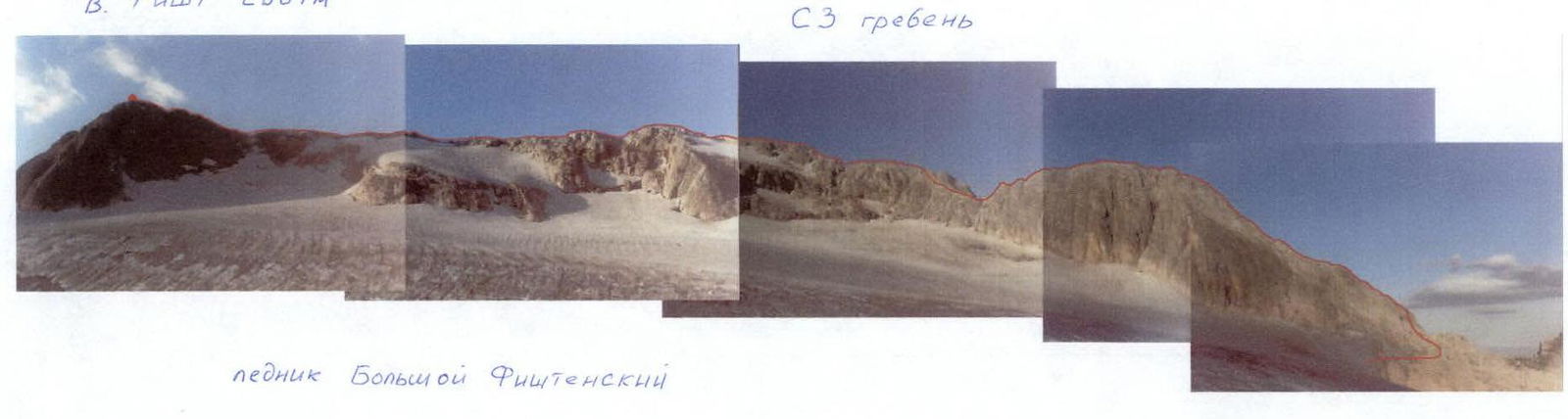
Photo from the Bolshoy Fishtinsky glacier


