
REPORT
On the first ascent to the summit "Peak 3231" (Eastern), made by a group of climbers from the Stavropol region on May 4, 1980, in the Arkhyz mountain range (Western Caucasus), Stavropol region, west of the "Marukh" pass, Sofiysky ridge.
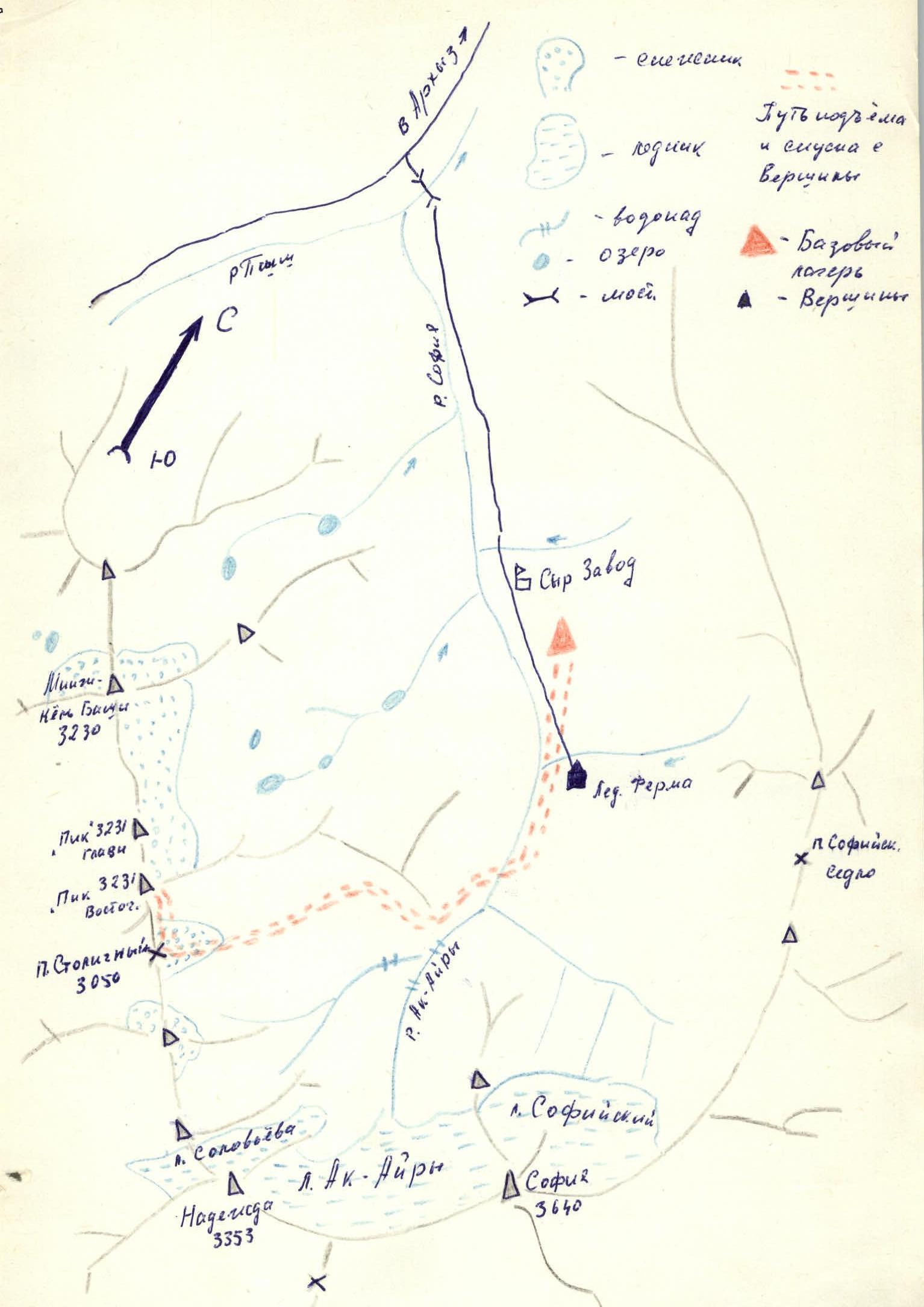
The Arkhyz mountain area is located on the northern slopes of the Main Caucasian Range between the Kardyvach area (Krasnodar region) to the west and the "Marukh" pass to the east. The area is entirely within the Stavropol region and is situated at approximately 43° north latitude. North of the Main Caucasian Range lies the Sofiysky ridge, where this unnamed peak with an elevation of 3231 meters above sea level is located.
The base camp was set up at an altitude of 1320 meters above sea level, 1.5 km from the "Glacier Farm" on a clearing. From the base camp:
- up along the Sofia River
- to the tributary from the Ak-Ayry glacier
- along which to the right up to the "Barańi lbov"
- then to the right into a wide couloir leading to the firn fields
- up the firn fields to the "Stolichny" pass (3 hours from the camp)
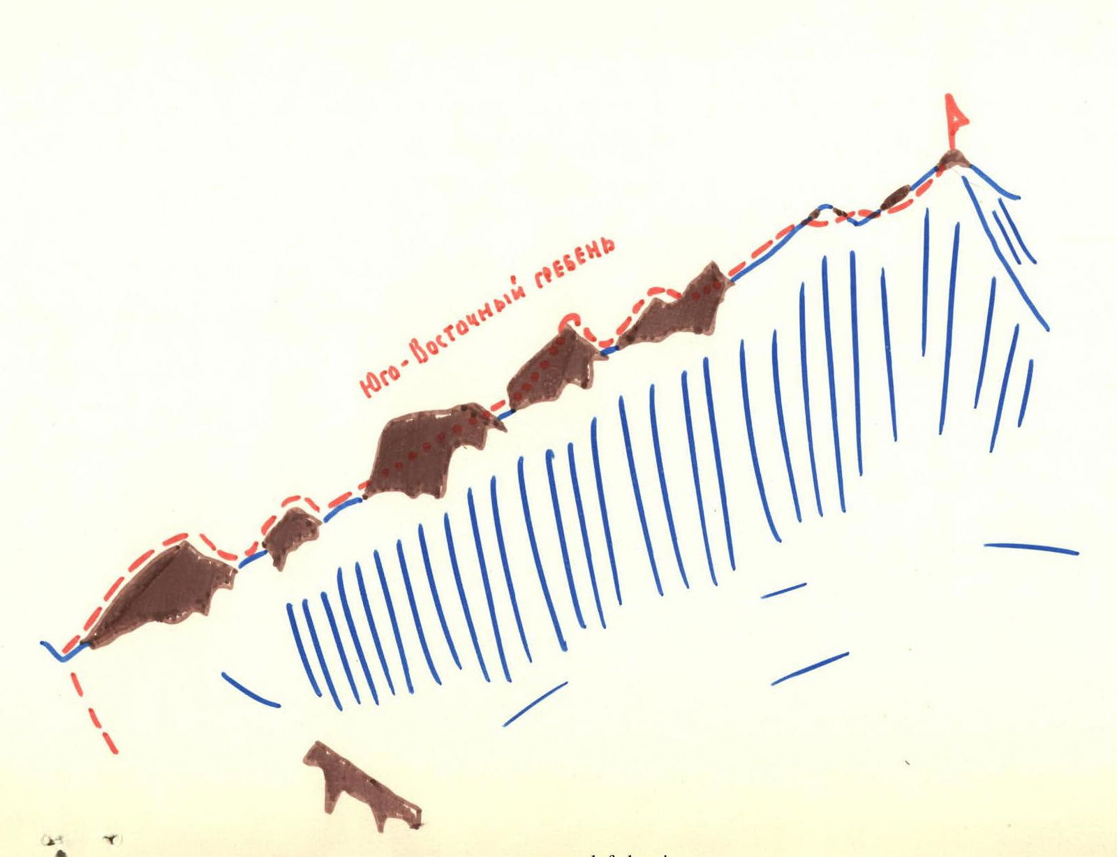
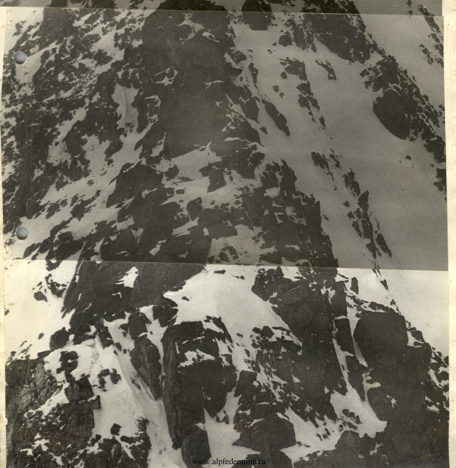
The "Peak 3231" summit is a section of the Sofiysky ridge crest (its northeastern part) with two peaks of equal height, located close to each other (200-250 meters along the ridge). Further northwest, the ridge continues with the Mingi-Kyol-Bashi peak. And to the southeast - with the following peaks:
- Peak 3305
- Peak 3200
- Nadezhda
The ascent was made along the 10-B ridge to the 1st peak (Eastern), the route is ridge-top, rocky, and ruined. The starting point of the route is the "Stolichny" pass.
Group composition:
- Fursov Yuri Sergeevich, 1st sports category
- Klochkov N.V., 2nd sports category
- Kobtsev A.M., 2nd sports category
- Belokurov I.L., 2nd sports category
- Grishchenko O.G., 2nd sports category
- Tsybakova L.V., 2nd sports category
Passport, table, photographs, map, and description are attached.
DESCRIPTION
of the ascent route to "Peak 3231" (Eastern) along the Southeast ridge from the "Stolichny" pass
From the base camp located on a clearing near the "Glacier Farm":
- up the Sofia River
- to the tributary from the Ak-Ayry glacier
- along the left (orographically) side of the tributary up to the "Barańi lbov"
- then up to the right into the gorge leading to the "Stolichny" pass
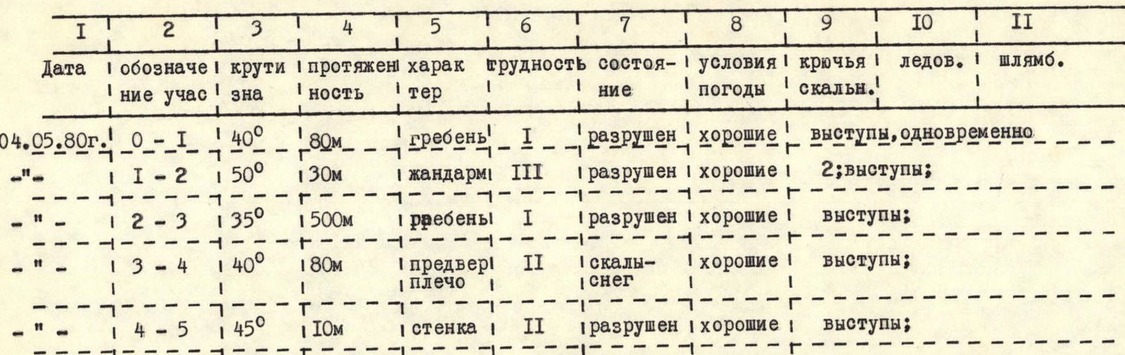
From the pass, up to the right along the 10-B ridge over severely ruined rocks to a gendarme - 80 meters. The gendarme is bypassed on the left with piton belay. After the detour, exit onto the ridge and up along it for 12-13 rope lengths. (Rockfall hazard!) The ridge is not steep - 30°-35°, belay through outcrops.
The ridge leads to a pre-summit shoulder, where rocks alternate with snowy sections. Directly to the summit, the ascent is via a small rock wall (10 meters), the wall is not steep - 45° with good holds.
The summit is a severely ruined rocky section of small size (4-5 people at most). The ascent from the "Stolichny" pass to "Peak 3231" took 1 hour 45 minutes.
Descent was made along the ascent route. RECOMMENDATIONS:
- Rock pitons - 4 pieces
- Rock hammers - 2 pieces
TABLE OF MAIN ROUTE CHARACTERISTICS
Departure on the route at 8:00 on May 4, 1980. Travel time to the summit - 1 hour 45 minutes. Descent to the camp took 3.5 hours. There were no overnight stays on the route. Descent to the camp was made at 14:00 on May 4, 1980.

Comments
Sign in to leave a comment