Description
First ascent to v. Sofia via the western ridge, approximately category 3A.
From the base camp, follow the left bank of the Sofia River (orographically) until the confluence with the Ak-Airy River. Then, move left and upwards along the left (orographically) bank of the Ak-Airy River to the first belt of "ram's foreheads" - 1 hour of movement.
The belt of "ram's foreheads" is bypassed from the right along a small stream. Then, move left across small meadows overgrown with rhododendron.
After the meadows, move along the middle talus to the shoulder, beyond which lies the upper part of the Ak-Airy River valley. Here, there is a green, flat clearing with a stream of clear water nearby. A suitable location for the initial bivouac. From the first belt of "ram's foreheads" - 1 hour.
From the initial bivouac, move upwards along the Ak-Airy River across talus to the Ak-Airy glacier. The glacier ends in an icefall, which is bypassed from the right across a rocky outcrop. Then, ascend a snowy slope with a steepness of 35-40° - 150-200 m upwards, exiting onto the glacier. From the initial bivouac to the glacier exit - 1 hour of movement.
On the glacier (in teams), move towards the broad snowy saddle located to the right of v. Sofia. The steepness increases with altitude, reaching 35-40° in the upper part. The glacier is closed! Movement to the ascent - 1 hour, and another 1 hour along the ascent. After the ascent - a 2.5-3 m high bergschrund with an icy upper edge. The bergschrund is overcome with step-cutting and piton belay. After the bergschrund - an icy slope with a steepness of 45°. Along this slope - 150-200 m to the second bergschrund, which is significantly simpler than the first. Beyond the second bergschrund - an icy slope with a steepness of 50°. Movement with step-cutting and piton belay - 20-25 m to the rocks. Then, across rocks of medium difficulty upwards - 15-20 m to a snowy slope with a steepness of 50°, and up it - 40 m to the ridge. The height of the ridge is 3300 m. From the first bergschrund to the ridge - 1-1.5 hours of work.
Movement along the western ridge begins with a 3-meter wall. Then, 10 m further - a 5-meter wall with an exit to a platform. Control cairn!
From the control cairn, bypass the destroyed gray "gendarme" on the left. Behind it - a steep 30-meter ascent with a steepness of about 60°. Then, 20 m to the right - exit to the ridge. Along the ridge, 40 m upwards to a "gendarme", which is climbed "head-on". The steepness of the "gendarme" is 70°. Piton belay! Rocks of medium difficulty. This section of the ridge was traversed in 1.5 hours, with 10 pitons used.
Beyond the "gendarme" - a steep ascent along the ridge with a steepness of 70-75°. Rocks are above medium difficulty.
Move:
- initially 30 m to the left,
- then 20 m to the right along a ledge, from which a 20-meter wall begins.
Rocks are above medium difficulty. Climbing is challenging. Piton belay (4 pitons).
Exit to a platform. Bivouac possible! Second control cairn!!!
From the "gendarme" to the platform - 1.5 hours of work. From the platform, 30 m to the left across rocks above medium difficulty with piton belay - exit to the pre-summit ridge. Along the ridge with simultaneous belay, bypassing the black "gendarme" on the left. 3 pitons used. Overnight stays possible on the ridge.
Beyond the black "gendarme" - a 10-meter wall with a steepness of 70°, which is climbed "head-on". Rocks of medium difficulty. 2 pitons used.
Then, along the ridge composed of simple, destroyed rocks, partially snow-covered:
- exit to the summit.
From the platform to the summit - 35-45 minutes of movement.
The ascent takes 10.5-11 hours. Descent follows the ascent route. During the ascent:
- On icy sections: 5 ice screws used
- On rocky sections: 19 rock pitons used
Recommendations: The following equipment is required for this route:
- Crampons - 2 pairs
- Ice screws - 3 pieces
- Rock pitons - 10-13 pieces
- Main rope - 2 × 30 m
- Tent - 1 piece
- Rock hammers - 2 pieces
- Climbing carabiners - 20 pieces
- "Shmel" stove - 1 piece
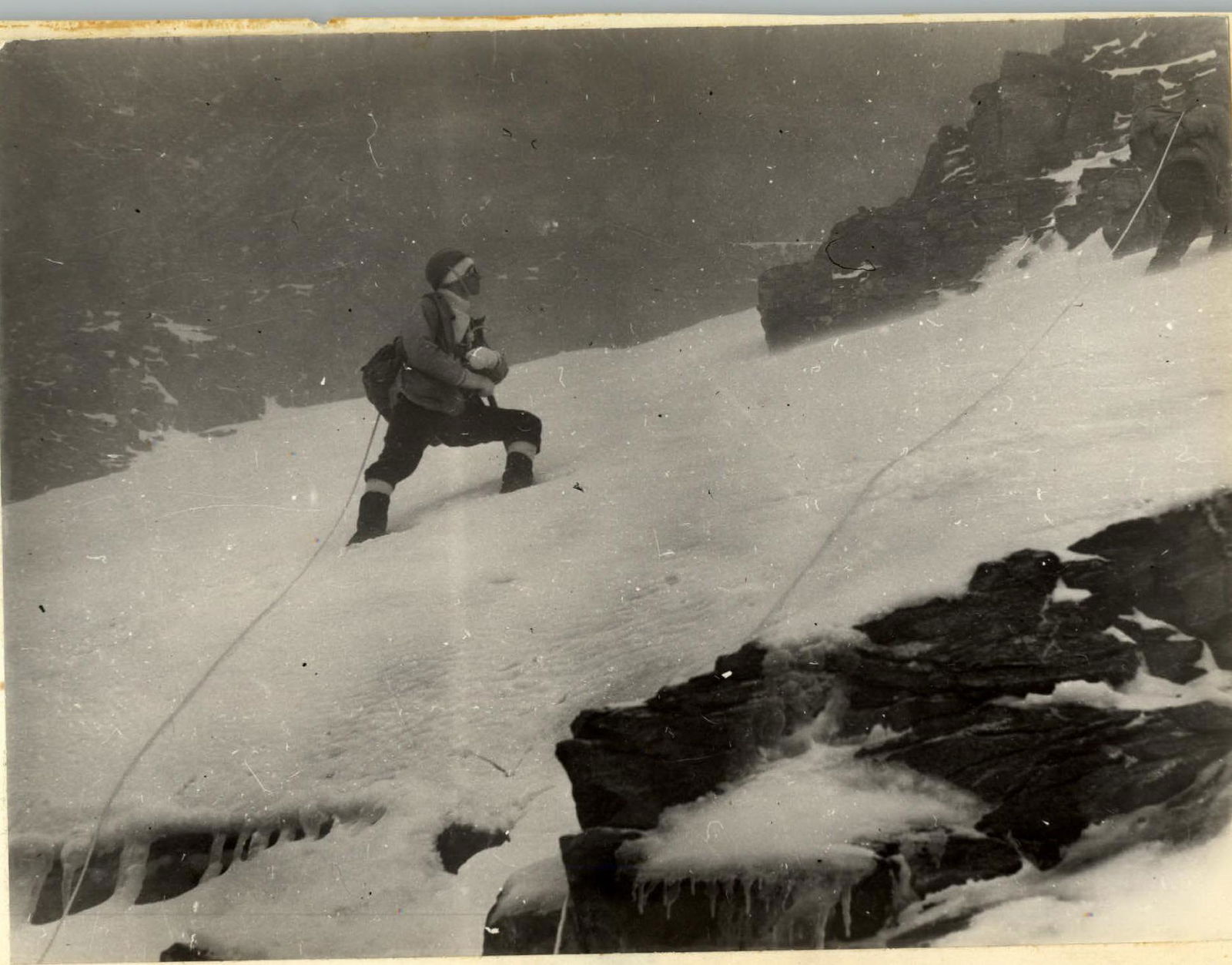
 On the route.
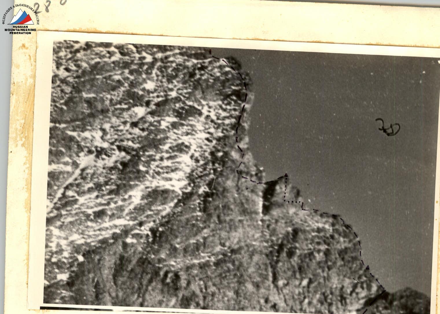
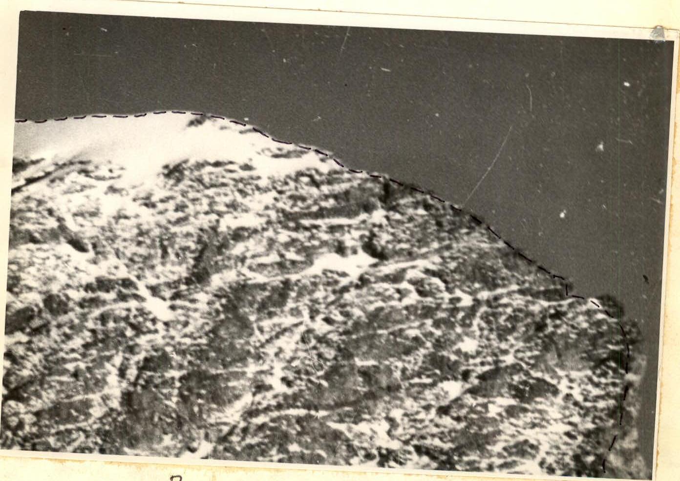 Ascent route close-up - control cairns.