
Ascent Log.
- Category: Rock
- Western Caucasus, Arkhyz, Sofiyskoe valley, Orlenok valley
- Sputnik (2650). Via southern ridge
- Proposed category: 1B, first ascent
- Height difference: 250 m Route length: 900 m. Rock section: 450 m
- Pitons left on the route: rock 2 pcs.
- Team's climbing hours: five up, four down
- Leader: Kolokolnikov Konstantin Vladimirovich 2nd sports category, 3rd category instructor
- Coach: Vdovin Oleg Anatolyevich 1st sports category, 3rd category instructor
- Departure to the route: 6:00 May 7, 2006 Summit: 15:00. Return to base camp: 20:00
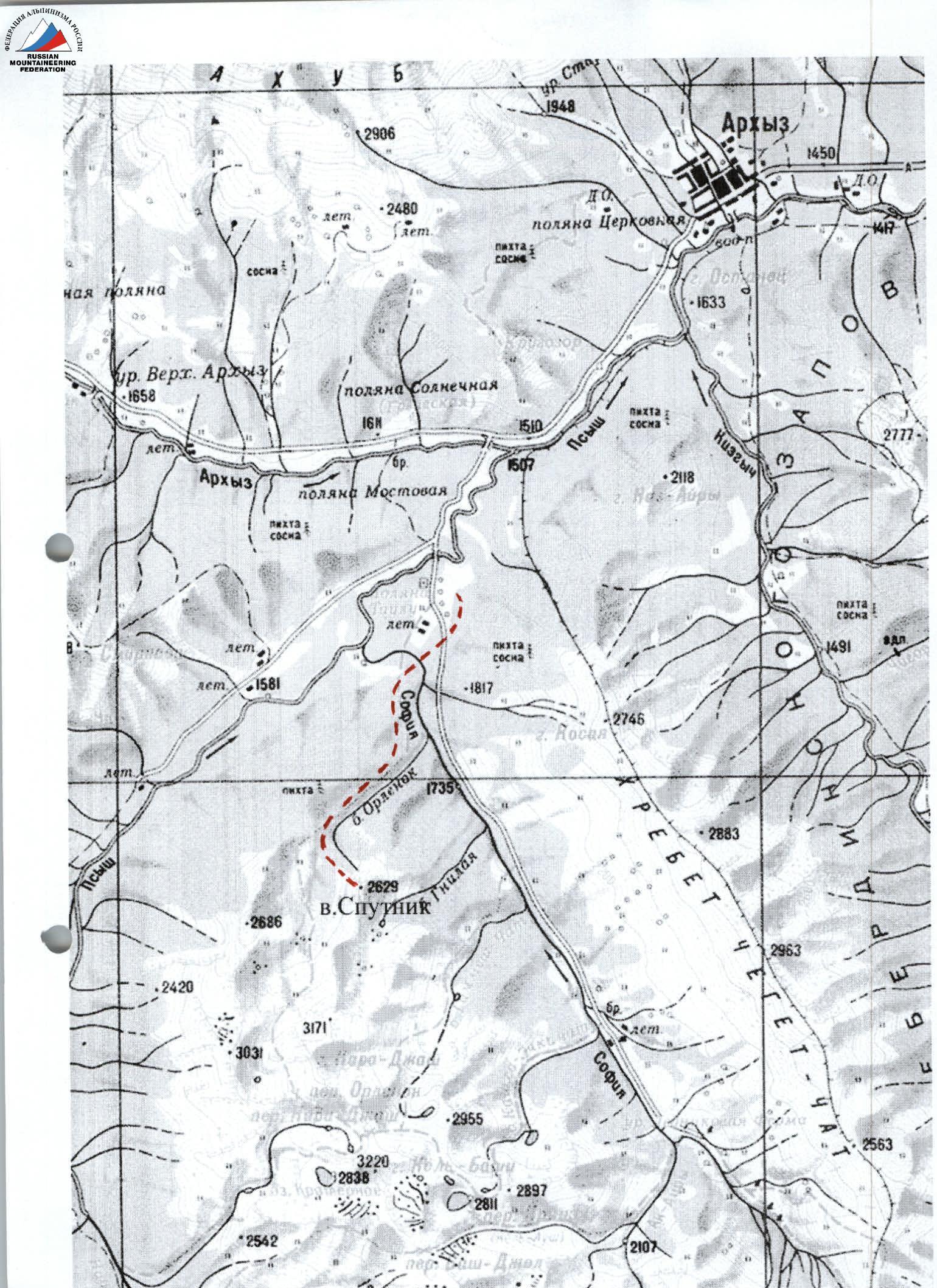
Area map and approach to Sputnik peak
Ascent to Sputnik via southern ridge (1B category)
May 7, 2006. SGKP "Skif" Stavropol. Leader: Kolokolnikov K.V. (2nd sports category, 3rd category instructor) Pлотников A.A. (1st sports category) Vdovin O.A. (1st sports category) Bezuglov A.V. (2nd sports category) Guryev M.I. (2nd sports category) Batalov A.V. (2nd sports category)
As known, over the last decade the tradition of May mountaineering gatherings has resumed in Arkhyz, initiated in the late 1970s by alpinist clubs from Stavropol, Pyatigorsk, and Kislovodsk together with Bulgarian mountaineers. The region is ideal for novice training and attracts more athletes from various Russian cities and neighboring countries each year!
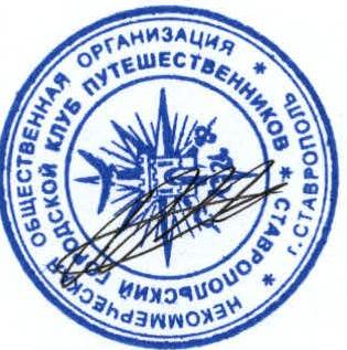
Sputnik peak is visible from almost any point in the Arkhyz area, known as "Pushka". (photo #1)
You can set up your camp on one of the terraced meadows near the Taulu tourist base. A motor road leads to the base. From the campsite (altitude 1600 m) approach the Sofia river and cross it via a pedestrian bridge. Then, left and up along:
- a marked trail;
- a logging road used for timber transportation.
In the Orlenok valley, three parallel roads lead to a stream, where they end. Continue up the valley (in summer, along a well-trodden and marked trail) to a rock step (ram's foreheads). Altitude 2250 m. From the camp: 3-4 hours.
Through the "neck" on the right (in May, avalanches are possible!) ascend to the rock step and turn left towards Sputnik peak (photo #2). Along the edge of the trough valley of Orlenok, approach the ascent to the ridge of Sputnik peak (photo #3). Altitude 2400 m. Here, near a large stone, you can have a snack and put on your harnesses.
The ascent to the ridge may be swept by an avalanche down to hard snow. Simultaneous movement: about 100 meters (photo #4).
Further, it is recommended to:
- hang fixed ropes on ice axes;
- the first climber moves in crampons and with an ice axe;
- the rest follow the fixed ropes (photo #5).
To the ridge: seven 50 m ropes. Average steepness 35-40°. Height difference from the stone to the ridge: 150 m. Ridge altitude: 2550 m. From the ridge, Zaimov peak is visible (photo #6).
Section R0-R1. From the ridge, move around the wall on the right along grassy slope ledges to a slanting ledge going left and up. Slope steepness: 25-35°.
If the slope is snowy:
- place an intermediate anchor;
- work in crampons.
Station on two anchors. From the ridge: 45 m.
Section R1-R2 (photo #7). From the station, left and up along the slanting ledge, transitioning into an internal angle, exit onto the ridge. Climbing is of medium difficulty. Slope steepness: 35-45°. (photo #8). Midway on the ledge:
- a rock anchor, or
- a friend for protection.
On the ridge, turn right and up, and after a few meters, approach a protruding sharp rock. Organize a station using a rope loop on the rock (photo #9). From the previous station: 45-47 m.
Section R2-R3. From the station, move left and up, around the wall on the ridge, along rock and grassy ledges, traversing along the boundary of the rocks (photo #10). Midway, a rock anchor is driven into the rock. Use it for protection! Slope steepness: 40-45°. On snow, work in crampons! Shortly before reaching the ridge, a sharp rock protrudes from the slope - a convenient spot for a station. From the previous station: 50 m (!) (photo #11, upper part of section R2-R3).
Section R3-R4. From the station, exit onto the ridge and move about ten meters to a rock wall (photo #12). Climb the wall directly, using a logical system of ledges and internal angles. Climbing is of medium difficulty. For intermediate protection:
- drive a rock anchor;
- or place a friend.
Wall steepness: 45-55°. At the top of the wall, a station on a large rock. From the previous station: 50 m.
View from above on section R3-R4: (photo #13).
Section R4-R5. From the ridge, descend into a depression (5 m) and along a difficult wall, on its right part (photo #14), ascend back to the ridge! Use a friend for intermediate protection! From here, along the ridge crest (photos #15 and 16), securing the rope to outcrops for protection, until the ridge turns right (photo #17). Station near a large rock, assembled on friends (photo #18). From the previous station: 50 m.
Section R5-R6. From the station, move right along the ridge to a steep slab, before which place a friend in a crack for a vertical section of fixed ropes (photos #19 and 20). Descend using a rappel or an "8" descender. From here, bypassing a gendarme on the ridge on the right, or directly on it, to the next gendarme, at the base of which is a station on friends (photo #21). From the previous station: 50 m.
Section R6-R7. Bypass the second gendarme on the right, along the boundary of the rocks, approach a ledge going to the right part of the slope (photo #22). Along the ledge, reach a columnar rock (2 m high), on which organize a station. From the previous station: 50 m.
Section R7-R8. From the columnar rock, left and up along a system of ledges and walls, exit onto the ridge. Climbing is easy. From the previous station: 50 m (photo #23).
Section R8-R9. From here, directly along the ridge, moving simultaneously, exit onto Sputnik peak (2650 m). (photos #24 and 25) From the previous station: 60 m. On the summit, there is cell phone coverage (Megafon), and you can safely call your parents and have a snack! (photo #26)
Descent is via the ascent route. Ascent from the stone to the ridge took 2 hours. From the ridge to the summit: 3 hours. Descent to the base camp on the bivouac meadow: 5 hours. Completing the route from camp to camp took 14 hours.
Height difference and section lengths:
- From the stone to the ridge: height difference 150 m, length 450 m.
- From the ridge to the summit: height difference 100 m, route length 450 m.
- From the base meadow to the summit: height difference 1050 m.
Possible bivouac sites:
- Trough valley of Orlenok (in summer, near the lake);
- Ridge at the start of the route.
Equipment used:
- 1 pair of crampons for the first climber;
- Ice axe;
- Three to four ropes to avoid delaying the ascent;
- Rock anchors;
- Set of friends;
- Set of quickdraws;
- Jumars and descenders for each participant.
Black and white photos were taken on A2Sh film (400 ISO) with a Canon EOS 50 camera and a Flektogon lens (20 mm).
Color photos were taken with a Canon D350 camera and lenses:
- Canon 18-55;
- Tamron 28-200.
Photographer: Plotnikov Alexander.
The route is recommended as a first "1B" for novices or a warm-up mountain for experienced climbers. Ascents to Sputnik can be made in any weather! Based on experience with 1B category ascents, the leader believes this is a solid "1B", with a difficulty that doesn't change with snow conditions (in summer).
When entering the border zone, don't forget to obtain a permit at the Arkhyz border post for the entire group, for which passports are required!
Observation group:
- Epaneshnikov Andrey (2nd sports category);
- Rybin Viktor (2nd sports category);
- Shipulin A.I. (1st sports category);
- Pavlov S.V. (2nd sports category).
Team coach:
Vdovin O.A. (cert. #825).
On May 6, 2007, a group of SGKP "Skif" climbers, part of the Novocherkassk gathering (senior coach Morozov A.I.), ascended Sputnik peak. The group consisted of:
- Kolokolnikov Konstantin - 2nd sports category, 3rd category instructor;
- Plotnikov Alexander - 1st sports category, photographer;
- Epaneshnikov Andrey - 2nd sports category, 3rd category instructor;
- Epaneshnikova Natalia - 3rd sports category;
- Abolin Alexey - 3rd sports category;
- Romanov Evgeny - 3rd sports category;
- Ignatov Mikhail - 3rd sports category;
- Koptyaeva Svetlana - 3rd sports category.
They retrieved a note from Kolokolnikov K.V.'s group from the summit and confirmed the 1B category of the route.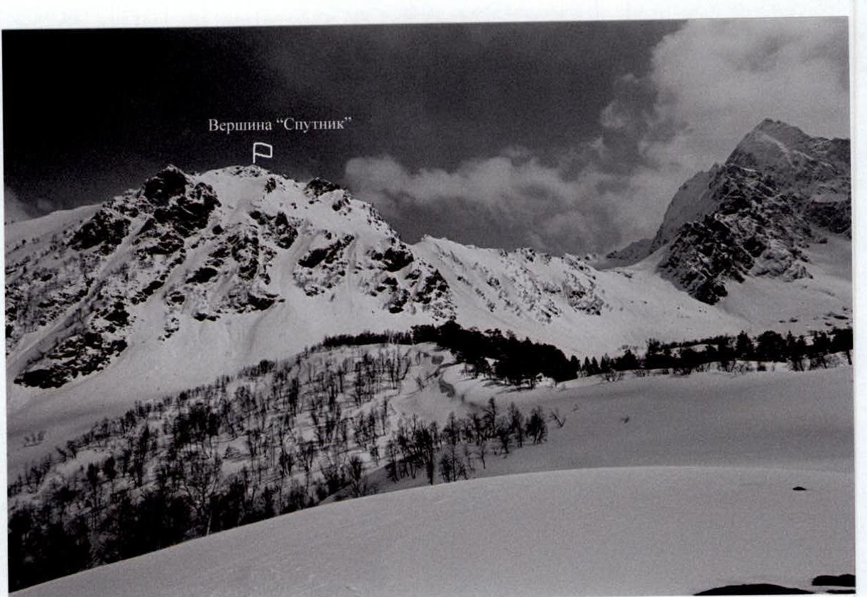
Photo #14 and 15
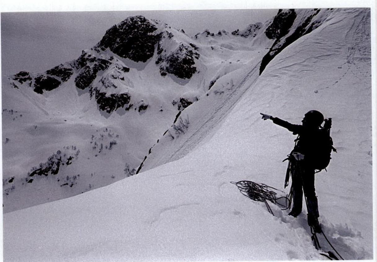
Photo #22 and 23

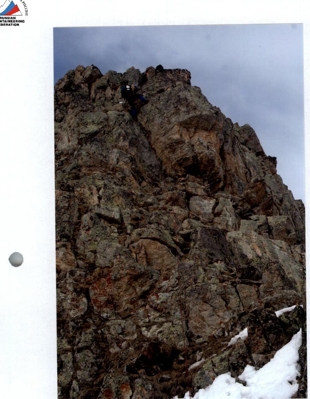
Photo #12 and 13
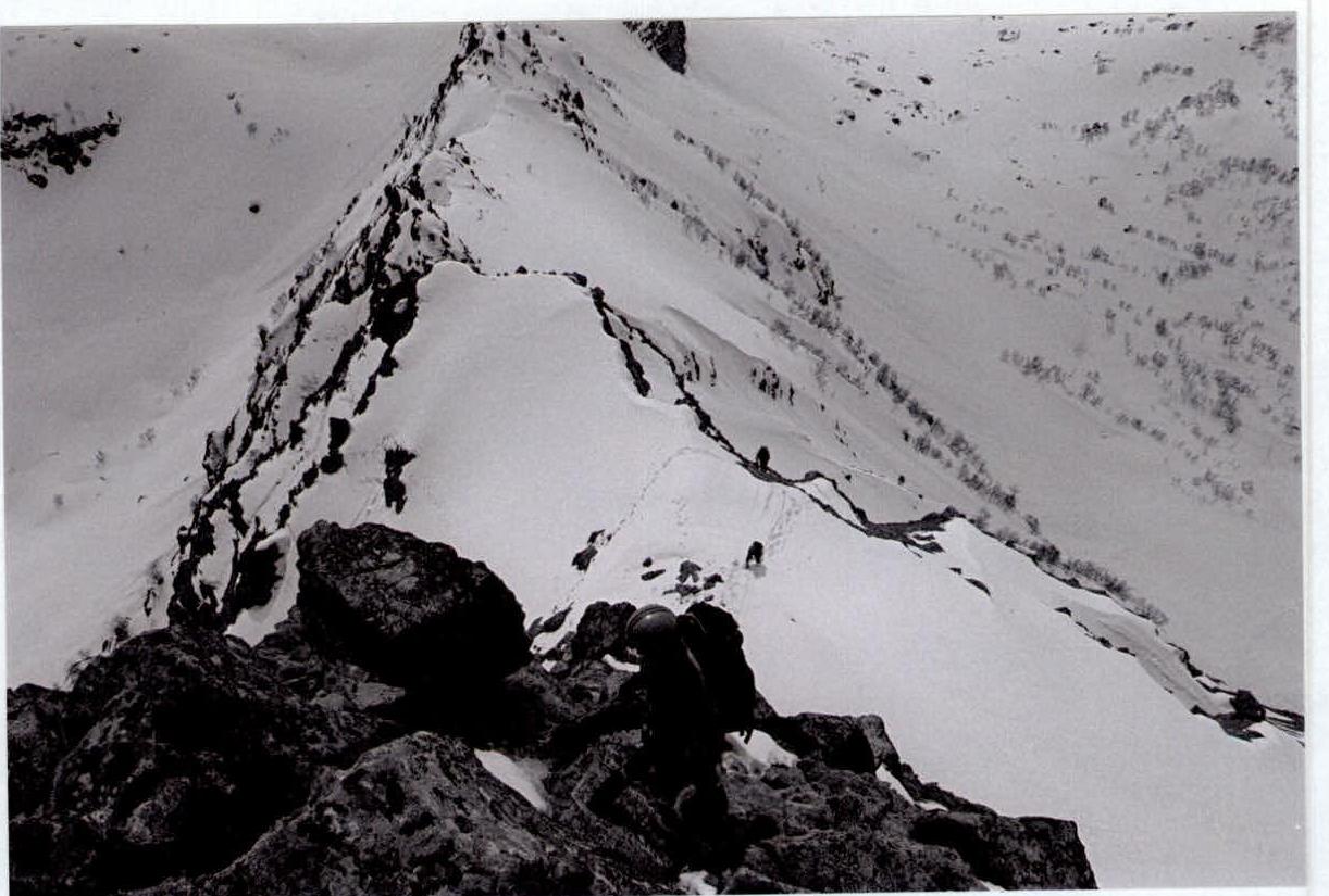
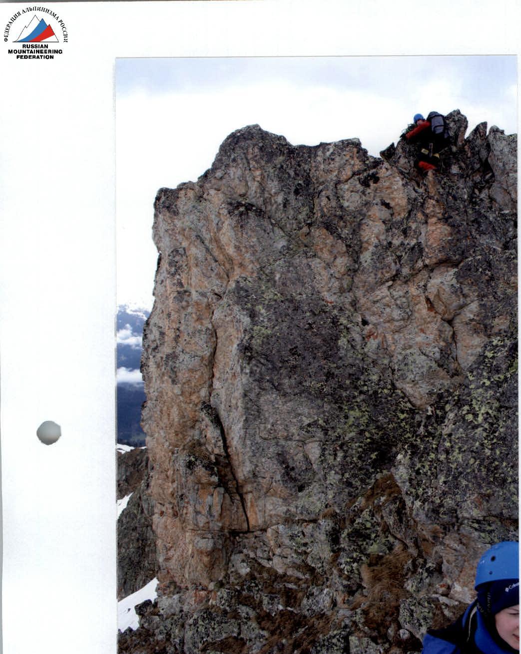
Photo #14 and 15
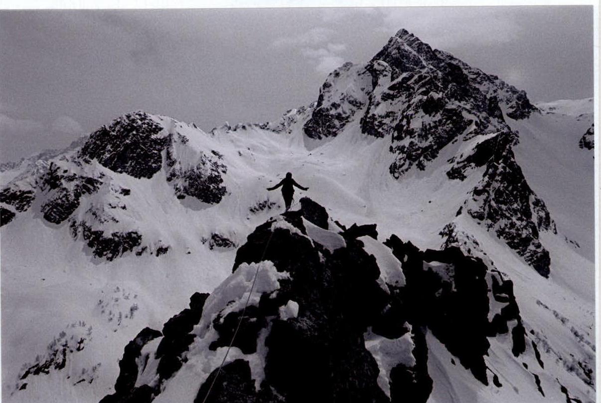
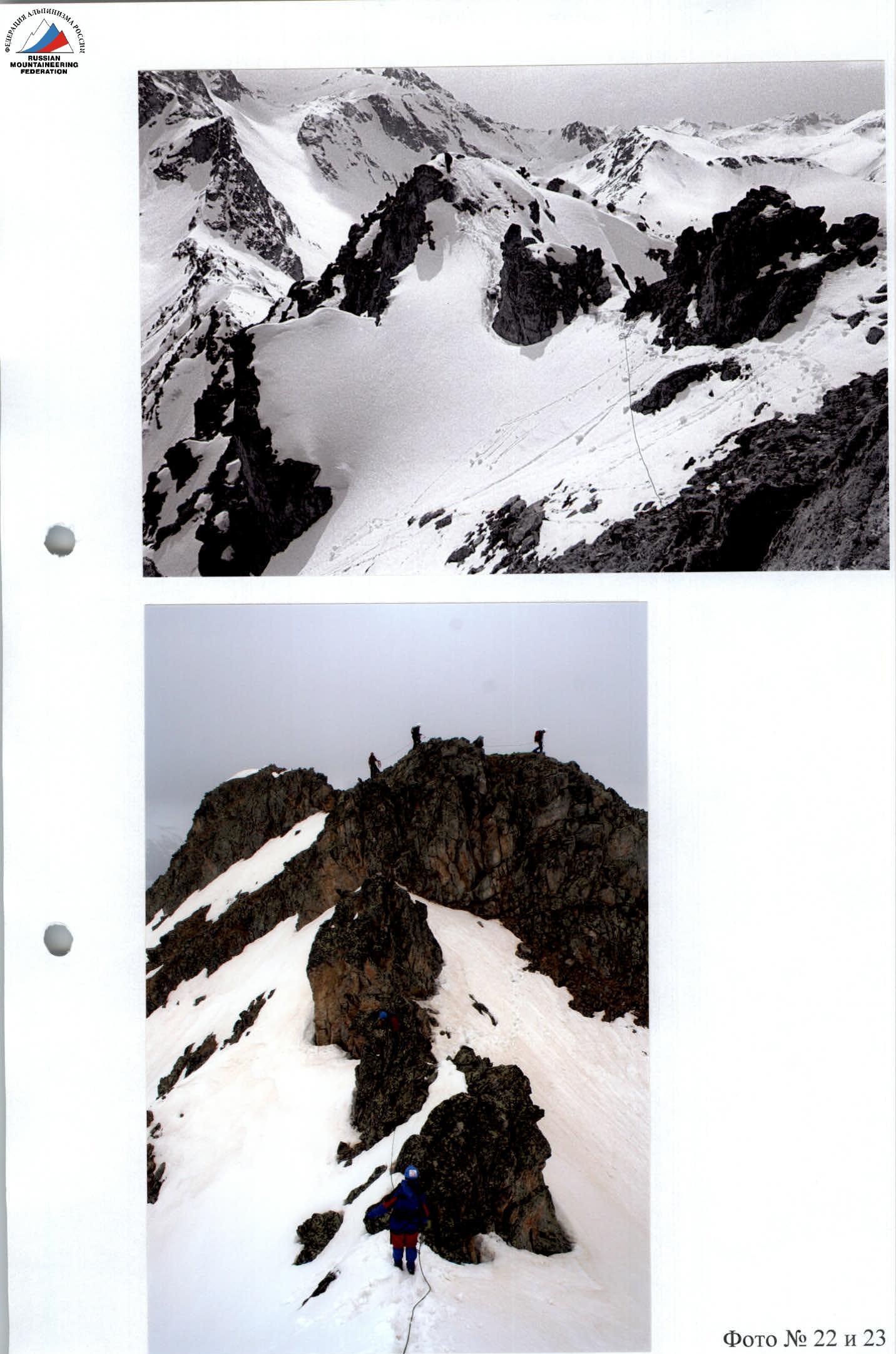
Photo #22 and 23
Comments
Sign in to leave a comment