| CLIMBING GRADE | — rock |
|---|---|
| CLIMBING REGION | — Western Caucasus, Arkhyz, the northern spur of the Sofiysky ridge between the valleys of the Psysh and Sofiya rivers |
| PEAK, ROUTE | — Peshtera (proposed by the first ascenders) via the North-West ridge |
| PROPOSED CATEGORY | — 2A (winter) |
| ROUTE CHARACTERISTIC | — rock and snow, mostly ridge, absolute height difference 500 m |
| PITONS DRIVEN | — 2 (when descending from the NE ridge) |
| MOVING HOURS | — 6 (from the start of the route to the summit) |
| NUMBER OF NIGHTS | — not required on the route |
| CLIMB LEADER | — Zaporozhchenko E.V., Candidate Master of Sports, instructor |
| PARTICIPANTS | Smerchansky V.A. — Climbing probationer |
| Tsybankova L.V. — Climbing probationer | |
| Sokolenko I.N. — Climbing cadet |
TEAM COACH — Master of Sports of the USSR Popov V.P.
DEPARTURE AND RETURN DATES — January 9, 1982
Photo 1. General view from the "Poliana-2000" base camp
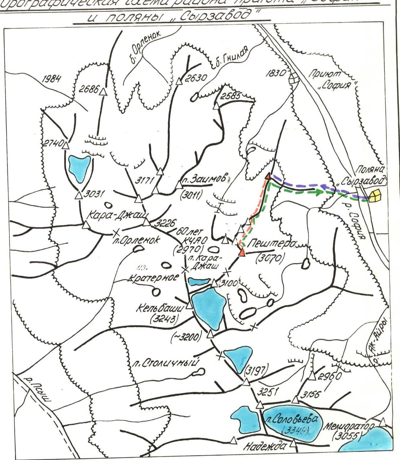
Orographic scheme of the "Sofiya" shelter area and the Syrzavod clearing
Legend
- Base camp
- Path to the start of the route
- Ascent route
- Descent path to the base camp
- Ridges and peaks
- Meliortor (3055) — first ascents 1980–1982
- Glaciers
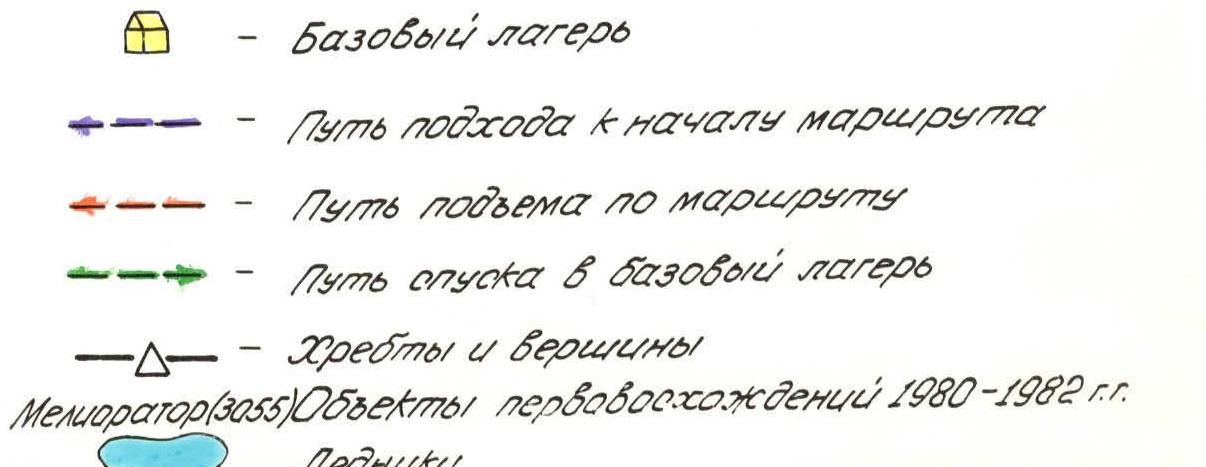
TABLE with the main characteristics of the first ascent route to the summit
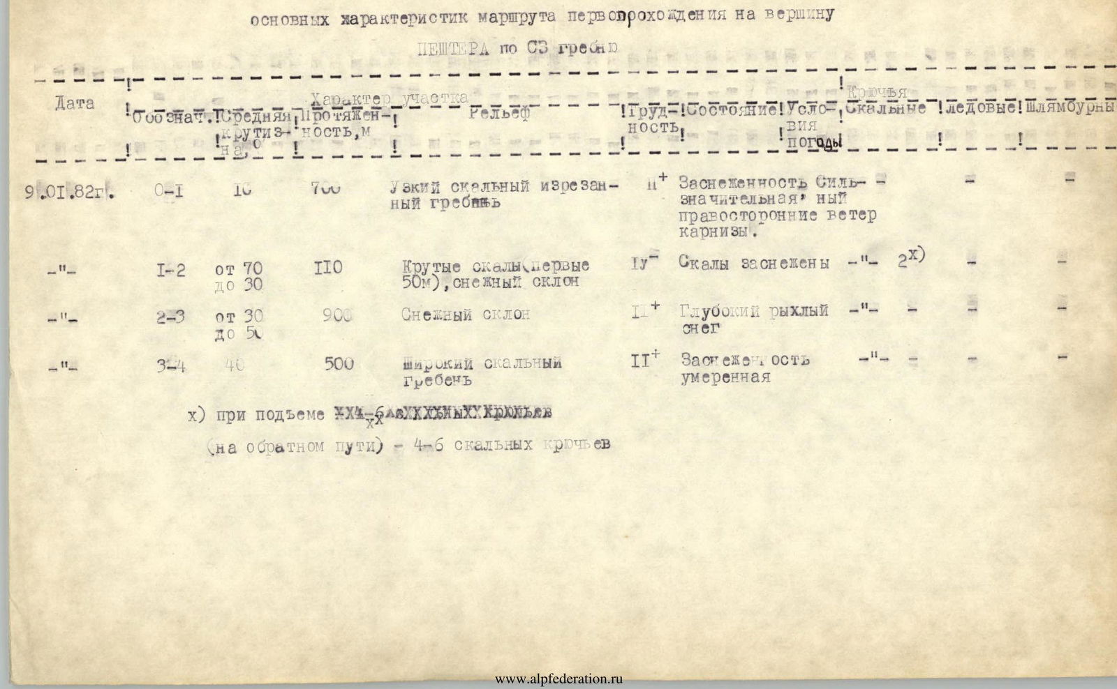
PESHTERA via NW ridge
| Date | Section type | Average slope | Length, m | Terrain | Difficulty | Condition | Weather conditions | Rock pitons | Ice pitons | Bolt pitons |
|---|---|---|---|---|---|---|---|---|---|---|
| January 9, 1982 | R0–R1 | 10° | 700 m | Narrow rocky jagged ridge | 2 | Significant snow cover | Strong right-side wind, cornices | — | — | — |
| — | R1–R2 | from 70° to 30° | 110 m | Steep rocks (first 50 m), snowy slope | 2 | Rocks are snowy | — | 2 | — | — |
| — | R2–R3 | from 30° to 50° | 900 m | Snowy slope | 2 | Deep loose snow | — | — | — | — |
| — | R3–R4 | 40° | 500 m | Wide rocky ridge | 2 | Moderate snow cover | — | — | — | — |
x) when ascending (on the way back) — 4–6 rock pitons