Ascent Passport
- ASCENT TYPE: rock climbing
- ASCENT REGION: Karachay-Cherkess Republic, Arkhyz, upper reaches of the Aman-Auz River
- PEAK, ROUTE: KGO (Caucasian Mountain Society) Peak, 2986 m. Via the Southwest ridge from Tol'yatti Pass
- PROPOSED CATEGORY: 1B, first ascent
- ELEVATION GAIN: 296 m
- total route length — 480 m
- average steepness — 40°
- PITS DRIVEN: 2 chocks
- MOVING TIME: 2 hours (from the pass to the summit)
- OVERNIGHT STAYS: not required on the route (below the pass)
- LEADER: Zaporochenko E.V., Candidate Master of Sports PARTICIPANTS: Uvarov I.A., 1st class Neporozhniy V.V., 1st class Rossoshenko I.V., 2nd class
- COACH: Abduramanov R.U., Master of Sports of the USSR
- DEPARTURE AND RETURN: May 1, 1998
KGO (Caucasian Mountain Society) Peak is marked on all state topographic maps and tourist charts and has an absolute elevation of 2986 m. It crowns the long Amanauzsky ridge branching off to the north from Medvezhiy Pass, where only the peaks 60 Years of VLKSM and Academician Kolesnik have classified routes of 2A–3B category. The Southwest ridge of the peak descends to the rarely visited Tol'yatti Pass (see Map M 1:50000 and Photos 1 and 2).
The approach to the start of the route from the base camp along the Aman-Auz River (at the forest boundary) or above the waterfalls of its left tributaries goes along steep slopes and snowfields under Tol'yatti Pass:
- from Psyshskaya Polyana — ∼6–7 hours
- from the base camp — ∼5 hours
Route Description
To Tol'yatti Pass, along steep 45–50° snow, the last 3 ropes — in three pitches. The pass point elevation is 2690 m (see Sketch).
Section R0–R1 (see UIUA Scheme). Along a narrow snow-covered ridge, in rope teams, simultaneous movement with a 40° ascent to the base of a large gendarme on the ridge (L ∼ 110 m, Photo 3). Then 2 ropes along snow-covered rocks like "ram's foreheads" (graniteoids) with a steepness of ∼ 50° (2) — bypassing the gendarme on the right along narrow ledges and steps, leading to a steep wide couloir that brings you to the ridge.
Section R1–R2. Along a steep wide couloir, 2 ropes up and to the right onto the ridge (handrail for novices) — a key point of the route, 60°, 3.
Section R2–R3. Along a wide snow-covered ridge straight up to the rock gate (∼4 ropes, α = 40° (2)).
Section R3–R4. Along stepped snow-covered rocks slightly to the left of the watershed line — to the summit (∼5 ropes, α = 40–45° (2)).
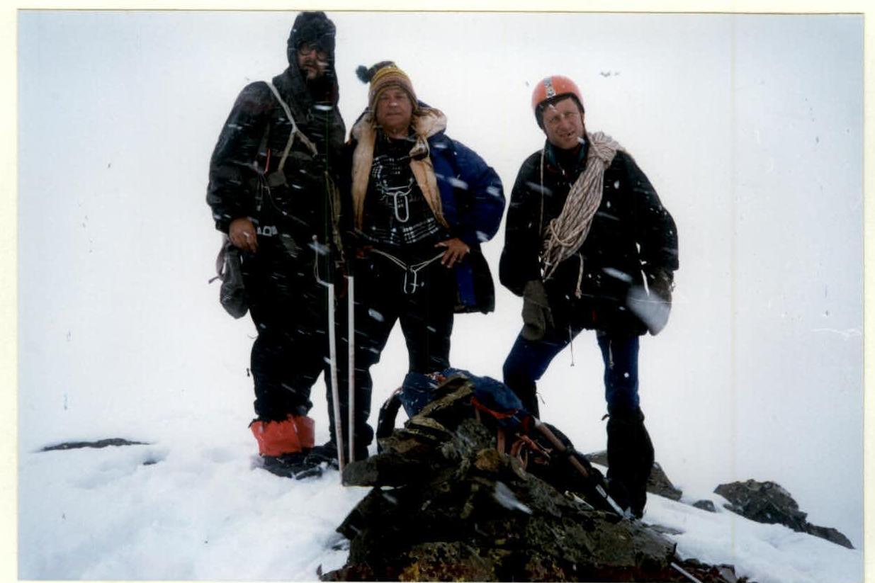
The cairn is built for the first time (Photo 4). The rocks are quite strong (graniteoids).
Descent is via the ascent route.
Description compiled by E. Zaporochenko on May 22, 1998.
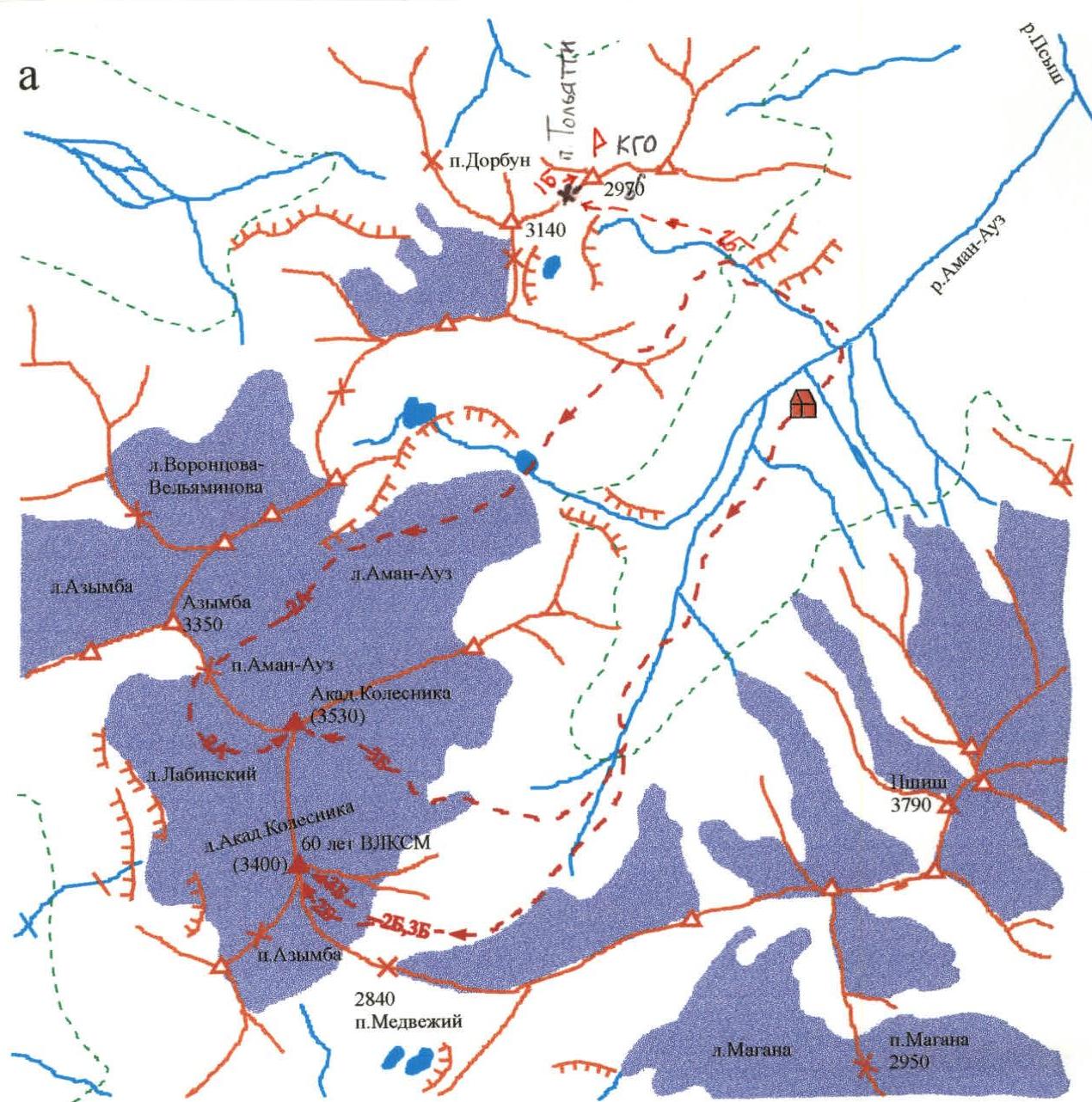
Plan scheme (M 1:50000)
 Fig. Sketch (a) and Scheme (b) of route 45. Scale ∼ 1:4000
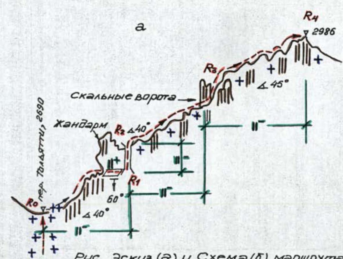
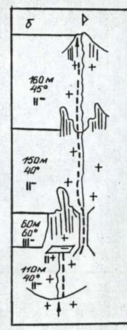 Photo 4. On the summit.
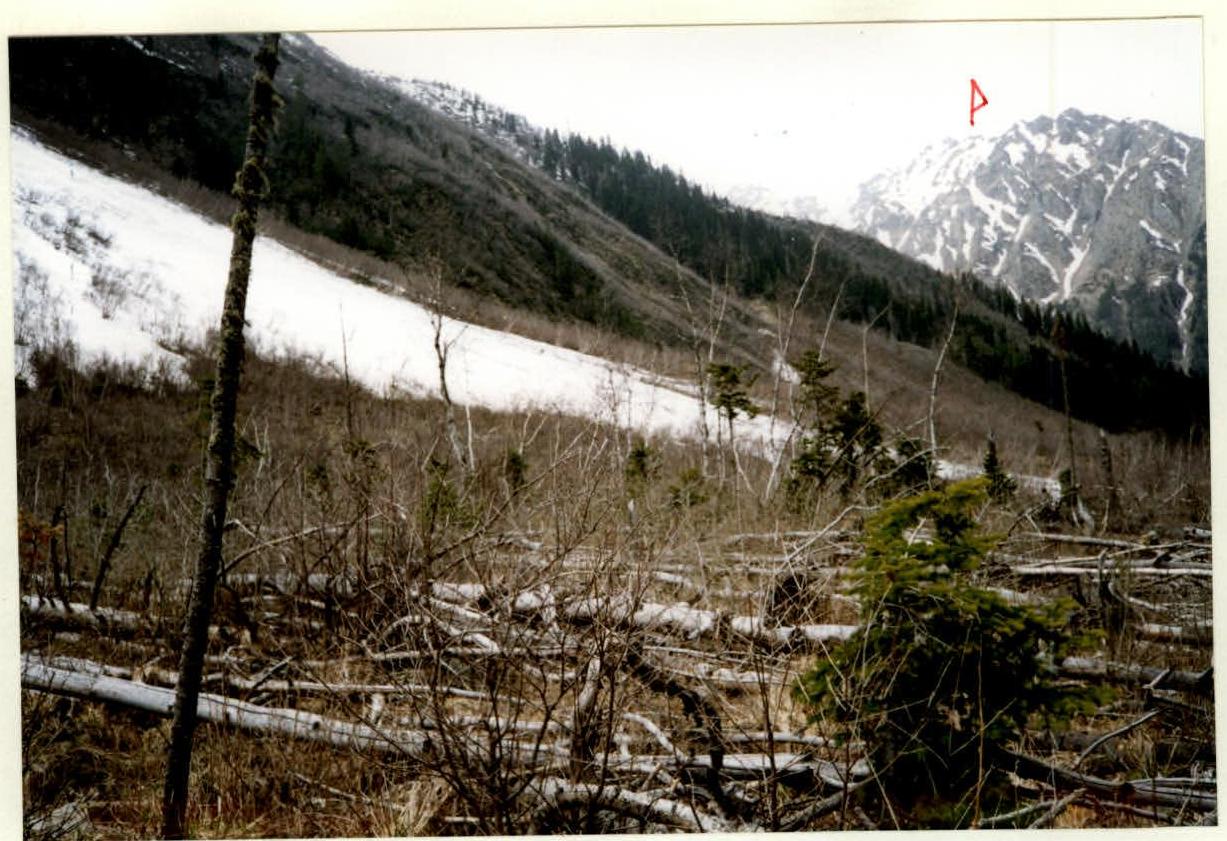
Photo 1. View of KGO Peak from Psyshskaya Polyana.

Photo 2. View of KGO Peak from the slope below Tol'yatti Pass.
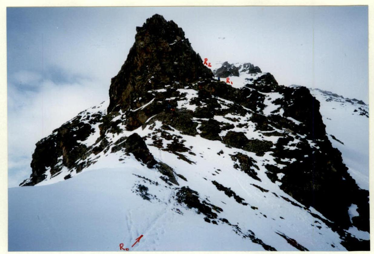
Photo 3. Bypassing the gendarme on the right (R0–R1).