Ascent Passport
- ASCENT TYPE: rock climbing
- ASCENT AREA: Karachay-Cherkessia, Arkhyz, upper reaches of the Aman-Auz River
- PEAK, ROUTE: Dorbun Glavny. 3140 m. Via the South Ridge from Duritsky Pass.
- PROPOSED DIFFICULTY CATEGORY: 2B, first ascent
- ELEVATION GAIN: 320 m
- total route length — 450 m
- average steepness of the route — 50°
- NUMBER OF PITOONS: ≈ 10–12 chocks
- NUMBER OF CLIMBING HOURS: 3 (from the pass to the summit)
- OVERNIGHT STAYS: not required on the route (below the pass)
- LEADER: Zaporozhchenko E.V., Candidate Master of Sports PARTICIPANTS: Uvarov I.A., 1st sports category Neporozhny V.V., 1st sports category Rossoshenko I.V., 2nd sports category
- COACH: Abduramanov R.U., Master of Sports of the USSR
- DEPARTURE TO THE ROUTE AND RETURN: May 3, 1998
The Dorbun Glavny peak is marked on all state topographic maps and tourist plans and has an absolute elevation of 3140 m. It is located at the northeastern end of the Amanauz ridge, between Duritsky, Dorbun, and Tolyatti passes, being a nodal point for three ridges that extend south (to Duritsky Pass), northwest (to Dorbun Pass), and northeast (to Tolyatti Pass, via Dorbun East). The South Ridge is composed of fairly solid granitoid rocks, narrow, and steeply dropping to the west (Dorbun Glacier) and east (see Plan Scheme M 1:50 000). The nearest classified routes — to the peaks 60 let VLKSM and Academician Kolesnik (first ascents in 1978) have a difficulty of 2A and 3B.
The approach to the start of the route from the base camp along the Aman-Auz River (at the forest boundary or above the waterfalls of its left tributaries) goes up steep slopes and snowfields to a stepped drop above the lake and further — to Duritsky Pass (from Psyshskaya Polyana ≈ 6–7 hours, from the base camp ≈ 5 hours).
Route Description
2–3 ropes to the pass — up steep snow in three pitches. The choice of the exit point to the pass ridge depends on the avalanche situation:
- closer to the snowy ascent to the peak Gorda (Photo 1)
- under the rocks of the South Ridge of the peak Dorbun Glavny (Photo 2)
The pass has an absolute elevation of ≈ 2820 m (see Sketch). Section R0–R1 (see UIIA Scheme). From the pass point, 30 m up the snow to the base of the ridge. Bypass the first rocks on the right through the snow and through a 3-meter wall up to the ridge. Along the undestroyed rocks of the sharp ridge "on top" or holding "in expansion" to the rocks on the left side through small dips to the main gendarme, overcome "head-on". α ≈ 55°, H ≈ 130 m. Difficulty category 3. 4–5 chocks.
Section R1–R2. Descent from the gendarme down a slab α ≈ 60° ≈ 20 m by free climbing and straight up, holding to the widened ridge on the left along the walls (Photo 3) and shelves (Photo 4) up to the right, and then — a narrow ridge to the base of the "white" monolithic gendarme (granite) 6–7 m high, clearly visible against the sky (Photo 5). α ≈ 45–50°, H ≈ 130 m, difficulty category 3. Many convenient ledges for belays, cracks, and crevices for chocks (4–5 pieces).
Section R2–R3. Narrow inclined shelves and low walls (2–3 m), under the base of the "white" rock — to a wall with a wide crevice (2–3 m), descending from the summit shoulder, α ≈ 30°, H ≈ 30 m. Difficulty category 3.
Section R3–R4. On the left side of the crevice with a steepness of 75–80° (there are loose rocks) ≈ 30 m to the summit shoulder. The most difficult part of the route (Photo 6). Difficulty category 4. 2–3 chocks.
Section R4–R5. To the left, with a slight ascent of about 20 m along a not very wide ridge to the summit point (Photo 7). α ≈ 25°, difficulty category 2. Cairn is built for the first time.
Descent — via the ascent route (from the shoulder — 25–30 m rappel).
Description and Photos  E. Zaporozhchenko, Pyatigorsk, May 29, 1998
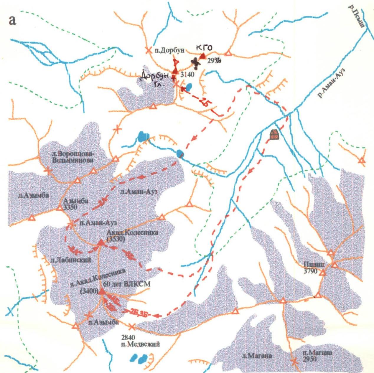
Plan Scheme (M ≈ 1:50 000) 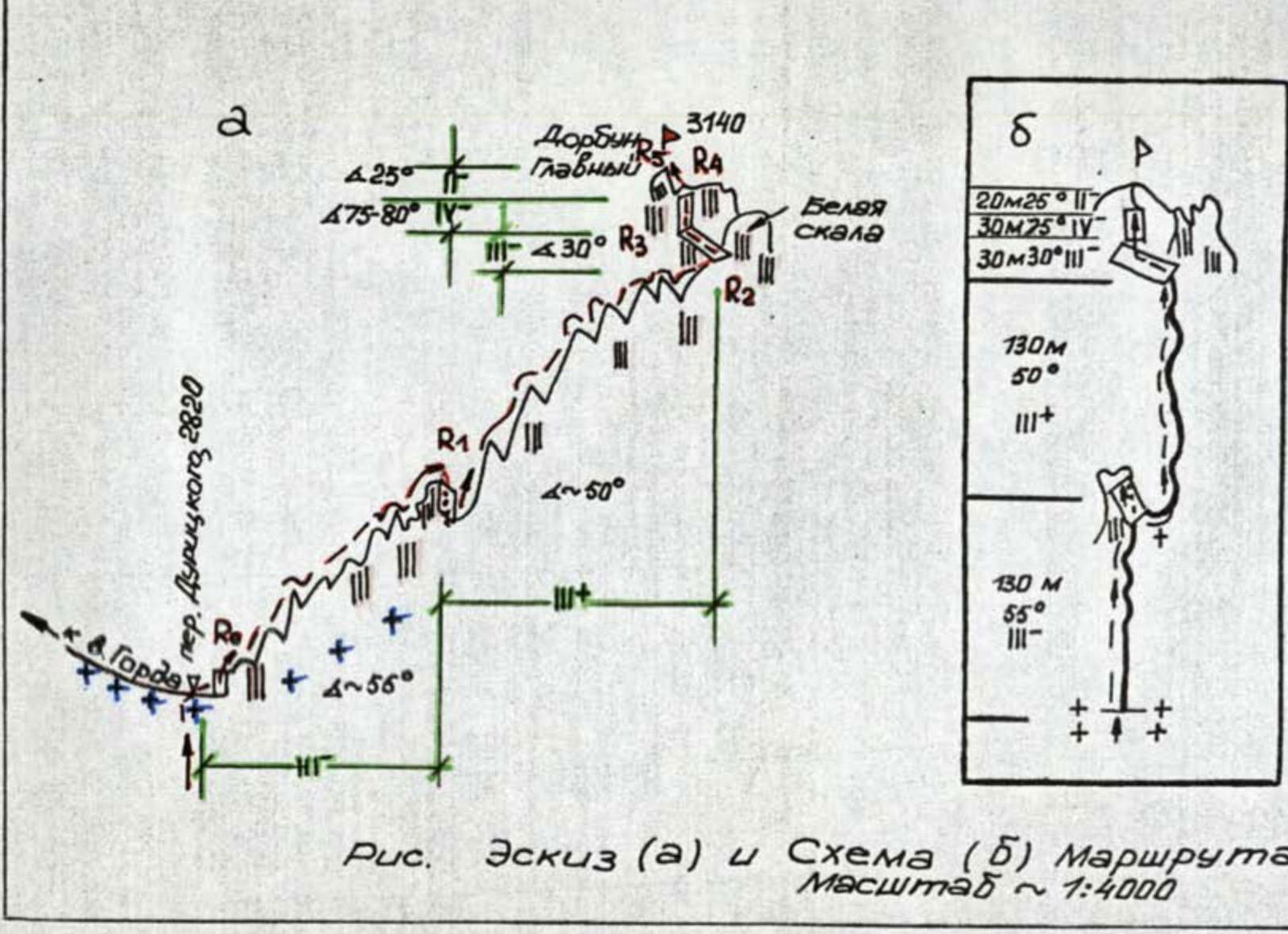
Fig. Sketch (a) and Scheme (b) of route #48. Scale ≈ 1:4000 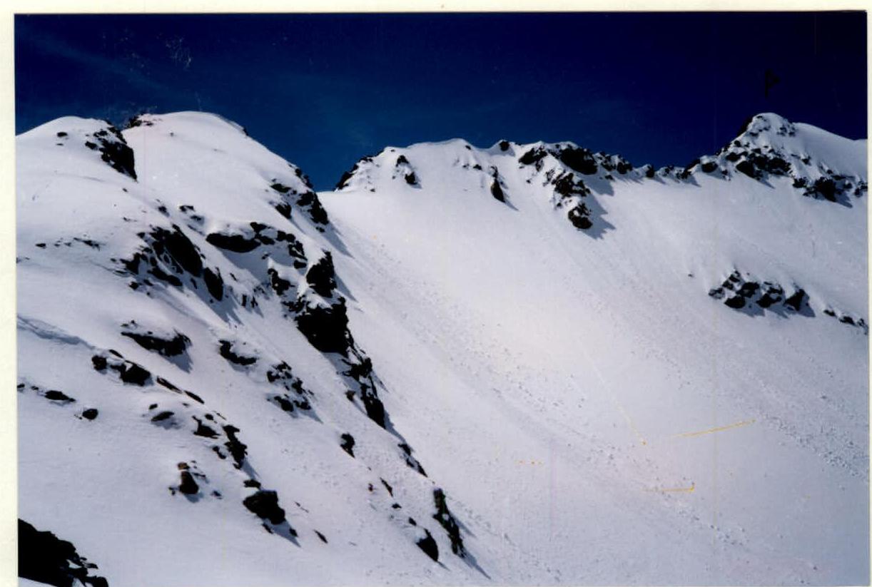
Photo 1. View of the eastern and northern ridges of peak Gorda from Duritsky Pass 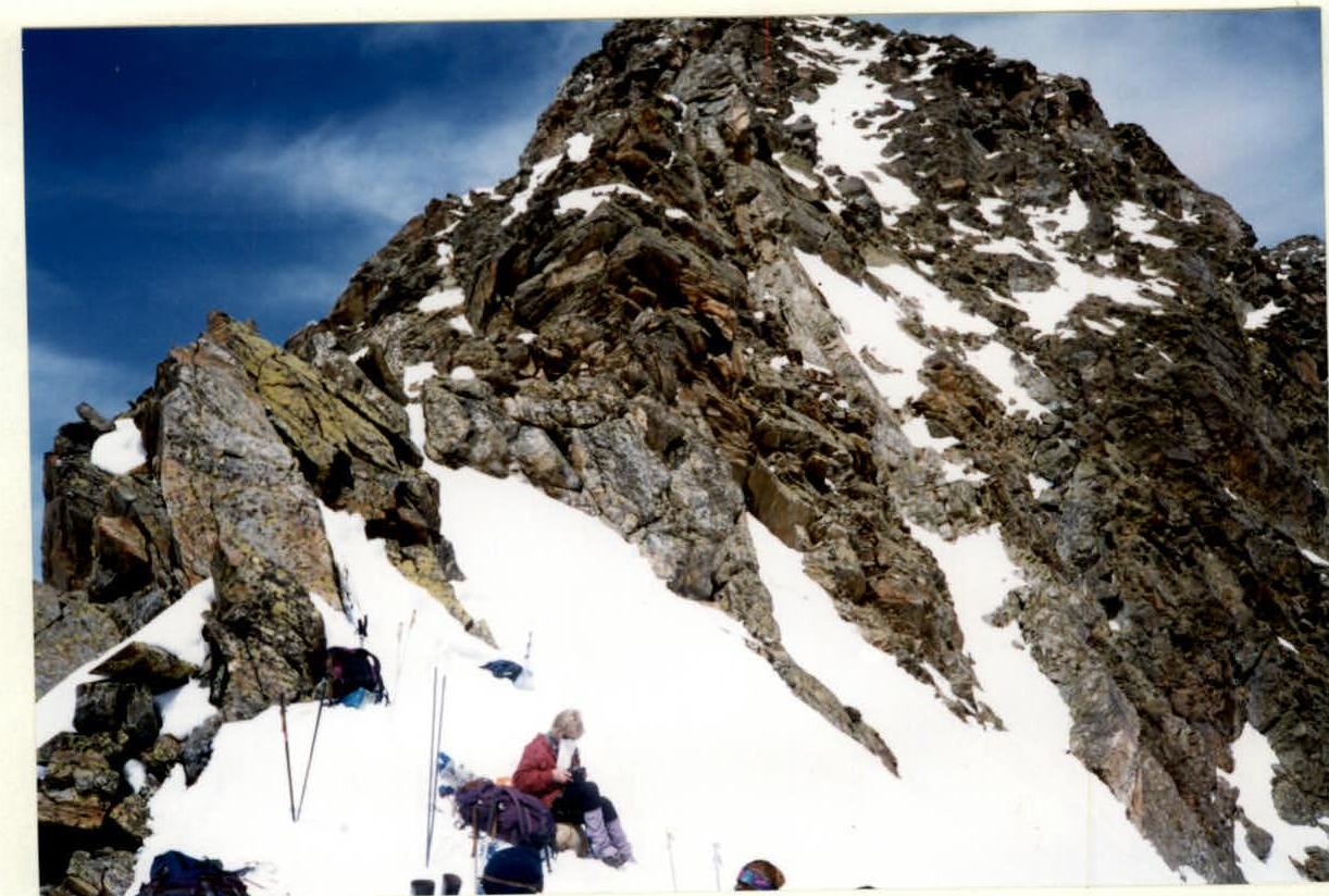
Photo 2. View of the lower part of the South Ridge of peak Dorbun Glavny from Duritsky Pass 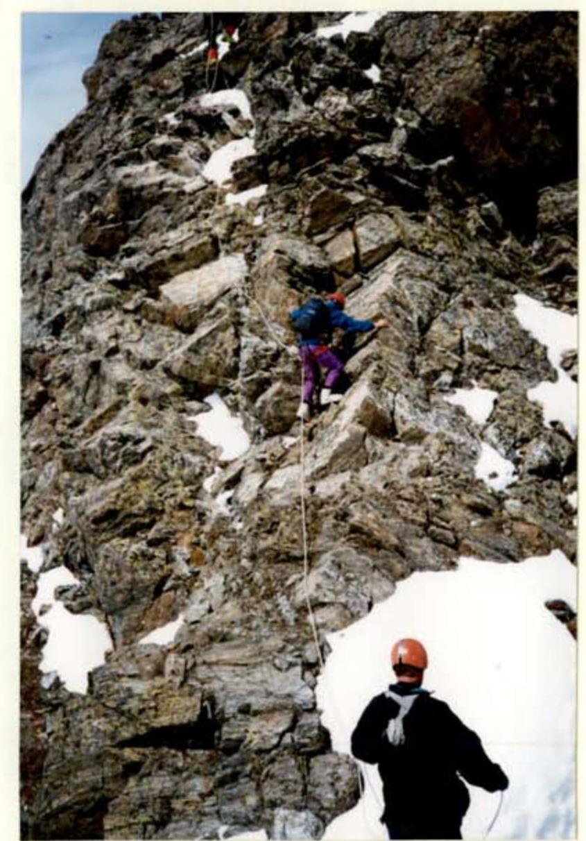
Photo 3. Ascent along the ridge after 20 m descent from the slab to the snow cushion (start of R1–R2) 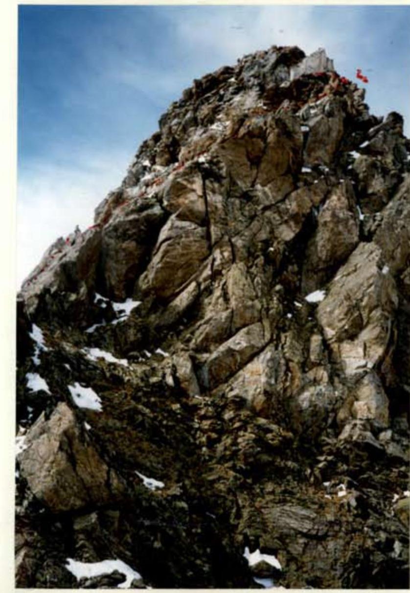
Photo 4. Second half of section R1–R2 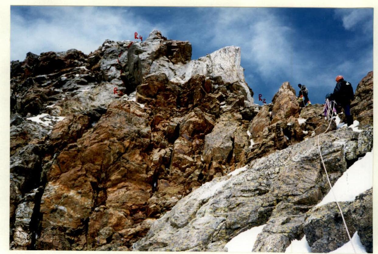
Photo 5. Sections R2–R3 and R3–R4 
Photo 6. On the wall — the crevice of section R3–R4