Mshatka-Kaya — 17. “Iron Path”
Massif: Mshatka-Kaya (618 m) Complexity: VI A3 Length: 215 m Route description The route goes through the right part of the wall, crossing the right edge of the triangle. Climbed in winter, on snowy rocks. At a temperature below −5 °C. Not repeated.
The approach to the route coincides with the approach to the “Triangle on the right”. From the old Yalta road, 200 m to the right of the fork to Baydarskie Vorota, a path leads to the wall.
On the path, then on the talus, general direction left — up, approach the lower rock belt.
Through the inner corner with trees (10 m II) exit to gentle rocks.
Further:
- up to the right, to an inclined shelf with trees;
- further under the wall along wooded shelves to the right upwards.
The beginning — from a group of trees, along a cleft.
R0–R1: 40 m
- Up the cleft in the direction of two trees
- From them to the left to a cleft, and up the cleft
Station on a bolt. (20 m III; 20 m VA2)
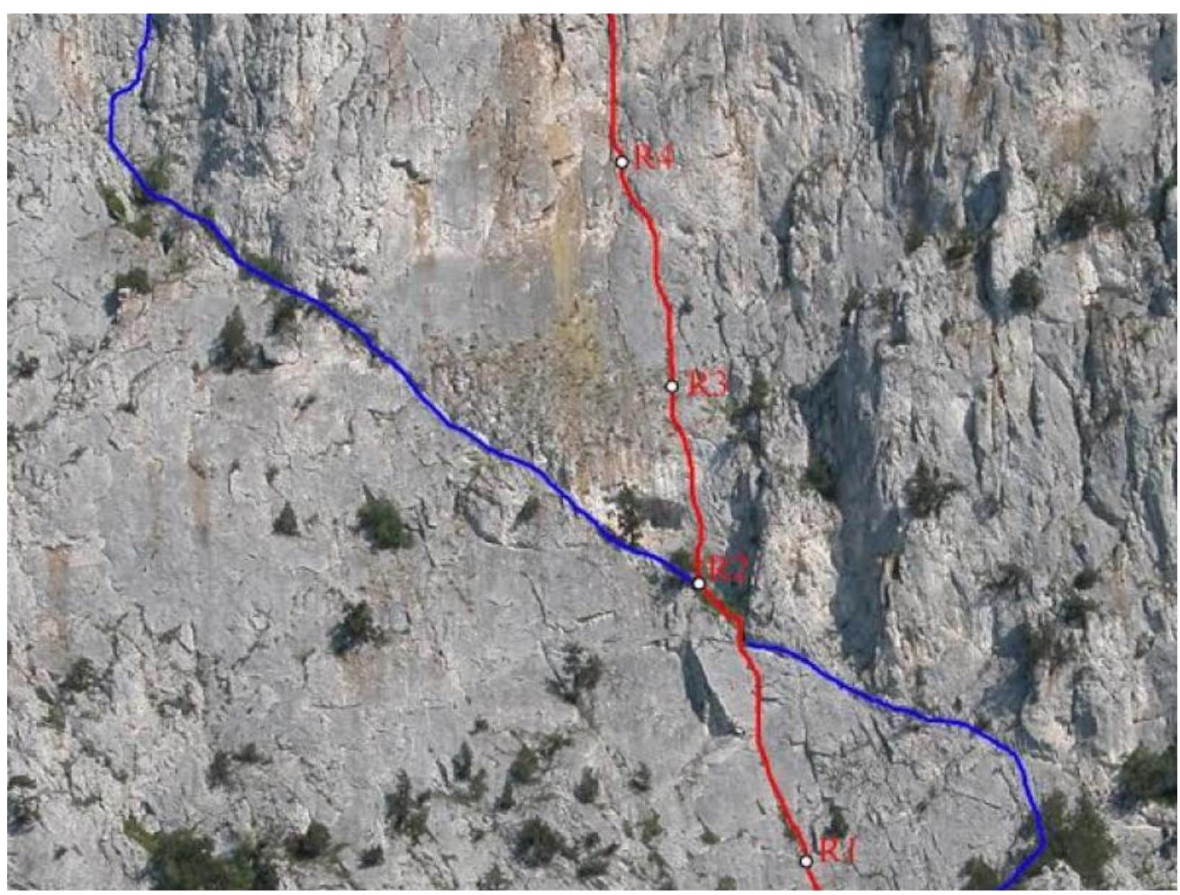
R1–R2: 50 m
- Along the cleft, the cleft gradually becomes steeper
- Exit to a shelf
- From the shelf along destroyed rocks to a “hollow” with trees
Station on a tree. (10 m IV–V; 30 m VIA2; 10 m III)
R2–R4: 35 m. From the station up, through a system of blind clefts and cavities. Station on a ledge. There is a bolt. (VA2/A3)
R3–R4: 45 m. Up, along a grassy cleft under a destroyed overhang, from under the overhang to the left upwards. Station on a bolt and pitons. (VIA3)
R4–R5: 45 m. From the station to the left to a cleft, further along the cleft, then along the inner corner, exit to a couloir. Along the couloir to the yayla. (35 m VA2; 10 m II)
The route requires a large number of pitons and anchors.