Author: Yura Kryglov, Sevastopol "Madera Krymskaya" (380 m, 5B, F6b+, E3, A2) — a new route on Merdven-Kayasy. No bolts
On Sunday, May 17, we completed a new line on Merdven-Kayasy (10 minutes walk along the upper road to the east from Chertova Lestnitsa). The route is called "Madera Krymskaya".
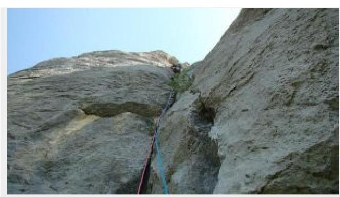
Yura Kruglov is climbing the second rope of the route. The second rope is a song.
It was because of this drink that, after finding myself in the company of stitched abstainers on Saturday evening and unnoticedly drinking it alone, I had to deviate from the pre-planned line of the intended route the next day in its upper part. But even as it turned out, the "Madera" route more than justified my expectations.
Approaching the route, history of the place, descent, and our recommendations
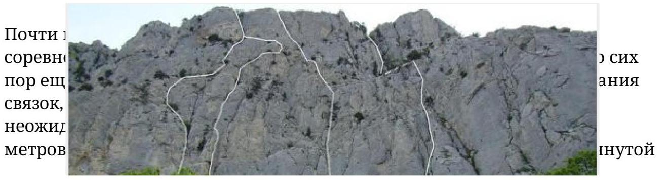
The lower part of Merdven-Kayasy wall was a popular training spot for rock climbers back when the upper road wasn't yet called upper. Buses on the Sevastopol-Yalta route would speed by on it. It's hard to imagine now...
Among rock climbers, the lower part of the wall was known as "Khergiani Rock". The approach from the upper road to the foot of the wall takes a few minutes. But you can shorten even these few minutes by driving a car on a dirt road that branches off the asphalt towards the wall. The road leads to a clearing with an excellent camping spot. It takes less than a minute of slow walking from the campsite to the start of the routes.
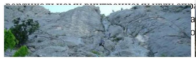
 The wire is still hanging horizontally for a hundred meters. One of the huge pines to which the via ferrata was attached has dried out and fallen but remains hanging on this wire at a height of 150 m, reminding of the rock's rich past. This can be seen in detail from the R3 point of the "Madera Krymskaya" route, which is 5 m to the right.
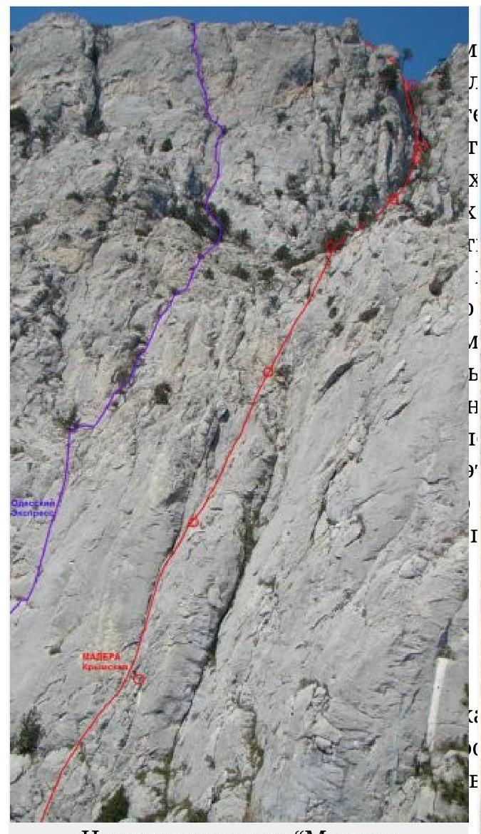
The thread of the "Madera Krymskaya" route. It was this drink that prevented me from climbing the upper part as I initially wanted. I promise to finish it as I wanted :-)
R2–R3: 50 m. Up 30 m through the right crack, then it becomes easier. Then it's simpler.
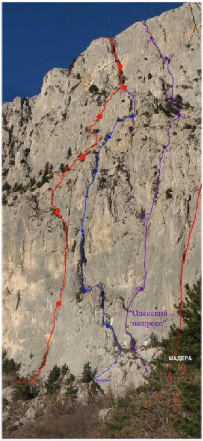
The first rope of the route. From below, it all seemed simpler. Blame the градус (alcohol content). It's not comfortable at all; you need to climb and protect yourself with a hook) and then climb 15 m up and to the right to the end of the corner and then 30 m up to a large tree on the top of the lower bastion along easier rocks.
R4–R5: From the tree, 10 m on foot along an inclined shelf to the start of the second bastion. Then 60 m up and to the right (2nd category of difficulty) towards a large couloir.
R5–R6: 40 m, F5a–F5c. 10 m up a vertical crack, enter the couloir, and then 30 m up the right side of the couloir. Belay point on a tree.
R6–R7: 30 m. Simple climbing up the couloir is greatly complicated by vegetation (!). Exit to a crack — an overhanging grotto that locks the couloir. Belay point on a shelf at the base of the overhanging grotto.
R7–R8: 50 m. First, 15 m up a vertical crack in the left wall of the couloir — to bypass the overhanging grotto (F6b climbing, and A2 artificial aids). Then continue climbing along easier rocks and after 35 m reach the yayla.
A good, long Crimean "5B" route. If we had climbed the upper part as initially planned, it would have been "6B". We managed without bolts. Standard equipment is necessary:
- friends from small to large (Camalot #4)
- small-medium stoppers
Without anchor hooks, organizing intermediate belay points in some numerous places will become much more complicated.

Base camp under the wall, a minute's walk from the start of the route. You can not only drive here but also camp on an excellent site inherited from our ancestors.
The route reconnaissance is done. The easiest part remains — to climb it — :-).