Kilse-Burun — 4
Via the center of the fourth counterfort of the western part of the massif (Three Pines), 2B
This route name was chosen by the first ascenders, apparently, because its main part passes through three groups of pines, or maybe they got lost on this simple route — as if between three
pines.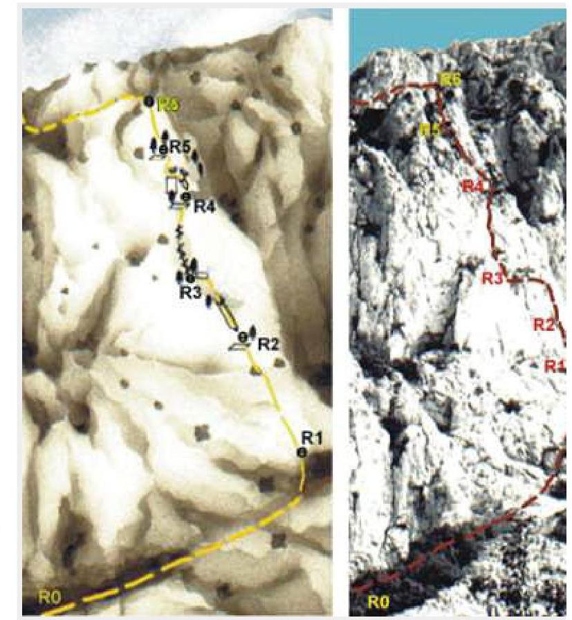
The approach to the route starts at the same place as route №3, 50 m east of the "36–18" pillar of the old highway. First along the trail, and then simple rocks 100 m up and left to a long sloping terrace. Along it 150 m to the right to the base of the fourth counterfort.
On sections R0–R1 and R1–R2, 80 m up simple rocks in the central part of the counterfort to a large shelf with a spreading oak tree.
List:
- R0–R1: 40 m, 50°, I
- R1–R2: 40 m, 60°, I
On section R2–R3 — 40 m up a long steep gully to a group of pines. This is the most difficult section of the route (R2–R3: 40 m, 70°, III).
On section R3–R4 — 20 m up and to the right to a 10-meter wall with an overhanging part (R3–R4: 20 m, 65°, II).
On section R4–R5 — first a 5 m ascent up a sheer inner corner, and then an awkward traverse to the left, bypassing the overhang, and further up (R4–R5: 15 m, 70°, III).
On section R5–R6 — up rocks of medium difficulty to the shoulder of the counterfort. Here the main part of the route ends (R5–R6: 40 m, 60°, II).
From the shoulder, exit to the terrace (section R6–yayla), and further up and left along a gentle gully to the exit to the summit plateau (R6–yayla: 200 m, 45°, no snow/ice). The length of the main part of the route is 200 m. The ascent takes 1–2 hours.