
REPORT First ascent via the second buttress of the western wall of the northern spur of Mt. Aikuayvenchorr (Eastern) (858 m), VMF cirque route "Radist", category 2B difficulty Aikuayvenchorr ridge, Khibiny August 27, 2020 (first ascent)
Leader: Petrova A.M. Coach: Kiselev D.M. Murmansk
I. Climbing Report
| 1. General Information | ||
|---|---|---|
| 1.1 | Full name, sports category of the leader | Petrova Alena Mikhailovna, 2nd sports category |
| 1.2 | Full name, sports category of participants | Shcherbakov Alexander Vladimirovich, 2nd sports category |
| 1.3 | Full name of coach | Kiselev Dmitry Mikhailovich, CMS |
| 1.4 | Organization | |
| 2. Characteristics of the Climbing Object | ||
| 2.1 | Region | Khibiny |
| 2.2 | Valley | VMF cirques |
| 2.3 | Section number according to the 2013 classification table | |
| 2.4 | Name and height of the peak | Aikuayvenchorr |
| 2.5 | Geographical coordinates of the peak (latitude/longitude), GPS coordinates | N67° 36′ E33° 46′ |
| 3. Route Characteristics | ||
| 3.1 | Route name | "Radist" |
| 3.2 | Proposed difficulty category | 2B |
| 3.3 | Degree of route exploration | First ascent |
| 3.4 | Terrain characteristics of the route | Summer — rocky, winter — combined |
| 3.5 | Elevation gain of the route (altimeter or GPS data) | 575 |
| 3.6 | Route length (in meters) | 850 |
| 3.7 | Technical elements of the route (total length of sections with different difficulty categories, indicating terrain type (ice-snow, rocky)) | I cat. diff. (rocky) – 110 m II cat. diff. (rocky) – 200 m III cat. diff. (rocky) – 35 m IV cat. diff. (ice/rock/combination) – m V cat. diff. (ice/rock/combination) – m VI cat. diff. (ice/rock/combination) – m Rock VI, A3 – m Rock VI, A4 – m |
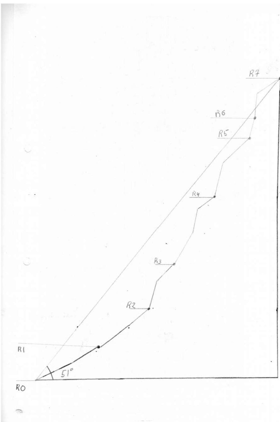
| 3.8 | Average slope of the route, (°) | 51° |
| 3.9 | Average slope of the main part of the route, (°) | 55.4° |
| 3.10 | Descent from the summit | Down category 0 difficulty into the VMF cirque. In winter, descent is possible along the cable car line of the southern ski slope. |
| 3.11 | Additional route characteristics | See below. |
| 4. Characteristics of Team Actions | ||
| 4.1 | Time of movement (team's working hours, in hours and days) | 4 hours — main part, 9 hours — total time |
| 4.2 | Overnight stays | Any part of the cirque |
| 4.3 | Time spent on route preparation | hours, days |
| 4.4 | Start of the route | 9:00, August 27, 2020 |
| 4.5 | Reaching the summit | 13:00, August 27, 2020 |
| 4.6 | Return to the base camp | 15:00 |
| 5. Weather Conditions | ||
| 5.1 | Temperature, °C | +12 °C |
| 5.2 | Wind speed, m/s | 5 m/s |
| 5.3 | Precipitation | No |
| 5.4 | Visibility, m | - |
| 6. Responsible for the Report | ||
| 6.1 | Full name, e-mail | Shcherbakov A.V. tahtar1054@mail.ru |
II. Climbing Description
1. Characteristics of the Climbing Object
1.1. Map-Scheme of the Area
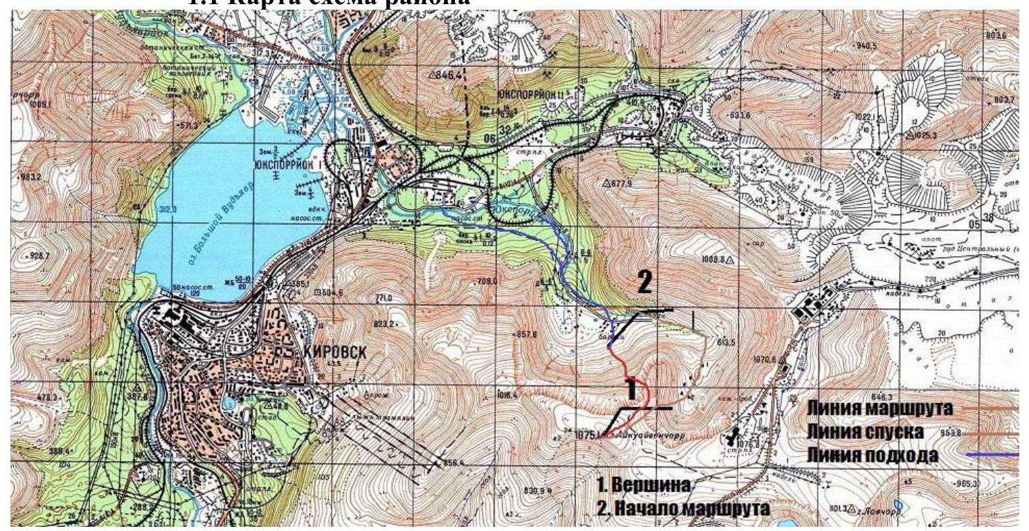
The route is located in the Khibiny mountain range, in its SW part. The nearest settlement is Kirovsk. The base camp is conditionally considered to be Kirovsk or any residential object (tourist base, hotel) in the administrative district of Kirovsk. The travel time by car to the start of the approach is 10–20 minutes. Then, on foot, 40–50 minutes to the VMF cirques to the start of the route. The approach is made along an old dirt road from the railway tracks. Move into the cirque and cross the river at any convenient place and continue towards the northern wall of Mt. Aikuayvenchorr.
1.2. Panorama of the Area
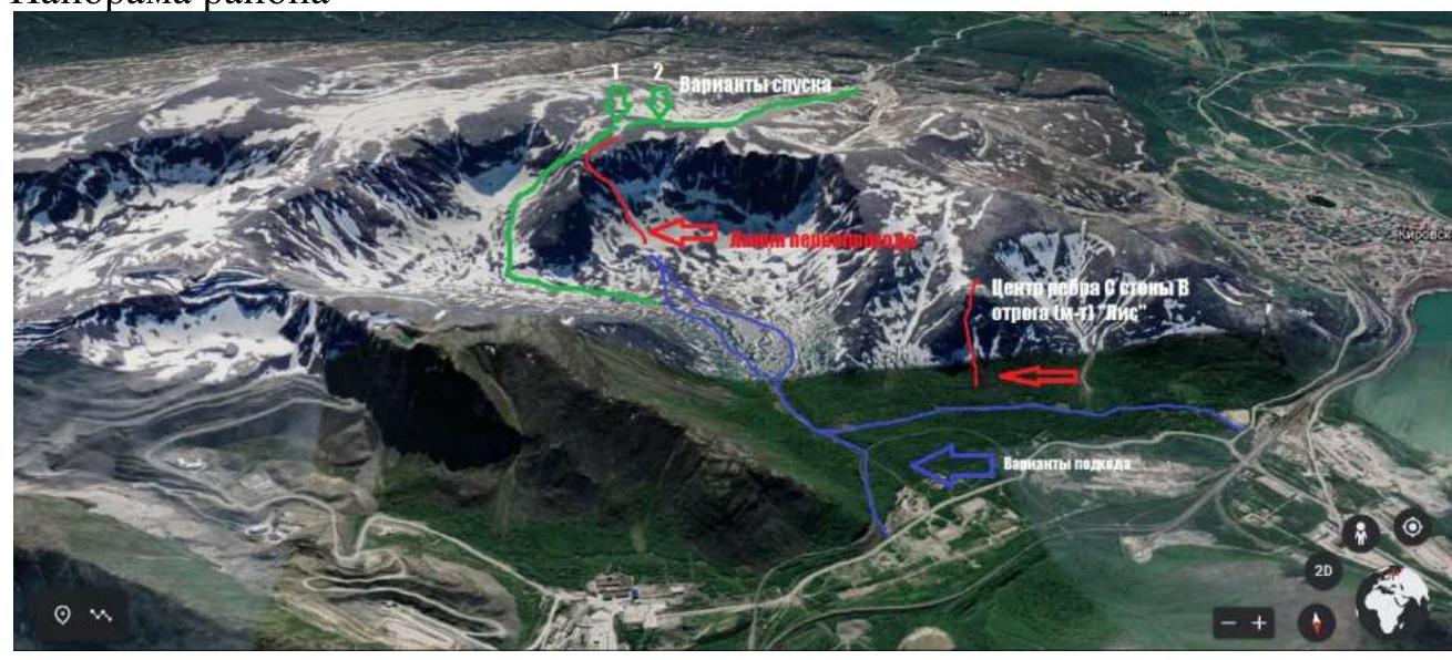
The nearest route "center. edge of the S wall of the W spur (route 'Lis')" is indicated on the panorama. Descent options are also indicated.
- Option 2 is recommended for winter and unfavorable avalanche conditions.
- Option 1 is convenient for summer.
- In winter and spring, the descent may be rockfall-prone.
- Approach options are equally convenient in winter and summer.
- Snowshoes or skis are recommended in winter.
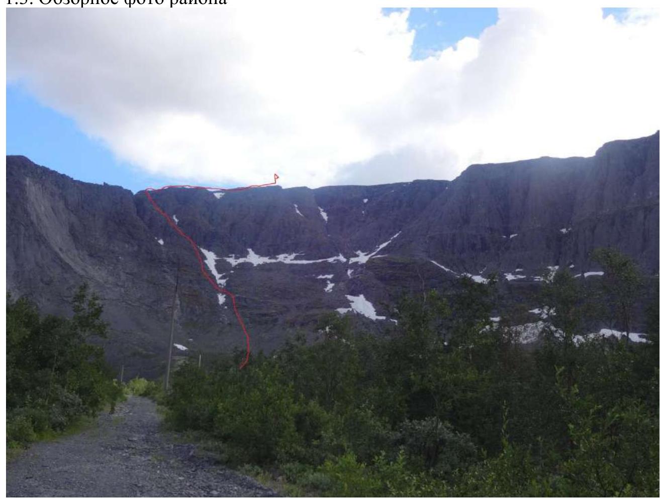
1.3. Overview Photo of the Area
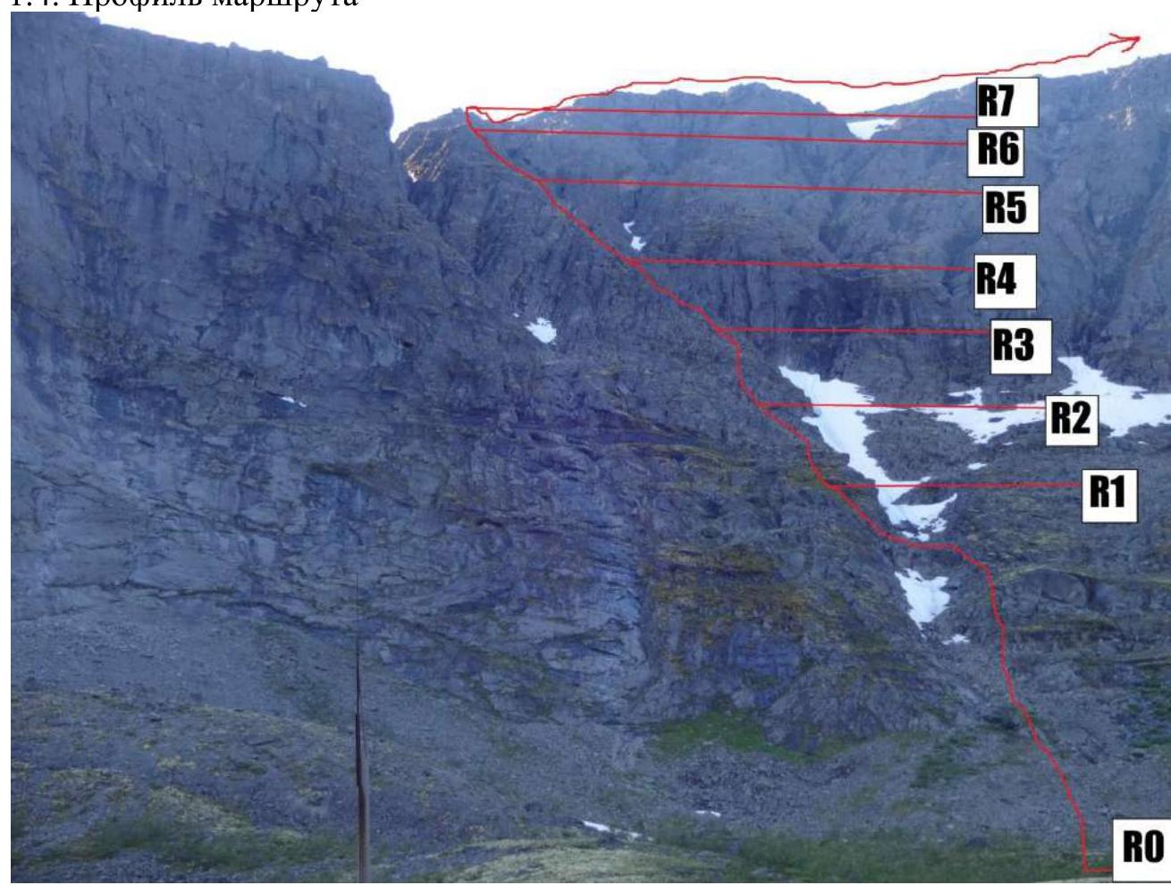
1.4. Route Profile
2. Route Characteristics
| Section # | Notes on movement and belay options | Description of the section | UIAA symbol representation | Section difficulty | Section length, m | Slope, ° |
|---|---|---|---|---|---|---|
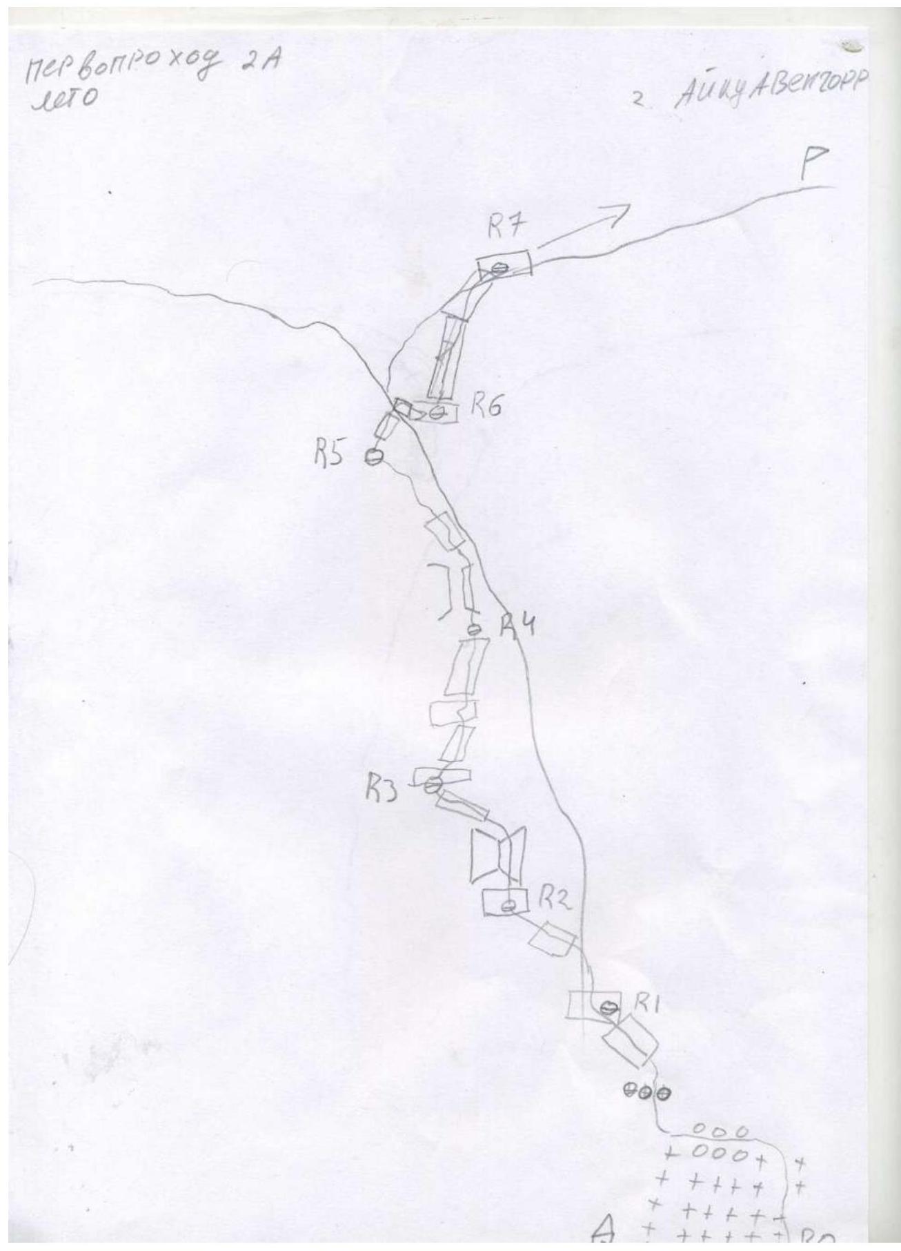
| R6–R7 | 2 loops, 4 nuts | From the saddle, slightly to the right upwards, along a vertical plate along a crack. Then exit onto an inclined plate. At the top, there is a drilled station on bolts and plenty of relief for organizing a station. Then exit onto the plateau and path to the summit. |  | II–III | 10 m | 45–85° |
| R5–R6 | 1 loop, 1 nut | Climb up the inclined wall and descend into the saddle and organize a station. There is a convenient place. |  | III | 10 m | 75° |
| R4–R5 | 1 nut, 1 loop. Simultaneous belay in the second part | Climb to the right of the chimney, exit onto a 15 m, 80°, III cat. diff. ledge, then along the ridge to the saddle 100 m, I cat. diff. | I–III | 100 m, 15 m | 40–80° | |
| R3–R4 | Belay using terrain features. Simultaneous movement | Move upwards, shifting to the right. Along ledges. | II | 70 m | 60° | |
| R2–R3 | Alternating movement. 1 loop, 1 nut | Follow the inner corner — stay to the right, upwards. Then exit onto an inclined ledge and continue moving upwards. | II | 10 m, 8 m | 45–75° | |
| R1–R2 | Simultaneous movement, belay using terrain features | Climb up simple rocky terrain along the ridge, sticking to the right side. After about 30 m, on a section with a broken-off rock, move left along a ledge. | II, II, II | 30 m, 20 m, 50 m | 40°, 30°, 35° | |
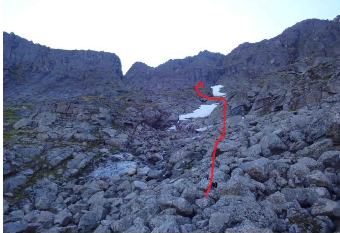
| R0–R1 | Simultaneous movement, belay using terrain features. In winter, belay using an ice axe is possible. | From the building upwards — movement through snow, in summer — along large stone scree 150–200 m, 25° — stay to the right of the remaining snowpatch, in winter — characteristic depression. Then cross the snowpatch and exit onto the ridge along smoothed plates. There is a characteristic area for gathering the group. |  | I | 10 m | 30° |
| N/A | 200 m | 25° |
3. Characteristics of Team Actions
| Section # | Description | Photo # |
|---|---|---|
| R0–R1 | Climb from the ruined building along the remains of a snowpatch in the couloir (in winter, a characteristic relief depression), staying to the right. Cross to the left along a stone bridge. Climb up to a large ledge. A good place to gather the group. | 1.7, 1.7.1 |
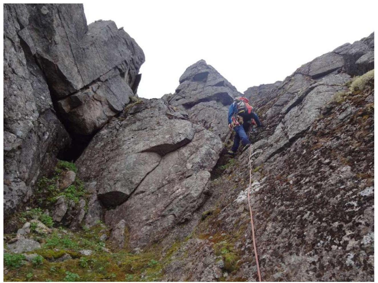
| R1–R2 | Move along the ledges of a wide buttress, sticking to the right side. At a characteristic place with a broken-off rock, turn left and continue moving upwards. Movement is simultaneous. | 1.6 |
| R2–R3 | Staying to the right of the inner corner, exit onto a led in the area of the first section. Alternating movement. Used 1 friend No. 4. | 1.5 |
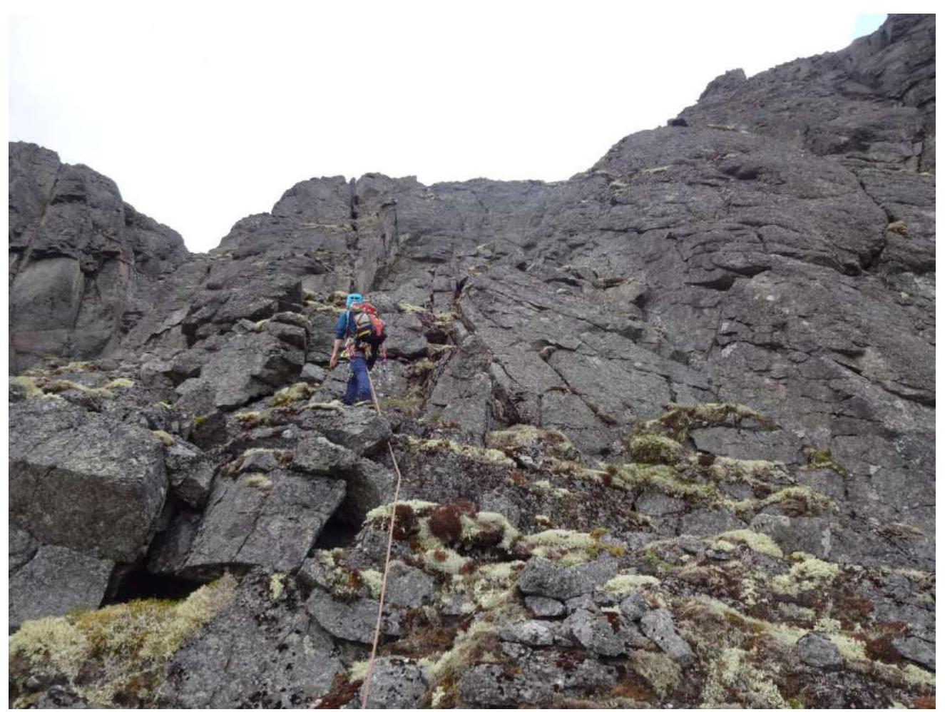
| R3–R4 | Uncomplicated simultaneous movement along inclined plates and ledges. Avoid strong traverses to the sides. | 1.4 |
| R4–R5 | Along the right wide wall of the chimney, move upwards; in the middle part, there is a narrow ledge and relief for setting up belay points. Then exit to the left onto a wide inclined ledge. Used 2 friends No. 4 and 5. At the end of the section, the belay is a loop on a stone. Belay using terrain features is possible. | 1.3 |
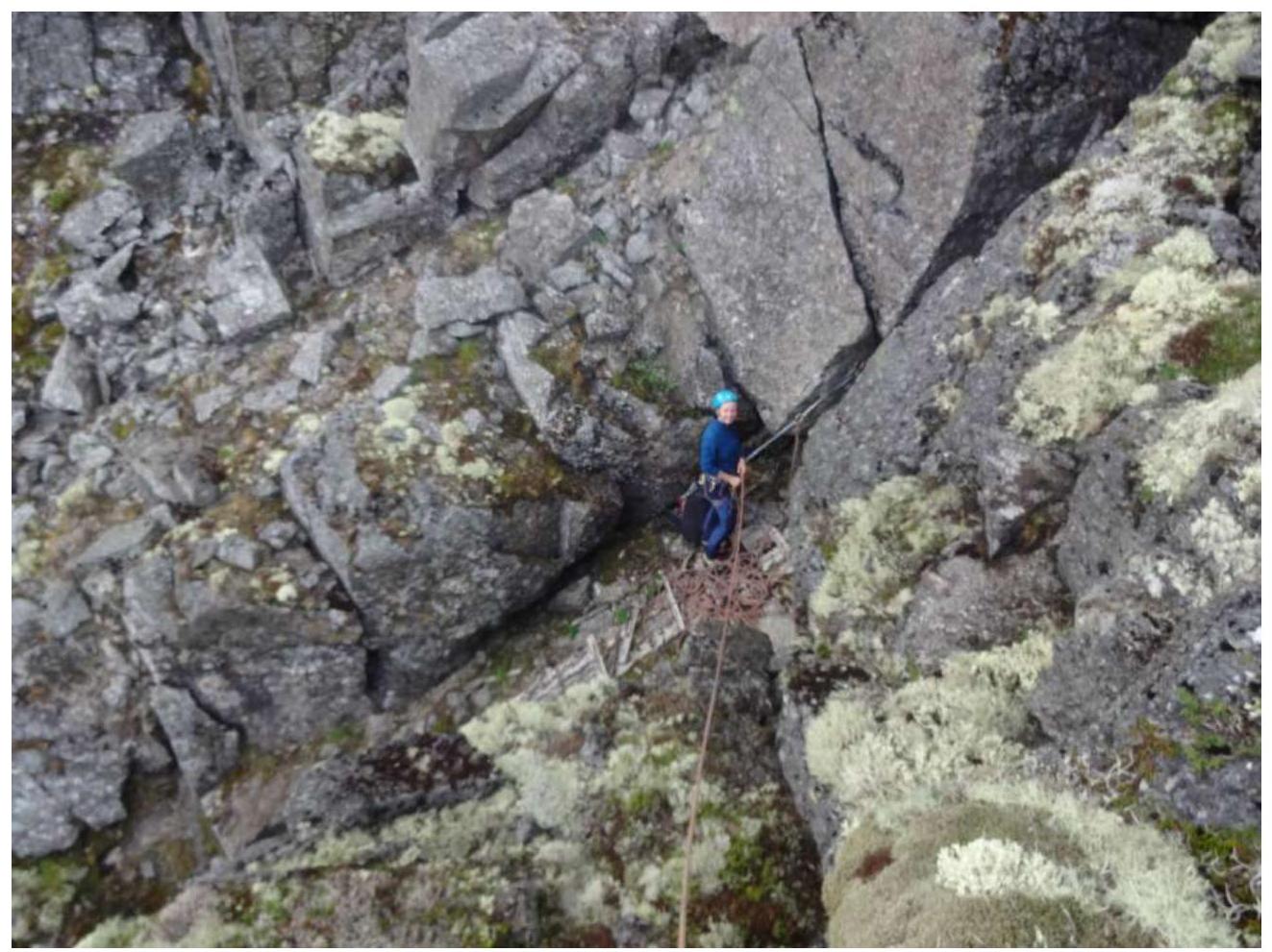
| R5–R6 | To the left of the ledge, there is a characteristic crack, convenient for belay and as a direction for climbing. Used "Vento Paras" nut. The section to the left, along the inclined ledge, avoids a difficult exit to the saddle. Descent into the saddle via climbing. | 1.2, 1.2.1 |
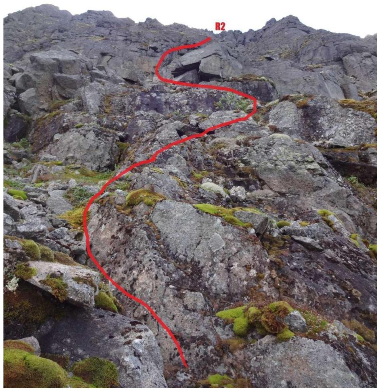
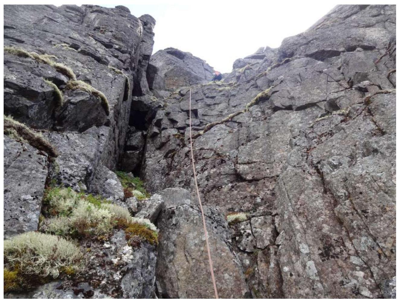
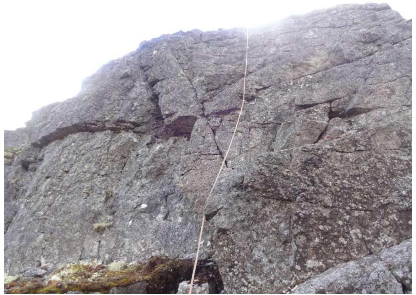
| R6–R7 | Station on two medium-sized nuts. Key section. Stick to the right of the crack during climbing. There are many available belay points and relief for climbing. To the left and right, there are couloirs. Couloirs are dangerous in spring — rockfall, in winter — avalanches, in summer — difficult to organize adequate belay. Used friends No. 3 and 4. After exiting onto the ledge, there are many places for organizing a station. Then exit onto the plateau and path to the summit. | 1.1 |
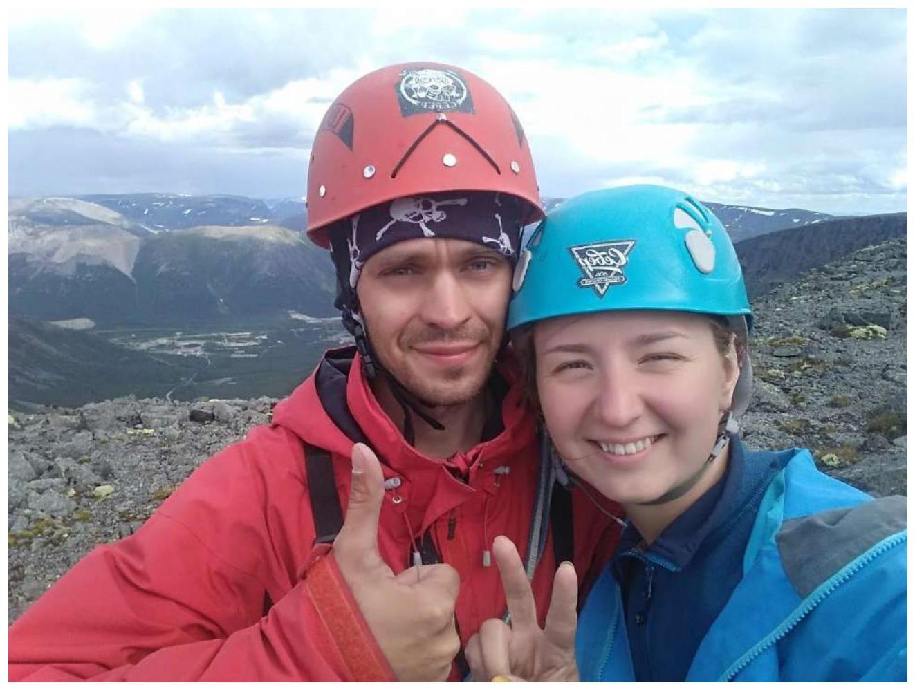
3.2. Team Photo at the Summit and Along the Route.
1.7. Start of the route R0–R1
1.7.1. Ledge for gathering. R1
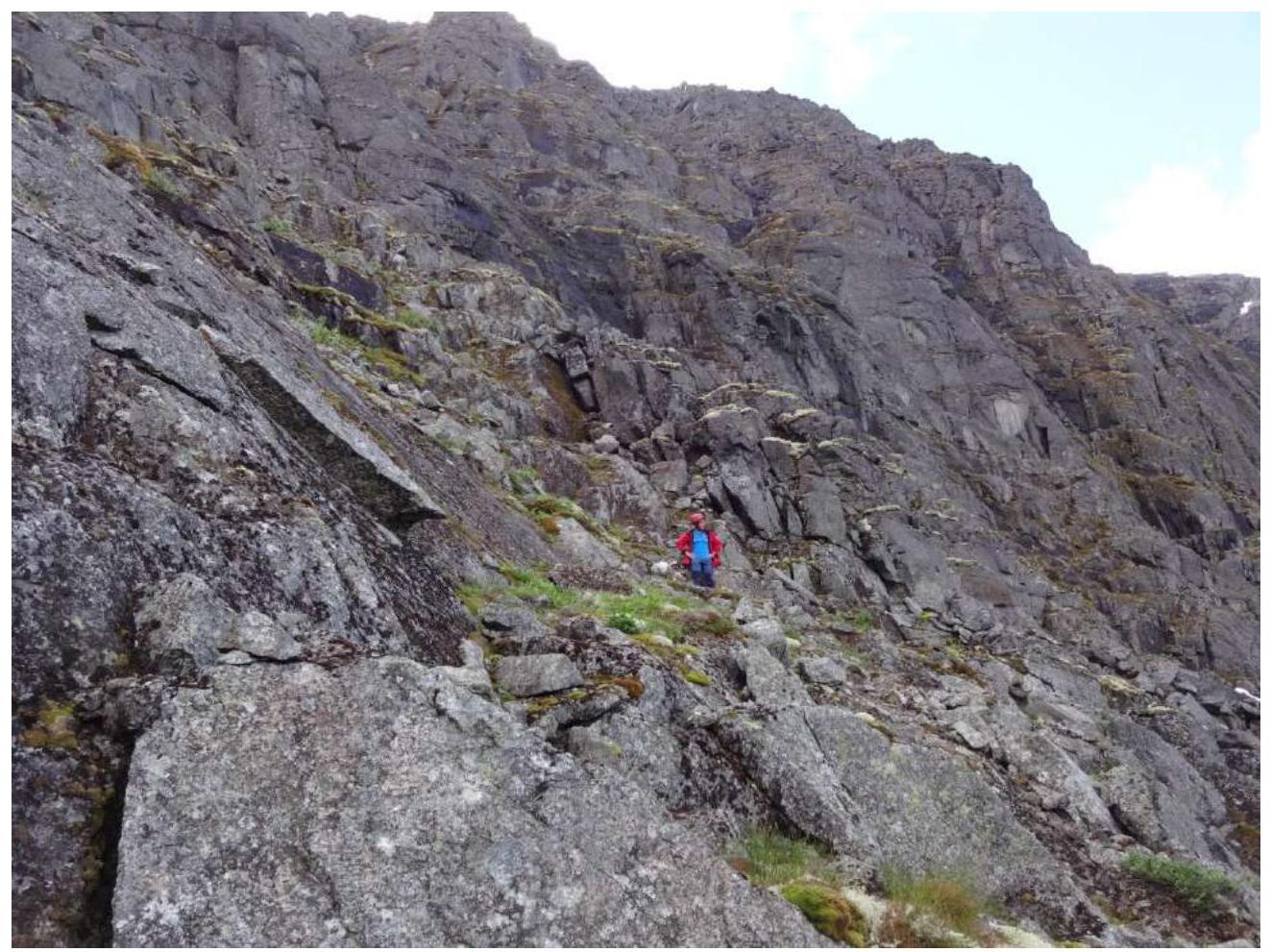
1.6. R1–R2
1.5. Inner corner. R2–R3
1.4. Section with plates and ledges R3–R4
1.3. Chimney R4–R5
1.2. Exit to the saddle R5–R6
1.2.1. Descent into the saddle R5–R6
1.1. Key. Exit onto the plateau from the saddle. R6–R7
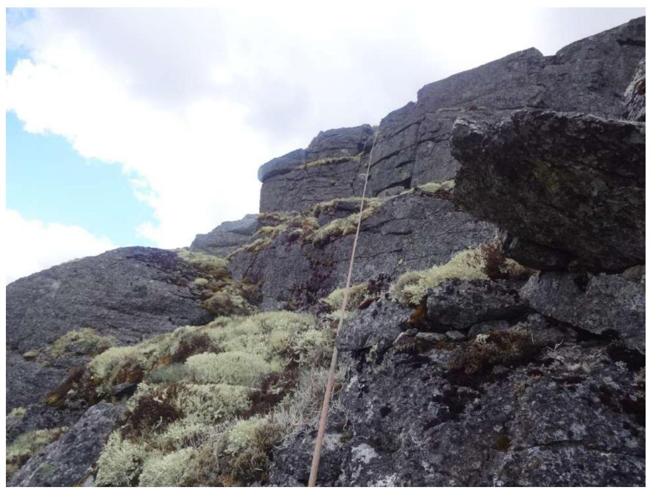
On the plateau. Summit.
Hand-drawn route diagram
Route profile.
3.3. Tactical Plan and Recommendations for the Route.
- At 7:30, we were at the dirt road leading to the VMF cirques.
- At 8:30, we were near the abandoned building, at the start of the route.
- 30 minutes were spent assessing and inspecting the route.
- We started moving at 9:00.
- We were at the summit at 13:00.
- We began descending at 13:30.
- We were in the second cirque at 14:10.
- We exited the valley to the car at 15:00.
Weather conditions were good throughout the route.
The team's equipment included a set of "Vento Paras" nuts, 4 medium-sized friends, 2 hard universal hooks, 2 anchor hooks. 2 ropes, 50 m each. Personal gear.
Sections R0–R5 do not cause problems with orientation. In R1, there is a characteristic broken-off rock that sets the direction for further movement. When exiting onto the saddle, it is necessary to stay as far to the right as possible, and before the key section, from the saddle, not to try to bypass the wall along the couloir, as snow may slide down in winter, and scree in summer.
After exiting onto the plateau, take Kirovsk as a landmark and move until a non-characteristic rise to the summit. Descent in summer and winter is possible through the eastern couloir into the "second cirque".
When descending in summer:
- Stick to the beginning of the rotten remains of wooden planks on the eastern side.
- Wet rocks are possible.
In winter:
- Assess avalanche conditions.
An alternative descent is possible in poor weather conditions and unsatisfactory group condition. To do this, it is necessary:
- Take a direction to the SW or 10–11 o'clock from Kirovsk.
- Move to the upper station of the chairlift, approximately 30–40 minutes, and descend along the southern side of the "Bolshoy Vudyavr" ski resort.
The route is safe to climb. It is uniform in terms of time spent on sections. Attention should be paid to avalanche conditions when climbing the route in winter. Also, attention should be paid to the short daylight hours when climbing the route in winter, especially during the period close to the polar night.
In poor visibility (fog, dark time of day), landmarks on the descent can be the lights of Kirovsk and the nearby mine. The route is partially covered by the Megafon operator's mobile connection, and at the summit — by all operators. The route is visible from the valley up to the exit onto the saddle.
Conclusion. The route is enjoyable and logical. It allows for practicing many climbing techniques and skills when training an athlete for the 3rd sports category. The route is necessary for the development of this mountain area, as the number of routes with category 2A and 2B difficulty in the Khibiny is extremely low. Considering that most training camps in the Khibiny take place in the winter-spring period, the presence of a large number of NP-2 groups on a section with 2–3 routes can be inconvenient and dangerous. The appearance of a new route in a new area will:
- unload the training camp program;
- increase interest in mountaineering in this area.
Comments
Sign in to leave a comment